Garston to St Albans walk
River Ver, historic St Albans and the Roman town of Verulamium
Book 1 Walk 7 Garston to St. Albans
The bridge is to the right! D.Allen Vivitar 5199
Feb-08 • magyardave2002 on Flickr
book1 stalbans garston walk7 swcwalks 2294601220


2 Duck Houses in our pond
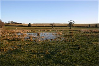
near Garston
Feb-15 • magyardave2002 on Flickr
book1 walk7 swcwalks 16344431400
River Ver, Moor Mill & Verulamium
| Length | 14.55km (9.04 miles), 4 hours. For the whole outing, including trains, sights and meals, allow at least 7 hours. |
|---|---|
| Toughness | 2 out of 10 |
| OS Maps | Explorers 173 (for the first 100m) & 182 or Landranger 166. Garston, map reference TQ 118 999, is in Hertfordshire, 2.5km north of Watford Junction. |
| Features |
This walk, although not the most beautiful in the book, is surprisingly unspoilt by 21st century civilization, despite being close to London and squeezed between Watford and St Albans, the M1 and M25. It highlights come at the very end - the Roman remains at Verulamium, and the Cathedral city of St Albans. From Garston the walk is through Bricket Wood Common to Lord Knutsford’s park and manor at Munden, passing the impressively converted Netherwylde Farm, to go along the River Colne and River Ver to Moor Mill Inn, a possible early lunchtime stop. The walk then follows Ver Valley Walk arrows almost all day, up through woods and blackberries, beside lakes, along the River Ver to a mobile home park and on into Park Street, where you find your second option for lunch. Then it’s onwards, over water meadows, along some quiet residential roads before a final leg back alongside the River Ver to the outskirts of the city. You are soon in the Roman town of Verulamium (which derived its name from the river) on the outskirts of St Albans. While there is little left to see, there's a very pretty city park and a recommended museum. And so to St Albans Cathedral and its cloisters; and the historic town centre. Then either back into the Cathedral grounds, down to the Roman walls, to head for the Abbey Station, or through the old town to the City Station. Bricket Wood Common (near the start) can be very muddy in winter, and the water meadows (shortly after Park Street) can be waterlogged or just soggy after periods of heavy rain. Wellington boots are recommended for walkers comfortable walking distances in them. Temporary Diversion At the beginning of para 37 the riverside path is blocked either side of the bridge which you cannot go under. You have to return to Cottonmill Lane by house no 63, and stay on roads until you reach St Albans Abbey station where you rejoin the main directions. This diversion is a shame as the riverside route into St Albans is most pleasant. When the path reopens by the river the diversion will be removed from these notes. |
| Walk Options | You could call a taxi from your lunchtime stop. You could also take a train from Park Street Railway Station back to Watford Junction. Or, near the end of the walk, as you approach St Albans, you could head straight for Abbey Station without sightseeing in St Albans. |
| History |
Munden House is owned by Lord Knutsford. Moor Mill, at Bricket Wood, built in 1762, was a working mill until 1939. A mill has stood on this site for over 1,000 years, known as Moremyll in Norman times. For 500 years it was under the control of the abbots of St Albans and was rebuilt in 1350. Its giant revolving waterwheel has recently been restored. In its heyday, the River Ver once powered eleven waterwheels and sustained the Hertfordshire watercress industry. Steps are being taken to increase its flow once more. The Catuvellauni tribe, in the Ver Valley, were defeated by Julius Caesar in 54BC. Boadicea destroyed Verulamium in 61AD while the Roman legions were in North Wales. In 209AD, the Roman Alban was beheaded for refusing to sacrifice to the Roman gods, on the orders of Geta Caesar, son of Emperor Severus, during the latter’s visit to Britain to put down a rebellion. The large, and impressively situated St Albans Cathedral (tel: 01727-860780) and its monastic buildings were completed in 1088 with bricks from the Roman town (dismantled because it had become a hiding place for robber gangs). In 1381 its Great Gateway was besieged during the Peasants’ Revolt; it was later used to imprison the rioters. In 1455, during the War of the Roses, Henry V1 was wounded in the neck by an arrow and took refuge in the Abbey, while drunken Yorkists ransacked the town. The Abbey, now a Cathedral, is open daily until 5.45 pm; outside these hours you can enter for evensong at 5.00 pm weekdays, 4.00 pm Saturdays and 6.30 pm on Sundays. The excellent Verulamium Museum (entrance 2024): £6, or £7-50 with the Roman Theatre, open 10.00am/Sun 2pm - 5pm) stands in the middle of the site of the Roman city of Verulamium, once one of the largest towns in Roman Britain. The site is now a pleasant city park. Very little remains - a Hypocaust’s mosaic and some city walls. Outside the park is a Roman theatre (mainly earthworks, few walls remain - £2.50 10am-5pm/4pm winter) |
| Travel |
Take the train nearest to 10am from Euston Station to Garston, changing at Watford Junction to platform 11. Journey time 32 minutes. Rail ticket update, March 2024 : following the relaxation in some rail fares, it is now posible to buy single tickets to Garston and the St Albans stations without being penalised. So to leave you with options for your return journey, the sugestion now is to purchase an off-peak single from Euston to Garston. For your return, buy an off-peak single from your return railway station viz either St Albans City to St Pancras, or St Albans Abbey to Euston. But if this is too much angst for you, buy a day return from Euston to St Albans Abbey (but the return section is not valid from St Albans City station). Trains back from St Albans Abbey Station to Euston via Watford Junction run every 45 minutes (hourly on Sundays). Journey time 40-45 minutes. There are much more frequent trains from St Albans City Station to St Pancras (up to six an hour). Journey time 20-35 minutes. |
| Lunch |
The suggested lunchtime stop comes just under halfway into the walk and is the popular Moor Mill (tel. 01727 875557), part of the Beefeater chain of family pub-restaurants. Groups of more than 6 people should try phoning ahead to book - although this establishment never answers the 'phone when you ring. Meals are served all day from noon, with some cheap and cheerful offers in addition to a full main menu. From Comments added to this website, some of you are sniffy over dining at a Beefeater. Actually, it is fine for a SWC group stop for lunch. The restaurant’s setting by a mill stream would be ideal – if it wasn’t situated underneath the M25 Motorway ! . Thirty five minutes further into the walk, and just over the halfway point, you come to the village of Park Street, which has two remaining pubs, one of which serves hot food. This is the Overdraught pub (tel: 01727-768221), an unpretentious hostelry which serves basic pub food from noon to 2.00 pm. However, this pub cannot cater for groups and is only suitable for individual walkers, couples or small groups of up to a maximum of 4. Larger numbers should always take lunch earlier at Moor Mill. 90 metres further along the road you come to the Falcon pub (tel: 01727-873208), a watering-hole for beer drinkers, where you can buy sandwiches or light snacks to go with your pint. On the other side of the road to the Falcon pub is a convenience store, Twinsco where provisions for a picnic can be purchased. |
| Tea |
The suggested tea place is Abbot's Kitchen , the cafeteria within St Albans Cathedral , which is open daily until 4-30 pm (4 pm on Sundays). An alternative is Abigails (tel: 01727-8560039), in the Village Arcade in the Cathedral precincts, which is open daily until 5 pm. Lovers of fine ale might like to call in at Ye Olde Fighting Cocks pub (tel: 017227 869152), below the Cathedral. It is one of several pubs which lays claim to being the oldest public house in England. This atmospheric pub serves a good range of real ales and guest ales, plus bar snacks and meals all afternoon at weekends. This pub reopened in April 2022 after the previous owners went into administration in February 2022. The new owners of the lease are the previous manager and head chef. Early reports on the new venture - beer and food - are very good. |
| Updates |
No major route changes. This edition - book check and walk update - March 2024. [2011] Details of Verulamium added. [Older editions]. Several minor changes since last edition of the TO Book - so use the online version. Diversion to avoid blocked riverside path added December 2023. |
| Book |
This walk was originally published in Time Out Country Walks near London volume 1. We now recommend using this online version as the book is dated. The book contained 53 walks, 1 for every week of the year and 1 to spare. Here is our suggested schedule |
|---|---|
| Profile | |
| Help Us! |
After the walk, please leave a comment, it really helps. Thanks! You can also upload photos to the SWC Group on Flickr (upload your photos) and videos to Youtube. This walk's tags are: |
| By Train |
Out (not a train station) Back (not a train station) |
| By Car |
Start WD25 9RT Map Directions Return to the start: Finish AL1 2DN Map Directions Travel to the start: |
| Amazon | |
| Help |
National Rail: 03457 48 49 50 • Traveline (bus times): 0871 200 22 33 (12p/min) • TFL (London) : 0343 222 1234 |
| Version |
Mar-24 Marcus |
| Copyright | © Saturday Walkers Club. All Rights Reserved. No commercial use. No copying. No derivatives. Free with attribution for one time non-commercial use only. www.walkingclub.org.uk/site/license.shtml |


Walk Directions
- [1] Coming off the train at Garston Railway Station, turn left off the platform down a tarmac path between fences, your direction 20°, with the railway track on your left-hand side.
- In 160 metres you come down to a car-road T-junction. Cross the road here by pedestrian traffic lights and turn right, your direction 85°. In 35 metres turn left on the road, Falcon Way, signposted as public bridleway no.16, your direction 70°. Keep on this road, ignoring turn-offs, as it swings to the right.
- In 180 metres, when this road comes to an end, continue straight on. In 15 metres you go through a tunnel under the M1 Motorway. At the other end of the tunnel, take the tarmac fork up to your left, your direction 70°, steadily uphill, through a woodland strip.
- Ignore ways off and in 400 metres, you pass what used to be the Old Fox pub on your left-hand side (permanently closed) and keep on the tarmac road. 50 metres beyond the pub, fork left on a signposted public footpath, with a plaque sign for Bricket Wood Common on your right, your direction 10°.
- In 70 metres cross a gravel drive, keeping ahead past cottages on your left-hand side and then go slightly to the right of a gated driveway. After a further 40 metres, you pass through a metal barrier to continue straight along a tarmac lane, with a thatched cottage and pond on your left-hand side.
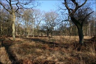
- Some 45 metres beyond this cottage, pass through a metal restrictive barrier into Bricket Wood Common (as marked on the OS map). [!] The route ahead for the next kilometre can be very muddy.
- In 70 metres, at a multiple junction, with a marker post, you have a choice of parallel paths – choose the one that looks the less muddy. Either keep ahead, on the main path, to follow a series of yellow arrows on marker posts, or fork right then immediately turn left to continue ahead, on a less used path, following a yellow arrow, your direction 20°. [2] In 330 metres go over a cross path junction and keep ahead. In a further 70 metres at a path T-junction (and in the case of the main path, by a two-armed metal footpath sign) [!] turn right, your direction 130°.
- In 45 metres pass a Bricket Wood Information panel on your right-hand side. In a further 50 metres go through a metal swing gate to the right of a wooden fieldgate onto a broad gravel way. This path is firm underfoot, and replaces a series of four car-wide wooden plank bridges over the former muddy path. In 240 metres pass through a metal swing gate to the left of a wooden fieldgate and pass another Bricket Wood information panel on your right. In a further 80 metres you pass through bollards to come out onto a tarmac road, which you cross (slightly to your right) to continue straight on, along a car-wide road marked “Munden Estate", your direction 140°.
- In 40 metres you pass house no.18, ignoring a wooden kissing gate on your left-hand side and go straight on through a metal swing gate to the left of a metal fieldgate on bridleway No 9, a concrete car-wide road.
- In 300 metres ignore a wooden kissing gate and footpath signpost to the right. In 50 metres fork left on a gravel car-wide road, which is signposted as a bridleway, your direction 100°.
- In 90 metres ignore a wooden kissing gate to your left, by a four-armed footpath sign with a cattle grid to its left. Then in 5 metres, go through a wooden swing gate set at right angles to a wooden fieldgate, to go down a car-wide track, soon with Munden House visible on your right-hand side.
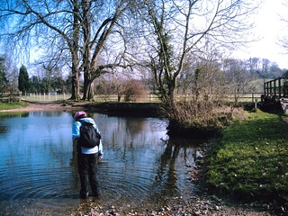
- In 180 metres, with a ford on your left-hand side, go over a wooden bridge with railings over the River Colne. On the other side, follow the path to the left, your direction 70°. This path used to be subject to flooding but in recent years it has been raised above the flood plain.
- In 150 metres you pass River Lodge on your right-hand side and go through a wooden swing gate. In 10 metres [3], go left on a bridleway, your direction 40°. In 40 metres you pass between low metal bollards to continue straight on, between hedges and tree line, with open fields beyond. In a further 350 metres ignore a turn left to Little Munden Equestrian Livery Yard [4] and continue straight on through a metal squeeze barrier.
- In 180 metres you pass under pylon cables. Ignore ways off and in 950 metres bear right on a new permissive bridleway, Bridleway 72 (sign missing October 2021), your direction 70°, initially uphill.
- In 250 metres, as Bridleway 72 turns sharply to the right and your way ahead swings to the left and goes downhill, you pass a private fieldgate entrance to Netherwylde Farm. In a further 125 metres you pass the main gated entrance to this farm on your left-hand side. In another 20 metres, by a footpath signpost, at times half-hidden in the hedge [!] turn left, your direction 320°, with a hedge and grass tennis court over to your left. In 60 metres go across the river on a wooden bridge with railings. In 10 metres [!] turn right along a potentially muddy footpath, through light woodland, heading due north.
- Some 150 metres along this winding path go over a two-plank bridge (with wooden railings on its left-hand side). At the other end of this little bridge, you have a choice of routes.
- Original TO Book route : once over the bridge follow the grassy path ahead, slightly left, in a northerly direction, close to the left-hand edge of the field, with hedges on your left. This path exits the field after some 650 metres onto the service road which comes out almost opposite the entrance to Moor Mill.
- The alternative route : once over the plank bridge go right, your direction 40°, following the riverbank on your right-hand side and passing under mini pylon cables in 15 metres.
- In 170 metres you pass a pumping station on your right-hand side (situated on the other bank). In a further 20 metres [!] turn left, down a field boundary, your initial direction 330° with open fields on either side of you as you head towards the elevated M25 motorway in the distance.
- In 500 metres go through a gap where there used to be a stile and turn left along an earth farm road, your direction 300°. In 180 metres you come to a tarmac road, which you cross - if you are planning to have lunch at the Moor Mill Inn - to enter the tarmac driveway signposted bridleway and Moor Mill, your direction 350°, a mill stream (River Ver) on your left. (If you are not stopping for lunch at the Moor Mill, turn left at the tarmac road and take the Ver Valley Walk path - per the directions below).
- For those taking lunch here, in 170 metres you come to Moor Mill Inn, the suggested lunch stop for groups of walkers. After lunch, retrace your steps for the 170 metres back to the car road T-junction. Here you turn right over the bridge, your direction 260°. 5 metres beyond the bridge, turn right on a signposted public footpath (the Ver Valley Walk), going through a wooden kissing gate and head uphill, through a woodland strip, your direction 320°.
- In 165 metres bear left up steps onto a muddy path between fences and in a further 185 metres you cross the M25 Motorway on a footbridge. From the other end of the bridge follow the arrows to the right, down alongside the motorway. In 35 metres [!] cross a track and just before you come to a metal fieldgate,turn left, your direction 350°, with the edge of the wood on your right-hand side and a series of horse paddocks over to your left.
- Ignore ways off and in 450 metres [5] as the main path swings to the right and heads downhill, and by a notice on your left-hand side noting the site of Park Street Roman Villa, [!] you have a choice of onward route .
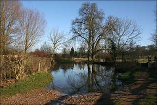
- The Lower Route (and GPX route). Stay on the main path as it swings to the right and heads downhill through woodland, on widely spaced-apart, shallow earthen steps. The broad path swings to the right, then left, and you now have lakes to your left and right. Keep ahead on this pleasant, firm way with water on either side and in some 300 metres you come to a T-junction, where you turn left . In 25 metres you pass on your right a bench with a River Ver map carved into its upright back. In a further 15 metres at a main path junction turn right to rejoin the Original Book route, as below, at point [6].
- The Original Book Route : at point [5], instead of following the main path downhill to the right, bear left to continue along the Ver Valley walk, with the field fence on your left-hand side, your direction 350°. This upper path can be overgrown in summer. Now continue ahead with the lake down below to your right, on a narrow and at times muddy path, following the field fence to your left. In 225 metres you turn left with the path and in a further 90 metres (and some 10 metres before the path exits onto a track), [!] you turn right to descend with the path, down to the lakeside, to continue ahead with the lake on your right-hand side, passing anglers’ stations, your direction 110°.
- In 150 metres, just before the end of the lake on your right-hand side, turn left, cross a main path and a grassy triangular area, with a bench seat on its left, to bear left (ahead) on the Ver Valley Walk [6]. You are now between two lakes, your direction 320°, on a wide gravel track.
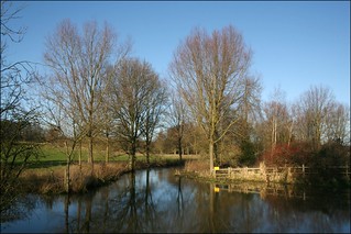
- Ignore ways off. In 250 metres, your way rejoins the River Colne on your right-hand side. Here, by a post with multiple discs and arrows,fork right, with the Ver Valley Walk path, hugging close to the river on your right-hand side, towards a closely packed town of mobile homes with aerials, your direction 50°.
- In 70 metres go over a plank bridge and follow the riverbank, ignoring other ways off. In 220 metres you come to the A5183 road, with what used to be the Old Red Lion pub, now a self-drive centre, on the other side of the bridge.
- Turn left on this main road, your direction 340°. In 150 metres you pass the Overdraught pub at Park Street on your left-hand side (a lunchtime option for individual walkers, pairs or small groups of up to 4 walkers, but no more). In 90 metres you come to the Falcon pub on your left-hand side (a watering-hole option, with sandwiches and light snacks). Here [!] you turn right to go down Burydell Lane, opposite the pub, a tarmac road, which runs beside Park Mill, your direction 45°. (For picnickers there is a "Twinsco" convenience store on this corner ). In 80 metres, you go over the River Ver on a bridge with brick headwalls.
- In 110 metres, by Toll Cottage, follow the public footpath sign sharply to the left, your direction 340°, with allotment fences on your left-hand side. In 100 metres, at the end of the allotments, go through a metal kissing gate to enter Ver Valley Meadows , your initial direction 350°. There is a an Information Panel on the restoration of the Meadows by this entrance. You now follow the new post, mesh and wire fence on your right-hand side, wih a line of thorn trees further over to your right. The way across the water meadows, by intention, is wet or semi-waterlogged in winter or after periods of heavy rain.
- In 150 metres by a marker post veer right with the new post, mesh and wire fence and keep ahead alongside this fence, your direction now 70°. [!] Your continued way ahead is now dependent on the wetness under foot. At times in winter wellingon boots are essential if you want to keep your feet and socks dry. Your target is the red brick bridge with two arches, over in the left-hand corner of the meadows, some 250 metres away. In 160 metres you can follow a way-marked route half-left across the meadows, on a bearing of 40° with the first post marked with multiple arrows and other posts with white tops. If this route looks too soggy, continue ahead alongside the new post, mesh and wire fence and cross over the meadows on any dryer looking way towards the bridge.
- Just before the bridge pass to the left of a (redundant) metal kissing gate (to the right of a metal fieldgate) then cross the bridge (at its far end there is another Meadows Information Panel) to then immediately turn right to follow the path with the river now on your right-hand side.
- In 35 metres, go under a bridge carrying the A414 road. In a further 20 metres beyond the bridge, go through a metal kissing gate (with a metal fieldgate to its left) onto an often muddy farm track, with the river on your right-hand side. In 80 metres, with a metal fieldgate ahead of you and a metal kissing gate over to its right, turn right through a metal swing gate and cross over the river on a concrete bridge with scaffolding pole railings. At the far end of the bridge turn left onto a restored gravel path between new post, mesh and wire fences, with the river on your left and an open, grassy field over to your right, your direction 30°.
- Keep ahead on this gravel path between fences, ignoring turns off and in 550 metres, at the far end of the field on your right, go through a metal kissing gate on to a surfaced path. In a further 80 metres you come to a tarmac road, with a wooden barn on your right-hand side (Blacks of Sopwell) and a brick bungalow on your left (Lamont Chairs). [7]. Go left on this road, Cottonmill Lane, your initial direction 330°.
- In 10 metres, turn left to go over a brick bridge over water and in a further 40 metres, go over another brick bridge. In 45 metres ignore Butterfield Lane to your left and instead bear right along the continuation of Cottonmill Lane, through a housing estate, initially uphill, your direction now 320°. In 270 metres, at the brow of the incline, ignore Old Oak (road) to your right. You can now see the Cathedral ahead.
- In 300 metres, and some 10 metres beyond a bus stop (Monks Close), and just before the road swings to the left and heads uphill, you come to house No 63 on your right and a signposted turning right 8[!] Temporary Diversion - December 2023 - to avoid a blocked riverside path - commences here .
- Temporary Diversion Keep ahead on Cottonmill Lane through its left-hand bend, then right, and in some 310 metres turn left into Prospect Road, to follow the sign for St Albans Abbey Railway Station. In 480 metres you come out to a main road. The first turning on your left takes you to the railway station. To rejoin the main walk directions turn right and in 100 metres rejoin the main walk directions where the riverside path comes out on to the main road.
- Main Walk Directions (once diversion cancelled). By house No 63, turn right down the tarmac lane signposted Sopwell Mill Farm and River Ver trail, your direction 70°. In 50 metres fork left through barriers into a playing field, with a children's playground ahead of you (slightly right), following the river walk arrow. At the end of the playground fence, head on a half-right diagonal across the playing field, your direction 20° towards a gap in the field boundary ahead of you, some 130 metres away (not the steps over to the far left). Once at the gap, go through it and continue on a path to the next waymark post 30 metres ahead by a concrete sluice, where you turn left , to pass on your right a River Ver Guide panel on a carved wooden background.
- In 30 metres you pass under a bridge ( Note - this is where the path is blocked by high wire fencing, either side of the bridge ). Continue ahead on a potentially muddy way, staying on the riverside path, ignoring all ways off, initially with allotments on your left, and the river to your right. You soon cross a series of wooden bridges with wooden handrails, then you pass Sopwell Nunnery Green space on your left.
- After 500 metres along this path you come up to a tarmac road [9] with St Peters School and Nursery over to your right. Turn right on the pavement to go over a road bridge over the river, then immediately turn left to cross over the road and go down steps to continue on the river walk, with the river on your left-hand side, with allotments on the far side of the river, your direction 290°.
- In 100 metres the path swings to the left and in a further 100 metres go through the remnants of gate posts in a field boundary and follow the path as it swings to the right, away from the river, your direction 290°, to rejoin the river in 130 metres. In a further 50 metres, go over the river on a metal bridge with scaffolding pole railings, to continue with the river now on your right-hand side.
- In 80 metres you come to the main road. [!] Going left here will take you, in 200 metres, to St Albans Abbey Railway Station.
- But the suggested onward route is to turn right, over a bridge, your direction 20°.
- In 30 metres, turn left into Grove Road, just before what used to be the Duke of Marlborough pub (now a private house), your direction 300° initially. In a further 40 metres, you pass the left turn into Pondswick Close. Then in 45 metres, turn left onto Lady Spencer’s Grove, a footpath lined with horse chestnut trees, your direction 295°, gently uphill.
- In 140 metres, after passing the buildings of The Abbey C.E Primary School over to your right, the path comes out to a green open space where you turn right up the hill towards St Albans Cathedral on a tarmac path (or you could go straight on for 150 metres for a drink at Ye Olde Fighting Cocks, a tea stop option - reopened under new owners April 2022. In 220 metres turn left along the southern, outside wall of the Cathedral until you come to the Cathedral's West End, and the main visitor entrance.
- After visiting the Cathedral, and after taking tea in its cafeteria, come out by the main visitor exit towards the east end of the Cathedral. Walk left around the Cathedral walls, towards the Great Gateway, if you wish to head for the Abbey railway station, then take the tarmac path half left downhill, your direction 250°, in 300 metres coming to Ye Olde Fighting Cocks pub - to continue with the directions below.
- If not taking tea in the Cathedral cafeteria, on exiting the Cathedral by the main visitor exit, turn left and head uphill away from the Cathedral, your direction 40°, passing Buon Amici and Lussmanns restaurants on your left-hand side. Opposite the latter, turn right uphill over a green for 50 metres towards the Village Arcade to come to the alternative tea place, Abigails, the last unit on the right in the arcade ahead of you.
- Coming out of the tearoom, keep ahead (right) down the arcade. In 45 metres you come to the High Street, where you turn left. In 30 metres you come to the Clock Tower on the other side of the road. If you have the time, the Clock Tower is a good starting point for a wander through the alleys of the old town, starting with French Row to its left.
- For St Albans City Railway Station
- Go to the left of the Clock Tower, with the Fleur de Lys pub (now branded “The Snug”) on your left-hand side, to go up French Row, your direction 30°.
- In 100 metres you come out into Market Square. Continue ahead and in 75 metres go right through an archway (Sovereign Way), your direction 130°. In 40 metres cross the main road by pedestrian traffic lights nearby on your left to turn under the archway into the Maltings Shopping Centre.
- Swing right, then left through this centre and in 250 metres at its far end, turn left to exit the Maltings onto a main road (opposite the Police Station). Turn right on the main road, downhill, your direction 105°.
- In 650 metres, as the road goes uphill, you go over the railway bridge. Before the bridge ends, go down the steps to your left, to St Albans City Railway Station. Platform 1 for trains to London is on this side.
- For St Albans Abbey Railway Station and the Roman Remains
- Continue along the High Street. In 45 metres you come to the Thai Square Restaurant (formerly the Tudor Tavern) on your right-hand side. Go straight on and in 100 metres fork left on a tarmac road signposted ‘Cathedral West Gate’.
- In 110 metres go through the Great Gateway of the monastery. Carry on down Abbey Mill Lane. In 150 metres take the left fork, with a house on your left-hand side.
- In 80 metres turn right to pass the front door of Ye Olde Fighting Cocks pub. The water is on your left-hand side. 30 metres beyond the pub, turn left over the bridge into Verulamium Park, your direction 245°, with the ponds to your right.
- To visit the Roman remains, which are scattered throughout the pleasant park, turn right 25 metres after the bridge. Follow the path parallel to the lake, initially 330°. Pass the Hypocaust on your left, the park café, and in 800 metres you reach the Museum. Follow the road past the museum, leaving the park. In 25 metres turn left, and in 100 metres cross a busy road to reach the Roman Theatre.
- The suggested route is straight on, along the edge of the pond on your right-hand side, to carry on beyond the ponds for 30 metres to the remains of the Roman Wall.
- Here turn left , your direction south. In 85 metres, your path merges with another coming in from the left and you keep ahead, your direction now 120°. You pass a sports ground on your right-hand side.
- In 300 metres your path joins a tarmac road, with Westminster Lodge Leisure Centre to your right, where you keep ahead along the pavement beside the road, your direction now 100°.
- In 260 metres exit the park by the main road T-junction. Cross the road by pedestrian lights and turn right along it. The entrance road to St Albans Abbey Railway Station is in 35 metres on your left, under a metal barrier.