Beaconsfield Circular walk
Gentle hills, Chalfont St Giles, and Jordans, a hamlet with Quaker links
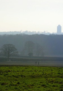
Book 1, Walk 10, Beaconsfield Round 1
4 February '07
beaconsfield book1 round walk10 swcwalks tocw110 383534564

Book 1, Walk 10, Beaconsfield Round 2
4 February '07
beaconsfield book1 round walk10 swcwalks tocw110 383534911

Book 1, Walk 10, Beaconsfield Round 3
4 February '07
beaconsfield book1 round walk10 swcwalks tocw110 383535730
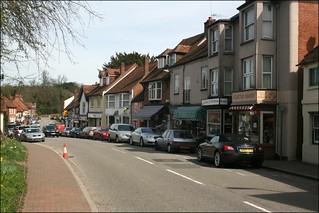
Chalfont St Giles
chilterns buckinghamshire book1 walk10 swcwalks 4500390287
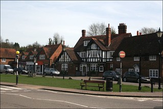
Chalfont St Giles
chilterns buckinghamshire book1 walk10 swcwalks 4501025592
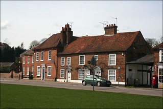
Chalfont St Giles
chilterns buckinghamshire book1 walk10 swcwalks 4500391921
Chalfont St Giles
chilterns buckinghamshire book1 walk10 swcwalks 4500393865
Milton's cottage & a Quaker hamlet
| Length |
19.5 km (12.1 miles), 5 hours 30 minutes. For the whole outing, including trains, sights and meals, allow at least 9 hours. |
|---|---|
| Toughness |
4 out of 10. |
| OS Maps |
Explorer 172 or Landranger 175. Beaconsfield, map reference SU 940 912, is in Buckinghamshire, 7km south-east of High Wycombe. |
| Features |
This walk is close to London. It passes the cottage of the poet John Milton in Chalfont St Giles and comes to Jordans, a hamlet with Quaker links. In between, there is typical Buckinghamshire countryside to enjoy – gently rolling wooded hills – enough to provide interest without being too tiring! Navigation through Hodgemoor Woods in the morning can be challenging, so bring along a compass to help you keep to the correct paths. With the removal of the last stile on this walk (by the exit / entrance to Beaconsfield Golf Course) this walk is now Stile Free . |
| Walk Options |
Shortening the walkInstead of completing the loop back to Beaconsfield, from Jordans you could take the short detour to Seer Green & Jordans railway station (see the asterisk [*] in the Walk Directions) and catch the return train from there. You can also cut out 750 metres of road walking by taking the short cut at point [7] in the Directions. You could also enquire at the lunchtime pub about buses or taxis back to Beaconsfield or (going in the opposite direction) to Gerrards Cross. The walk in ReverseThis walk also works well when done in reverse, i.e. Anti-Clockwise. The directions are below after the main walk. This might appeal to walkers who prefer to complete the longer leg of a walk before lunch. Beaconsfield to Chorleywood via the Chiltern Open Air MuseumLength: 15.7 km (9.75 miles). Toughness: 4 out of 10 This walk is designed to visit to the Chiltern Open Air Museum (www.coam.org.uk). The first half of the walk follows the route of the morning section of the walk as far as the normal lunchtime stop at Chalfont St Giles. After lunch it is a relatively short distance (about 2 km / 1.25 miles) to the museum. From the museum to Chorleywood (described by John Betjeman as “essential Metro-land”) is about 4km / 2.5 miles. As Beaconsfield and Chorleywood are on different lines you will need to but a single to Beaconsfield and a single back from Chorleywood. Chorleywood is in Zone 7 so Oyster cards can be used for the return journey. You can get tea at the museum café, or at the end of the walk in Chorleywood in either Rootz Coffee Lounge or, if it is still open by the time you arrive, Morgans Deli. If both are closed you can try the Peppermill on the opposite side of the road from Rootz. |
| History |
Bekonscot Model Village & Railway (tel. 01494 672919) in Beaconsfield is the world’s oldest original model village (1929) comprising 6 model towns of 1930s vintage, a Gauge 1 railway, a ride-on railway and other attractions on a 1.5 acre site. It is open mid-February to end of October, and at weekends only from 09 November until 08 December, from 10am to 5pm daily, including bank holidays. Admission (2023) is £ 14.00. Family and season tickets and concessions are also available. Post Covid, you are required to purchase your tickets in advance and on-line. The village of Chalfont St Giles is largely unspoilt, with many listed buildings and lying mostly within a Conservation Area. (It was used as Warmington-on-Sea in the film of Dad’s Army). It was a Quaker, Thomas Ellwood, who acquired a cottage in Chalfont St Giles as a refuge for John Milton. In London, the plague was a serious threat and, as a high profile supporter of the republican cause, Milton’s liberty was also at risk following the Restoration. It was during the short time that he lived here that he completed his epic poem Paradise Lost and was inspired (by a question from Ellwood) to begin Paradise Regained. The cottage was probably built in the late sixteenth century, and has an interesting history – it is now a museum, containing the first edition of Paradise Lost. Incidentally, Milton was himself a keen walker. Milton's Cottage (tel.01494-872313) is open from April 1st to October 31st, 2pm to 5pm, Wednesday to Saturday (plus Bank Holiday Sunday and Monday, and the 4th Sunday in the calendar month), admission (2023)is £ 7.00. The Friends Meeting House was built within the grounds of Old Jordans Farm in 1688 (The Farm was sold to a private owner in 2006). The Meeting House was the first to be erected following James II’s Declaration of Indulgence which gave the Society of Friends the freedom to congregate. William Penn is buried next to the Meeting House, along with his wives Gulielma and Hannah, and ten of their sixteen children. Penn founded Pennsylvania, the only example of a state without a military presence, with no religious or aristocratic group in control, and where Indians were fairly treated. As Voltaire commented: “William Penn could boast of having brought forth on this earth the Golden Age”. The Meeting House suffered from a major fire in 2005 and following a lengthy period during which restoration took place, it reopened for its first meeting in September 2008. It is open to the public daily, 2pm to 5pm between March 1st and October 31st. Admission is free, although donations are welcomed. The burial ground at Jordans has several hundred more burials than there are headstones, the reason being that for a hundred years, from 1766, the Quakers believed that even a simple headstone with inscription was too ostentatious. On the south side of the farm building is a large wooden barn, which is reputed to be constructed from the timbers of the Mayflower, the ship of the Pilgrim Fathers – those Puritan pilgrims who in New England persecuted the Quakers, had their ears cut off and flogged, branded and executed them. |
| Travel |
Take the train nearest to 9.30am from Marylebone Station to Beaconsfield. In summer you can take a train up to an hour later. Journey time 30-40 minutes. There are about three trains an hour back from Beaconsfield. Hodgemoor Woods has a car park. |
| Lunch |
You have a good choice of lunch stops in the village of Chalfont St Giles.
|
| Tea |
The early tea stop in Jordans at the former Quaker Guest House no longer exists, although the Village Store in Jordans, when open, does serve hot drinks and cold snacks. For tea in Beaconsfield, the choices are:
|
| Updates |
Online version recommended (many small updates). This version October 2021. Old Jordans Quaker Guest House and the Mayflower Barn (mentioned in the books) are closed. |
| Book |
This walk was originally published in Time Out Country Walks near London volume 1. We now recommend using this online version as the book is dated. The book contained 53 walks, 1 for every week of the year and 1 to spare. Here is our suggested schedule |
|---|---|
| Profile | |
| Help Us! |
After the walk, please leave a comment, it really helps. Thanks! You can also upload photos to the SWC Group on Flickr (upload your photos) and videos to Youtube. This walk's tags are: |
| By Train |
Out (not a train station) Back (not a train station) |
| By Car |
Start HP9 2PJ Map Directions |
| Amazon | |
| Help |
National Rail: 03457 48 49 50 • Traveline (bus times): 0871 200 22 33 (12p/min) • TFL (London) : 0343 222 1234 |
| Version |
Mar-23 Marcus |
| Copyright | © Saturday Walkers Club. All Rights Reserved. No commercial use. No copying. No derivatives. Free with attribution for one time non-commercial use only. www.walkingclub.org.uk/site/license.shtml |


Walk Directions
Main walk (clockwise)
- [1] From platform 2 cross over the footbridge to platform 1 and exit Beaconsfield Railway Station through the ticket barriers. Take the surfaced footpath opposite (a few metres to your left), uphill, and signposted Model Village. At the top of this footpath in 100 metres, carry straight on along Caledon Close. In 40 metres take the road to the left – St Michael’s Green – your direction 345°.
- In 100 metres you pass the Parish Church of St Michael and All Angels on your right-hand side. For Bekonscot Model Village and Railway take the road to your left, following the sign to the Model Village. To continue the main walk, follow the road as it bends round to the right into Grenfell Road.
- In 300 metres – and 10 metres before the road curves round to the right into Wilton Road – turn left into a road which has no street sign (but also Wilton Road), your direction 350°.
- [2] In 120 metres you come to the end of what you can now see is Wilton Road, and to a traffic island planted with trees and bushes. Go round the left of this island, straight over the main road (slightly to the right) and down the enclosed public footpath dead ahead, with Ledborough Lane electricity substation on your left, your direction 20° initially.
- Ignore ways off and keep straight ahead, initially between fencing to back gardens. In 325 metres the gardens end on your right. Bear slightly left with the path, your direction 5°, with a wooden fence on your left and a wooded area now on your right.
- In 350 metres [!] ignore a faint footpath to your right and keep ahead (slightly to your left), your direction 300°, the wooden fence still on your left
- In 75 metres the fence on your left turns left. [!] 8 metres beyond this, at a footpath post with multiple yellow arrows take the right-hand fork, ahead, your direction 345°, into the wood (not the 90°right turn). Keep to this path and, in 260 metres, by a post with yellow arrows, ignore the paths you cross to continue straight on, along the same path, due north, and gently uphill through the wood.
- 320 metres further on, you come to a footpath post with a yellow arrow pointing ahead where another path crosses the path you are on. At this juncture, there is a single white arrow on a tree pointing straight ahead. Continue straight on, for another 20 metres, until you come to another tree with a white arrow pointing left and right, and 25m further on [!] turn right off the path, your direction 70° initially [3].
- Keep to the footpath, ignoring ways off, for the next 500 metres, steadily uphill, following footpath posts. In 500 metres [!] a broad path joins from the left, with two new marker posts on your left-hand side, and you swing right , now close to the wood boundary on your right. In 45 metres you bear left to go down and up a slight dip, to reach a tree with an arrow pointing right. Here Turn right , your direction 115° and follow the path with a field off to your left. In 190 metres you have a wooden slat fence in front of a high boarded fence on your right-hand side.
- In 200 metres the path exits onto a car-wide tarmac track with a four-armed footpath sign on your left and Wood Cottage over to your right.
- Keep ahead on the lane and follow it downhill. In 750 metres you come out on to a road (the A355) with fast-moving traffic. Cross this road with care and walk straight ahead along the car-wide track ahead of you, your direction 125°. In 125 metres ignore the fork left to a metal fieldgate and curve left with the track, downhill, initially in a shallow cutting.
- In 300 metres, ignore a stile on your left at a crosstracks, by a four-way metal footpath sign on a metal pole, and keep straight ahead, on the same track, now going up a hill, your direction east. The narrow path becomes steep until in 200 metres you come to the top of this hill, with views through gates to left and right. Just follow the path between hedgerows and underneath overhead cables. This path has a tendency to become overgrown in high summer - and it is muddy in winter.
- In 220 metres the path brings you down on to a lane [4] where you turn left, your direction 40°, and walk along the lane. In 250 metres the lane curves sharply round to the right and you leave the lane, to go straight ahead.
- In 10 metres you pass a barrier and enter Hodgemoor Woods. In 40 metres at Widmer Corner footpath post ignore a turn to the left and keep ahead, your direction 20° initially, into the wood. Keep to this bridleway and at the first junction, in 140 metres, as the bridleway swings to the right, leave it and take the left fork, more or less straight on, gently uphill, your direction due north, to go past a no horse-riding post.
- In 250 metres cross a main horse-riding track and keep ahead. In 50 metres you pass a deep crater on your right. In a further 110 metres, uphill, you come to a T-junction with what once was a corrugated barn dead ahead (all that now remains is its slab and foundations, behind a wooden fence). Here you turn right. In 30 metres, walk past the entrance gate to the former barn on your left. 25 metres beyond that, there are two paths going off to the right.
- [!].It is easy to get lost during the next 500 metres or so, so please follow these directions carefully, and have a compass to hand. Take the first path sharply to the right, signed by a no-horses symbol on a white-topped post, up into the trees, your direction 140° initially. This path soon becomes a car-wide track.
- In 70 metres keep ahead at a path crossing. In a further 80 metres, veer right with the track, now due south, through a potentially muddy stretch.
- In 75 metres, veer left on the track through a grassier area, your direction now 120°. In 80 metres you come out to a path junction. [!] Turn left onto the gravel track, your direction 80°. In 25 metres you pass on your left-hand side a permitted horse-riding post. Continue ahead, soon gently downhill
- In 130 metres you come to a path crossing with a permitted horse-riding post on your left and a no riding post on your right, marking a path to the right. Here keep ahead , your direction 50°.
- In 80 metres next to a wooden horse blocking barrier on your left, at a path crossing [!], turn right, your direction 100°, slightly downhill. In 20 metres you pass a permitted horse-riding post on your left and in a further 15 metres, at a T-junction, [!] go left, your direction 10°, and immediately in 3 metres, [!] go right, on a bridleway, which is initially narrow but soon widens as you head downhill, your direction 120°.
- Keep to this bridleway, downhill, ignoring all ways off. In 175 metres a path joins from your right, with a no riding post on your left and a no riding post on your right, and in a further 140 metres, as the bridleway curves sharply around to the left uphill, you follow the narrower path curving off to your right, - now on the level - through the wood, your direction 140° initially.
- Ignore ways off and, in 130 metres, you come to a T-junction near to the edge of the wood, and you turn left along the path as it follows the tree line, your direction 50° initially.
- [5]. In 15 metres ignore a fork right. In a further 30 metres, by a post on your left with a yellow arrow, turn right through the trees, with an open field visible ahead. This takes you out of the wood in 15 metres around a wooden horse blocking barrier, onto a car-wide earth track, where you turn left, gently uphill, with the edge of the wood on your left-hand side, and a post and wire fence to the open field on your right, your direction 20°.
- In 175 metres the track levels out and opposite a metal farm gate, it swings left, then right, your direction now 45 °. In a further 100 metres, where the track swings left, keep ahead to pass to the side of a redundant wooden barrier. Now turn right down the left-hand side of the field, your direction 120°.
- At the bottom of the field, in 300 metres, ignore the wooden kissing gate in the left-hand corner with a footpath going off to the left, and instead, turn right, your direction now 190°. Continue along the bottom edge of the field for 40 metres and go through a gap in the hedge into the next field, with a fence on your right-hand side and a hedge and tree line on your left.
- Continue along the left-hand edge of this field, your direction 175°. In 150 metres go through a field boundary and keep ahead on this grassy path, still following the left-hand edge of this field.
- In 350 metres at the far left-hand corner of the field, turn left through a metal kissing gate, to follow the fenced-in path. In 150 metres you come out beside a metal fieldgate on to the corner of a residential street. Turn right up this street (Back Lane) and in 50 metres you come to a T-junction with the main road, at Three Households, where you turn left. (The White Hart Inn is on your right at this junction).
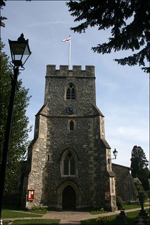
- Carry on down this road (Dean Way) into Chalfont St Giles. In 500 metres you reach Milton’s Cottage on the right-hand side – a museum well worth visiting if time permits. Keep on down Dean Way and in a further 250 metres you pass The Feathers pub on your left-hand side, a good pub-lunch option. Almost next door is Crown Coffee (formerly Costa Coffe, and before that the Crown pub). In a further 75 metres, on the other side of the road, across the Village Green, is Merlins Cave pub, your suggested lunchtime stop. Sandwichers can make use of the five benches on the Village Green to eat their picnics. A few doors away to the pub's right is The Deli on the Green. If making for the Fox & Hounds pub, take the road next to Crown Coffee, uphill for 125 metres: the pub is on your right-hand side. But please Note this pub neither welcomes, nor likes, walking groups: individual walkers or pairs of walkers should be fine.
- After lunch, coming out of Merlins Cave, turn left . Opposite Crown Coffee, [!] turn left through the beamed archway, leading to the (sometimes locked) Parish Church of Chalfont St Giles. Follow the footpath which goes along the right-hand side of the lychgate, along metal railings bordering the churchyard, your direction 120°.
- The “via Chiltern Open Air Museum” Option starts here.
- To continue the main walk. The path swings right then left and in 130 metres brings you down to a bridge with metal railings going over at times a dried-out riverbed. [!] 5 metres before this bridge, turn right and head half-right on a path beside a residential estate on your right, your direction 230°.
- In 60 metres this path swings left, away from the estate, your direction now 165° initially, and continue ahead now between lines of trees.
- In 135 metres go through a metal kissing gate and continue in the same direction as before, now with an open field on your right. In 200 metres go through another metal kissing gate and continue straight on.
- The path leads out into an open field. You are now going to walk south for the next 1.5 km, through a series of five fields, keeping to the left-hand edge of each field in turn. This path generally follows the route taken by the River Misbourne before it dried up completely due to over-extraction of water from the valley.
- In more detail: Follow the path along the field’s left-hand edge. In 80 metres ignore a stile on your left. In 275 metres, ignore a farm gate, then a stile and another farm gate on your left, but keep ahead close to the left-hand edge of this field. In 60 metres you come to a metal swing gate in the far left-hand corner of the field and pass through, to continue along the left-hand edge of the next field.
- On your right is a horse gallops, with a tarmac base covered at times with a sand bed, 3 metres wide, between new fences.
- In 300 metres you pass a row of trees going uphill to your right, on the other side of the gallops. Continue on in the same direction along the left-hand edge of the field on a grassy path. In 150 metres cross a grassy track with a metal farm gate to your left and a pair of wooden gates giving access to the gallops on your right.
- In 200 metres you come to the far left-hand corner of this field, to go through a gap into the next field, to continue ahead, with the left-hand edge of this field over to your left, following the gallops over to your right.
- In 250 metres ignore a wooden kissing gate on your left. In a further 80 metres go through a metal swing gate, then immediately a metal kissing gate, into the next field, to continue along the left-hand edge of this field, in the same direction as before.
- In 70 metres pass through a metal kissing gate and keep ahead, aiming for the left of the two metal kissing gates some 20 metres apart in the boundary fence directly ahead. In 120 metres go through the left of the two gates and take the well-defined path ahead, between trees to left and right, your direction 190° initially.
- In 200 metres, the trees on the right peter out and the path is bordered by a wooden fence on your right-hand side. In another 130 metres go through a metal kissing gate into a lightly wooded area and, in 5 metres, the path ahead forks. [!] Take the right-hand fork which meanders past Chalfont St Giles Tennis Club on your left-hand side, your initial direction 200°.
- In 140 metres you come out from the lightly wooded area into playing fields. Continue along the right-hand edge of the playing fields on an indistinct path, passing a pavilion structure on your right. 50 metres past the pavilion [!] [6] turn right, up a fenced-in footpath between houses, your direction 250°. 70 metres brings you up to a road. Go straight ahead uphill along Boundary Road, on the outskirts of the village of Chalfont St Peter .
- In 200 metres, where the road becomes Lovel End, continue straight on up the hill. In 250 metres, having passed Chalfont St Peter Infant School on your right, Lovel End curves off to the left. Just before the cul-de-sac dead ahead, you turn right down a footpath, which goes between the school and the houses, your direction 345°. This is signed as a public footpath and there is a “No cycling” sign.
- In 60 metres the path swings left. In another 250 metres you come out to a main road. Go straight across this road into woods on the far side, and walk dead ahead through the trees into the grounds of Chalfont Grove.
- 30 metres into the wood you keep ahead , your direction 275°, either on the narrow path which follows the chainlink fence on your right or along the broader track, 5 metres to its left: both ways eventually converge.
- In 400 metres you come to a faded silver-painted metal fieldgate, now off its hinges. Turn half right through this gap and bear a quarter-left across the grass, your direction 300°. In 80 metres you pass between two large lime trees whose lower branches look as though they’ve been filled up with twigs for some enormous bird’s nest.
- In 100 metres by a marker post pass through a gap in trees and in 20 metres follow the direction of the footpath post into the trees, your direction 305°. In 110 metres ignore a wooden kissing gate directly ahead of you and bear left on a broad path now between fences, your direction 265°.
- In 140 metres you come out on to a surfaced track. [7].
- At this point there is a short cut which saves 750 metres of road walking, but bypasses the Friends Meeting House. To take the short cut, cross over the surfaced track and instead of turning left, go through the wooden kissing gate ahead. Keep ahead, passing a large National Grid electricity pylon immediately to your left, across a field in a westerly direction. Keep close to the right-hand boundary of this field and in 225 metres, head for a wooden kissing gate, part hidden, in the right-hand corner of this field. Pass through this gate and keep ahead, now beside a wooden fence on your right, your direction 260°, with a large field to your left. In 250 metres, skirt left around trees and bushes, and keep ahead. In 100 metres go through a wooden kissing gate and keep ahead, now along a fenced-in path, your direction 280°. In 380 metres go through another wooden kissing gate and come out onto the road opposite Seer Green Lane, at point [8A] below] (If you wish to visit the Friend’s Meeting House, turn left down the road, afterwards retracing your steps to this point).
- But to continue on the main route, turn left, due south, down this car-wide track, following the direction of overhead cables on your right-hand side.
- Continue down the car-wide track and in 450 metres you come out to a road, by the entrance to Grove Farm. Turn right along the road, your direction 285°.
- In 450 metres you pass Welders House and Gate House on your left-hand side. 300 metres beyond that you come down almost to the end of the road, where on your right is the Friends Meeting House (which is well worth visiting).
- [8] After visiting the Meeting House, come out of its entrance, turn right around its front and turn right again, along the left-hand side of House, uphill into the Quaker Burial Ground, your direction 10°. Walk through the burial ground and in 115 metres, you come to a new path diversion (as a result of the sale of the Guest House and Mayfair Barn to a private owner). Go through the wooden gate and turn left down the path, following the sign to Jordans Village, with a high timber fence on your right. In 50 metres the path swings right and continues with the road below and parallel to you. In 85 metres the path ends and you pass through a wooden swing gate to come out on to the road.
- Continue up the road and in 30 metres you pass the entrance to what was the Jordans Quaker Guest House and the entrance to the Mayflower Barn. Keep on up the road for another 100 metres until you reach the road junction with Seer Green Lane. [8A] Turn left down this lane.
- Go down Seer Green Lane, following the sign to Jordans Village.
- In 30 metres you pass a house called One Ash on your left. Keep ahead and ignore ways off. In 170 metres, at the end of the village green, where the road curves around to the right, continue straight on down the road dead ahead, your direction initially 300°.
- [!] Note: to visit Jordans’ Village Store and Post Office, bear right with the road at the end of the village green, down Green West Road for 80 metres – the store is on your left-hand side.
- Continuing with the main route: 170 metres down this road you come to a junction with Copse Lane [9]
- [*] If you want to catch the train back from Seer Green & Jordans Station, turn left down the hill. [After 300m at the bottom of Copse Lane, (where it curves up to the left into Beech Lane), turn right down a footpath, further on going down some steps onto Wilton Lane. In 100m go over a crossroads with Longbottom Lane, to follow the signs for the station 250m further on.]
- To continue the loop back to Beaconsfield, cross straight over on to a car-wide track going steeply downhill, dead ahead. 115 metres brings you to the bottom of the hill, where another path crosses your path. Continue straight on, following the public footpath sign, through the metal railings, on a path uphill, between hedges. In 110 metres go through a second set of metal railings, and straight on as the path leads you through some trees.
- Ignore ways off as you keep ahead, with woods on your left and fields over to your right. In 400 metres the path brings you out on to a car-wide track. Here turn left along this track, your direction 265° initially. In 50 metres you pass the entrance to Hall Place on your left-hand side. 30 metres further on, you come out to the roadside in the village of Seer Green, opposite the Parish Church Hall. Turn left into School Lane, your direction 210°.
- In 150 metres you pass Stable Lane on your right. In 130 metres you walk past the entrance to Seer Green CE Combined School, which is on your right-hand side. 20 metres further on [!] [10] turn right off the road, your direction 215°, down the footpath going to the left of Vicarage Close. In 180 metres, cross straight over a residential street, continuing on the footpath on the other side. 30 metres down the tarmac path going straight down the hill, [!] take the path going off to the right, your direction 245° initially. 185 metres brings you down to the main road, alongside Weathering House on your right-hand side.
- Cross this busy road to go straight on, through a metal kissing gate, into trees, your direction 245°, in 40 metres coming out on to a golf course. Follow the direction of the public footpath sign. (Note the warning about “flying golf balls”– keep watching the direction of play). Head half-right across the fairway, towards the green-and-white striped pole which marks the continuation of the footpath, your direction 225°. When you reach this pole, go straight on towards the footpath sign dead ahead. In 70 metres follow the direction of this sign and turn right along the side of a fence which borders the railway on your left, your direction 310°, along the left-hand edge of the golf course.
- [11] In 500 metres you come to another public footpath sign, this time pointing left, and you follow the path left, over the bridge across the railway track. Over the bridge, there are three paths [!] and you take the rightmost path, which is signposted public footpath, your direction 250°. Walk through a wooded area and in 60 metres you come out on to the golf course again.
- Walk straight across the golf course for the next 500 metres, following the directions and the green-and-white striped poles, crossing fairways and going through wooded areas.
- At the edge of the golf course, go through a new metal kissing gate, then pass through a woodland strip for 20 metres to go through another metal kissing gate to come out into the open. Keep ahead for 20 metres on an earth path to join a brand new, broad surfaced path (opened October 2019) and cross a new road by pedestian traffic lights (road not yet open, nor pedestrian lights yet operational, July 2020). Keep ahead on this new path, your direction 245° over an open field, and in some 380 metres you emerge on to Amersham Road, the A335 road. Cross this busy road with care - by the traffic island just to your left - and on the far side head up Ronald Road, which leads into Fernhurst Close.
- In 240 metres there is a parking area in the semicircle of houses on the right, and you continue straight on down the road. 90 metres brings you down to the bottom of Candlemas Mead, and you continue slightly left, your direction 280°.
- In 150 metres, the road curves sharply round to the left. (If you are interested in visiting the Old Town of Beaconsfield, follow the road round to the left, turn right at the first T-junction and left at the second one, which takes you on to the road linking the Old and New Towns.)
- To go directly to the suggested tea stops and railway station, turn right here, pass through a metal barrier and go down the footpath which takes you between houses, your direction 10°.
- Having taken this right turn, in 80 metres you come out on to a road, which you cross over to walk straight ahead along the left-hand side of the green. 170 metres brings you to the bottom of Chesterton Green, where you turn left into Maxwell Road, your direction 280°.
- In 200 metres you pass Sainsbury’s on your left-hand side and Revolution (formerly Bar Med) on your right – a refreshments option. There is an unmarked footpath here beside Revolution which takes you direct to the railway station.
- In 100 metres you come to the road junction with Station Road, where you turn right. Pass a mini-roundabout, with Costa Coffee over to your left-hand, and continue along Station Road, your direction 340°. In a further 60 metres you pass on your left-hand side The Cape café, which serves excellent cakes.
- Cross the railway bridge. If heading for Jungs Patisserie, keep ahead, cross over the roundabout, pass Waitrose on your right-hand side and you come to Jungs in the parade of shops on your right. If heading for the railway station, once over the railway bridge turn right down the road to Beaconsfield Railway Station. The nearside platform, platform 1, is for trains back to London.
Reverse walk (anti-clockwise)
- [1] From platform 2 take the exit on this platform and walk up the access road for some 180 metres and at the top, turn left onto Station Road. [!] If the exit on platform 2 is closed, you will have to cross over the footbridge to platform 1, exit the station building and turn left up the access road on this side of the station. In 170 metres at the top, join Station Road, turn left to cross over the railway on a road bridge, and continue as below.
- In 140 metres along Station Road, having kept ahead at a mini-roundabout, you come to the junction on your left with Maxwell Road. Turn left and head down this road, passing a Sainsbury’s supermarket on your right-hand side and Revolution (formerly Bar Med) on your left. Some 300 metres down Maxwell Road, you turn right into Chesterton Green.
- In 170 metres at the top of the Green, cross a road and go up a tarmac footpath for 80 metres to go through a metal barrier. On its far side turn left into Candlemas Mead at a bend in the road. In 100 metres bear right through an estate car parking area then left to continue on Candlemas Mead, now uphill.
- In 60 metres you have another estate car parking area, this time on your left. Candlemas Mead now becomes Fernhurst Close. Keep ahead along this road, which in 100 metres becomes Ronald Road. Continue ahead on this road for a further 200 metres until it joins Amersham Road - the A335 – at a T-junction.
- Cross this busy road with care, making use of the traffic island a short distance to your right. On the far side of the road keep ahead on the brand new, broad tarmac path (opened October 2019) over a field, your direction 65 degrees.
- In 380 metres you cross a new road (not yet open, July 2020) by pedestrian crossing lights (not yet operational,July 2020). On the other side, the tarmac path soon becomes earth and in 30 metres pass through a new metal kissing gate to enter a woodland strip. In 20 metres you go through another new metal kissing gate to come out onto Beaconsfield Golf course .
- You now walk across the golf course, following green and white striped (directional) poles. Having crossed a fairway in 200 metres you enter light woodland. In a further 300 metres you exit the woodland and cross another fairway. On its far side you re-enter light woodland which you exit in 60 metres at a track T-junction. Turn left and in 20 metres cross over a bridge over the railway line below. On the far side of the bridge, turn right and keep ahead, gently downhill, keeping close to the right-hand edge of the golf course, with hedgeline and fence on your right, with the railway down below.
- In 500 metres you pass a raised golf tee, then a green, on your left-hand side and you head down a short section of new gravel path. In 40 metres you have a footpath sign on your right. Here [!] bear left to cross a fairway and head towards a directional pole, some 60 metres away. At this pole continue down over the golf course following directional poles until you reach the far-side of the course. Pass through a woodland strip for 40 metres to exit the golf course through a metal kissing gate onto a busy road.
- Cross over this road, with Weathering House on your left-hand side, and head up the signposted and enclosed tarmac footpath directly ahead of you. In 185 metres a tarmac path joins your way from your right, and you bear left then keep ahead. In 30 metres you cross a residential road, and keep ahead on the enclosed path opposite. The path heads down into a dip then up the other side. In 180 metres at the top of the path, you way merges with Vicarage Close on your left, to then turn left into School Lane [10]. In 10 metres you pass the entrance to Seer Green Church of England Primary School on your left, and in a further 130 metres you pass Stable Lane on your left, with a cemetery and a war memorial on the other side of the road (to your right).
- In 150 metres you come to Seer Green’s Parish Church Hall on your left-hand side. [!] Here cross over the road and head down the signposted track, in 30 metres passing the entrance to Hall Place on your right. In a further 50 metres at a track junction, turn right and head down a broad track between fences. In 100 metres the track narrows to a footpath with horse paddocks to your left and the start of woodland to your right.
- Keep ahead gently downhill and in 300 metres, having passed through a belt of trees, go through a set of metal railings and continue down a path, now with hedges on either side. In 110 metres pass through a second set of metal railings. You are now at the bottom of the slope. Cross over a path crossing and keep ahead, now steeply uphill.
- In 115 metres cross a major path crossing with Copse Lane [9] where turning right for 650 metres takes you to Seer Green and Jordans Railway station . The main walk keeps ahead on Seer Green Lane into the village of Jordans , gently uphill. In 170 metres you come to a road junction where the road on your left takes you to the village store and post office. But your route is to keep ahead, still on Seer Green Lane, to pass the village green on your left-hand side. In 200 metres you reach the main road [8A].
- Turn right on this busy road, soon passing on your left the Mayflower Barn . In some 250 metres from the road junction bear left off the road and pass through a wooden swing gate and take the path initially parallel to the road you have just left, now below you. In 85 metres turn left with the path, now with a high timber fence on your left, and in a further 50 metres turn right through a gate to enter the Quaker Burial Ground .
- Now walk down through the burial ground over a lawn, passing between the semi-circular arrangement of headstones. In 115 metres bear left around the Friends Meeting House [8] (worth a visit during visiting hours) and come out through a wooden swing gate onto a road (Welders Lane), close to a road junction to your right. Turn left up Welders Lane, a narrow local road which is used as a rat run at certain times of the day by car drivers, so take care, particularly at bends in the road.
- You pass the entrance to Jordans YHA on your left an in 300 metres you pass on your right Gate House and Welders House. Keep ahead still steadily uphill for a further 450 metres, and at a sign on your left to Lazdon Farm and Grove Barn, turn left onto a surfaced car-wide track. In 450 metres [!][7] with a National Grid electricity pylon over to your left and signposted paths to your left and right, [!] turn right onto a broad path between fences, with woodland to your right.
- In 140 metres ignore a wooden kissing gate on your left-hand side and bear right into light woodland along a broad path. In 110 metres you pass a footpath post and in a further 20 metres you come out into an open, grassy field. Bear a quarter-right on a way over the grass (ignoring the path to your right), your direction 135° to pass between two lime trees, as you head towards the woods directly ahead of you. In 180 metres go through a faded silver-painted metal fieldgate and turn left into the woods, your direction 80°. You are in the grounds of Chalfont Grove.
- Keep close to the mesh fence along the left-hand edge of the woods as you proceed through them, going inland (to the right) only to dodge the many muddy sections in winter. In some 430 metres you exit the woods out onto a road, which you cross, to head up the signed and enclosed footpath ahead of you. In 250 metres the path swings to the right. In a further 60 metres you come out onto a road, with a cul-de-sac to your right.
- Turn left and head down this residential road (Lovel End) on the outskirts of the village of Chalfont St Peter . You pass on your left-hand side Chalfont St Peter Infant School and in 250 metres Lovel End becomes Boundary Road. Continue down this road for a further 200 metres to its end. Now keep ahead down a fenced-in footpath between houses and in 70 metres you come out into playing fields. [6]. Turn left and head over grass on an indistinct way towards a pavilion structure on your left. Go past the pavilion, bear left, and in 20 metres you enter light woodland on a path.
- Your path meanders through the light woodland, with Chalfont St Giles Tennis Club's courts on your right-hand side. In 140 metres at a path T-junction, turn left and in 5 metres exit the woods through a metal kissing gate. You will now keep ahead in a northerly direction close to the right-hand edge of five fields following the course of the usually dried-up River Misbourne for some 1.5 km, towards the village of Chalfont St Giles, but in more detail.
- Your path has a wooden fence on your left-hand side. In 130 metres take the right-hand path which goes between trees on either side. In 200 metres go through a metal kissing gate in a boundary fence directly ahead of you. There is another similar gate in this fence some 20 metres to your left. In a further 120 metres pass through a metal kissing gate and keep ahead close to the right-hand edge of the next field.
- In 70 metres go through a metal kissing gate, then immediately through a metal swing gate, to come out into the next field. Keep ahead, as before, close to its right-hand edge. In 80 metres ignore a wooden kissing gate on your right. To your left you now have horse gallops , bounded by wooden fencing. In a further 250 metres pass through a gap in a field corner and keep ahead into the next field.
- In 200 metres cross a grassy track with a metal farm gate on your right and a pair of wooden gates on your left, giving access to the gallops. In a further 150 metres you pass a row of trees going uphill to your left. In 300 metres you come to the end of the horse gallops to your left. Go through a metal swing gate and keep ahead. In 60 metres ignore a farm gate, then a stile, then another farm gate on your right.
- In 275 metres ignore a stile on your right. In a further 80 metres go through a metal kissing gate. Keep ahead for 200 metres to go through another metal kissing gate. You now enter a light woodland strip. In 135 metres at a path T-junction, turn right on a path, with a new housing estate to your left. In a further 60 metres turn left , with a pedestrian bridge with metal railings some 5 metres to your right. With the housing estate on your left, keep ahead up a surfaced path. In 130 metres the path, having swung to the right then left, heads up beside the metal railings to the churchyard of the Parish Church of Chalfont St Giles on your right-hand side.
- Pass through a beamed archway with the church’s lychgate on your right and come out into the Village of Chalfont St Giles . Directly opposite you is Crown Coffee (formerly Costa Coffee, and before that, the Crown pub). Just to its left is the Feathers pub , a pub-lunch option. Turn right along the pavement to Merlins Cave pub , your suggested lunch stop, with a green space in front of it. Sandwichers can sit on one of the five benches in this green to enjoy their picnics. Coming out of the pub after lunch, turn left and head up the main road (Dean Way).
- In some 325 metres you pass on your left-hand side the entrance to Milton’s Cottage (well worth a visit if time permits). In a further 490 metres up this road, [!], turn right into Back Lane, with a pub – The White Hart Inn – just ahead of you. Head down this minor road for 50 metres and then [!] turn left beside a metal fieldgate and enter a fenced-in path. In 60 metres the path turns sharp right and in a further 100 metres turn right through a metal kissing gate and keep ahead on a grassy path, following the right-hand edge of a field, your direction 300°.
- In 350 metres pass through a field boundary. In a further 150 metres pass through a gap in a hedge into the next field. In 40 metres, ignore a wooden kissing gate in the corner of the field ahead of you and instead turn left and head up the field along its right-hand boundary. In 300 metres, at the top of the field, go through a wooden barrier at a bend in an earthen track which heads to the left, and turn left .
- Keep ahead along this track, with the open field to your left and the edge of a wood to your right. In 100 metres the path swings to the right, then left and levels out opposite a metal farm gate. In a further 175 metres, as the track goes gently downhill, and just before it swings to the left [!] turn right into the woods, around a wooden barrier, then immediately turn left on a path just within the wood.
- [!] You are now in Hodgemoor Woods[!]. Take care when following the Directions for the next kilometre [!].
- In 10 metres pass between wooden fence post (there is a yellow arroww on the right-hand post). In 5 metres turn right on a narropw path, your direction due west. In 20 metres at a path T-junction, [5], turn left . In a further 15 metres [!] turn right onto a minor, unmarked path , your direction 340°. This path is indistinct at first - but it becomes more obvious and clearer as it meanders through the wood. In 130 metres your path joins a wider path. Ignore a path which heads uphill to your right, and keep ahead on the main path (a bridleway) which heads steadily uphill.
- In 140 metres at a path junction, take the right-hand fork (almost straight ahead), with a permitted horse-riding post on your right and a no-riding post on your left. Continue uphill on the bridleway. In 175 metres [!] turn left at a main path junction then in 3 metres at a path junction [!] turn right onto a path, slightly uphill, your direction due west.
- In 15 metres you pass a permitted horse-riding post on your right and in a further 20 metres at a path crossing [!] turn left onto a main path, a gravel track, with a section of wooden fencing ahead of you. In 5 metres you pass a permitted horse-riding post on your right. In a further 80 metres go over a path crossing, with a permitted horse-riding post on your right and a no-riding post on your left.
- In 120 metres you pass a permitted horse-riding post on your right. In 25 metres [!] turn right off the gravel track onto grass and in 5 metres, by a no riding post, [!] turn half-left, your direction 285°, gently downhill, into woodland. Keep ahead for some 155 metres on a track which can be muddy in winter, then bear left on the track and head gently downhill. In a further 80 metres go over a minor path crossing.
- In 70 metres you come down to a main bridleway at a path T-junction. On your right there is a no-riding post. Turn left on the main bridleway. In 25 metres you pass on your right-hand side the entrance gate to a former barn (all of which remains to your right is its concrete floor slab behind wooden fencing).
- In 30 metres at a path junction turn left , into woodland, your direction 150°. You soon pass a permitted riding post on your left. In 110 metres you pass to your left a deep crater. In a further 50 metres cross a main horse-riding track and keep ahead. In 250 metres at a bridleway junction, take the path ahead – slightly right – and keep ahead.
- In 140 metres at a Widmer Corner footpath post ignore a turn to the right and keep ahead for 40 metres to exit Hodgemoor Woods. In 10 metres you pass a barrier and come out onto a car road, at a bend in the road. Keep ahead up the road. In 250 metres at a footpath sign take the path on your right initially uphill, soon between hedges [4][!]. This path can be overgrown in summer, and muddy in winter.
- In 200 metres at the top of the incline you have fine views through fieldgates on your left and right. You now head downhill, quite steeply, and in a further 200 metres, at a path crosspath by a four-way metal footpath sign on a pole, ignore a stile on your right-hand side and keep ahead on a track, soon in a shallow cutting.
- In 300 metres ignore a fork right to a metal gate and keep ahead. In a further 125 metres you come out onto the busy A355 road, which you cross with care. Ahead of you, go up the lane , steadily uphill. In 750 metres, as the lane swings to the left, and with Wood Cottage over to your left, keep ahead by a four-armed footpath sign onto a path, to head into light woodland.
- In 20 metres you have a wooden slat fence in front of a high boarded fence on your left. In 200 metres at the end of the fence keep ahead. In a further 180 metres, by a tree with a white directional arrow on it, turn left with the path, with a field over to your left. You soon go down a slight dip and up the other side to keep ahead to then bear right keeping close to the wood boundary on your left.
- In 45 metres, at a main path junction, where the path you are on keeps ahead, [![ turn left to start you descent of these woods. You keep ahead in a southerly direction, steadily downhill, as your path winds its way through woodland. Ignoring all ways off. In 500 metres, and some 35 metres before you come down to a redundant stile in a section of fencing ahead of you, bear left onto a minor path and in a further 25 metres, by a tree with a white arrow pointing left and right [!], turn left onto a main path [3]. In 20 metres go over a path crossing by a footpath post with, on its far side, a yellow arrow pointing ahead, and by a white arrow on a tree. Keep ahead, your direction now 160°.
- In 320 metres at a cross paths by a post with yellow arrows, keep ahead, your direction due south. In a further 260 metres, at a path junction take the left-hand fork , your direction now 140°. In 8 metres the wooden fence on your right-hand side turns to the right. In a further 75 metres ignore a faint footpath to your left. Your path now follows the wooden fence to house back gardens on your right, with woodland on your left.
- In 350 metres, at the start of back gardens on your left (as well as to the right), bear right with the path. In a further 325 metres exit the path onto a public road, with Ledborough Lane Electricity Station on your right. Cross over the road and pass through a traffic island planted with trees to come out into Wilton Road [2].
- Keep ahead along Wilton Road and in 120 metres, at the end of this road, turn right into Grenfell Road. Keep ahead along this road for 300 metres, where the road swings to the left, and now becomes St Michael’s Green. You pass the signed entrance road to Bekonscot Model Village and Railway on your right-hand side. You then pass the Parish Church of St Michael and All Angels on your left.
- At the road junction with Caledon Road, turn right . In 40 metres, take the signed and surfaced footpath on your left which in 100 metres heads down to Beconsfield Railway Station , ahead of you. For tea and refreshment stops, turn right up the station access road. At the top of this road, turn left or right for the tea options mentioned in the Introduction to the Main Walk Directions.
Via Chiltern Open Air Museum Option
Not recently walk checked
- The path swings right then left and in 130 metres brings you down to a concrete bridge with metal railings going over the dried-out bed of the River Misbourne.
- Cross the bridge and continue straight on along the left hand edge of the field. In 200 metres exit the field by way of a earth path bordered with wooden fencing which runs between the gardens of two houses.
- In 110 metres it emerges onto a busy road. Cross this and go straight ahead on a sign-posted footpath opposite that runs, between fences, to the right of a house called “The Edge”.
- In 350 metres, at the end of a green chain link fence on your right, the path forks. Take the left hand fork which is marked by a “Chiltern Way” waymark on a post.
- In 40 metres pass through a kissing gate to enter a field with a hawthorn hedge (which forms the boundary of the houses behind) on your left hand side. Follow a clear path alongside this hedge for 25 metres and then continue in the same direction (60°) diagonally across the field to a kissing gate in the hedge on the far side of the field, 200 metres away. Pass through this into the next field and, continuing in the same direction as before, head for another kissing gate 100 metres away in the corner of the field.
- Go though the kissing gate and another directly opposite to continue down a footpath between a hedge on your right hand side and barbed wire fence on your left.
- In 120 metres leave the path by a wooden gate and cross a road to go down a sign-posted bridleway opposite which runs within a narrow belt of trees, your direction 60°.
- Stay on this bridleway for 530 metres until you reach another road. Cross this, passing a lodge on your left. Here you have a choice.
- To visit the Chiltern Open Air Museum: Continue straight ahead down the tarmac access road that leads to the museum. In 200 metres, just before you reach a barrier across the access road, turn left to pass through double wooden gates into the museum car park. Once through the gates follow the earth road round to your right which will lead you, in about 100 metres, to the entrance building. When you leave the museum, retrace your steps through the car park, pass back through the double gates and turn right onto the access road. In 190 metres, just after a sign supported on two red posts, and about 30 metres before the lodge, turn right and cross the wide grass verge to a stile in the wooden fence.
- To continue the main walk: Turn left just after you have passed the lodge, cross the verge to the stile in the wooden fence
- Cross the stile and follow a clear path in the grass towards the left hand edge of the field, your direction 190°. In 130 metres the path curves to the left and then continues along the left hand edge of the field. In 520 metres you will come to a stile with a “Chiltern Way” waymark in the corner of the field. Cross this and continue along a fenced path through a wood.
- In 230 metres, where the path splits, take the right hand fork marked by a white “CW” and arrow on a tree, following the line of the rather dilapidated boundary fence on your right hand side. In 300 metres you will come to a wooden fence at the paths junction with a car wide bridleway. Pass through the gap in the fence and turn left onto the bridleway, heading uphill along the left hand edge of the wood.
- It is now a straight 2.5 km walk to the centre of Chorleywood along a route that marks the old boundary between Hertfordshire and Buckinghamshire, initially along the bridleway, then on a metalled lane and finally on a road that leads downhill into the town. But in more detail …
- In 850 metres the wood on your left comes to an end just before an open fronted barn. In a further 75 metres ignore a sign-posted bridleway to the right to continue along what is now a metalled lane (Old Shire Lane) with fields on the left hand side and large detached houses on the right.
- In 575 metres the lane comes to an end at junction with a road (Shire Lane). Cross the road and continue in the same direction as you have been walking, now heading downhill. In 150 metres you pass a sign-posted turning to Little Chalfont: 30 metres beyond this, by the entrance to “Hollybank”*, cross the road and turn right into a residential access road that runs parallel to the main road, separated from it by a narrow belt of trees.
- *“Hollybank” was designed by the Arts and Craft architect Charles Voysey. “The Orchard”, the similarly styled house that he designed for himself (and which featured in Metro-Land - John Betjeman’s 1970s documentary eulogy to the people and places served by the Metropolitan Line), is 100 metres further down the hill. Voysey also had a hand in designing St John Fisher catholic church towards the bottom of Shire Lane.
- Walk down this road for 800 metres until you reach the bottom of the hill by the start of a parade of shops on your left. As the road that you are on turns left to serve the shops, continue straight ahead to cross Whitelands Avenue, aiming for S&S Newsagents on the corner.
- If you want to go directly to the tube station, go right here to cross Shire Lane by the zebra crossing and then turn left to walk under the railway bridge. On the other side of the bridge follow the road round to the right to head uphill - with the railway embankment to your right - to the station which is 200 metres away.
- For tea turn left at the newsagents for either Morgans Deli (which is next door) or Rootz which is further along the short parade of shops. If neither is open, try the Peppermill in the parade of shops on the other side of Whitelands Avenue, directly opposite Rootz.