Leigh to Tunbridge Wells walk
Penshurst Place (a stately home), rivers, woods, and Kent's rolling hills

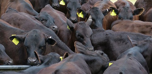
Calves
Jun-15 • msganching on Flickr
brown black english countryside cattle book1 winchester calves swc hants walk15 walkicon tocw115 18942546288

Book 1 Walk 15 Leigh to Tunbridge Wells
Sheep warriors near Penshurst Estate. DGA. Vivitar 5199 5mp
Jan-06 • magyardave2002 on Flickr
book1 walk15 swcwalks 2410362148
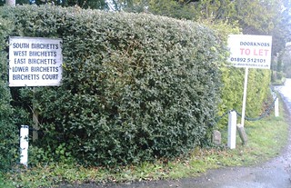
To let
Birchetts and Doorknobs! DGA. Vivitar 5199 5mp
Jan-06 • magyardave2002 on Flickr
book1 walk15 swcwalks birchetts 2409531643

Book 1, Walk 15, Leigh to Tunbridge Wells 2
Small child investigates small dog, 14 April '07
wells book1 leigh tunbridge penshurst walk15 swcwalks 460340114

Book 1, Walk 15, Leigh to Tunbridge Wells 1
Small child spots small dog, 14 April '07
wells book1 leigh tunbridge penshurst walk15 swcwalks 460350637

Book 1, Walk 15, Leigh to Tunbridge Wells 4
14 April '07
kent sheep wells book1 lamb leigh tunbridge penshurst walk15 swcwalks 460334184
Penshurst Place & Medway Valley
| Length | 18.9km (11.7 miles), 5 hours 20 minutes. For the whole outing, including trains, sights and meals, allow 10 hours 30 minutes. |
|---|---|
| Toughness | 5 out of 10. |
| OS Maps | Explorer 147 or Landranger 188. Leigh, map reference TQ 546 462, is in Kent, 4km west of Tonbridge. |
| Features |
This is a pretty walk with a nice lunchtime pub. The route is through a landscape of great beauty, confirming the description of Kent as the Garden of England. It proceeds through the grounds of Penshurst Place, with fine views of the house, taking in a truly pastoral landscape of rivers, lakes, woods and rolling hills; and passes through the lovely village of Penshurst. The walk then makes its way along the River Medway and into historic Royal Tunbridge Wells, through woods and parks which extend right into the heart of the town. The suggested tea place is in the colonnaded Pantiles. The morning leg to the lunchtime pub takes one and a half hours. The afternoon leg takes over three hours at average walking pace, so outside of British Summer Time leave plenty of time when leaving the lunch pub. |
| Walk Options |
You can reduce the length of the walk by 4km, by more or less following the River Medway from point [5] to point [8] on the map – missing out the steepest hill, but also the suggested lunchtime stop and the best view. This would be a good option if you set out late, and stop for lunch in Penshurst. Except on Sundays, you can also get a 231 or 233 bus about once an hour going to Tunbridge Wells or Edenbridge, from either the bottom of Smart's Hill (a ten-minute walk from the lunchtime pub) or from Penshurst. For bus information, call 0871 200 2233. |
| History |
The stately home of Penshurst Place (tel 01892 870 307) is a perfectly preserved, unfortified manor house, which has been the home of the Sidney family since 1552, when Edward VI gave it to his old tutor, Sir William Sidney. The poet Sir Philip Sidney was born here in 1554. The oldest part of the building dates from the fourteenth century, but the present house represents a curious blend of five centuries of architectural styles. Penshurst Place is open on weekends in winter, and daily from the end of March to the end of October. The gardens are open from 10am to 5pm, the House and Toy Museum from 11.30am to 3.30pm. Admission (2023) is £14.00; or £12.00 for the gardens and grounds only. On the south side of St John the Baptist Church, Penshurst, are timber-framed cottages which form part of Leicester Square (named after a favourite of Elizabeth I) and include a post office house from 1850. In the Sidney Chapel of the church are many memorials and the effigy of the top half of Stephen de Penshurst, Warden of the Cinque Ports and Constable of Dover Castle, who died in 1299. The fine armorial ceiling in the chapel was restored in 1966. By the side altar is the Luke Tapestry (in Greek), made by Penshurst's former village doctor: it honours the partnership between medical science and Christianity. The spa town of Royal Tunbridge Wells had its beginning in 1606, when a courtier, Dudley, Lord North, discovered a chalybeate (iron-bearing) spring which made good the damage to his health from dissolute living. At the town's zenith, William Pitt, Dr Johnson, David Garrick and Sir Joshua Reynolds were regular visitors. Queen Victoria frequented Tunbridge Wells as a child, but the 'Royal' prefix was added in 1909 by Edward VII. The colonnaded Pantiles are named from the small clay tiles that Princess Anne paid for in 1698, after her son fell on the slippery ground. |
| Travel |
Take the train nearest to 9.45am from London Bridge Station to Leigh (Kent), going via East Croydon and Redhill. On Sundays there is only a direct service in summer; at other times of the year you would need to change at Redhill, with a longer journey time. An alternative route is to travel out via Tonbridge, changing there for a connecting service to Leigh; this indirect route is sometimes quicker. There are frequent direct trains from Tunbridge Wells back to Charing Cross. Journey time about 55 minutes. Buy a day return to Tunbridge Wells. If driving, you can park near Leigh Station and return by train, changing at Tonbridge for the hourly service to Leigh. |
| Lunch |
The suggested lunchtime stop is the Spotted Dog (tel 01892 870 253) at Smart's Hill, some 6.4 km (a third ) into the walk. This traditional clapboard pub dates back to 1520. This popular pub has log fires in winter and enjoys a superb view across the Medway Valley to Swaylands and Penshurst from its rear terraces. There are plenty of outside tables, but call ahead or arrive early if you want a table inside for lunch. Locally sourced food from a mostly English menu is served; lunch from midday to 2.30pm, Monday to Saturday, and from midday to 4pm on Sunday. Nearby is another large and popular pub, the Bottle House Inn (tel 01892 870 306). This 15th century Free House serves meals - again, locally sourced - from Wednesday to Saturday from midday to 9pm and on Sunday from midday to 5pm. Alternatively, for late starters, there is the Leicester Arms (tel 01892 871 617) in Penshurst, some 3.8 km into the walk. This Grade 11 listed building was once an integral part of the Penshurst Estate but it is now privately owned. Under new management since May 2020, this pub-hotel serves lunch from midday to 2pm most weekdays including Saturday (occasionally closed on Mondays and Tuesdays) and from midday to 3-30pm on Sundays. |
| Tea |
There are several tearooms, restaurants and wine bars in the Pantiles, some with outdoor seating. Some serve excellent cream teas in the afternoon, but most so-called tea rooms annoyingly close at tea time. In the High Street on your way to the railway station you have an alternative choice of tea rooms, restaurants and wine bars. Try Juliets tea room at No 54 High Street (tel 01892 522 931), open until 5pm, in a bohemium setting with exposed brickwork and mismatched furniture. This very popular establishment serves lovely cakes (some gluten free) and tea in a pot. A five-minute walk past the station up Mount Pleasant Road will bring you to The Opera House, a splendid building which more recently was a cinema and bingo hall, and is now a JD Wetherspoon pub. |
| Updates | No major changes. This edition August 2019. Lunch pub updates September 2021. |
| Book |
This walk was originally published in Time Out Country Walks near London volume 1. We now recommend using this online version as the book is dated. The book contained 53 walks, 1 for every week of the year and 1 to spare. Here is our suggested schedule |
|---|---|
| Profile | |
| Help Us! |
After the walk, please leave a comment, it really helps. Thanks! You can also upload photos to the SWC Group on Flickr (upload your photos) and videos to Youtube. This walk's tags are: |
| By Train |
Out (not a train station) Back (not a train station) |
| By Car |
Start TN11 8RU Map Directions Return to the start: Finish TN1 1BT Map Directions Travel to the start: |
| Amazon | |
| Help |
National Rail: 03457 48 49 50 • Traveline (bus times): 0871 200 22 33 (12p/min) • TFL (London) : 0343 222 1234 |
| Version |
Apr-23 Marcus |
| Copyright | © Saturday Walkers Club. All Rights Reserved. No commercial use. No copying. No derivatives. Free with attribution for one time non-commercial use only. www.walkingclub.org.uk/site/license.shtml |


Walk Directions
- [1] From either platform at Leigh Railway Station , take the path down to the road. Turn left and walk up the road, your direction 200°. In 100 metres, you pass an oasthouse conversion called Paul's Farm Oast. The road starts to head uphill and bends to the left. 150 metres further on, there is a signpost on the left-hand side of the road indicating a link to the Eden Valley Walk to the right , with a concrete public footpath sign at ground level to the right of Paul's Hill House .
- [2] Turn right up this car-wide, earthen track, your direction 240° initially. In 150 metres you come to a metal fieldgate. Go through the squeeze stile to the left of the gate when the latter is not propped open and continue along the track. In 100 metres at a fork and with a pond to your right, take the left-hand fork along a level, grassy way and head for the far left corner of the field. In 250 metres at this field corner go through a sqeeze stile to the right of a metal field gate when the latter is not propped open.
- Continue on a wide grassy way in the same direction down an avenue of plane trees, ignoring a footpath off to the right after 100 metres. In a further 300 metres you come to a metal fieldgate and go through the adjacent squeeze gate, when the former is not propped open, to continue on the Eden Valley Walk.
- In 100 metres, where the Eden Valley Walk goes off to the left on a gravel way, continue ahead on the wide grassy path, soon with a fine view of Penshurst Place, Penshurst village church, and the sylvan dales of Penshurst Park on your left, still with London plane trees to left and right.
- In 550 metres, with a three-arm signpost on your right, [3], turn half-left down the hill, between trees, on a broad grassy path, aiming towards Penshurst Place. 350 metres down the hill, pass through a metal squeeze gate to the left of a metal fieldgate (off its hinges August 2019) and follow the wide grassy path as it turns slightly to the right, aiming for the far end of the fence on your right.
- In 200 metres go through a metal swing gate in this fence to the left of a metal fieldgate (off its hinges August 2019) and follow the fence on your left-hand side, with the lake beyond it. In 150 metres, where the fence turns left, continue straight on towards a metal kissing gate in the fence some 150 metres ahead. Go through this gate and keep ahead towards the right-hand side of Penshurst Place, over grassy parkland on a non-defined path, passing three magnificent English oak tress on the way, your direction due south.
- In 450 metres, having gone to the right of boundary fencing to a cricket field, go through a pair of metal kissing gates on either side of a tarmac access road and bear slightly right on a grassy way to the right of a gravel access drive. In 150 metres you come to a projecting piece of Penshurst Place's hedge-topped stone wall and continue ahead with the wall on your left-hand side. In 80 metres go through a metal kissing gate leading into the churchyard of St John the Baptist Church, Penshurst.
- Walk through the churchyard (the church is worth visiting – the second door on your left). Continue out of the churchyard, underneath a cottage which stands on stilts (in a line of remarkable ancient cottages), into Leicester Square and down past the 1850 post office. Some stone steps take you down to the road.
- If you want an early lunch, for example if planning to take the short cut later on, turn right here for the Leicester Arms or Quaintways tearoom. Afterwards, return to this point.
- To continue on the main walk, turn left and follow the road as it curves around to the right. The entrance to Penshurst Place is on your left, on the corner. You cross a backwater on a small stone bridge and then, 150 metres beyond this, the River Medway itself on a second stone bridge.
- [4] 150 metres further on, going uphill, you come to a sign on your right pointing left to the 'Enterprise Centre' and a green footpath sign on the right-hand side of the road. Turn right onto this footpath, an earthen car-wide track with grass down its middle. In 15 metres go through a metal swing gate to the left of a metal fieldgate.
- In 350 metres go through a field boundary with an open field to your right. In a further 350 metres, you come to a hedge with some disused hop poles on your right. On your left there are directional arrows on a tree.
- Go past the hedge and immediately [!] turn right along the field edge, downhill, your direction west. You are aiming for a large footbridge which you can see in the opposite corner of the field. Halfway down, follow the field edge round to the left and then cut diagonally across the field to the bridge (this is the route shown on the OS map, but you could walk all the way around the field edge if you prefer). Cross over the River Medway on this footbridge [5].
- Once over the bridge, you have the option of turning left for a short cut. Follow the field edge for 600 metres, keeping the river close by on your left, then go through a gap in the hedge and over a plank into the next field. Turn left and go along the field edge, following it round to the right towards a stile in the barbed wire fence. Cross over the stile, turn right and follow the field edge up and round to the left; when you go over the brow of the hill you will see a large metal footbridge in the bottom right-hand corner of the field. Go down to this bridge, cross back over the River Medway and take the path straight ahead across the field, your direction 100°; this is [8] below.
- [5] To continue the main walk: on the other side of the bridge, turn right to go along the field edge. In 50 metres, where the river curves off to your right, continue straight on across the field, towards a red-brick building in the distance, your direction 290°.
- In 220 metres you come to the far side of the field and see a 'Penshurst Estate public footpath' sign. Cross over the ditch and head up the grassy car wide track, with light woodland on your right and tree-line on your left.
- In 200 metres you come to a T-junction with a once-surfaced lane, with Ford Place (marked on the OS map) on your right-hand side. Turn left along this track, your direction 220° initially.
- [6] In 300 metres you come to a T-junction with the B2188. Directly opposite you can see the old wooden buildings of South Park Farm, with the house of South Park in the background. Turn left on to the road and then immediately take the right fork, signposted 'Smart's Hill, half mile'. The incline starts steadily but as you start to tire the hill becomes steeper !
- In 650 metres up the hill, having ignored a bridleway to the left, you come to a T-junction, where you have a choice.
- For the Spotted Dog (the suggested lunchtime stop), turn left, following the sign for Fordcombe and Tunbridge Wells. In 150 metres you come to the Spotted Dog on your left-hand side. After lunch, turn right out of the pub, retracing your steps up the road. In 150 metres, continue past the road you ascended before lunch. 30 metres further on, fork left along Nunnery Lane. In 150 metres ignore a footpath on the right.
- For the Bottle House Inn (an alternative lunch stop), turn right and in 30 metres fork right again. In another 350 metres you come to the Bottle House Inn. After lunch, go back down the road you came on for 25 metres, then take a footpath on the right. In 200 metres you come out onto Nunnery Lane and turn right.
- [Both lunch options continue] Follow this road steeply downhill, ignoring ways off, for the next 500 metres. At the bottom of the hill go straight past the turning to the left, signposted Fordcombe and Tunbridge Wells, following the sign for Walter's Green and Blackham. In 50 metres turn left off the road, where public footpath signs point to both left and right. Cross over the stile and follow a line of oak trees, your direction 140°.
- 100 metres further on, you come to the last oak in the row and continue straight on down the hill, following a fenceline on your right-hand side, for 120 metres, to a new wooden bridge with wooden railings, passing through a metal swing gate on the bridge's near side.
- On the far side of the bridge, head half-right across the field on a faint path, your direction 180°, aiming for a metal swing gate in the fenceline ahead and to the right of a hedgerow on the banks of the River Medway. Go through the gate and follow the path beside the river on your left. Your way swings to the right and in 120 metres you come to a footbridge on your left-hand side. Cross the river on this bridge and bear half-left along a path, heading north-east towards a metal fieldgate 100 metres away.
- [7] Cross the stile to the right of the metal fieldgate, which brings you out to the B2188. Cross over the road but ignore a footpath directly opposite and turn left along the road. In 15 metres [!] take another footpath on the right, over a stile. Head across the field, your direction 70°. In 50 metres go through a metal kissing gate then over a ditch and continue along the right-hand side of the next field, in the same direction as before, with oasthouses over to your right-hand side, and a large open field to your left.
- In 350 metres you come to the corner of the field. Follow the path as it bears around to the left. 20 metres further on, turn right through a field boundary to cross a wooden bridge with a scaffolding pole railing, go through the metal swing gate at the far end of the bridge into the next field, where you continue on a faint path, directly ahead, your direction 70°.
- In 150 metres you come to a bend of the river on your left. Ignore a path leading off between trees into the field on your right and continue ahead through a gap in the hedge. Bear half-left , over a vast grassy field, your direction 40°, eventually passing under some pylons and meeting the river again in 500 metres. Cross a rickety stile, drop down into a ditch and head up the othdr side, to continue with the riverbank close by on your left-hand side for the next 700 metres, going through a number of field boundaries along the way.
- [8] You then come to a bridge with high metal railings, going over the River Medway, on your left-hand side. The Walk's shortcut joins here . Do not cross the bridge. Instead [!] turn right and go along the left-hand field edge towards a row of trees and an electricity pylon in the distance, your direction 100°. In 250 metres go through a wooden swing gate to the right of a metal fieldgate and turn half-right gently uphill, on a clear path, your direction due south.
- Ahead of you is the tiny (locked) chapel - All Souls Chapel, Poundsbridge - and graveyard (used because Penshurst churchyard is full). Go through a metal swing gate and the path goes up the side of a row of oak trees towards the left-hand edge of the graveyard. In 35 metres you come to a metal fieldgate and go through the wooden gate on its left. 40 metres further on, you pass the wooden gate leading into the churchyard and come out on to a road.
- Turn left on to the road (Coopers Lane). In 120 metres you come to a T-junction, with Poundsbridge House opposite. Turn left, down the hill. In 150 metres, at the bottom of the hill, go over the bridge crossing a small brook. 50 metres beyond the bridge, you come to another T-junction, signposted Penshurst and Leigh to the left, with a 1593 house and walled garden on your right. Turn right and, in 20 metres, [!] turn left off the road, over the stile which is marked by concrete and wooden footpath signs. Head straight up the hill, with the edge of the field on your right-hand side, your direction at this point 65°.
- For the next 1km you will be walking more or less parallel to the pylons away on your left hand side. In more detail:
- In 300 metres the path goes underneath two parallel sets of overhead cables. Continue along the edge of the pond on your right-hand side. 80 metres further on, at the far end of the pond, go through a metal squeeze stile into the next field. Continue in the same direction, with the field edge on your right-hand side. In 60 metres the overhead cables take a sharp right hand turn, but you continue straight on, to go through a broken metal squeeze stile, your direction 95°.
- Ignore the turning right and continue along the path, with another pond on your right-hand side. In 50 metres go over a stile into the next field and turn right uphill, heading in the same direction as before, with trees and the edge of the field on your right-hand side.
- In 150 metres cross a wooden footbridge with single wooden handrail into the next field and continue ahead, with a vast open field over to your left. In 200 metres, over the brow of the hill, you again have the field edge on your right-hand side, with woodland beyond. In another 120 metres, cross over the stile in the corner of the field (with a metal gate on its left-hand side) to follow the footpath between a fence and a copse.
- [9] In 70 metres the footpath comes out onto a surfaced drive. Keep ahead along the drive and in a further 60 metres, you come out on to a road. Turn left down the road. In 35 metres, turn right down a car-wide track, marked by a concrete public footpath signpost and a wooden sign for Squirrelsmead and Barden Mill Cottage. In 160 metres cross a stile to the left of a metal fieldgate. Beyond this, follow the worn concrete track sharply round to the right. In 180 metres ignore the turning off to the left and continue ahead. 160 metres further on, the track curves around to the left, across a brook, now uphill.
- 450 metres further on, you come to the top of the hill, with a barn on your left-hand side and a large house with an oast chimney on your right. At the end of the track, just beyond the barn, there is a metal fieldgate. Cross over the stile made of brick steps next to the gate and go half-right across a concrete yard for 15 metres. Go to the left of the large horse chestnut tree and cross over the stile to the right of the wooden fieldgate, and walk straight ahead with the right-hand edge of the field on your right-hand side, your direction due east. In 120 metres cross over a stile into the next field. Follow the path half-left, slightly downhill at first, to skirt a tall hedge up ahead on the right-hand side of the field.
- In 150 metres, at the far side of the field, cross over a stile which brings you out on to a tarmac lane. Turn right up the hill, initially in a cutting. In 90 metres there is a house on your right-hand side called Hollanbys. In another 250 metres along this winding road you come to a T-junction.
- Turn left on to the road through the village of Stockland Green. In 120 metres you pass Birchetts Lodge on your left-hand side, and a white sign pointing to various other Birchetts. Immediately opposite the drive going off to the left here, there is a public footpath sign on the right-hand side of the road. [!] Turn right here through a metal kissing gate, down an enclosed path between houses. (If you see Birchetts Cottage on your right-hand side, you have gone too far down the road.) In 60 metres cross over a stile and continue along the left-hand side of the field, with a fenceline on your right.
- In 70 metres, at the corner of the field, cross over the stile on your right-hand side. Turn left and resume your previous direction along the left-hand field edge. In 100 metres, at the top corner of this field, turn left through a kissing gate frame.
- Go straight down the path, between the hedgerows, your direction 80°. In 25 metres there is a wooden post on your left, pointing straight ahead for the High Weald Walk, but you turn right here through a metal kissing gate and follow a narrow enclosed path, heading due south.
- [10] In a further 200 metres you come down through another kissing gate on to a road.
- Go straight over the road and on to the narrow footpath opposite. In winter this is a potentially muddy little path which makes its way between hedgerows, steeply downhill. In summer, the path can be overgrown in places. In 500 metres you come out on to a busy minor road, where you turn right.
- In 20 metres the road crosses over a small brook and passes Cobblestone Mews and Mill Farm Close on your right-hand side. To your right used to be Redsheen Kennels at Mill Farm. The new user is Salomons Estate wedding venue and conference centre. 200 metres further on, the road curves around to the right, and there is a public footpath sign off to the left.
- [!] Turn left off the road here on to a track going downhill, quite steeply, soon narrowing to an uneven path, your direction 135°. In 120 metres cross over a fast flowing stream and follow the path as it starts to make its way back uphill. 50 metres up the hill, the path forks. Take the right-hand fork, your direction due south. In 100 metres you come to wooden fieldgates with signs saying 'Keep Out'. Continue along the track, soon into woods.
- 80 metres further on, you come to a metal fieldgate and go over the stile on its left-hand side, into the wood, to continue along the woodland path. In 200 metres you come to a Forestry Commission sign saying 'No admittance to vehicles'. Ignore the paths to left and right and continue straight on, ignoring all ways off.
- In 500 metres you come down to a metal fieldgate. Go through the wooden kissing gate on its left. 200 metres further on, you come to the end of the public footpath. Ignore a track leading down to the right and continue ahead on a wide track which passes to the left of a brick building belonging to Southern Water Services.
- 40 metres further on, you come out on to a residential street, on the outskirts of Tunbridge Wells. You are on a corner with Coniston Avenue heading left and Bishops Down Park Road ahead, with a footpath between them. Go up Bishops Down Park Road, your direction 145°. In 120 metres a metal fieldgate blocks the road ahead. In a further 40 metres you come to a T-junction and turn right, still on Bishops Down Park Road, past a house called Charlcombe on your left-hand side. There is a golf course beyond the hedgeline and treeline over to your right as you go along this road.
- 300 metres further on, [!] you come to some tall iron gates painted black on your left. 15 metres beyond these gates [!] turn half-right on to an unsigned path, through light woodland, now heading due south. In 200 metres this woodland path comes out onto a private, surface-dressed road (Manor Park) with houses on either side. Keep ahead and in a further 250 metres, with Grange Cote on your right-hand side, you come to a road T-junction. Turn right, your direction 240°.
- [11] At the end of this cul-de-sac, turn half-left onto a small grassy area and go up to the A264 at a junction, with the Major Yorke pub on the other side. Cross the main road carefully and go down Major Yorke Road opposite, then immediately turn half-left past some low wooden posts onto a wide path leading into the woods of Tunbridge Wells and Rusthall Commons, your direction 100°.
- In 150 metres cross over a path to go straight on. In another 180 metres go past a scaffolding pole barrier and over a tarmac road (Fir Tree Lane) to continue ahead, now on a surfaced path, with a cricket pitch on your left-hand side.
- Ignoring ways off, in 200 metres you come to a tarmac path, where you turn right downhill, your direction 155°. Continue to ignore ways off.
- In 350 metres you come to the A26 by a mini-roundabout. Cross this busy road carefully and go down steps to the left of the Swan Hotel to reach the Pantiles. You have several tea options in this parade.
- Continue north-east along the Pantiles to reach Nevill Street, with King Charles the Martyr Church opposite. Cross Neville Street by the pedestrian lights to your right. On the other side of the street, turn left and then immediately right into Cumberland Walk. In 25 metres turn left up some steps and a brick alleyway to the start of the High Street. You will find Juliets tea room on your left-hand side as you progress up the High Street. Continue along the length of the High Street, about 300 metres, to its intersection with Vale Road. On the other side of Vale Road you can see signs for Tunbridge Wells Railway Station.
- You can enter the station from either side, but trains to London depart from platform 1 on the left. The Opera House (now a JD Wetherspoon pub) is up the hill on the right, 400 metres past the station.