Princes Risborough to Wendover walk
The Ridgeway, lovely views and the Chilterns.


The Ridgeway Path through Chequers
| Length | 16.9 km (10.5 miles), 4 hours 30 minutes if detouring to the Swan pub in Smokey Row. If you by-pass Great Kimble, the walk length is 14.1 km (8.8 miles). You can reduce the walk length by a further 1 mile by taking the Ridgeway footpath route direct to Coombe Hill. For the whole outing, including trains, sights and meals, allow 8 hours. |
|---|---|
| Toughness | 6 out of 10. |
| OS Maps | Explorer 181 or Landranger 165. Princes Risborough, map reference SP 799 027, is in Buckinghamshire, 11km south of Aylesbury. |
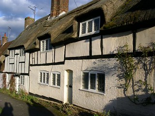
| Features | This walk is easy to follow, being mainly along the Ridgeway and is very much uphill and downhill, but not strenuously so. The way is predominantly through high beech woods and chalk downlands, including the Grangelands Nature Reserve and has views out from Coombe Hill over the Vale of Aylesbury and surrounding counties. The walk ends by descending into the pleasant old town of Wendover. |
| Walk Options | There are buses back to Princes Risborough from near the lunch pub in Great Kimble. You could also shorten the walk by 1 mile by staying on the Ridgeway and not detouring via Dunsmore. |
| History |
The town of Princes Risborough derives its name from the Black Prince who in 1343 was lord of the manor. This area was first settled by farmers in neolithic times, around 4,000BC, and was defended by a line of hilltop forts linked by the broad Icknield Way which can be traced from Dorset to Norfolk and on this walk survives as the narrow Ridgeway. Remains of such forts can be found on Pulpit Hill and Coombe Hill. Whiteleaf Cross, carved into a hillside, is thought to commemorate a victory over the Danes. Chequers, the prime minister's country retreat, was given for this purpose to the nation by Lord and Lady Lee of Fareham in 1921. Lady Mary Grey, sister of Lady Jane Grey, was imprisoned in Chequers in 1566 and the house was later owned by a grandson of Oliver Cromwell. Wendover's name comes from the Anglo-Saxon 'wand' (winding) 'ofer' (bank). In 1600, the town had one pub for every 50 inhabitants. Wendover became the property of the crown and was given by Henry VIII to his wife Catherine of Aragon. It had John Hampden as its MP during the five parliaments leading up to the Civil War. He was one of the MPs whose attempted seizure by Charles I led to the Civil War. |
| Travel | If planning to take lunch at the Swan, Smokey Row, take the train nearest to 10.00am from Marylebone Station to Princes Risborough. If luncheoning earlier at the Plough, Lower Cadsden, take a train around 10.45am. Journey time 40-45 minutes. Trains back from Wendover run twice an hour. Journey time 50 minutes. As your journeys are on different branches of the Chiltern Railways network you will need to buy a return ticket to Aylesbury, where the two branch lines converge. Make sure your ticket is valid on both branches by purchasing a Day Return Any Route Permitted . When available, the cheapest, valid ticket at weekends only is a Super Off-Peak Day return to Aylesbury from Marylebone (but it does not appear (2023) that this ticket is being sold by the rail company). |
| Lunch |
The original lunch pub on this walk, the Bernard Arms, closed some twelve years ago and the building has since been demolished. The suggested lunch stop now is The Swan (tel 01844 275288) in Smokey Row (Great Kimble), a family owned Free House, some 8.2 km into the walk. The pub is open Thursday to Sunday (closed Monday to Wednesday) serving cask beers and with a good lunch menu (seasonal modern British menu with creative salads, grilled fish and meat) served midday to 2.30 pm weekdays, to 5 pm on Sunday. On Saturdays in summer, lunch is a barbecue with pizzas; on Sundays, classic roasts are served (recommended). Vegetarian and Vegan options also available. Best to book ahead or 'phone from Princes Risborough to reserve a table. This pub is off the TO Book's original route. Directions to and from the pub are at the end of the main walk directions. For those starting later or not wishing to detour to the Swan can take an early lunch (a little over one hour into the walk) at the Plough (tel 01844 343 302) in Lower Cadsden, some 5.1 km into the walk. It serves lunch midday to 2pm, Monday to Friday, and until 3pm on Saturday and until 3-30pm on Sunday. |
| Tea |
The suggested tea place for chocaholics is Rumsey's Chocolaterie (tel 01296 625 060), five minutes from Wendover Station, which is open until 5-30pm (last orders taken at 5-15pm). Also worth considering is the bar of the 17th century Red Lion Hotel (tel 01296 622 266) For pure convenience, SWC walkers usually end up at the Shoulder of Mutton pub (tel 01296 623 223, Chef and Brewer), right by the station. Food is served all day (2023), seven days a week. |
| Updates |
This updated edition January 2022. An alternative - less muddy - route through Dunsmore Woods before the Boer War Monument is now included. Travel, and Lunch pub and tea details, updated September 2023. |
| Book |
This walk was originally published in Time Out Country Walks near London volume 1. We now recommend using this online version as the book is dated. The book contained 53 walks, 1 for every week of the year and 1 to spare. Here is our suggested schedule |
|---|---|
| Profile | |
| Help Us! |
After the walk, please leave a comment, it really helps. Thanks! You can also upload photos to the SWC Group on Flickr (upload your photos) and videos to Youtube. This walk's tags are: |
| By Train |
Out (not a train station) Back (not a train station) |
| By Car |
Start HP27 9DN Map Directions Return to the start: Finish HP22 6BN Map Directions Travel to the start: |
| Amazon | |
| Help |
National Rail: 03457 48 49 50 • Traveline (bus times): 0871 200 22 33 (12p/min) • TFL (London) : 0343 222 1234 |
| Version |
Sep-23 Marcus |
| Copyright | © Saturday Walkers Club. All Rights Reserved. No commercial use. No copying. No derivatives. Free with attribution for one time non-commercial use only. www.walkingclub.org.uk/site/license.shtml |


Walk Directions
- [1] Coming out of Princes Risborough Railway Station, turn left. In 65 metres turn right with the road, away from the station. There are hoardings on your right around a site awaiting redevelopment. At a T-junction in 90 metres turn right on Summerleys Road, signposted to High Wycombe and Aylesbury.
- In 95 metres ignore the first turn on the right (Picts Lane) and veer left with the road. In 90 metres take the next road on the right, Poppy Road (the B4444), signposted to High Wycombe.
- Keep straight on, passing on your left-hand side the new Poppysead residential development (on the site of the former Black Prince pub and its subsequent incarnations, the last being the Poppysead Bar and Indian restaurant) and come out to the A4010 road where you bear right. Cross over the road and continue along it in the direction of High Wycombe.
- In 160 metres turn left up a tarmac lane, the historic Upper Icknield Way, signposted the Ridgeway, your direction 60° initially [2].
- Keep straight on up this lane, gently uphill. In 150 metres the tarmac ends and becomes a gravel then grassy way (an earth road recently re-seeded). Ignore all ways off to the right and left.
- In 850 metres, after passing a school and playing fields on your left, cross over a road and continue straight on along the Ridgeway Path (still called the Upper Icknield Way). Keep on this lane, ignoring a footpath sign off to the left.
- [3] In 350 metres, as you reach the end of playing fields on your left-hand side, take the Ridgeway footpath to your right at a three-armed footpath sign, your direction 95°, uphill. The Whiteleaf Cross becomes visible on the hillside to your left at 40°. Keep on this main way all the way up, with a field fence on your right-hand side. After you pass through the first field boundary ignore a fork to the left. The path now ascends more steeply.
- Follow the acorn sign (the Ridgeway Path symbol – and the symbol for all National Trails) up a flight of steps into the wood. In 15 metres, with a Brush Hill notice board to your right, ignore a footpath sign to the left to keep on up more flights of steps on the Ridgeway Path.
- Near the top of the hill, go through a metal kissing gate (with a view back over Princes Risborough) then up eight earthen steps. In order to stay on the right of way, follow the acorn sign straight on upwards, eastwards (less leftwards than the arrows by the kissing gate might lead you to believe), going between bushes 15 metres up from this gate, on a clear grasssy way, gently uphill. Your grassy way soon swings to the left.
- In 200 metres, you pass a stone pillar with directions, and a bench on your right-hand side, and enter woods. Bear left and in 50 metres go through a metal kissing gate to the right of a wooden fieldgate. Keep ahead in the woods and in 75 metres go through another metal kissing gate, to the left of a metal fieldgate.
- Drop down to a car road, keep ahead then in 25 metres cross over and go sharp left by a four armed sign, up a bank on to the Ridgeway bridleway, your direction 345 degrees, past a car park and picnic tables on your right hand side.
- In 50 metres at a path junction turn right, following the blue arrow for the Ridgeway bridleway that goes along the ridge of the hill.
- In some 350 metres go through a wooden swing gate to the left of a metal fieldgate. Immediately after the gate there is a neolithic mound a few metres to your left. In 50 metres you reach a three armed sign. Here you go right with the Ridgeway Path, your direction 80°. However, you may first like to detour left for 50 metres to the top edge of the Whiteleaf Cross to enjoy a lovely view. In 50 metres go through a metal kissing gate (with a Welcome to Whiteleaf and Bush Hill information board on your left, compliments of the Chiltern Society). 100 metres past this gate, as your path starts going steeply downhill, you veer left with the main path downhill, past a knee high concrete post, your direction 60 degrees.
- Keep on the main path downhill through the woods. In 400 metres at a four way path crossing keep ahead to follow either the Ridgeway path, slightly to your left or the wider path, parallel to it on its right. The paths meet and in 100 metres go through a metal kissing gate to the right of a metal fieldgate.
- Drop down to the Plough pub, in Lower Cadsden, your early lunch pub option. Turn left , following the sign of the Ridgeway path, onto the pub's access drive, which in 70 metres joins a road at a bend in the road. Keep ahead and in 20 metres [!] turn right through a wooden barrier by an electricity pole, your direction 45°. Keep ahead through light woodland on a narrow, undulating path.
- In 150 metres you reach the end of the woods, with a Grangelands Nature Reserve sign ahead. [!]The detour to the Swan pub, Smokey Row, starts here [!] See the Directions at the end of the main directions. The main walk continues as follows. Go through the wooden kissing gate ahead of you (not the wooden swing gate with Ridgeway bridleway sign to your left) and up into the Grangelands Nature Reserve. Note: this route across the Reserve is more interesting than the Ridgeway route to its left, although you re-join the Ridgeway shortly. Ignore forks to the left, keep to the path upwards, on chalk and grassy ways, your direction initially 35° but soon 55°.
- [4] In 325 metres, at the edge of the Reserve, you come to a T-junction with a path. Here turn left soon to reach a wooden kissing gate. Go through and turn left downhill on a car-wide track, your direction 310 degrees.
- In 115 metres ignore a wooden kissing gate to your left and a metal kissing gate above you on your right. Then in 70 metres, at a five armed footpath sign, take the Ridgeway footpath, up a bank and through a metal kissing gate to your right, your direction 15° and head up the Rifle Range section of Grangelands Nature Reserve, with Pulpit Wood to your right. Ignore a footpath that you cross in 150 metres. Soon there are fine views on your left-hand side out over the Vale of Aylesbury.
- You head down into a dip and up the other side and some 225 metres beyond the footpath crossing go up steps to a wooden kissing gate, then more steps, in 40 metres coming out onto a car-wide sunken track, with a four-armed footpath sign ‘North Bucks Way – Wolverton 35 miles’.
- Turn right along the track on the waymarked Ridgeway bridleway and in 30 metres turn left up three earthen steps and go through a metal kissing gate. Now head gently downhill on a meandering grassy way and soon [4A] the path from the Swan pub detour joins from your left . Keep ahead on this path and in some 60 metres you come to a Ridgeway path post at a cross paths.
- Cross over and in 65 metres the path swings to the right past a three armed footpath sign, ignoring a footpath to the left, to follow the Ridgeway Path along the top of an old rifle range valley on your left-hand side, gently uphill, as you follow the fenceline on your left.
- In a further 110 metres ignore a wooden kissing gate and footpath off to the left and go on for 75 metres uphill to a metal swing gate (next to a metal field gate and a stile off to the left).[!] Go straight on, through the swing gate along the Ridgeway footpath, due east, over a grassy field. Your way soon swings gently to the right.
- In 250 metres, by a three armed footpath sign, go out through a wooden swing gate and go to your right, following the Ridgeway footpath sign, your direction 140 degrees, on a broad earthen track, with the wood’s edge on your right-hand side, and a low steel girder and rail fence on your left.
- You now have your first glimpse of Chequers to your left (at 70°). In 420 metres pass through a redundant metal fieldgate and the path swings to the right. In a further 70 metres your turn left through a wooden swing gate by a two-armed footpath sign and head gently downhill between fields towards the Chequers gate-houses, your direction 115°. Note the signs along the way "This is a Protected site under Section 128 of the Serious Organised Crime and Police Act 2005. Trespass on this site is a criminal offence". So best keep to the footpath and not stray !.
- In 280 metres go through a wooden swing gate, cross a grassy way and in 25 metres go through another wooden swing gate to cross Chequers drive - the lodges are some 60 metres to your right. Go through a metal swing gate and keep ahead on a path between grassy fields. In 350 metres leave the Chequers Estate through another metal swing gate and carefully cross a car road and continue straight on, following the Ridgeway bridleway sign, your direction 75°. Buckmoorend farm shop, with its signage to your left and right, is down a drive to your right.
- Follow the path steadily uphill through a strip of woodland, soon passing barns on your righ-hand side.
- Keep ahead following an acorn and blue arrow on a post. In 100 metres (at a sign marked ‘alternative footpath for walkers only’) fork left (the right fork merges again with your way in 100 metres).
- Some 45 metres beyond where these ways merge, by a four-armed footpath sign, ignore the South Bucks Way to your right and carry straight on up the Ridgeway footpath.
- [5] In 250 metres you come to a three-armed footpath sign, more or less at the top of the hill, a potentially muddy patch. Leave the Ridgeway Path here, which goes left [!] unless you wish to head direct to the Boer War Monument on Coombe Hill, by-passing Dunsmore Village, in which case turn left here and follow the directions which follow
- Direct route to the Boer War Munument Having turned left to follow the direction of the Ridgeway footpath sign (330°), keep ahead on a broad, earthen path which meanders through the woods. In 150 metres at a crosspaths, by a four-armed sign, keep ahead (slightyly left). In 60 metres you come to a path T-junction, where you turn right. In 110 metres at another cross paths by a four-armed sign, keep ahead. In 170 metres you come to wooden fencing which you keep on your left. You are now close to the right-hand edge of the wood, with a farm over to your right. In 240 metres you come out onto a road, with the entrance to Lodge Hill Game Farm access drive on your right. Turn right, gently uphill, and in 110 metres, with Lodge Hill Cottage on your right, turn left to follow a Ridgeway footpath and South Bucks Way sign, your direction 300°. Your path meanders through woods and in 125 metres bear right at a path junction. In 100 metres go through a metal kissing gate, with a Coombe Hill NT sign to your left, and a three-armed sign on your right. Turn left, and in 20 metres, bear right to follow a path along the ridge of Coombe Hill, with the woods to your right, and the slope of the hill to your left. In 415 metres you come to the Boer War Memorial. Now continue with the Main Directions.
- The Main route via Dunsmore Village continues as follows : carry on, soon downwards, through woods, ignoring ways off. In 450 metres you ignore a footpath that crosses yours, staying on your car-wide track. In 300 metres ignore a footpath up to your left. Go down past the brick and flint wall to a house and stables on your left hand side, to go over an access road, at a three-armed path sign.
- Carry straight on, along a signposted footpath uphill, over a stile, your direction 70°, on a narrow path between fences. Then go over a stile into a field, following the path half left and uphill to the next stile. Go over this stile and head uphill on a clear path across a field towards its upper left-hand corner which you exit over a stile just to the left of an electricity pylon, onto a car road. [6]
- Turn right on the road. In 80 metres, just past a pond on your right-hand side, turn left, signposted ‘Dunsmore Village only’, onto a tarmac car lane.
- Ignore a footpath sign off to the right in 60 metres. In a further 20 metres, a bridleway sign points your continuing way, straight on up the tarmac car lane.
- In 90 metres continue past Apple Tree Cottage on your right-hand side and The Beeches slightly further on. Ignore a stile to the left to carry on.
- The path has by now narrowed and in 100 metres, just after the path swings to the right, you [!] fork left on a wide path, between fences to your left and right, through woods, your direction 330°. [!]You are now going to walk for some 1.2 km along the edge of these woods in a north, north-westerly direction, following yellow arrows and ignoring turnings off to the left, marked by blue arrows (unless you take the alternative route through the woods as in the box below).For most of the way you are between fences, on a path that can be very muddy in winter. But in more detail:
- In 450 metres go over a cross paths with a gap on your left (a dilapidated stile) and a gap in the fence on your right, and keep ahead.
- In 130 metres cross over an access track to a private property on your right. The fenceline on your right is now an old rusting metal fence. The fence on your left now ends.
- In winter, when the original TO Book route through the woods can be very muddy, you might like to consider this alternative route : in a further 130 metres turn left through the wood along a footpath (initial bearing 260°). You follow occasional yellow arrows on trees and in 150 metres at a T-junction of paths turn right with a National Trust marker. In 250 metres ignore a left turning footpath and continue in the same direction. You pass occasional NT marker posts (on top of more yellow arrows on trees) and in a further 320 metres veer left with the path, where the NT path turns right. In 80 metres join a wider track and in a further 30 metres turn left through the metal swing gate to go past the National Trust sign saying Coombe Hill - and continue with the original route as below.
- The original route : in 130 metres ignore a footpath off to the left (the alternative route, as above) and in 60 metres (100 metres away on the other side of the fence to your right) you pass a house with a conservatory. In a further 220 metres, ignore a turning to the left and keep ahead through, or passing to the side of, old metal gates and wire stretchers. The rusting fence on your right ends here, to reappear in sections ahead at intermittent intervals. Continue straight ahead, your direction now 315°.
- In 200 metres [7][!] there is a tree on your left-hand side with a metal railing partly embedded in it. Here [!] turn half-left into the wood, your direction 300° on an initially indistinct path, soon made clearer by yellow arrows on trees. In 100 metres, with yellow path junction arrows marked on a tree, you join a path coming in from your left and keep ahead, slightly right, your direction now due north.
- In 65 metres you come to the edge of the wood where you go through a gap in the fence and turn right .
- In 10 metres go through a metal swing gate and turn left to go past a National Trust sign saying Coombe Hill. Carry straight on, your direction 285°, with a fence on your left-hand side. You soon join a gravel path which swings to the right and after 450 metres you come to the Boer War Monument.
- At the Monument, there is a concrete pillar indicating directions to distant points. Follow more or less the direction it marks to Edlesborough Church to your right to pick up the Ridgeway Path (marked with acorn posts) down towards Wendover, your direction 80°.
- Exit the Coombe Hill grounds by a metal kissing gate to go over a bridleway and through another kissing gate and straight on along the Ridgeway Path, your direction 70°.
- In 300 metres, by a sign for Bacombe Hill, you fork left, following the Ridgeway Path down , in 100 metres passing through a kissing gate, then straight on, your direction 70 degrees. There are fine views out on to the Vale of Aylesbury below.
- Keep to the main path. Further on, a fine view of Halton House appears ahead of you on your left-hand side. 400 metres on from the kissing gate, follow an acorn marked post to fork to the left.
- Carry straight on along this path downhill, ignoring a further fork to the left into woods by a bench some 300 metres on. In 200 metres go through a metal kissing gate marked with the acorn and carry on down.
- In 80 metres turn right on the car road and carry on down under pylons into Wendover, passing Station Approach road on your left, then the Shoulder of Mutton pub - a tea stop option. Head on down the High Street to Rumsey’s Chocolaterie on your left-hand side and the Red Lion Hotel on your right hand side.
- After tea at the Chocolaterie retrace your steps up the High Street, passing the Shoulder of Mutton pub on your right. Turn right into Station Approach which leads down to [8] Wendover Railway Station. The platform nearest to you is the one for London.
Detour to the Swan pub, Smokey Row
- Go through the wooden swing gate some 10 metres to the left of the wooden kissing gate (which is used to follow the main route up into the Grangelands Nature Reserve) and follow the direction of the Ridgeway bridleway sign, initially north.
- Keep ahead, gently uphill through the Nature Reserve on a broad, grassy way. In 400 metres go through a wooden swing gate and in 10 metres at a path crossing by a five-armed sign turn left on to a bridleway down a car-wide track, with high trees and hedges on either side.
- In 300 metres you come down to a once surfaced access road, with a farm entrance on your right. Keep ahead along a tarmac road, your direction 300°and in a further 300 metres cross over the busy A4010 Aylesbury Road and keep ahead over a cattle grid into the grounds of a property known as The Grange, following the direction of a footpath sign along a fine gravel access road.
- In 150 metres cross a stile directly ahead of you onto a grassy path between fences, with horse paddocks on either side. In a further 160 metres go over a stile and bear left then immediately right to go along the right-hand edge of a field, your direction 320°. In 80 metres at a path junction in a field boundary bear right through a rickety swing gate on to a broad grassy way, your direction 35° with a hedge on your right.
- In 100 metres swing left to cross over a stile then over a single track railway line. On the far side cross over another stile to come out into a field. [!] The main route onwards takes you half-right across this field then through the front and rear gardens of a number of private properties, following well signed footpath signs. Although this is an official footpath route, it is very intrusive on the property owners, and so is best avoided. [!] Instead, having crossed the stile on the far side of the railway line, immediately turn right along the right-hand edge of the field, parallel to the railway over to your right. Pass through a wooden swing gate and continue ahead until, some 50 metres before you reach the fences marking the end of the fields ahead [!] turn right through an easy to miss stile in the hedgerow and treeline on your right, to then follow an enclosed footpath parallel to the railway line on your right and below you. In some 100 metres go up a flight of twenty earthen steps to come out onto a road, with a road bridge over the railway on your immediate right. Turn left along this residential road, soon passing houses on either side.
- In 400 metres you come to a T-junction with the Icknield Way road. Directly opposite is your lunchtime pub, The Swan , Smokey Row. Coming out of the pub after lunch, turn left along the main road (now called Grove Lane). In 140 metres turn right onto the Aylesbury Ring footpath, a grassy way. In 105 metres turn left over a stile and head right, down the right-hand edge of a field, with a hedgerow on your right.
- In 150 metres go through a wooden kissing gate and go down steps with railings to cross back over the single track railway line. On the other side, go up steps with railings and go through a wooden kissing gate. Cross a small grassy field and in 60 metres cross a stream, go through a wooden swing gate to the left of a wooden fieldgate and keep ahead, your direction 170°. In 60 metres go through a wooden kissing gate and keep ahead up the left-hand side of a field on a grassy way.
- In 110 metres at the top of the slope bear right and go through a wooden kissing gate to the left of a rusty metal fieldgate. In a further 30 metres pass to the right of a wooden fieldgate, now along a tarmac drive, with Great Kimble Church of England School on your right-hand side. Turn left uphill, on Church Lane and in 85 metres you come to the T-junction with the A4010 road, where you turn right . (Immediately on your left-hand side is where used to be the Bernard Arms pub, the original lunchtime pub for this walk).
- Head down the road, passing St Nicholas Church, Great Kimble on your right-hand side. In 135 metres turn left onto a signposted public bridleway (The North Bucks Way) along a lane, steadily uphill. In 400 metres, with a metal fieldgate on your right, and a deer protection fence behind it, [!] turn left through a rusty metal kissing gate and bear half-right , your direction 110° on a grassy way, gently uphill.
- Keep to the main path that goes just to the left of the hillock ahead. In 400 metres you come to a cross paths, where the Ridgeway path joins from the right. You re-join the main route here by turning left to pick up the directions in the main text at point [4A] above.