Forest Row Circular walk
The heathlands of Ashdown Forest. Travel by Bus.
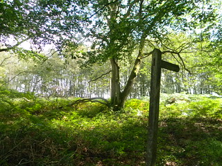

Yellow slope
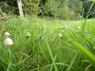
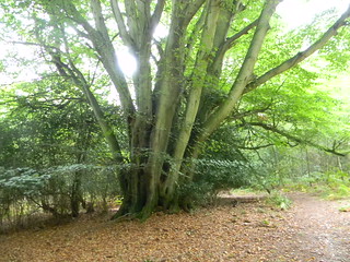
Due to some sort of non-dandelion. Forest Row Circular
ashdownforest book3 walk23 swcwalks 6138391742

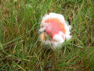
Mouldy agaric
Theres some that reckon Father Christmas was inspired by fly agaric hallucinations. Here's his hat and beard. Fly agaric is poisonous. Forest Row Circular
ashdownforest book3 walk23 swcwalks 6137851001

| Length |
Forest Row Circular: 17.7km (11 miles) Morning only: 7.7km (4.8 miles) Afternoon only: 10km (6.2 miles) Extension to East Grinstead: adds 5.5km (3.4 miles) |
|---|---|
| Toughness |
4 out of 10: mainly level, but with some gentle hills |
| Maps |
OS Landranger 187 & 188; Explorer 135. |
| Features |
This walk explores the interesting high heathlands of Ashdown Forest, with extensive views both south and north (there is for example a fine distant view of the South Downs in the early stages of this walk). The heaths are particularly beautiful from mid August to mid September, when the purple heather is at its best, and from March to May when there is plenty of gorse in bloom. In the afternoon the walk passes the Ashdown Forest Visitor Centre, which has lots of interesting displays about this unique habitat. The walk is not all heathland, however. Interspersed with it are sections across some pleasant green valleys, as well as some woodland. For lunch there is a pub with a fine garden. Special note : the written directions aim to be comprehensive, but need careful following on the heath sections, where once you are lost it is very hard to re-discover the route. |
| Walk options |
The 270 bus (see Transport below) carries on from Forest Row to pass the Red Lion in Chelwood Gate, the recommended lunch pub, enabling you to do just the morning (7.7km/4.8 miles) or afternoon (10km/6.2 miles) of this walk. Last buses back are at roughly 8pm Monday to Friday. 7.40pm on Saturdays and 6pm on Sundays, but the timetable changes regularly, so do check. On a summer evening it is possible to extend the walk to East Grinstead (5.5km/3.4 miles) in just over an hour on the path along the old railway line. This starts on the left, just beyond the bridge at the bottom of the village’s main street. The Horsted Keynes Circular walk on this website shares the same lunch pub as this walk, so you could combine the morning of one walk and the afternoon of the other to make a linear walk. Forest Row to Horsted Keynes is 16.2km (10.6 miles) while Horsted Keynes to Forest Row is 18.9km (11.7 miles) |
| Transport |
Unlike most other walks on this website, this one requires a bus ride as well as a train to reach the start. But the bus leaves from right outside the station and only takes 13 minutes. The fare is currently £2.60 one way or £3.40 return. If there are four or five of you, it may be not much more expensive to squeeze into a taxi. First you need to take a train from Victoria to East Grinstead. These leave every 30 minutes, and the train at 9.23 is a good one to take in order to reach the lunch pub in good time. Coming out of East Grinstead station, turn half left to find the bus stop just outside the station. From here you can take the 291 or 270 buses to Forest Row (the ultimate direction of the bus being Tunbridge Wells for the 291 or Brighton for the 270). Both buses are hourly Monday to Saturday, with the 270 currently at 5 past the hour and the 291 at 41 past the hour. On Sunday the buses run every two hours, the only convenient buses being the 9.25 and 11.25 for the 270 and the 9.41 and 11.41 for the 291. Get off the bus in at the ‘Brambletye’ stop in Forest Row, which is the first one after you enter the village, with the Chequers Inn on your left. The return bus leaves from the opposite side of the road. The last bus is late in the evening Mondays to Saturdays but only around 6pm on Sundays. |
| Lunch |
The Red Lion (01825 740836) in Chelwood Gate (7.7km/4.8 miles into the walk) is a modernised country pub, which has an extensive garden, and serves food all afternoon (until 8pm Sunday, 8.30pm Monday to Thursday and 9pm Friday and Saturday). |
| Tea |
It is possible to get a cup of tea or coffee mid afternoon, as well as cakes or other snacks, in the Ashdown Forest Centre, which is open till 4pm daily. Otherwise, independent cafes in Forest Row come and go, but a reliable backstop is Java and Jazz (01342 826699) just downhill from the Chequers Inn, which has a good selection of cakes as well as serving pizzas and the like. It is open till 8pm Monday to Thursday, 9pm Friday and Saturday and 5pm on Sunday. The most obvious pub stop is the Chequers Inn, but there is a more contemporary option in the Hop Yard Brewery, which serves craft beers and also tea. The Brambletye Hotel, a pub situated conveniently just behind the bus stop for East Grinstead (in summer you can sit at an outside table with a pint as you wait for the bus), also serves tea and coffee, and the Tesco Metro in the petrol station in the centre of the village sells cakes. If you follow the extension to East Grinstead, there are various refreshment options clustered around the old centre of the town, including pleasant pubs such as the Dorset Arms or the Crown, independent cafes, and branches of Caffe Nero and Costa Coffee. |
| Profile | |
|---|---|
| Help Us! |
After the walk, please leave a comment, it really helps. Thanks! You can also upload photos to the SWC Group on Flickr (upload your photos) and videos to Youtube. This walk's tags are: |
| By Car |
Start Forest Row, Kent Map Directions |
| Amazon | |
| Help |
National Rail: 03457 48 49 50 • Traveline (bus times): 0871 200 22 33 (12p/min) • TFL (London) : 0343 222 1234 |
| Version |
Mar-24 Peter |
| Copyright | © Saturday Walkers Club. All Rights Reserved. No commercial use. No copying. No derivatives. Free with attribution for one time non-commercial use only. www.walkingclub.org.uk/site/license.shtml |


Walk Directions
Full directions for this walk are in a PDF file (link above) which you can print, or download on to a Kindle, tablet, or smartphone.
This is just the introduction. This walk's detailed directions are in a PDF available from wwww.walkingclub.org.uk