Overton to Whitchurch walk
An easy walk down the Test valley which passes many interesting mills, old and new.

Overton to Whitchurch SWC walk 12 May 2019 No6
May-19 • Steven F Coles on Flickr
swcwalks swcwalk53 32900166107

DSCF0807
Brown trout at Fulling Mill
May-09 • Sean O'Neill
banner, swcwalk53, swcwalks 5444909036905542946 P

DSCF0273(1)
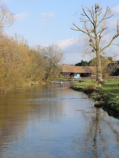
Bere Mill on River Test
Feb-09 • Sean O'Neill
swcwalk53, swcwalks, walkicon 5444908211355171202 P

DSCF0282
Whitchurch Silk Mill
Feb-09 • Sean O'Neill
swcwalk53, swcwalks, walkicon 5444908685975865314 P

1002110086
Footpath to All Hallows Church, Whitchurch
Feb-10 • Sean O'Neill
swcwalk53, swcwalks, walkicon 5444909142710401314 P
CIMG1717
River Test at Tufton
Mar-12 • Sean O'Neill
swcwalk53, swcwalks, walkicon 5718602252166767522 P

Book 3, Walk 53, Whitchurch to Overton
A good walk for trout-spotting, Midweek Day Walk, 17 Sept '07.
whitchurch book3 overton rivertest swcwalks walk53 tocw353 2884740283
| Length |
Main Walk: 17¼ km† (10.7 miles). Four hours walking time. For the whole excursion including trains, sights and meals, allow at least 9 hours. Circular Walk, from Whitchurch: 15 km† (9.3 miles). Three hours 25 minutes walking time. Short Circular Walk, omitting Freefolk: 11 km† (6.9 miles). Two hours 30 minutes walking time. † Subtract 2¾ km (1.7 miles; 40 minutes) if taking the shorter ending, omitting Tufton. See Walk Options below. |
|---|---|
| OS Map |
Explorer 144. Overton, map reference SU518508, is in Hampshire, 12 km W of Basingstoke. |
| Toughness |
3 out of 10 (2 for the Circular Walks). |
| Features |
This walk is along the upper reaches of the River Test, a world-famous trout stream. You can expect to see brown trout vigorously competing with ducks for scraps of food from passers-by at any of the bridges along the route, notably at Whitchurch Town Bridge by the Silk Mill. The clear, iron-free water of the river is ideal for several industries, including silk-making. Overton's silk mill failed but Whitchurch Silk Mill is still operating. After a major refurbishment it re-opened in 2018 and can be visited towards the end of the walk (Tue–Sun & BH, last entry 4pm); admission is £9 (2022). An even more prominent local industry is paper-making. The industry was started in 1712 by Henri Portal, a Huguenot refugee who brought over the secret of watermarking paper. The business was so successful that he was soon able to transfer production from Bere Mill to the much larger Laverstoke Mill, a short distance upstream. The industry continues at De La Rue's modern Overton Mill, alongside Overton station. Much of the picturesque Bere Mill was destroyed by fire in February 2018 but it has been comprehensively restored. Laverstoke Mill closed in 1963 and was derelict for many years, but the site is now the Bombay Sapphire Distillery. Tours of the Distillery cost £17.50 and have to be booked in advance, but casual visitors can freely access a Heritage Room describing the history of the mill (as well as the Mill Bar and Gin Shop). Many of the churches in the area look solidly Victorian, including All Hallows Church in Whitchurch, but this one dates from the 13thC and has many interesting features. The most unusual church passed on the walk is St Nicholas in Freefolk, which contains an elaborate Jacobean monument to a Shakespearian-looking gent, Sir Richard Powlett. From the ridge to the north of the river you can glimpse Watership Down, the setting of the celebrated 1972 novel about a group of rabbits who undertake a perilous journey to the Down. The author Richard Adams (1920–2016) lived locally and is buried in Whitchurch Cemetery. The end of this river valley walk overlaps slightly with the start of the Whitchurch to Andover walk (1–48), which goes through Tufton and continues further downstream. |
| Walk Options |
Directions are also provided for a Circular Walk from Whitchurch, which goes up the valley to the lunch pub in Freefolk. This option is 2¼ km shorter than the main route from Overton, so it would be worth considering if you missed a train and would have to start an hour late. As the outward leg of this variation is actually a Figure-of-8 you could cut out the loop to Freefolk and head back to Whitchurch from Bere Mill, making a Short Circular Walk. From the Silk Mill an alternative ending (to all the walk variations) replaces the loop out to Tufton with a shorter one going directly to Fulling Mill. More simply, you could go straight through the town to Whitchurch station, although that would omit the attractive riverside stretch towards All Hallows church. |
| Additional Notes |
The walk was revised in 2021 to cut out the less appealing of the two routes from Freefolk to Whitchurch, as well as tweaking the selected route to include some new open spaces on the edge of the town. This simplification also made the longer and shorter endings available to both the Main and Circular Walks. |
| Transport |
Overton and Whitchurch are adjacent stations on the Basingstoke–Salisbury line, both of which normally have a direct service from Waterloo taking about 1 hour. However, in the current Sunday timetable there is only a shuttle service between Reading and Salisbury for most of the day, requiring a connection at Reading (from Paddington) or Basingstoke (from Waterloo). For all the walk variations buy a return to Whitchurch (Hants). If you want to abandon the walk Stagecoach 76 runs along the B3400 from Whitchurch to Basingstoke (every 20-30 minutes Mon–Sat, hourly Sun). If driving, the station car park at Overton is free “for railway users”; the one at Whitchurch costs £5.20 Mon–Fri, £1 Sat, free Sun (2021). The free car parks in the centre of Whitchurch (in Bell Street and near the Silk Mill) would also be convenient for the Circular Walks. |
| Suggested Train |
Take the train nearest to 10:00 from Waterloo to Overton. For the Circular Walk, take the train nearest to 10:30 to Whitchurch. |
| Train Times |
|
| Timetables |
|
| River Levels |
|
| Lunch |
The suggested lunch pub is the Watership Down Inn (01256-892254) in the small village of Freefolk, after 7¼ km on the Main Walk or 5 km on the Circular Walk. Richard Adams was a regular patron (when it was called The Freefolk Arms) and after the success of his novel this free house was renamed in his honour. It has a good selection of local ales and ciders and serves excellent home-cooked food to 2.30pm (3pm Sun). The alternative (and the only option if you want a lunch stop on the Short Circular Walk) is to carry on to Whitchurch. The White Hart Hotel (01256-892900) is right in the town centre and the Kings Arms (01256-896333) a short distance out along Church Street; there is also The Bell (01256-893120) but this pub might not be serving food. |
| Tea |
The suggested tea place in Whitchurch is the Riverside Café at the Silk Mill (01256-892065; open to 4.30pm Tue–Sun & BH Mon), with outdoor seating available on the front and back lawns even if you are not visiting the mill. In the town centre there are several convenience stores as well as the three hostelries listed above. Allow at least 15 minutes (20 mins from the Silk Mill) for the long trudge up the hill to the station. |
| Profile | |
|---|---|
| Help Us! |
After the walk, please leave a comment, it really helps. Thanks! You can also upload photos to the SWC Group on Flickr (upload your photos) and videos to Youtube. This walk's tags are: |
| By Train |
Out (not a train station) Back (not a train station) |
| By Car |
Start RG25 3JG Map Directions Return to the start: Finish RG28 7ER Map Directions Travel to the start: |
| Amazon | |
| Help |
National Rail: 03457 48 49 50 • Traveline (bus times): 0871 200 22 33 (12p/min) • TFL (London) : 0343 222 1234 |
| Version |
Jun-22 Sean |
| Copyright | © Saturday Walkers Club. All Rights Reserved. No commercial use. No copying. No derivatives. Free with attribution for one time non-commercial use only. www.walkingclub.org.uk/site/license.shtml |

Walk Directions
Click the heading below to show/hide the walk route for the selected option(s).


 Walk Map
©
Walk Options ( Main | Circular)
Click on any option to show only the sections making up that route, or the heading above to show all sections.
- Main Walk (17¼ km)
Walk Directions
Click on any section heading to switch between detailed directions and an outline, or the heading above to switch all sections.
If you are doing a Circular Walk (from Whitchurch), start at §C.
- Overton Station to the Harroway (4 km)
- Go down the approach road and turn right onto a bridleway alongside the River Test. Turn left on the B3051, cut through St Mary's churchyard and turn right onto Church Road. Go along Silk Mill Lane to Southington Mill and continue on The Lynch to Northington Farm. Turn right onto a byway going over the railway and up to an ancient track, the Harroway.
- Leave the station at the London end of the platform and go through its small car park to the approach road, with Overton Mill? behind you on the other side of the tracks. Go downhill on this road, which in 300m merges with the access road to the mill. Keep ahead on the main road and follow it round to the right at a junction by farm buildings.
- 100m past the entrance to Quidhampton Farmhouse veer right at a bridleway sign, going past a vehicle barrier onto a path alongside the infant River Test?. The bridleway later joins the gravel driveway to a house “Flashetts”, which curves round to the left alongside a backwater and eventually comes out onto the B3051. Turn left onto this road to head S, passing Little Meadow? on the right.
- In 150m cross the road and go up the right-hand of two flights of steps into a churchyard. The path climbs away from the road and turns left at the top, going past a small “Quiet Garden” and then St Mary's church? itself. Follow the path down towards a sports ground and turn right onto Church Road.
- In 100m ignore Bridge Street on the left and bear right into Court Drove. In a further 150m, having gone past Glebe Meadow on the left, bear left downhill into Silk Mill Lane. Follow this quiet tree-lined lane for 600m, later with occasional glimpses of the river over walls on your left.
- At the junction with Southington Lane (with a nice river view from the bridge on the left) keep ahead on The Lynch, ignoring a parallel footpath on its right-hand side. You pass the converted Southington Mill? on the left and a picturesque thatched cottage on the right. The lane goes alongside a mill-stream, then swerves right and left uphill, away from the river.
- In 200m the lane passes the driveway to Northington House and comes to Northington Farm. Turn right in front of its entrance onto a stony farm track, with an orange (byway) waymarker. This goes gently uphill between tall hedges, crossing over the railway after 500m.
- In a further 300m keep ahead as indicated on an enclosed grassy track where the farm track splits off to both sides. After climbing gently for 400m this green lane reaches a strip of woodland containing a broad track known as the Harroway?.
- The Harroway to Freefolk (3¼ km)
- Turn left and go along the Harroway for just under 1½ km. Turn left at a junction onto a farm track which goes back over the railway. Follow it round to the right at North Lodge and turn left onto Watch Lane. Cut through a back lane to the B3400 to reach the Watership Down Inn on Priory Lane.
-
Turn left to head SW along the Harroway Belt for 800m. The simpler route is to take the main track at the signposted byway crossing.
- If this is too muddy a narrow path meandering through the belt of trees on its left may be easier. There are several places where you can switch between the two routes before the narrow path swings right to join the main track at a signposted byway junction.
- Ignore the byway off to the north at this junction and go along the tree-lined main track for a further 600m, with occasional views through the trees on the right towards the North Wessex Downs. At the next junction (unsignposted at the time of writing) turn left off the Harroway onto a farm track.
- This track goes gently uphill at first, levels out and passes a water tower. It then slowly descends, crosses back over the railway and passes some houses and dilapidated farm buildings. Ignore all driveways off to the left and follow the lane sharply round to the right by an entrance to Laverstoke Park? at North Lodge. In 100m there is a signposted footpath on the left.
-
For the pub, keep ahead on the lane to a T-junction and turn left (onto Watch Lane), taking care as there is no pavement and rather more traffic. In 150m there is a private road on the right which offers a safer way of getting to the B3400.
- At the time of writing there was nothing to deter walkers (rather than vehicles) from using this back lane, but if necessary you could continue along the rather awkward Watch Lane and turn right at the bottom onto the main road.
- If you take the private road it winds past some garages and houses in the hamlet of Freefolk? on its way to the B3400. Turn right onto this busy road; it is advisable to use the pavement on the other side even though you have to cross back again after 60m. Go up Priory Lane to find the Watership Down Inn on the left-hand side.
- Whitchurch Station to Bere Mill (3 km)
- Turn left onto Station Road and turn right at a T-junction. Go down Newbury Road towards the town centre and turn left into Kings Walk. Turn right into Jobson Close and continue on a path across a semi-open area. Turn left onto a footpath running along the side of Lynch Hill, eventually dropping down to meet the B3400. Turn right briefly onto the road, then left down steps leading to The Green. Turn left and continue on a footpath which goes along the side of a water meadow, then curves round the edge of some large fields. At the end turn right onto a lane which crosses the River Test on Bere Mill Bridge. Turn right onto a track going past the left-hand side of Bere Mill.
- Head directly away from the station and make your way out past a car park and some new houses. Turn left onto Station Road, following directions to the Silk Mill. At the far end turn right to go down towards the town centre on Newbury Road.
- In 350m turn left into Kings Walk. Take the first turning on the right (Jobson Close), passing Berehill House? on the right. At the end of this cul-de-sac continue on a tarmac path past the left-hand side of the last house. This swings left and right (crossing a concealed sunken path?) and emerges into a semi-open area.
- Veer left to go across this to the far side and continue on a path into the trees, heading E. This soon meets a path crossing where you turn right to drop down to a public footpath running along the side of Lynch Hill. Turn left onto this path, with glimpses through a chainlink fence of old watercress beds in the Test valley below.
- The footpath eventually drops down to the busy B3400, where you need to take great care as there is no pavement on this side. Cross over and turn right, briefly heading back towards Whitchurch. Immediately after passing the Prince Regent pub, turn left onto an unmarked path which goes down a flight of concrete steps and comes to a residential street.
- Turn left onto this cul-de-sac and keep ahead on a signposted footpath at the end. At the end of this short path go through a wooden side gate onto a fenced path alongside a water meadow. In 250m this veers left up a slope to continue on a similar fenced path on the other side.
- Follow this along the right-hand edge of two large fields, gradually curving round to the left and later with glimpses of the river behind the trees on your right. At the far end go through a wooden kissing gate and keep ahead on a faint grassy path across a field, with the historic buildings of Bere Mill 250m away to the right.
- In the far left-hand corner go through a side gate and turn right onto a lane, ignoring the continuation of the footpath ahead. The lane crosses a ditch on a small brick bridge and then the River Test? itself on the picturesque Bere Mill Bridge.
- After crossing the river turn right and go along the tree-lined gravel drive towards the attractive Bere Mill?, passing a farm shop on the left. Continue on the track to the left of the converted mill building, over a small rise and down to a wooden fieldgate.
- Bere Mill to Freefolk (2 km)
- After passing the mill continue along the bottom edge of a field. At the end turn sharp left, going uphill to reach a large field at the top of the valley. Go along the ridge and then back down through the edge of some parkland. Take a path briefly heading back towards Bere Mill, then turn right onto a footpath going down across fields and the river to the B3400. Turn left and go along the road for 250m, then turn right into Priory Lane to reach the Watership Down Inn.
- Go over a stile next to the fieldgate to continue between a wire fence and a hedge, with a field sloping up to the left. Where the track curves right towards a wooden fieldgate do not go through it but veer left as indicated. Go up the short side of the field, now with a wire fence on your right.
-
In the field corner turn left again, still climbing. Stay close to the right-hand field edge to come to a kissing gate in the top corner. Go through this to continue in the same direction along a rutted grassy track above some large fields.
The churches of Laverstoke and Freefolk are in the valley below and further along you might just be able to glimpse the top of Laverstoke House?.
-
At the far end you come to a track at a bend. You could simply turn left and go down it for 150m, but the suggested route is to go across it (slightly to the right) to find a concealed wooden kissing gate in the tree boundary. Go through this and bear left to go down the side of some parkland, parallel to the track.
As you go downhill you should be able to see some old industrial buildings off to the right on the valley floor, part of Laverstoke Mill?.
- In 150m, when level with a large cedar tree off to the right, veer left to exit the parkland through a wooden kissing gate. Go back across the track (slightly to the right) and through another gate onto a broad grassy strip, briefly heading back towards Bere Mill and Whitchurch.
- For the full route veer right after 50m, before the start of a belt of trees on the right, and follow a faint grassy path down the side of a field. In the bottom corner go through a gate onto a narrow fenced path and continue across a mill-stream on a narrow sluice-gate.
- Follow the waymarked route round to the left to cross a branch of the River Test on a substantial wooden footbridge. Continue through some scrubland, cross another water channel on a footbridge and veer right onto a track to come out onto the B3400 opposite Watch Lane.
- For the pub turn left and go along the B3400 for 250m, to its junction with Priory Lane. Cross the main road carefully and go up the side road to find the Watership Down Inn on the left-hand side.
- Freefolk to Bere Mill (2 km)
- From the pub return to the B3400 and head east along it, passing Manor Cottages. Turn right into a lane which goes past St Nicholas's church. Halfway up the valley turn right onto a footpath going across fields and down to the river. In front of Bere Mill Bridge turn left onto a track going past the left-hand side of Bere Mill.
- From the pub, return to the B3400. Cross over carefully and turn left to go along the pavement, continuing past the private road on the left and the track opposite Watch Lane (the outward routes from Overton and Whitchurch respectively).
- After the junction with Watch Lane you pass the striking Manor Cottages? on your left, with the parish church of St Mary the Virgin? behind them. At the end of the row of thatched cottages, turn right into a lane signposted to St Nicholas's church.
- The lane bends left and crosses the River Test at a picturesque spot. After another left-hand bend the lane turns right in front of a hedge, where a black metal gate off to the left would let you visit the tiny St Nicholas's church?. To resume the walk carry on up the track, soon passing the entrance to an isolated house. Shortly after passing a metal fieldgate turn right through a wooden kissing gate in the hedgerow.
- Follow a clear grassy path alongside a wire fence for 500m, soon with a belt of trees on your right, then an open field. At the far end go through a wooden kissing gate in the tree boundary and keep ahead across a potentially muddy field, churned up by cattle.
-
On the far side go through a gate and down a broad track to the left of a cottage. This meets a lane in front of Bere Mill Bridge, another picturesque spot on the river.
If you are doing the Circular Walk (which reached this point from the other side of the bridge) you now repeat your outward route for 300m.
- Do not cross the bridge but turn left …
- Bere Mill to Whitchurch Silk Mill (2½ km)
- … right through a gate into a crescent-shaped meadow below Coombedown Hanger. At the far end keep ahead on a footpath going along the bottom of the valley. The suggested route is to veer left at the end of a farm field and take a higher route through some new open spaces, dropping back through Daniel Park to rejoin the public footpath. Go back across the river at Town Mill and continue along Town Mill Lane. Turn left onto the B3400, then left again into Test Road. Follow this to Winchester Street and turn left to come to the Silk Mill.
- …
- In the field corner turn right through a wooden gate in the fence to continue along the left-hand side of a long crescent-shaped meadow below Coombedown Hanger. At the end of this wooded hillside go through a small wooden gate to continue on a fenced path in the same direction.
-
In 250m go through a metal kissing gate and continue along the bottom edge of a large farm field. In the next corner the suggested route is to turn left to stay inside the field, climbing gently with a hedge on your right.
-
Alternatively you could carry on along the bottom edge of another large field, then bear right to follow the public footpath through the trees alongside a backwater. If you take this direct route (saving 175m) continue the directions at [?].
This was the original walk route, before the creation of some new open spaces.
-
Alternatively you could carry on along the bottom edge of another large field, then bear right to follow the public footpath through the trees alongside a backwater. If you take this direct route (saving 175m) continue the directions at [?].
- After climbing for 125m veer right through a wide gap in the hedge into the bottom corner of a large open space criss-crossed with broad mown paths. For the simplest route keep right to go along its bottom edge, later with another hedge on your right. On the far side go through a gap into the top corner of another new open space, QE Ⅱ Daniel Park?.
- The suggested route is to take the middle of the three mown paths through this community meadow, sloping diagonally down to the opposite corner and passing a low wooden fence surrounding a BMX track in the centre. In the bottom corner follow the path into the tree boundary and fork right where it splits, soon merging with the direct route coming in from the right.
- The public footpath comes to a wooden fence with a gate into a private property ahead. Turn right in front of this gate onto a short path leading to a footbridge across the River Test, with Town Mill? on your left.
- After crossing the river ignore a tarmac path on the right and keep ahead along Town Mill Lane, which curves to the left and goes alongside the mill-stream for the Silk Mill. At the end it crosses the stream on a small humped bridge and comes to the B3400 (London Street), with the tiny Voters Cottage? (#41) opposite.
- Turn left and go along the main road for 100m, then turn left into Test Road. This residential street goes back across the mill-stream, bends right and eventually comes to a T-junction with Winchester Street. Turn left to come to the entrance to the Silk Mill and its Riverside Café, just before Town Bridge.
- The Silk Mill to Tufton (2¼ km)
- Head north on Winchester Street to come to The Square in the town centre. Turn left and go along Bell Street for 250m, then turn left into Wells Lane. In 175m zig-zag right and left onto a path on the other side of a dismantled railway line. Follow it around the edge of a housing estate on the right and cut through the town's cemetery to the B3400. Turn right to go under the A34, then turn left onto a permissive path which merges with a public footpath leading to the River Test. Go under an old railway viaduct and cross the river on a footbridge. Turn left onto a lane going through the hamlet of Tufton to its church.
- Turn left out of the Silk Mill and follow Winchester Street for 150m to reach a busy five-way road junction called The Square. Ahead on the right, the prominent White Hart Hotel (between Newbury Street and London Street) is another possible refreshment stop.
- For the full walk take the second road on the left, Bell Street. Go along it for 250m, passing The Bell pub on the right halfway along. At a crossroads in front of a high brick bridge (with a blue plaque about the railway line? it carried) turn left into Wells Lane.
-
In 175m turn right onto the signposted footpath opposite Fairclose, going up the bank and through a tunnel under the dismantled railway. On the other side turn left at a path T-junction to continue between the low embankment and a housing estate up to its access road.
Towards the end of this path you might be able to see the old station house (now a private residence) behind a high garden fence.
-
Go straight across the access road onto the path opposite, taking the right fork where it splits to come out by some of the houses. Turn left and go downhill to find a gate on the right leading into the town's cemetery.
- The route through the cemetery is particularly attractive in February, when it is carpeted with snowdrops. If the gate is locked, however, simply continue down the lane and turn right at the bottom onto the B3400.
- Inside the cemetery you pass Richard Adams' grave and come to a gazebo (The Cross). Turn left to go down the central tree-lined avenue and out onto the B3400. Cross the road carefully and turn right onto a footway going under the bridge carrying the town's bypass (the A34). On the other side go over stile on the left onto an enclosed track, designated as a permissive footpath.
- At the far end go over another stile and veer right as indicated to go along the right-hand edge of a large field, gently uphill and then down the other side. Near the bottom veer right through a fieldgate and turn left onto the old public footpath coming down from the B3400.
- Go through the first of several metal kissing gates on this fenced path, ignoring the continuation of the permissive footpath off to the right along the way. The public footpath continues through an area of scrubland containing some abandoned watercress beds and comes out into a meadow. Turn half-left as indicated onto a faint grassy path towards another gate in the tree boundary.
-
Go through this gate to continue along the bottom of a steeply-wooded bank (the old railway embankment). At the far end follow the path through more gates and under the old railway viaduct to a narrow footbridge over the River Test, another picturesque spot. After crossing the river go up to a lane and turn left, ignoring a footpath signpost pointing the other way.
You will now be following the route of Walk 1–48 (in reverse) to All Hallows church.
- Follow the lane past cottages and round to the right by some barn conversions to come to the attractive St Mary's church? (which is worth visiting) in the hamlet of Tufton.
- Tufton to Fulling Mill (1¼ km)
- Immediately after passing the church turn left onto a farm track. Keep ahead on an enclosed path around two sides of a large field, alongside the embankment carrying the A34. Turn left to go under the main road and continue along Winchester Road towards Whitchurch. In 500m turn left onto a footpath going across Millennium Green to Fulling Mill.
- Immediately after the church turn left onto a farm track, signposted as a footpath. Shortly after passing the churchyard veer right in front of a wooden fieldgate to find a yellow waymarker a few paces away indicating the continuation of the right of way, a potentially overgrown grassy path between fences.
-
The footpath goes around two sides of a large field, eventually running alongside the embankment carrying the noisy A34. Follow the path out to a lane and turn left to go under the main road. On the other side the suggested route is to turn left onto a signposted footpath, leading to a metal gate into a field.
- If this field is overgrown you could simply carry on along Winchester Road, curving round to the left and passing the exit from the field after 200m.
- On the suggested route the footpath runs parallel to the embankment at first, then turns half-right to cut across the field. In the far corner go out through a gap and turn left onto the footway alongside Winchester Road.
- In 300m, shortly after passing Shuttle Street on the right, turn left onto a signposted footpath. Go through a wooden gate into an open space called Millennium Green?. Unless you want to meander around this long triangular meadow, keep left where the path splits to head directly away from the road. On the far side keep ahead across a backwater to come out onto a lane (The Weir).
- The Silk Mill to Fulling Mill direct (¾ km)
- Go across Town Bridge and head south on Winchester Road for 500m. Turn right into Millennium Green and take any path across it to the far right-hand side. Turn right onto a footpath to reach a lane called The Weir.
- Turn right out of the Silk Mill and cross the River Test on Town Bridge. Head S on the main road for 500m, passing Micheldever Road on the left and a lane called The Weir on the right. 125m after The Weir, turn right through a black metal gate with a fish symbol to enter an open space called Millennium Green?.
- Take any of the mown paths through this long triangular meadow, aiming for its top right-hand corner. About 50m before the far side, turn right onto a straight path running across it. This public footpath crosses a backwater and comes out onto The Weir.
- Fulling Mill to Whitchurch Station (2 km)
-
 Cross the river in front of the mill and head north on the riverside path towards All Hallows church. Turn right onto Church Street and follow this to The Square in the town centre. Head north on Newbury Street for 800m and turn left into Station Road to reach the station.
-
Take the continuation of the footpath (just off to the left) to cross a footbridge over the River Test, with the picturesque Fulling Mill? on your left. On the other side follow the fenced riverside path alongside a meadow, an attractive stretch with a church spire visible up ahead.
- At the end follow the path round to the left and out to the B3400 (Church Street). Unless you want to make a short out-and-back detour to visit All Hallows church? opposite, turn right onto the road.
-
Follow the B3400 to a busy five-way road junction called The Square, passing the Kings Arms pub towards the end. Ahead on the left,
…
- If you want to revisit the Silk Mill and/or its Riverside Café (150m away), turn sharp right into Winchester Street. Return the same way.
-
To complete the walk head N on Newbury Street from The Square, passing the Town Hall? on the left. After climbing steadily for 800m turn left into Station Road. In 150m turn right into the station's short approach road. Cross the footbridge to Platform 1 for trains to London.
- The Portal family opened Overton Mill in 1921 and later transferred the production of banknote paper here from Laverstoke Mill. The business is now part of De La Rue.
- At Quidhampton the River Test is only about 2 km from its source in the hamlet of Ashe, although much of the water is actually pumped up through boreholes to supply Overton Mill before being added to the river here.
- Little Meadow was developed by the Overton Biodiversity Society in 2007. There is an information panel about it just inside the gate.
- St Mary, Overton dates from the 12thC, with the nave pillars surviving from the original church. The 14thC ‘great door’ in the main entrance is unusual in that it folds in the middle.
- Southington Mill was a corn mill until it was converted into a private house in the 1930s, with a new wing designed by Luytens.
- The Harroway (or Harrow Way) is an ancient drovers road, where cattle and sheep were herded to markets across the south of England.
- Laverstoke Park is now a 2,500-acre organic farm. It raises pure-breed Aberdeen Angus and Hereford cattle and has a large herd of Water Buffalo, as well as unusual breeds of more familiar farm animals.
- The unusual name Freefolk is thought to relate to the medieval village being outside the feudal system.
- Berehill House was the Portal family home when they began their paper-making business at Bere Mill. It is now a nursing home.
- The sunken path (crossed by a flint bridge known as Jerusalem Arch) was supposedly built by the Portal family so that they did not have to see their mill-workers walking to Laverstoke.
- Bere Mill was originally a corn mill until it was acquired by Henri Portal in 1712 for his paper-making business. Demand was so great that he was soon able to move production to a much larger mill at Laverstoke.
- The grand Laverstoke House was built for the Portal family in 1780. Their new estate displaced the tiny village of Laverstoke and only the ruins of the original St Mary's church remain in the grounds.
- Laverstoke Mill was built by the Portal family in 1718 for their expanding paper-making business. In 1727 their success was assured when they negotiated a deal to supply watermarked banknote paper to the Bank of England.
- Manor Cottages were built in 1939 by the Portal family, in an Arts and Crafts style. Note that even the bus shelters here have thatched roofs!
- St Mary the Virgin, Laverstoke dates from Victorian times. It was built to replace a much older St Mary's in Laverstoke Park, which is now in ruins.
- St Nicholas, Freefolk dates from the 13thC. Its functions were transferred to the new church across the road after the parish merged with Laverstoke. The building was declared redundant in 1974 and it is now maintained by the Churches Conservation Trust.
- Queen Elizabeth Ⅱ Daniel Park was created from arable farmland and includes community facilities such as a Skate Park and BMX Track inside a wildflower meadow.
- Town Mill was one of Whitchurch's corn mills. In 1967 it was the setting for The Private Life of the Kingfisher, the first BBC natural history film to be shown in colour.
- Voters Cottage was bought by the Earl of Portsmouth so that he could be elected to Parliament from this ‘Rotten Borough’ before the 1832 Reform Act.
- The dismantled railway line was the Didcot, Newbury and Southampton Railway (later amalgamated into the GWR). This rural branch line formed a vital north-south link for military traffic during WW Ⅱ, but it was always uneconomic and was closed by Beeching in the 1960s.
- St Mary, Tufton dates from the 12thC. It has a large 15thC wall painting of St Christopher carrying the Christ Child, depicted unrealistically because “thou shalt not make any graven images”.
- Millennium Green is one of many such open spaces created in 2000 as part of a nationwide initiative by the Countryside Agency (there is another just off the walk route in Laverstoke).
- A Fulling Mill cleansed woollen cloth by pounding it with hammers into a solution containing Fullers Earth, which removed oil and dirt particles from the fibres.
- All Hallows, Whitchurch dates from the 13thC and has retained its Norman pillars and arches. A Saxon stone (discovered during rebuilding work) is evidence of a much earlier church on the site. An unusual Commandments Board (dating from 1602) depicts the fate of those who disobeyed them.
- Whitchurch Town Hall was built in 1791 in neoclassical style, replacing an earlier municipal building in The Square which had become dilapidated. It is the meeting place for Whitchurch Town Council.
Continue the directions at §E.
If you are doing the Short Circular Walk (omitting the loop to Freefolk), go to §F.
If you are doing the shorter ending (omitting Tufton), go to §I.
Complete the directions at §J.
Walk Notes
» Last updated: March 1, 2022
Return to Top | Walk Map | Walk Options | Walk Directions.