Great Missenden to Amersham walk
The Chilterns, beech woods, and Little Missenden.

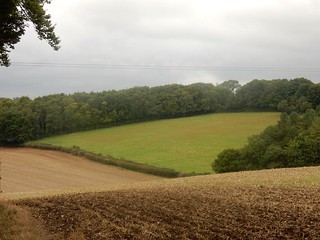
Chiltern fields
Great Missenden to Amersham Near Great Missenden
chilterns book1 walk5 walkicon swcwalks 21156898306
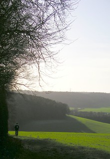
Chiltern fields
Great Missenden to Amersham Near Great Missenden
chilterns book1 walk5 walkicon swcwalks 20996327329

Book 1, Walk 5, Great Missenden to Amersham
1 January 2007
great book1 missenden amersham walk5 swcwalks 010107 tocw15 344616717

Book 1, Walk 5, Great Missenden to Amersham
1 January 2007
great book1 missenden amersham walk5 swcwalks 010107 tocw15 344616721
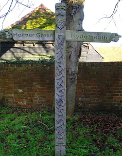
Book 1, Walk 5, Great Missenden to Amersham
Pagan signpost in Little Missenden, 1 January 2007
great book1 missenden amersham walk5 swcwalks 010107 tocw15 344616725
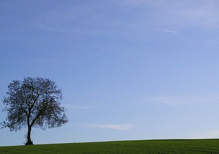
Book 1, Walk 5, Great Missenden to Amersham
1 January 2007
great book1 missenden amersham walk5 swcwalks tocw15 344616731
Little Missenden & Penn Wood
| Length |
16.3km (10.1 miles), 5 hours. For the whole outing, including trains, sights and meals, allow 8 hours. |
|---|---|
| Toughness |
5 out of 10. |
| OS Maps |
Explorers 172 & 181 or Landranger 165. Great Missenden, map reference SP893013 is in Buckinghamshire, 8km north-west of Amersham. |
| Features |
This lovely Chilterns walk, only 40 minutes from London by train, makes an easy outing at any time of year. The route is more open than most Chilterns walks, but there is one large beech wood, Penn Wood, which produces fine autumn colours. Other attractions include four interesting churches, the ancient village of Little Missenden, and Amersham’s surprisingly unspoilt old town, which is approached over a ridge with fine views. After tea, it is a 20 minute walk up through a wood to reach the station. In January and February one section of the bridleway (Toby's Lane), between points [5] and [6] is invariably flooded. Should this be the case try walking in the field to the left and parallel to the Lane along its field edge. |
| Walk Options |
The easiest way to shorten the walk is to carry on along the road past The Crown Inn at point [5] and follow the well waymarked South Bucks Way into old Amersham, a distance of 3.6km (2.2 miles) compared to 9.4km (5.8 miles) by the main walk route. The only disadvantage of this short cut is that it is close to the busy A413 throughout. It reduces the overall walk length to 10.5km (6.5 miles). There is an hourly bus into Amersham from point [6] but this is a disappointing place to finish the walk. Another option would be to get a taxi from one of the lunch pubs. This walk also works well when done in reverse . Directions for walking the walk "Backwards" are given after the main Directions. Former Path Closure : in late October 2023 a large sink hole appeared in the dip below Chapel Farm (point 15 in the Directions), probably caused by HS2 tunnelling works. A well signed diversion to avoid the hazzard was shown in the Directions - but a club walk in January 2024 reported the diversion was no longer necessary (presumaby the sink hole had been repaired) so the diversion has been deleted from these Directions. |
| History |
The Parish Church of St Peter and St Paul in Great Missenden was built mainly in the fourteenth century. It is located on a hill outside the town because when it was built Great Missenden was only a collection of scattered farms and the hilltop location made a good focal point. St John the Baptist Church in Little Missenden has a giant thirteenth-century mural to St Christopher carrying the Christ child across the waters. Part of the church was built in the tenth century. The gatepost is in memory of Dunkirk in 1940. All Saints Church in Coleshill is a neo-Gothic church designed by Street, whose work was praised by Betjeman. The stone for the church, completed in 1856, was brought by river to Windsor and then by cart. The building of the Parish Church of St Mary in Amersham started in the early 1100s. The window glass is mainly from the nineteenth century. |
| Travel |
Take the train nearest to 9.55am from Marylebone Station to Great Missenden. Journey time 42 minutes. Great Missenden is one stop outside London Transport zone nine and Network card holders can get a discounted London Transport zone 1-9 travelcard at weekends and on bank holidays from any Underground ticket office up to a week in advance. You then only need to buy a one stop extension from Chiltern Railways from Great Missenden to Amersham. This approach has the advantage that on the return journey from Amersham you can use the four Underground trains an hour (45 minutes to Baker Street) as well as the two hourly Chiltern Railway trains to Marylebone (39 minutes: only one train an hour on Sundays). By contrast, a normal day return to Great Missenden is only valid on Chiltern Railways. |
| Lunch |
The original lunch stop for this walk is the Squirrel pub (tel 01494 711 291) in Penn Street, some 9½km into the walk, which serves pub classics from midday to 2pm Tuesday to Saturday and 2.30pm Sunday. But you really are spoiled for choice for pubs on this walk, all of which have some outside seating for fine days. 140 metres down the road from the Squirrel, the Hit or Miss Inn (tel 01494 713 109) – the name refers to cricket, in case you were wondering – has a more creative menu, and plenty of seating. It serves food until 2.30pm Monday to Friday, 3pm on Saturday and all afternoon on Sunday (roasts only), and is open in the afternoon for drinks, including tea and coffee. For slower walkers or late starters, Little Missenden, some 5½km into the walk, has two characterful old pubs. The Red Lion (tel 01494 862 876) is particularly charming, with a garden with a large pond and friendly ducks and chickens. Inside it is a cosy old-fashioned pub and the food is basic but hearty. The Crown (tel 01494 862 571) is more rudimentary, offering pies, baked potatoes, sandwiches and soup from midday to 2pm Monday to Saturday. For a late lunch the Potters Arms pub (tel 01494 726 222) in Winchmore Hill, a mile beyond the Penn Street pubs, has reopened and serves lunch, Monday to Friday, from 12 noon until 2pm, and at weekends from 12 noon until 4pm. The other pub in Winchmore Hill - The Plough - is currently closed (November 2023) and up for sale. |
| Tea |
The recommended tea stop is Seasons Café Deli in Old Amersham, which is open until 6pm daily. This has limited seating, however, so groups might like to explore other options nearby. One immediately across the road from Seasons is Gilbey’s Restaurant (01494 727142) which advertises cream teas. Otherwise, there are a number of ancient pubs in the vicinity, including the Crown Inn Hotel 50 metres to the west of Seasons, which offers afternoon tea and the Kings Arms 100 metres beyond that. There are slim pickings up by Amersham railway station. One option is the Beech House bar-restaurant 150 metres up and on the left-hand side of Hill Avenue, the road almost opposite the station. Opposite the Beech House is the Metro Lounge , which some SWC walkers like. Closer to the station and also on the left-hand side of Hill Avenue there is a Tesco Express selling snacks and a Subway beyond that which sells tea. |
| Updates |
No major changes. Reverse Directions added August 2019. This edition - Book check and walk update November 2023. Sink hole update January 2024. |
| Book |
This walk was originally published in Time Out Country Walks near London volume 1. We now recommend using this online version as the book is dated. The book contained 53 walks, 1 for every week of the year and 1 to spare. Here is our suggested schedule |
|---|---|
| Profile | |
| Help Us! |
After the walk, please leave a comment, it really helps. Thanks! You can also upload photos to the SWC Group on Flickr (upload your photos) and videos to Youtube. This walk's tags are: |
| By Train |
Out (not a train station) |
| By Car |
Start HP16 9AZ Map Directions Finish HP6 5AZ Map Directions |
| Amazon | |
| Help |
National Rail: 03457 48 49 50 • Traveline (bus times): 0871 200 22 33 (12p/min) • TFL (London) : 0343 222 1234 |
| Version |
Apr-24 Marcus |
| Copyright | © Saturday Walkers Club. All Rights Reserved. No commercial use. No copying. No derivatives. Free with attribution for one time non-commercial use only. www.walkingclub.org.uk/site/license.shtml |


Walk Directions
Main walk
- [1] Coming off the train, cross the footbridge and leaving Great Missenden Railway Station building, turn left, your direction 20°. At the T-junction, turn right downhill, your direction 50°.
- In 70 metres, at the next T-junction, go left, your direction 320° (to the right is the High Street).
- In 25 metres turn right onto Walnut Close, your direction 50°. In 60 metres, at the end of this, take the tarmac path going to the left of the double garage of house number 18.
- In 20 metres ignore a footpath to the left and a car park to the right to keep straight on, initially with a green metal fence to your left. In a further 100 metres, pass through a metal kissing gate and turn right, your direction 160°.
- In 40 metres go through a metal kissing gate to the right of a wooden fieldgate. Cross the main road and continue straight on, using a tarmac path down the left-hand side of a green space, signposted South Bucks Way, your direction 160°.
- In 300 metres you emerge onto a road, with a residential cul-de-sac to your right. Keep straight on and in 70 metres you come out into an oval-shaped green [2].
- Turn right to follow the edge of the green for 40 metres until you are in front of a brick and flint house on its far side (bearing 160° from the point you entered the oval-shaped green). Pass to the right of this house up a tarmac lane signposted South Bucks Way (Church Lane, though the signpost is not that visible; the first cottage on the left is called The Pound).
- Follow this lane as it climbs uphill. In 200 metres, ignore the South Bucks Way footpath off down to the right to continue on a bridge over the A413 to the Parish Church of St Peter and St Paul.
- If you want to visit the church, its entrance is on its left-hand side but otherwise pass to the right of the church. 30 metres up its right-hand side, look out for a rusted kissing gate in the fence to the right (it may be hidden by foliage in summer).
- [!] Turn right through this kissing gate and then turn hard left uphill, ignoring a faint path straight ahead if you can see one. Aim to the right of a clump of three large trees 80 metres ahead and towards an electricity pylon high on the ridge in the far distance (again, this may be less visible in summer), your direction 80°.
- In 450 metres, at the top of the field, go over a stile (a nice view backwards here), across a car-wide track, and over another stile to continue in roughly the same direction as before (now 100°) across an open field, heading to the right of the nearest pylon ahead.
- In 250 metres go over a stile to continue with a hedge on your left-hand side, your direction 130°. In 250 metres pass under electricity pylons and in 300 metres, at the far end of the field, cross another stile to continue straight on, now with the hedge on your right.
- In 160 metres, go past a redundant stile to continue along the field edge, with a house visible ahead. In 100 metres, before you get to this house, turn right through a new metal kissing gate into light woodland and carry on down a new gravel path. In 40 metres you emerge onto a road opposite Rowen Farm (bungalow), and turn right , your direction 200°. Note [!] The temporary diversion here (October 2023) to avoid a sink hole in the dip below Chapel Farm is no longer needed (January 2024) - the original route is reinstated.
- Having turned right opposite Rowen Farm, pass the timber-framed Chapel Farm on your right with lighthouse lamps on either side of its front door. 20 metres beyond this turn left on a concrete drive, signposted Circular Walk, your direction 100°. In 40 metres go through a gap to the right of a wooden fieldgate and follow what is now a track of two concrete strips with grass down its middle, and head downhill.
- In some 240 metres at the bottom of the dip, bear right and ignore a metal kissing gate and the Circular walk going off to the left and continue ahead, now uphill, now on a gravel track. In summer sections of this track, which narrows to a path in places, can be overgrown.
- In 180 metres, at the top of the hill, and just before the wood ends right, ignore a metal kissing gate on the left, and turn right opposite it, following an arrow on a post, on a path just inside the woodland edge, your direction 220°.
- In 60 metres veer left to leave the wood past the remnants of a stile and turn right along the edge of a field, with the wood now to your right.
- Keep to the edge of this field as it turns left in 80 metres (it can be very muddy here in winter) and then veers right in another 40 metres. In another 30 metres, at a footpath post [!] veer left on a faint path across the field, your direction 120°.
- In 60 metres, just before you get to the wood edge on the far side, turn right along the field edge, your direction 200°. Keep to this field edge, with the wood to your left, as it descends the hill.
- In 300 metres, where the wood edge ends at a line of mini-pylons, turn left with the path across the open field, your direction 130°, down a slight dip and up the other side. In 150 metres, at the edge of the wood, pass a car blocking barrier and head up a car-wide track into the wood, your direction due south.
- In 200 metres you come to a path T-junction (the footpath post here is missing) [4]. Turn right here onto a woodland path, your direction 210°. You use to pass a sign for Mantle's Wood but this is still missing (since September 2019).
- Stay on this woodland path, ignoring ways off, for 400 metres, until you pass through horse-blocking woodland barriers and see a footbridge to your right, the path to it marked by a marker post. Turn right over the footbridge, crossing the railway line. On the far side of the bridge, head down a flight of concretre steps and follow the path and in 30 metres you emerge into an open field. Carry straight on downhill, heading just to the left of the first mini-pylon, your direction due south.
- In 150 metres cross the A413 with great care and go through a wooden kissing gate on the other side to continue down the left-hand edge of the field. In 90 metres cross a stream ( The River Misbourne) on a concrete footbridge. In 120 metres, go through a wooden kissing gate and turn left on the road, into Little Missenden. Immediately on your left is St John the Baptist Church, which is usually open and well worth a look inside, to watch the videos and projections of its murals.
- Carry on along the road, past the church. In 50 metres, ignore a road to the right to Holmer Green, and in a further 20 metres ignore Taylors Lane to the left. In a further 90 metres you pass the Red Lion pub, a possible early lunch stop.
- Carrying on along the road, in 170 metres you pass Missenden House on your left: ignore a stile and footpath on the right here. In another 250 metres, the Crown pub is on your left, another possible early lunch stop [5].
- [!] For the short cut to Amersham, continue along the road for about 85 metres and take the footpath on the right-hand side, signposted South Bucks Way.
- Your onward, main route is to turn right on the bridleway 10 metres before the Crown, between Jug Cottage and the village hall, your direction south. In 60 metres, you pass Toby's Lane Farm on your left-hand side. Keep straight up uphill.
- You now stay on this bridleway called Toby's Lane all the way up the hill, between hedges, and at times in a narrow cutting, ignoring all ways off. At the top of the hill, having ignored a footpath on the left though a wooden gate, the bridleway levels out, with open fields on either side. Some 1,250 metres from the start of Toby's Lane you pass under a line of electricity pylons and after a further 250 metres another. The section after this second set of pylons seems to be invariably flooded in January and February. Should this be the case, you used to be able to gain access to the field on your left, but repaired fencing and barbed wire now discourages this (January 2024). So you have to walk along the bridleway edges as best you can to keep your boots and socks dry.
- 400 metres after the second line of electricity pylons, ignore footpaths left and right (a metal fieldgate to the left, a wooden fence to the right). But in another 250 metres, with the main road not far ahead, you come to a second crosspaths. [!] Here there are metal gates left and right and you turn right, following the footpath arrow across an open field on a very slightly raised bank, your direction 250°. A main road, the A404, can be seen and heard away to your left.
- In 250 metres at the end of the field pass through a metal swing gate onto an enclosed path and continue on past a white bungalow. In 200 metres the path comes out on to a driveway between houses. Keep ahead on this driveway and in 90 metres you come to a tarmac road, with the gates of Beamond Lodge ahead of you [6]. Turn left on this road, your direction 200°.
- In 70 metres go straight on at a road junction. (To shorten the walk by getting the bus to Amersham mentioned in Walk Options, turn sharp right here, to find the bus stop on the right-hand side of the road). For the main route in 50 metres cross the A404 with care, to enter Penn Wood through a wooden kissing gate.
- Keep straight on into the wood, your general direction south-east, ignoring a path to the right in 60 metres and a fork to the left 10 metres after that, with a footpath marker post over to your left. Here take the right-hand fork (almost straight ahead), your initial direction 160°. In 50 metres more, ignore a fork to the right.
- After this, keep straight on through Penn Wood, in a sourth-easterly direction. This path is broad and muddy in winter, and it can be a bit of an obstacle course. Be careful when walking round the morasses of mud not to stray off the path.
- In 1km, you exit the wood onto a road where you turn left. The Squirrel, a possible lunchtime pub, is straight ahead across the green and cricket field.
- If not stopping at the Squirrel keep to the road along the right-hand edge of the green. In 80 metres turn right on a road signposted to Winchmore Hill and Amersham. (To reach this point from the Squirrel, come out of the pub and turn left for 40 metres, and then keep straight on along the road to Winchmore Hill).
- The Hit or Miss Inn is 100 metres along this road on the left. To continue the walk, however, in 20 metres, turn left up a signposted footpath. (If coming out of the Hit and Miss turn right on the road and in 70 metres, just after the end of some new live-work buildings over to your right, turn right up a signposted footpath.)
- In 80 metres pass through a kissing gate and curve right along the edge of a field, with industrial buildings to your right. In 180 metres pass through another kissing gate and carry straight on across an open field, your direction 90°.
- In 130 metres enter a wood and go straight on, with its edge to your right, your direction 120°. In 400 metres exit the wood by a metal kissing gate, and veer slightly to the right across a field, your direction 150°.
- In 130 metres go through a metal kissing gate and carry straight on along a path between hedges. In 200 metres you come to a tarmac road with a bus shelter opposite (not served by any useful buses) [7].
- Cross the road to continue straight on up an open space, keeping the hedge to your left, your direction 140°. In 160 metres merge with a tarmac road. You are now in the village of Winchmore Hill.
- Keep on along the road, passing the Memorial Hall on the left in 100 metres. 40 metres beyond this, turn sharp left (ie nearly doubling back on yourself), down a road called The Hill, and signposted to Amersham, passing The Plough pub - CLOSED autumn 2023 and up for sale Note your late luncheon stop on this walk is now The Potters Arms , some 60 metres along the green after your sharp turn left.
- In 80 metres, opposite the Methodist church on your left, turn right on a signposted footpath, your direction 80°. In 130 metres keep straight on along the right-hand edge of a field, and in 200 metres carry on down the right-hand edge of the next field.
- In 400 metres enter a wood and keep straight on along a car-wide track, your direction 100°. In 80 metres, you emerge from the wood and keep straight on, heading to the right of a copse 120 metres ahead. From far end of the copse bear left and in 130 metres go through a wooden kissing gate into a wooded strip, with an open field to the left beyond a wooden fence.
- In 200 metres go through a metal swing gate and keep straight on up a grassy path. In 80 metres this becomes a concrete drive. In 80 metres more pass through a metal gate to the right of a wooden fieldgate and carry on down a gravel driveway between gardens. In another 80 metres go through a gate and in 60 metres more turn left onto a road.
- On your right is All Saints Church, Coleshill. Carrying on past the church, in 80 metres merge with Village Road to your right, and carry straight on, passing Coleshill First School on your right.
- In 500 metres you pass a bus stop on your right. In a further 150 metres you come to a three-way junction where you fork right with the main road, Tower Road [8].
- In 40 metres [!] fork left up a concrete road, marked Cherry Tree Farm (not the tarmac drive to its left), your direction 30°. The farm is being redeveloped, since September 2019 - and unfinished November 2023. In 150 metres, where the concrete ends, continue straight on along a path between a white fence left and a rusty metal fence right, your direction still 30°. In 70 metres go through a kissing gate.
- In 40 metres the path emerges into a field. Keep on along its right-hand edge. In 120 metres go through a wooden kissing gate and in 30 metres more emerge into a field, with a view of Amersham (and a large electricity pylon) ahead [9].
- Bear right before the electricity pylon, keeping the field edge to your right-hand side, your direction 60°. In 160 metres at the end of the field (marked by a slight ridge), keep on down the right-hand edge of the next field, on a bank raised above the field to the right.
- In 200 metres turn sharp right where the bank ends, heading to the left of a lone tree at the bottom edge of the field (or if you prefer, just to the left of a circular tower on the hill behind), your direction 160°. In 90 metres, at the field edge, turn left, your direction 10°, soon passing to the left of a line of bushes.
- Follow this path along the valley bottom, with a ditch to your right. In 600 metres, houses start to the right and in another 300 metres you come to the far corner of the field.
- Here turn left on a tarmac path, following a footpath sign. In 40 metres cross the A413 on a footbridge. 30 metres after the bridge, at a tarmac path T-junction, turn left.
- In 100 metres, ignore a road right and veer left into a field. Immediately turn right down its edge, heading for the tiled roofs of Old Amersham ahead, your direction 310°. In 40 metres, curve right on a faint path, downhill, heading to the right of the church tower, to come to a wooden fieldgate 120 metres away, your direction north.
- Pass through a wooden swing gate to the right of the fieldgate and turn left on an accesss road (Whielden Green). In 60 metres this comes out on to a road where you turn right into Old Amersham .
- You pass Zaza Lusso Italian restauarnt on your left (previously the Nags Head pub) and 100 metres along this road you come to a mini-roundabout at the junction with the Old Amersham's main street, with a churchyard ahead. The recommended tea stop, Seasons Café Deli, is immediately to your left on this corner.
- For other tea choices and a look at the picturesque main street of Old Amersham, turn left: the Crown Inn Hotel is in 50 metres on your left, and the Kings Arms another 100 metres further along.
- Your onward route, however, is to cross the main street and [!] take the path directly across the road from Seasons into a churchyard , your direction 20°.
- If it is dark by this point, you can instead follow the road that starts in front of the old market building, 70 metres to the left (west) at this point and climbs uphill. This brings you up to the railway bridge mentioned in point 62 below.
- Passing to the right of the Parish Church of St Mary on the path, you come to a tarmac lane and turn right, with a stream on your left, your direction 80°. In 60 metres, at a T-junction with a cemetery ahead, turn left and in 30 metres turn right uphill on a tarmac path with the cemetery wall to your right and allotments to your left.
- In 280 metre you enter Parsonage Wood and keep straight on, ignoring all turnings off, and keeping some 40 metres from the edge of the wood and the road on your left-hand side.
- In 500 metres, with the railway bridge visible some 100 metres ahead and 60 metres before the path merges with the road to your left, [!] take an unmarked right fork. In 100 metres turn right along the railway embankment. (If you miss the fork, go to the railway bridge and turn right before it on a footpath).
- The path by the railway embankment passes houses on the right and in 70 metres comes to a main road. Cross the road carefully, go left under the railway bridge and turn right just beyond it for Amersham Railway Station, 60 metres away. The near platform has trains to London. For tea in Amersham-on-the Hill, just before you reach the railway station turn left into Hill Avenue. Your tea options are up this road on either side of the road. After tea, retrace your steps to the railway station.
Walk in Reverse: Amersham to Great Missenden
| Travel |
Take the train nearest to 09-55 hrs from London Marylebone to Amersham or take the Metropolitan underground train from Baker Street to Amersham. The return from Great Missenden is to Marylebone. Great Missenden is one stop beyond travel zone 1 to 9, so those with all-zone travelcards will just need to purchase an off-peak single from Great Missenden to Amersham. |
|---|---|
| Lunch |
Doing the walk this way round gives you a choice of an early(ish) stop for lunch in Penn Street, 7 km into the walk, at either the Squirrel pub (tel 01494 711291) or at the Hit or Miss Inn (tel 01494 713109): both are popular with SWC walkers. But for those who can wait a little longer for lunch, your recommended stop is in the village of Little Missenden at the Red Lion pub (tel 01494 862876), some 11 km into the walk. |
| Tea |
Tea At walk end in Great Missenden can be taken at The Cafe at the Roald Dahl Museum (formerly known as Café Twit, and part of the Roald Dahl Museum and Story Centre . Post Covid Lockdown (2021) opening hours remain restricted, as follows; CLOSED Monday to Wednesday; Thursday to Sunday 10 am to 4 pm (last orders 3-45 pm). At the junction of the High Street and Station Approach there is another cafe, Matildas , open Monday to Thursday until 6 pm, Friday and Saturday until 8 pm and early closing on Sundays at 4 pm. Next to Matildas is a branch of Costa Coffee . On Station Approach there is a Co-operative Convenience store. For a pub tea, there are two pubs in the village and a new (2021) micro-pub. The George Ale House , a recent incarnation of the former George Inn, is now a community run pub. Closer to the railway station on the High Street is the Cross Keys , popular with SWC walkers. On the right-hand side of Station Approach (when heading up towards the railway station) you find Wild Kite Taproom and Bottleshop , a micro-pub serving a good range of beers, opening hours as follows: CLOSED Monday; Tuesday and Wednesday 12 noon to 9-30 pm; Friday and Saturday 12 noon to 10-30 pm; and on Sunday 12 noon to 5 pm. |
- Coming out of Amersham Railway Station turn left . In 60 metres at the road junction turn left down a main road and pass under the railway bridge
- Cross the road carefully at an island crossing and [!] head down a signposted, surfaced footpath close to the edge of the railway embankment. In 70 metres bear half left away from the embankment, gently uphill on a faint path (not the larger path to your left) now in woodland (Parsonage Wood).
- In 100 metres your path merges with a path from the right and keep ahead , downhill, through the wood, your direction 225°. There is a road some 25 metres over to your right (later 45 metres). In 500 metres, with a wooden bench on your left and a three-armed footpath sign on your right, you exit the wood and keep ahead on a tarmac path, downhill, with a vast field on your left.
- In 230 metres at the end of the field on you left you have a red brick cemetery wall on your left. Keep ahead for 50 metres then turn left at a signed path junction and in a further 30 metres turn right on a tarmac path. In 60 metres at a T-junction turn right on a bridge with brick headwalls over a stream and keep ahead now on an access road, with a church ahead of you. In 50 metres bear left off the access road onto a surfaced path through the churchyard, passing the Parish Church of St Mary on your right. In 110 metres you come out onto the main street in Amersham Old Town . Cross the road with care at a mini roundabout (or take the pedestrian crossing 20 metres to your left). Head along the road opposite, your direction 200°.
- You pass on your right-hand side what used to be the Nags Head pub - now Zaza Lusso Italian restaurant. Some 100 metres along this road from the junction with the main street[!] turn left on an access road (Whielden Green) and in 60 metres turn right through a wooden swing gate to the left of a wooden fieldgate, into a field. Head uphill on a clear path which soon bears left towards the left-hand edge of the field. In 120 metres curve left uphill with the path and in a further 40 metres turn left along the edge of a field, then in 5 metres [!] turn right onto a tarmac path, with house gardens to your left and tree line to your right.
- In 100 metres, just before the path starts to head downhill, at a path T-junction, turn right and in 30 metres cross the A413 road below you on a footbridge. In a further 40 metres [!] turn right through undergrowth into a field. Now head uphill following the field edge (later with a ditch) on your left-hnd side along the valley bottom, your initial direction 220° with vast open fields to your right.
- In 900 metres, with a footpath post with four yellow discs on your left [!] bear right uphill, almost doubling back on yourself, on a bearing of 320°, away from the field edge on a path usually kept clear by the farmer, and in 90 metres, at a footpath marker post with yellow discs, turn left along a bank between open fields. In 200 metres cross into the next field and keep ahead. In 160 metres, and some 15 metres beyond an electricity pylon, [!] turn left through the treeline into light woodland [9].
- In 30 metres by a marker post go through a wooden kissing gate to come out into an uncultivated field. Keep close to its left-hand edge and after 160 metres you go through a wooden kissing gate onto a path with a white coloured steel and plastic fence on your right and a rusty metal fence on your left. In 70 metres the path merges with a concrete access road to pass the farm buildings of Cherry Tree Farm on your right (major building works and redevelopment taking place September 2019).
- In 150 metres the concrete access road comes down to a main road (Tower Road) where you turn right . In 40 metres, at a three-way junction, bear left on the main road (Village Road) [8] slightly uphill. In 150 metres you pass a bus stop and Village House on your left-hand hand side and Coleshill Cottage on your right.
- In 500 metres you pass Coleshill First School on your left. Directly opposite it, almost directly ahead of you, is a War Memorial within the cemetery and grounds of All Saints Church, Coleshill . Here turn right down Manor Way, passing the church on your left and Coleshill Village Hall on your right. In 80 metres, with your way now called Barracks Hill, as it starts to head downhill [!] turn right down a signposted path – a gravel driveway – giving signed access to Lands Farm. In 60 metres go through a gate to the right of the farm's entrance, onto a gravel driveway between gardens. In 80 metres go through a metal gate to the left of a wooden fieldgate to come out onto a concrete drive.
- In 80 metres your way becomes a grassy path. In a further 80 metres the path bears slighty left and you pass through a metal swing gate (not the gate 20 metres to its right) and keep ahead, now with a wooden fence and open field on your right and treeline to your left.
- In 200 metres go through a wooden swing gate and bear half-left down an open field, your direction 240° heading towards the edge of a copse on your right. The path down this field can be very muddy in winter. In 130 metres you pass the edge of the copse on your right. Here keep ahead and in 120 metres you enter a wood on a car-wide track - another potentially muddy secction. In a further 80 metres you emerge from the wood and head up the left-hand side of a field, with a hedgerow on your left and a vast open field to your right, your direction west.
- In 400 metres go through a field boundary and head up the left-hand edge of the next field, with treeline on your left. In a further 200 metres keep ahead along a signposted footpath and in 130 metres turn left onto a road, called The Hill, with the Methodist Church opposite.
- In 80 metres up this road you pass the Plough pub (CLOSED and up for sale, autumn 2023) and turn sharp right , onto a road, nearly doubling back on yourself. In 40 metres you pass the Memorial Hall on your right and keep along the road, gently downhill. You are now in the Village of Winchmore Hill , with the village green on your left-hand side.
- In 100 metres leave the road to keep ahead over a grassy open space, head down it close to its right-hand edge and in 160 metres at the end of the open space cross a road, with a brick bus shelter on your left. [7]. On the far side of the road enter a narrow path between hedges and head gently uphill - this path can be overgrown in summer. In 200 metres go through a metal kissing gate and keep ahead, slightly to the right across a field.
- In 130 metres enter a wood through a metal kissing gate and keep ahead on a path just within the wood with its edge on your left. In 400 metres exit the wood through a metal kissing gate and keep ahead - slighly left - on a clear path over an open field, your direction 275° - not the path to its right. In 130 metres pass through a kissing gate and curve left along the edge of a grassy field, with industrial sheds over to your left behind a hedgerow.
- In 180 metres pass through a wooden kissing gate onto a signposted footpath, with a new development of live-work units over to your left and treeline to your right. In 80 metres exit the path and turn right onto a road. However, if you are planning to take lunch at the Hit or Miss Inn turn left here and the pub is some 100 metres on your left-hand side.
- Continuing on the walk from the path junction: head along the road signposted to Amersham and in 60 metres you come to a green with the Squirrel pub (another lunch option) on your right-hand side. If not stopping at this pub, keep ahead along the road with the village green and cricket pitch on your right.
- As the road bends to the left turn right into Penn Wood at a path sign. Take the left-hand path of two in a north-westerly direction. Keep ahead through the wood – which can be very muddy in winter – for 1 km, ignoring all ways off.
- Exit Penn Wood through a wooden kissing gate and cross the busy A404 road with care, to go down the road ahead - Sheepcote Dell Road. In 50 metres, as the road swings to the left, at a road junction keep ahead on Beamond End Lane. In a further 70 metres, at a footpath sign turn right onto a worn tarmac access road. [6]. In 90 metres, as this driveway swings to the right into a farm, keep ahead on an enclosed narrow path, your direction east, passing a white bungalow along the way. In 200 metres go through a metal kissing gate to come out into a field. Keep ahead on a clear path down the middle of this grassy field, on a very slightly raised bank, your direction 55°.
- In 250 metres at the end of the field turn left through a metal swing gate onto an enclosed woodland path. You now stay on this broad bridleway, Toby’s Lane , mostly between hedges for some 1,300 metres before you commence a descent down to the village of Little Missenden. In more detail: in 250 metres ignore footpaths to your left and right (a metal fieldgate to your right and a wooden fence to your left) and keep ahead on what can be a very muddy and waterlogged path in winter. Should you find the Lane flooded, you used to be able to access the field on your right, but recent repaired fencing and barbed wire (January 2024) now discourages this. So walk along the bridleway edges as best you can in flooded areas to keep your boots and socks dry.
- In 400 metres cross under pylons, then in a further 250 metres you pass under more pylons.
- Keep ahead along this lane, in and out of light woodland, for a further 400 metres before the path narrows and swings slightly to the left. You now commence your descent to the village. [!] In 550 metres turn left through a metal swing gate and take the path which crosses a field diagonally downhill towards the village, your direction 320°. In 350 metres you come down to a tarmac lane where you turn right and in 180 metres you come to the centre of Little Missenden . Turn left and you come to the Red Lion pub on your right-hand side, your suggested late lunch stop.
- After lunch turn right out of the pub and keep ahead, in 90 metres ignoring Taylors Lane to your right. In a further 20 metres ignore a road to your left to Holmer Green. In a further 50 metres you pass St John the Baptist Church on your right-hand side (usually open and well worth a visit). Just past the church [!] go through a wooden kissing gate on your right and take the path down the right-hand side of a field, to cross a stream (The River Misbourne) on a concrete slab bridge in 120 metres. Keep ahead up the field and in 90 metres go through a wooden kissing gate to come out onto the A413 road, which you cross taking great care.
- On the other side take the path up a field, your direction due north and in 150 metres you enter light woodland. In 30 metres go up a flight of concrete steps and cross a footbridge over the railway line below. On the bridge's far side, at a path T-junction turn left . Now keep ahead along this woodland path, ignoring all ways off, your direction 300°, and in 400 metres you come to path junction [4]. The sign for Mantles Wood which use to be here is missing, since September 2019. Here [!] turn left onto a woodland path, which heads downhill.
- In 200 metres you exit the wood past a car blocking barrier and come out into an open field. Here you head down then up this field on a clear way, your direction 320° aiming for the edge of the wood ahead, to your right. In 150 metres at the edge of the wood bear right along the field edge, gently uphill. Your path soon swings to the left and after 300 metres you come to a footpath marker post on your right at the end of the wood on your right. [!] Here turn left over the field on a faint path, your direction 300°. In 60 metres, at the far side of this field, bear right and follow the edge of a wood on your left. Keep close to the field edge, veering left then right. After some 160 metres veer left to enter the wood, by the remnants of a stile, and turn right onto a woodland path just inside the wood. The path soon swings to the right.
- In 60 metres exit the wood at a path T-junction, with a metal kissing gate opposite. Note [!] The diversion here (October 2023) to avoid a sink hole at the bottom of the dip in the path ahead is no longer needed, having presumably been repaired, as club walkers discovered, January 2024.
- Turn left opposite the metal kissing gate onto a path which heads steadily downhill with the wood on your left, and a fence and open field beyond on your right, your direction 305°. In summer this path can be overgrown in places. In 180 metres you come to the bottom of this path, which by now has widened to a gravel track. On your right is a metal kissing gate which you ignore. The track swings to the left and starts to go uphill. The track is now two concrete strips with grass up its middle.
- In 240 metres go through a gap to the left of a wooden fieldgate and keep ahead, uphill, now on a concrete drive. In 40 metres this drive comes out onto a concrete estate road. Here you turn right and in 20 metres you have the start of the impressive flint and brick wall to Chapel Farm on your left-hand side. Some 20 metres beyond the end of this long wall [3] and with Rowan Farm (bungalow) on your right [!] turn left onto a signed gravel path into a woodland strip. In 40 metres go through a metal kissing gate cross and turn left along a field edge with an open field to your right. In 100 metres go through a gap by a redundant stile in a field boundary hedge ahead of you and come out into the next field. Keep ahead along its left-hand edge, your direction west, with a vast open field to your right.
- In 160 metres go past a redundant stile in a finger of hedgerow and keep ahead on a grassy way now along the right-hand edge of a vast field with hedgerow on your right. In 250 metres pass under electricity pylons and in a further 250 metres go over another stile, and head down the middle of an open field, your direction 275°. In a further 250 metres you come down to cross steep wooden stiles on either side of a surfaced access road. On the far side bear right on a clear way down a grassy field, aiming for the church ahead, your initial direction 260°.
- In 450 metres [!] turn right through a rusty kissing gate and enter the churchyard of the Parish Church of St Peter and St Paul (worth a look inside when open). Pass to the left of the church to come out onto its access road. Turn left to leave the entrance to the church and go over a bridge over the A413 road to go down Church Lane. In 200 metres you come to a junction with a green [2] on your right-hand side. Here keep ahead, slightly left , now on Church Street.
- In some 250 metres Church Street comes out into High Street, at a T-junction, in the centre of the village of Great Missenden . Opposite you is the George Ale House , a tea option. For all other tea options and the railway station, turn right into the High Street. The Cafe at the Roald Dahl Centre is on your right-hand side. A short distance further up the High Street, you come - all on your left-hand side, and in order - first the Cross Keys pub , then Costa Coffee and then Matildas.
- At the road junction beside Matildas, turn left up Station Approach. On your right-hand side you have the Wild Kite Taproom and Bottleshop , and on your left-hand side you soon come to a Co-operative Convenience store . Some 70 metres up Station Approach road from the junction with the High Street you come to Great Missenden Railway Station . Trains back to London are from the nearside platform. [1].