Wakes Colne to Bures walk
The Colne Valley, thatched cottages, brooks, farms, woods and undulating hills

Book 1, Walk 46, Wakes Colne to Bures
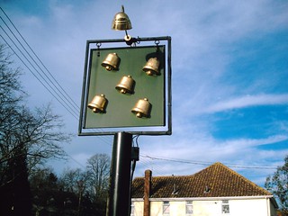
Colne Engaine village pub sign: anyone know the name of the pub? (D.Allen; Vivitar 5199mp)
Jan-08 • magyardave2002 on Flickr
book1 wakes colne bures engaine swcwalks walk46 2226642848
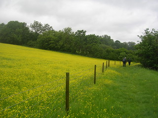
Us walking near the buttercups
Wakes Colne to Bures Spectacular show of....
book1 swcwalks walk46 2524589767

Us walking through the buttercups
Wakes Colne to Bures Spectacular show of....
book1 swcwalks walk46 2524591031

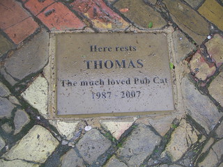
Plaque at the Five Bells
Wakes Colne to Bures You have to walk over Thomas to get in the pub
book1 swcwalks walk46 2524593703
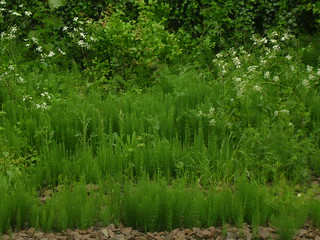
Horsetails
Wakes Colne to Bures Plenty of these on the walk. Some were even attached to horses.
book1 swcwalks walk46 2524598801
The Colne valley
| Length |
17.7km (11.0 miles), 5 hours 30 minutes. For the whole outing, including trains, sights and meals, allow at least 9 hours 30 minutes. |
|---|---|
| Toughness |
5 out of 10. |
| OS Maps |
Explorers 195 (for most of the walk) & 196 or Landranger 168. Chappel & Wakes Colne Station, map reference TL 897 288, is in Essex, 11km north-west of Colchester and 5km south of Bures. The town of Bures sits on the Essex-Suffolk border. |
| Features |
This walk is delightful. Chappel & Wakes Colne, the station where the walk starts, is a railway museum on every side, with old carriages on display. The village and church at Chappel are a foretaste of the lovely architecture to come, along the Colne Valley, such as fine thatched barns and cottages and the neo-Tudor mansion of Colne Priory. The lunch pub at Colne Engaine is just past the church, and then the route follows the side of a fishing lake. Brooks, farms, woods and undulating hills lead into tea at one of the pubs in Bures. Many walkers associate Essex with flat landscapes, surly pubs and badly maintained footpaths. This walk suffers only from this last failing – in summer, one 400 metre stretch near the end (just past point [8]) can be invaded by almost head-high nettles or vegetation, so wear long trousers and take a walking pole and compass if possible. Other paths on this walk can also be overgrown in high summer. During the June 2021 book check and walk update many of the footpath posts and marker posts were either missing or were hidden in deep, dense undergrowth. Reference to missing posts in the Directions refers to the situation found in-situ in June 2021 (updated where appropriate during May 2022 Book check). Some posts might reappear and come out of hiding when the undergrowth falls back in autumn. Since the last Book edition there have been some path diversions and a new route is now recommended between Chalkney Wood and Earls Colne. There is also a diversion around the golf course at Earls Colne. |
| Walk Options |
Shortening the Walk It is a short walk after lunch down to the main road (the A1124), where there are hourly buses going via Wakes Colne viaduct, which is just down the road from the station at which you began the walk; or call for a taxi from the lunch pub. Lengthening the walk If you are fit and would like a very long walk, try adding on Walk 8, Bures to Sudbury, (the shortened version, by-passing Bulmer Tye) to the end of this walk, making an excellent long walk of some 20 miles. |
| History |
'Colne' is an old English word meaning 'roaring river', and thus there are Colne (or Calne) rivers in various parts of the country. The station at Chappel & Wakes Colne forms the East Anglian Railway Museum (tel 01206 242 524). It is open at weekends, Wednesdays and on Bank Holidays from 10am to 5pm, April to October, and from 10am to 4pm, November to March. Admission (2022): General admission: £ 8.00; Special events, such as steam galas and Thomas the Tank Engine days: £ 10.00 to £ 12.00. Concessions and annual passes also available. The museum contains a cafe - Platform Two Cafe - open when the museum is open, and on Events days only its small pub - the Viaduct pub - opens. If you don't want to pay the admission fee you get to see a lot of the museum's exhibits just coming off the train and there is a bookshop selling everything for railway enthusiasts. SWC Walkers who had a yearning to be a train driver when a youngster can attend full day or half day courses in driving a steam train !. The impressive Chappel Viaduct, adjacent to the station, is the longest in East Anglia, 75 feet high and made with 7 million bricks. It opened in 1846. The small church in Chappel dates from 1352, although it may incorporate earlier Norman work. In the fourteenth century, the local bishop granted indulgences - remissions of punishment for sins - to all who contributed to the church's repair. It has a tiny wooden steeple and is constructed of stone in the Early English style, with walls of flint rubble and dressings of cement and local materials. Margery Allingham, the crime novelist, lived in the Chappel area. One of the local walks is named after her. Colne Priory in Earls Colne was rebuilt with its high neo-Tudor chimneys by the enterprising local vicar in the 1940s. The sarsen stones in the tower of St Andrew's Church in Colne Engaine are sandstone boulders brought down by ice in the glacial period and were probably previously used as ritual marker stones in a Stone Age temple on the site. Some of the other building material came from a Roman villa nearby. The church dates back to the early twelfth century and the reign of Henry I. Bures is a village which straddles the Essex and Suffolk border, on opposite sides of the River Stour (the county boundary).The Parish of Bures Hamlet is on the Essex side, and Bures St Mary on the Suffolk side. The village is unusual in that it is served by two County Councils and three District Councils - with two Members of Parliament. |
| Travel |
Take the train nearest to 9.30am from Liverpool Street Station to Chappel & Wakes Colne, changing at Marks Tey. Journey time just over 1 hour. Trains back from Bures are hourly, again changing at Marks Tey. Journey time about 1 hour 10 minutes. Rail ticket - buy a day return to Bures (pronounced ‘Bewers’). |
| Lunch |
The suggested lunchtime stop is the Five Bells pub (tel. 01787-224166) in Colne Engaine, some 7.9 km into the walk. Under new management since 2022, the pub is back open seven days a week, serving food from 12 noon until 8pm. The lunch menu covers most tastes, with a good selection of main meals and snacks. Walkers are made welcome. The pub has informal eating areas, a separate restaurant area and a pub garden, part of which is under cover. This pub is considered by many a SWC walker as being one of the best pubs on any SWC walk. Walkers should aim to leave the pub no later than 2pm in winter to avoid walking in the dark. |
| Tea |
You have two options for tea in Bures, one in Essex and one in Suffolk. The nearest watering hole to the railway station used to be the Swan Inn, but this closed in October 2011 and is now a private dwelling. Around the corner from the former Swan Inn, in Colchester Street, Essex, is the Eight Bells pub (tel. 01787-227354), a Free House, open Monday to Fridays 11.30 am to 3 pm then 6 pm to 11.pm, Saturday and Sunday open all day for drinks (11.30 am to 11 pm), serving food from noon to 2 pm and from 7.pm to 9.30 pm. The pub has a beer gardens. Over the town bridge in Suffolk is the Three Horseshoes pub (tel. 01787-228303) which has a choice of real ales. |
| Updates |
[All Editions] Use the online edition - diversion around a golf course. This edition May 2022. Pub and admission cost updated April 2022. |
| Book |
This walk was originally published in Time Out Country Walks near London volume 1. We now recommend using this online version as the book is dated. The book contained 53 walks, 1 for every week of the year and 1 to spare. Here is our suggested schedule |
|---|---|
| Profile | |
| Help Us! |
After the walk, please leave a comment, it really helps. Thanks! You can also upload photos to the SWC Group on Flickr (upload your photos) and videos to Youtube. This walk's tags are: |
| By Train |
Out (not a train station) Back (not a train station) |
| By Car |
Start CO6 2DS Map Directions Return to the start: Finish CO8 5HS Map Directions Travel to the start: |
| Amazon | |
| Help |
National Rail: 03457 48 49 50 • Traveline (bus times): 0871 200 22 33 (12p/min) • TFL (London) : 0343 222 1234 |
| Version |
Jul-22 Marcus |
| Copyright | © Saturday Walkers Club. All Rights Reserved. No commercial use. No copying. No derivatives. Free with attribution for one time non-commercial use only. www.walkingclub.org.uk/site/license.shtml |


Walk Directions
- [1] After looking round the museum, exit Chappel & Wakes Colne Railway Station via the booking hall; if the booking hall is closed or if you are not visiting the museum, follow the ‘Way Out’ sign at the end of the platform. Walk down the approach road, as it bears right and in 120 metres you come down to the road T-junction where you turn left into Station Road, going downhill into the village.
- In 300 metres you come to a crossroads with the A1124 (formerly the A604), with the railway viaduct on your left-hand side and the village general store opposite. Cross straight over the main road into the village of Wakes Colne on a road called The Street. In 30 metres cross the bridge over the River Colne and immediately beyond the bridge you pass the Swan Inn on the left-hand side.
- In 130 metres, having passed Chappel Church of England Primary School on your left-hand side, you come to the end of the houses on the right-hand side. Ignore a public footpath sign pointing off to the left towards the viaduct, but opposite the sign, turn right off the road, down the surfaced car-wide access road alongside the half-timbered Raynham House, your direction due west.
- In 40 metres you pass the entrance to St Barnabas Chapel on the right-hand side. In 30 metres go through or pass to the left-hand side of a metal fieldgate. 75 metres further on, ignore a footbridge some 30 metres off to your right, going over the river. Continue straight on, pass a barn on your left-hand side and in 50 metres you come to a metal fieldgate and cross the stile to its left-hand side into a field. Continue straight on, slightly left, along the left-hand edge of the field, your direction 235°.
- In 140 metres go through a gap in the left-hand corner of the field (the wooden kissing gate here is missing) and turn right into the next field. Follow the path towards the far side of the field in the same direction as before. In 70 metres you come to a footpath post (part hidden in the hedge to your right), indicating the continuation of the path straight ahead, with the hedge on your right-hand side. In 60 metres further on go through a wooden kissing gate at the far side of the field and go straight on in the next field on a wide grassy path with a wire fence to your left and a hedge on your right.
- In 200 metres go through a wooden kissing gate, cross a stony path and then a wooden bridge with a metal gate on its far side and keep ahead, your direction 255°. In 100 metres you come to the start of a lake on your right-hand side. In a further 120 metres you come to the far side of the field. Turn right through a metal gate down towards the lake and turn left down the path with the lake on your right-hand side.
- In 50 metres cross over a stream and then a wooden bridge with a metal gate on its far side into the next field. Follow the direction for the Colne Valley Path straight ahead along the left-hand edge of the field, with the trees now on your left-hand side.
- [2] In 200 metres the fence goes sharply left, following the tree line. On the corner there is a footpath post and here [!] you leave the Colne Valley Path and turn left through a metal gate on a way known as The Marjory Allingham Walk .
- Walk up the sunken footpath going along the edge of the wood, your direction 220° initially. In 120 metres, just before a footpath post, the path bears half right and then left, to continue on a bearing of 200°. In 100 metres you pass a footpath post on your right. In 50 metres, by another footpath post on your left, bend with the path round to the right, your direction now 195°, slightly uphill between trees, an open field beyond to your right-hand side. In 30 metres pass a footpath post on your right and keep ahead, uphill.
- [3] In 180 metres at a path crossing you come to a footpath post with many yellow arrows on your left-hand side. [!] Turn right through the field boundary, pass a footpath post and head along the clear path going up and over the field, your direction 295 ° initially. In 100 metres you come down to the edge of a small lake and you follow the footpath sign straight ahead, around the right-hand side of the lake. Past the far side of the lake, carry straight on towards a gate ahead.
- In 90 metres pass through this metal gate into the next field. On your right-hand side, looking north, there is a fine view across the valley to a distant church spire. Your path continues straight ahead, down the field. 100 metres straight down the hill, go through a metal gate and then cross a wooden footbridge over a stream. Follow the footpath up the hill ahead, through the trees.
- In 100 metres you come out to a lane T-junction. Turn right down the lane, your direction 30 °. In 25 metres [!] turn left off the road, following a footpath post marked Margory Allingham Walk, along a path into the trees, gently uphill, your direction 295° initially. In 80 metres keep ahead where previously there had been a wooden fieldgate with a sign on its gatepost welcoming walkers to Chalkney Wood (sign now gone May 2022).
- In 80 metres the path converges with a wider track and you go straight ahead (slightly right), ignoring a way to the left, through light woodland, your direction 320° initially, now gently downhill. Ignore all ways off.
- In 250 metres you come to a crossing of car-wide tracks. Take the right fork, gently downhill, through the wood, your direction 340° initially. In a further 250 metres you come down the hill towards gate posts to the entrance to a farmyard (wooden fieldgate missing), with a farmhouse and dog kennels directly ahead. [!] Immediately before these gateposts turn left to cross over a ditch and stream to take a path along the right-hand edge of the woods.
- Follow this path as it winds through woodland and scrub for about 150 metres, until you reach the hedge at the far end of this field, at a path crossing. Here [!] turn right to cross over a ditch, via a single wooden railway sleeper, and pass through a gap (stile missing) into the next field and carry straight on, your direction 340°, down its right hand edge with a hedge on your right-hand side.
- In 90 metres, on reaching the bottom right-hand corner of the field, ignore the other path coming in from the right. Turn left here and continue along the right-hand edge of the field, your direction 240° initially. In 170 metres you walk underneath a National Grid electricity pylon. 30 metres beyond the pylon pass to the left of a metal fieldgate and enter the next field. Continue straight on along its right-hand edge.
- In 60 metres you come to the far, right hand corner of this field, with a number of metal fieldgates and rusted gates ahead [4]. Follow the field boundary to the left. [!] In 40 metres turn right over a stile in the hedge, cross a wooden footbridge with metal railings into a field, where you turn half right at a footpath post, to cross a field, and head towards a post and wire mesh fence on your right, your direction 315°.
- In 80 metres you come to this fence by a footpath post, with arrows pointing ahead and left. Here you have a choice of way: you can turn left across the field, direction 220°, in 210 metres going over a stile to turn right down Tey Road, in 650 metres arriving at the former Carved Angel pub, to continue on the main route below.
- But the recommended route is to keep ahead at this footpath post to walk along the fence [!] but note later you need to be on its other side. In 125 metres (and 25 metres before a metal field gate ahead of you), with wooden fencing around a paddock on your left, turn right through a metal swing gate and bear left . In 25 metres go through a hotchpotch of gates and barriers and in a further 10 metres go through a metal fieldgate into a field.
- Now keep ahead close to the left-hand edge of the field (you are now on the other side of the field edge as required). Head towards the far left-hand corner of this field.
- In 450 metres at this field corner, go through a metal swing gate and proceed along a fenced-in path, your direction 310°. In 120 metres you come out onto a gravel drive, turn left for 10 metres to reach the main road, A1124 (formerly A604) and turn left.
- In 175 metres you reach the junction with Tey Road on your left by the former Carved Angel pub as the road swings to the right. Cross over the A1124 road with care and with Colne Priory directly ahead of you. Follow the public footpath sign along the side of Colne Priory. Walk along the footpath with a metal railing fence on your right-hand side and a hedge on your left. Soon you can see the church of Earls Colne on your left-hand side.
- In 150 metres, the path swings to the left on a new asphalt way with a wooden fieldgate 15 metres ahead. Turn onto this new way [!] but in 10 metres turn right and head towards a metal kissing gate. In 25 metres cross over a new driveway, with wrought iron gates to the Priory to your right, go through the kissing gate and head down a woodland path, your direction 320°.
- In some 120 metres the path comes down to the edge of Colne Valley Golf Course . [!] The original route has been diverted around this course. Turn right onto a new path between fences with a hedgerow to your right. Keep ahead on this earthen and grassy path, your initial bearing 20°, with the golf course on your left-hand side.
- In 150 metres pass an electricity pylon on your right-hand side. In another 130 metres the path swings to the right. In 65 metres you come to the end of the golf course on your left, with the River Colne ahead of you. Turn left onto a slightly raised bank, your direction 325° and keep ahead, with the river to your right and the golf course to your left.
- The path follows the meanders of the river. In 350 metres the path on top of the bank comes to an end and you merge with a gravel golf path on your left, just past a sign to the 14th Tee.
- Keep ahead for a few metres before you bear right to return to a grassy way beside the river on your right as the path follows the bends in the river. The path swings to the left and in some 300 metres you pass new fencing on your left, with a sign advising you that you are on Footpath 19. (May 2022 - the fencing is blocking the original footpath route which headed down the golf course to the bridge). In a further 100 metres turn right to cross the River Colne on a metal footbridge. Once over the bridge turn half-left and in 60 metres go up and over the embankment of a dismantled railway line. On its far side turn left and in 40 metres turn right with the river now on your left-hand side.
- In 80 metres you pass a mini-weir (Earls Colne Gauging Station). After a further 120 metres, before the way ahead enters a field, [!] bear right, your direction 330°, and in 30 metres you go across a three plank bridge through the hedgerow, and keep ahead - ignoring a fork to the right - to follow a broad path through light woodland. In 130 metres you come out into a field. The main route has you continuing ahead, but you can take a short cut here to the lunchtime pub.
- For the shortcut to the pub, turn right on a permissive path along the right-hand edge of an open field. Ignore ways off and in some 170 metres the path comes out onto Mill Lane, where you turn left. Head along this country road and in some 400 metres you come down to the Five Bells pub on your right-hand side.
- The Main route: continue straight on along the left-hand edge of the field, your direction 310°. On your right-hand side, up the hill, you can now see the tower of St. Andrew’s Church in Colne Engaine. In 140 metres the path crosses over into the next field and you keep ahead, now between fields, heading in the same direction as before, towards the right of a copse of trees directly ahead.
- In 150 meters you come to the corner of the copse, where you keep ahead as the path bears slightly to the left, following the edge of the wood. In 300 metres you come out on to a road at a T-junction. The road opposite is signposted to Buntings Green. Turn right up the road. (This is the official way, although there is a more pleasant, well-used local footpath that runs parallel to the road, to its right-hand side, which brings you to the church via a climb up a bank and over a football pitch).
- But following the road uphill, ignoring ways off, you come into Church Street, following the sign for Pebmarsh and Bures. In 10 metres further on, you turn right off the road, through the entrance to St. Andrew’s Church, Colne Engaine (worth a visit).
- Walk straight through the churchyard - a good picnic spot - past the church entrance and straight down the path on the far side, down to the road. To your right is the Five Bells pub, the suggested lunchtime stop.
- After lunch, come out of the pub and turn right, uphill. This is Mill Lane. In 80 metres you pass a turning on the left for Halstead and Earls Colne. Go straight on and in 60 metres you pass the village store and post office on your left-hand side. 20 metres beyond that, you come to the village green, with its village sign, and bench seats. Walk across the middle of the green and cross the road on the far side. [!] Walk straight down the path ahead, between houses, your direction 15° initially. The path is indicated by a concrete public footpath sign which may be obscured by a bush.
- In 150 metres you come out into the corner of a large, flat field and follow the clear path straight ahead along its right-hand edge. 300 metres further on, the path curves to your right, down on to a road. Turn left along the road, gently uphill, in the same direction as before.
- In 270 metres, and some 50 metres before a brick farmhouse, [!] turn right off the road, by a footpath sign, cross over a stile to the left of wooden fieldgates, and keep ahead to go straight down a paddock between wooden fences. In 60 metres pass by a stile - the section of wooden fencing ahead of you is missing - and head down a grassy way between fenced-in paddocks, with a horse training ground (a manège) on your left-hand side. 70 metres further on, in the corner of the field, turn left by a gap in the fence - the stile here is missing. Follow the path along the line of overhead cables, around the back of the manège.
- In 40 metres, with a horse training circle to your left, [!] turn right through a gap - another missing stile - and head down the right-hand edge of a field, with treeline and bushes on your right, your direction 85°. In 385 metres, near the bottom right-hand corner of this field, bear right through undergrowth and in 10 metres cross a concrete footbridge with metal pipe railings across a stream.
- On the far side of the bridge keep ahead through more undergrowth for some 25 metres then bear left on at first an indistinct path which heads into woodland, your initial direction 340°.
- [5] Keep ahead on what is now a clear path which winds its way through the wood through many twists and turns, occasionally clambering over fallen tree trunks. In 210 metres you exit the wood into a large field. There is a wooden footpath post on your right-hand side, just before the exit to the wood. Turn left and follow the path along the left-hand side of the field, your direction 320° initially.
- The way swings to the right and in 140 metres, ignore a car-wide way through a gap in the hedgerow and treeline to the left. In a further 20 metres [!] bear left by a footpath post (missing) through a narrow gap in the hedgerow and treeline into the woodland and in 30 metres cross a three plank bridge across a stream and in 10 metres come out into the next field. Turn left and walk along the left-hand edge of this field, gently uphill.
- In 120 metres you come to the end of the trees on your left-hand side. Turn right up the hill, to follow the direction of the footpath post part hidden in bushes on your left-hand side (missing). Aim for the wooden bench, halfway up the hill, your direction 50°. On reaching this bench, bear left , your direction now 340° initially, to walk along a gravel track and parking area next to the large fishing lake called Prestons Lake on your left-hand side.
- In 180 metres, at the end of this gravel track, turn right and in 10 metres [!] turn left to go between a gap in the hedge, passing two portaloos on your left, to continue ahead along a grassy path, with woodland on your left and a large, open field on your right. In 400 metres you come to the far, left-hand corner of the field. Keep ahead through a field boundary and in 30 metres, with a footpath post on your right, bear left into woodland, your initial direction 330°.
- Now follow an undulating footpath which is intermittently fenced on both sides, through woodland and open areas, and latterly uphill. In 600 metres you come to a path junction with a post on your left-hand side covered with many yellow arrows. [!] 2 metres before this post, turn right past a rusty metal fieldgate, to come out into a large open field. Now follow the left-hand edge of this field with a hedge on your left-hand side, and a vast open field to your right, your direction 90°.
- In 200 metres, after a 60 metre long gap in the hedge which then resumes, you keep ahead, with the hedge on your left-hand side. In a further 150 metres [6], where the main route keeps ahead through a woodland strip, you come to another footpath post (missing) and turn right down the left-hand edge of a field with hedgerow and treeline on your left, gently downhill, your direction 140°.
- In 160 metres you come down to the far end of the field. Cross over a stile into an open area with bushes to your left and right. Keep ahead, downhill, and in 25 metres cross over a grassy track. Ignore the tempting way to your left and instead [!] take the narrower path uphill and ahead, slightly to your right, through undergrowth, coming to a footpath post in 30 metres, your direction 140°. Here keep ahead and take the path gently uphill along the left-hand side of the field, your direction 130° initially, with a hedge and treeline on your left and a low fence on your right.
- In 200 metres the path curves around to the left and takes you out to a road T-junction. [7] Turn left along the road, your direction 350°. In 260 metres, where the road curves around to the left towards a pretty thatched cottage, turn right along the road signposted Valiants and Garlands Farms only.
- In 170 metres you pass the entrance to Valiants Farm on your right-hand side. Follow the road as it continues around to the left, then right. 350 metres further on, ignore a public footpath sign pointing off to the left. In a further 180 metres you pass Garlands Cottage on your right-hand side.
- Keep ahead on this access road, now gravel, following it round to the right, with ponds on your left-hand side, a drive lined with lime trees, until within 80 metres of the very substantial Garlands Farmhouse, at which point, by a footpath post, [!] you turn left over grass, away from the track, opposite the first farm building, along the right-hand side of the farmhouse front garden, your direction 75°.
- In 35 metres bear right on a car-wide grassy path, your direction 145°, with a hedgerow separating the path from the farmhouse on your right-hand side. 90 metres further on, you come out into open fields and follow the grassy track as it continues along the left-hand edge of the field, your direction 105°, with a hedge on your left.
- Ignore ways off and in 340 metres, you walk underneath overhead National Grid cables to reach the left-hand corner of the field. Here keep ahead and pass to the left of vehicle blocking fieldgates, with a footpath post with yellow arrow on your left, and in 10 metres enter the next field and walk straight ahead along the right-hand edge of the field, your direction due east initially. Do not go down the track to the right into the trees.
- In 280 metres along the field edge, as it swings to the left, with a footpath post on your right [!] turn right and cross over a ditch via a bank into the trees. In 3 metres bear left through the trees and in 10 metres go on a three plank bridge with a metal railing on its left-hand side across another ditch. Turn left following the direction of the footpath post with hedges to your left-hand side, your direction 55°. Walk straight ahead along the left-hand edge of the field.
- In 180 metres, with a pretty thatched barn ahead of you on your right-hand side, you come to the left-hand corner of the field, to go down a couple of steps, cross some planks and come out on to a narrow country lane. Turn right along the lane and in 40 metres you pass the thatched barn and the entrance to Polsteads Farm on your left-hand side.
- In 70 metres, turn left following the footpath sign, your direction 75°, between new trees on an alleyway between two fields, ignoring the field entrance on your left, gently downhill. In 200 metres you bear left , your direction 90°, with a brick hut over to your left. You make for the footbridge that is 90 metres ahead of you. Cross this wooden footbridge with metal railings in a field boundary.
- Go over the stile on the far side of the bridge into a narrow field. Keep ahead, your direction 80°, ignoring the horse jump to your left and in 15 metres go through a gap in the fence where previously there had been a metal gate. Proceed uphill along the left-hand edge of the field with a hedge and ditch on your left towards a large farmhouse at the top of the hill. 150 metres up and over the brow of the hill, you can see a fieldgate on your right-hand side. [!] Turn half-right across the field, towards the gate, your direction 120°. In 70 metres pass through the wooden fieldgate and keep ahead, in 40 metres coming out into a farmyard.
- Go straight ahead through the farm yard of Ravensfield Farm (marked on the OS map) between buildings towards double metal gates on the far side. When you get to the gates, pass through them and turn right along the gravel drive, in 25 metres coming down to a road T-junction. There may be peacocks in the garden on your right.
- Turn left into the road and in 5 metres turn left again, onto a car-wide track between hedges, your direction 20°. In 200 metres you come out into a field and continue along the track on the right-hand side of the field in the same direction, with a hedge and treeline on your right.
- Ignore all ways off and in 650 metres, you come out to a road T-junction where you turn left past the gateway into Horne’s Green Cottage, a very pretty 1821 thatched cottage on your left-hand side. In 35 metres turn right down the road signposted to Lamarsh.
- In 300 metres, just past a dip in the road, [8] turn right off the road, following the direction of a concrete public footpath sign, down a grassy car-wide track between two hedgerows with a ditch on your right, your direction 120°.
- In 370 metres the track narrows to a footpath as you come to a wooden footpath post pointing you straight ahead into the trees (can be hidden in undergrowth in summer). Ignore the tempting path uphill to your left and keep ahead on a narrow footpath through trees and undergrowth in the same direction as before. This rather nasty undulating footpath with an uneven footbed can be overgrown in summer and very muddy in winter.
- In 400 metres you come out on into a field. Depending on the exact point where the previous path emerges into this field, you initially turn right along the field edge to then bear left on to a grassy farm track, to follow the direction of the tree-line away to your right, your bearing 90°.
- In 160 metres you come to another footpath post and you follow its direction ahead. In a further 50 metres, as the track bears half left uphill, keep ahead, passing farm buildings on your left. In 150 metres at the field end you come out on to a road at a T-junction. There is a grassy triangle at the junction and you follow the right-hand edge of the triangle to pick up the blue bridleway arrow pointing down the road ahead, your direction 75°.
- 125 metres further on, you come to another T-junction, with a horse chestnut tree in the middle of the junction. Go right on a track downhill, your direction 140°. In 50 metres you pass the entrance to Ferriers Barn on your right-hand side and carry straight on down the road. In a further 100 metres, ignore a footpath going over a bridge to your right.
- In 450 metres, latterly having passed the entrance to a new mobile home park on your left with its red brick walls, you come down to the bottom of the track and out on to a residential street T-junction. The sign to your left says “Lamarsh Hill”. Turn right going into the village of Bures. In 50 metres you pass a turning on the right signposted White Colne, and go straight ahead under the railway bridge. After the bridge you pass Water Lane on your left. 25 metres beyond that is the turning on the right, The Paddocks, which takes you up to Bures Railway Station.
- If you wish to have tea in Bures, continue straight on down the road. 100 metres further on, you pass the other end of Water Lane on your left. After another 40 metres, you pass what was the former Swan Inn on your right-hand side (now a private dwelling. In a further 20 metres, at the junction with Colchester Road, turn right to get to the Eight Bells pub, your suggested "Essex" tea stop in Bures. For the Three Horseshoes pub, at the road junction with Colchester Road, keep ahead on Bridge Street, cross the town bridge over the River Stour, enter Suffolk, pass St Mary’s Church on your right and turn right into Church Square, which swings left. The pub is on your left-hand side.
- To return to Bures Railway Station retrace your steps.