Wadhurst Circular walk
The High Weald, quiet countryside - woods and rolling hills, the Sussex Border Path, and historic Mayfield for lunch.
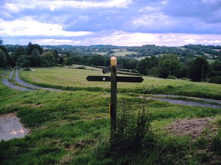
Crosspaths near Mayfield
View from near Mayfield. David A. Vivitar 5199
Jul-07 • magyardave2002 on Flickr
book2 walk18 swcwalks 1469409852

Wadhurst Circular
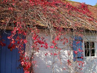
Paint Your Wagon - or any other farm implements to prevent rust. David A. Vivitar 5199 mp
Jul-07 • magyardave2002 on Flickr
book2 walk18 swcwalks 1469403962

Stags Rutting
Sep-08 • msganching on Flickr
walks englishcountryside book2 swc walk18 swcwalks wadhurstcircular tocw218 462605300


Mayfield & Wadhurst Park
| Length |
Standard walk: 19.0km (11.8miles), 5 hours 50 minutes. For the whole outing including trains, sights and meals allow 8 hours Short walk: 10km (6.2miles), 3 hours 10 minutes. Alternate ending in Stonegate: 16km (9.9 miles). Etchingham Circular: 22km (13.7 miles). Long walk to Roberstbridge: 34.5km (21.4 miles), 7 hours (fast pace) 10 hours 30 minutes (relaxed pace) walking time. |
|---|---|
| Maps |
OS Landranger Map Nos. 188 & 199 (for last part of the long walk section). OS Explorer Map No. 136. Wadhurst station, reference TQ 621330 is in East Sussex 7km south east of Tunbridge Wells. |
| Toughness |
4 out of 10 |
| Features |
The prime attraction of this walk is the pleasure of walking through the unspoiled countryside of the High Weald through a region classed as an area of outstanding natural beauty. In August and September the hedgerows are rich with blackberries. The route at the outset follows the Sussex Border Path, but soon diverts south to Tidebrook, and continues south to the pub in Mayfield. It is worth spending some time in Mayfield as it has many attractive old buildings and the 15th century church is now a grade I listed building. The route after lunch heads north east before continuing north to Wadhurst village for tea. The long walk takes you past Bewl Water, which lies just north east of Wadhurst. Bewl Water is the largest area of open water in south east England and host to a huge variety of wildlife; it is one of the region's most popular attractions. |
| Walk Options |
Short WalkYou may reduce the length of the standard walk by 9km to 10km (6.2 miles) by following the standard walk directions as given until [3]. Then follow the Short walk directions and then pick up the standard walk directions at [10]. Alternative Ending in StonegateIf you are happy to go without tea, then you may vary the end of this walk and finish at Stonegate. This reduces the length of the standard walk by 3km to 16km (9.9 miles). Follow the Standard walk directions to [7], then follow the Alternative ending for the Standard walk at Stonegate directions, to link up with the end of the long Stonegate directions at [7]. Buy a return rail ticket to Stonegate. Wadhurst to Robertsbridge Long Walks - 34.5 km (21.4 miles) or 43.5 km (27 miles)For the long distance walker, this walk may be extended to 34km (21.1miles) by taking the short walk and linking it with the long walk directions. After leaving the shorter Wadhurst walk, this longer walk heads north to go around the Northern side of Bewl Water (the largest lake in the south east). It then follows the peaceful Sussex Border path, to skirt Etchingham and into Robertsbridge. Walking at a faster pace you should still allow 9 hours for the 34km walk. You may even take the standard walk and link it with the long walk directions for a 43km (26.7 mile) walk. Buy a return rail ticket to Robertsbridge. Further details, and the walking instructions are in the Wadhurst to Robertsbridge Long Walk Option PDF (link above). Etchingham circular walk - 22km (13.7 miles)These directions provide a circular walk from Etchingham, with an option to finish at Robertsbridge. (Lunch after 7km at The Bull Inn, Three Leg Cross. Tea at The Bistro at the station.) Further details, and the walking instructions are in the Wadhurst to Robertsbridge Long Walk Option PDF (link above). |
| History |
Wadhurst is a pleasant village set on a ridge and has many attractive weatherboarded or tiled houses. The village was once one of the most flourishing of the iron-smelting centres of the Weald. The industry had modest beginnings in the 2nd century, but by the middle of the 16th century it had established Sussex as the foremost industrial county of England. However, by the 17th century competition from Swedish iron imports led to a gradual decline in the industry, resulting in its eventual demise at the start of the 19th century. The Parish Church of St Peter and St Paul, Wadhurst, dates from the 11th century. It is famous for 31 iron tomb slabs dating 1617 to 1799, a greater number than any other church in England, reflecting Wadhurst's connection with the Wealden iron industry. The church has a Norman tower with a pretty needle spire. In the west window of the south aisle there is glass designed by Burne-Jones and made by William Morris. Mayfield, a delightful village situated at the end of an almost detached ridge above the headwaters of the River Rother. There are many attractive old buildings along the High Street. The Church of Saint Dunstans, Mayfield, was named after the 10th-century priest who was a principal adviser to all the Wessex kings of his day. His effigy is in the church. His many achievements included founding abbeys and becoming Archbishop of Canterbury. A legend exists that while St Dunstan - a man of many talents - was forging a horseshoe, he was approached by the devil in the guise of a fair lady. However St Dunstan, seeing a cloven hoof protruding from beneath the dress, grabbed the devil's nose with his red hot pincers, resulting in a mighty leap to Tunbridge Wells, to plunge his nose in a stream. Thereafter the devil vowed never to enter any building with a horseshoe over the door. |
| Travel |
Take the train nearest to 9.20am (before or after) from Charing Cross station to Wadhurst. Journey time is just over an hour. Trains back from Wadhurst run once an hour. Wadhurst station car park £2.00 weekdays and free at weekends. |
| Lunch |
Standard walk The lunchtime stop is The Rose & Crown Inn (tel 01435 872200), Mayfield 8km from the start of the walk, which serves inventive food from 12pm to 2.30pm daily. Restaurant and bar snacks. No bar snacks on Sundays. (Alternatively The Middle House 400m east up Fletching Street into the village.) Short walk The White Hart (tel 01892 782878), Wadhurst 7km from the start of the walk, which serves pub food from 12 to 2pm daily. Long walk The Old Vine (tel 01892 782271), Cousley Wood 12.5km from the start of the walk, which serves pub food from 12 to 2pm daily. The Look Out restaurant (tel 01892 890171), Visitor's Center, Bewl Water (www.bewl.co.uk) 16 km from the start of the walk, which serves food from 12 to 4 pm at weekends, April to September (please phone for other times). An earlier suggested lunch place is The Greyhound (tel 01892 783224) St. James Square, Wadhurst, 7km from the start of the walk which serves food from 12 to 2.30pm daily. Picnic Virtually anywhere along the route would be a good picnic spot. |
| Tea |
Standard walk The suggested tea place is the Wealden Wholefoods Gallery Café (tel 01892-783065), Wadhurst. It is open 9am - 4.45pm Monday to Saturday. The alternate tea place is The White Hart (tel 01892 782878), Wadhurst which offers tea and coffee. It is open daily. Short walk There is no tea stop after Wadhurst. Long walk The Ostrich pub (tel 01580 881737), Robertsbridge which serves tea and coffee. It is open daily. |
| Current Issues |
For the main walk afternoon section, the footbridge (TQ619285) just past Combe Wood has been damaged by recent flooding and will be replaced when conditions allow. There is a temporary diversion in place detailed in the instructions. January 2023 |
| Book |
This walk was originally published in Time Out Country Walks near London volume 2. We now recommend using this online version as the book is dated. |
|---|---|
| Profile | |
| Help Us! |
After the walk, please leave a comment, it really helps. Thanks! You can also upload photos to the SWC Group on Flickr (upload your photos) and videos to Youtube. This walk's tags are: |
| By Train |
Out (not a train station) Back (not a train station) |
| By Car |
Start TN5 6RZ Map Directions |
| Amazon | |
| Help |
National Rail: 03457 48 49 50 • Traveline (bus times): 0871 200 22 33 (12p/min) • TFL (London) : 0343 222 1234 |
| Version |
Jan-23 DAC |
| Copyright | © Saturday Walkers Club. All Rights Reserved. No commercial use. No copying. No derivatives. Free with attribution for one time non-commercial use only. www.walkingclub.org.uk/site/license.shtml |


Walk Directions
Full directions for this walk are in a PDF file (link above) which you can print, or download on to a Kindle, tablet, or smartphone.
This is just the introduction. This walk's detailed directions are in a PDF available from wwww.walkingclub.org.uk