Naturist / Nudist Beaches in England, Scotland, Wales and Ireland
Fairlight Glen - near Hastings
East Sussex
Great hidden sandy beach in a beautiful setting surrounded by forest covered cliffs. Long 500 feet (150m) descent, the last part thanks to a local's maintained beach path
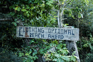
Clothing Optional Beach Ahead
Aug-19 • Rhisiart ap Cymru on Flickr
hastings england nature naturism canon trees canoneos2000d beach tree sussex fairlightglen clothingoptional naturist unitedkingdom hastingscountrypark sign eastsussex nudist parks nufffairlight canoneos greatbritain gb nuffbeach 48630441577

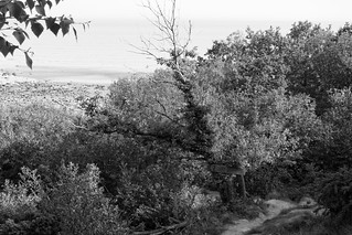
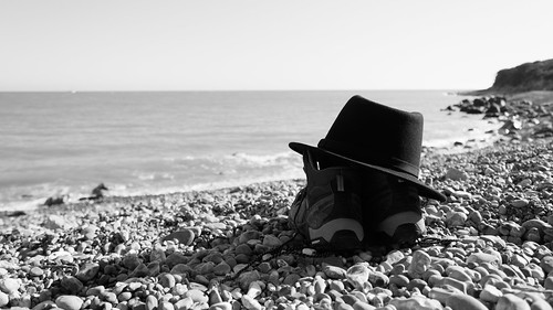
Self Portrait
Aug-19 • Rhisiart ap Cymru on Flickr
horizon shingle england water blackwhite canon selfportrait englishchannel shoes unitedkingdom hat summer beach eastsussex monochrome sussex sea rocks stone waves canoneos2000d coastline coast fairlightglen shore hastings nufffairlight canoneos gb greatbritain nuffbeach 48672769443
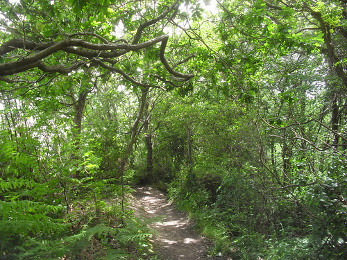
Fairlight Glen
May-17 • Rhisiart ap Cymru on Flickr
england gbr ore oreward unitedkingdom nufffairlight nuffbeach 35907256296
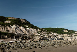
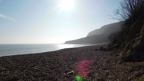
Fairlight Glen
May-17 • Rhisiart ap Cymru on Flickr
england gbr ore oreward unitedkingdom nufffairlight 35108354754
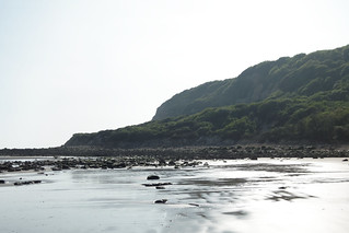
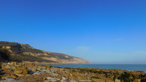
Fairlight Glen
May-17 • Rhisiart ap Cymru on Flickr
england gbr ore oreward unitedkingdom nufffairlight nuffbeach 35778082362
General
The naturist beach at Fairlight Glen lies on the coast between Hastings (about two miles to the west) and the delightful town of Rye to the east. In fact, the beach is in Covehurst Bay, at the bottom of Fairlight Glen. (Fairlight Cove is a seaside village a two miles to the east). Naturist use of this beach was first recognised by the local council in 1978, although it had been in use for many years prior to that. It enjoyed official status by the Council until 1999 when it was reclassified as unofficial for reasons unknown.
Access is from the cliff top path through Hasting County Park from Hastings itself to the Fireheights viewpoint (car park) near Fairlight village.
The official path down to the beach was destroyed some years ago by a land slip, and hasn't been replaced. Not to worry! Just duck under the fence by the warning sign(at your own risk, of course), as some locals have done a great job in repairing the path and installing some new steps.
[May-24] The winter storms have once again damaged the path down. But repair teams have already swung into action and provided a rope to help you. No doubt by the summer, the steps will be repaired!
The previous land-slip has now greened-over, and the bay is really beautiful, well worth the steep climb back up to the cliff top. The bay is a little narrow at high tide, but quite big at low tide. Look out for submerged rocks if swimming (surf shoes are a good idea).
You can walk along the beach in either direction (on a falling tide!), but its hard going on the shingle or rocks - much harder than climbing up to the cliff top path.
There is a new land slip to the west (Hastings direction) of the beach creating an 'undercliff'. Beware - there is no break in the cliffs until Hastings.
To the east, there is a large sandy bay (access inland only in an emergency through private houses) with a wall of large boulders to defend against coastal erosion. There were 2 public footpaths down to this beach, but they have long since fallen into the sea. At low tide only, you can walk round to Petts Levels beach. At high tide this is cut off by the sea.
Getting There
Satnav: TN35 4AD (Coastguard Lane car park)
The beach is part of Hastings Country Park (640 Acres, 5km of coastline).
Access
Users of the beach should also be aware that the cliffs from Hastings to Pett Level have been designated a SAC (Special Area of Conservation) as well as a SSSI (Site of Special Scientific Interest). This is because of the unusual conditions of erosion that exist on the cliff slopes and the rare wildlife inhabiting them.
Being a conservation area it is intended that human disturbance be kept to a minimum. In order to respect this people should refrain from climbing the cliff slopes and keep to the one cliff access path that the routes described below lead to.
Route 1 : Fairlight Road Picnic Site (toilets).
TN35 4DT
From the A21, A28, A2100 junction in Baldslow (north of Hastings) take the B2083 signposted to Ore. After about 3 miles turn right at the A259 (it's a T-junction with traffic lights and a traffic island). Almost immediately, turn off left (very sharp turn) into Fairlight Road, signposted to the Country Park. After 3/4 mile there's a Picnic Site car park (on the inland side of the road) - park there. The beach is a 1 mile walk from here.
Take the narrow road almost opposite the car park entrance, it's signposted as a footpath (you'll pass by a yellow vehicle gate near the entrance). When the tarmaced road bends sharply to the right, stay on the tarmaced road (not straight ahead on a gravel track. [Aug'17] The route here has changed).
After about 1/4 of a mile (at point 11), take the first turning on the left. Follow this path round to the left, then uphill to a gate, straight on past the gate and then down to where there is a junction of paths and an information sign (point 15).
Turn sharp right here and continue downhill to a simple wooden fence and a council sign informing the public that the access is officially closed. Turn left here and carry on a short distance until you reach this path's lowest point.
This is the best place to climb over. From here follow the path and steps down towards the sea.
Route 2 : Fireheights viewpoints on Lower Coastguard Lane (longer, steeper, but great cliff top walk).
TN35 4AD
This pay car park is a turning off Fairlight Road (between Hastings an Fairlight / Pett Level) signed as the Country Park visitor centre. Lower Coastguard Lane leads to a pay car park with toilets and a little further on an information centre and more parking spaces. From here it's a longer walk than Route 1 (nearly 2 miles) but useful if the other car park is full and also makes for a scenic coastal walk through the country park with great views overlooking the sea.
After parking the car, carry on down Lower Coastguard Lane towards the coastguard cottages and radar tower. Having passed the cottages go through the swing gate next to the radar tower, head straight on for a short distance then turn right and follow the coastal-most paths; firstly downhill towards the valley, left down a flight of steps opposite a bench, over a stream at the bottom of the valley and then up the other side. A further flight of steps in the wooded section ahead will take you up to the very top of the hill and another set of steps part way down the other side.
When you reach a T-junction with a bollard turn left, this path then takes you down to the fence and Council signs as in Route 1.
If hill climbing isn't for you there's an alternative route from the car park (with less of a sea view) that avoids some of the hill climbing. Just before you reach the coastguard cottages take the path to the right and continue on past the new picnic area to the next gate.
Through the gate continue straight ahead for a quarter of a mile until you come across a house very nearly hidden by trees, to the right of this house is a swing gate, go through this and then 100 metres on to another swing gate and then take the path immediately to the left. After about 1/3 mile you will reach the flight of steps in the wooded section mentioned previously.
Route 3 : Barley Lane (no toilets).
From the centre of Hastings head to the sea and take the A259 along The Bourne east of Hastings Castle. Fork right into Harold Road and soon turn right into Barley Lane. The car park is about 3/4 mile along on the right. From the car park take the path south, then turn left, then turn right, then turn left, then turn right. At the cliffs the path bears left - keep going for just over half a mile until you come to the wooden fence and Council sign as in Route 1.
Route 4 : Walk from Hastings.
To walk from Hastings, follow the beach east past the Castle Hill to the East Cliff Railway, then either ascend to the Country Park and follow the paths always turning right until you come to the two-bar fence and Council sign as in Route 1. [2017] There has been a landslip half way along this path. There is a long diversion, but, unofficially the path is passable (at your own risk) with care, but not during (or after!) wet weather.
Alternatively it is possible to walk along the beach from the East Cliff Railway, but ONLY when the tide is out - YOU MUST CHECK THE LOCAL TIDE TABLE BEFORE ATTEMPTING IT. It is about 2.5 miles from the railway to the beach, and at sea level it is shingle walking (so harder work than the cliff path), though this route is surprisingly popular especially for dog walkers.
Coastal access from the east (next access point is at Cliff End, Pett Level) is quite a trek at over 3 miles and also mostly shingle walking with one or two rocky sections to negotiate, but none the less quite a pleasant walk if you fancy it but again you should only attempt this route near low tide and be able to get back again when the tide is out, so you must check the local tide times.
Description
Originally the beach was only covered with rocks and large flat stones, but since Hastings replenished its town centre beaches with shingle in the late 80's / early 90's it is now (due to long shore drift) covered in conventional shingle, ideal for sunbathing and walking on.
At low tide the beach becomes a wide flat expanse of clean sand, great for walks and beach recreation. In the height of summer the sea becomes warm and swimming is excellent. The cliffs are of soft sandstone with a good deal of vegetation, mostly gorse and goat willow bushes, but a fair number of wild flowers and land song birds in season add to the attractiveness.
The rock pools host beadlet sea anemones, but the beach is very poor for shells. Unfortunately there is virtually no shade of any use, except in late afternoon when the sun goes behind the cliffs. The only motorised noise is from the occasional aircraft or motorboat.
The atmosphere is excellent - with a good mixture of singles, couples and quite a few families with children. Most people settle in and around the small bay where the steps lead out onto the beach, the remote location ensuring it never gets overcrowded. Heading east or west along the beach will soon provide a quieter spot for those who prefer solitude.
The beach tends to be used by naturists for up to a mile from the access point in the easterly direction. This stretch provides the best places to sunbathe, walk and swim, and has the largest expanses of sand at low tide. The westerly direction is generally rockier and provides little in the way of sand at low tide and is therefore not favoured by many.
During above average high tides the sea can just reach the cliff/cliff falls in a small number of places and so you'll be forced to move from these areas at such times. If you've moved some distance from the access point you could also therefore find yourself cut off and unable to get back for an hour or two until the sea recedes, there is little danger though as there are many safe areas to retreat to above high ground.
Updated
Aug 2017
Map

Comments
Please leave a comment via the email address below.
-
Sandy31-May-20
Note that some of the path down to the beach was washed away over the winter. The heroic repairer(s) have been at work and the beach is accessible with care but there is a steep scramble down an approx 6m muddy bank about half way down the path; a rope has been put in place which is certainly needed when going uphill
-
Nov-20
Next year.
-
Aug-20
Route 1 updated to avoid a private path.
-
Aug-20
Fairlight Glen beach path in excellent condition - many thanks to the volunteer repair crew. Beach much busier than usual on a sunny August Saturday afternoon. About half clothed, half clothes free.
Photos
Tag and share your photos to the UK Naturist Beaches group on Flickr.
Photos should be of the beach, or show the way to it. They should NOT have people in them.

Clothing Optional Beach Ahead
Aug-19 • Rhisiart ap Cymru on Flickr
hastings england nature naturism canon trees canoneos2000d beach tree sussex fairlightglen clothingoptional naturist unitedkingdom hastingscountrypark sign eastsussex nudist parks nufffairlight canoneos greatbritain gb nuffbeach 48630441577
Self Portrait
Aug-19 • Rhisiart ap Cymru on Flickr
horizon shingle england water blackwhite canon selfportrait englishchannel shoes unitedkingdom hat summer beach eastsussex monochrome sussex sea rocks stone waves canoneos2000d coastline coast fairlightglen shore hastings nufffairlight canoneos gb greatbritain nuffbeach 48672769443

Fairlight Glen
May-17 • Rhisiart ap Cymru on Flickr
england gbr ore oreward unitedkingdom nufffairlight nuffbeach 35907256296

Fairlight Glen
May-17 • Rhisiart ap Cymru on Flickr
england gbr ore oreward unitedkingdom nufffairlight 35108354754

Fairlight Glen
May-17 • Rhisiart ap Cymru on Flickr
england gbr ore oreward unitedkingdom nufffairlight nuffbeach 35778082362
Fairlight Glen
Mar-17 • Rhisiart ap Cymru on Flickr
england fairlight gbr ore unitedkingdom nufffairlight nuffbeach 33374594503

Fairlight Glen
Mar-17 • Rhisiart ap Cymru on Flickr
england fairlight gbr ore unitedkingdom nufffairlight nuffbeach 33322234674
Fairlight Glen
Mar-17 • Rhisiart ap Cymru on Flickr
england gbr ore oreward unitedkingdom nufffairlight nuffbeach 34186195515

SDC11530
End of the path down to beach from Fairlight Glen
Jun-12 • Andrew Murphy on Flickr
book3 swcwalks walk169 nufffairlight 9246561951

SDC11532
Fairlight Glen beach at high tide
Jun-12 • Andrew Murphy on Flickr
book3 swcwalks walk169 nufffairlight 9249373184

SDC11558
Path down to Fairlight Glen's beach
Jun-12 • Andrew Murphy on Flickr
book3 swcwalks walk169 nufffairlight 9249346962

SDC11561
Steps on path down to Fairlight Glen's beach
Jun-12 • Andrew Murphy on Flickr
book3 swcwalks walk169 nufffairlight 9249349444
SDC11563
Path down to Fairlight Glen's beach
Jun-12 • Andrew Murphy on Flickr
book3 swcwalks walk169 nufffairlight 9246569573
Updates and Trip Reports
Tag and share your photos
UK Naturist Beaches on Flickr
Follow us on Facebook
Inappropriate behaviour
The beach descriptions originally came from the closed NUFF website.
Thanks to its authors.