London Loop
Circular (almost) walk around the greenbelt surrounding London
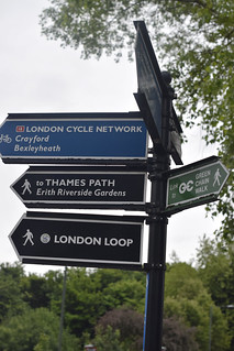
photo from walk
May-17 • hikinginlondon on Flickr
london loop swcwalks ldp24 southeast england 34030258523
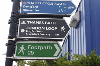
photo from walk
May-17 • hikinginlondon on Flickr
london loop swcwalks ldp24 southeast england 34679464282
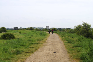
photo from walk
May-17 • hikinginlondon on Flickr
london loop swcwalks ldp24 southeast england 34803390336
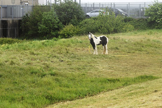
photo from walk
May-17 • hikinginlondon on Flickr
london loop swcwalks ldp24 southeast england 34683158122
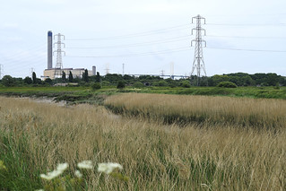
photo from walk
May-17 • hikinginlondon on Flickr
london loop swcwalks ldp24 southeast england 34714730501
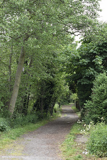
photo from walk
May-17 • hikinginlondon on Flickr
london loop swcwalks ldp24 southeast england 34808001816
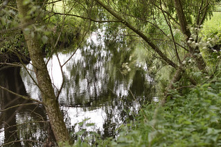
photo from walk
May-17 • hikinginlondon on Flickr
london loop swcwalks ldp24 southeast england 34808314306
| Length | 151.7 miles (244.1 km) with 4,450 ft (1,350 meters) of ascent split into 24 sections |
|---|---|
| Toughness | 4 out of 10 |
| Maps |
OS Explorer Maps |
| Walk Notes |
The London Loop (London Outer Orbital Path) is an almost circular walk (The Thames gets in the way at 1 point) that loops around London's green belt with a wide variety of terrrain. Its split in to 24 sections of about 5 miles each.Logistically, the walk is very with many train and tube stations on route. Use a Travelcard or Oyster/Pre-Pay as otherwise fares may be expensibe as out and back may be on different rail lines The TFL website has PDF's for each section, with directions and a map # 4 : West Wickham Common to Hamsey Green, 16 km (10 miles)This section is through the wooded Addington Hills south of Croydon. There is a noted viewpoint overlooking Croydon and London. Just along the road from the viewpoint (no view) is a Chinese restaurant. Hayes is on a rail lines from Charing Cross and Londonm Bridge. There is a fairly short walk (described in the TFL directions) from Hayes station to the start of section 4. At Hamsey Green catch the frequent 403 bus to Sanderstead station for trains to Victoria # 17 : Cockfosters to Enfield Lock : 15 km (9.5 miles)Suggested lunch stop: Rose and Crown, 185 Clay Hill, EN2 9AJ ( 020 8366 0864) Cockfosters is a tube station. Enfield is British Rail to Liverpool Street #20 and #21 Chigwell to Harold Wood : 16.6 km (10.3 miles)Chigwell Underground station is about 40 mins Journey time from central London Suggested lunch stop: The Royal Oak, Havering-atte-bower, RM4 1PP T:01708 744523. # 23 : Upminster Bridge to Rainham - 6.4km (4m)This section takes you through Ingrebourne Valley Nature reserve which has a superb visitor centre where you can have refreshments or brunch and has lovely views over the valley. There are 4 pub options in Rainham village but not all serve food . The Albion Flaming Grill may be the best bet. (We are not talking nouvelle cuisine here….). Upminster Bridge is on the District Line in Zone 6. # 24 : Rainham to Purfleet- 9km (5.6m)This section takes you on an atmospheric path along the river Thames to the RSPB reserve at Rainham Marshes which has an ace café serving light meals, teas, coffees and cakes. It closes 30 mins before the reserve so you need to get there around 4pm. If you get there early enough you could do a circuit of the reserve – about 3km – free to RSPB members otherwise there is a charge of £5. Purfleet station is about 10 mins walk from the reserve and on the way there are some fine views looking back to London’s 21st century skyline and expansive vistas across the Thames Rainham (Zone 6) and Purfleet (outside the zones, but you can use Oyster) are train stations on a line to Fenchurch Street. You can connect with the District Line at Barking. |
| Profile | |
|---|---|
| Help Us! |
After the walk, please leave a comment, it really helps. Thanks! You can also upload photos to the SWC Group on Flickr (upload your photos) and videos to Youtube. This walk's tags are: |
| By Train |
Out (not a train station) Back (not a train station) |
| By Car |
Start RM19 1PP Map Directions Return to the start: Finish DA8 1TY Map Directions Travel to the start: |
| Amazon | |
| Help |
National Rail: 03457 48 49 50 • Traveline (bus times): 0871 200 22 33 (12p/min) • TFL (London) : 0343 222 1234 |
| Version |
Apr-24 |
| Copyright | © Saturday Walkers Club. All Rights Reserved. No commercial use. No copying. No derivatives. Free with attribution for one time non-commercial use only. www.walkingclub.org.uk/site/license.shtml |
