Pennine Way
Long moorland walk along England's spine via the Peak District, Yorkshire Dales and Cheviots.
| Length | 429km (268 miles) |
|---|---|
| Toughness | 10 out of 10. |
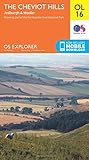
| Maps |
OS Explorer Maps : 1, 21, 2, 30, 31, 19, 43, 42, 16 |
| Walk Notes |
The Pennine Way is the daddy of National Trails in the UK, though others are now longer (South West Coast Path), tougher, or just plain better (The Coast to Coast) It is a 268 mile long distance national trail, and there is now a newer Pennine Way Bridleway that is roughly parallel to it that can be used by horse riders or cyclists |
| History |
The First National Trail - The Pennine WayGiven the history of the area, then it is probably only right that the Pennine Way became the first National Trail in England and Wales. The 269 mile/429km route runs along the "backbone of England" - The Pennine Hills. It owes its origin to an idea of Tom Stephenson, first secretary of the Ramblers Association. Starting at Edale in The Peak District it runs north via the Yorkshire Dales and Northumberland National Park to finish at Kirk Yetholm on the Scottish borders, just inside Scotland. The Wider Significance of The Pennine WayThe recent (20th century) history of this route has come to represent the struggle by hikers for public access to land, led by Tom Stephenson and The Ramblers. In June 1935 Tom Stephenson wrote an article for the Daily Herald which is widely credited to have been the inspiration for the creation of The Pennine Way. In the article 'Wanted - A Long Green Trail' he contrasted the financial support and encouragement of the US government towards the creation of the 2000 mile Appalachian Trail and 2500 John Muir Trail, against the UK authorities hostile attitude to walkers in Britain. (This was just three years after The Kinder Scout trespass.) Tom Stephenson wrote of two American girls asking for advice for a walking holiday in England, and wondered "what they would think of our island, particularly the restrictions placed in the way of those who wished to see some of our most captivating scenary. If, at the end of their tour, these visitors from across the Atlantic are over-loud in their praises of their native 'Land of Liberty', who shall blame them?" His article concluded: "Let us have this through route to health and happiness for this and succeeding generations who may thus make acquaintance with some of the finest scenary in the land. Whatever the cost, it would be a worthy and enduring testimony bringing health and pleasure beyond computation, for none could walk that Pennine Way without being improved in mind and body, inspired and invigorated and filled with the desire to explore every corner of this lovely island." Thus the establishment of The Pennine Way came to signify the wider struggle to open up the private shooting moors and estates of the north of England. A walk with TomIn one of his last interviews, Tom Stephenson walked the Pennine Way with Roly Smith in 1976. “Aye,” said Tom, a warm smile creasing his weatherbeaten face. “It’s a grand valley isn’t it?” We were looking up Grindsbrook Clough to the rock-rimmed Edale Moor. This was where it all began. The Pennine Way snakes northwards for 250 miles from here to beyond the Scottish Border, keeping to the upper vertebrae of England’s backbone all the way. But when Tom Stephenson proposed, in a throwaway centre-spread filler for the Daily Herald 41 years ago, “a faint line…which the feet of grateful pilgrims would engrave on the face of the land,” he could have had no idea of what would follow. “The way I feel, this route has given so much pleasure to so many thousands of people who perhaps otherwise would not have ventured onto the hills,” said Tom. “This is what I wanted in the first place, and when I see young people enjoying themselves on the Way, it makes it seem worthwhile.” But there had been a mounting wave of criticism in mountaineering circles against the designation of all forms of long-distance footpaths. The proposed Cambrian Way and a long-distance route in the Cairngorms had attracted a storm of protest. Were there not too many ‘ways’ now? “Mountaineers were always opposed to the Pennine Way,” he recalled. “The Times complained that ramblers were being molly-coddled when the Pennine Way was first proposed. But having a designated ‘way’ has meant more people enjoying the freedom of the hills, and I can’t see anything wrong in that.” Talking to Tom about the inception of the Pennine Way, and the setting up of the National Parks Commission, you realise how important a part fate plays in these things. He was the right man in the right place at the right time. It is doubtful whether any of this important legislation would have passed onto the Statutes had not all these conditions have been in place at the time. Tom’s face lights up and his tongue darts out mischievously as he recounts the tales of a judiciously-worded press release written with carte blanche Ministerial consent, or the publicity-seeking walks with leading MPs and Ministers along sections of the Pennine Way; all arranged when he was Press Officer to the Ministry of Town and Country Planning just after the war. “Aye, we had some fun,” he grins. He frankly admits that one of the major reasons for the route was to clear up the longstanding and knotty problems of access over Kinder and Bleaklow. When the route was first proposed, there were 180 miles on existing rights of way, leaving about 70 miles of new rights of way to be negotiated. Half of these were in the Kinder-Bleaklow section. Tom has some horrifying tales to tell of the old access battles fought between ramblers and gamekeepers on the moors of the Dark Peak, and still keeps a dossier of gamekeeper assaults during that period. It was an incredible 70 years ago that Tom had his introduction to the hills. He climbed Pendle Hill from his home in Whalley, Lancashire, one crisp February morning, ‘equipped’ only with his wooden clogs, and stood for the first time on a summit. The memory of that crystal-clear morning is still as fresh to Tom as if it were yesterday. “It was breathtaking,” he recalled. “I saw range after range of snow-capped hills – Ingleborough, Penyghent, all of which I didn’t know then, but which were to become old friends. “Oh gosh, I just hadn’t realised that this whole new world was on my doorstep. I made up my mind that day that this was for me.” The nine-bob-a-week apprentice textile printer walked the Pennines from Dovedale to the Roman Wall during the next seven years, and got to know them intimately, although he admits he still hasn’t walked the whole length of his Pennine Way in one continuous trip. Seventy years on, the attraction of the hills is still as strong. He was looking forward to a walking holiday in the Lakes when we met, keenly anticipating a reunion with his favourite hill, Glaramara – “not too high, but nice and knobbly.” A recent television documentary renamed the Pennine Way ‘Stephenson’s Way’, and it is a fitting tribute to his imaginative conception to say that this was no exaggeration. A version of this interview first appeared in Peak Park News, Journal of the Peak District National Park, in Autumn 1976. |
| Profile | |
|---|---|
| Help Us! |
After the walk, please leave a comment, it really helps. Thanks! You can also upload photos to the SWC Group on Flickr (upload your photos) and videos to Youtube. This walk's tags are: |
| By Train |
Out (not a train station) |
| By Car |
Start S33 7ZN Map Directions Finish Kirk Yetholm Map Directions |
| Amazon | |
| Help |
National Rail: 03457 48 49 50 • Traveline (bus times): 0871 200 22 33 (12p/min) • TFL (London) : 0343 222 1234 |
| Version |
Apr-24 |
| Copyright | © Saturday Walkers Club. All Rights Reserved. No commercial use. No copying. No derivatives. Free with attribution for one time non-commercial use only. www.walkingclub.org.uk/site/license.shtml |