Boston Manor to Osterley walk
Grand Union Canal and Osterley Park (NT)
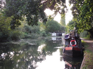
Barges on River Brent/Grand Union Canal
SWC Short Walk 22 - Boston Manor to Osterley
Aug-19 • thomasgrabow on Flickr
swcwalks short22 banner 48520949132
Boston Manor to Osterley
swcwalks short22 walkicon bostonmanorpark london 36335815642

Hanwell Lock on Barges on River Brent/Grand Union Canal
SWC Short Walk 22 - Boston Manor to Osterley
Aug-19 • thomasgrabow on Flickr
swcwalks short22 walkicon 48520951037

Boardwalk in Long Wood Local Nature Reserve
SWC Short Walk 22 - Boston Manor to Osterley
Aug-19 • thomasgrabow on Flickr
swcwalks short22 walkicon 48520778416

Under the Heathrow flightpath (Korean Air?)
SWC Short Walk 22 - Boston Manor to Osterley
Aug-19 • thomasgrabow on Flickr
swcwalks short22 walkicon 48520777531

Boston Manor to Osterley
swcwalks short22 bostonmanorpark london 36504171175

| Start | Boston Manor underground station |
|---|---|
| Finish | Osterley underground station |
| Length |
6km. |
| Time | 1 hour 30 mins |
| Travel | Piccadilly line trains run frequently to Boston Manor and Osterley. Both stations are in Travelcard Zone 4. |
| Walk Notes |
This walk takes you along the Grand Union Canal and through Osterley Park. The grounds to Osterley House are accessible during daylight hours most days of the year. |
| Eat |
The Hare & Hounds, Wyke Green, TW7 5PR. T: 020 8560 5438 |
| Profile | |
|---|---|
| Help Us! |
After the walk, please leave a comment, it really helps. Thanks! You can also upload photos to the SWC Group on Flickr (upload your photos) and videos to Youtube. This walk's tags are: |
| By Car |
Start TW8 9LQ Map Directions Finish TW7 4PU Map Directions |
| Amazon | |
| Help |
National Rail: 03457 48 49 50 • Traveline (bus times): 0871 200 22 33 (12p/min) • TFL (London) : 0343 222 1234 |
| Version |
May-17 DAC |
| Copyright | © Saturday Walkers Club. All Rights Reserved. No commercial use. No copying. No derivatives. Free with attribution for one time non-commercial use only. www.walkingclub.org.uk/site/license.shtml |


Walk Directions
- From the entrance to Boston Manor station, turn left down the main road. In 100m turn left along Wellmeadow Road and in 60m turn right along Southdown Avenue. After 200m turn left along a small road leading to a small car park and in 40m go through a wooden kissing gate and fork left to join the Capital Ring footpath, which after 15m continues along a fenced in path.
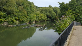
- In 100m go over a path cross paths, to follow a Capital Ring waymark down into a wood, (with the noisy M4 clearly audible ahead). After 220m you reach the Grand Union Canal (with the M4 up above); turn right along the towpath. In 160m go past a Lock and in a further 80m cross a bridge over a weir. In 550m go under a road bridge (Trumpers Way). After 500m (with Green Lane off to your right), cross a bridge over a canal arm to reach Hanwell Lock.
- Cross over the first set of lock gates for Hanwell Lock, to follow a footpath on the other side, 190º. In 100m cross over a single track railway, to then turn left through a metal gate along a fenced in footpath, (with the railway line off to your left), 130º. After 450m at a cross paths (with a metal gate on your left hand side), continue in the same direction through a wooden kissing gate, (with an embankment up to your right and the railway line off to your left).
- In 400m cross the remnants of a stile to the left of a metal fieldgate. [!]In 80m at an unmarked path junction, turn right, (with the noisy M4 clearly audible off to your left). In 100m join a wooden slatted walkway to then go up over a mound to then join a second wooden slatted walkway. At the end of the walkway continue up the path for 100m to come out onto a main road. Turn left, passing under the M4 after 60m, to then reach the Hare and Hounds PH after 400m.
- Pub to Osterley station.
- From the road entrance to the Hare and Hounds, turn left for 25m, to then cross the road to follow a path into a wooded area, 210º. In 150m cross over a car wide gravel track (with white lodge houses off to your right), to continue along the right hand side of a green, (initially with a 2½m high brick wall on your right).
- In 120m ignore a path forking off to the right, to continue through a wooded area. In 270m the now enclosed path curves to the right, and in 70m go through a wooden kissing gate and turn left along a fenced in footpath across a field. After 300m cross the driveway to Osterley House and Gardens*, flanked by two metal kissing gates.
- Should you wish to explore the grounds / visit the tea rooms of Osterley House, you are free to do so during opening hours - opening times on the National Trust website. Entrance to the parkland is free. There is a charge for the House and small formal gardens.
- After 120m the enclosed footpath comes out in to the corner of a field. Continue along the left side of this field in the same direction to exit through a gate after 270m onto a road.
- Cross the road to go along Bassett Gardens. In 180m at a T-junction, turn right and in 70m, turn left along an enclosed paved footpath to reach Osterely station after 100m.