Chelsea and Battersea Park walk
Chelsea with the King's Road, two Thames Bridges and Battersea Park, optional: Battersea Power Station and Nine Elms


| Start | Sloane Square underground station |
|---|---|
| Finish | Victoria or Vauxhall underground and mainline stations. |
| Length |
5.9 km or 6.3 km. |
| Time | 1 hour 45 minutes |
| Travel | Sloane Square and Victoria are on the Circle and District lines, Vauxhall and Victoria are on the Victoria line. Sloane Square and Victoria are in Zone 1, Vauxhall on the boundary with Zone 2. |
| Walk Notes |
Through quiet and not so quiet Chelsea streets across Albert Bridge to Battersea Park (choose your route through it). Then either across Chelsea Bridge and on to Victoria or along the Thames past Battersea Power Station and through Nine Elms to Vauxhall. |
| Eat |
Many en route. At Victoria: The Willow Walk. 25 Wilton Road. Victoria. SW1V 1LW (T: 020 7828 2953) provides reasonably priced food (until 22:00) and drink |
| Profile | |
|---|---|
| Help Us! |
After the walk, please leave a comment, it really helps. Thanks! You can also upload photos to the SWC Group on Flickr (upload your photos) and videos to Youtube. This walk's tags are: |
| By Car |
Start SW1W 8BB Map Directions Finish SW1E 5ND Map Directions |
| Amazon | |
| Help |
National Rail: 03457 48 49 50 • Traveline (bus times): 0871 200 22 33 (12p/min) • TFL (London) : 0343 222 1234 |
| Version |
Apr-24 DAC |
| Copyright | © Saturday Walkers Club. All Rights Reserved. No commercial use. No copying. No derivatives. Free with attribution for one time non-commercial use only. www.walkingclub.org.uk/site/license.shtml |


Walk Directions
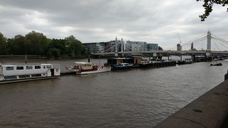
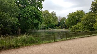
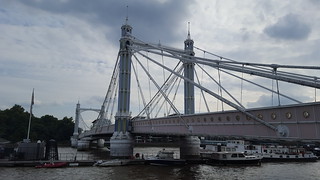
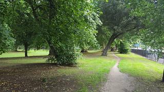
- From Sloane Square underground, head south-west along Kings Road. Turn left along Cheltenham Terrace to go along Franklins Row. At the cross roads with Royal Hospital Road, turn right to reach the Embankment and Albert Bridge. Cross over Albert Bridge to enter the western entrance to Battersea Park. On the far side of the park cross over Chelsea Bridge.
- Continue along Chelsea Bridge Road in a north westerly direction. At the traffic light junction with Royal Hospital Road (left) and Pimlico Road (right), turn right along Pimlico Road. [If wishing to return to Sloane Square underground, ignore this right turn and continue along Lower Sloane Street.]
- After 250 metres fork left along Ebury Street. Continue along Ebury Street for 500 metres to reach a cross roads with Eccleston Street where you turn right. In 200 metres you cross over Buckingham Palace Road to go across Eccleston Bridge (crossing over the tracks into Victoria Station on your left).
- Once over Eccleston Bridge, turn left along Bridge Place which leads out to Wilton Road, with The Willow Walk pub on the other side of Wilton Road.