West End and Esher Commons walk
Wooded commons and a pretty village

Esher Common
SWC Short Walk 17 - Oxshott Heath, Esher and West End Commons
Aug-19 • thomasgrabow on Flickr
swcwalks short17 banner 48521264027
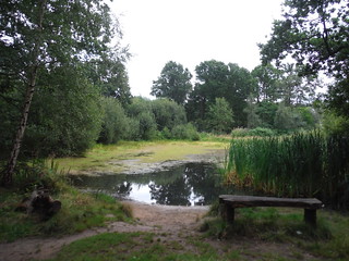
Halfpenny Pond, West End
SWC Short Walk 17 - Oxshott Heath, Esher and West End Commons
Aug-19 • thomasgrabow on Flickr
swcwalks short17 walkicon 48521260572

Viewpoint into Mole Valley, The Ledges, West End Common
SWC Short Walk 17 - Oxshott Heath, Esher and West End Commons
Aug-19 • thomasgrabow on Flickr
swcwalks short17 walkicon 48521085801
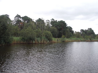
Black Pond, Esher Common
SWC Short Walk 17 - Oxshott Heath, Esher and West End Commons
Aug-19 • thomasgrabow on Flickr
swcwalks short17 walkicon 48521254682
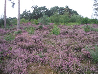
South Slope, Oxshott Heath
SWC Short Walk 17 - Oxshott Heath, Esher and West End Commons
Aug-19 • thomasgrabow on Flickr
swcwalks short17 walkicon 48521080741
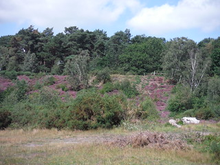
South Slope, Oxshott Heath
SWC Short Walk 17 - Oxshott Heath, Esher and West End Commons
Aug-19 • thomasgrabow on Flickr
swcwalks short17 48521270857
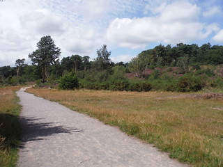
Path near South Slope, Oxshott Heath
SWC Short Walk 17 - Oxshott Heath, Esher and West End Commons
Aug-19 • thomasgrabow on Flickr
swcwalks short17 48521270442
| Start and Finish | Oxshott Station |
|---|---|
| Length | 10.0 km (6.2 miles); Ascent 139m |
| Time | 2 1/4 hours. |
| Travel |
Oxshott station (2 trains an hour from Waterloo, 34 mins), is 3 stops outside Zone 6, but you could travel to Surbiton (Zone 6, frequent trains) and catch a frequent K3 bus (TFL, Oyster valid) to Esher or Claygate, and walk from there. Car drivers can park for free in West End Common (SatNav: KT10 8LA), or one of the many car parks around the commons. Claygate, and West End Common are just off the A3 in SW London |
| Walk Notes |
This is a walk through several adjoining wooded commons on the Surrey/London border. You start at Oxshott station and ascend the South Slope of the wooded Oxshott Heath to a fine viewpoint by the War Memorial. Skirt a pretty ex-sandpit and follow narrow paths through the woods and across the A3 into Esher Common. There you follow enchanting paths through the heathland and then some woods into West End Common to West End, a lovely Surrey village (willow-fringed pond, diminutive church, cricket green, nice pub), with a large garden centre. From the pub you return through more woods to The Ledges, the northwesterly escarpment of the Commons, hanging over the Mole Valley, and on back into Esher Common and past the atmospheric Black Pond, then eventually back to Oxshott station. Just off the route, is an NT Garden (Claremont). The commons have a very different feel in Summer and Winter when the trees are leafless. Note: There are far more paths in the woods than appear on any map. Map and compass or a smartphone/GPS device would help navigation! |
| Walk Options |
A longer return route descends from The Ledges to follow a riverside path along The Mole (adds 600m, currently map-led but shown on the route map). You can continue on, from Oxshott to Epsom through Prince's Coverts and Ashtead Common (map-led) You can start from Claygate or Esher stations (map-led, but suggested route shown on the route map). For a longer walk in this area, try SWC Walk 178 : Oxshott to Ashtead |
| Eat/Drink |
If starting at Oxshott, the Prince of Wales (Chef & Brewer, KT10 8LA), West End Common's pub is a very nice place for a meal or a drink. If starting at West End Common, it's at the finish. |
| Links |
There have been ongoing battles between local residents and English Nature (the commons are an SSI) / Elmbridge Council who would like to remove secondary woodland, 1950's conifers and non-native species (e.g. rhododendron ) to allow the "original" heathland to restablish itself. They carry out this work in winter to avoid upsetting nesting birds. However, the heavy equipment the use churns up paths, turning them into rutted muddy quagmires. |
| Profile | |
|---|---|
| Help Us! |
After the walk, please leave a comment, it really helps. Thanks! You can also upload photos to the SWC Group on Flickr (upload your photos) and videos to Youtube. This walk's tags are: |
| By Train |
Out (not a train station) Back (not a train station) |
| By Car |
Start KT10 8DY Map Directions |
| Amazon | |
| Help |
National Rail: 03457 48 49 50 • Traveline (bus times): 0871 200 22 33 (12p/min) • TFL (London) : 0343 222 1234 |
| Version |
Apr-24 Andrew |
| Copyright | © Saturday Walkers Club. All Rights Reserved. No commercial use. No copying. No derivatives. Free with attribution for one time non-commercial use only. www.walkingclub.org.uk/site/license.shtml |
Walk Directions
Full directions for this walk are in a PDF file (link above) which you can print, or download on to a Kindle, tablet, or smartphone.
This is just the introduction. This walk's detailed directions are in a PDF available from wwww.walkingclub.org.uk
Notes for some of the options (not in the PDF
Start from Claygate (station or K3 bus)
- Cross over the railway line via a footpath. Once you reach the overhead pylons, use them as a guide, and head west
Walk From Esher Station to the 2 Commons
- Turn left out of main exit of Esher Station (i.e. south, not under the railway bridge), and walk down to the end of the road. Cross the busy Portsmouth Road, and carry on in the same direction along a path across Littleworth Common.
- Join a quiet residential road, and carry on walking for 500m (crossing a main road) until you reach Arbrook Common
- Follow the path, towards the A244 and the National Grid Power lines.
- Cross the road, and follow the path under the powerlines. After a small incline, turn left, down an incline on a car wide track. At the bottom of the incline, turn right onto the horse wide trail on the main walk.
Longer walk via Ardbrook Common to Epsom Station
- From Ardbrook Common (marked on the OS map), head southwest (footpath marked on the OS map), past Ardbrook farm under the A3 and the railway line (waterproof shoes needed in wet weather as underpass can flood)
- At the next junction head south to explore Princes Coverts (Crown Land), or carry on, through 100 Acre wood (no proper path, not marked on the OS map, but route is marked on the Surrey streetmap), south of Chessington World of Adventures, towards Epsom Common (Corporation of London land). Continue towards Epsom (station outside zone 6)
