Aldermaston to Woolhampton via Stanford Dingley walk
Quiet and scenic West Berkshire Downs: woodlands, fields, commons, chalk stream valleys, heathland, finish along a canal or through parkland.
Kennet Valley and Hampshire Downs, from Wooten's
SWC Walk 117 Aldermaston to Woolhampton (via Stanford Dingley)
Feb-16 • thomasgrabow on Flickr
swcwalks swcwalk117 banner walkicon 25258082611


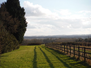
Scene near Oakwood Farm, Beenham
SWC Walk 117 Aldermaston to Woolhampton (via Stanford Dingley)
Feb-16 • thomasgrabow on Flickr
walkicon swcwalks swcwalk117 25258500911
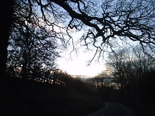
in King's Copse, Stanford Dingley
SWC Walk 117 Aldermaston to Woolhampton (via Stanford Dingley)
Feb-16 • thomasgrabow on Flickr
walkicon swcwalks swcwalk117 24720885214

Murals, St. Denys', Stanford Dingley (II)
SWC Walk 117 Aldermaston to Woolhampton (via Stanford Dingley)
Feb-16 • thomasgrabow on Flickr
walkicon swcwalks swcwalk117 24724656123
| Length | 20.4 km (12.6 mi), with 278/275m ascent/descent. For a shorter or a longer walk see below Walk Options. |
|---|---|
| Toughness | 4 out of 10, with 4 ½ hours walking time. For the whole outing, including trains, sights and meals, allow at least 7 ½ hours. |
| Walk Notes |
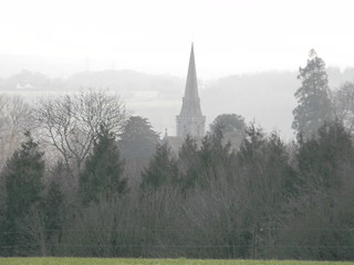
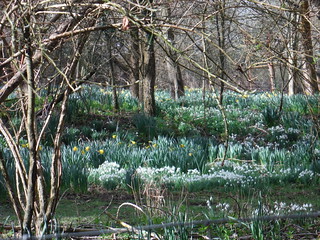
This walk explores a surprisingly quiet part of the commuter area that is West Berkshire, less than an hour from Central London. It is an undulating landscape with some fine views over unspoilt countryside - the West Berkshire Downs, which are part of the North Wessex Downs Area of Outstanding Natural Beauty and consist of a mix of ancient woodlands, commons, fields and pretty villages with pleasant, historical pubs.
The route passes through the chalk stream river valleys of the Kennet, the Bourne and the Pang, where you’ll also find some evidence of traditional water meadows. Lunch destination is the very pretty village of Stanford Dingley in the Pang Valley.
|
| Walk Options |
You can shorten the walk around lunch, cutting 4.7 km/2.9 mi and 61m ascent, rated 2/10.
|
| Maps | OS Explorer: 158 (Newbury & Hungerford) & 159 (Reading, Wokingham & Pangbourne)
|
| Travel |
Aldermaston station, map reference SU 601 673, is 71 km west of Charing Cross, 13 km south west of Reading and 54m above sea level; Midgham station, map reference SU 572 666, is 3 km west of Aldermaston and 57m above sea level, both are in West Berkshire. Both stations are on the Berkshire and Hampshire line from Reading to Newbury (and on to Bedwyn and Taunton). Journey times are from 47 minutes Mon-Fri (hourly), 51 mins Sat (hourly) and 53 minutes Sun (between hourly and two-hourly). Change at Reading. Midgham station is one stop further from London with a journey time from 49 minutes. Saturday Walkers Club: Take the train nearest to 09.30 hours for the recommended lunch stops. Later trains are possible, as some lunch stops are reached after about an hour of walking. |
| Lunch |
The Six Bells, The Green, Beenham, RG7 5NX (01189 713 368). This is a possible very early lunch stop. Located 2.8 km from the start of the walk.
|
| Tea |
The Coach & Horses, Bath Road, Midgham, RG7 5UX (01189 713 384). Located 3.3 km from the end of the walk. This is a possible early tea stop.
|
| Profile | |
|---|---|
| Help Us! |
After the walk, please leave a comment, it really helps. Thanks! You can also upload photos to the SWC Group on Flickr (upload your photos) and videos to Youtube. This walk's tags are: |
| By Train |
Out (not a train station) Back (not a train station) |
| By Car |
Start RG7 4LB Map Directions Return to the start: Finish RG7 5SE Map Directions Travel to the start: |
| Amazon | |
| Help |
National Rail: 03457 48 49 50 • Traveline (bus times): 0871 200 22 33 (12p/min) • TFL (London) : 0343 222 1234 |
| Version |
Apr-24 Thomas G |
| Copyright | © Saturday Walkers Club. All Rights Reserved. No commercial use. No copying. No derivatives. Free with attribution for one time non-commercial use only. www.walkingclub.org.uk/site/license.shtml |


Walk Directions
Full directions for this walk are in a PDF file (link above) which you can print, or download on to a Kindle, tablet, or smartphone.
This is just the introduction. This walk's detailed directions are in a PDF available from wwww.walkingclub.org.uk