Cross Fell and Great Dun Fell (Langwathby to Appleby) walk
Exhilarating route along the North Pennines Ridge, over the highest hills in England outside of the Lake District

Backview to Dufton Pike, Threlkeld Side and Great Dun Fell
SWC Walk 414 - Cross Fell and Great Dun Fell (Langwathby to Appleby)
Jul-22 • thomasgrabow on Flickr
banner swcwalks swcwalk414 53043032618
North Pennines Ridge under clouds
SWC Walk 414 - Cross Fell and Great Dun Fell (Langwathby to Appleby)
Jul-22 • thomasgrabow on Flickr
walkicon swcwalks swcwalk414 53042724704
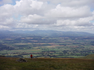
Backview towards Lake District, with walker in picture
SWC Walk 414 - Cross Fell and Great Dun Fell (Langwathby to Appleby)
Jul-22 • thomasgrabow on Flickr
walkicon swcwalks swcwalk414 53042931610
![Snowpoles on the highest asphalted road or track in England (descent from Great Dun Fell) SWC Walk 414 - Cross Fell and Great Dun Fell (Langwathby to Appleby) [Shortcut]](https://live.staticflickr.com/65535/53041959062_6cf6d79449_n.jpg)
Snowpoles on the highest asphalted road or track in England (descent from Great Dun Fell)
SWC Walk 414 - Cross Fell and Great Dun Fell (Langwathby to Appleby) [Shortcut]
Jul-22 • thomasgrabow on Flickr
walkicon swcwalks swcwalk414 53041959062
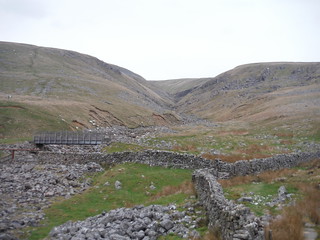
Bridge over Swindale Beck and view back up the descent route (to left of deep valley)
SWC Walk 414 - Cross Fell and Great Dun Fell (Langwathby to Appleby)
Apr-23 • thomasgrabow on Flickr
walkicon swcwalks swcwalk414 53042545246

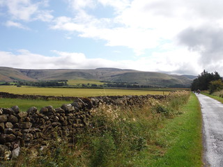
The road to Skirwith
SWC Walk 414 - Cross Fell and Great Dun Fell (Langwathby to Appleby)
Jul-22 • thomasgrabow on Flickr
swcwalks swcwalk414 53043032423

The Road to Skirwith with Cross Fell under Clouds
SWC Walk 414 - Cross Fell and Great Dun Fell (Langwathby to Appleby)
Jul-22 • thomasgrabow on Flickr
swcwalks swcwalk414 53043032428
| Length |
33.0 km (20.5 mi), with 1048/999m ascent/descent. For a shorter or longer walk, see below Walk Options. |
|---|---|
| Toughness |
10 out of 10, with 8 ½ hours walking time. |
| Walk Notes |
This route follows the Pennine Way across Cross Fell and Great Dun Fell (with Little Dun Fell squeezed in), the- highest hills along the Pennines and therefore the highest in England outside the Lake District. They are part of a more than 12 km long ridge, the largest area of continuous high ground in England, forming part of the English watershed. The tops are often windswept and foggy, with snow clinging on into May. Cross Fell is an iconic structure of a broad-based and mighty flat plateau top with boulder-filled slopes sitting on a long ridge, and the only place in Britain with a named wind, the Helm Wind. The views from the top (in good weather) include The Lakes, Solway Firth, Scottish Uplands, Tyne and Tees Valleys and the Pennine Ridge. Great Dun Fell is dominated by large Air Traffic Control radomes, guiding transatlantic air traffic.
The hills are far from any train station, making this a very long walk. Only taxis or car shuttles can reduce the length substantially. |
| Walk Options |
A Taxi or organised car shuttle to St. Lawrence’s Church in Kirkland cuts the initial all-tarmac 7.9 km of the route, giving a 25.1 km/15.6 mi walk with 932/972m ascent/descent and an 8/10 rating.
A more strenuous outing continues even further over the open moorland plateau to High Cup Nick where you can pick up one of the SWC’s High Cup Nick Walk routes for a descent to Appleby.
|
| Maps |
OS Landranger: 91 (Appleby-in-Westmorland) & 98 (Wensleydale & Upper Wharfedale)
|
| Travel |
Langwathby Station, map reference NY 573 334, is 393 km northwest of Charing Cross, 28 km southeast of Carlisle and 113m above sea level. Appleby-in-Westmorland Station, map reference NY 686 206, is 17 km southeast of Langwathby and 161m above sea level. Both are in Cumbria. Both are stations on the Leeds - Settle – Carlisle Line, with eight trains per day Mon-Sat and seven on Sundays. The journey time to Langwathby is 27 minutes from Carlisle, 71 from Settle and 133 from Leeds. Appleby-in-Westmorland is the next stop in the direction of Settle, with 15 minutes journey time from Langwathby. Saturday Walkers’ Club: The walk is not practicable as a daywalk from London. |
| Lunch | Picnic |
| Tea |
The Stag Inn The Ride,Dufton, Cumbria, CA16 6DB (01768 351 608). The Stag is located 100m off route, 5.7 km from the end of the walk.
Numerous options in Appleby on an out-and-back (adds 1.2 km and 40m ascent): |
| Northern Glossary |
beck: stream, brook; brig(g): bridge; -by: habitation; cam: bank, slope, ridge; carr: marshy woodland or shrubland; clough: narrow valley, cleft in a hillside, ravine, glen, gorge, cliff, rocky precipice; crag: steep rugged mass of rock projecting upward or outward; currick: cairn, pile of stones, often locations used to keep watch for Scottish raiders; dale: valley; -ey: island, dry area in a marshy place; fell: hill, mountain slope (especially rough moorland); firth/frith: long, narrow inlet of the sea or estuary; force/foss: waterfall, rapids; frith: area of peace, protection, safety, security, pasture; garth: small grass enclosure adjacent to a house; gate: way, street; gill/ghyll: small narrow valley or ravine;hagg: part of an area of woodland, especially on a sloping bank; holm(e): island, inland promontory, raised ground in marsh, river-meadow; how(e): barrow, small hill; hush: (Roman era) mine on steep hillside, using dammed up water to wash away topsoil and boulders, revealing the underlying lead or ore veins; ing(s): meadow(s), especially water meadow near a river; keld/kell: spring or well; kirk: church; laithe/leeath: barn, agricultural building; lang: long; ling: heather; lonning/lonnin’: lane or track, something less than a road, more rural than a street, usually short; mell: sand dunes; mire: bog; moss: bog, marsh; ness: headland, promontory; nick: shallow notch, cut or indentation on an edge or a surface; pike: spike, sharp point, peak; rake: slant, incline; rigg: ridge; scar/scaur: cliff, rocky outcrop with a steep face; seat/set(t)/side: summer pasture or dwelling place; seaves: rushes; shaw: hurdle, gate; sike/syke/sitch: small stream or gulley, gutter; stang: pole, shaft, stake, wooden bar; stoop/stowp/stoup: post, gatepost, distance marker (milestone), standing stone; -sty: ascent, ascending lane or path, narrow pathway or course; tarn: lake or pond (especially in an upland location); thorp(e)/t(h)rop: village or small settlement; thwait(e): village or small settlement; toft(s): small farmstead with enclosed land, later applied to a village or small settlement; wath: ford; whinny: gorse, furze, thorny vegetation; -wich/wick: village or settlement. |
| Profile | |
|---|---|
| Help Us! |
After the walk, please leave a comment, it really helps. Thanks! You can also upload photos to the SWC Group on Flickr (upload your photos) and videos to Youtube. This walk's tags are: |
| By Train |
Out (not a train station) Back (not a train station) |
| By Car |
Start CA10 1NZ Map Directions Return to the start: Finish CA16 6TT Map Directions Travel to the start: |
| Amazon | |
| Help |
National Rail: 03457 48 49 50 • Traveline (bus times): 0871 200 22 33 (12p/min) • TFL (London) : 0343 222 1234 |
| Version |
Apr-24 Thomas G |
| Copyright | © Saturday Walkers Club. All Rights Reserved. No commercial use. No copying. No derivatives. Free with attribution for one time non-commercial use only. www.walkingclub.org.uk/site/license.shtml |


Walk Directions
Full directions for this walk are in a PDF file (link above) which you can print, or download on to a Kindle, tablet, or smartphone.
This is just the introduction. This walk's detailed directions are in a PDF available from wwww.walkingclub.org.uk