Ely Circular walk
An easy walk through open Fenland, The River Great Ouse, 'big' skies, tree-lined farm tracks, historic Ely Cathedral and a quayside stroll at the end

Ely Cathedral from River Great Ouse, near Cuckoo Bridge
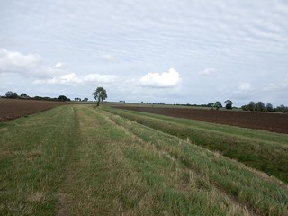
SWC Walk 118 Ely Circular (off-route off the Ely Extension)
Sep-16 • thomasgrabow on Flickr
swcwalks swcwalk118 banner walkicon 29576172111
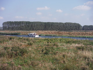
Boat on River Great Ouse
SWC Walk 118 Ely Circular
Sep-16 • thomasgrabow on Flickr
swcwalks swcwalk118 walkicon 29031563404

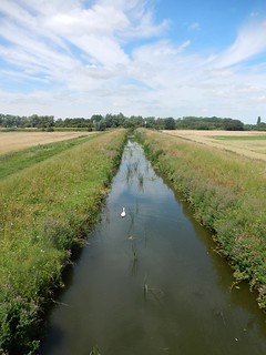
Big Skies in Fenland, w/o Ely Cathedral
SWC Walk 118 Ely Circular
Sep-16 • thomasgrabow on Flickr
swcwalks swcwalk118 walkicon 29657866025
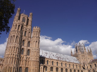
Ely Cathedral
SWC Walk 118 Ely Circular
Sep-16 • thomasgrabow on Flickr
swcwalks swcwalk118 walkicon 29657703775

| Length | 18.0 km (11.2 mi) with negligible ascent. For a longer or a shorter walk see below Walk Options. |
|---|---|
| Toughness | 2 out of 10, with 3 ¾ hours walking time. For the whole outing, including trains, sights and meals, allow at least 7 ½ hours. |
| Walk Notes |
This walk is centred around Ely, the second smallest city in England, and the low-lying land of the Isle of Ely, the site of the supposed ‘Last Stand of the Saxons’, led by Hereward the Wake against the Norman Invaders, a landscape reminiscent of the Low Countries or Northern Germany: open fenland, largely flat, former marshy and boggy ground now drained for intensive agriculture, with long straight tree-lined farm tracks, hedge-lined meadows and big, cloud-filled skies. The River Great Ouse, ditches, dykes, embankments and catchwater drains all help to create the special atmosphere of Fenland.
|
| Walk Options | You can walk a slightly longer variation in the morning, further along the Great Ouse (map-led).
|
| Visit | Ely Cathedral is a must.
|
| Maps | OS Explorer: 226 (Ely & Newmarket)
|
| Transport | Ely station, map reference TL 543 793, is 23 km north east of Cambridge, 102 km north north east of Charing Cross, 5m above sea level, and in East Cambridgeshire. Ely Station is on the Fen Line from Cambridge to King's Lynn, i.e.: it is being served by trains from King’s Cross (quicker) and Liverpool Street. From King’s Cross there are two direct trains per hour Mondays-Saturdays and one on Sundays (journey time from 70 mins). Saturday Walkers Club: Take a train no later than 10.15. |
| Lunch |
The Red Lion 47 High Street, Stretham, Cambridgeshire, CB6 3LD (01353 648 132). The Red Lion is located 8.2 km (5.1 mi) into the walk.
|
| Tea |
Plenty of options in Ely, the ones passed en route are mentioned in the text; recommended are:
|
| Profile | |
|---|---|
| Help Us! |
After the walk, please leave a comment, it really helps. Thanks! You can also upload photos to the SWC Group on Flickr (upload your photos) and videos to Youtube. This walk's tags are: |
| By Train |
Out (not a train station) Back (not a train station) |
| By Car |
Start CB7 4BS Map Directions |
| Map Walk | This walk requires an OS map and a compass or GPS for navigation. You can print out OS maps using the link above. |
| Amazon | |
| Help |
National Rail: 03457 48 49 50 • Traveline (bus times): 0871 200 22 33 (12p/min) • TFL (London) : 0343 222 1234 |
| Version |
May-23 Thomas G |
| Copyright | © Saturday Walkers Club. All Rights Reserved. No commercial use. No copying. No derivatives. Free with attribution for one time non-commercial use only. www.walkingclub.org.uk/site/license.shtml |

Walk Directions
Full directions for this walk are in a PDF file (link above) which you can print, or download on to a Kindle, tablet, or smartphone.
This is just the introduction. This walk's detailed directions are in a PDF available from wwww.walkingclub.org.uk