Farningham Road to Otford walk
Ancient woodlands, low hills and riverside paths in the Darent valley.

Farningham Road to Eynsford (alternative circular walk, from Eynsford)
swcwalks swcwalk291 walkicon eynsford kent 35687886084

CIMG7471
Curtain wall, Eynsford Castle
Nov-16 • Sean O'Neill
swcwalk291, swcwalk59, swcwalks 6401018954776806322 P

CIMG7474
The Hall, Eynsford Castle
Nov-16 • Sean O'Neill
swcwalk291, swcwalk59, swcwalks 6401018969901104210 P

CIMG8338
St Martin's church, Eynsford
Jan-17 • Sean O'Neill
swcwalk291, swcwalk59, swcwalks 6401018907739122098 P

CIMG8339
St Martin's church, Eynsford
Jan-17 • Sean O'Neill
swcwalk291, swcwalk59, swcwalks 6401018925806600882 P

CIMG8341
St Martin's church, Eynsford
Jan-17 • Sean O'Neill
swcwalk291, swcwalk59, swcwalks 6401018939184423698 P

CIMG8375
Veteran oak, Lullingstone Park
Jan-17 • Sean O'Neill
swcwalk291, swcwalk59, swcwalks 6401018441797584098 P
| Length |
Main Walk: 19 km† (11.8 miles). Four hours 40 minutes walking time. For the whole excursion including trains, sights and meals, allow at least 8½ hours. Main Walk, finishing in Shoreham: 15¾ km† (9.8 miles). Three hours 45 minutes walking time. Short Walk, looping back to Eynsford: 13 km†‡ (8.1 miles). Three hours 10 minutes walking time. Circular Walk, returning to Farningham Road: 17¼ km†‡ (10.7 miles). Four hours 5 minutes walking time.
† Subtract 2¾ km (1.7 miles; 45 minutes) with shorter start, omitting Farningham Wood. See Walk Options below.
|
|---|---|
| OS Maps |
Explorers 162 & 147. Farningham Road station (in Sutton-at-Hone), map reference TQ555694, is in Kent, 4 km E of Swanley. |
| Toughness |
5 out of 10 (4 if finishing in Shoreham, 3 for the other options). |
| Features |
The Darent Valley between Otford and Eynsford is covered by several SWC walks and this one extends the range northwards. It starts with a rather nondescript 2 km along field edges and farm tracks, but the scenery improves with a stretch through Farningham Woods Nature Reserve, an ancient woodland containing a now rare native tree, the small-leaved lime. The reserve also includes some fields which are being restored to their original ‘unimproved’ condition in order to support orchids and other wild flowers. The morning section concludes with the first of several stretches along the waymarked Darent Valley Path (DVP), with the riverside path leading directly into the beer garden of a pub in Farningham (overlooking a unique and puzzling structure in the river). Its attractive High Street was once on the main London-to-Folkestone highway but all the through traffic now thunders past on the main roads you passed under on the approach to the village, the M20 and the A20. After lunch the walk goes along the side of the valley overlooking the ruins of Eynsford Castle, one of the earliest Norman stone castles. After descending to the outskirts of this village the Main Walk stays on the DVP as it climbs back up the side of the valley to go past Eagle Heights, one of the UK's largest Bird of Prey centres; admission (2024) is £13.95 but you might be able to see something of the afternoon flying display from the public footpath. The walk then drops down to the valley floor where it goes past Lullingstone Castle (01322-862114), a historic manor house which can be visited (but with limited opening hours). Its grounds contain an unusual parish church (freely open to the public at all times) and a World Garden with plants from around the globe, open Thu–Sun from April to October; admission (2024) is £9. After a short detour along the edge of Lullingstone Country Park the walk rejoins the DVP at the park's Visitor Centre. The final leg will be familiar from other SWC walks as it essentially follows the route of the Shoreham Circular (Figure-of-8) walk (#289), passing through this attractive village. You can either finish the Main Walk at Shoreham station or continue through two small nature reserves on the other side of the valley (White Hill and Fackenden Down) to finish in Otford. |
| Walk Options |
You can shorten the Main Walk (and the following options) by taking a more direct outward route, omitting the stretch through Farningham Wood. This shorter start saves 2¾ km and would be worth considering if you missed a train and were starting an hour behind the main group (or if you wanted to avoid a noisy motocross event at Canada Heights). The other options take a different route out of Eynsford, along the valley floor as far as Lullingstone Roman Villa (01322-863467), which has two well-preserved mosaic floors and some early wall paintings dating back to AD 75. The site is managed by English Heritage and is open daily (weekends only in winter) to 6pm in summer, 5pm in October and 4pm in winter; standard admission (2023) is around £11 but varies by season. These options then loop back past Eagle Heights to Eynsford; you can either finish in this village for a Short Walk or return to Farningham Road station for a Circular Walk. The Circular Walk passes conveniently close to Eynsford Castle (seen from above on the outward leg; free entry), but there is quite a high proportion of road walking on the return leg as there are few useful rights of way in this part of the Darent valley. |
| Additional Notes |
The original version of this walk went out as far as Lullingstone Country Park before looping back to finish in Eynsford, but with the closure of the tearoom in this village it made more sense for the Main Walk to continue southwards to Shoreham or Otford. A variation of the original walk ending in Eynsford has been retained as the Short Walk, with the longer loop through the park transferred to the morning section of a new Eynsford Circular via Farningham walk (#419). |
| Transport |
There is an hourly service from Victoria to Farningham Road station, taking 40 minutes. The three villages in the Darent valley are on the Blackfriars to Sevenoaks line, with a half-hourly stopping service; Otford also has hourly fast trains to Victoria (daily) and Charing Cross (Mon–Sat). On the way back you should buy a single from one of these other stations to Swanley (where the two lines diverge) to supplement a return to Farningham Road, although in practice that return ticket might be accepted from Eynsford. If you have a Travelcard the Boundary Zone 6 station is St Mary Cray, but a London Freedom Pass is valid as far as Swanley (in TfL Zone 8). If you want to abandon the walk in Farningham there is a bus service to Swanley from the stop outside the Lion Hotel (hourly Mon–Fri, two-hourly Sat). There is also a very limited service (Mon–Sat) along the A225 between Sevenoaks and Swanley. Car drivers could park in Swanley and take separate services out and back for the non-Circular Walks. The station car park costs around £8 Mon–Fri, £6 Sat, £3.50 Sun & BH (2024); the council car parks in the town are free at weekends. |
| Suggested Train |
Take the train nearest to 10:15 from Victoria to Farningham Road, or an hour later for the shorter start. |
| Train Times |
|
| Timetables |
|
| River Levels |
|
| Lunch |
The suggested place to stop for lunch is at one of the two large coaching inns in Farningham village, after 6¾ km (4 km on the shorter start). The obvious choice is the popular Lion Hotel (01322-860621), which has an enviable location with a riverside beer garden. If it is too crowded the Pied Bull (01322-862125) is a short distance away along the High Street; both places serve a good selection of food all day. The village also has The Chequers (01322-865222), but this small and quirky pub might be closed at lunchtime. A later lunch stop is possible in Eynsford at the Plough Inn (01322-862281), beside the river. This requires a short detour from the Main Walk but is passed directly on the Short and Circular Walks after the southern loop via the Roman Villa. The latter option also passes The Five Bells (01322-863135; open from 3pm weekdays, noon weekends) and the Castle Hotel (01322-633917) in the centre of the village. |
| Tea |
On the Main Walk you could have a mid-afternoon refreshment break at the Lullingstone Café in the Country Park Visitor Centre (01322-865995; open to 5pm summer, 4pm weekends & 3pm weekdays in winter). There are also several cafés (and pubs) in both Shoreham and Otford, familiar from other SWC walks. If you finish in Shoreham there are a couple of tearooms on its High Street: one at the Shoreham Aircraft Museum (01959-524416; open weekends to 4pm); and The Honey Pot Café & Tea Rooms (07546-696623; open to 4pm Fri–Sun). The Coffee Box at the vineyard is open weekends to 3pm and tea might also be available at the church on Sundays in August. If you do the full walk there are three tearooms in Otford: The Olive Tree in the Hospices of Hope charity shop (01959-524322; open to 5pm Sat & Mon–Fri summer, 4pm Sun & Mon–Fri winter); Sally's Cake Emporium (01959-928447; open to 4pm Tue–Sun); and the Pond View Café (01959-522150; open daily to 4.30pm). On the other walk options there are several pubs but no cafés. The Riverside Tea Room in Eynsford has permanently closed, so the most convenient tea place towards the end of the Short Walk is the Plough Inn (see Lunch above). The Circular Walk also passes the Five Bells and the Castle Hotel in the centre of Eynsford (see above), then the Pied Bull in Farningham village. The pub nearest the station (but still 1½ km away) is the Fighting Cocks (01322-862299) in Horton Kirby, a family-friendly pub / restaurant with a large beer garden stretching down to the river. |
| Profile | |
|---|---|
| Help Us! |
After the walk, please leave a comment, it really helps. Thanks! You can also upload photos to the SWC Group on Flickr (upload your photos) and videos to Youtube. This walk's tags are: |
| By Train |
Out (not a train station) Back (not a train station) |
| By Car |
Start DA4 9JB Map Directions Return to the start: Finish TN14 5QY Map Directions Travel to the start: |
| Amazon | |
| Help |
National Rail: 03457 48 49 50 • Traveline (bus times): 0871 200 22 33 (12p/min) • TFL (London) : 0343 222 1234 |
| Version |
Apr-24 Sean |
| Copyright | © Saturday Walkers Club. All Rights Reserved. No commercial use. No copying. No derivatives. Free with attribution for one time non-commercial use only. www.walkingclub.org.uk/site/license.shtml |


Walk Directions
Click the heading below to show/hide the walk route for the selected option(s).


 Walk Maps
©
Walk Options ( Main | Short | Circ. )
Click on any option to show only the sections making up that route, or the heading above to show all sections.
- Main Walk (19 km)
Walk Directions
Click on any section heading to switch between detailed directions and an outline, or the heading above to switch all sections.
If you are doing the shorter start (omitting Farningham Wood), start at §C.
- Farningham Road Station to Farningham Wood (2¼ km)
- Leave by an exit on the north side of the station and turn sharp left onto a footpath heading west. Cross over the railway at a bridge and continue on footpaths through Homefield Farm, then up past a motocross circuit to Farningham Wood.
- Arriving from London on Platform 2, do not cross the footbridge but leave on a nearby tarmac path heading NE through a belt of trees. This comes out into a large field above the village of South Darenth, dominated by its prominent chimney? (a useful landmark). Ignore the two paths ahead and turn sharp left to go along the field edge, back past the station and heading W.
- In 400m go through a new metal kissing gate and turn left to cross over the railway tracks. On the other side turn right onto a broad track going between the railway and polytunnels for 500m. After descending gently it curves left, goes past Homefield Cottages and enters Homefield Farm.
-
Bear right to go diagonally across the large farmyard, as directed. In the far corner turn right onto another broad farm track, with a footpath waymarker. Follow the long straight track between more polytunnels for over 500m, heading W. In front of a hedge follow the track round to the left.
- A gap in the hedge suggests that you could also go through it and turn left onto a grassy track on the other side. At the time of writing there was no waymarking to show which was the actual right of way.
-
Either way, turn right at the next corner. Go along the field edge for just 60m, then veer left up a slope and go through a metal kissing gate. Almost immediately turn right at a waymarker post onto a path through a belt of trees. Go along the path for 50m and then turn left at a footpath junction to go uphill on a broad path, with the Canada Heights? Motocross Circuit off to your right.
The footpath up to Farningham Wood was officially diverted in 2020. The old right of way went through the motocross circuit, which was clearly impracticable.
- At the top of the slope follow the track briefly round to the right in front of a wood, then turn left onto a clear path through the trees. In 60m go through a metal kissing gate into Farningham Woods Nature Reserve.
- Farningham Wood to Franks Lane (2¾ km)
- Follow the public footpath through Farningham Wood, initially heading south and gradually curving round to the left. Go along the southern edge of the wood, across Little Folly Field and through a copse. Head north-east across Great Folly Field and go down Calfstock Lane to the A225. Turn left onto the main road, then turn right into Franks Lane and follow it to the bridge over the River Darent, joining the Darent Valley Path (DVP).
- Follow the footpath through the wood, heading S and later broadening out into a grassy strip. Go straight across a byway flanked by metal fieldgates into a more open part of the wood, with an information panel on the left about the Nature Reserve.
- There are many possible routes but the simplest is to follow the main path ahead (shown as Footpath SD77 on the panel) for the next 1 km. At first you go across a patch of heathland, passing a pond in the trees on your right. As you re-enter woodland ignore side paths dropping down to the right and keep to the main path, gradually curving left to head SE.
- The path finally drops down and comes to a recently-cleared area at the southern edge of the wood (with a view across a large field to Farningham in the Darent valley, and the M20 motorway snaking through the landscape). Leave the wood through a wooden kissing gate and turn left to go all the way along the top of the field, heading E.
- In the field corner bear left through a narrow gap and go over a stile at the top of a small bank. Go across Little Folly Field, slightly to the left, then over another stile into a small wood known as The Folly. Follow the woodland path through it, keeping right at a path junction and then swinging left to come to another viewpoint.
- Go over a stile to the right of a wooden fieldgate into Great Folly Field, with a new wooden bench inviting you to “rest awhile and feast your eyes”. As you go down across this field aim slightly to the right of the chimney and railway viaduct in South Darenth, 2 km away: the exit is by a metal fieldgate about 50m to the left of a more prominent wooden fieldgate.
- Go over a stile to the left of this metal fieldgate and down a short track. Squeeze past another fieldgate and turn right to go down Calfstock Lane to the A225. Veer left onto a small patch of grassland and cross the main road carefully to continue on the footway opposite, briefly heading back towards Farningham Road station.
- At the first junction fork right into Franks Lane, taking care as there is no pavement and more traffic than you might expect. Keep right where another slip road joins from the main road. Follow the lane for a further 300m to a bridge across the River Darent, where you join the Darent Valley Path? (DVP).
- Farningham Road Station to Franks Lane direct (2¼ km)
- Go down the station approach road and straight across the A225. Near the bottom of Station Road turn right onto the Darent Valley Path (DVP) and follow it alongside the river and across Westminster Field. At the end of another riverside stretch turn left onto Franks Lane.
- Arriving from London on Platform 2, cross the footbridge to the main exit and go down the station approach road to a crossroads. Cross the A225 carefully and carry on down Station Road.
- Just before a bridge over the River Darent turn right onto a signposted footpath, joining the Darent Valley Path? (DVP) and heading away from South Darenth Viaduct?.
-
Follow the riverside path for 750m, passing the access gates to Horton Kirby Lakes on your right halfway along. The path comes out into a recreation ground, Westminster Field. Keep left to stay near the river.
- In about 50m you could detour through a pleasant grassy area alongside the river with a few benches; there is a gate at both ends.
- Go past a sports pavilion and along the field edge, passing a small car park on your left. In the corner of the recreation ground go through a wooden kissing gate and continue on a clear path; initially through some scrubland, then back alongside the river on a tree-lined stretch. At the end turn left onto a minor road (Franks Lane), joining the main route.
- Franks Lane to Farningham (Lion Hotel) (1¾ km)
-
 Follow the DVP to Farningham: south-east along Franks Lane for 200m and then south-west on a footpath which later goes alongside the river. After passing under the M20 and A20 the path crosses the river on a footbridge and leads into the beer garden of the Lion Hotel.
- Cross the river on the road bridge and head east along Franks Lane for 200m, ignoring a footpath off to the left along the way. At a pair of footpaths in front of Horton Kirby Cricket Club turn right through a wooden kissing gate.
- The walk continues as a long straight path between fences, passing the cricket pitch on the left and with a glimpse of Franks Hall? away to the right, through a gap in the trees. The path eventually zig-zags right and left to continue alongside the River Darent.
-
You now simply follow this attractive riverside path into Farningham, passing under two main roads: the M20 and later the A20. At the second road bridge the path crosses the river on a footbridge to continue on the other side.
-
The path leads directly into the beer garden of the first of the village's two coaching inns, the Lion Hotel. At the river's edge an information panel describes what is known about the ornate Farningham Cattle Screen? spanning the river here.
- The prominent weatherboarded building ahead on the far side of the High Street is Farningham Mill?.
-
Detour to the Pied Bull (+600m)
- Go up to the High Street and turn left onto it, crossing over the river. The picnic area is a pleasant grassy enclosure with benches, overlooking the river.
- Continuing up the High Street, you could detour through the churchyard of Ss Peter and Paul? on the right (there is another gate further along). The Pied Bull is on the right-hand side of the road in a further 100m, just past Horton Way on the left (on the return leg of the Circular Walk).
- Return the same way, recrossing the river and continuing along the High Street past the Lion Hotel.
- Farningham to Eynsford (Sparepenny Lane) (1¾ km)
- Go up the High Street and turn left into Sparepenny Lane. In 200m go through a gate on the left to continue on a permissive footpath parallel to the road for 1¼ km, along the top of several large fields and a small wood. At the end return to the road and go downhill to a T-junction at the bottom.
- From outside the Lion Hotel go uphill on the High Street, passing The Chequers pub at the junction with Dartford Road. In a further 75m turn left into Sparepenny Lane?. In 200m, shortly after the lane levels out and bends slightly left, turn left onto a signposted permissive footpath. Go down a few steps and through a wooden kissing gate into the top corner of a large field.
- Veer right and follow this footpath for 1¼ km, mostly along the top of large fields but with a short interlude through the top of Nine Hole Wood?. The path never strays far from Sparepenny Lane and towards the end you can see the ruins of Eynsford Castle in the Darent valley below.
- In the far corner of the last field return to Sparepenny Lane via a gate. Follow the lane downhill to a T-junction on the outskirts of Eynsford, with Riverside to the left and Lullingstone Lane to the right.
- Sparepenny Lane to the Plough Inn (3¼ • ¼ km)
-
For the full walk, turn right at the T-junction into Lullingstone Lane and go along it for 1 km, leaving the DVP. Shortly after passing the Roman Villa turn right onto a footpath (the DVP again) climbing up the side of the valley. Turn right at a path junction and follow the DVP back past Eagle Heights to Lullingstone Lane. Keep ahead at the junction with Sparepenny Lane and go along Riverside to the Plough Inn.
- To cut out this entire loop simply turn left from Sparepenny Lane into Riverside to go directly to the Plough Inn.
-
Loop via the Roman Villa & Eagle Heights (+3 km)
- For the full Short or Circular Walk turn right at the T-junction into Lullingstone Lane, which curves around a water meadow dotted with trees. Ignore a footpath on the right after 100m (this is your return route on the DVP).
- Continue along the lane for a further 1 km, under Eynsford Viaduct? and past a turning on the right for Eagle Heights. Eventually you come to the large shed housing Lullingstone Roman Villa.
- Go past it on the lane and then immediately turn right up steps in the wooded bank, signposted as the DVP again (but in the opposite direction). At the end of the trees continue up the left-hand side of a large field for 400m.
-
Turn right at a footpath junction in front of a hedge stretching across the field, staying on the DVP. Go alongside the hedge and continue in the same direction across a field where it turns left, passing Eagle Heights off to your left.
…
- Go across the Bird of Prey centre's access road and through a gap in the fence opposite. Take the footpath sloping downhill across more large fields, heading towards Eynsford in the valley below and crossing the railway tracks near the left-hand end of the viaduct.
- The path eventually drops down to Lullingstone Lane where you turn left, retracing your outward route for 100m to the T-junction with Sparepenny Lane.
- Go along Riverside from the T-junction, leaving the DVP and heading SE. In 150m the lane justifies its name by going right alongside the river on an attractive stretch. You soon come to the Plough Inn, the suggested tea place on the Main Walk and a possible late lunch stop on the Circular Walk.
- The Plough Inn to Eynsford Station (1¼ km)
-
 Carry on along Riverside, which crosses the river to a T-junction with the A225.
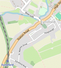
To avoid a long walk up this main road to the station, go through the churchyard and along an alleyway to Pollyhaugh. Turn right and follow this residential street (which becomes St Martins Drive) to a T-junction. Turn right down Eynsford Rise for the station.
Carry on along Riverside, which crosses the river to a T-junction with the A225.
To avoid a long walk up this main road to the station, go through the churchyard and along an alleyway to Pollyhaugh. Turn right and follow this residential street (which becomes St Martins Drive) to a T-junction. Turn right down Eynsford Rise for the station.
- Carry on along Riverside, crossing the River Darent on a narrow bridge by a ford (with refuges to avoid the traffic if necessary). You pass the (closed) Riverside Tea Room and come to a T-junction with the A225, with the church of St Martin of Tours? opposite.
-
Detour to Eynsford Castle (+800m)
- Turn left onto the main road (away from the station) …
- Turn left …
-
The suggested route to the station is a quiet route away from the main road. Take a tarmac path up the left-hand side of the churchyard to an exit in its top corner. Bear right across a small parking area and go up a short alleyway (with vehicle barriers at both ends) to a residential street.
-
Turn right and follow this quiet street (Pollyhaugh, later St Martins Drive) for 700m, climbing steadily. At the far end turn right and go down Eynsford Rise to the station. Cross the footbridge to Platform 1 for trains to London.
- The Plough Inn to Farningham (Pied Bull) (1¾ km)
- … Turn left onto the High Street and go all the way through the village, with the option of a short detour to Eynsford Castle. After passing Mill Lane take a parallel footpath to the left of the road, alongside Millfield Meadow. Shortly after the path returns to the main road, bear left into Oliver Crescent. Go via Till Avenue to the far end of this cul-de-sac. Keep ahead on Cinder Path and turn left onto Farningham's High Street.
- …
-
Turn left onto the main road
to go through the village. In 250m you pass the Five Bells pub on your right, then the Castle Hotel.
- If you want to visit the ruins of Eynsford Castle (which is only 125m away) turn left into the lane opposite the hotel, signposted to the Village Hall. The lane zig-zags right and left and a broad wooden bridge takes you through a gap in the curtain wall into the site. Return the same way.
-
To resume the walk carry on along the High Street for 500m, passing the Baptist Church, a primary school and a row of cottages (all on the left-hand side of the road). Shortly after passing Mill Lane you can get some respite from the traffic by veering left through a wooden gate onto a signposted public footpath; this goes along a strip of grassland parallel to the road for 250m, with a hedge on the left.
- You could also detour along grassy paths through the adjoining Millfield Meadow; there are several gaps in the hedge.
- After returning to the main road for a final 75m turn left into Oliver Crescent, then immediately fork right into Till Avenue. Follow this back street and then a tarmac path to the far corner of a large triangular green, then bear right onto the continuation of Oliver Crescent.
- At the end of this cul-de-sac keep ahead on an alleyway (Cinder Path) into Farningham. Turn left onto its High Street to come to a possible refreshment stop on the left-hand side of the road, the Pied Bull pub.
- The Pied Bull to Horton Kirby (Fighting Cocks) (2¼ km)
- Just past the Pied Bull turn right into Horton Way. After going under the A20 turn left and follow the field edge back to the River Darent. Turn right onto the riverside path and retrace your outward route back to Franks Lane. Go straight ahead onto a footpath leading to The Street and follow this lane through Horton Kirby to the Fighting Cocks pub.
-
Unless you want to visit the church of Ss Peter and Paul? (100m further along the High Street) turn right just after the pub into Horton Way, signposted as a bridleway. At the end of this short lane continue on a path going under the A20 into a large field. Turn left onto a footpath just inside the tree boundary.
- Local dog-walkers seem to prefer a well-trodden grassy path around the field edge; if you do the same there are gaps on the far side which let you reach the riverside path.
- However you get there, turn right onto the path in front of the River Darent and retrace your outward route back to Franks Lane along the DVP: under the M20, then zig-zagging away from the river onto the long straight path between fences.
- Go straight across Franks Lane onto the footpath opposite, leaving the DVP. In 150m another footpath merges from the left. Go through a metal kissing gate and a belt of trees into a large field and turn left along its edge, ignoring another footpath straight ahead.
- In the field corner go out onto a lane at a bend (with Rays Hill to the right). Keep ahead (on The Street) to go through the village of Horton Kirby. In 150m you come to the last refreshment place before the station on the left-hand side of the road, the Fighting Cocks pub / restaurant.
- The Fighting Cocks to Farningham Road Station (1½ km)
-
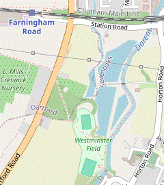 Where The Street turns right, turn left onto a footpath crossing the river into Westminster Field. Go across the recreation ground, through 100 Year Wood and alongside the A225 to the station approach road.
-
To complete the walk carry on along The Street. Where it swings right by the village sign after 250m, turn sharp left onto a short lane, signposted as a footpath. Go past the back of the properties in Millen Court and across the River Darent into a recreation ground, Westminster Field.
- Pass to the right of the sports pavilion and take the surfaced path across the recreation ground, along an avenue of young cherry trees. On the far side go past a vehicle barrier and follow the path up a slope, soon passing an information panel for 100 Year Wood?.
- Unless you want to detour through it, simply follow the fenced path alongside this small community woodland, climbing gently. At the top bear right in front of the A225 onto a tarmac path, passing the entrance to “The Topiary Centre” and then stables and paddocks on the right.
-
At the junction with Station Road cross the A225 carefully and go up the approach road to the station. Platform 1 on the near side is for trains to London.
- Sparepenny Lane to Lullingstone Castle (2¾ km)
- Unless you want to make an out-and-back detour to the Plough Inn on Riverside, turn right onto Lullingstone Lane. In 100m veer right up a bank to follow the DVP uphill across several fields (and over the railway tracks). Go across the access road to Eagle Heights and continue across another field, then alongside a hedge. Turn left at a footpath T-junction, staying on the DVP. Go back down the hillside to return to Lullingstone Lane by the Roman Villa. Turn right and go along the lane to Lullingstone Castle.
-
Detour to the Plough Inn (+400m)
- Turn left and go along Riverside for 200m to come to the Plough Inn on the left, where the lane goes alongside the River Darent.
- Return the same way to the T-junction and go straight ahead onto Lullingstone Lane.
- Go along Lullingstone Lane for 100m, which curves around a water meadow dotted with trees. After passing a small business centre veer right up the bank at a footpath sign, staying on the DVP. Follow a path slanting up across a field, gradually moving away from the lane.
-
In 300m cross the railway tracks carefully and continue in the same direction across a larger field, still climbing. On the far side go through a gap in the hedge and across the corner of the next field to a lane, the access road for Eagle Heights. Cross the lane and continue on the footpath opposite, aiming for the left-hand end of a hedge 300m away.
If your walk coincides with a flying display you might see eagles and other exotic large birds overhead. They are not supposed to attack walkers who stay on the public footpath.
- After passing the Bird of Prey centre off to the right the footpath carries on alongside the hedge. On the far side of the field turn left to go down the field edge, staying on the DVP. Towards the bottom of the hill the path goes through a wooded area and down steps to a lane.
- Unless you want to visit Lullingstone Roman Villa (in the large shed off to the left) turn right onto the lane, staying on the DVP. The lane passes a loop of the river and climbs gently past a few properties, with fields and paddocks stretching down to the river.
- In 500m there is a high brick wall on your left, behind which is the World Garden in a corner of the grounds of Lullingstone Castle. In a further 100m you come to the manor house's imposing entrance.
- Lullingstone Castle to Shoreham (Mill Lane) (3 km)
- Shortly after passing the gatehouse veer right off the DVP onto a track curving away from the castle grounds. In 200m turn left onto a grassy path along the top of a ridge, on the boundary of Lullingstone Country Park. Keep ahead through a patch of woodland and veer left down a grassy slope to the Lullingstone Park Visitor Centre (which has a café). Rejoin the DVP, at first on a permissive path alongside Castle Road and then across fields. A riverside stretch leads to Mill Lane on the outskirts of Shoreham.
-
After passing the entrance keep ahead briefly towards a small parking area. The DVP goes straight ahead and continues as a tree-lined path alongside the river, but the suggested route is to veer right through a gap in the hedge onto a track curving away from the castle grounds.
- The DVP goes past the back of the Lullingstone Park Visitor Centre after 600m and comes out onto Castle Road. If you take this short cut (saving 400m) resume the directions at [?].
- The track curves gently uphill, with a large farm field on the left and a prominent cedar tree ahead on the right. When level with this tree turn left off the track onto a broad grassy strip alongside the top of the farm field, now going around the boundary of Lullingstone Country Park? with a line of shrubs and trees on your right.
- In 250m the path merges with a horse ride (waymarked with blue arrows) coming in from the right. Keep left at the next two Y-junctions with marker posts, staying on the horse ride at the first but leaving it at the second where it turns half-right.
- At the corner of a wood go straight ahead to continue between the trees and a tall hedge, now briefly joining the end of a children's Discovery Trail (red arrows) and a Woodland Walk (white arrows). In 100m stay on the main path as it swings left and right and emerges onto a broad grassy slope.
- Veer left down the slope and make your way through the car park at the bottom to the Lullingstone Park Visitor Centre, which has a café if you want a mid-afternoon refreshment stop. To continue the walk either go past its left-hand side and turn right onto the riverside path behind the building, or simply go out on the car park's short access drive to Castle Road.
-
If coming out onto Castle Road from the riverside path, go past the car park entrance and a horse ride coming down from the country park. Immediately after these go through a wooden kissing gate onto a signposted permissive footpath, a broad path parallel to Castle Road. There is a large lavender field beyond the fence on your right and in 250m a wide gap in the hedge on your left.
- You could detour through this gap and go across the road into Castle Farm, whose Hop Shop sells local farm produce and snacks.
- At the end of the permissive path go down a few steps and cross the road carefully (slightly to the left) to pick up the continuation of the DVP, a broad path between farm fields (with hops on the left and more lavender fields behind them).
- Follow this well-defined path across several fields, going through a line of poplars and over an access road along the way, to the corner of a field in front of a line of trees.
- Go through a wooden kissing gate and continue along a fenced path, with glimpses of the river behind the trees. After another gate a tree-lined stretch alongside the river leads to Mill Lane on the outskirts of Shoreham.
- Mill Lane to Shoreham Station (1½ • 1 km)
-
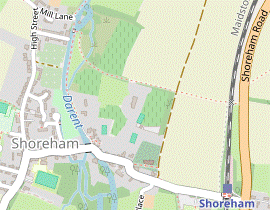 For a choice of refreshment places go up Mill Lane and turn left onto the High Street to go through the village. Turn left onto Church Street and follow the road across the river and up to the church.
- Alternatively, simply follow the riverside path directly to Shoreham Bridge and keep ahead on Church Street.
-
If finishing the walk here, go up steps on the left to the station.
-
Main route
- Bear right to go up Mill Lane. At the top turn left onto Shoreham's High Street to come to the first of the village's three pubs, The Crown.
- In a further 400m the tearoom for the Shoreham Aircraft Museum? is up a track on the right (The Landway). Carry on along the High Street, soon passing the Honey Pot Café on the left.
- At the next junction turn left into Church Street, in 175m passing the Kings Arms? on the right. After crossing the River Darent stay on Church Street as it swings right, alongside a branch of the river.
-
Riverside route (−½ km)
- Bear left to go past the entrance to Mill House onto a path alongside its garden fence. At the end turn left to cross the River Darent on a footbridge. Ignore a footpath straight ahead and turn right onto the riverside path, passing an orchard on the left with a vineyard beyond it.
- In 400m the path leads into a short cul-de-sac (Darenth Way), with Water House? on the left. Go past the War Memorial? and road bridge to continue in the same direction on Church Street, with a branch of the river on your right.
-
Shortly after Church Street has curved round to the left and started to climb, there is a driveway on the left leading to The Mount Vineyard? (which has a restaurant and a coffee shop). At the top of the slope the road turns sharply right by The Samuel Palmer pub / restaurant.
- Although you could stay on this street (now Station Road), the suggested route is to go through the lychgate ahead. Follow the tree-lined path past the church of Ss Peter and Paul?, which is well worth visiting. At the far end go out through a wooden swing gate and turn right to go along the edge of a large field.
- In the field corner veer left onto a new permissive path alongside the boundary hedge, parallel to Station Road and leaving the DVP. In the next corner rejoin the road and go under the railway bridge. Unless you are finishing the walk here, follow the road up to its T-junction with the A225.
-
Finishing at Shoreham Station
-
Turn left up steps to the station forecourt. Cross the footbridge to Platform 1 for trains to London.
- Shoreham Station to Fackenden Down (1½ • 2 km)
-
Take the bridleway heading east from the A225, opposite Station Road. If possible, turn right onto a permissive path along the side of White Hill and then Fackenden Down.
- Alternatively, follow the bridleway up the hill to Fackenden Lane and turn right onto a footpath going past Warren Farm and along the hillside to Fackenden Down.
- Cross the main road with great care and take the track to the right of the house opposite, signposted as a public bridleway and climbing gently. Shortly after the track bends right ignore a signposted footpath off to the left and continue briefly along the bridleway.
- The next turning is easy to miss. In 50m there are paths off to both sides from the broad grassy path going straight up the hill ahead (which is not the route). The main route is a narrow unmarked path off to the right, but if access through this small nature reserve is not possible (eg. during conservation work), take the alternative route in [?] along rights of way.
-
Main route
- Turn right onto the narrow path along the side of White Hill?, going through a belt of trees after 125m to continue along a broad grassy strip. After a further 200m the path curves left in front of a field and goes up the edge of the nature reserve.
- At the top make your way out past a vehicle barrier and turn right onto Fackenden Lane. Where the road turns sharply right after 175m, go through a squeeze gate to the left of a metal fieldgate onto Fackenden Down?.
-
The straightforward route is to follow the broad grassy strip between hedges running along the bottom of this nature reserve for 500m, going over a slight rise along the way. Eventually you meet a broad grassy path between fences coming down from the left (the alternative route) and turn right.
- For better views you could venture up the hillside at the entrance to Fackenden Down; there is a narrow permissive path along the top of this nature reserve which also leads into the alternative route.
-
Alternative route (+½ km)
- Turn left onto the continuation of the bridleway (with a ground-level concrete marker) and follow it up the wooded White Hill for 400m, climbing quite steeply in places. At the top turn left onto Fackenden Lane.
- In 250m turn right into the driveway to Warren Farm, signposted as a public footpath. Go over a stile to the right of a fieldgate and follow the long straight drive past farm buildings.
- At the end of the drive go through a metal kissing gate (just off to the right) to follow a grassy path across a field, heading SSW towards a wooden fieldgate by the left-hand end of a line of trees.
- Go through this fieldgate (or a side gate) to continue in much the same direction through another field, slanting slightly downhill. The grassy path stays just above the bushes and small trees dotted around the bottom of the field and leads to another kissing gate near the bottom corner.
- Go through this gate onto a woodland path, slightly to the left. The path gradually approaches a wire fence on the right and after going alongside it for a short distance you emerge onto open access land by a wooden bench at a viewpoint overlooking Otford.
- From the bench go straight downhill on a broad grassy path between wire fences and keep ahead at a crosspaths, where the main route joins from the right.
- Fackenden Down to Otford Station (1¾ km)
-
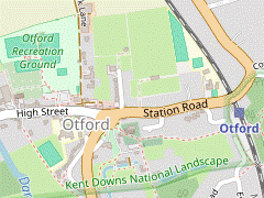 Take the footpath going downhill to the A225. Turn left onto the main road for a short distance, then turn right onto a footpath which crosses the railway and goes along a field edge to a bridleway. Turn left and go through the large recreation ground on its right containing the Otford Solar System model. Turn left onto the High Street, skirt around the village pond and take a footpath going up to the church. Head east through the churchyard and continue on an enclosed path to the station car park.
 - Go through a gate in the hedge and follow the broad grassy path downhill across a couple of wildflower meadows to the A225. Turn left and walk along the right-hand side of this busy road for 125m, taking care as there is no pavement. At “Stileways” turn right onto a signposted footpath to the left of its driveway. Follow this between garden fences to the railway line and cross the tracks carefully.
- Go up to a new wooden gate and bear left as indicated to continue alongside a wire fence. At the far end go through a gate, across a farm track and through another gate to drop down onto a track between hedges. Turn left and go along this bridleway for 50m.
- Opposite some stables turn right through a gap in the hedge into the corner of Otford's large recreation ground. Directly ahead there are four concrete pillars representing the sun and inner planets of the Otford Solar System?, with an information panel about the model ahead on the right.
-
Take any convenient route across the recreation ground to its large car park on the far side. Go through this to come out onto the High Street opposite one of the village's pubs, The Bull.
While crossing the recreation ground you could try to find two more planets: Mars (a ground-level disc between two football pitches) and Jupiter (a pillar by the groundsman's hut on the left-hand boundary hedge).
-
Turn left onto the High Street. You pass Sally's Cake Emporium on the left, with The Olive Tree bistro and tearoom at the back of the Hospices of Hope charity shop opposite. The other places are on the left of the large roundabout encircling the village pond? at the eastern end of the street, the Pond View Café and The Woodman pub.
-
Make your way to the far side of the pond where there are two footpath signs, with the left-hand path leading to the parish church of St Bartholomew?.
- If you want to visit the church, use the set of modern doors on its north side.
- A short out-and-back detour along the right-hand path would take you to the ruins of Otford Palace?.
-
To complete the walk, take the left-hand path past the south side of the church and head E through the churchyard, with a high brick wall on your left. At the far end go through a wooden gate and follow the enclosed path to the station car park. Platform 1 on the near side is for trains to London.
- The prominent chimney (originally attached to a boiler house) was built in 1881 during a major expansion of Horton Kirby Paper Mill, which operated from 1820 to 2003. The chimney has listed building status and was retained in the new housing development.
- Canada Heights acquired its name in World War Ⅰ when Canadian troops were stationed on this low hill. The Sidcup Motorcycle Club hold regular motocross events at this circuit, mainly on Sundays.
- The Darent Valley Path follows the course of the river for 31 km, from Sevenoaks (near its source in the Greensand Hills) to the River Thames at Dartford.
- South Darenth Viaduct was built in 1859-60, with ten high brick arches spanning Horton Road and the River Darent. Like the similar railway viaduct at Eynsford, its appearance has been marred by the use of poorly-matched bricks for repairs.
- Franks Hall is a large Elizabethan country house, completed in 1591. The estate declined in the 19thC and it had multiple owners in the 20thC, most recently as a business headquarters.
- The Farningham Cattle Screen was once thought to have been the remains of a medieval bridge, or an 18thC folly. It is not known why such an ornate structure was built simply to prevent cattle from straying downstream while crossing the ford. It was restored by the Parish Council in 2008/9.
- Farningham Mill was built in the late 18thC. In 2013 the water mill and surrounding properties were converted into a residential estate.
- Ss Peter and Paul, Farningham dates from the 13thC; the tower was added about a century later and enlarged in the 19thC. It contains a painted alabaster monument of 1597 to Antony Roper, the grandson of Sir Thomas More. Unusually for an Anglican church, the 15thC font depicts the Seven Sacraments of the Roman Catholic church.
- The name Sparepenny Lane implies this was a private toll road which was cheaper than the main turnpike.
- Nine Hole Wood was gifted to the Woodland Trust in 1997. This open-access woodland was originally part of a 9-hole golf course.
- Eynsford Viaduct was built in 1862 to take the railway over the Darent valley, with nine high brick arches and a stone parapet. In the past some repairs have been made with poorly-matched bricks and it has been given listed building status to maintain its original appearance.
- St Martin of Tours, Eynsford was built by one of William the Conqueror's knights in the 11thC on the site of a Saxon church. It has retained its Norman ground plan with apsidal chancel.
- 100 Year Wood was planted in 1994 to commemorate the centenary of Horton Kirby & South Darenth Parish Council.
- The Tudor Gatehouse of Lullingstone Castle was one of the earliest all-brick buildings in Britain.
- St Botolph, Lullingstone dates from the 14thC and contains some impressive memorials to ancestors of the Hart Dyke family, the owners of Lullingstone Castle. It also has an elaborately carved wooden rood screen and some particularly fine stained glass windows, the oldest dating back to the 14thC.
- Lullingstone Country Park was a medieval deer park in the estate of Lullingstone Castle. Some of its veteran trees (notably oak, hornbeam, beech and sweet chestnut) are over 500 years old. The park was used as a decoy airfield in World War Ⅱ and as a result Shoreham was dubbed “the most heavily bombed village in Britain”.
- The Shoreham Aircraft Museum was founded by volunteers in 1978 and holds donated items and aviation relics from the crash sites of local British and German aircraft in World War Ⅱ.
- The Kings Arms still has its ostler box, a shelter at the front of the pub for the person who used to attend to horses at coaching inns.
- Water House is associated with Samuel Palmer (1805-1881), one of the group of artists influenced by William Blake who called themselves The Ancients. He lived in the village from 1826 to 1835, for some of the time with his father (also called Samuel) who had rented Water House.
- The War Memorial in Darenth Way is inscribed Remember as you look at the cross on the hill those who gave their lives for their country 1914-1919.
- The Mount Vineyard was planted in 2004 and produced its first harvest in 2008. Eight grape varieties are now grown on the 10 acre site, producing award-winning red, white, rosé and sparkling wines.
- Ss Peter and Paul, Shoreham dates from Norman times and has many interesting features, all described in an informative Visitor's Guide. They include an outstanding wooden rood screen spanning the width of the building and some fine stained glass windows, including one by the Pre-Raphaelite artist Burne-Jones.
- White Hill Nature Reserve is one of 36 sites in the UK managed by Butterfly Conservation. An observation on its web site (“…frequented by dog walkers”) implies that this small area of scrub and chalk grassland is open access but there is no information panel at the site to confirm this.
- Fackenden Down is a Local Nature Reserve managed by the Kent Wildlife Trust. This area of chalk grassland supports many varieties of orchid.
- The Otford Solar System is a scale model showing the relative position of the sun and planets at the start of the millennium. The pillars representing the outer planets are scattered around the village, the furthest over 1 km away at the 1:5 billion scale used.
- Otford Pond is one of many protected structures in the village, which has led to claims that its duckhouse is Britain's smallest listed building.
- St Bartholomew, Otford dates from the 11thC; construction began in 1060 with the tower added in around 1185. It contains a large marble memorial to Charles and David Polhill, descendants of Oliver Cromwell.
- Otford Palace was created by Archbishop Warham in 1514, a year before Cardinal Wolsey (his rival and successor as Lord Chancellor) began the construction of Hampton Court Palace. Both were subsequently taken over by Henry Ⅷ but Otford (in its unfavourable marshy location) fell into ruins while Hampton Court expanded into a major royal palace.
Continue the directions at §D.
The walk continues up the High Street to the right, but follow the directions below if you want to use the designated picnic area across the river, visit the alternative lunch pub or simply explore the village.
If you are doing the Main Walk (to Otford or Shoreham), go to §K.
If you want to shorten the walk you could cut out the loop below, which returns to this road junction from the right and continues along Riverside.
If you are doing the Circular Walk, go to §H.
Follow the directions below if you want to visit the ruins of Eynsford Castle.
At the T-junction the walk continues along Lullingstone Lane to the right, but follow the directions below if you want to visit the late lunch pub.
The rest of the walk, through Shoreham and on to Otford, is the same as Walk #289.
If you are not planning to visit any of the refreshment places on Shoreham's High Street you could take the more attractive riverside route in [?].
Walk Notes
» Last updated: April 8, 2024
Return to Top | Walk Map | Walk Options | Walk Directions.