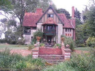
Haddenham to Aylesbury via Waddesdon walk
Tranquil stretches of the Thame Valley, combined with a few energetic climbs and long passages through two magnificent Rothschild estates.

Waddesdon Manor
Haddenham to Aylesbury via Waddesdon walk
Jul-14 • Saturdaywalker on Flickr
swcwalks swcwalk192 banner 18472157341

Avenue towards Waddesdon Manor
SWC 192 Haddenham to Aylesbury (via Waddesdon)
Aug-16 • thomasgrabow on Flickr
swcwalks swcwalk192 walkicon 28604414434

View from Courtyard of Windmill Hill Archive, Waddesdon Estate
SWC 192 Haddenham to Aylesbury (via Waddesdon)
Aug-16 • thomasgrabow on Flickr
swcwalks swcwalk192 walkicon 29148604151

Aviary, Waddesdon Manor Gardens
SWC 192 Haddenham to Aylesbury (via Waddesdon)
Aug-16 • thomasgrabow on Flickr
swcwalks swcwalk192 walkicon 29148398091

Waddesdon Manor, from Gardens
SWC 192 Haddenham to Aylesbury (via Waddesdon)
Aug-16 • thomasgrabow on Flickr
swcwalks swcwalk192 walkicon 29118623662

Chiltern Views from near North Lodge
SWC 192 Haddenham to Aylesbury (via Waddesdon)
Aug-16 • thomasgrabow on Flickr
swcwalks swcwalk192 walkicon 29118574042

Weir Lodge, Eythrope Park
SWC 192 Haddenham to Aylesbury (via Waddesdon)
Aug-16 • thomasgrabow on Flickr
swcwalks swcwalk192 walkicon 29118515892
| Path closed for HS2 Works |
As of Q122, HS2 have closed the footpath just by the north westerly fringe of Aylesbury (close to where Thame Valley Walk and Round Aylesbury Walk meet), for safety reasons until at least late 2024, as the right of way crosses a work access road busy with trucks and dippers. No feasible alternative route is available. Therefore, only the Alternative Endings at Aylesbury Vale Parkway or in Stone are possible.
|
|---|---|
| Length |
25.3 km (15.8 mi), with 329/332m ascent/descent. For a shorter walk see below Walk Options. |
| Toughness |
5 out of 10, with 5 hours 45 minutes walking time. For the whole outing allow at least 8 hours 30 minutes. |
| Walk Notes |
This walk through some scenic northerly parts of Aylesbury Vale combines tranquil stretches of the Thame Valley Walk with more energetic climbs and nice vistas in between, heading north through Upper Winchenden and the Rothschild’s Waddesdon estate, finally along a long tree-lined avenue up to Waddesdon Manor, situated on the prominent Lodge Hill.
Shorter Alternative Endings at Aylesbury Vale Parkway Station or in Stone are described. They enable a visit of Waddesdon Manor House and Gardens (tickets need to be bought or scanned at the Welcome Pavilion in the Main Car Park). |
| Walk Options |
Bus routes 16 and 17 (Marsh Gibbon or Bicester to Aylesbury) pass through Waddesdon and offer an option for a shorter walk, especially useful if planning an extended visit of Waddesdon Manor’s Gardens and Manor House. It takes you to or from Aylesbury station (roughly hourly Mon-Sat). The nearest stop is at The Lion pub mentioned in the walk notes. The walk also offers one Shortcut and two Alternative Endings:
|
| Maps |
OS Explorer: 181 (Chiltern Hills North)
|
| Travel |
Haddenham & Thame Parkway station, map reference SP 731 085, is 10 km south west of Aylesbury, 22 km east of Oxford, and 81m above sea level. Aylesbury Station, map reference SP 817 134, is 78m above sea level. Both are in Buckinghamshire. Haddenham & Thame Parkway is on the London Marylebone to Bicester main line. Aylesbury is on the Marylebone to Aylesbury line (also operated by Chiltern Railways). It is also served by a loop branching off from the Bicester line at Princes Risborough. Buy a ‘Haddenham Return’-ticket, this is usually accepted at Aylesbury on the return, as it’s more expensive than an Aylesbury return. You may have to pay a single Aylesbury to Princes Risborough ticket, where the lines meet. Journey times are from 34 mins to HTP and from 60 mins from Aylesbury, with up to three trains per hour Mondays to Saturdays, and up to two trains per hour Sundays. Saturday Walkers’ Club: Take the train closest to 9.30 hours. |
| Lunch |
Waddesdon Manor offers several options for lunch and/or tea, from formal service to food-to-go: for details check here: https://waddesdon.org.uk/your-visit/shop-eat-stay/.
|
| Tea |
The Honey Bee Fairford Leys, Trenchard Street, Aylesbury, Buckinghamshire, HP19 7AA (01296 708 363) The Honey Bee is located 2.1 km from the end of the walk, and a Marston’s pub. A plethora of options in Aylesbury City Centre (see Walk Directions pdf), recommended is:
|
| Profile | |
|---|---|
| Help Us! |
After the walk, please leave a comment, it really helps. Thanks! You can also upload photos to the SWC Group on Flickr (upload your photos) and videos to Youtube. This walk's tags are: |
| By Train |
Out (not a train station) Back (not a train station) |
| By Car |
Start HP17 8EQ Map Directions Return to the start: Finish HP20 1RU Map Directions Travel to the start: |
| Amazon | |
| Help |
National Rail: 03457 48 49 50 • Traveline (bus times): 0871 200 22 33 (12p/min) • TFL (London) : 0343 222 1234 |
| Version |
Apr-24 Thomas G |
| Copyright | © Saturday Walkers Club. All Rights Reserved. No commercial use. No copying. No derivatives. Free with attribution for one time non-commercial use only. www.walkingclub.org.uk/site/license.shtml |
Walk Directions
Full directions for this walk are in a PDF file (link above) which you can print, or download on to a Kindle, tablet, or smartphone.
This is just the introduction. This walk's detailed directions are in a PDF available from wwww.walkingclub.org.uk
