Hathersage Circular via Bretton Clough and Eyam walk
Rolling hills, drystone walls, deep wooded valleys,the Hope Valley, Eyam and Hucklow ridges, mining industrial heritage, Eyam, peat bogs (on a good path)

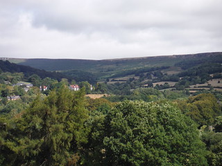
Eyam Moor, from Highlow Hall
SWC Walk 315 - Hathersage Circular (via Bretton Clough and Eyam)
Aug-18 • thomasgrabow on Flickr
swcwalks swcwalk315 banner 44193170432

High Low, from Bole Hill
SWC Walk 315 - Hathersage Circular (via Bretton Clough and Eyam)
Aug-18 • thomasgrabow on Flickr
swcwalks swcwalk315 walkicon 42434199220

Sun breaking through
SWC Walk 315 - Hathersage Circular (via Bretton Clough and Eyam)
Aug-18 • thomasgrabow on Flickr
swcwalks swcwalk315 walkicon 43524541634

Heather, Bilberries, Crumbling Drystone Wall: Eyam Moor
SWC Walk 315 - Hathersage Circular (via Bretton Clough and Eyam)
Aug-18 • thomasgrabow on Flickr
swcwalks swcwalk315 walkicon 29306256117

Win Hill, from Mount Pleasant Farm
SWC Walk 315 - Hathersage Circular (via Bretton Clough and Eyam)
Aug-18 • thomasgrabow on Flickr
swcwalks swcwalk315 43524574464

Hathersage, Cowper Stone, Burbage Rocks, from Mount Pleasant Farm
SWC Walk 315 - Hathersage Circular (via Bretton Clough and Eyam)
Aug-18 • thomasgrabow on Flickr
swcwalks swcwalk315 29306302617
Stanage Edge, from Mount Pleasant Farm
SWC Walk 315 - Hathersage Circular (via Bretton Clough and Eyam)
Aug-18 • thomasgrabow on Flickr
swcwalks swcwalk315 30374898308
| Length | 22.2 km (13.8 mi), with 649m ascent/descent. For a shorter or longer walk see below Walk Options. |
|---|---|
| Toughness | 7 out of 10, with 6 hours walking time. For the whole outing, including trains, sights and meals, allow at least 13 hours. |
| Walk Notes |
Centred on Hathersage, an attractive village in the Hope Valley surrounded by the ringed cliffs of the Stanage and Millstone edges as well as the ancient iron-age hill fort of Carl Wark and the distictive Higger Tor on Burbage Moor, this walks leads through some outstandingly beautiful scenery: delightful meadows with a jigsaw of drystone walls and other signs of small-scale livestock farming, rolling hills backed by open moorland and the deep wooded valleys of the Highlow Brook (one of the few remaining in the Peak District with the remains of ancient oakwoods) and the Bretton Clough with their fast flowing streams. You have magnificent views all day (weather permitting).
|
| Walk Options |
A Shortcut down from the Hucklow Edge to Foolow cuts out Great Hucklow, this cuts 2.2 km/1.3 mi and 61m ascent and is rated 6/10.
|
| Maps | OS Explorer: OL1 (The Peak District – Dark Peak Area) & OL24 (The Peak District – White Peak Area)
OS Landranger: 110 (Sheffield & Huddersfield) Harvey Superwalker XT25: Peak District Central Harvey British Mountain Map: Dark Peak or White Peak |
| Travel |
Hathersage station, map reference SK 232 810, is 14 km south west of Sheffield, 227 km north west of Charing Cross, 163m above sea level and in Derbyshire. It is on the Hope Valley Line from Manchester to Sheffield, with a journey time of 18 mins from Sheffield. Sheffield Station is the terminus of the Midland Main Line from London St. Pancras, with up to two trains per hour (journey time from 118 mins Mon-Sat, longer on Sundays). Saturday Walkers’ Club: Take a train no later than 9.00 hours. |
| Lunch |
The Barrel Inn Bretton, near Eyam, Hope Valley, Derbyshire, S32 5QD (01433 630 856). The Barrel Inn is located 7.3 km/4.5 mi into the walk.
With an early start, the tea options in Eyam come into play for lunch (see the pdf for details). |
| Tea |
In Eyam
In Hathersage
|
| Profile | |
|---|---|
| Help Us! |
After the walk, please leave a comment, it really helps. Thanks! You can also upload photos to the SWC Group on Flickr (upload your photos) and videos to Youtube. This walk's tags are: |
| By Train |
Out (not a train station) Back (not a train station) |
| By Car |
Start S32 1DT Map Directions |
| Amazon | |
| Help |
National Rail: 03457 48 49 50 • Traveline (bus times): 0871 200 22 33 (12p/min) • TFL (London) : 0343 222 1234 |
| Version |
Apr-24 Thomas G |
| Copyright | © Saturday Walkers Club. All Rights Reserved. No commercial use. No copying. No derivatives. Free with attribution for one time non-commercial use only. www.walkingclub.org.uk/site/license.shtml |

Walk Directions
Full directions for this walk are in a PDF file (link above) which you can print, or download on to a Kindle, tablet, or smartphone.
This is just the introduction. This walk's detailed directions are in a PDF available from wwww.walkingclub.org.uk