Kinder Scout Circuit from Edale Walk
Strenuous circuit of the Kinder Scout moorland plateau from Edale Station
Upper Ashop Clough (Pennine Way runs along ridge)
SWC Walk 304 - Kinder Scout Circuit (from Edale)
Oct-17 • thomasgrabow on Flickr
swcwalks swcwalk304 banner 38210508062

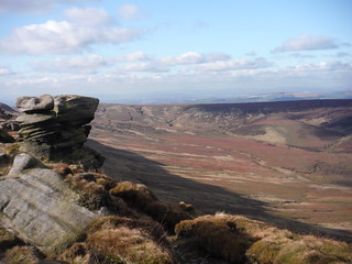
Kinder Downfall
SWC Walk 304 - Kinder Scout Circuit (from Edale)
Oct-17 • thomasgrabow on Flickr
swcwalks swcwalk304 walkicon 38187743186
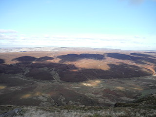
Shadowplay (Black Ashop Moor)
SWC Walk 304 - Kinder Scout Circuit (from Edale)
Oct-17 • thomasgrabow on Flickr
swcwalks swcwalk304 walkicon 26466256139

Win Hill, Lose Hill, Back Tor, Hollins Cross
Oct-17 • thomasgrabow on Flickr
swcwalks swcwalk304 walkicon 38210249112
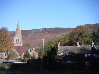
Edale Church and first view of the Edge
SWC Walk 304 - Kinder Scout Circuit (from Edale)
Oct-17 • thomasgrabow on Flickr
swcwalks swcwalk304 38242917341
| Length | 27.0 km (16.8 mi), with 902m ascent/descent. For a shorter or longer walk see below Walk Notes. |
|---|---|
| Toughness | 9 out of 10, with 7-9 hours net walking time. For the whole outing, including trains, sights and meals, allow 13-15 hours. |
| Walk Notes |
This is a circuit of the Kinder Scout moorland plateau in the Dark Peak area of the Peak District with minimal directions, readily accessible by public transport. The route described is not a true circuit, as it takes a different route up from Edale than it takes down from the plateau back to Edale. Completists can either continue along the edge from Ringing Roger to the point where the morning ascent over Grindslow Knoll joins the edge and re-trace the route from there (adds 3.4 km), or they can ascend and descend along the Grindsbrook Clough to/from the same point on the edge, this involves light but prolonged scrambling and adds 5.1 km.
|
| Maps |
OS Explorer: OL1 (The Peak District – Dark Peak Area)
|
| Travel |
Edale Station, map reference SK 122 853, is 236 km north west of Charing Cross and 244m above sea level, and in Derbyshire. It is on the Hope Valley Line from Manchester to Sheffield, with a journey time of 32 mins from Sheffield. Sheffield Station is the terminus of the Midland Main Line from London St. Pancras, with two trains per hour (journey time from 116 mins Mon-Sat, longer on Sundays). Saturday Walkers’ Club: Take a train no later than 8.00 hours. |
| Lunch |
Picnic |
| Tea |
The Old Nag’s Head Grindsbrook Booth, Edale, Hope Valley, Derbyshire, S33 7ZD (01433 670 291). Situated at the start of the Pennine Way, it dates back to 1577.
|
| Profile | |
|---|---|
| Help Us! |
After the walk, please leave a comment, it really helps. Thanks! You can also upload photos to the SWC Group on Flickr (upload your photos) and videos to Youtube. This walk's tags are: |
| By Train |
Out (not a train station) Back (not a train station) |
| By Car |
Start Map Directions |
| Amazon | |
| Help |
National Rail: 03457 48 49 50 • Traveline (bus times): 0871 200 22 33 (12p/min) • TFL (London) : 0343 222 1234 |
| Version |
Mar-24 Thomas G |
| Copyright | © Saturday Walkers Club. All Rights Reserved. No commercial use. No copying. No derivatives. Free with attribution for one time non-commercial use only. www.walkingclub.org.uk/site/license.shtml |

Walk Directions
Directions last checked: 28/09/2023
- Alight from the train at Edale Station on platform 1 and exit through the further right of two wooden gates and then through the small car park and turn left along a tarmac lane’s pavement. In 100m turn left at a T-junction to go under the railway line and up into the village. You pass The Rambler Inn on your left hand side and continue up the road. In 680m you get to a signposted four-way junction of footpaths (with the Newfold Farm Café and the Edale General Store away to the left and The Old Nag’s Head pub ahead). Turn left between houses (signed ‘Upper Booth 1¼ mile’), along The Pennine Way (PW). In 30m you pass a plaque on the wall, commemorating the official start of the PW. In 300m go through a wooden gate into an open area with pastures on both sides and with a hill ahead (Broadlee-Bank Tor).
- In 30m turn right at a signposted three-way junction along a permissive footpath to Grindslow Knoll, broadly along the left hand edge of a pasture and in 80m walk through a wall gap and curve right through the next pasture towards its upper right hand corner. Walk through a wooden gate left of a wooden field gate into Access Land and follow a track uphill. You rise up to the top of the Grindslow Knoll, with the Grindsbrook Clough below on your right, en route walking through a wooden gate. Follow an engineered path up to a scrambly stretch (with a steep grass avoidance path to the right). Near the top of the rise fork up left to a cairn at the summit of the Knoll (601m above sea level, Grid Reference: SK 109 868), a superb vantage point, ignoring a path skirting around the right hand flank of it. Continue in the previous direction off the top, soon with the steep drop of the Grindsbrook Clough on your right. 30m before a large cairn at the narrow top of one arm of the clough, GR SK 105 872, turn left along a paved path.
- You follow the path around to the right in 220m and then continue broadly in the same direction along the edge for 800m, including some paved sections and/or boggy ground while passing quite a few rock formations and crossing a few streams along the way. Descend to and ford the Crowden Brook and re-ascend on the other side to the left to the top of Crowden Tower, a fortified pile of gritstone. Continue along some more paved sections and then for a while meandering, often ill defined, through part-boggy ground, to then continue through an area of scattered wind-and-rain-sculpted gritstone boulders (The Woolpacks), without much of a defined path for stretches, but some way away from the edge. You pass to the left of a prominent and large gritstone formation (Pym Chair, GR SK 088 869, 700m from Crowden Tower) and then descend gently to continue through the Edale Head area, where several small streams down from the plateau join to form the River Noe, always staying close to the left hand edge. Pass Noe Stool (500m from Pym Chair), an anvil shaped rock, and continue towards Edale Rocks.
- In 600m, at a large cairn (GR 079 865), with Edale Rocks up on the right and the Swine’s Back knoll ahead, turn hard right back on yourself along a clear earthen path through the boulder-strewn upland bog, broadly in a northerly direction, for the next 2.7 km. But in more detail: you pass Edale Rocks on its right and in 570m pass a trig point a little on your right (GR SK 079 870), this is Kinder Low (633m above sea level); you follow a clear path, soon gently descending to the edge of the plateau, with the Kinder Reservoir down below on the left [the large conurbation on a bearing of 295° about 25 km away is Manchester] and in 1.1 km ford a prominent stream, the Red Brook, by a deep cleft on the left (GR SK 080 879). In another 1.0 km (GR SK 082 888), as you approach the Kinder Downfall, the best views of it are from a point a little to the left. At 30m height, it is the tallest waterfall in the Peak District.
- Follow the path around to the right to the downfall’s head and ford the Kinder River. On the other side turn left with a clear path in a north westerly direction for 1.4 km. En route, you walk through a fence gap (a missing gate) and then through a wooden gate and in another 380m pass a large cairn (GR SK 070 893). In another 50m you turn right to continue in a northerly direction. In 820m by another large cairn in the far northwest corner of the Kinder Scout plateau (GR SK 066 899), turn right towards a fence line 50m away (leaving the Pennine Way). You go over a stile in the fence and continue with the edge on your left and the Ashop Clough below.
- Continue in the same direction for 2.0 km towards The Edge, a protruding rock face, fording several streams and the Upper Red Brook along the way and after fording the Nether Red Brook (GR SK 085 896), turn left along the edge towards The Edge and in 50m turn right along it. In 1.1 km you reach the Fairbrook Naze (GR SK 096 897), with views ahead down the Fair Brook into the Woodlands Valley and out to Howden and Derwent Moors. Turn right along the edge and in 800m turn left to ford the Fair Brook and continue along Seal Edge for 2.5 km. On this stretch you can spot The Snake Inn down on the A57 Snake Road, a large white building in teh Woodlands Valley, and a little along the road Upper House Farm. Turn right with the edge (GR SK 116 888) with Blackden Moor below, go through a wooden gate in a fence line en route and in 500m ford the Blackden Rind stream to then curve left with the path to again continue in a broadly easterly direction along Blackden Edge, with a steep drop on the left for a while.
- From here on the plateau’s width is only about 500m, so – even without a clear path – a shortcut across it is not too arduous a prospect, but: Warning – Danger of Death! Unless you are an experienced and confident walker with good orienteering skills using just map and compass, the route across the moor is potentially extremely dangerous, even in benign conditions, never mind in rain, fog, sleet or snow. The terrain will be one of pathless deep bog with deep groynes, and without any discernible landmarks, making orientation difficult and mobile phone reception unlikely. It is easy to get completely disorientated and lost. You are likely to be on your own.
- In 2.4 km from the Blackden Rind crossing (GR SK 137 882) at a four-way junction the top of a light rise and with the Madwoman's Stone (on the OS map) up on the right behind, turn left with the path (10°), ignoring the continuation ahead, and in 100m curve right with the path, with the drop on the left. In another 130m turn right with the path, ignoring a left turn downhill. In 50m continue ahead at a four-way path junction (160° initially), ignoring a faint path through the heather to the right and a descending path to the left which picks up a line of grouse butts downhill. In 150m turn left at a staggered four-way junction along a faint path towards the plateau corner. In 90m a path joins from the left out of a shallow dip and you continue along Crookstone Knoll towards the far north easterly corner of the plateau 500m away.
- With the Derwent Edge across the valley in the distance (GR SK 145 883), turn hard right to continue in a south westerly direction. In 320m veer right at a crosspaths (the path from the left links to Wooler Knoll and Win Hill) and in 450m (GR SK 139 877) ignore a path joining from the right, cross a stream and fork left on the level (the right fork uphill is a valid shortcut though, it runs a little further away from the plateau edge and re-joins further along). In 200m you have Win Hill and the Great Ridge from Lose Hill to Mam Tor on the left across the Vale of Edale (SWC Walk 302) and bear right with the edge path, slightly uphill. In 80m a path joins from the right and in about 100m you can just about spot the top of the chimney at Hope Cement Works lurking out of the Hope Valley above the Great Ridge.
- In 800m (GR SK 132 872), by a long wall running perpendicular to the edge down the slope on the left into the valley, the path starts to curve around to the right on the level (ignore a lefty fork gently descending, it re-joins further along). In 500m ignore a left fork descending down the flank of Ringing Roger to ascend to its top. In 150m at the top, by a couple of large cairns (GR SK 126 873), turn left to eventually find a part-paved descent route down Ringing Roger that stays to the right of the rock face where scrambling would be needed to descend the rocks. You pick up a clear path at the bottom of Ringing Roger (GR SK 125 872) and follow it downhill, eventually zigzagging down The Nab and towards Grindsbrook Booth.
- Cross the Grinds Brook (GR SK 122 861) and pick up a tarmac lane down through Grindsbrook Booth to Edale Station.
Grindbrook Clough Ascent
- From The Old Nag’s Head pub continue in the same direction along the tarmac lane and further up veer right with a signpost to cross the Grinds Brook (GR SK 122 861) and follow a paved path up the Grindsbrook Clough towards a wood.
- Go through the small wood and cross a bridge over a stream to follow a clear path up the clough, at times high above the stream through the heathery slopes. Eventually you walk through some gates either side of a deer fence and the path soon peters out.
- Scramble up, initially gently ascending, then steeply so (the best route is initially to the right of the Grinds Brook, then to the left) and follow the stream up to the very top of the clough (GR SK 105 872).
Ringing Roger to Grindsbrook Clough
- From the cairns at the top of Ringing Roger continue in the same direction with a clear path and pass Nether Tor and Upper Tor to turn right to cross the north most tributary of the Grinds Brook and turn left in a southerly direction.
- In 400m cross another tributary to reach the point where the morning ascent route over Grindslow Knoll joined the edge path (GR SK 105 872).
Descent down the Grindsbrook Clough
- Turn left along a clear path into the Grindsbrook Clough. With good views across the valley to Win Hill and with Stanage Edge beyond – scramble down the first few hundred metres, initially steeply so (the best route is initially to the right of the Grinds Brook, then to the left).
- Eventually you walk through some gates either side of a deer fence and turn right with the path, now with Ringing Roger above on the left.
- The path continues to the left of the stream, at times high above the stream through the heathery slopes. In about 1.0 km you first ford one stream (views of Mam Tor ahead) and then cross a second stream joining from the left down Golden Clough on a bridge.
- Walk through a wooded section and continue in the same direction further downhill along a paved path. Cross the Grinds Brook (GR SK 122 861) and pick up a tarmac lane down through Grindsbrook Booth.