Moreton-in-Marsh Grand Circular via the Escarpement walk
The Cotswold Hills and Escarpment with fine views and bucolic villages - Stanway, Stanton and Snowshill, and optionally, Broadway Tower

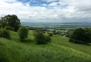
On the Cotswold Escarpment
Moreton-in-Marsh Grand Circular walk
Jun-17 • Saturdaywalker on Flickr
swcwalks swcwalk288 walkicon banner 35223647986

View from the Cotswold Escarpment
Moreton-in-Marsh Grand Circular walk
Jun-17 • Saturdaywalker on Flickr
swcwalks swcwalk288 walkicon 35097838262


| Length |
Main Walk: 26.5 miles (42.6 kilometers) Main Walk with Broadway Ending (taxi required): 21.5 miles (34.6 kilometers), with possibility to shorten by taking a taxi to Longborough making an 18 mile/28.9 km walk Shorter Circular Walk: 12.5 miles (20.1 kilometers) It is possible to shorten the Main Walk by taking a taxi to Longborough or Ford and/or arranging one to collect you from Blockley, Broadway, or elsewhere along the route. Distances with a taxi assist: Longborough to Moreton-in-Marsh: 22.0 miles/ 35.4 km Longborough to Blockley: 19.0 miles/ 30.6 km Moreton-in-Marsh to Snowshill: 17.5 miles/ 28.2 km Ford to Moreton-in-Marsh: 16.5 miles/ 26.6 km Longborough to Snowshill: 14.0 miles/ 22.5 km The taxi fare to Longborough and from Blockley is approximately 10 pounds and a taxi to Ford or back from Broadway or Snowshill ranges between 20 and 25 pounds. Recommended taxi companies are: AAA Station Taxis 07732 382 153/07871 936 651/07951 304 329; North Cotswold Taxi 07832 915 871/07774 693 720; Cotswold Taxi 07710 117 471; Moreton Taxi 0800 955 8584/01608 650 343/07800 957 646 or Jays Taxi 07554 424 793. It is recommended to book in advance. For those on the Shorter Circular walk, you can shorten the walk by 3 miles (4.8 km) by catching a bus (Number 1 or 2 operated by Johnsons) in Blockley back to Moreton-in-Marsh. They change the schedule often -- so verify ahead of time. As of June 2017, the last bus Monday-Friday is 18:20 and the last on Saturday is 16:23 with a possible "request only" bus stopping about 19:00. There are no buses on Sunday. Marchants Coaches operates bus 606 which runs through Stanton a few times a day and may be useful in shortening the walk. So, worth checking its most up to date schedule if this option is of interest. |
|---|---|
| Toughness |
10 out of 10 (8 out of 10 for the Shorter Circular Walk). |
| Time |
13-15 hours for the Main Walk and 8-10 hours for the Shorter Circular Walk, including transportation, lunch, afternoon refreshment stop and time spent admiring views and sites. |
| Transport |
Take the train closest to 8:00am from London Paddington to Moreton-in-Marsh. For the Shorter Circular Walk, the train closest to 9:00am or 10:00am would be preferable. Return trains run hourly. Buy a day return to Moreton-in-Marsh. |
| Lunch & Tea |
On the Main Walk: The recommended lunch pub is The Plough Inn (theploughinnford.co.uk/01386 584 215) in Ford (10 miles (16.1 km) into the walk), a 16th century inn serving traditional home cooked food. It is open Monday-Thursday from 12:15-2:15pm and Friday-Sunday 12:00-9:15pm (serving food all day). As it is a popular pub, it is worth calling ahead. A potential late lunch stop for starters from Ford or early starters from Longborough is the Mount Inn in Stanton (themountinn.co.uk/01386 584 316) (15 miles (24 km) into the walk or 11.5 miles/18 km if starting from Longborough or 5.5 miles/8.9 km if starting from Ford), a traditional country pub perched high on a hill with tremendous views. It serves food daily 12:00-2:00pm and drinks until 3:00pm. The recommended tea stop on the main walk is the National Trust Tea Room at Snowshill Manor if arriving before 5:00pm. Snowshill Manor is a 1 km diversion (500 meters out and back) and entrance to the tea room requires NT membership or purchase of a garden ticket. Alternatively, from 6:00pm the Snowshill Arms (donnington-brewery.com/01451 830 603) in the village center is open. On the Shorter Circular Walk: The recommended lunch stop is the Coach & Horses in Longborough (01451 830 325), 3.5 miles (5 km) into the Shorter Circular Walk. It serves food from 11:00-2:30pm Monday to Thursday and all day on Friday, Saturday and Sunday. The recommended tea stop is the Blockley Village Shop and Café, a community run venture (01386 701411/blockleyshop.com). It is open until 4:00 pm. If the café is closed (or you prefer something stronger), the Great Western Arms in Blockley (01386 700 362/ thegreatwesternarms.co.uk) also serves a variety of beverages (including tea). It is open from 5:30pm Monday-Friday and all day on Saturday and Sunday. For all walks: Moreton-in-Marsh also has a number of options for post walk libations. Some recommendations include the Bell Inn (reputedly a haunt of J.R.R. Tolkien) and the Black Bear Inn. Hassan Balti serves good Indian food (also available on a take-out basis to eat on the train – don’t forget to ask for plastic cutlery!) |
| Map | OL 45 OS Explorer |
| Walk Notes |
The Main Walk is a long and demanding journey out to the Cotswold escarpment and back. Along the way, you will have stunning views, pass through a race horse training facility and by an open mine harvesting Cotswold stone. You will also pass through three particularly charming and bucolic Cotswold villages – Stanway (with its stunning Manor House), Stanton and Snowshill. There is a slightly shorter alternate ending that brings you past Broadway Tower before descending into Broadway from where you will need to organise a taxi back to Moreton-in-Marsh. During the height of summer some of the paths between Snowshill and Blockley may be overgrown with long grass making a compass very handy for route finding. The Shorter Circular Walk is also a very lovely outing with some nice views, but misses the drama of the escarpment. The Main Walk can be shortened with some strategic planning and fairly inexpensive taxi assistance – in particular, the route from Longborough to Blockley (19 miles/30.6 km) is delightful without missing any highlights. The Shorter Circular Walk can also be shortened by catching a bus in Blockley, making for a 9.5 mile/15.2 km walk. Features of Interest: Moreton-in-Marsh: Moreton-in-Marsh is one of the principal market towns in the Northern Cotswolds, Gloucestershire located on the Roman Fosse Way (a Roman road that linked Exeter and Lincoln). It grew up as a market town during the 13th century and there is still an active market on Tuesdays. Buildings of note include the Redesdale Market Hall (erected in 1887) located on the High Street and the Curfew Tower (probably the oldest building in the village dating from the 16th century) located at the corner of the High Street and Oxford Street. The bell was rung nightly until 1860 to warn people of the risks of fire at night. Moreton means “Farmstead on the Moor” and “in Marsh” comes from henne and mersh, meaning a marsh used by birds such as moorhens. An alternative suggestion is that Marsh is a corruption of March, an early English word for boundary. Stanway Watermill: Part of the Stanway Estate dating from the 8th century. The Estate was known to have 4 watermills in 1291. They have been used over the centuries for various purposes. This mill is a fully restored flour mill and has the 8th largest waterwheel in England. Stanway House: An outstandingly beautiful Jacobean Manor House made from Cotswold Stone (Guiting Yellow). It has expansive water gardens and a tithe barn. It was owned by the Tewkesbury Abbey for 800 years, then the Tracy Family for 500 years. At present, it is owned and occupied by the Earls of Wemyss. It is open for visits on Tuesday and Thursday afternoons and by special arrangement. Snowshill Manor: Snowshill Manor is a National Trust property located on the edge of the hill top village of Snowshill. It is packed with extraordinary treasuries collected by Charles Wade. Admittance is by timed ticket. Broadway Tower: Broadway Tower is a folly created by Capability Brown for the Earl of Coventry. It is located on Beacon Hill (the second highest point in the Cotswold) and overlooks the charming town of Broadway. Located nearby is a nuclear bunker used by the Royal Observer Corps during the Cold War to monitor nuclear activity. Monarch’s Way: The Monarch’s Way is a 615 mile (990 km) long-distance footpath that approximates the escape route taken by King Charles II in 1651 after being defeated at the Battle of Worcester. It runs from Worcester to Brighton (via Bristol and Yeovil). Cotswold Way: The Cotswold Way is a 102-mile long-distance footpath that largely follows the Cotswold escarpment and goes from Chipping Campden to Bath. |
| Profile | |
|---|---|
| Help Us! |
After the walk, please leave a comment, it really helps. Thanks! You can also upload photos to the SWC Group on Flickr (upload your photos) and videos to Youtube. This walk's tags are: |
| By Train |
Out (not a train station) Back (not a train station) |
| By Car |
Start GL56 0AA Map Directions |
| Amazon | |
| Help |
National Rail: 03457 48 49 50 • Traveline (bus times): 0871 200 22 33 (12p/min) • TFL (London) : 0343 222 1234 |
| Version |
Apr-24 KarenG |
| Copyright | © Saturday Walkers Club. All Rights Reserved. No commercial use. No copying. No derivatives. Free with attribution for one time non-commercial use only. www.walkingclub.org.uk/site/license.shtml |
Walk Directions
Full directions for this walk are in a PDF file (link above) which you can print, or download on to a Kindle, tablet, or smartphone.
This is just the introduction. This walk's detailed directions are in a PDF available from wwww.walkingclub.org.uk
