Newborough Warren Circular Walk
Remote coastal walk with sand dunes, beaches, pine forests and salt marsh - ideal for rest day, or when there is bad weather on the tops.


| Length |
Circular walk : about 12 miles / 19 km ( add 1 mile / 1.5 km to finish in Maltraeth, add 5 miles / 8 km to walk to/from the station) Short Walks : from 4 to 9 miles / 6 to 14 km for one/both walks |
|---|---|
| Toughness |
2 out of 10 |
| Maps | OS Explorer 263 (Anglesey East) |
| Features |
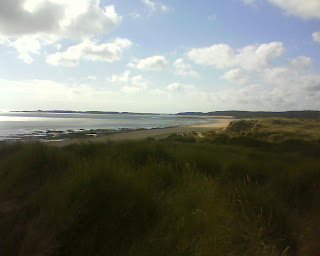
This is a short and gentle but very varied low-level costal walk around Newborough Warren (the largest area of sand dunes in Wales), a remote beach, a sand spit (with big open wiews along the Menai Straights to Snowdonia and the Llwyn Peninsular), salt marshes, a Pine Forest, Llanddwyn Island (with its lighthouse) and Maltraeth Sands. This walk would make a good alternative walk if you have come to North Wales to visit Snowdonia, but there is poor weather or low cloud over the tops, but it is a lovely walk in its own right. It is suitable for children. There are 2 options, a circular walk (public transport friendly), and for car drivers, 2 short coastal walks starting from a beach car park.
Train travellers can start from Bordorgan Station, walk to Maltraeth and cross the cob to start the circular walk, then return the same way, but while pleasent, this would make quite a long walk. Dog aren't allowed on the stretch of beach from the car-park to the island in the summer (May to September) - but there is a forest path behind the beach you could use Maltraeth Sands are also used by naturists, and the saltmarsh north of the spit to Abermenai Point is also used by migrated birds. |
| Tides | A small part of the circular walk is tidal - do not walk across the sands to Menai Point on a rising tide - circle around the sands (and the salt marsh) to cross via the sand dunes |
| Lunch | The beach has no facilities, but Newborough has a pub - the White Lion Hotel |
| Travel |
Bus
#42 Bus from Bangor. Every 2 hours or so, takes 35 mins. Stops in Newborough and Maltraeth Train
Bodorgan Station (on the Bangor to Holyhead line) has hourly trains, and is about 3km from Maltraeth - there is a path that runs alonside the tracks to just north of the village centre. From there you couls head south along the Anglesey Coastal path along the cob / causeway to pick up the circular walk - but this would add 8km/5m miles to the walk Car
Park for free at the end of the small roads by the mini roundabout on the A480 just south of Newborough. Near: LL61 6RS Park for 3 x £1 coins in a barrier in the main beach car park, along Church Street from Newborough village centre. A km or so past along the road past: LL61 6SG |
| Links |
|
| Profile | |
|---|---|
| Help Us! |
After the walk, please leave a comment, it really helps. Thanks! You can also upload photos to the SWC Group on Flickr (upload your photos) and videos to Youtube. This walk's tags are: |
| By Car |
Start Map Directions |
| Map Walk | This walk requires an OS map and a compass or GPS for navigation. You can print out OS maps using the link above. |
| Amazon | |
| Help |
National Rail: 03457 48 49 50 • Traveline (bus times): 0871 200 22 33 (12p/min) • TFL (London) : 0343 222 1234 |
| Version |
Aug-24 Andrew |
| Copyright | © Saturday Walkers Club. All Rights Reserved. No commercial use. No copying. No derivatives. Free with attribution for one time non-commercial use only. www.walkingclub.org.uk/site/license.shtml |

Walk Directions
A) Short beach walk to Abermenai Point
This walk starts from the Newborough Forest beach car park
- Head southeast through the pine forest, then across the sand dunes backing the beach to Abermenai point, return along the beach (8km out and back)
B) Short beach walk to Llanddwyn Island and Malltraeth Sands
This walk starts from the Newborough Forest beach car park
- Head northwest along the beach to Llanddwyn Island (1.5 km)
- Walk out to the tower at the end of the Island and back (2 km)
- Continue along the beach towards Malltraeth Sands as far as you wish. Walk back through the pine forest backing the beach, along the Anglsey Coastal Path (4 km)
- Return through the pine forest to the car park (1.5 km)
C) Long Circular Walk Starting from Newborough Village
The walk out to Abermenai Point is best done at low tide - so do in reverse if need be.
- Starting from the A4080 in Newborough Village, head West down Church Street for 100m
- Then South on a footpath for 500m. At a small road, turn left for 20m to a small roundabout on the A480
- Continue south on a small road, pass a car park. The road becomes a path across the sand dunes. Continue to the high tide mark (2 km).
- At low tide/falling tide, continue to Abermenai Point (otherwise contour in a big loop to the west around the high tide mark and the salt marsh, and walk along the dunes, as this part can be dangerous when the tide is coming in) (1.5 km)
- Head west along the beach or along the dunes behind it. Pass the main beach car park (4 km)
- Continue along the beach, or the pine forest behind it, to Llanddwyn Island (1.5 km)
- Walk out to the tower and back (2 km)
- Continue north along the beach, or the waymarked Anglsey Coastal Path through the pine forest (4 km)
- Circular Walk : By a small tower, head east back to Newborough (1 km) (If you reach a car park on the A480, you've gone to far).
- Linear Walk : Or if you came by bus, continue north, past the A480 car park, then along the cob (causeway) to Malltraeth to catch the bus home.(2.5 km)