Otford Circular via Shoreham walk
The steep-sided hills and secluded valleys around the Darent valley.

CIMG7529
Ye Olde George Inn, Shoreham
Nov-16 • Sean O'Neill
swcwalk290, swcwalk59, swcwalks 6401018052135602626 P

CIMG7529
Ye Olde George Inn, Shoreham
Nov-16 • Sean O'Neill
swcwalk290, swcwalk59, swcwalks 6500290081012645506 P

CIMG7860
Ye Olde George Inn, Shoreham
Dec-16 • Sean O'Neill
swcwalk289, swcwalk290, swcwalk59, swcwalks 6401018066964269074 P

CIMG7860
Ye Olde George Inn, Shoreham
Dec-16 • Sean O'Neill
swcwalk289, swcwalk290, swcwalk59, swcwalks 6500290098174906258 P

CIMG7942
Pickmoss, Otford
Dec-16 • Sean O'Neill
swcwalk289, swcwalk290, swcwalks 6479786578317134450 P
| Length |
Main Walk: 14 km (8.7 miles). Three hours 35 minutes walking time. For the whole excursion including trains, sights and meals, allow at least 7 hours. |
|---|---|
| OS Map |
Explorer 147. Otford, map reference TQ532593, is in Kent, 4 km N of Sevenoaks. |
| Toughness |
5 out of 10. |
| Features |
This walk includes a good mix of woodland and open countryside, with fine views from the steep-sided hills overlooking the Darent valley. It has obvious similarities with the original Otford Circular walk (1–43), with the same lunchtime village now that the pub in Romney Street has closed. Its shorter morning and longer afternoon essentially offer a more balanced walk, closer to the “good, brisk, shortish autumn or winter walk, with a late start possible” which perfectly described the original. This walk's relatively short morning section starts with the same stiff climb to the top of Otford Mount. It continues through the secluded valley of Magpie Bottom, one of several small nature reserves in the area managed by the Kent Wildlife Trust. In this valley it joins the route (in reverse) of the Knockholt to Otford walk (#37), then rejoins the Walk 1–43 route just before Dunstall Farm. A steep descent through the wooded White Hill brings you to the attractive village of Shoreham and lunch at one of its hostelries. The afternoon section starts with a climb up the other side of the valley into a fine bluebell wood. The increasing traffic noise reveals the presence of the (unseen) M25, and after a close encounter with the motorway the walk descends via another small nature reserve, Polhill Bank. It rejoins the Walk 1–43 route once again for an easy stretch along the Darent Valley Path into Otford, another attractive village with many interesting old buildings. |
| Walk Options |
The serpentine nature of the afternoon route allows for a couple of (mutually exclusive) short cuts, each partly overlapping the route (in reverse) of the Otford to Eynsford walk (1–23) and saving about 2 km. If you bring the appropriate directions you could also substitute the longer morning or shorter afternoon route of Walk 1–43. If you want to abandon the walk at lunchtime (or in mid-afternoon) you could divert to Shoreham station. |
| Transport |
There are two hourly fast services to Otford, one from Victoria (daily) and the other from Charing Cross (Mon–Sat); both take around 35-40 minutes. There is also a half-hourly stopping service from Blackfriars which takes just over an hour; these trains also call at Shoreham. If you have a Travelcard the Boundary Zone 6 station is St Mary Cray, but a London Freedom Pass is valid as far as Swanley (in TfL Zone 8). If you wanted to abandon the walk there is a very limited bus service (Mon–Sat) along the A225 between Sevenoaks and Swanley, but it will nearly always be better to head for the nearest station. If driving, Otford station car park costs around £5.50 Mon–Fri, £4 Sat, £3.50 Sun & BH (2024). The car park in the High Street is free on Sundays & Bank Holidays. |
| Suggested Train |
Take the train nearest to 10:15 from Victoria (or Blackfriars) to Otford. |
| Train Times |
|
| Timetables |
|
| River Levels |
|
| Lunch |
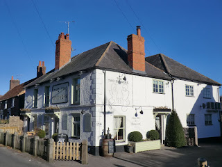
There is a good choice of lunch places in Shoreham, after around 6 km. The first places you come to are The Samuel Palmer (01959-525442), an up-market pub / restaurant on the site of Ye Olde George Inn; and a restaurant and a coffee shop at The Mount Vineyard (01959-524008; open Wed–Sun). In addition there are two equally good pubs at opposite ends of the village: the Kings Arms (01959-523100) on Church Street, open again after its fire in March 2022; and The Crown (01959-522903; food to 2pm Mon–Wed, 3pm Fri–Sun, closed Thu) at the northern end of Shoreham's High Street. Shoreham used to have another pub but the Two Brewers has permanently closed. |
| Tea |
At the end of the walk there are three tearooms in Otford: The Olive Tree in the Hospices of Hope charity shop (01959-524322; open to 5pm Sat & Mon–Fri summer, 4pm Sun & Mon–Fri winter); Sally's Cake Emporium (01959-928447; open to 4pm Tue–Sun); and the Pond View Café (01959-522150; open daily to 4.30pm). There are also two pubs on the High Street, The Bull (01959-580585) and The Woodman (01959-522195). |
| Profile | |
|---|---|
| Help Us! |
After the walk, please leave a comment, it really helps. Thanks! You can also upload photos to the SWC Group on Flickr (upload your photos) and videos to Youtube. This walk's tags are: |
| By Train |
Out (not a train station) Back (not a train station) |
| By Car |
Start TN14 5QY Map Directions |
| Amazon | |
| Help |
National Rail: 03457 48 49 50 • Traveline (bus times): 0871 200 22 33 (12p/min) • TFL (London) : 0343 222 1234 |
| Version |
Jul-24 Sean |
| Copyright | © Saturday Walkers Club. All Rights Reserved. No commercial use. No copying. No derivatives. Free with attribution for one time non-commercial use only. www.walkingclub.org.uk/site/license.shtml |


Walk Directions
Click the heading below to show/hide the walk route for the selected option(s).


 Walk Map
©
Walk Options
Click on any option to show only the sections making up that route, or the heading above to show all sections.
- Main Walk (14 km)
Walk Directions
Click on any section heading to switch between detailed directions and an outline, or the heading above to switch all sections.
- Otford Station to Magpie Bottom (2¼ km)
- From the station head north-east through a small wood (the Chalk Pit) and cross Pilgrims Way East to join the North Downs Way (NDW). At the top of Otford Mount fork left across a field (leaving the NDW) and turn left onto Rowdow Lane. Opposite the entrance to Mount Farm turn right onto a footpath going down through Great Wood to a valley, Magpie Bottom.
-
Arriving from London, do not cross the footbridge to the station building but go up a flight of steps near the middle of Platform 2. Bear right onto a footpath heading away from the station, with a small wood on your left. Almost immediately there is a metal fieldgate on a track leading into the wood.
- If this open-access area is fenced off, retrace your steps along the footpath and go past the station exit to reach the A225. Turn right onto its pavement, then turn right again into Pilgrims Way East. In 75m you rejoin the main route at the exit from the wood.
- For the main route, turn left and go past the fieldgate onto the woodland track, passing a sign for “The Chalk Pit”. Where the track emerges into an open area veer left onto a path curving up through the trees, which comes out onto a road (Pilgrims Way East).
-
Cross the road carefully and take the left-hand of two driveways just off to the right, joining the North Downs Way? (NDW). You now have a long steady climb up Otford Mount, initially between garden fences and then through a wooded area.
- Halfway up, a short detour along a side path by a wooden bench offers some fine views across the Darent valley.
- The path eventually levels out and you go through a wooden kissing gate. Go across a potentially muddy stretch into a field and fork left onto a faint grassy path (leaving the NDW and the Walk 1–43 route, which both continue up the right-hand field edge). Follow this path as it curves around the left-hand side of the field, passing by a trig point.
- In the far corner go out through a gap in the trees and turn left onto a minor road (Rowdow Lane). In 250m, after the last house on the right and opposite the entrance to Mount Farm, turn right through a small metal gate onto an easily-missed footpath.
- Follow this potentially muddy path alongside a screen of trees, across a field and then steadily downhill through Great Wood, heading NE. At the bottom go through a wooden gate onto a grassy path leading across a secluded valley, Magpie Bottom?.
- Magpie Bottom to Dunstall Farm (1½ km)
- At the bottom turn left onto a permissive path along the valley floor to Rose Cottage Farm. Turn left onto a lane (Magpie Bottom). In 400m turn right off the lane onto a footpath climbing through a small wood, then along field edges to Dunstall Farm.
- Do not continue up the other side of the valley, but veer left off the public footpath onto a grassy path along the valley floor, heading for a wooden fieldgate in a belt of trees across the valley.
- Go through a side gate next to the fieldgate and continue across a meadow towards another gate in the hedge on the far side. Go out through a side gate and turn left onto a lane (also called Magpie Bottom), heading W and soon with views on the right down the valley.
- In 400m, where the lane bends left, go over a stile on the right (to the left of a wooden gate) into a potentially muddy area at the bottom of a sloping field. Start along a farm track to the right, but almost immediately veer left uphill (as indicated by a yellow waymarker on a tree) on a narrow path between small trees.
- Follow the path up the right-hand side of the field. At the top go up a few steps, over a stile and through a belt of trees into a field. Turn right onto a farm track along its edge, with another footpath (the Walk 1–43 route again) joining from the right after 250m. Follow the track across a dip and back up into Dunstall Farm.
- Dunstall Farm to Shoreham Bridge (1¾ km)
- Follow the footpath across a field and steeply down through a wood to reach the A225. Cross over and go down Station Road. After passing under the railway bridge by Shoreham station veer right into a large field and continue on a new permissive path parallel to the road. On the far side go through the churchyard, joining the Darent Valley Path (DVP). Continue down Church Street to the River Darent.
- Go more or less straight on through the muddy farmyard, veering to the right of a barn on the far side. Continue in the same direction across a field. On the far side go down into a wood, soon crossing a path to descend a long flight of earth steps. In a further 350m the path merges with a bridleway coming in from the left, which leads out to the A225.
- Cross this main road carefully (slightly to the right) and go down Station Road. After passing under the railway bridge by Shoreham station veer right into a large field and take a new permissive path along its edge, parallel to the road.
- In the next corner follow the field edge briefly round to the right, joining the Darent Valley Path? (DVP), then turn left through a kissing gate in a low flint wall into the churchyard. Follow the tree-lined path past the church of Ss Peter and Paul?, which is well worth visiting.
- Go out through its lychgate, with The Samuel Palmer pub / restaurant opposite. Follow the road (now Church Street) gently downhill, passing a driveway leading to The Mount Vineyard? (which has a restaurant and a coffee shop) on the right. At the bottom the road bends right to run alongside a branch of the River Darent for a short distance.
- Shoreham Bridge to Meenfield Wood (1¼ km)
-
 For a choice of refreshment places follow Church Street across the river and up to a T-junction. Turn right and go along Shoreham's High Street to its junction with Mill Lane.
- Alternatively, simply follow the riverside path directly to Mill Lane and go up this lane to the High Street.
-
Main route
- Follow Church Street across the river (leaving the DVP) to come to the Kings Arms? on the left. At the T-junction at the top turn right onto the High Street.
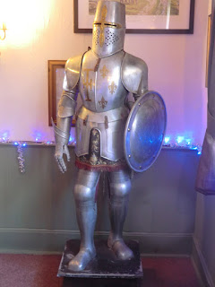
- The Honey Pot Café is on the right and a little further on the small Shoreham Aircraft Museum? (which has a tearoom) is on the left.
- The Crown is on the right near the end of the village. In a further 100m turn left off the road onto the footpath opposite Mill Lane.
-
Riverside route
- Do not cross the river on the road bridge but keep ahead on Darenth Way, passing the War Memorial? on the riverbank. Pass to the left of Water House? and follow the tree-lined riverside path.
- After passing a few properties the vineyard is visible off to the right, beyond an orchard. At the far end cross the river on a footbridge and follow the path alongside the garden fence for Mill House.
- After passing its entrance leave the DVP (a footpath off to the right) and go up Mill Lane to its T-junction with the High Street. Cross the road carefully onto the footpath opposite.
- Follow the enclosed footpath alongside the main road. In 100m go through a metal kissing gate and turn right to follow a line of wooden posts curving round the edge of a large field, climbing steadily. At the top go through another kissing gate and up a short slope.
- Do not go out to the lane ahead but turn left onto a straight tree-lined path heading S, which soon starts to climb gently. In 200m the path forks by a sign for Meenfield Wood.
- Meenfield Wood to Polhill Bank (2¼ km)
- Fork right onto the permissive bridleway climbing through the trees and eventually going along the top of Meenfield Wood. At the far end continue briefly alongside a hedge and then in the same direction through Pilots Wood. Ignore a footbridge across the M25 and follow the footpath as it turns left and goes down through the trees into the top of Polhill Bank.
- Fork right at the sign, taking the permissive bridleway into the wood. This climbs steadily and gradually curves round to the left, eventually levelling out at the top of the wood. Keep ahead at a set of path junctions, ignoring two footpaths off to the right and one down to the left.
- The main track can become very muddy but there are parallel side paths which you could take for the next 600m. At the end of the wood rejoin the main track to go along the top of an open area, though with a hedge blocking the view across the Darent valley. At the end of the hedge keep ahead on a broad track into Pilots Wood.
-
Follow this track for 700m (or side paths to avoid the mud, as before), gradually getting closer to the M25 which you can hear away to your right. The various routes converge to run alongside a high wire fence on the right. After going down a short slope a bridleway off to the right leads onto a high footbridge.
- This is not the onward route, but a short detour would finally let you see the motorway, in a deep cutting.
- Continue past the bridge on a footpath, which in 75m swings left and goes downhill through the trees. In 100m go through a wooden kissing gate onto the top of a steeply-sloping patch of grassland, Polhill Bank?, where you can finally pause to admire a fine view across the Darent valley.
- Polhill Bank to Water Lane (1½ km)
- Take the footpath heading north-east along the top of the reserve. At the far end turn left onto a permissive path into Pilots Wood, staying near its eastern boundary. Turn half-right across an open patch of grassland and continue on a footpath going down a track to Filston Lane.
- Bear left to follow a path along the top of the grassy bank, steadily descending and going through a gate along the way. The reserve narrows and you leave it through a wooden kissing gate at the far end. Go down a slope towards a second gate but turn left before reaching it onto an unmarked path going back into Pilots Wood.
- The path meanders along the bottom edge of the wood, passing a picnic table as it curves left. After a right-hand bend the path straightens out to head N, climbing gently with a field behind the fence on your right.
- The next turning is easy to miss. Where the main path bears slightly left away from the fence and before it starts to climb more steeply, veer right onto a side path to stay alongside the fence. Follow this narrow path to the edge of the wood, still climbing gently.
- Leave the wood via a stile and turn half-right to go diagonally down across a grassy slope. In the bottom corner go through a gate and down a track to a minor road (Filston Lane).
- Polhill Bank to Otford High Street direct (2¼ km)
- Take the footpath heading south-east, steeply down the bank and continuing across Filston Lane. After passing the buildings of Sepham Farm turn right briefly along the edge of a large field to its corner, then turn left onto a footpath heading south-east across fields and meadows, eventually coming out on Pilgrims Way West. Turn left onto this road, which crosses the River Darent and becomes Otford's High Street.
- Make your way down the steep-sided grassy bank to a wooden kissing gate at the bottom, directly below the one where you entered the reserve. Go through this and down a fenced path, underneath power lines and heading SE.
-
At the far end go through a metal kissing gate and down a few steps, taking great care as this comes out directly onto a narrow winding lane with limited visibility for drivers. Cross Filston Lane carefully onto the continuation of the footpath, passing several enclosures and the buildings of Sepham Farm off to the right. At the far end turn right onto a broad grassy track between fences.
The remainder of the walk follows the Walk 1–23 route, in reverse.
- In 100m turn left onto another broad grassy track, heading SE again. In the next corner ignore a footpath off to the left, then fork right off the farm track onto a path between hedges. In 125m keep left at a path junction and follow the footpath through scrubland and across a brook on a concrete slab.
- Continue along the waymarked path for a further 750m, initially on enclosed paths and finally across a meadow. On the far side go out through a gate and turn left onto a road (Pilgrims Way West). Follow this main road past Broughton Manor? and across several branches of the River Darent, rejoining the Main Walk where it becomes Otford's High Street.
- Meenfield Wood to Water Lane direct (1½ km)
- Take the footpath along the bottom edge of Meenfield Wood. At the far end turn left onto a footpath going down the left-hand edge of a steeply-sloping field, then on a track to Filston Lane.
- Keep left at the sign, going past a metal vehicle barrier and continuing along a broad path between a hedge and the wood, with views on the left of Shoreham in the Darent valley below. In 300m you reach a small enclosure on the left with benches to enjoy the view and an information panel about the Shoreham Cross? on the hillside below.
- In a further 200m keep ahead at a path crossing and continue for a further 600m to the far end of the wood. On leaving the wood turn left to go steeply down a grassy slope. …
- Water Lane to Otford High Street (2½ km)
- Go down Water Lane and along a bridleway past Home Farm. Turn right onto the Darent Valley Path and follow it to Otford's High Street.
- Cross Filston Lane carefully and go down Water Lane opposite. After the last cottage the track becomes a bridleway which swings left and goes alongside a branch of the River Darent for 200m. Cross the stream on a footbridge and continue along a track.
-
After passing an attractive old mill house keep ahead on its driveway, climbing steadily. At the top you come to a major path junction where you turn right (not sharp right into a private drive) onto a path with a concrete footpath marker, rejoining the DVP.
The remainder of the walk follows the Walk 1–43 route.
- Follow the enclosed path through a golf course, shielded by trees. At the far end go through a metal gate and keep ahead along the left-hand edge of a large farm field. Go through kissing gates on either side of the track to Lower Barn Farm and continue in the same direction along another field edge.
- After another gate you are back alongside the tree-lined River Darent for the final stretch into Otford, eventually going past some allotments and out along a driveway to its High Street. Cross the road carefully and turn left onto its pavement, leaving the DVP.
- Otford High Street to the Station (1 km)
-
 Head east along the High Street, passing several refreshment places. At the far end skirt around the village pond and take a footpath going up to the church. Head east through the churchyard and continue on an enclosed path to the station car park.
-
Head E along the High Street, soon passing the timber-framed Pickmoss? on your right where the road narrows. In 200m you pass The Bull pub opposite the car park entrance to Otford's large recreation ground, then in a further 50m two more possible refreshment places.
- The Olive Tree bistro and tearoom is at the back of the Hospices of Hope charity shop, opposite Sally's Cake Emporium. The other places are on the left of the large roundabout encircling the village pond? at the eastern end of the street, the Pond View Café and The Woodman pub.
-
Make your way to a footpath signpost on the far side of the pond, with the left-hand footpath leading to the parish church of St Bartholomew?.
- If you want to visit the church, use the set of modern doors on its north side.
- A short out-and-back detour along the right-hand footpath would take you to the ruins of Otford Palace?.
-
To complete the walk, take the left-hand footpath past the south side of the church and head E through the churchyard, with a high brick wall on your left. At the far end go through a wooden gate and follow the enclosed path to the station car park. Platform 1 on the near side is for trains to London.
- The North Downs Way runs for 246 km along the length of the North Downs (with two sections at its eastern end), from Farnham in Surrey to Dover in Kent.
- Magpie Bottom and Polhill Bank are Local Nature Reserves managed by the Kent Wildlife Trust. These areas of chalk grassland support many varieties of orchid.
- The Darent Valley Path follows the course of the river for 31 km, from Sevenoaks (near its source in the Greensand Hills) to the River Thames at Dartford.
- Ss Peter and Paul, Shoreham dates from Norman times and has many interesting features, all described in an informative Visitor's Guide. They include an outstanding wooden rood screen spanning the width of the building and some fine stained glass windows, including one by the Pre-Raphaelite artist Burne-Jones.
- The Mount Vineyard was planted in 2004 and produced its first harvest in 2008. Eight grape varieties are now grown on the 10 acre site, producing award-winning red, white, rosé and sparkling wines.
- The War Memorial in Darenth Way is inscribed Remember as you look at the cross on the hill those who gave their lives for their country 1914-1919.
- Water House is associated with Samuel Palmer (1805-1881), one of the group of artists influenced by William Blake who called themselves The Ancients. He lived in the village from 1826 to 1835, for some of the time with his father (also called Samuel) who had rented Water House.
- The Kings Arms still has its ostler box, a shelter at the front of the pub for the person who used to attend to horses at coaching inns.
- The Shoreham Aircraft Museum was founded by volunteers in 1978 and holds donated items and aviation relics from the crash sites of local British and German aircraft in World War Ⅱ.
- The 16thC Broughton Manor was originally a Crown property housing part of the retinue at Otford Palace.
- The Shoreham Cross was cut into the chalk hillside above the village in 1920, to commemorate those who lost their lives in World War Ⅰ.
- Pickmoss resembles a genuine medieval hall house but is actually the result of an extensive refurbishment in the 1950s. A small Elizabethan house and a pair of unrelated cottages were amalgamated and a typical Elizabethan frontage added to give the appearance of a single large property.
- Otford Pond is one of many protected structures in the village, which has led to claims that its duckhouse is Britain's smallest listed building.
- St Bartholomew, Otford dates from the 11thC; construction began in 1060 with the tower added in around 1185. It contains a large marble memorial to Charles and David Polhill, descendants of Oliver Cromwell.
- Otford Palace was created by Archbishop Warham in 1514, a year before Cardinal Wolsey (his rival and successor as Lord Chancellor) began the construction of Hampton Court Palace. Both were subsequently taken over by Henry Ⅷ but Otford (in its unfavourable marshy location) fell into ruins while Hampton Court expanded into a major royal palace.
The first 1 km is the same as the Walk 1–43 route.
If you do not want to visit any of the other refreshment places in the village you can take the more attractive riverside route in [?].
If you are doing the first short cut (omitting Polhill Bank), go to §H.
If you are doing the second short cut (omitting Water Lane), go to §G.
Continue the directions at §I.
Complete the directions at §J.
Walk Notes
» Last updated: July 23, 2024
Return to Top | Walk Map | Walk Options | Walk Directions.