Oxshott to Ashtead walk
The River Mole and the heaths, commons and woods of metropolitan Surrey. Including Oxshott Heath, Esher Common, Prince’s Coverts, Ashtead and Epsom Commons.

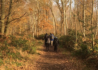
Pond near the start
Oxshott to Ashtead walk
Nov-16 • Saturdaywalker on Flickr
swcwalks swcwalk178 walkicon 30552975694

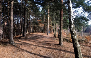
Winter woods
Oxshott to Ashtead walk
Nov-16 • Saturdaywalker on Flickr
swcwalks swcwalk178 walkicon 30567153713
Late autumn colours
Oxshott to Ashtead walk
Nov-16 • Saturdaywalker on Flickr
swcwalks swcwalk178 walkicon 30567153013

Dusk in Ashtead Forest
Oxshott to Ashtead walk
Nov-16 • Saturdaywalker on Flickr
swcwalks swcwalk178 walkicon 30552974204

Along the pond
Oxshott to Ashtead walk
Nov-16 • Saturdaywalker on Flickr
swcwalks swcwalk178 30552975214
Heathland mid morning
Oxshott to Ashtead walk
Nov-16 • Saturdaywalker on Flickr
swcwalks swcwalk178 30552974704

| Length |
19.6 kilometres |
|---|---|
| OS Maps |
Explorer map 146. Oxshott station (TQ141610) and Ashtead station (TQ181590) are both in Surrey. |
| Toughness |
3 out of 10. The only significant gradients are to and from the River Mole. |
| Features |
The walk is easily accessible from Waterloo and links together several surviving and diverse heaths and commons in metropolitan Surrey. It begins by heading North through Oxshott Heath, goes over the A3 and cuts West across Esher Common and round Black Pond to the A307 (Portsmouth Road). The most scenic section of the walk follows as the route descends through Winterbottom Wood to take in a section of the River Mole, heading North, then climbs up to the Ledges with views down to the river. You cross the A307 again and continue through Esher Common from a high vantage point, now heading East to the A244 (Copsem Lane). Head South-East on farm lanes and well-marked bridleways through Arbrook Common, back under the A3 and railway line near Claygate station. Next you explore the little known Crown Property of Prince’s Coverts (also known as Oxshott Woods). You emerge to the South of the Estate on the A243 (Kingston Road or Leatherhead Road) by the Star Inn. In the afternoon you take a convoluted route around Ashtead Common and Epsom Common, with options for taking a more direct route to Ashtead station. Although you are never from traffic, there is virtually no road walking involved. Paths are well-signposted in Oxshott Heath (to Sandy Lane), Esher Common, Arbrook Common and Ashtead Common – less so elsewhere! |
| Shortening the Walk |
A glance at the map will show that short cuts are possible in sections 2 and 3, before or after crossing the A307. A possible short cut is suggested in the text (see section 2). Abellio bus 515 runs on the Portsmouth Road (A307) to Esher, Surbiton and Kingston or in the opposite direction to Guildford, hourly and seven days a week. It stops at Blackhills, near Claremont Gardens at the end of section 3. Buses generally depart on the hour to Kingston, except on Sundays when they depart at 08 minutes past. Abellio bus 513 runs infrequently from Copsem Lane/Meadway at the end of section 4 to Esher and Kingston, or to Oxshott and Guildford. Buses depart Monday to Saturday only at 11.56 and 14.16 for Kingston; generally it would be easier to continue to Claygate. You could end the walk at Claygate station (one station from Oxshott) by walking from Points 1 or 2 as indicated in section 5. The total distance is 9.2 kms or 11.9 kms respectively. After lunch at the end of section 6 you could catch London Bus 465 which stops at the Star Inn and runs every half hour or every hour on Sundays to Chessington South, Surbiton and Kingston or to Leatherhead and Dorking. Buses for Kingston generally stop at the Star Inn at 12 and 42 minutes past in the week, 09 and 39 minutes past on Saturdays and 20 past on Sundays. A short cut to Ashtead station is suggested in section 7. This avoids Epsom Common altogether and reduces the distance by 4.3 kms. |
| Travel |
Oxshott is on the London Waterloo to Guildford (via Cobham and Stoke d’Abernon) line. All trains stop at Clapham Junction, Wimbledon and Surbiton. Trains run twice an hour and once an hour on Sundays, journey time 36 minutes. Catch the train nearest to 10am from Waterloo. Ashtead is on the Guildford to London Waterloo (via Epsom) line. All trains stop at Wimbledon and Clapham Junction. Trains run twice an hour and once an hour on Sundays, journey time 41 minutes. Southern trains from Horsham and Dorking to Victoria via Clapham Junction also call at Ashtead, journey time 40 minutes. Trains run twice an hour, seven days a week. Buy a day return to Effingham Junction (as Oxshott and Ashtead are on different lines). By Car: There are free car parks on Esher Common between the A3 and Oxshott station. The train journey back to the start takes about 30 mins. |
| Points of interest |
|
| Lunch |
|
| Tea |
Ashtead (main walk)
Claygate (short walk)
|
| Profile | |
|---|---|
| Help Us! |
After the walk, please leave a comment, it really helps. Thanks! You can also upload photos to the SWC Group on Flickr (upload your photos) and videos to Youtube. This walk's tags are: |
| By Train |
Out (not a train station) Back (not a train station) |
| By Car |
Start KT22 0TA Map Directions Return to the start: Finish KT21 2DR Map Directions Travel to the start: |
| Amazon | |
| Help |
National Rail: 03457 48 49 50 • Traveline (bus times): 0871 200 22 33 (12p/min) • TFL (London) : 0343 222 1234 |
| Version |
Oct-24 Mike Powell |
| Copyright | © Saturday Walkers Club. All Rights Reserved. No commercial use. No copying. No derivatives. Free with attribution for one time non-commercial use only. www.walkingclub.org.uk/site/license.shtml |

Walk Directions
Oxshott Heath (1.9 kms)
- Trains from London Waterloo arrive at Oxshott station on platform 2. Cross over the footbridge to platform 1 and leave the station.
- Cross the car park and in 30 metres take the path immediately to the right of a building (The Coal House). In 50 metres continue ahead at a cross paths. In 50 metres take the path to the right, midway between seats a few metres away on either side. Keep to the left hand edge of the steep climb. Go up steps in 120 metres to reach the war memorial in 70 metres.
- Take the path to the right of the memorial with a bench to your right. In 35 metres go straight on, taking the middle one of three paths. In 115 metres continue ahead at a cross paths marked by a post with a white arrow. In 60 metres turn half left with The Sandpit below you to the right. In 80 metres turn right with the main path (not the small path leading down into the Sandpit.
- In 100 metres a white arrow points left into the woods, but you continue ahead, then in 10 metres fork left (10°) at a post with a yellow arrow, in to the woods and away from the main path and the Sandpit. Stay on the main path forking right in about 50 metres towards a post with a yellow arrow. Take the left fork at this post to come out in 100 metres on Sandy Lane.
- Cross Sandy Lane to the car park opposite. (!) In 20 metres take the clear raised wheelchair accessible path a few metres to the right of the information board, away from the road and in to the woodland, heading North-West. Soon there are houses visible through the trees to the right.
- Stay on the pleasant twisting woodland path ignoring all side paths, crossing a stream after 200 metres, then when the path divides in another 100 metres, veer left. Soon you are parallel to a wide horse ride, which you can join if it is easier. Whichever path you take, in 120 metres you come to a 3-armed signpost where you turn right on to a bridleway, signposted for West Bridge and Portsmouth Road.
- In 70 metres there are houses visible through the trees to the left. Stay on the wide path across the open heath. In 400 metres turn right at a wooden signpost. In 40 metres ignore the path to the left at another signpost (for Sandy Lane) and cross over the A3 by West Bridge in 40 metres.
Black Pond (1.3 kms)
- In 120 metres turn right at a three armed signpost pointing you to Arbrook Common, on to a wide tarmac path. In 150 metres you pass wooden railings on both sides. In 50 metres, before you emerge in the open, cut across to the left on to a marshy path which runs to the left of Black Pond. In 60 metres ignore a stretch of boardwalk leading towards the Pond. In 40 metres you go over a short stretch of boardwalk. Ignore another section of boardwalk to the right and in another 250 metres you go through a wooden barrier and turn right to follow the causeway, still with the Pond to your right.
- In 30 metres you pass a seat in the shape of a leaf. In another 160 metres you go through a wooden barrier and in 80 metres through a second wooden barrier, then turn left through the next wooden barrier in 60 metres (by continuing ahead here and taking the next path to the right, before the pylons, you can reduce the distance by 3 kilometres and pick up the route at paragraph 4.2, but it would be a shame to miss out on the River Mole).You soon have a ditch on your right and you go through another wooden barrier in 200 metres, merging with a path to your left. In 30 metres turn left at a three-armed signpost. In 20 metres turn right to reach the A307 (Portsmouth Road) in 30 metres. Cross the main road to The Homestead and turn right.
Winterdown Wood, River Mole and The Ledges (2.5 kms)
- In 25 metres take the wide horse ride by a wooden signpost pointing to Winterdown Wood. In 150 metres fork left then turn left in 25 metres on another wide path (where turning right would take you under a line of pylons).
- In 150 metres you pass the back of The Homestead (a modern white house owned by the National Trust), visible behind a paling fence on your left. In 60 metres continue ahead at an unmarked cross paths. In 40 metres turn left at a T-junction. In 80 metres veer to the right and go uphill with a wire fence on your left. (!) In 120 metres you reach the corner of the fence (with a private wooden gate behind it) and turn right (South-West), steeply downhill through the beech wood and rhododendrons. If in doubt veer left towards a stream.
- In 250 metres you reach the River Mole with a wooden paling fence and a ‘private’ sign to your left. Turn right and follow the muddy riverside path. In 250 metres ignore a wooden signpost and steps leading to the car park on your right. In 150 metres you pass under the line of pylons. The high ground above you is The Ledges and you will be passing back this way.
- In 100 metres continue over new sections of boardwalk. Continue by the river to pass a wooden bench in 90 metres. In 80 metres go over another section of boardwalk. In 80 metres you pass another bench. In 50 metres turn to the right, away from the river. In 25 metres, go up steep steps supported by hand rails. At the top of the steps in 80 metres you go through a wooden barrier.
- There is a viewpoint to the left but you turn sharp right by two old tree stumps, away from the fence to the left and still climbing slightly. In 80 metres the climbs levels out and you have wooden railings to your right with fine views of the river below. In 60 metres you pass a seat on the left, then a memorial seat in 60 metres and another in 60 metres. In 40 metres you pass a post marked ‘The Ledges’ and another seat. (!) In 120 metres, just before the end of the wooden railings and with the pylons towering ahead of you, turn left.
- In 60 metres go straight on at a cross paths and continue ahead at a second cross paths in 60 metres. In 30 metres, on reaching a grassy area with a bench on your right, turn right and descend steeply. Go straight on at a cross paths in 100 metres. In 50 metres cross the A307 (Portsmouth Road) again, just to the right of the car park with bus stops on both sides of the road.
Esher Common (1.6 kms)
- Take the horse ride marked by a blue arrow, to the right of the small parking area. In 100 metres continue ahead at a cross paths by a wooden signpost on a faint path which can be wet. In 40 metres you are walking directly under the line of pylons. In 70 metres cross a wide path by an information board.
- In 150 metres you pass to the left of a pylon. In 40 metres take the next path to the right. In 50 metres turn left at an unmarked cross paths in to woods, gradually uphill. In 160 metres cross another path by a barrier. Continue ahead on an earth bank with the ground falling away to left and right and traffic from the A3 audible to the right. In 180 metres you pass a bench at the top of the climb and you are now at the right hand edge of the trees with open views beyond. In 50 metres pass another seat on the right. In 70 metres you pass a two armed signpost pointing you to Copsem Lane (and away from Black Pond) at a cross paths with another seat to your right.
- Later there are woods on both sides. You pass another seat to your left in 250 metres and go down the first of several flights of steps in 25 metres. Continue ahead towards Copsem Lane car park. In 250 metres turn left at the near end of the car park, past an information board and a shelter. In 20 metres take the path to the right of a sign for the Esher Common Cycle Route. Continue parallel with the road, passing another Cycle Route waymark post in the woods in 20 metres. Go over a plank bridge in 40 metres and turn right in 30 metres on a wide path, following the line of the pylons again to reach the A244 (Copsem Lane) in 90 metres by a signpost pointing back to Longy Down.
Arbrook Common and Birchwood Lane (2.4 kms)
- Cross the main road with care (or turn left for an infrequent bus to Esher or Kingston) and continue on the main path which can be muddy, keeping the pylons to your right. At the first path junction in 150 metres take the tarmac path to the right and pass a Coal Tax Post (these posts were erected in the mid-19th century by the City of London at points where tax was payable by people bringing coal and other commodities into the city and there are several passed on this walk). Cross a brick bridge over a stream (The Rythe) and turn left in 20 metres. In 150 metres at a two armed signpost, ignore the path to the left and continue towards Claygate (1½ miles says the signpost). In 100 metres at another signpost again ignore the path to the left (to Arbrook Common) and continue towards Claygate. In 50 metres, [1] go straight on for the main route to Ashtead (South East) at a four armed signpost (pointing to Claygate 1¼ miles), with Arbrook Farm to your right
- Alternatively turn left at point [1], and follow directions below for the most direct route to Claygate station, though if you are not pressed for time it is worth continuing to Point 2.
- In 15 metres cross a brook and continue towards the A3, on a wide stony track (Birchwood Lane) with fields to both sides. You go under the pylons for the final time and through a tunnel under the A3 in 480 metres.
- Continue ahead with wooden fences on both sides. In 120 metres the track turns to the right, away from the A3. In 150 metres you go under a rail bridge. In 50 metres you pass a blue bridleway arrow and continue with woods on your left (Birch Wood) and a ditch to your right. In 350 metres you pass another Coal Tax Post on your right. Stay on the path, which is muddy in places, to reach a wood on your right in 200 metres (Limekiln Wood). In another 300 metres, [2] take the wide path to the right for the main route to Ashtead (New Road) at the corner of a meadow, marked by a three armed signpost directing you to ‘Fairoak Lane ¼ mile’
- Alternatively turn left at [2], and follow the directions below for Claygate station
- Enter more woodland (Great Oaks), still with a ditch to the right. Cross Fairoak Lane (B280) in 300 metres.
To Claygate station
- Route from [1] above For Claygate station, turn half left through a wooden barrier at Point 1 with woods on your left and a field on your right. You pass another wooden signpost pointing to Claremont Road (¼ mile) in 250 metres. Stay on the path, between two fields and across a brook in 250 metres and over the railway line by a brick bridge in 300 metres. Take the first left (Gordon Road) in 50 metres (or continue ahead in to Claremont Road for The Foley, which is at the end of the road on your left). In 300 metres turn left on Albany Crescent, then in 150 metres turn left in to The Parade. To your right is Williams of Claygate and opposite is Café Capital. In 50 metres you reach Claygate station which has Coco Café. Take the footbridge to Platform One for trains to London Waterloo.
- Route from [2] above Alternatively turn left at Point 2 on to New Road (the signpost points you to ‘Coverts Road ¼ mile’), an unsurfaced wide stony track. In 150 metres you pass under pylons and enter a pleasantly shaded section. In 150 metres there is a Coal Tax Post in the woods to your right and signs for the Crown Estate and Great Oaks. In 100 metres you take a bridge over the A3. On reaching the road ahead at a bend in 150 metres, turn right in to Holroyd Road by the post box. Where the road bends to the right you take the path to the left (Common Lane) in 150 metrres, heading North through Claygate Common. In 20 metres take the path forking left, away from the main path. In 40 metres go through a wooden barrier and continue uphill. In 300 metres the path divides and you veer to the left. In 25 metres continue along the left hand edge of a path of grass, passing two seats. In 80 metres turn left by an unmarked wooden post. In 140 metres you come out on Fee Farm Lane, a gravel road. In 150 metres cross Foley Road ahead in to Church Road and in 20 metres go through the gate on your left in to Claygate Recreation Ground. Head just to the left of the play equipment and in 260 metres go through the high black metal gates in to Dalmore Avenue, then in 200 metres left in to Hare Lane. In 150 metres you pass The Foley on the corner of Foley Road, then in 200 metres turn left in to The Parade to reach Claygate station in 150 metres.
Prince’s Coverts (3.4 kms)
- Cross Fairoak Lane (B280). Take the drive ahead, past Highgate Cottages on the left to reach the entrance to Prince’s Coverts in 80 metres.
- Go through the gate and continue on a wide path (The Avenue). After a staggered junction (The Cross Gravels) in 320 metres, the path veers gradually to the left. In 200 metres there are picnic benches hidden away to your left. Continue past a clear path on the right in 140 metres.
- (!) It is easy to miss the next turning in 50 metres – it is a few metres before you reach a pond on the left. Look for a low level wooden post, on the reverse of which is a red arrow marked Prince’s Coverts Walkers’ Trail (PCWT). Turn right here, cross a ditch with care and continue on a narrow path to pass to the left of Jessop’s Well, a brick building, in 30 metres. In 20 metres you turn to the left by another post with a red arrow for the PCWT, which you now follow, but be warned that the trail is marked in the opposite direction, so the arrows only point back in the direction from which you have come and they may be on the back of the posts. In 40 metres you reach an enclosure on your right and the path may become very muddy. In 180 metres you pass the far corner of the enclosure and the path becomes easier. Ignore paths to the left until in 150 metres you reach another PCWT red arrow on your right. Turn left here (160°).
- When the path divides in 150 metres, take the right fork. In 100 metres turn right at a post which is marked for the PCWT and also for the Prince’s Coverts Horses’ Trail (PCHT) by a green arrow. Evergreen trees line the path to the left. In 60 metres continue past another post with arrows for both the PCWT and the PCHT. Continue past another PCWT and PCHT post in 40 metres. The path is now grassy and firmer underfoot. In 120 metres turn left (160°) at the next waymark post (on your left, leaving the PCHT but staying with the PCWT. This is an important turning - your general direction from this point is South-East, which should take you back to The Avenue, where you turn right. If you stray any further to the West you are likely to come to a wide gravel path which leads from The Cross Gravels to the A244 to the South of Oxshott.
- In 30 metres you cross a plank bridge over a ditch. In 250 metres turn left (70°) at a T-junction on to a wide path. There are evergreens on your left and new plantations on your right.
- In 120 metres you ignore a path to the left and follow your path round to the right (170°). In 150 metres you reach a complex staggered path junction. A PCWT arrow points to the right up a hill but you take the path to the left, by a tall wooden post on your right with the number 13 (there is also a post for the PCHT here). The path takes you uphill with tall evergreens on your right. In 140 metres you reach the top of the climb. In 120 metres ignore a path to the left. (!) In 20 metres go right (70°) at a PCWT red arrow (through the remains of a wooden barrier). Continue through a very muddy section. Pass a PCWT post on your left in 150 metres. Go through a wooden barrier in 80 metres and turn right (opposite a PCWT arrow), back on The Avenue, in 20 metres.
- In 100 metres go through a barrier and a wooden gate, leaving Prince’s Coverts. In 60 metres, with houses to your right, go through another wooden gate (usually kept open). The path becomes tarmac and gradually descends and curves to the left. Go under more pylons in 180 metres. This unmade access road has unfortunately suffered from the irresponsible dumping of litter. In 80 metres you pass 1 d’Abernon Chase on your right. In 110 metres cut through the pub car park on your left (the bus stop for Kingston is at the junction of the access road and the main road ahead). You reach The Star Inn, the recommended lunch stop, in 60 metres.
Ashtead Common (3.1 kms)
- There is another Coal Tax Post outside the pub. Cross the A243 (Leatherhead Road) in 20 metres and turn right. In 80 metres go down Epsom Gap, as vaguely indicated by a red arrow on a leaning signpost, to enter Ashtead Common. You go past a barrier in 70 metres and turn right by a City of London Corporation (CLC) noticeboard and three armed signpost in 30 metres, marked as Concessionary Ride 1 (CR1), passing New Pond on your left. At the next signpost in 60 metres ignore the path ahead (marked as footpath 24) and stay on the stony uphill CR1, which turns to the left. At the top of the climb in 240 metres, continue ahead on an easy grassy path. At a signpost in 80 metres, turn to the right (now on footpath 27). Go through a wooden barrier in 10 metres and turn to the left with a seat to your right in 60 metres. In 80 metres ignore footpath 26 on your right.
- The route again becomes very muddy. In 300 metres you pass the Wishing Tree on your left and your path turns to the right. In 70 metres at the next signpost, turn left, on to footpath 25. In 300 metres you cross CR1 (but for a direct route to Ashtead station, turn right here to reach the brick bridge referred to at the end of section 9 in 400 metres). In 200 metres you turn left on Public Bridleway 33 (turning right here would also take you to the brick bridge but it tends to be a much muddier path).
- The bridleway takes you steadily uphill and is very muddy in places. In 150 metres you cross Concessionary Ride 2 at the next signpost. In 550 metres you pass Flag Pond and a seat on your left. In 280 metres you merge with Public Footpath 34 on your right at another signpost, with a private enclosure (Newton Wood) now on your right.
- In 120 metres turn right (North-East) by a CLC noticeboard, a Coal Tax Post and a four armed signpost, with wide views ahead, following the public bridleway to Epsom Common. Stay on the firm stony path, now also following the Chessington Country Walk (a 5 mile circular walk which passes Chessington South station) and still with Newton Wood fenced off to your right. In 300 metres cross a path by a seat and a four armed signpost, staying on the public bridleway. In 100 metres pass another CLC noticeboard.
Epsom Common (2.0 kms)
- In 10 metres you pass another Coal Tax Post and in another 20 metres at Woodcock Corner continue ahead at a three armed signpost, following the public bridleway to Christchurch Road. In 180 metres you reach Stew Pond on your right. This is a haven for wildlife and anglers (Stew means fish). Take the path to the right, with the pond to your left (leaving the Chessington Country Walk). In 50 metres you pass a memorial seat and in 120 metres go up a flight of wooden steps to reach Great Pond (which is protected from fishing and is a wildlife reserve for ducks, swans, frogs, newts, etc).
- Turn left at the top of the steps, with the pond on your right, on to a gravel path. At the corner of the pond in 60 metres, by a seat, you turn right and continue through a possibly muddy section, still with the pond on your right. Turn right in 120 metres and take the unmarked path (just before a gate giving access to meadows) in another 80 metres. Follow the path steadily uphill and to the East. Turn right in 320 metres by a wooden post which reads Epsom Common on one side and Low Meadow on the other, with the first of several low signs for the Thames Downs Link (TDL) opposite (this runs for 15 miles from Kingston to the North Downs Way at Box Hill). Continue straight on through woodland on a wide grassy ride, past a second low sign for the TDL in 80 metres. Turn right and downhill opposite the next TDL sign in 250 metres. Keep right at the next path junction by a bench in 200 metres, now on a surfaced all weather horse ride, which you follow round to the left at a TDL sign in 70 metres. In 300 metres continue ahead at a two armed signpost with a sign for West Heath to your right, following the path to Ashtead Common. In 140 metres you reach another CLC noticeboard and turn left at a path junction in 10 metres.
The Rye Brook (1.4 kms)
- Turn right in 20 metres at a three armed signpost (leaving the TDL) to re-enter Ashtead Common, still on a surfaced all-weather path (Concessionary Ride 2). In 230 metres there is an information board and a footbridge over The Rye Brook a short distance to your left. In 220 metres Concessionary Ride 2 continues ahead as marked by a post to the right, but you turn left towards houses. In 20 metres turn right (this grassy path can be very muddy, but there is an all-weather alternative running alongside the residential fence). Go through a wooden barrier in 40 metres and continue ahead. In 350 metres follow the path round to the left and merge with the path on your left by the fence. In 150 metres you reach a junction with CR1 and Public Bridleway 33.
- Turn left and cross The Rye Brook by a stone bridge, passing a bench on your left. Stay on the path or walk at the left hand edge of the grass (Wood Field), to cross Woodfield Road at a sharp turn in 300 metres. Ashtead station is to your right in 30 metres and trains to London leave from the near side (platform 1).
- For refreshments, cross the railway line by the level crossing and continue on Woodfield Road then cross the grassy area on your right by the tarmac public footpath diagonally to the opposite corner. This brings you to the junction of Woodfield and Barnett Wood Lane and The Woodman is on the opposite corner (but when you return to the station, fork left for the car park). Further along Barnett Wood Lane to the right there is a parade of shops including Benya’s Coffee Shop. Alternatively stay on Woodfield Road then turn left past Tesco in to Craddocks Parade which has Allisons Bakery and Ashtead Café.