Portsmouth to Havant or Eastoke Point via Hayling Island walk
Portsmouth Harbour, Southsea promenade, Eastney Beach, a ferry to Hayling Island, quiet beaches. Either continue to Eaststoke Point, or head inland along a disused railway path alongside Langstone Harbour.

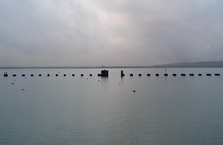
Distant ships and sun, Southsea
Portsmouth to Hayling Island walk
Jan-18 • Saturdaywalker on Flickr
swcwalks swcwalk179 walkicon 39108195554
The old rail bridge, Hayling Island
Portsmouth to Hayling Island walk
Jan-18 • Saturdaywalker on Flickr
swcwalk179 swcwalks walkicon 39108193774
20160719_133417
View from the Royal Oak towards Halyling Island Causeway
Jul-16 • Andrew Murphy on Flickr
swcwalk179 swcwalks 28431504695
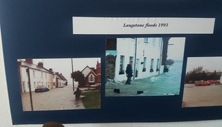

20160719_141212
Entrance to chapel and local museum
Jul-16 • Andrew Murphy on Flickr
swcwalk179 swcwalks 28431500195
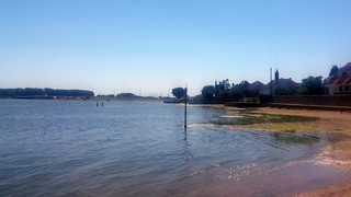
20160719_150646
View from beach back towards the Ferry Inn
Jul-16 • Andrew Murphy on Flickr
swcwalk179 swcwalks 27814990344

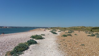
20160719_150651
View from Ferry In beach
Jul-16 • Andrew Murphy on Flickr
swcwalk179 swcwalks 27814986024
| Status | [Aug-16] The Hayling Island - Portsmouth ferry has re-opened |
|---|---|
| Length |
Portsmouth - ferry - Hayling beach - disused railway path - Havant : 13 miles, ascent : none Portsmouth - ferry - Hayling beach - Eastoke Point (Sandy Point Nature Reserve) : 11.1 miles ( 17.8 km), ascent : none |
| OS Maps | Explorer map 118 |
| Toughness | 1 out of 10. No hills. Walking on pavement, paths or sandy beaches |
| Features |
This coastal walk features Portsmouth's historic harbour, Southsea's promenade, a pier, several forts, Eastney's naturist beach, a short ferry ride to Hayling Island, sand dunes of Gunner Point, then either a disused railway path around Langstone Harbour to Havant, or a seafront promenande to Sandy Point and the entrance to Chichester Harbour, followed by a bus back to Havant The walk starts at Portsmouth Harbour, with views over the harbour entrance and naval base. It follows the seafront past Gunwharf Quays development and the landmark Spinnaker Tower (viewing platform, £9.95 in 2016). You then join the Solent Way seafront path with views over the Isle of White. This is a seafront promenade through the resort of Southsea, passing Southsea Castle, South Parade Pier, Lumps Fort, and Eastney Forts. There is an option to follow the shingle beach to Eastney's naturist beach before detouring inland around Fort Cumberland to the Hayling Island Ferry. Next is a short ferry ride across the entrance to Langstone Harbour, to Hayling Island, and the popular Ferryboat Inn, with outside tables overlooking the coast and harbour entrance. From here, the walk follows a sandy beach (or a seafront trail) back to the coast, a beach where the sea is very shallow at low tide, and goes out a long way with sand bars - great for paddling on a falling tide. It then follows the wide sandy beach along the south (sea facing) coast of Hayling island. The coast here is protected by a golf course (hidden by dunes), which makes this the quietest part of Hayling's coast. That is, until you reach the Inn on the Beach, a seafront pub, just before the amusements, where you have a choice.
|
| Walk Options |
You could start at Havant, follow the railway path south to the coast, then follow the coast to Sand Point (i.e. walk both the options above, missing out Portsmouth) You can follow the railway path south, take the ferry, then follow the Solent Path north around the other side of Langstone Harbour back to your starting point for a circular tour of the harbour. This would take 14 miles, but would be better suited to cycling rather than walking as it might get a bit monotonous after a while |
| Travel |
Portsmouth Harbour and Havant are on the same rail line from London Waterloo. Buy a ticket to Portsmouth Harbour, at least 2 trains and hour. The Hayling Ferry runs every 30 mins from Hayling Island (Ferryboast Inn) to Eastney, takes 10 mins, 7 days a week. In 2016: £5 return, every 40 mins (ask if the £25 10 crossing ticket can be used by groups) The Stagecoach #30/ #31 buses runs in an (anti) clockwise loop from Havant - causeway - Hayling - Sandy Point (Sandy Bay Road) - Ferryboat Inn - Hayling - causeway - Havant. It takes 30 mins from Hayling to Havant Station (Mon-Fri: every 30 mins. Sat: hourly. Sun: 2-hourly) On Sunday, check the time of the last bus. |
| Points of interest |
|
| Lunch and Tea |
Lots of options including:
|
| Profile | |
|---|---|
| Help Us! |
After the walk, please leave a comment, it really helps. Thanks! You can also upload photos to the SWC Group on Flickr (upload your photos) and videos to Youtube. This walk's tags are: |
| By Train |
Out (not a train station) Back (not a train station) |
| By Car |
Start PO1 3PA Map Directions Return to the start: Finish PO9 1PP Map Directions Travel to the start: |
| Amazon | |
| Help |
National Rail: 03457 48 49 50 • Traveline (bus times): 0871 200 22 33 (12p/min) • TFL (London) : 0343 222 1234 |
| Version |
Apr-24 Andrew |
| Copyright | © Saturday Walkers Club. All Rights Reserved. No commercial use. No copying. No derivatives. Free with attribution for one time non-commercial use only. www.walkingclub.org.uk/site/license.shtml |


