Rowlands Castle Grand Circular walk
Long walk via Kingley Vale SSI, Beacon Hill, and the South Downs ridge


| Length | 37km (23m) |
|---|---|
| OS Map | Explorer Map OL8 (was 120) |
| Toughness | 10+ out of 10 |
| Features |
This walk explores the area and visits all the highlights to the north east of Rowlands Castle. It passes a Saxon Church at Stoughton, Kingley Vale Nature Reserve with its yew tree woods, bronze-age burial mounds on Bow Hill, Beacon Hill on the South Downs Way with its magnificent views, the site of a murder most foul at Harris Well and an early Norman church. In late April / early May you will come across vast areas of wild garlic. The ancient landscape the walk passes through feels remote and quiet, as if harking back to a more pastoral life. This is a long and strenuous walk with several steep climbs. There are several pubs along the route for refreshments. Stansted House and Park: This location has been recorded in the Domesday Book. It is likely that the site contained a hunting lodge in the 11th century and over the following centuries has been developed until today's structure was built "in the style of Wren" in 1903 after a fire destroyed the previous buiding in 1900. The park and the house are now owned by the Stansted Park Foundation, a charitable trust. St Mary, Stoughton: This church was most likely built sometime during 11th century before the Norman conquest. It still has many features considered typical "Saxon" such as the high-rise chancel, much thinner walls than Norman churches, windows set high up in the walls and a round arch separating the nave from the chancel. Kingley Vale National Nature Reserve: One of Euope's most impressive yew tree forest which for some reason survived the felling of yew trees in the middle ages. The wood of yew trees was used for longbows. Devil's Humps: Bronze-age burial mounds on top of Bow Hill, part of KVNNR. Beacon Hill: Highest point on the walk with fantastic views towards Portsmouth and the Isle of Wight beyond. Remnants of a bronze-age fort surround the top. Uppark House (Optional): A 17th century house built by Ford Grey and now owned by the National Trust. It was completely restored using historical craftsmanship after a devastating fire in 1989. Harris Well: In 1749 the cobbler Daniel Chater was brutally murdered by a gang of smugglers to prevent him from testifying against one of their partners in crime by being thrown into the well and stoned to death. Chalton: Chalton is a charming small village with the church of St Michael built in the 13th century and the Red Lion Inn from the 16th century. St Hubert's Church at Idsworth: 11th century church, the only remnant of the village of Idsworth which was abandonded in the 14th century. |
| Walk Options |
You can shortcut the walk in various ways. But even with these shortcuts it still remains a strenuous walk: Use walk SWC 68 either for the morning section to The Royal Oak at Hooksway or the afternoon section back from Hooksway to Rowlands Castle. Take bus 54 to Petersfield from South Harting or from Uppark (total 25km / 16m) Finish the walk in Petersfield (total 33km / 20m) |
| Travel | Take the train nearest to 7:30 from London Waterloo to Rowlands Castle |
| Lunch |
The Royal Oak (01243 535257) A wonderful 16th century inn in the middle of nowhere with a big garden. Note that they serve lunch only between 12:00 and 14:00 and it is 18km from the start to this pub. The White Horse (01243 519444) A bit pricier inn that was once owned by the wine merchant who still plies his trade from the house in front of the pub. The current owner is also keen on wine. It serves the full lunch menu until 15:00 and then a reduced menu. If you cannot make it by 14:00 to The Royal Oak have lunch here. |
| Tea |
Various places in Rowlands Castle: The Castle Inn (02392 412494) Robin Hood Inn (02392 412268) The Fountain Inn |
| Profile | |
|---|---|
| Help Us! |
After the walk, please leave a comment, it really helps. Thanks! You can also upload photos to the SWC Group on Flickr (upload your photos) and videos to Youtube. This walk's tags are: |
| By Train |
Out (not a train station) Back (not a train station) |
| By Car |
Start PO9 6BP Map Directions |
| Amazon | |
| Help |
National Rail: 03457 48 49 50 • Traveline (bus times): 0871 200 22 33 (12p/min) • TFL (London) : 0343 222 1234 |
| Version |
Apr-24 Dirk |
| Copyright | © Saturday Walkers Club. All Rights Reserved. No commercial use. No copying. No derivatives. Free with attribution for one time non-commercial use only. www.walkingclub.org.uk/site/license.shtml |


Walk Directions
- Leave the station and walk down the road. Turn left and then left again underneath the railway bridge. Follow the road to where it veers left and take the footpath into the woods through a gap in the stone wall on your right.
- In 70m cross another footpath and continue on towards the east onto the long avenue towards Stansted House. In 1.9km cross a road, pass Middle Lodge and follow the tarmac lane slightly turning left and entering Stansted Park.
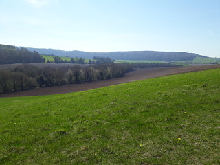
- In 500m, now outside the woods, turn left through a wooden gate at a signpost. Follow this path along the edge of a wood ingoring all ways off for 1.1km to where the path veers left into the woods. Towards the end of this stretch look towards your right: The ridge you can see in the distance is the Kinlgey Vale Nature Reserve you will climb up to in about 1.5h. Immediately after the turn into the woods there is a small footpath going off towards the right which you ignore. In a further 20m there is a wide track joining from the right at an angle of 125deg which you also ignore. In a further 30m the path turns right towards the north and immediately crosses another path.
- In 500m before you enter the open field turn right just inside the edge of the wood. In 340m the path then opens up into a field. Follow the hedge on your left until you reach Broadreed Farm in 630m.
- Walk through Broadreed Farm and at its other end turn left onto a tarmac lane.
- In 500m ignore the first path to the right along the edge of the wood, instead take a path on the right just inside the wood at a 4 way footpath signpost.
- Follow the path as it turns left downhill and descends to the B2146. Cross the road and walk up Locksash road.
- In 240m leave the road as it turns left uphill and continue straight following the footpath sign. in 50m you pass a metal sign saying "Watergate" on your right.
- In 200m the tarmac lane turns left. Continue straight on onto a gravel track.
- Keep going in this direction ignoring all ways offs until in 550m the path veers left uphill into woods. Ignore the path joining from the left and continue walking towards the right until you come out on an open field. There, follow the path along the edge of the wood on your left.
- Continue following the edge of the wood as it turns left. In a further 200m the path enters the woods and then comes to an intersection with a path where you turn right downhill.
- In 200m cross a lane and follow the path uphill. In 400m at the top of the ridge, the Monarch's Way joins from the right. Continue on your path, now the Monarch's way, ignoring the path on the left. Soon you will see the roofs of the village of Stoughton in the valley ahead of you. Descend in between houses until ...
- ... in 550m you reach the "centre" of Stoughton. To view the Saxon church turn left uphill. The Hare and Hounds pub is 200m towards the left along the main road through Stoughton.
- To continue the walk turn right on the main road through Stoughton. [!] In 150m turn left up a concrete driveway.
- In 380m you pass a memorial to a polish fighter pilot who crashed his plane into the hill in front of you after being shot down by a German plane.
- In 1km, on top of the hill, you come to a intersection with a signpost. Ignore the path on the left and continue on straight. Here look over you right shoulder: In good visibility you can see the high rise buildings of Portsmouth, among them the Spinnaker. In front of Portsmouth you can see Hayling Island and Longstone Harbour and beyond Portsmouth is the Isle of Wight.
- In a further 200m at a triangular intersection turn left. In 400m at an information board you enter the Kingley Vale Nature Reserve with its yew tree woods on your right.
- In 400m you come out on an open hill top with two bronze-age burial mounds (Devil's Humps). From the top of the mounds you can see towards the south-east Chichester Cathedral and the eastern-most arm of Chichester Harbour. Towards the north you can see Beacon Hill, the highest point on the walk, which you will climb in the afternoon.
- Continue along the path ignoring the one which turns off downhill towards the right.
- In 700m at a 4 way intersection with a 4 way footpath signpost turn left. Before you do that look towards the east where you can see The Trundle with its radio masts.
- In 700m you join a path coming from the left.
- In 100m at a 6 way intersection enter the woods ahead taking the second path on your left.
- In 600m you join a car wide track.
- In 300m turn right at a 3 arm footpath sign.
- Continue along this path ignoring all ways offs (in particular a path going uphill on your right in 500m and a 4 way intersection in a further 900m) until in 2.1km you come to the B2141 with the White Horse opposite. Cross the road with care and turn left walking along the road passing the White Horse. The White Horse is a possible earlier lunch time stop. It is another 2.4km to the Royal Oak, the recommended lunch time stop. If you are too late to get there by 14:00 stop at the White Horse for lunch.
- About 150m past the White Horse turn slightly right off the road through a metal gate and follow a path in roughly the same direction for 800m until you reach a T-junction with a car-wide track where you turn right. In more details: In 250m go through a gate. In 160m cross a car wide track and go through another gate. You will reach the T-junction in a further 400m where you turn right along the car wide track.
- In 250m take the bridal way past the wooden gate on the left entering West Dean Estate. Follow this ignoring all ways offs until in 1.1km you reach the Royal Oak at Hooksway the suggested lunch stop.
- Coming out of the Royal Oak turn left and left again past the pub. Follow the moss-covered footpath sign and the corresponding path for 1.1km where you join a car wide track coming up from the left.
- In 60m leave the car wide track and take the footpath on its left. Further up this path you can see in the distance the Black Downs Escarpment towards the north-east.
- In 1km at a 4-way junction turn left joining the South Downs Way. From here follow the South Downs Way up to Pen Hill.
- In 500m you reach the top of Pen Hill. From there you can see at the foot of the next hill (Beacon Hill) the South Downs Way turning left towards the south and a rough path going straight up Beacon Hill. Take this path straigth up to the top of Beacon Hill from where you have a magnificient view towards Portsmouth across Hayling Island and the Isle of Wight beyond.
- Drop down from Beacon Hill towards a 5 way footpath sign and follow the direction of the South Downs Way which is the path closest to the escarpment. In the valley towards the north you can see the hamlet of South Harting.
- In 1.5km you cross a road.
- In 800m you cross another road. You have two options here: If you want to pass or even visit the 17th century Uppark House follow the instructions under []. Otherwise cross the road and continue on the South Downs Way and follow instructions under [].
- Remain on the SDW
- In 20m you can short-cut the walk by leaving the South Downs Way and taking the path downhill, forking left in 20m all the way into South Harting where you can take bus 54 to Petersfield or Chichester. Otherwise continue on the South Downs Way.
- In 450m ignore a 3-armed footpath sign on the right but in a further 170m at a three-armed footpath sign on the left you have again two options: You can again short-cut the walk to Petersfield by following the instructions below (Finish in Petersfield). Otherwise turn left leaving the South Downs Way. Coming out into a field turn right for 5m before turning left into a row of trees.
- Follow this path for 1km staying in the woods for as long as possible and when coming out of the trees continue in the same direction keeping the line of trees on your right.
- Continue in this direction ignoring all ways off until the path enters into woods, turns into a harder car wide track and veers right uphill. A few metres further on the path joins a car wide track where you turn left until in 500m you come to a four-way intersection. Continue with instructions under [].
- Via Uppark House (NT)
- Turn left along the road for 300m then turn left off the road. This is the northern access road towards Uppark House which you will reach in 500m. After having visited the house turn right here down the road in northerly direction. In 500m you cross a road and continue on the path opposite for 400m.
- When you reach a T-junction with a footpath signpost turn left for 300m until you come to a four-way intersection.
- Both options continue. Turn right uphill. [!] In 120m after following the track around to the right turn left off the car wide track onto a grassy path which is easily missed.
- In 350m cross a path and in 400m, just after crossing a small path, continue in the same direction following the signpost by entering a track ahead of you into woods which soon veers slightly left. If you end up on a car wide track you have gone too far.
- In 800m, at the bottom of the slope, turn right with a path joining from the left and in 10m turn left onto a car wide track.
- In 500m, about 50m before a track joins from the right at a corner of a tall pine wood, you will find a fenced-in well on our right. This is the old Harris Well. In 1749 the cobbler Daniel Chater was brutally murdered by a gang of smugglers to prevent him from testifying against one of their partners in crime.
- In 400m you come to a wide intersection. Follow the footpath sign onto a grassy path straight ahead.
- [!]In 350m turn off the path onto a small path on your right which can be hidden among bushes and trees.
- In 700m cross a road, go straight ahead and over a footbridge hidden in the bushes ahead of you across the railway tracks.
- On the other side of the railway track turn left along the road for 10m and then turn right off the road going steeply uphill.
- Follow the path uphill across two stiles and a field. In 350m the path joins the road downhill into Chalton. In 250m you reach the 16th century Red Lion Inn on your left.
- Take the path opposite the pub towards the 13th century St Michael's church. Continue past the church (viewing recommended) through the church yard. Exit the church yard through a gate, continue along the path crossing a car wide gravel track and going through another gate. With a large open area ahead of you, turn right with the footpath sign towards the top of Chalton Down.
- Go through gates in 300m, another one in 650m and in a further 350m go through a gate through a hedge. Note St Hubert's church from the 11th century down in the valley on your left the only remnant of the village of Idsworth.
- In 850m cross a path at a footpath signpost.
- In 350m turn left downhill with the path and in another 70m right into a line of trees. There is a footpath signpost hidden in the trees on your right indicating the Sussex Border Path and Staunton Way.
- In 850m you come to a hedge and a road beyond. Turn left into Finchdean this side of the hedge. In 190m step onto the road and fork right with it. The George Inn is the last watering hole before Rowlands Castle.
- At the George Inn turn right along the road for 100m and then turn right uphill towards White Hill.
- In 350m leave the road following the footpath sign towards the left. There is a gate in 50m.
- In 850m go through a gate and in further 50m turn right where the car wide track forks.
- In 170m where the road veers right turn left through houses on a public foot path.
- In 230m step out onto a road. Continue in the same direction towards the bus stop and then follow the road slightly downhill ignoring Broadcroft lane turning off to your right.
- In 300m turn left downhill and in another 100m turn left towards the station. The various tea options can be found by ignoring the left turn towards the station and continuing on into the centre of Rowlands Castle.
Finish in Petersfield
- Continue in the same direction on the South Downs Way for 650m until you reach a road where you turn right.
- In 900m to come to an intersection where you join a footpath on the opposite side 900m until you reach a three-way road intersection where you follow the road opposite in northerly direction.
- In 500m go straight.
- In 90m fork left.
- In 1.1km at a T-junction continue on the path opposite into the woods.
- In 100m you come out into a field and continue along the edge of the wood for 400m or until you enter the next field.
- Here you turn right across the field towards a style on the other side.
- Cross the style and a concrete footbridge in 300m.
- Cross a style in 100m.
- Turn slightly left to a style in the distance.
- Continue by following the sequence of styles across a number of fields for 1.5km until you come to a road which you cross into the heath opposite. Continue along the direction of the path until you reach Heath Pond. Follow it around towards the left until you come out on a road. Cross the road and follow the road opposite into Petersfield and towards its station.