Tattenham Corner Circular walk
Exploring a First World War Centenary Wood taking shape behind Epsom Downs racecourse.
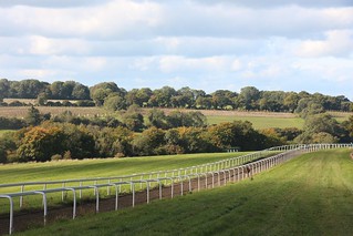
Tattenham Corner Circular 9 Oct 22 SWC1
Oct-22 • Steven F Coles on Flickr
swcwalks swcwalk398 52435069465
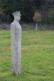
Tattenham Corner Circular 9 Oct 22 SWC2
Oct-22 • Steven F Coles on Flickr
swcwalks swcwalk398 52434894629
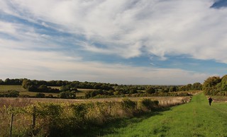
Tattenham Corner Circular 9 Oct 22 SWC3
Oct-22 • Steven F Coles on Flickr
swcwalks swcwalk398 52434894634
| Length |
Main Walk: 17¾ km† (11.0 miles). Four hours 10 minutes walking time. For the whole excursion including trains, sights and meals, allow at least 8 hours. Shorter Walk, finishing at Tadworth: 13¼ km (8.2 miles). Three hours 5 minutes walking time. Alternative Walk, finishing at Merstham: 18 km (11.2 miles). Four hours 15 minutes walking time. Short Alternative Walk, starting from Tadworth: 11 km (6.9 miles). Two hours 30 minutes walking time. † Add 1¾ km (1.1 miles; 25 minutes) if finishing at Epsom Downs station. See Walk Options below. |
|---|---|
| OS Map |
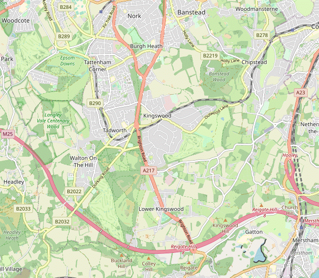
Explorer 146. Tattenham Corner, map reference TQ226582, is in Surrey, 3 km SE of Epsom. |
| Toughness |
4 out of 10 (3 for the Shorter Walk, 2 for the Short Alternative Walk). |
| Features |
Tattenham Corner station was built to serve Epsom Downs Racecourse and you soon get a fine view along its finishing straight towards the Grandstand. A ridge walk along Walton Downs then takes you to what was once arable farmland in Langley Vale but is being transformed by the Woodland Trust into a First World War Centenary Wood, with poignant sculptures in new plantations and wildflower meadows. After an undulating route through this extensive site a sustained gentle climb brings you to the lunch stop in Walton on the Hill, with its attractive village pond. The afternoon section starts with an optional loop around the partly-wooded Banstead Heath (part of Banstead Commons). The rest of the walk is similar to the outward leg in reverse: past riding stables, through another part of the Centenary Wood and over Walton Downs to the racecourse. |
| Race Days |
The public footpaths across Epsom Downs Racecourse are kept open on some race days, but since 2016 they have been closed during major events (and for several hours before and after). Sadly, it is no longer possible to do the full walk on Derby Day. |
| Walk Options |
The 4¾ km loop around Banstead Heath after lunch can be shortened to 2–2½ km, or indeed omitted altogether. The other option for a Shorter Walk would be to divert to Tadworth station after the heath loop. At the end of the Main Walk directions have been included for an alternative ending at Epsom Downs station. This is hidden away at the end of a long residential street with no refreshment places nearby, but it offers a more convenient link to some south London destinations as well as providing a fall-back if the Tattenham Corner service is disrupted. For a substantially different afternoon route you could finish at Merstham, essentially reversing the start of the Merstham to Tattenham Corner walk (#4). There are fine views from the North Downs ridge on this Alternative Walk but you have to put up with the incessant grumbling from the M25. For convenience directions have also been included for a shorter start from Tadworth for this ending, although this option does not go through any part of the Centenary Wood. |
| Additional Notes |
A circular walk from Tattenham Corner was originally included in Walk #4, but since this option missed out the fine views from the North Downs ridge it was somewhat neglected. The ongoing development of the Centenary Wood has given this option added interest and so it has been redesignated as a separate walk. There is inevitably some overlap between the two walks, but where possible those stretches are done in the opposite direction. |
| Transport |
Tattenham Corner and Tadworth are the last two stations on the Chipstead Valley branch line, with a half-hourly service from London Bridge taking about one hour. On Sundays there is only an hourly service requiring a change at Purley, with a slightly longer journey time. On the alternative ending Epsom Downs has a half-hourly service to Victoria via West Croydon. All three stations are in TfL Zone 6. At the end of the Alternative Walk Merstham has half-hourly Thameslink trains via London Bridge plus Southern trains to Victoria (half-hourly Mon–Sat, hourly Sun), both taking around 30 minutes. Oyster PAYG can be used from Merstham but it is outside the numbered Travelcard zones, so if you had a Zones 1-6 Travelcard or Freedom Pass you would need to buy a ticket to Coulsdon South (or take TfL bus 405 to Coulsdon, Purley or Croydon). Walton on the Hill has a regular bus service (Metrobus 460) if you want to finish the walk after lunch there, although Tadworth station is only a 15-minute walk away. If driving, Tattenham Corner has a small station car park costing around £5 Mon–Sat, £3 Sun (2024). There are large free car parks on the edge of Epsom Downs. |
| Suggested Train |
Take the train nearest to 10:15 from London Bridge to Tattenham Corner. |
| Train Times |
|
| Timetables |
|
| Lunch |
Except on the Short Alternative Walk the suggested lunch place is Walton on the Hill, after 7½ km on all the other walk options. For a pub lunch the Blue Ball (01737-819003) reopened in May 2021 under new ownership; lighter fare is available at the Village Café (01737-814171), overlooking Mere Pond. On the way into the village the walk route passes The Bell, a quirky (and drinks-oriented) pub known locally as The Rat (01737-812132; open from noon weekends, 4pm Mon–Fri). On the far side of Banstead Heath, The Sportsman (01737-224950) is a later option on the Alternative Walk (after 11 km). If this comes too soon on the Short Alternative Walk (after 4 km) you could carry on for a further 3¼ km to the Junction 8 servery at the Reigate Hill car park, or have a late pub lunch in Merstham at The Feathers (see below). |
| Tea |
At Tattenham Corner you could grab a takeaway drink and snack at the Downs Lunch Box kiosk (open daily). There are several places in the parade of shops beyond the station, such as the Silver Spoon Diner (01737-668049; open to 5pm Mon–Sat, 4pm Sun) and the Wine Rack (a store with a few inside tables to try their wine or craft beers). There are no more refreshment places on the route to the alternative return station, Epsom Downs. The large pub at Tattenham Corner is being refurbished by its new owners (Youngs) and should reopen in Autumn 2024. If you finish the Shorter Walk in time there is a small café opposite the ramp leading down to the London-bound platform at Tadworth station, The Coffee House (01737-277422; open to 4pm Mon–Fri, 3pm Sat, closed Sun). The old station building now houses Station Fish for takeaway fish & chips, and a Mediterranean Bar & Restaurant, The Bridge (01737-213919). On the Alternative Walks there is a large pub and a couple of cafés near Merstham station. As well as normal pub fare The Feathers (01737-645643) offers a full afternoon tea, but this has to be pre-booked. The other places nearby are the Pizza Project Café (01737-642399; closed Mon) at the top of Station Road South, and Quality Café (01737-642929; open daily to 4pm) in this side street. |
| Profile | |
|---|---|
| Help Us! |
After the walk, please leave a comment, it really helps. Thanks! You can also upload photos to the SWC Group on Flickr (upload your photos) and videos to Youtube. This walk's tags are: |
| By Train |
Out (not a train station) Back (not a train station) |
| By Car |
Start KT18 5QD Map Directions |
| Amazon | |
| Help |
National Rail: 03457 48 49 50 • Traveline (bus times): 0871 200 22 33 (12p/min) • TFL (London) : 0343 222 1234 |
| Version |
Jul-24 Sean |
| Copyright | © Saturday Walkers Club. All Rights Reserved. No commercial use. No copying. No derivatives. Free with attribution for one time non-commercial use only. www.walkingclub.org.uk/site/license.shtml |

Walk Directions
Click the heading below to show/hide the walk route for the selected option(s).


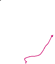


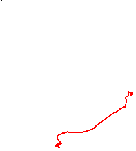 Walk Map
©
Walk Options ( Main | Alt. )
Click on any option to show only the sections making up that route, or the heading above to show all sections.
- Main Walk (17¾ • 19½ km)
The longer distances for the Main Walks are when finishing at Epsom Downs.
Walk Directions
Click on any section heading to switch between detailed directions and an outline, or the heading above to switch all sections.
If you are doing the Short Alternative Walk (from Tadworth), start at §E.
- Tattenham Corner Station to Langley Vale Wood (2½ km)
- Leave the station and bear left up a grassy knoll, then go down to cross the B290. Go alongside the racecourse fence and join a sandy ride going round to the right, past where the six and seven-furlong races start. Go all the way along the top of Walton Downs, with woods on your right. At the bottom take a bridleway curving left through trees. Turn right onto Sheep Walk (another bridleway) and in 80m turn right again into Langley Vale Wood.
- Leave the station past the ticket office and go straight ahead. Cross a street to the left of a small car park and go past low wooden barriers onto a patch of grassland. Veer left up this knoll towards a line of benches for a fine view of Epsom Downs Racecourse, with its Grandstand at the end of the finishing straight.
- Go along the top of the small knoll, with the course off to your right. Drop down to leave it via another gap in the barriers and turn right onto a short side street. Go past a black metal gate onto the B290 (Epsom Lane North) and cross the main road carefully. Turn left and go alongside the wooden barriers for a short distance, then veer right through a gap and follow a grassy path towards the white railings protecting the racetrack.
-
Bear left at the railings, which continue alongside a section of the course used for the six-furlong races. At the end turn right to go past their starting point on a sandy track. Go across the start of a fenced-off training gallop used for exercising racehorses and continue on a broad grassy strip between the gallop and another section of the course.
Epsom Downs and Walton Downs are both open access but racehorses have priority before noon, so follow instructions from the Downskeepers if necessary.
- In 200m you pass the starting point for the seven-furlong races and bear right to join a path on the edge of the strip of grassland between the training gallop and woodland. Follow this path gently downhill for 1 km, ignoring a couple of openings into the trees. Eventually you pass the end of the gallop and in a further 250m your route merges with a track coming out of the trees.
- Carry on downhill for 200m to come to a major path junction in front of a belt of woodland. Go straight across another training gallop and take the middle of three paths down into the trees, signposted as a bridleway to Langley Vale Wood. The path curves round to the left and merges with another bridleway at the bottom.
- Almost immediately you come to another bridleway junction and turn right, again signposted to Langley Vale Wood. After 80m along this potentially muddy wide track (Sheep Walk) you come to a Woodland Trust sign for Langley Vale Wood?, with new plantations on both sides. Go through a gate on the right-hand side of Sheep Walk to enter this part of the extensive First World War Centenary Wood.
- Langley Vale Wood to Sheep Walk (2 km)
- Go up the hillside, round to the right along Cherry Avenue and up to the Regiment of Trees. After a short loop past these sculptures head south through the Community Orchard and Jutland Wood to Sheep Walk.
-
Like many of the fields in this memorial site, the first one you enter is a plantation of young trees. The mown path immediately splits and the suggested route is to fork left, directly up the hillside.
- For a gentler climb you can take the lower path, which doubles back to rejoin the other route near the top of the field.
- At the top go through a gap in the tree boundary into another plantation and fork right on a path (Cherry Avenue) slanting gently up the hillside, with a wildflower meadow behind the wire fence on your right. At the next path junction keep ahead through a gap in the hedge to continue along the bottom edge of another plantation, again with a wildflower meadow on your right.
-
At the far end follow the mown path round to the left. In the top corner veer right through a gap in the trees and follow the path up the left-hand edge of the next plantation, coming to a crossing of farm tracks in the trees at the top.
Your onward route is through the field on the left, but the full route includes a short loop around the sculptures in the field on the right.
- Take the mown grassy path diagonally across the right-hand field to come to a set of sculptures: a line of soldiers arranged as if for inspection. Turn half-right to walk along this Regiment of Trees?, then turn half-right again to view the prominent wooden sculpture Witness?. Go back along the perimeter track to the track junction in the field corner to complete the circuit.
-
Go straight across your outward route into the corner of a large open space, with a Community Orchard ahead on your left. The suggested route is to go through a high gate into this orchard and follow the meandering path past the fruit trees (apple, pear, cherry and plum), leaving through another gate at the far end.
- If the orchard gate is locked simply take the mown path straight ahead, alongside its fence. On the far side the path veers left and merges with the path from the orchard.
- In the field corner go through a gap in the tree boundary and veer right into the next plantation, Jutland Wood?. Follow the mown path round to the right, where you soon pass an information panel about the eponymous sea battle at the start of an avenue of fourteen wooden sculptures. Go along this avenue to a small clearing with a couple of benches and a steel sculpture of a sailor.
- Carry on along the broad grassy path as it winds its way through the large plantation, initially heading SW and gradually curving round to the left. Unless you want to take a longer loop out to the right, keep left at the first two path junctions. The path is now heading E and you turn right at the third junction to head S towards the tree boundary.
- Go through this belt of trees and immediately fork left onto a short path heading SE towards a wooden gate in the tree boundary. Leave the field through this gate to come out onto a public bridleway (Sheep Walk again).
- Sheep Walk to Mere Pond (3 km)
- Cross over Sheep Walk and head south-east through more plantations and some mature woodland, Little Hurst Wood and Round Wood. Turn right onto a bridleway heading south-east, then take a footpath on the left leading to the north-western corner of Banstead Heath. Follow a lane along the edge of the heath to Mere Pond in Walton on the Hill.
- Cross the bridleway (slightly to the left) and go through a high wooden gate in a deer fence. Follow a mown path downhill through another plantation. At the bottom go through a gate onto a path climbing through Little Hurst Wood, ignoring side paths. After the path emerges from this mature woodland go through a gate and again follow a path downhill through a plantation, still heading SE.
- At the bottom go through a gate and turn left briefly onto a farm track. Almost immediately turn right onto a grassy path alongside a low wire fence, gently uphill and heading E. Where the path splits you can go either side of a tall hedge; the paths rejoin at the field corner. Follow the path round to the left and then into Round Wood.
- The path through this mature woodland alternates between heading E and N and eventually comes out in front of a large wildflower meadow. Turn left briefly along its edge to come to an information panel about Tadworth Camp? at the corner. Turn right and follow a grassy track heading E along the left-hand edge of the meadow. Go out through a wooden gate and turn right onto a public bridleway, heading SE.
- In 100m this chalky track goes through a small wooded area. After emerging into the open it continues between a hedge and a wooden fence as it climbs gently for 350m alongside two large fields. From the end of the second field carry on through another wooded area for just 40m and then go over a stile on the left into a field.
- Follow a faint grassy path across the field, passing to the left of a line of trees and with views back to Walton Downs (and the Grandstand at one point). On the far side go over a stile and cross a lane (slightly to the right) onto the continuation of the footpath, a narrow fenced path between paddocks, gently uphill. In 200m cross another lane and carry on along the footpath.
- At the top go over another stile and turn left onto another enclosed footpath. At the end veer right to pass between a vehicle barrier and a white-painted Coal Tax post? onto a thickly-wooded part of Banstead Heath?. Take the unsurfaced lane along its right-hand edge, in 100m passing The Bell pub on the right.
- The main refreshment places are 500m further on, in Walton on the Hill. The lane leads to the B2220 (Walton Street) at its junction with Deans Lane, with the triangular Mere Pond on the right. The Spaghetti Tree restaurant? is directly opposite, with the Village Café 100m off to the right in the parade of shops opposite the pond. The Blue Ball pub is 100m ahead on Deans Lane.
- Mere Pond to Tadworth Windmill (1 km)
- Take the path across the grassland beside Deans Road into a lightly wooded area. Go diagonally across an enclosure and back into woodland. After crossing a bridleway veer left and right to come to a small rectangular field. Go diagonally across this and out to the B2032 (Dorking Road). Cross the road and keep left to reach an open plateau, with Tadworth Windmill behind the tree boundary on the left.
- From the corner of the heath by Mere Pond take the path across the patch of grassland beside Deans Lane (not the signposted bridleway). When level with the Blue Ball keep left at a Y-junction and stay on the main path as it curves gently round to the left to head ESE through a lightly wooded area. Keep ahead at path crossings to come to a large clearing surrounded by low banks and ditches. Follow the path diagonally across this earthwork?.
- On the far side follow the path back into woodland, bearing slightly left to head E. In 100m, after passing some pits on the right, go straight across a bridleway in a slight dip. In 50m the path swings round to the left and emerges onto a strip of grassland. Go along this for 75m and then veer right by a bench onto a path through a lightly wooded part of the heath. In 100m this comes to the corner of what was once a hockey pitch.
- Keep ahead briefly along its edge and bear right onto a grassy path cutting across it to the opposite corner. Go out through a gap in the trees to the B2032 (Dorking Road) and cross this road carefully. Keep left to go alongside some trees, then in 50m fork left through a gap to come to the corner of a small rectangular field with another earthwork of low banks and ditches.
- Go alongside the left-hand edge of the field and veer left in the corner to emerge onto a large open plateau. On the left is a permissive horse ride which has also emerged from the trees, with Tadworth Windmill? hidden behind the tree boundary of the private garden beyond it.
-
Suggested short cuts
- For a shorter heath loop of just 2 km you could turn sharp right onto the grassy path alongside the belt of trees, then turn half-right where these end to head towards a distant noticeboard by an exit onto the B2032.
- For a slightly longer loop of around 2½ km you could follow the directions at the start of §F, then turn right onto one of the long straight horse rides heading roughly W across the plateau, which converge on the same exit.
- Tadworth Station to Tadworth Windmill (1½ km)
- From the station head south briefly on The Avenue and Station Approach Road, then turn half-right onto a footpath. Cross over another branch of The Avenue onto Banstead Heath and take a bridleway along its left-hand edge to the junction of the B2220 and the B290. Cross the B2220 and take the bridleway heading south-southeast. In 250m turn left at a bridleway crossing, then bear right onto a side path leading …
- Arriving from London, go up a few steps from the middle of the platform to a road. Turn left and cross over at some point. Keep ahead at a road junction, then turn half-right at a footpath signpost onto an enclosed tarmac path going gently uphill. At the top turn right briefly onto a residential street.
- Cross the street and almost immediately turn left through a wide gap between houses into a wooded part of Banstead Heath?. Keep left at all path junctions, initially on a tarmac path but soon branching off onto a signposted bridleway. Follow this along the left-hand edge of the wood for 250m to come to a road junction, with New Road on the far side of the B2220.
- Cross the B2220 carefully and take the signposted bridleway to the right of New Road, into a less thickly wooded part of Banstead Heath. Just inside the wood keep left where the path splits and follow this fairly straight bridleway through the heath for 250m, going straight ahead at three path crossings and heading SSE.
- At the fourth path crossing (with a bridleway signpost pointing back the way you came) turn left onto another bridleway. In 50m ignore a path off to the right, but in a further 50m bear right onto another side path through a lightly wooded part of the heath. In 150m this comes to the corner of what was once a hockey pitch.
- Take … an earthwork? of low banks and ditches.
- …
- Tadworth Windmill to The Gallops (1½ km)
- Go out onto the plateau and follow mown paths curving gently round to the right to come to the bottom of the slope on the far side, next to a belt of trees. Veer left onto a woodland path heading south-southeast, crossing a horse ride (part of The Gallops) after 175m. In 150m fork right onto a side path going across a more open part of the heath. In 100m turn left onto a grassy path heading south and sometimes south-east for 350m, to reach another part of The Gallops.
- Take the mown path ahead onto the plateau, heading SE. In 100m turn half-right at an oblique path crossing onto a signposted bridleway. In a further 100m fork right at a Y-junction, aiming for the right-hand end of a clump of trees. Go straight across a horse ride after 50m, then when near the trees turn half-right at another oblique path crossing to head SW.
- The path slopes downhill towards the bottom corner of the grassland, crossing more horse rides along the way. In this corner veer left through a gap in the trees onto a narrow woodland path, heading SSE. In 50m keep ahead at a staggered path junction to climb steadily through the wood.
-
In 125m cross a broad horse ride (part of The Gallops) and go between wooden posts opposite onto a wider woodland path, now heading S. In 150m, shortly before the path emerges onto a more open part of the heath, fork right onto a side path which leads into the same area.
- If you miss this useful short cut you can turn right off the main path when it emerges into the open; the two paths soon merge.
- There is a large clump of pine trees on the left and in 100m you turn left at a path crossing to stay close to them. Follow this clear grassy path on a slightly meandering course through this semi-open area for 350m, varying between S and SE.
- You eventually reach another stretch of The Gallops. Turn right onto this tree-lined horse ride for just a few paces to come to a major path junction, with a blue waymarker post on the right for a permissive ride going back into the trees. Turn left to face SE, with the horse ride behind you and looking towards the top of a tree boundary down the slope ahead.
- The Gallops to Mere Pond • Tadworth Station (2¼ • 3¼ km)
-
Turn half-left onto a grassy path curving round through the heathland to return to The Gallops. Briefly head north-east on this horse ride and keep ahead where it curves off to the left. At the end of an open area turn left at a path crossing and go through a wooded path of the heath. At a major path junction turn half-left onto a bridleway sloping up the plateau and through a belt of trees to the B2032. Cross the road and follow the bridleway back to Mere Pond.
- To finish at Tadworth station, take a bridleway heading north-northeast across a wooded part of Banstead Heath, coming out onto The Avenue. Cross over and continue on the footpath just off to the right, leading to Station Approach Road. Turn left and follow the road round to the right for the station entrance.
-
To loop back to Walton on the Hill go through the gap to the left of the tree boundary and turn half-left to take a grassy path sloping gently downhill through the bracken, heading E. Follow the path round to the left in a gentle arc, so that after 250m you are going back uphill alongside trees to return to The Gallops. At the top you come to a permissive ride signpost and turn right onto this horse ride, heading NE.
- You could simply have turned left onto The Gallops at the end of the last section, but the path curving through the bracken is more appealing.
- In 125m keep ahead where the horse ride curves off to the left. The path goes through a gap in the trees and continues to head NE along the left-hand side of an open area, sloping down to the right. At the far end you come to a path crossing where you turn left onto a path leading into a grove of pine trees, heading NW.
- Follow the path through this attractive spot, passing a picnic table. The path curves round to the left and enters a more heavily wooded area, going gently downhill. It eventually swings right and comes out onto a broad horse ride heading N. Follow this down to a signposted bridleway junction at the bottom of the slope and turn half-left, with four mown paths spreading out across the grassland from this point.
- Take the second path from the left (one of those signposted as a bridleway), sloping gently uphill and heading WNW. You pass a waymarker post after 100m, then in a similar distance cross over your outward route. Shortly afterwards fork left at a Y-junction by a second post and keep ahead through a gap in a belt of trees. In 100m the path turns slightly right at a third post to head towards a noticeboard by an exit onto the B2032 (Dorking Road).
- Go through wooden barriers and cross the road carefully onto the continuation of the bridleway. Follow it down a slope and across a potentially muddy dip in the ground, curving slightly to the right as it climbs up the other side. Continue through this lightly wooded area for 400m, eventually emerging on the clearing in front of the Blue Ball. Go past the pub to return to the corner of the heath by Mere Pond.
-
Finishing at Tadworth Station (+1 km)
- From the corner of Mere Pond take the lane (Withybed Corner) opposite Deans Lane. In front of the street sign bear right off the lane onto a signposted bridleway and follow this broad straight ride through the wood for 400m, heading NNE.
- On the far side keep ahead across a small clearing and go out between houses to a residential street. Turn right briefly onto the street, cross over and turn half-left at a partly-concealed footpath sign onto an enclosed tarmac path going gently downhill.
- At the bottom turn left onto a road and follow it round to the right at a junction, passing Station Fish and The Bridge restaurant in the old station building. Around the corner The Coffee House is in the parade of shops on the right-hand side of the road, opposite the ramp leading down to Platform 1 (for trains to London).
- Mere Pond to Sheep Walk (2¾ km)
- From the Village Café on Walton Street go up Sandlands Road. At the end keep ahead on a footpath and Motts Hill Lane. Turn right onto Ebbisham Lane and follow this past Wildwoods Riding Centre and Wingfield Farm, then re-enter the Centenary Wood by the driveway to Downsview Farm. Head west through two plantations and cross over the bridleway. Turn right to go down through more plantations, eventually leaving the memorial site opposite the entrance from your outward route.
- From the corner of the heath go along Walton Street, with Mere Pond on your right. Opposite the Village Café turn right into Sandlands Road and go all the way along this residential street. At the far end ignore Sandlands Grove on the right and keep ahead on a signposted footpath. Follow this narrow enclosed path over a crosspaths and out to a private road (Motts Hill Lane), signposted as a public byway.
- Go down Motts Hill Lane to a T-junction and turn right onto a minor road (Ebbisham Lane). In 125m you cross over your outward route, a pair of footpaths. The lane bends left by the entrance to Wildwoods Riding Centre and carries on past Wingfield Farm. In a further 250m, just beyond a private drive to Downsview Farm, veer left up a small bank to re-enter the Centenary Wood through a wooden gate.
- Inside the field fork left and go along the edge of two fields, with a new plantation in the second and views on the right of your outward route along Walton Downs, 1 km away. At the end of the second field follow the path through a gap in the hedge to briefly join Downsview's farm drive, but where this swings right keep ahead to come out onto a bridleway.
- Go straight across this chalky track and through a wooden gate to retrace your outward route alongside a line of trees for 125m. At the Tadworth Camp information panel veer right and follow a broad mown path gently downhill, passing a memorial bench carved with soldiers' kit.
- In 500m you pass another memorial (for sailors) and the path turns left, dropping down through another plantation. At the bottom of the slope leave the memorial site through a gate, coming out onto a bridleway (Sheep Walk) and meeting your outward route once again.
- Sheep Walk to Tattenham Corner (2¼ km)
- Retrace your outward route for 500m: along Sheep Walk and onto a bridleway curving up across Walton Downs. Stay on the bridleway for a further 400m, then fork right onto a permissive horse ride through woods and across open grassland to the back straight of Epsom Downs Racecourse. Rejoin the bridleway and follow it across the course to the B290, with the Downs Lunch Box kiosk in the car park opposite and a pub off to the right on Tattenham Crescent.
- Turn right onto Sheep Walk and follow this potentially muddy track to a bridleway T-junction. Turn left at the junction, then almost immediately fork right onto another bridleway. This climbs gently through the trees and then curves to the right to emerge onto open downland.
- Go across a training gallop and follow the bridleway up the slope, in 200m passing the start of another gallop on the right. Keep left to stay on the bridleway (leaving your outward route) as it enters a more wooded area.
- In 300m ignore a signposted footpath off to the left (where the downs briefly come into view on the right) and follow the bridleway back into the trees. In 75m keep ahead at a bridleway signpost by another opening on the right, but after going back into the trees fork right off the public bridleway.
- In 250m this permissive horse ride emerges onto a broad strip of open grassland. Keep ahead on a clear grassy path towards a wide gap in the trees 400m away, where you rejoin the public bridleway.
-
Go across the back straight of Epsom Downs Racecourse at the designated crossing point. Follow the bridleway across the downland inside the course, with distant views of west London ahead.
- On the far side a short detour off to the right would take you to a commemorative plaque? on the inside rail.
- Go back across the racetrack on a driveway leading to a roundabout on the B290. Cross the main road to its right to come to the Downs Lunch Box kiosk, serving snacks and drinks. When it reopens stronger fare will be available at the large pub 100m off to the right, on the other side of Tattenham Crescent.
- Tattenham Corner to its station • Epsom Downs Station (½ • 2¼ km)
-
To complete a circular walk, follow the B290 round a right-hand bend and turn left into the other arm of Tattenham Crescent to reach Tattenham Corner station.
- To finish at the alternative station of Epsom Downs, head north-west and then north across Epsom Downs golf course, crossing Grandstand Road along the way. Follow the path round to the right and across the B284. In 500m turn right in front of the B288 and head south alongside it for 250m, then cross this road and go all the way down Bunbury Way to the station.
-
Finishing at Tattenham Corner Station (½ km)
- From the kiosk, cross Tattenham Crescent (heading towards the pub) and veer right across the grass towards the B290. Follow the road round a right-hand bend and across a section of the course where the five-furlong races start, taking care as there is no pavement.
-
On the other side of the racetrack veer left across a patch of grass to join the other arm of Tattenham Crescent. The station is set back on the other side of this road.
- The Silver Spoon Diner and a few more eateries can be found in the parade of shops up ahead.
-
Finishing at Epsom Downs Station (2¼ km)
- From the kiosk, cross Old London Road near the car park entrance (heading away from the pub). Keep ahead across the grass until you meet a well-defined path coming up from the roundabout behind your left shoulder. Turn half-right onto this path to head NW across a golf course fairway.
- Continue on a path through a copse, with a distant view of the west London skyline when you emerge from the trees. Cross Grandstand Road by a couple of small parking areas and follow the main track opposite through the golf course for 500m, going gently downhill and later curving gradually to the right.
- Cross the B284 (Burgh Heath Road) and continue on a broad track for a further 500m. The golf course is on your right and there are stables and large houses (and later the club house) off to your left.
- Just before coming out onto the B288 (Longdown Lane South) turn right onto a horse ride parallel to the road, shielded by a line of trees. In 250m there is a gap in the trees opposite Bunbury Way. Cross the B288 carefully and go all the way down this twisting residential street to the station, 500m away.
- The Gallops to Margery Wood (2 km)
- Follow a mown path heading slightly east of due south all the way to the far left-hand corner of Banstead Heath. Go past The Sportsman pub and follow a cul-de-sac out to a T-junction. Turn right onto a lane, then in 200m turn left onto a bridleway heading east for 600m to the NT car park for Margery Wood.
- To head for Merstham go through the gap to the right of the tree boundary and fork left onto a mown path going gently downhill, heading slightly east of due S. You will essentially be following a clear path in this direction for just over 1 km, all the way to the edge of Banstead Heath.
- At the bottom of the slope go through a belt of trees and bear right to continue on the main path. In 500m it merges with another mown path from the left and carries on towards the far left-hand corner of the heath, heading SSE. In this corner go past a vehicle barrier onto the end of a cul-de-sac, with The Sportsman pub the first building on the left.
-
Follow the cul-de-sac out to a T-junction and turn right onto a lane. In 80m keep left at a Y-junction, then in a further 120m turn left off the lane onto a signposted bridleway, heading E.
- There are a couple of unofficial paths into the trees before the signpost which you could take; these run parallel to the lane and merge with the bridleway.
- In 100m go straight across a lane (Margery Grove) onto the continuation of the bridleway, a potentially muddy enclosed path between a mix of fields and woodland. In 500m, just before reaching a major path junction, veer right through a gap in the trees into the National Trust car park for Margery Wood.
- Margery Wood to Reigate Hill (2¼ km)
- Enter the wood at the back of the car park and take the main path through it. Cross the M25 on a footbridge to emerge on Colley Hill and turn left along the North Downs escarpment, joining the North Downs Way (NDW). Continue through woodland, passing Reigate Fort and eventually crossing the A217 on a footbridge to reach the NT car park on Reigate Hill.
- Pass between wooden barriers at the back of the car park and take the left-hand of two paths through Margery Wood, heading S. In 200m this leads to a footbridge where you cross over the M25. A short path through a remnant of the wood on the other side of the motorway leads out through a metal gate onto the North Downs Way? (NDW) at the top of an escarpment, with magnificent views to the south.
- For the best views the suggested route is to veer left onto the grassy slopes of Colley Hill and take any convenient route for the next 600m, staying fairly close to the top of the downs. All routes converge on what looks like a small circular temple, the Inglis Folly?. Go past it and through a gate to continue on a tree-lined bridleway, joining the NDW (which you will be following all the way to Merstham).
-
In 300m the bridleway passes an unidentified brick structure? in a small clearing on the right, then the larger Memorial Glade?. A little further on it continues between some communications masts and Reigate Fort?.
- Its entrance is ahead on the right if you want to detour into the site.
- For the next 450m you could switch to a broad grassy strip on the left of the bridleway, which affords occasional distant views of the London skyline. After the two routes rejoin follow the bridleway across the A217 on a white-painted footbridge into the National Trust's Reigate Hill car park, with the Junction 8 servery a possible mid-afternoon refreshment stop.
- Reigate Hill to North Lodge (2 km)
- Follow the NDW across Wray Lane and down through Gatton Park. Continue through the grounds of the Royal Alexandra & Albert School to North Lodge.
- Skirt around the car park to its entrance and cross Wray Road carefully (traffic is one-way and comes quickly up the hill from the right). Take the path opposite between metal railings into Gatton Park?, passing a “Discover Gatton” information panel. Follow the path round to the right and fork right at a Y-junction (the left fork is a short cut, but with no views of the parkland).
- You pass a children's play area on the left (Gatton Fort) and fork left at the next Y-junction. On a long descent through woodland there are occasional gaps in the trees on the right giving fine views across the parkland. Along the way the path merges with the short cut mentioned above and eventually comes to a T-junction by Tower Lodge, where you turn right onto a driveway.
- In 250m there is an information panel on the right about the Millennium Stones?, with a gate in the metal fence giving access to the inscribed sculptures. To continue the walk, follow the drive round to the left and through the grounds of the Royal Alexandra & Albert School, between the school buildings and its playing fields.
- In 400m you come to a major road junction, with a modern chapel on the left. Turn left as signposted and follow the tree-lined driveway out of the school grounds, passing North Lodge where it comes out onto a minor road (Rocky Lane) at a sharp bend.
- North Lodge to Merstham Station (1¾ km)
- Follow the NDW along Rocky Lane, then via a driveway and a fenced path onto Reigate Hill golf course. Continue across the course and past a cricket pitch to Quality Street. Turn right to come out onto the A23 opposite The Feathers. Cross the A23 and go down one of the Station Road side roads to reach Merstham station.
- Bear right onto Rocky Lane, taking care as there is no pavement. In 60m ignore the driveway to some new houses on the left, but 40m further on veer left into the next driveway, with a NDW signpost. In 40m fork right at another signpost onto a short track. This leads into a potentially muddy enclosed path through a wooded area, soon with a golf fairway visible on the left. At the end go through a wooden gate and keep ahead on a golfers' track.
-
Go across the access road to Reigate Hill golf course, through a copse and then straight ahead across grassland. The path descends through the golf course and continues past a cricket pitch. After passing a new NDW information panel “In the footsteps of pilgrims” go through the club's car park and along its access road to Quality Street?, with The Feathers pub off to the right on the other side of the A23.
- You might like to make a short out-and-back detour along this cul-de-sac to admire its collection of attractive old houses, an unexpected survival in such urban surroundings.
- To complete the walk you need to cross the busy main road. Unless there is a break in the traffic by the pub it is best to do this at the zebra crossing ahead, passing the stop for buses towards Croydon by a tiny Village Garden? along the way. The other refreshment choices nearby are two cafés by the junction with Station Road South, the second side street on the left after the crossing.
- To reach the station go down any of the three Station Road side streets (the signposted footpath on the right-hand side of the pub goes via the back of its car park to Station Road North). All routes converge on the station forecourt; trains to London leave from Platform 1, on the near side.
- Langley Vale Wood is the largest of four World War Ⅰ memorial sites which the Woodland Trust began developing in 2014 to mark its centenary. The trust purchased these 640 acres of arable farmland and are planting 200,000 native trees; the site also includes extensive wildflower meadows.
- The Regiment of Trees commemorates an inspection of the troops by Lord Kitchener in January 1915. Among a mix of native broadleaf trees, twelve sandstone figures carved by Patrick Walls represent the 20,000 volunteer soldiers arranged for inspection on Epsom Downs in harsh blizzard conditions.
- Witness is a World War Ⅰ memorial feature created by John Merrill from around 35 large pieces of oak. It was inspired by the paintings of the war artist Paul Nash and is carved with words from seven poets of the period.
- Jutland Wood has been planted to commemorate the 6,097 British lives lost in the biggest naval battle of World War Ⅰ, on 31 May & 1 June 2016. The wooden porthole markers (created by Andrew Lapthorn) represent the fourteen British warships sunk in the battle. The steel sculpture (by Christine Charlesworth) shows a sailor in 1916 naval uniform on one side, and 2016 uniform on the other.
- This area was the site of Tadworth Camp, where up to 8,000 new recruits were trained in trench warfare at the start of World War Ⅰ. Later in the war the area became a convalescence unit to cater for the extensive casualties.
- These cast-iron Coal Tax posts were erected in the 1860s to mark a taxation boundary. A levy on coal had been brought in to help pay for the rebuilding of London after the Great Fire of 1666, and with the growth of road and rail transport it was no longer practicable to collect it in the Port of London.
- Banstead Heath is one of four open areas which make up the Banstead Commons. A wily developer tried to buy up the land for house building in the late 19thC and was only stopped after a 13-year legal battle; as a result the Banstead Commons Conservators were established to preserve the area.
- The Spaghetti Tree restaurant's name refers to a famous April Fool joke in 1957, when the BBC ran a hoax report on Panorama about a Swiss family harvesting a ‘spaghetti tree’ in their orchard.
- The rectangular earthworks on Banstead Heath are believed to be medieval stock enclosures, which would have been fenced and used by farmers to corral livestock.
- Tadworth Windmill is said to be the tallest surviving post mill in England. It was built in the 18thC, although there have been much older mills on this site. It lost its sails in 1921 and was further damaged in World War Ⅱ.
- The commemorative plaque marks the spot where Emily Davison suffered a fatal injury when she threw herself under the King's horse in the 1913 Derby. It was erected in June 2013 to mark the centenary of this important event in the history of the suffragette movement.
- The North Downs Way runs for 246 km along the length of the North Downs (with two sections at its eastern end), from Farnham in Surrey to Dover in Kent.
- The Inglis Folly was donated to the borough in 1909 by a Lt Col Inglis. It was originally a drinking fountain for horses.
- Recent research suggests that the brick structure might have been a listening post for monitoring radio communications during World War Ⅱ, but no documentary evidence of this has been found.
- Memorial Glade contains an information panel and two memorial oak wing tips marking the crash site of an American ‘Flying Fortress’ in 1945.
- Reigate Fort was part of a chain of forts built to defend London at the end of the 19thC, but the idea was soon abandoned. It is now owned by the National Trust.
- Gatton Park was built up by Sir Jeremiah Colman, of mustard fame. The house (not visible from the North Downs Way) is now part of the Royal Alexandra & Albert School.
- The Millennium Stones were created by Richard Kindersley to mark the double millennium from AD 1 to AD 2000. The ten stones are inscribed with extracts from poems (one for each 200-year segment) inviting the traveller to “stop, rest and reflect” at this point on the Pilgrims' Way.
- Quality Street was the name of a 1902 play by JM Barrie, and when its leading actors moved to the 15thC Old Forge at the end of this street it was renamed. The eponymous sweets were launched in the same year as the 1936 film of the play, and the street scene on the tin was probably inspired by this picturesque cul-de-sac.
- Merstham Village Garden contains replica cast-iron rails and an information panel about the Croydon, Merstham and Godstone Railway, an extension to the “first public railway in the world” (but only for horse-drawn freight wagons), the Surrey Iron Railway. This section opened in 1805 and operated for about 30 years before being superseded by the main Brighton line.
There are many mown grassy paths and old farm tracks through this site and there is no need to follow these directions precisely. The suggested route takes you through the main areas but if you have downloaded the Woodland Trust map you could take longer loops around the plantations and wildflower meadows on side paths.
The full Main Walk now makes a 4¾ km loop around Banstead Heath (with some possible short cuts) and returns to this point. If you want to skip this loop and start the return leg to Tattenham Corner immediately, go to §H.
Unless you want to shorten the loop around Banstead Heath, go to §F.
If you take any of these suggested short cuts, resume the directions at [?] in §G.
If you are doing an Alternative Walk (to Merstham), go to §K.
Unless you are completing the Shorter Walk, go to §H.
You will now be retracing your outward route for the next 500m.
If you want to return from a different station, follow the directions in [?].
The route described here is not the shortest, but the most direct route would be alongside Old London Road and Longdown Lane South, both fairly busy roads. There are no more refreshment places on the way to this station.
Walk Notes
» Last updated: July 22, 2024
Return to Top | Walk Map | Walk Options | Walk Directions.