Tonbridge to Penshurst walk
Through Haysden Country Park and along the Eden Valley Walk to Penshurst Place and Chiddingstone Castle.

CIMG6337
The Chiding Stone
May-13 • Sean O'Neill
swcwalk235, swcwalk78, swcwalks, walkicon 6094509320592338034 P

CIMG8439
Harden Vineyard in August
Aug-13 • Sean O'Neill
swcwalk235, swcwalk78, swcwalk92, swcwalks, walkicon 5914268117646008306 P

CIMG8439
Harden Vineyard in August
Aug-13 • Sean O'Neill
swcwalk235, swcwalk78, swcwalk92, swcwalks, walkicon 5914275095818401698 P
CIMG6275
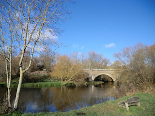
Railway bridge across the River Medway
Dec-14 • Sean O'Neill
swcwalk235, swcwalks, walkicon 6094507960709396658 P
Penshurst Place
Tonbridge to Penshurst walk
Mar-16 • Saturdaywalker on Flickr
walkicon swcwalks swcwalk235 25313896934

Leicester Square, Penshurst
Tonbridge to Penshurst walk
Mar-16 • Saturdaywalker on Flickr
walkicon swcwalks swcwalk235 25825827482
| Length |
Main Walk: 18 km† (11.2 miles). Four hours 10 minutes walking time. For the whole excursion including trains, sights and meals, allow at least 8½ hours. Circular Walk, returning to Tonbridge: 18¼ km (11.3 miles). Four hours 5 minutes walking time. Alternative Walk, starting from Hildenborough: 18 km† (11.2 miles). Four hours 15 minutes walking time. Alternative Walk, finishing in Tonbridge: 18¼ km (11.3 miles). Four hours 10 minutes walking time. † Subtract 2¾ km (1.7 miles; 40 minutes) with shorter afternoon. See Walk Options below. |
|---|---|
| OS Map |
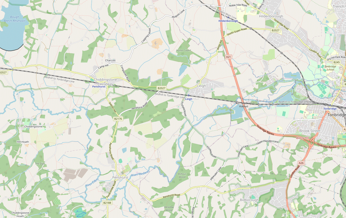
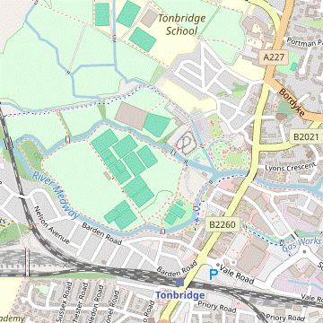
Explorer 147. Tonbridge, map reference TQ587460, is in Kent, 10 km SE of Sevenoaks. |
| Toughness |
3 out of 10. |
| Features |
This walk provides a link from a major town with a frequent rail service to the rolling countryside around the villages of Penshurst and Chiddingstone. You are soon out of Tonbridge town centre and heading for Haysden Country Park, a popular recreational area of lakes and water meadows alongside the River Medway. The area's industrial past can be glimpsed in the many abandoned waterways and reclaimed gravel pits, while the modern Leigh Flood Relief Barrier is a reminder that this low-lying area is prone to flooding. The remainder of the morning section follows the Eden Valley Walk, reversing part of the Hever to Leigh walk (1–19) to a choice of lunch places in Penshurst. This attractive village is dominated by Penshurst Place, a well-preserved medieval manor house with an attractive formal garden, the home of the Sidney family since the 16thC. It is open weekends from mid-February to March, and daily from April to October; admission is £15, or £13 for the gardens only (2024). The afternoon section closely follows the route of the Leigh and Penshurst walk (#92), climbing the low hills between the Medway and Eden rivers to Chiddingstone. In this equally picturesque village Chiddingstone Castle is a castellated manor house rebuilt in the 19thC, containing an unusual collection of art and curiosities left behind by its late owner, Denys Eyre Bower. It is currently open Sun–Wed from April to October; admission is £11 (2024). The grounds are normally open daily (free entry but donations welcome). A short final section takes you back over the River Eden and across low-lying farmland to a station which calls itself Penshurst but is 3 km away from that village. This walk will not be feasible when the Leigh Flood Relief Barrier is raised, and parts of it can be muddy even after moderate amounts of rain. See also the note in Walk Options below. |
| Additional Notes |
This walk originally included a Short Circular Walk option from Penshurst station, but this was dropped when some more satisfying routes around Bough Beech Reservoir to the north of the railway line were devised for the Penshurst Circular walk (#300). When this walk was being planned the lengthy closure of a footbridge across the A21 scuppered plans to include a circular route back to Tonbridge. When a new bridge was eventually installed this option was added in 2020, together with an alternative start from Hildenborough (see below). To prevent the directions from becoming too bloated an optional extension to Edenbridge was dropped. |
| Walk Options |
You can save nearly 3 km by staying on the Eden Valley Walk between Penshurst and Chiddingstone, following the route of the Cowden to Hever walk (#78). For variety this shorter afternoon variation includes a different final section to Penshurst station (which you could switch to from the Main Walk). As mentioned above, two new options have been added. The first is a Circular Walk back to Tonbridge, initially on a familiar path through Penshurst Park which reverses the start of the Leigh to Tunbridge Wells walk (1–15) and continues with a new route back to the town via the playing fields of Tonbridge School. A shorter variation is also possible by cutting out the loop into Penshurst village, although this misses out some attractive features (and the main lunch place). The second addition starts from Hildenborough station, the stop before Tonbridge. There are no useful footpaths nearby so you have to endure 1 km of roadside walking before this Alternative Walk becomes more rural. It reverses the start of the Leigh to Sevenoaks walk (1–21) and goes on to join the outward route from Tonbridge by the River Medway. All the afternoon routes (to Penshurst and Tonbridge) can be combined with this start. Both of the new options go through Leigh village, so you could use its station (the stop between Penshurst and Tonbridge) to start later on the Alternative Walk or to curtail the Circular Walk. There are major works taking place on the Leigh Flood Relief Barrier in 2022-24, but the route through Haysden Country Park should remain open. |
| Transport |
There are four or five fast trains an hour from Charing Cross to Tonbridge, taking 40-45 minutes. Not all these trains stop at Hildenborough; its off-peak service is half-hourly (hourly on Sundays). From London an “Any Permitted” return to Penshurst is valid for all the walk options; a return to Tonbridge is slightly cheaper if you will be finishing there. Penshurst station is on a sleepy branch line with an hourly off-peak service back to Tonbridge. Alternatively, you can take a train in the other direction and change at Redhill for Victoria or London Bridge; an “Any Permitted” Penshurst ticket is valid on both routes. There is a frequent service back from Tonbridge for the walk options finishing there. If you want to finish the walk in Penshurst village, Metrobus 231 & 233 go via Penshurst station to Edenbridge in one direction and Tunbridge Wells in the other (Mon–Sat). If driving, the large station car park in Tonbridge costs around £8 Mon–Fri, £6 Sat, £3.50 Sun & BH (2024). On the Main Walk you could park in the lane leading to the south side of Penshurst station and take a train to Tonbridge for the start. |
| Suggested Train |
Take the train nearest to 10:00 from Charing Cross to Tonbridge or Hildenborough. |
| Train Times |
|
| Timetables |
|
| River Levels |
|
| Lunch |
The suggested lunch place (after 8¼ km) is the refurbished Leicester Arms Hotel (01892-356141) in Penshurst. This up-market establishment has a large garden and serves good food until around 3pm (later on Sun & BH). On the way into the village the Porcupine Pantry (01892-871277) is just outside the main entrance to Penshurst Place and open daily to non-visitors; it serves light lunches but might struggle to cope with a large group. There is also a tearoom in the village, but the Fir Tree House (01892-870382) does not open until 2.30pm. A later lunch option on the Main Walk might be the Rock Inn (01892-870296) in Hoath Corner, which has some outside seating at the front and a small back garden. As with any small pub in a rural location, call beforehand to check that it will be open (and serving food). There are more options in Chiddingstone (see below). For the walk options ending in Tonbridge a later lunch option (Thu–Sun only) might be the Fleur De Lis (01732-832283) in Leigh. This pub / restaurant is in fact the only possibility if you take the short cut mentioned in §E, bypassing Penshurst village. |
| Tea |
For the walk options finishing at Penshurst station, the nearby Little Brown Jug (01892-870318) is usually open all day and serves tea and coffee as well as normal pub fare. If you want to break for refreshment in mid-afternoon the suggested tea place is the Tulip Tree (01892-870326) in Chiddingstone. Tucked away in a converted coach house behind the Chiddingstone Stores, this popular tearoom is open daily to 5pm. When Chiddingstone Castle is open its equally good Tea Room (01892-870347) is open to non-visitors. Stronger fare is available at the Castle Inn (01892-870371; closed Mon), which has a particularly attractive back garden. For the walk options ending in Tonbridge the Fleur De Lis in Leigh is a possible mid-afternoon stop if open (see above). There are of course plenty of cafés, coffee shops and pubs in Tonbridge itself. The walk route passes Sixty Five MM Coffee (07878-897871) in River Walk and Nancy's Tea Rooms (01732-300401; open to 5pm Mon–Sat, closed Sun) in Lamberts Yard; then on the High Street a Caffè Nero (01732-351356; open to 6.30pm Mon–Sat, 6pm Sun) and – the suggested tea place, serving good home-made cakes – the Finch House Café & Bakery (01732-771775; open to 5pm Mon–Sat, 4pm Sun) at the front of the Pavilion Shopping Centre. |
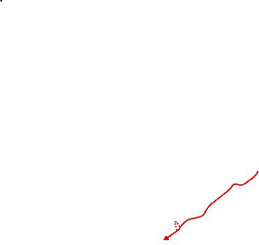
| Profile | |
|---|---|
| Help Us! |
After the walk, please leave a comment, it really helps. Thanks! You can also upload photos to the SWC Group on Flickr (upload your photos) and videos to Youtube. This walk's tags are: |
| By Train |
Out (not a train station) Back (not a train station) |
| By Car |
Start TN9 1TT Map Directions Return to the start: Finish TN11 8JE Map Directions Travel to the start: |
| Amazon | |
| Help |
National Rail: 03457 48 49 50 • Traveline (bus times): 0871 200 22 33 (12p/min) • TFL (London) : 0343 222 1234 |
| Version |
Jul-24 Sean |
| Copyright | © Saturday Walkers Club. All Rights Reserved. No commercial use. No copying. No derivatives. Free with attribution for one time non-commercial use only. www.walkingclub.org.uk/site/license.shtml |


Walk Directions
Click the heading below to show/hide the walk route for the selected option(s).


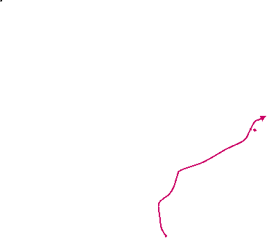
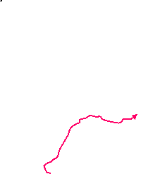


 Walk Map
©
Walk Options ( Main | Alt. || »Pens. | »Ton. )
Click on any option to show only the sections making up that route, or the heading above to show all sections.
- Main Walk (18 km)
Walk Directions
Click on any section heading to switch between detailed directions and an outline, or the heading above to switch all sections.
If you doing the Alternative Walk (from Hildenborough), start at §C.
- Tonbridge Station to Haysden Country Park (2 km)
-
 From the station head north towards the start of the High Street, then cut through the streets on the left to the River Medway. Cross the river into the Racecourse Sportsground and take any route across it to the far side. Cross the other branch of the river on a footbridge and turn left, joining the Eden Valley Walk (EVW) and Cycle Route 12. After going under the railway turn left into Haysden Country Park.
-
Arriving from London at Tonbridge? station, go up the steps near the front of the platform to emerge on a busy main road. Turn left onto Quarry Hill Road, go down the slope and past a roundabout into the start of the High Street.
- Almost immediately turn left into Avebury Avenue, then take the first right into River Lawn Road. Towards the end of this short street, bear left onto a tarmac path cutting across a patch of grass towards the River Medway.
- Cross a footbridge over a water channel (Gas Works Stream) at Buley's Weir and go alongside the river for a short distance. Opposite the entrance to Tonbridge Memorial Garden? cross the river on a footbridge into the Racecourse Sportsground?.
- Take the path directly away from the river. In front of the sports pitches veer right, signposted to the Castle and Swimming Pool. In 100m do not cross the bridge ahead but turn left onto a tree-lined path around the edge of the sports ground, alongside another branch of the river.
-
After 600m the path goes up a short incline where you turn right to cross the river on a footbridge. On the far side of some more sports pitches turn left onto the Eden Valley Walk? (EVW), which you will be following intermittently to Penshurst (and beyond on the shorter afternoon route).
Much of this route is also shared with the Tonbridge to Penshurst Cycle Route (CR 12). The pedestrian and cycle routes stay close together and occasionally merge; where they split again, ignore the CR 12 signs and stick to the footpath.
-
After passing the sports pitches follow the path under a low railway bridge carrying the South Eastern main line. A further short stretch of tarmac leads onto a broad woodland path alongside a water channel, the outflow from the Powder Mills? site. In 200m you come to a path junction and turn left, crossing a couple of footbridges into Haysden Country Park?.
- Haysden Country Park to Ensfield Bridge (3½ km)
- Cross the river on Lucifer Bridge and go along the side of Barden Lake. Continue on paths close to the main branch of the river, going through Heusenstamm Wood and over an embankment by the Leigh Flood Relief Barrier. Go under the A21 Medway Viaduct and a railway bridge to continue on a strip of land between the river and Haysden Water. Go across the James Christie Bridge and turn right onto the Straight Mile. Follow CR 12 to Ensfield Bridge.
- Follow the footpath for 150m, passing a well-camouflaged WW Ⅱ pillbox in the undergrowth. Where the two paths merge again cross the river on Lucifer Bridge (with steel lattice sides), leaving the EVW. Do not cross a second footbridge over a backwater but immediately turn right between metal barriers onto a narrow woodland path, leaving CR 12.
- The path winds its way through the trees for 100m, then veers left down a short flight of steps to the perimeter path around Barden Lake. Unless you want to take the long way round the lake (adding 500m or so) turn right onto the path. At the far end of the lake keep right on a path into the trees, which soon crosses a backwater on Sharpe's Bridge. The path continues alongside a straight stretch of the river, the New Cut?.
- In 150m you pass the ruined Stone Lock? and its bridge to continue on a long straight grassy path through a meadow. In 300m ignore Friendship Bridge across the river, but where the main path turns left shortly afterwards, keep ahead through a squeeze gate into Heusenstamm Wood?.
-
Inside the wood fork left where the path splits by a wooden sculpture. At the far end of the wood go over a stile and follow a stony track between protective fencing up a grassy embankment. At the top there is a water meadow ahead and the Leigh Flood Relief Barrier? is off to the right.
It goes without saying that if the barrier has been raised and the meadow is flooded the rest of the walk will not be feasible.
- Go all the way along the raised bank on the left-hand side of the water meadow, passing under the A21 Medway Viaduct. In the corner veer left to go under the railway bridge carrying the Redhill–Tonbridge line?. Fork right at a couple of path junctions to continue on a potentially muddy path between the river and Haysden Water.
-
You are now back on the EVW and heading SW. As you approach a projecting piece of woodland over the lake, ignore a path for anglers off to the right.
- Just after this fork an inconspicuous path through the trees on the left leads to a viewpoint across Haysden Water. If you take this detour it loops back to rejoin the main path by the footbridge a little further ahead.
- The main path swings left and goes alongside a wooden fence. Cross a water channel on the James Christie Bridge and follow the path round to the right, soon coming to a path junction at the boundary of the Country Park where CR 12 rejoins from the left. Go straight ahead onto a broad tree-lined path between two abandoned waterways, the western part of the Straight Mile?.
-
In 500m keep ahead at a path crossing. In 200m you pass a couple of places where the waterways would have linked up with the river, with the path swinging left to cross the second one. After a short climb a footpath joins from a gate on the left.
After crossing over the Walk 1–19 route along the Straight Mile, you will now be following it (in reverse) into Penshurst village.
- Follow the path for a further 400m to reach a minor road. Turn right onto the road to cross the river on Ensfield Bridge.
- Hildenborough Station to Leigh (3¾ km)
- Head north on Rings Hill and turn left into Philpots Lane. After crossing the A21 and the railway line turn left onto a footpath heading south-west and then south across fields. Continue through Home Covert and alongside the parkland of Hall Place into Leigh village.
-
Arriving from London on Platform 2, cross the footbridge to leave by the ticket office on the far side. Turn right, go up the station approach road and turn right onto the pavement alongside a road (Rings Hill). This soon crosses over the railway and in a further 250m you turn left into Philpots Lane.
You will be following the Walk 1–21 route (in reverse) into Leigh village.
- You have to go along this minor road with no pavement for 700m, but it is fairly wide and does not usually have much traffic. You soon cross over the A21 and later cross back over the railway.
- 100m after the railway bridge turn left onto a signposted footpath, going over a stile in the hedge into the corner of a field. Follow a grassy path diagonally across it to the opposite corner. Go over another stile and continue along the broad right-hand margin of a large field. In 100m ignore a gap into another field and carry on with a hedge on your right.
- At the far end go over a stile in the hedge ahead and across a plank bridge onto a lane (Lower Street). Cross the lane and go through an old gate to the right of a double metal fieldgate onto the continuation of the footpath. Go past the side of a house and keep ahead along the right-hand side of a field.
- In the next corner go through a squeeze gate, across a stream on a concrete bridge and along the right-hand edge of another field. In 100m bear right through a squeeze gate into a wood. Follow a clear woodland path for 400m, going across a farm track and later curving round to the left. On the far side the path merges with another footpath from the right and you go across a patch of scrubland to a track, with a house off to the right.
- Turn left onto the track as indicated. In 100m ignore a “Private” path on the right, but in a further 75m turn right at a waymarker post, entering the Hall Place estate. Follow the path through a belt of trees in Home Covert and keep ahead across a field. After another short path through some trees you cross a stream on a wooden footbridge and emerge into a large open space.
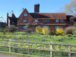
- Bear left and go through a squeeze gate to continue along the right-hand side of some farm fields, with parkland behind a wire fence on your right (about half-way along you might be able to glimpse Hall Place? itself, but the building is mostly screened by trees). The footpath eventually goes alongside a house and comes out past East Lodge?.
- Go across the driveway and bear right through a lychgate onto a path past the south side of St Mary's church? (which is worth a visit). At the far end go through another gate and down a tarmac drive to the B2027, coming out opposite the north-western corner of the village green.
- Leigh to Ensfield Bridge (1¾ km)
- Cross the village green to its southern side and go all the way up Green View Avenue. Continue on a footpath going under the railway, across fields and over the River Medway. Go across the Straight Mile to join the Eden Valley Walk (EVW) and follow it to Ensfield Bridge.
- Make your way across the green to the middle of the south side, aiming for the right-hand side of the cricket pavilion. Go all the way up Green View Avenue and bear left at the top onto a track which goes down a slope and under a railway bridge carrying the Redhill–Tonbridge line?. Follow the track over an embankment and down the other side.
- Go through a kissing gate on the left of the track and continue in the same direction along the right-hand edge of a field. Go through a wide gap in the hedge and follow a grassy path across a meadow. On the far side cross the River Medway on a substantial footbridge and follow the path as it swings left and right, crosses a backwater and comes to a major path crossing.
- Go straight ahead onto a short path through a belt of trees, joining the Eden Valley Walk? (EVW). At the end go through a metal gate and turn half-right to cut across the corner of a field. Go through another gate and continue near the right-hand edge of a large field.
- In 250m go through a side gate next to a metal fieldgate and bear left onto a fenced path, now also on Cycle Route 12 (CR 12). Follow the path for 400m to reach a minor road. Turn right onto the road to go back across the river on Ensfield Bridge.
- Ensfield Bridge to Penshurst (2¾ km)
-
Cross the river and follow the EVW towards Penshurst, initially heading south-west along the riverbank. Go up a slope to rejoin CR 12 at Killick's Bank, going along a farm track to Penshurst Park. For the main route continue along the EVW, skirting Well Place Farm and going alongside the grounds of Penshurst Place into the village.
- If you are doing the alternative afternoon (to Tonbridge) you could skip the loop around Penshurst Park by turning right onto a footpath along its eastern boundary, rejoining the walk route in §L.
- After crossing the river immediately turn left onto the riverbank, temporarily leaving CR 12. In 500m bear right in front of a fence, as directed. Head towards the trees and cross a backwater on a wooden bridge, coming out into the bottom of a field. Follow a faint grassy path up to its top left-hand corner, in front of a house at Killick's Bank.
-
Go out through a metal gate, turn right and then immediately left at a T-junction with a concrete lane, rejoining CR 12. Follow the lane for 600m, heading SW. Where the lane (and cycle route) turns left towards Well Place Farm, keep ahead on a track. In 100m go through a gate into the top of a field, with a view of Penshurst Place 1 km ahead.
If you are doing the alternative afternoon (to Tonbridge) and do not mind missing the lunch places in Penshurst village, you could omit the loop through Penshurst Park. If you want to take this short cut (saving 2½ km), follow the directions below.
-
Short Cut, bypassing Penshurst
- After going through the gate turn right onto a grassy path going along the right-hand edge of several large fields (interrupted by a short stretch through a wood) for almost 1 km. At the end of the last field bear right onto a broad tree-lined avenue and resume the directions at [?] in §L.
-
For the full walk follow a broad grassy path sloping downhill and go through a small metal gate in the bottom left-hand corner. Continue along a field edge for 100m, then back onto CR 12 through another gate on the left. Turn right onto the lane, soon passing some fishing lakes on the right. In 400m you pass the large car park for Penshurst Place on the right.
- The Porcupine Pantry (a possible lunch stop) is at the back of this car park. If you detour there for refreshment, return to this lane afterwards.
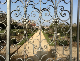
- From the end of the car park to the main road there is a high brick wall on your right, in the middle of which a locked gate affords you a glimpse of the formal gardens. At the end of the driveway go out through a stone and brick archway and keep ahead on the B2176, soon coming to the Leicester Arms Hotel (the suggested lunch stop) on the left-hand side of the road.
- Penshurst to Salmans Manor (1¾ km)
- Head south-west out of the village on the B2188. At the school, turn right into a lane and follow this to the Warren. Keep ahead along a footpath which crosses the River Eden and continues to Salmans Manor.
- For the longer afternoon route to Chiddingstone, turn left out of the pub and keep left at the road junction in the centre of the village, leaving the EVW. Go along the B2188 for 200m, passing some attractive old buildings (note the horseshoe-shaped doorway? in the garage). Immediately after passing the primary school, turn right into a lane (The Warren).
- Stay on this lane for 600m, eventually passing a row of cottages. Where the lane ends, keep ahead down the right-hand edge of a large field. In the bottom corner go through a metal gate and veer right across the grass to a footbridge over the River Eden?. Cross this and continue on an enclosed path.
- In 200m go through a metal kissing gate and turn right along a narrow fenced path. This takes you around two edges of a large field, with two more kissing gates along the way. After the second of these, do not continue on the broad grassy track ahead (with a tall hedge on its left), but turn right to head NW on another wide track.
-
The track soon comes to a tarmac lane by the buildings of Salmans Manor. Turn left briefly onto the lane, but instead of following it round to the right keep ahead through a wooden side gate to the right of a fieldgate to continue on a tree-lined track.
- A short detour up the lane would give you a fine view of a large mill pond opposite a particularly attractive oast-house conversion.
- Salmans Manor to Hoath Corner (2 km)
- Leave Salmans Manor on a footpath heading west, climbing gradually through fields, woods and the edge of Harden Vineyard. Soon after the path joins a track by Oakenden Farm, turn right and take the path through Puckden Wood to Hoath Corner.
- Go along the track for 100m, with glimpses of the mill pond on your right. Just before a metal fieldgate leading into a large field, turn left through a kissing gate and climb a short flight of steps. This leads through another kissing gate into the field where you continue up its left-hand edge.
- In 150m turn left through a wooden kissing gate into a small enclosure, leaving it by a metal kissing gate in the opposite corner. Bear right and go across a small fenced-in field to another gate. Go through this and continue along the field edge, passing Harden Vineyard? on your left. At the end of the vineyard go through some trees to a path T-junction. Turn right and follow the path round to the left.
- In 100m you come to the edge of the wood and go over a stile into a more open area. Follow the enclosed tree-lined path gently uphill between two large fields. At the top continue through a belt of trees to join a driveway by the entrance to “Skipreed”.
- About 100m along this drive, opposite a house “Oakenden”, turn right up a few steps in the earth bank and go over a stile with two footpath waymarkers. Ignore a gate into a field and take the fenced-in path ahead. At the far end go over another stile with two waymarkers and turn right to go through a small metal gate in the wire fence. Continue along the right-hand side of a triangular strip of grassland between fences.
-
In the far right-hand corner follow the path down through Puckden Wood. At the bottom the path curves right and then veers left up a slope to leave the wood. Climb a broad grassy path between fences and continue along a short driveway to a road junction in the hamlet of Hoath Corner.
- If you want to break for refreshment the Rock Inn is just off to the right.
- Hoath Corner to Chiddingstone (3¼ km)
- Take the lane heading west for a short distance and turn right onto a footpath which goes via Trugger's Gill to Stock Wood. Turn right at a path junction and follow this footpath through woods and fields to Hill Hoath. Take the lane heading north to the entrance to Chiddingstone Castle. If they are open the suggested route is to cut through the castle grounds to the village, rather than skirting around them on the road.
- Take the narrow lane heading W from the road junction, signposted to Markbeech. In 150m turn right at an easily-missed footpath sign to go down a fenced path between gardens. After crossing a stream the path continues along the right-hand edge of some rough grassland, heading NW.
- Just before the far corner follow the path into the trees and down through a small wooded glen, then back up into the corner of a large field. Keep right, initially alongside a projecting piece of woodland. Where these trees end, bear slightly right across the field to find a path leading into a large wood on the far side.
- The woodland path comes to a T-junction with footpath markers. Turn right onto a potentially very muddy wide path, which soon bends left. After passing a sign welcoming walkers from the other direction to Stock Wood the path narrows and continues between hedges, with a field laid out for show-jumping on your left.
- At the end go through a metal kissing gate and follow a well-trodden path through a long strip of grassland. At the far end go through another kissing gate, down a short slope and turn right onto an earth track. This leads into a short lane through the hamlet of Hill Hoath, where you pass an attractive low-lying house Withers? on the left.
- At a three-way road junction keep left to head N on a quiet country lane. In 300m you pass a corner of the grounds of Chiddingstone Castle on your right (with a locked gate), then in a further 400m come to its main driveway. An estate notice at the entrance confirms that access is permitted through the grounds; they include an attractive fishing lake and some pleasant woodland paths beyond the lawns around the manor house.
-
Road route
- Continue along the lane to a crossroads and turn right. In 250m this road bends right and crosses a stone bridge, with a view of the manor house beyond the lake. In 150m the road turns sharply left by a pedestrian entrance to the castle (the exit for the alternative route).
-
Castle Grounds route
- Turn sharp right off the lane to go up the driveway, which curves gently round to the left in front of the manor house.
- To go directly to its Tea Room without visiting the house and its collections, go past the main entrance and all the way round the back of the house to find the gift shop and tearoom in the far corner.
- After exploring the grounds, return to the front of the house and turn right. Follow the path across an arm of the lake on a footbridge and out through a gate in the castle walls, emerging on a bend in the road.
- There are two more refreshment places along the picturesque village street through Chiddingstone?. The Castle Inn is the first building on the right, and opposite St Mary's church? the Tulip Tree tearoom is up a passageway beside the Chiddingstone Stores.
- Chiddingstone to Penshurst Station (2¾ • 3 km)
-
For the main route head east along the road to Larkin's Farm and continue along a footpath across the brow of Hampkins Hill. Turn left in front of Vexour and go downhill to rejoin the road, crossing the River Eden at Vexour Bridge. Take the right-hand of two footpaths, heading north-east across meadows and fields to the station.
- Alternatively, you could switch to the Beckett's Farm route in §K by turning left outside the village onto a footpath heading north to a footbridge over the River Eden.
-
To complete the walk follow the street out of the village, heading E.
- After passing the primary school you could turn right onto a signposted path to see the Chiding Stone?, 200m away. If you take this detour, return the same way.
- Just after the path to the Chiding Stone ignore a public footpath on the right (the direct route from Penshurst village). In a further 25m there is another footpath on the left.
-
Alternative route, via Beckett's Farm (+¼ km)
- Turn left off the lane onto this footpath, the driveway to a house “Coachmans”. At the end of the drive bear right as indicated in front of a wooden fieldgate onto a fenced path skirting around the house. On the far side follow the path gently downhill alongside a wood. Keep ahead where another footpath joins from the left and follow the path up to the River Eden. Cross the river on a new wooden footbridge and resume the directions at [?] in §K.
- For the main route stay on the lane, climbing gently and with good views of the Greensand Hills on your left. In 400m fork right in front of Triangle Oast (with Larkin's Brewery? in the farm buildings on your left). Almost immediately turn left at a footpath signpost onto a clear path across the brow of Hampkins Hill.
- At the far end of the field turn left along its edge. In the corner veer right down a narrow path through a belt of trees and turn left onto a tarmac driveway. At the bottom rejoin the lane you left at Triangle Oast, crossing over the River Eden on the attractive Vexour Bridge. On the other side bear right off the lane by a pair of footpath signposts, going over a stile to the left of a metal fieldgate.
- Take the right-hand of two faint grassy paths to head NE across a large meadow. After skirting a projecting group of trees surrounding a loop of the river fork left where the path splits, avoiding the more obvious route towards a fieldgate.
-
In the tree boundary at the end of the left-hand path you cross a stream on a new wooden footbridge flanked by metal gates. Bear left across a field, heading NNE. In 125m go through a small metal gate in a gap in the trees and keep ahead across the next field.
In the past this field has been divided, so there might be a temporary wire fence on your left.
- In 200m go through a gap and continue along the left-hand edge of another field. At the far end go over a stile into a large field and turn right to head E along its edge.
- In the field corner go over a stile beside a metal fieldgate. In 50m go through another gate and turn left along the field edge. About 100m before reaching the railway embankment ahead, turn right by a footpath waymarker to go straight across the field. On the far side go through a gap to continue on a rough track along the left-hand edge of a field.
- In the corner go out through a metal side gate and across the parking area for a timber yard onto Platform 1 of Penshurst station?, for trains to Redhill. Cross the footbridge to Platform 2 for trains to Tonbridge and/or refreshment at the Little Brown Jug, directly opposite the station on the B2027.
- Penshurst to Chiddingstone direct (4 km)
- Head north out of the village on the B2176, then turn left onto the old coach road. Follow the EVW past Wat Stock, across Wellers Town Road and through a wood, then fork right onto a footpath heading north. Go over a small hill and turn left onto Chiddingstone's village street.
- For the shorter afternoon route to Chiddingstone, turn left out of the pub and then fork right at the road junction in the centre of the village to stay on the B2176. You soon pass the Fir Tree House tearoom on your left (usually closed at lunchtime). In a further 200m turn left into the lane to Salmans Farm, signposted as a public bridleway.
- In 500m this old coach road crosses the River Eden? and you fork right up a track, with increasingly fine views over the Eden Valley on your right and later with a huge array of polytunnels in the fields on your left. Follow the main track for 1½ km to the derelict farm buildings at Wat Stock and keep ahead where a lane joins from the left.
- Follow the lane past a pond and round to the right. 150m after this bend bear right onto a track and go through a gate to the right of a metal fieldgate. Go diagonally across a field on a grassy path and leave it through another gate to emerge on a minor road.
- Cross the road (slightly to the right) and go through a metal gate onto a broad woodland path. In 400m leave the wood through a gate and continue on a grassy tree-lined path. In 50m leave the EVW by forking right onto a narrow path near the edge of the wood.
- In 200m go through a wooden kissing gate into a large farm field. Ignore the path ahead across the field and veer left onto a broad path going uphill, slightly away from the field edge.
-
The path goes past an isolated tree and leads to a projecting corner of the field. Go through a gap and continue down a tree-lined path. At the bottom turn left onto the main street through Chiddingstone?.
- In 30m you could turn left …
-
There are a couple of refreshment places along the picturesque village street. Opposite St Mary's church? the Tulip Tree tearoom is up a passageway beside the Chiddingstone Stores. The Castle Inn is the last building on the left before the road turns sharply to the right by a pedestrian entrance to Chiddingstone Castle.
- On the path to the manor house there is a “Welcome to Chiddingstone Castle” information panel with a map of the grounds, so if they are open you could explore them and perhaps visit the Tea Room (at the back of the house). If you do this, return to this point to resume the walk.
- Chiddingstone to Penshurst Station via Beckett's Farm (3 km)
- Head north out of the village and take a footpath on the right across fields to a footbridge over the River Eden. Fork right off the main path onto a footpath leading to a house (Fissenden). Go out along its driveway and turn left briefly onto Hampkin's Hill Road, then turn right onto a footpath heading east across fields to Beckett's Farm. Continue on field paths heading east and then north-east to Penshurst station.
- Follow the lane out of the village, passing the church tower up on your right and heading N. Immediately after crossing a stone bridge at the end of the lake in the castle grounds go through an old metal gate on the right onto a signposted footpath.
- Go along the right-hand side of some small fields, then through a belt of trees into a larger field. Bear left and make your way around its edge to a footpath T-junction in the far corner. Turn left and follow the path up to and across the River Eden on a new wooden footbridge.
- Shortly after crossing the river go through a small metal gate on the right into the corner of a field. Turn left to continue in your previous direction along its edge, veering slightly away from it at the end to go through a gap into the bottom of a sloping field. Make your way over to its right-hand edge and go up to the top corner.
- After going through a gap in the trees make a similar manoeuvre in the next field to continue along its right-hand edge, heading N. In the corner go through a side gate and bear right across a field which slopes downhill, aiming just to the right of an attractive tile-hung house “Fissenden” which comes into view.
- Go over a stile onto the house's driveway and follow it out to a lane (Hampkin's Hill Road). Turn left and go along the lane for 60m, then go over a stile on the right onto a strip of grassland between a hedge and a meandering stream, signposted as a footpath.
- At the end of the hedge bear left towards the field corner. Go through a wide gap in this potentially muddy area and veer right up a slope to continue along the right-hand edge of a field, towards the buildings of Beckett's Farm. Go over a stile in the field corner onto a track towards the farm buildings.
- Veer left briefly onto the driveway leading away from the farm, then immediately go over a stile on the right into a large field. After passing the farmhouse turn half-right to go across a patch of rough ground (with no clear path) towards a narrow gap in a hedge 100m away. In the gap cross a ditch on a plank bridge and continue along the right-hand edge of a large field, heading E.
- …
- …
- Penshurst to Leigh (4 km)
- Briefly head east along the B2176, then go through Leicester Square and the churchyard. Take the footpath heading north and then north-east through Penshurst Park. At the top of a slope fork right onto a long tree-lined avenue through the estate, eventually coming out onto a minor road. Turn left and follow it down past Leigh station into the village.
- From the centre of the village briefly head E on the B2176. Before the road turns right in front of the stone and brick archway for Penshurst Place, turn left into the picturesque Leicester Square?. Go under an archway into the churchyard and take the path round the left-hand side of St John the Baptist church? (which is worth visiting).
- Leave the churchyard through a metal kissing gate and take the right-hand of two grassy paths ahead, leaving the EVW. The path stays close to the hedge-topped stone wall guarding the manor house and then curves gently to the right. Cross the estate's driveway via two metal kissing gates and continue along a tree-lined avenue, in 75m merging with another grassy path from the left.
- Follow the path through the right-hand line of trees and across Penshurst Park, gradually moving away from the avenue. In 300m go through a kissing gate in a fence and turn half-right to continue across the parkland, later alongside a wooden fence with a line of clipped yew trees on the other side.
- After going through another gate the path turns left past the lifeless stump of the veteran Sidney Oak? (designated one of the country's “Great British Trees” in 2002) and one of its replacements. Follow the grassy path up a gentle slope, through a side gate beside a wooden fieldgate and then up a broad tree-lined avenue.
- At the top turn right at a three-way footpath signpost to go along another broad tree-lined avenue for 1 km, with the short cut from §E rejoining from a path on the right halfway along.
-
At the end of the long avenue carry on in the same direction across an open field, then down a rough track to a road. Turn left onto the road, taking care as there is no pavement. Follow it downhill for 250m to a railway bridge under the Redhill–Tonbridge line.
- If you want to end the walk here there are two tarmac paths leading up to the platforms of Leigh station (with no footbridge linking them). Platform 1 is for trains to Redhill; Platform 2 for trains to Tonbridge.
- For the full walk carry on along the road to a T-junction, with the Fleur De Lis pub on the corner. Turn right and go along the B2027 for 250m, passing a restored water pump, the Village Stores and some attractive almshouses. Continue onto the north-western corner of the village green (crossing over the Alternative Walk's outward route).
- Leigh to Tonbridge School (grounds) (4 km)
- Go along the High Street and across the village green to Powder Mill Lane. Turn left onto a short linking footpath, then turn right onto a footpath heading east. Follow it across the A21 to Leigh Road. Head east briefly along the road, then turn left onto a footpath heading north-east. After going under the railway fork right onto a footpath going past Hawden Farm to the grounds of Tonbridge School.
- Head E across the green, on the far side going alongside a minor road (Powder Mill Lane) which branches off the B2027 by the War Memorial. Continue along this road for 75m past the end of the green and then turn left onto a signposted footpath. Follow this narrow fenced path round to the right and out past a house onto a junction of driveways.
- Where the drive turns sharply left towards the main road go through a wooden gate on the right and take the right-hand of two paths through a copse, as indicated by a FOOTPATH> sign on a wooden post. At the end go through a metal kissing gate and continue along a fenced path, then through more gates and out into the corner of a large meadow.
- Carry on along the right-hand side of three meadows, going through gates between them, with a view of the Greensand Hills 6 km away to your left. At the end of the third field cross the A21 on a new footbridge. Go through another small wood and then along the left-hand edge of a large farm field.
- On the far side carry on through another copse, crossing a stream on a wooden footbridge and coming out into a small field. Follow a grassy path round to the right, which then veers left into a belt of trees. Go through these and up a slope to continue on an enclosed track, with a meadow behind a wooden fence festooned with some rather incongruous “No Parking” notices.
- At the far end the track passes the attractive Spring House? off to the right and comes out onto a narrow lane at a sharp bend. Bear right onto this lane, taking care as there is no pavement. After an awkward 150m the lane bends right and goes past Hawden Bungalow. Turn left off the road onto a short footpath between the bungalow and its small orchard. Go out through a gate and turn left onto a stony track.
- In 250m ignore a track forking off to the right. Follow the track past some some cottages and under a railway bridge carrying the South Eastern main line. Go through a metal kissing gate and continue alongside a wire fence for a further 150m, then fork right onto a broad grassy track across the middle of a field, parallel to the railway embankment.
- Carry on in this direction for 750m, going through gates as necessary and crossing the driveway to a cluster of buildings off to the right. Eventually you go across a wooden footbridge in a hedge and find yourself in the grounds of Tonbridge School?.
- The School Grounds to Tonbridge Station (2 km)
-
Go straight across the playing fields and continue along Hawden Road and Stafford Road to Tonbridge Castle. After crossing the River Medway on Big Bridge the suggested route loops away from the High Street on River Walk before returning via Lamberts Yard. Continue along the High Street to the station.
- The right of way is not waymarked but essentially you carry on in the same direction across the school playing fields. In 250m you join a tarmac drive at a bend and continue alongside it for 150m to a footpath signpost by a junction of driveways. Cross a ditch on a concrete footbridge and continue on an enclosed path to the end of a residential street.
-
Keep ahead along Hawden Road, which becomes Stafford Road after a junction. It then bends right and passes a primary school. At the next junction go straight across Slade Road and up a tarmac path onto a small green. After passing a car park keep ahead at a path junction to come to the imposing Gatehouse for Tonbridge Castle?.
- You could detour into the Castle Courtyard and perhaps take in the far-reaching views from the top of the tall Motte (mound). Afterwards, either retrace your steps through the Gatehouse or take the path down to the riverfront and turn left to reach the High Street.
-
The most direct continuation is to go past the Gatehouse and take a path curving down to the right outside the castle wall. This comes out onto the High Street in front of the town's Big Bridge.
A new information panel on the High Street denotes the meeting point of “Three of Kent's Finest Walks”: the central section of the Wealdway, the eastern end of the Eden Valley Walk and the western end of the Medway Valley Walk.
-
For the suggested route to the station (bypassing part of the congested High Street) cross the River Medway and turn right onto a broad pedestrian pathway (River Walk). You pass Sixty Five MM Coffee and the beer garden of The Humphrey Bean.
- At the end of River Walk keep ahead on a cycleway to the left of a modern apartment block (Waterside Lodge). At the far end the path veers right to pass between Tonbridge Memorial Garden? and the river. You briefly retrace a section of the main outward route, but immediately after crossing the water channel at Buley's Weir turn sharp left.
- Follow the path into a short side street (Lamberts Yard), passing Nancy's Tea Rooms on the left. At the end turn right onto the High Street, with some more refreshment places on the way to the station: there is a Caffè Nero on the right and the Finch House Café & Bakery across the road at the front of the Pavilion Shopping Centre.
-
To complete the walk make your way onto the right-hand side of the High Street and follow it up the slope beyond the roundabout. The station entrance is at the top; trains to London usually leave from Platform 2 (down the steps on the left).
- Tonbridge has always been pronounced Tunbridge and was often spelt that way. The 'o' spelling became standard in the late 19thC to help distinguish it from its spa neighbour Tunbridge Wells, which retained the 'u' spelling.
- Tonbridge Memorial Garden was created after World War Ⅱ “in grateful memory of the men of this town who died in the service of their King and Country”.
- Tonbridge Racecourse Sportsground was used for horse racing from 1851-74. This large meadow between two branches of the River Medway was acquired by the Urban District Council in 1923 for the benefit of local sports clubs and is now a public park.
- The Eden Valley Walk runs for 24 km, from Tonbridge to a remote spot on the Vanguard Way west of Edenbridge. The section to Penshurst (where the River Eden flows into the Medway) is essentially a continuation of the Medway Valley Walk.
- Gunpowder was manufactured at the Powder Mills site from 1813 until its closure in 1934, with the channels from the River Medway providing the water power for grinding and mixing the ingredients. The site has been redeveloped for housing but traces of its former existence have been preserved in place names.
- Haysden Country Park was opened in 1988 after sand and gravel extraction ceased, a process which had created Barden Lake and Haysden Water.
- The New Cut was a more successful attempt to straighten out the river, and is now the main channel. The original course of the river is on the other side of the railway line and is gradually reverting to marshland.
- Stone Lock is at the eastern end of the Straight Mile, where the original canal joined the River Medway. The huge blocks of stone were reputedly taken from Tonbridge Castle.
- The trees in Heusenstamm Wood were donated from Tonbridge's twin town in Germany after the 1987 storm. The wood is on the site of a large weir which controlled water levels before the construction of the Leigh Flood Barrier.
- The Leigh Flood Relief Barrier was completed in 1981. The embankment acts as a dam and a large area of water meadows can be flooded to hold back the water (although it did not have enough capacity to fully protect Tonbridge in the winter storms of 2013/14).
- The Redhill–Tonbridge line opened in 1842 as part of the main line between London and Dover, and retained that status until the direct line via Sevenoaks opened in 1868.
- The Straight Mile was dug in 1830, the first attempt to straighten out the meanders of the original river. The canal (now cut in two by Haysden Water) never filled with water and the project was abandoned.
- The present house at Hall Place was built in a Tudor style in the 1870s, replacing an older house. It is listed Grade Ⅱ.
- The ornate East Lodge with its entrance arch was built in the late 19thC to serve the new Hall Place. Like the main house, it is listed Grade Ⅱ.
- St Mary, Leigh dates from the 13thC, although there were earlier churches on this hilltop site. In the 19thC two parties were responsible for different parts of the building and each employed their own architect for its restoration, with the result that the chancel was reconstructed with a different type of stone from the rest of the church.
- The large horseshoe-shaped doorway in the shop / garage is a relic of its days as the village smithy.
- The source of the River Eden is in the Titsey Estate, on the slopes of the North Downs near Oxted. It is one of the main tributaries of the River Medway and flows into it near Penshurst.
- Harden Vineyard grows Regent grapes which are used to make a rosé wine.
- Withers is a 15thC timber-framed hall house, with the bricks on the ground floor being added in the 19thC. The side facing the lane is actually the rear of the house.
- Chiddingstone remains largely unspoilt because the Streatfeild family sold many of the buildings to the National Trust in 1939. It has been used as a location in period films such as A Room with a View.
- St Mary, Chiddingstone contains many memorials to the Streatfeild family. On display is a Vinegar Bible of 1717, so called because in St Luke's Gospel, Chapter 20, “The parable of the vineyard” is written as “The parable of the vinegar”!
- The Chiding Stone is a large sandstone boulder where wrongdoers were supposedly told off (chided) by the other villagers.
- Larkin's Brewery was established in 1986 and moved to the family's farm a few years later. Chiddingstone Cider is also produced here.
- The Penshurst Platform Gallery in the shelter on Platform 1 displays works by local artists associated with Jessops Farm Studios.
- Some of the half-timbered and tile-hung houses around Leicester Square (named after a favourite of Elizabeth Ⅰ) are Victorian imitations, like the post office house of 1850. “My Flesh also shall rest in Hope”, inscribed on the archway from the churchyard into the square, is from Psalm 16:9.
- The Sidney Chapel in St John the Baptist, Penshurst contains many memorials and a fine armorial ceiling, restored in 1966. By the side altar is the Luke Tapestry (in Greek), made by Penshurst's former village doctor: it honours the partnership between medical science and Christianity.
- The Sidney Oak was reputedly planted in 1554 at the birth of Sir Philip Sidney but was judged to be many hundreds of years older when it died in 2016. Cloned saplings have been planted around the Penshurst estate and its acorns distributed around the world.
- Spring House is a late 15thC house, with a new wing added in the early 17thC. The porch is a modern addition.
- Tonbridge School is a leading independent school for boys, founded in 1553. The main school buildings date from the second half of the 19thC, with more buildings and sports facilities added in recent years.
- Tonbridge Castle dates from the 13thC, with the imposing gatehouse being completed in 1260. An earlier motte and bailey castle was destroyed after a failed rebellion against William Ⅱ in 1088. The site is now owned by the local council and the grounds are a public park.
Continue the directions at §E.
You will be following the Walk 1–19 route (in reverse) into Penshurst village.
If you are doing the shorter afternoon on the Main Walk, go to §J.
If you are doing the alternative afternoon (to Tonbridge), go to §L.
On a day when the grounds are open to the public you can take the more interesting route in [?].
If you want to switch to an alternative route to Penshurst station, follow the linking directions below.
This section is the same as Walk #78 (with the short cut at the beginning).
The route in this section can be difficult to follow. It is all on rights of way but the footpaths across farm fields are unlikely to be marked out on the ground.
This section follows the route of Walk 1–15 (in reverse) to Leigh station.
Walk Notes
» Last updated: October 20, 2024
Return to Top | Walk Map | Walk Options | Walk Directions.