Wateringbury Circular walk
Medieval bridges and churches in an attractive part of the Medway Valley.

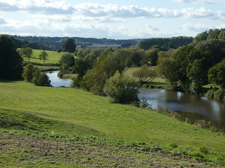
Riverside in the morning
Wateringbury Circular walk
Oct-19 • Saturdaywalker on Flickr
swcwalks swcwalk336 banner 48835847483

East Farleigh riverside
Wateringbury Circular walk
Oct-19 • Saturdaywalker on Flickr
swcwalks swcwalk336 walkicon 48836216096

Riverside in the afternoon
Wateringbury Circular walk
Oct-19 • Saturdaywalker on Flickr
swcwalks swcwalk336 walkicon 48836393057
The view from near Tutsham Hall
Wateringbury Circular walk
Oct-19 • Saturdaywalker on Flickr
swcwalks swcwalk336 walkicon 48836215786
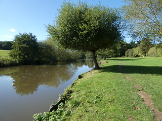
Riverside in the morning
Wateringbury Circular walk
Oct-19 • Saturdaywalker on Flickr
swcwalks swcwalk336 48836394052
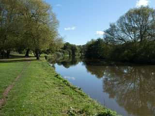
Riverside in the morning
Wateringbury Circular walk
Oct-19 • Saturdaywalker on Flickr
swcwalks swcwalk336 48835847208

Teston Bridge
Wateringbury Circular walk
Oct-19 • Saturdaywalker on Flickr
swcwalks swcwalk336 48836216746
| Length |
Main Walk, from Wateringbury: 14 km† (8.7 miles). Three hours 10 minutes walking time. For the whole excursion including trains, sights and meals, allow at least 8 hours. Main Walk, with longer morning: 15½ km† (9.6 miles). Three hours 30 minutes walking time. Main Walk, with Nettlestead ‘preamble’: 17¼ km† (10.7 miles). Three hours 55 minutes walking time. Longer Walk, from Maidstone West: 17½ km† (10.9 miles). Four hours walking time. Alternative Walk, from East Farleigh: 13½ km† (8.4 miles). Three hours walking time. Medway Valley Walk, from Maidstone West: 9¾ km† (6.1 miles). Two hours 5 minutes walking time. Extended Walk, combined Longer & Alt. walks: 25 km† (15.5 miles). Five hours 50 minutes walking time. † Add 2¾ km (1.7 miles; 35-40 minutes) if extending the walk to finish at Yalding station. |
|---|---|
| OS Map |
Explorer 148. Maidstone, map reference TQ756555, is the county town of Kent, 52 km ESE of London. |
| Toughness |
3 out of 10 (2 for the Alternative Walk, 1 for the Medway Valley Walk, 6 for the Extended Walk). |
| Features |
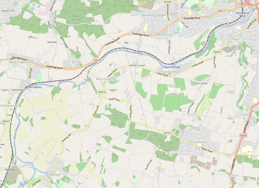
This walk takes as its starting point a 12 km stretch of the Medway Valley described by William Cobbett in 1823 as “the finest seven miles that I have ever seen in England…with hop gardens and orchards two miles deep”. Sadly there are no hop gardens and fewer orchards to be seen now, but much of it is still very rural in character. This document actually describes three overlapping walk routes, all intermingling sections alongside the river with short excursions into the low hills on either side. The one designated as the Main Walk is a circular (Figure-of-8) route from Wateringbury station. From other stations on the same branch line you could do a Longer Walk starting from Maidstone West or an Alternative Walk from East Farleigh. These variations were both added in 2022 and merge with the Main Walk along their route, so all three walks finish at Wateringbury. All the walk routes pass two historic bridges across the River Medway, at Teston (pronounced Teestun) and East Farleigh. Both are splendid examples of medieval design and craftmanship, with the latter claiming to be “the Finest Bridge in Southern England”. The walks also pass some ancient churches but unfortunately these are usually locked. There are several possible lunch pubs and an appropriately-named café towards the end, in the marina across the river from Wateringbury station. |
| Walk Options |
All the walk routes can be extended along the riverside path to the next station on the line, Yalding. There are several ways of mixing the walk options but the only one specifically listed is a longer morning variation for the Main Walk, which would let you visit the suggested lunch pub on the Longer Walk. A slightly artificial ‘preamble’ has also been retained from the original version of this walk: a short triangular route via Wateringbury Mill and Nettlestead before the start of the Main Walk. For an easy short walk you could simply follow the published Medway Valley Walk from Maidstone West. Conversely, this document has been arranged in such a way that those wanting a greater challenge could combine the Longer and Alternative Walks into a rather convoluted Extended Walk. |
| Transport |
Yalding, Wateringbury, East Farleigh and Maidstone West are adjacent stations on the Medway Valley branch line (Paddock Wood–Maidstone–Strood), with a half-hourly service (hourly on Sundays). The suggested route is to travel out via Paddock Wood, taking around 1 hour 10-20 minutes. On this route buy a return to your chosen starting station, which will be valid for returning from either Wateringbury or Yalding. In theory you could also travel out via Strood or Maidstone (walking to Maidstone Barracks if travelling from Victoria to Maidstone East). On these routes you would need to ask for a ticket to your chosen finishing station which was valid via Maidstone, as well as being routed "Plus High Speed" if connecting from those trains. There is a half-hourly bus service between Tonbridge and Maidstone along the A26, which is close to the Medway Valley Walk at Teston Bridge (the nearest stops are in the village, by the road junction with The Street). There are also some infrequent services (Mon–Sat) through the villages south of the Medway. If driving, there are small free car parks at both Wateringbury and Yalding stations, so you could park there and (if necessary) take a train to the start of your chosen walk. |
| Suggested Train |
Take the train nearest to 10:15 from Charing Cross to Wateringbury, changing at Paddock Wood (or the High Speed train via Strood if you prefer). If you want to extend the walk to Yalding in winter, an earlier train would be better. |
| Train Times |
|
| Timetables |
|
| River Levels |
|
| Lunch |
There are several traditional village pubs scattered about the area, so a choice of places for refreshment. At the highest point of the Main Walk in Farleigh Green (after 4½ km, or 7¾ km with the ‘preamble’) the Good Intent (01622-812426; food to 3pm Tue–Sat, 4pm Sun, not Mon) serves good-value pub food. The Longer Walk goes quite near this pub but its suggested lunch place (after 8½ km) is the more up-market “Country Pub & Dining” Horseshoes Inn (01622-741683) on Dean Street. There are two later options on these walk routes in East Farleigh: the Bull Inn (01622-583149) near the church at the top of the village (which has reopened after being closed throughout 2023); and The Victory (01622-298234) in the valley near the station. The Alternative Walk makes a different loop to the north of the river and its suggested lunch place (after 8¼ km) is a “traditional English freehouse pub and restaurant” on Red Hill, the North Pole (01622-812721). |
| Tea |
There are two refreshment places near Wateringbury station. The Ramblers Rest Café (01622-960288; open daily to at least 4pm winter, 5pm summer) in Medway Wharf Marina describes itself as a “quirky bistro café with alfresco seating”; for stronger fare The Railway pub (01622-812911) is on the B2015 opposite the station car park. If you want further refreshment on the longer finish to Yalding station you will probably have to make an additional 1½ km mini-extension to Twyford Bridge, where the Boathouse pub (01622-814359) and the “bistro-style café” on Teapot Island (01622-814541; open to 3pm Mon–Fri, 4pm Sat, Sun & BH) are on opposite sides of the river. |
| Profile | |
|---|---|
| Help Us! |
After the walk, please leave a comment, it really helps. Thanks! You can also upload photos to the SWC Group on Flickr (upload your photos) and videos to Youtube. This walk's tags are: |
| By Train |
Out (not a train station) Back (not a train station) |
| By Car |
Start ME18 5EA Map Directions |
| Amazon | |
| Help |
National Rail: 03457 48 49 50 • Traveline (bus times): 0871 200 22 33 (12p/min) • TFL (London) : 0343 222 1234 |
| Version |
Sep-24 Sean |
| Copyright | © Saturday Walkers Club. All Rights Reserved. No commercial use. No copying. No derivatives. Free with attribution for one time non-commercial use only. www.walkingclub.org.uk/site/license.shtml |


Walk Directions
Click the heading below to show/hide the walk route for the selected option(s).


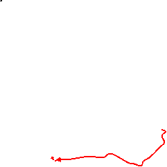
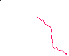
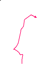
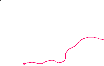


 Walk Map
©
Walk Options ( Main )
Click on any option to show only the sections making up that route, or the heading above to show all sections.
- Main Walk, from Wateringbury (14 • 16¾ km)
The two distances are for finishing at Wateringbury & Yalding respectively.
Walk Directions
Click on any section heading to switch between detailed directions and an outline, or the heading above to switch all sections.
If you are doing the Main Walk without the Nettlestead ‘preamble’, start at §A.
If you are doing the Longer Walk or a version of the Medway Valley Walk (from Maidstone West), start at §D.
If you are doing the Alternative Walk (from East Farleigh), start at §J.
- Wateringbury Station to Bow Bridge Marina via Nettlestead (3½ km)
- Go out through the station car park and turn right onto the B2015. In 350m turn left onto a byway heading west along the side of a small valley to Love Lane. Go up the lane to the mill pond and turn left onto a footpath heading south to the B2015 at Nettlestead. Take the path opposite through the churchyard and join a footpath going down across the railway to the river. Turn left onto the riverside path, briefly joining the Medway Valley Walk (MVW). Stay on the north bank at Bow Bridge.
- For the ‘preamble’, go out through the small station car park to the B2015. …
- …
- Keep ahead on the lane, which bends right and goes up a slope to an old mill pond. Veer left uphill, passing Brooms House? (with blue plaque) on the left. At the top of the slope the lane straightens out, heading S with views across fields on the left to the Medway valley.
- In 300m go through a couple of gates by the last group of houses onto a footpath which zig-zags right and left, then continues along the left-hand edge of some large farm fields for a further 300m. In the bottom corner of the last field go past metal vehicle barriers and bear right past a second set onto an enclosed path, with a housing estate behind garden fences on the left.
- Continue past Nettlestead's recreation ground and more houses to reach the B2015. Cross the road carefully and take the unmarked path directly opposite, which curves to the right and leads into the north-western corner of a churchyard. Go past the church tower and turn left to come to the west door of St Mary the Virgin?, which is worth visiting if open.
- Continue on the path heading away from the door, which turns left on the edge of the churchyard and leads to an exit in its south-eastern corner. Go down a few steps, through a stone archway and follow a potentially muddy path downhill, with glimpses of Nettlestead Place? and its gardens through the trees on the right.
- At the bottom cross the railway tracks and turn left onto the riverside path, joining the Medway Valley Walk? (MVW) and heading N. In 500m the path crosses a stream on a wooden footbridge and the final 300m is on a driveway between a caravan park and pleasure craft moored on the river.
- Go past a wooden fieldgate and take the left-hand of two driveways up a slope past the back of the (closed) Riverside Restaurant. At the top go straight across the minor road (leaving the MVW, which temporarily switches to the other bank) to continue on the tarmac lane opposite, going down a slope to Bow Bridge Marina.
- Bow Bridge Marina • Wateringbury Stn to Teston Bridge (2¼ • 2½ km)
-
- If starting the walk here, go out through the station car park and turn left onto Bow Hill. Go over the level crossing and immediately turn left onto the riverside path.
-
Starting from Wateringbury Station (+¼ km)
- Go out through the small station car park and veer left onto the minor road (Bow Hill) branching off the B2015 by The Railway pub. Go over the level crossing and immediately turn left onto the driveway leading down to Bow Bridge Marina.
- Squeeze past a fieldgate to the left of the small marina building and continue along the lane. Where it splits take the right fork to stay close to the pleasure craft moored along the River Medway. At the end of the lane go through a wooden fieldgate to continue along the riverbank.
- Where the path splits fork left as indicated to stay on the right of way; a short stretch of the riverbank here is private. After the two paths rejoin continue along the tree-lined riverside path. In 200m you go through a metal kissing gate and the next stretch is along the riverbank again. At the far end go through a wooden gate into Teston Bridge Country Park?.
- There is a map of the park on an information panel and there are several routes you could take through it. The simplest route is to stay close to the river on the waymarked public footpath, although you could take the slightly more direct mown path across the first meadow where the river curves gently round to the left. The two paths rejoin on the far side where you go through another wooden gate.
-
The riverside path continues past the Teston Canoe and Fish Pass and a plaque for the Maidstone Millennium River Park? at Teston Lock?, with the ivied ruins of Tutsham Oil Mill? on the opposite bank. As you approach the medieval Teston Bridge? veer left up a small slope into Bridge Meadow, with a fine view of Barham Court? ahead, 500m away.
- There are picnic tables in the meadow, and a refreshment kiosk and toilets in the car park.
- Leave the country park through a wooden gate and turn right onto the B2163. Cross the river carefully on the narrow road bridge, using the refuges when necessary to avoid the traffic. On the other side immediately veer left onto a permissive path in the belt of trees parallel to the road.
- Teston Bridge to Farleigh Green (2¼ km)
- At the end of the short woodland path go through a gate and continue on a path heading east across two fields to a third. Keep ahead past a cricket pitch to the junction of the B2010 (Lower Road) and Church Lane (or bear left towards West Farleigh church and turn right up Church Lane). From the junction head east along the B2010 for 300m and turn right into Charlton Lane. Go all the way up this lane, at the top of the hill passing the Good Intent pub in the north-western corner of Farleigh Green.
- At the end of the short woodland path go through the metal kissing gate ahead into a field. Follow a clear path heading E across this field and the next, going through a squeeze gate in the tree boundary between them. On the far side go out through a kissing gate into a third field, with a choice of two grassy paths going past a cricket pitch off to the left.
-
Unless you want to take a closer look at West Farleigh church (which is usually locked) continue in your previous direction along the right-hand path across the field, later passing the cricket pitch on your left. Follow the path through a copse and out onto the top of Church Lane.
- Alternatively you could take the left-hand path along the field edge, then go through a wooden gate to pass the cricket pitch on your right. The path comes out onto Church Lane in front of All Saints? church. To rejoin the main route, turn right and go up Church Lane to its junction with the B2010.
- At the top of Church Lane turn left onto the B2010 and go along its pavement for 300m, with the spacious grounds of Court Lodge Park behind the stone wall and railings on your left. Opposite its East Gate entrance, cross the road carefully into Charlton Lane. The route continues almost all the way up this quiet lane, climbing steadily and with a pavement for most of the way.
- In 800m ignore a signposted footpath on the right. In a further 75m fork right onto a side road, passing to the right of a small triangular green. In 100m you pass the Good Intent pub (a possible lunch stop) on the right, at the corner of the main village green. Bear left to go diagonally across this green, rejoining Charlton Lane at its junction with the B2163.
- Farleigh Green to East Farleigh (Church) (1¾ km)
- At the top of Charlton Lane turn sharp left into Kettle Lane. In 300m take a footpath on the right across fields to Gallants Lane. Turn left onto the lane, then in 200m take a footpath on the right through a copse and across more fields to the B2010. Turn right and go along the road to East Farleigh church and the Bull Inn at the top of Station Hill.
-
At the road junction turn sharp left into a narrow lane signposted as “Unsuitable for motor vehicles” (Kettle Lane). Follow it for 300m, past a few houses and then a paddock on the left. About 20m before the tall hedge on your right is replaced by trees, turn right through an easily-missed wooden kissing gate in the hedge into the first of several large farm fields.
These fields used to be orchards with little or no waymarking to indicate the right of way, but apart from a missing (or well-hidden) footpath signpost on Kettle Lane the route was easy to follow when last checked.
- Follow a clear path across the corner of the first field to the tree boundary 100m away. Continue on a path through the belt of trees and then in much the same direction across another field. On the far side go through a gap in the hedge (with a footpath waymarker post) and keep ahead across a third field
- On the far side of the third field go down a new flight of wooden steps in the bank to a road (Gallants Lane). Turn left and go downhill on the road for 200m. Just after the entrance to “Cokehurst” turn right onto a signposted footpath into a small wood, heading E. Keep ahead and leave through a wooden gate on the far side, going down a few steps into a field.
-
Bear left across the field towards a group of converted oast houses, going through what used to be a field boundary after 100m. To stay on the right of way turn half-right towards a line of poplars, then turn left on reaching them to go down the field edge to the B2010.
- There is no obvious reason for the right of way not to continue diagonally across the field to the bottom corner (and a field path suggests that some walkers clearly do this). This direct route might evolve into the right of way in due course.
-
Cross the road carefully opposite Court Lodge Farm Oast? and turn right onto the pavement. After the road bends left you pass the ornate Old School Hall? and the parish church of St Mary? on the left, with the Bull Inn ahead at the top of Station Hill.
- The church is usually locked, but a detour to the back of the churchyard will reveal a fine view across the Medway valley.
- Maidstone West Station to Barming Bridge (5 km)
- Go through the station car park and past the Law Courts to the Medway Towpath. Turn right and simply follow the riverside path out of Maidstone and through East Farleigh to Barming Bridge.
-
If arriving from Paddock Wood on Platform 1, cross the footbridge and exit through the ticket hall. Turn right towards the car park and veer left to walk through it, directly away from the station.
- If you arrive on Platform 2 there is an exit near the Paddock Wood end of the platform leading directly out to the car park.
- Leave the car park through a pedestrian gate and go straight across a road junction. At the end of a short street turn right onto Barker Road, passing the Law Courts on your left. In 125m, just before reaching the forecourt of the Lockmeadow Entertainment Centre, turn left onto a signposted footpath leading to the River Medway.
- There is a fine view across the river to the Archbishop's Palace? and All Saints Church?. Turn right onto the surfaced Medway Towpath?, the name given to this stretch of the Medway Valley Walk? (MVW). You pass a large metal sculpture The Stag? in front of the leisure centre and go under an elegant new footbridge across the river, Lockmeadow Millennium Bridge?.
- After passing the back of the leisure centre the riverside path goes past a succession of new apartment blocks on what was once a large industrial area, somewhat reminiscent of London's Docklands. At Lower Fant you pass a girder footbridge connecting two of Maidstone's suburbs, as well as the brick supports of a dismantled railway bridge.
- The path continues along a narrow strip of land between the river and the embankment carrying the railway line. There are more residential properties on the other bank until these eventually give way to Bydews Wood. Keep ahead at a path junction, ignoring a byway going under the railway line. The path passes a number of small allotments, presumably tended by the owners of the narrowboats moored here.
- In 750m the landscape across the river changes, with the woodland being replaced by a series of large gardens sloping down to the riverbank. In a further 750m you pass the refurbished East Farleigh Lock? and fish pass, with a fine view of the medieval East Farleigh Bridge? ahead. Follow the path under a low arch in the bridge.
- In 200m a raised footbridge takes you across the entrance to a small marina. The surfaced path continues for a further 1 km to Barming Bridge?, where you go through a metal squeeze gate onto a track. The MVW continues alongside the river, but unless you are doing this option turn left onto the bridge to cross the river.
- Barming Bridge to Farleigh Green (1¾ km)
- Cross the river and go up St Helens Lane to the B2010 at Kettle Corner. Cross the main road (slightly to the right) and go all the way up Kettle Lane to its junction with the B2163 at Farleigh Green.
- After crossing the river keep ahead on a lane past a number of cottages. The lane goes quite steeply uphill in places and comes to a T-junction with the B2010. The continuation of the walk is along Kettle Lane just off to the right, so cross the main road carefully where you have a good view in both directions.
-
Go all the way up this narrow lane (almost 1¼ km), with hedges or trees on both sides almost throughout. As it levels off at the top of the hill there are paddocks on the right. The lane eventually comes out onto the B2163 at the corner of Farleigh Green, where the continuation of the walk is a signposted footpath on the left.
- If you want an early stop for refreshment the Good Intent pub is on the far side of the village green, 125m away.
- Farleigh Green to the Horseshoes Inn (1¾ km)
- Take the footpath heading south-east across farm fields and past the buildings of Roses Farm to Gallants Lane. Turn right onto the lane, then in 100m turn left into Wilson Lane. Where this turns sharply left keep ahead on a footpath heading east. At the end turn left onto Dean Street to come to the Horseshoes Inn.
- At the road junction take the signposted footpath through a metal gate into a farm field. Follow a clear path across this field and several others, heading SE.
- In 500m keep ahead at a waymarker post in one of the tree boundaries (though with no sign of any path crossing). Continue on a fenced path past some paddocks and around the stables at Roses Farm. At the end turn right onto a minor road (Gallants Lane).
- In 100m turn left into a side road, Wilson Lane. Where this turns sharply left go straight ahead onto a footpath. Make your way through a vehicle barrier to the left of a metal fieldgate to go along the left-hand edge of a large field. In 300m the path swings left and continues along the right-hand edge of another large field.
- In the corner follow a narrow path through the tree boundary and turn left onto a road (Dean Street), taking care as there is no pavement. In 150m you come to the Horseshoes Inn on the left-hand side, the suggested lunch stop.
- The Horseshoes Inn to East Farleigh (Church) (1½ km)
- Just past the pub turn left onto a bridleway through the grounds of Horseshoes Riding School, initially heading north-west and then north. 150m after it joins a farm track veer left to follow the bridleway out to Wilson Lane. Turn right and go downhill on the lane to the B2010 at East Farleigh, with the Bull Inn opposite.
- Turn left out of the pub and then almost immediately turn left off the road into the grounds of Horseshoes Riding School, signposted as a bridleway. Keep ahead through a metal gate onto a path between high hedges, heading NW. It continues through a copse and then bears right to go between high hedges again.
- In 300m keep ahead where the bridleway merges with a concrete farm track. In a further 150m, where the concrete track bends right, veer left onto an easily-missed path with a bridleway waymarker. Follow this gloomy path through a tree tunnel and out onto a road (Wilson Lane again).
-
Turn right and go downhill past a primary school on this long straight road, with views ahead across the Medway valley. At the bottom the road comes to a T-junction with the B2010 (Lower Road), with the Bull Inn directly opposite. The parish church of St Mary? is across Station Hill on the left.
- …
- East Farleigh to Barming Bridge (2¾ km)
- Go down Station Hill and cross the river on East Farleigh Bridge. Go over the level crossing on Farleigh Lane and turn right onto a footpath opposite The Victory pub. Follow it past The Oast and loop back via Little Fant Farm to Farleigh Lane. Continue on Rectory Lane opposite and then a footpath between orchards to Court Lodge Farm. Turn left and go down South Street to Barming Bridge.
-
Go down Station Hill towards the river, where there is an information panel about the history of the medieval East Farleigh Bridge?. Make your way carefully across this narrow bridge (which has no refuges from the traffic), with a view of East Farleigh Lock? on the right. There is a level crossing ahead, with East Farleigh station's two platforms on either side.
- If you want to curtail the walk, trains to Paddock Wood leave from Platform 1, on the right. For trains to Maidstone and Strood from Platform 2, cross the tracks and turn left (or use the footbridge). If you have a long wait, The Victory pub is just up the road.
- Go over the level crossing and continue briefly up the right-hand side of the road (Farleigh Lane). Opposite The Victory pub turn right through a wooden swing gate in the hedge onto a narrow and potentially muddy footpath.
- This rather awkward path gradually drops back towards the railway line, then a short flight of steps takes you up to an easier path alongside the stone wall of a house (The Oast). At the end of the property follow the path round to the left and up to a path junction, marked by a telegraph pole with footpath waymarkers.
-
Fork left up a broad grassy strip through Little Fant Farm, passing an ‘Honesty Hut’ with farm produce and Sonya's Tea Barn Bakery (where refreshments might be available on summer weekends). At the top of the slope there is a fieldgate on the left, in front of a hedge.
In the past the farm owner has allowed access through this gate onto a grassy track at the top of the field, a pleasant alternative to the rather gloomy public footpath. At the time of writing, however, this permission had been withdrawn.
- If you have to stay on the right of way, go past the fieldgate and turn left into a tree tunnel inside the hedge. Follow this narrow footpath all the way out to a road (Farleigh Lane again). Cross over carefully to continue in the same direction on Rectory Lane opposite.
-
Follow this quiet lane for 450m, past a few cottages and with orchards on both sides. Shortly after a right-hand bend turn left by a large cedar tree onto a signposted footpath. This long straight farm track goes between commercial orchards and eventually leads out between buildings to a lane (South Street).
- Halfway along look through a wide gap in the hedge on your right: at the time of writing there was a ‘Permissive Access’ notice allowing you to detour through the orchard (but “no large groups”).
- At the end of the footpath turn left onto South Street and follow it all the way downhill, passing some attractive cottages. After going under the railway bridge do not cross Barming Bridge? but go down a few steps on the right and through a metal kissing gate onto the riverside path.
- Barming Bridge to Teston Bridge (2 km)
- This section simply follows the Medway Valley Walk (MVW), with the river on your left throughout. At Teston Bridge go up to the B2163 and turn left onto the road. …
- This section simply follows the Medway Valley Walk? (MVW) along a broad strip of grassland dotted with trees. On this attractive riverside path there are occasional gates to negotiate and wooden footbridges to take you across side streams. As you approach the medieval Teston Bridge? (for the second time on the Main Walk) fork right onto a grassy path leading up to a stile.
- Go over the stile and turn left onto the B2163. …
- East Farleigh Station to Barming Bridge (1¼ km)
- Go down the road towards the river but before reaching it turn right onto a footpath going past buildings to the riverside. Turn right and follow the Medway Towpath to Barming Bridge.
-
From the end of the station platform go out onto the road by the level crossing. Head downhill towards the river, but just before reaching the bridge turn right into a driveway past an old Maidstone Waterworks building.
A footpath signpost “To the Medway Valley Walk” was missing when last checked.
- Pass between some converted buildings, following a series of FOOTPATH► signs. Shortly before the drive reaches the gated entrance to a caravan park one of these signs directs you onto a short path leading to the river, with a fine view of the medieval East Farleigh Bridge?.
- Turn right onto the Medway Towpath?, joining the Medway Valley Walk? (MVW) and heading W (away from the bridge). For the rest of this section you simply follow the riverside path.
- In 150m … Go down a few steps opposite and through a metal kissing gate to continue alongside the river.
- Barming Bridge to Bow Bridge (4 km)
- This section simply follows the riverside path throughout. In 2 km go under an arch in the medieval Teston Bridge and continue through Teston Bridge Country Park. The final stretch is along the riverbank and past Bow Bridge Marina to a lane (Bow Hill).
-
The first half of this section continues to follow the MVW
…
fork left and go under an arch of the bridge into Teston Bridge Country Park?.
- If the riverside path is flooded by the bridge, go up to a stile leading out onto the road and enter the Country Park via a kissing gate opposite.
- There are several routes you could take through the Country Park, but the simplest route is to stay close to the river on the waymarked public footpath. You soon pass the Teston Canoe and Fish Pass and a plaque for the Maidstone Millennium River Park? at Teston Lock?, with the ivied ruins of Tutsham Oil Mill? on the opposite bank.
- The riverside path continues through a wooden gate into a meadow. The river curves gently round to the right and if you wish you can take a slightly more direct mown path across the meadow. The two paths rejoin on the far side where you leave the Country Park through another wooden gate.
- The next 250m is along the riverbank, at the end of which you go through a metal kissing gate. Ignore a path branching off to the right towards the railway, but in a further 200m where the tree-lined path splits again you should fork right to stay on the right of way; a short stretch of the riverbank here is private.
- After these two paths rejoin continue along the riverbank past a long string of pleasure craft tied up at their moorings, eventually reaching Bow Bridge Marina. Squeeze past a fieldgate to the right of the small marina building and go up its driveway to a lane (Bow Hill).
- Bow Bridge to the North Pole (pub) (3 km)
- Turn right onto Bow Hill and then right again onto the B2015. In 350m turn left onto a byway heading west along the side of a small valley to Love Lane. Turn right and go up the lane to the A26 (Tonbridge Road). Cross the main road and continue on the footpath opposite, heading north past the grounds of Wateringbury Place and orchards. Keep ahead at a path crossing with a byway. In Hoath Wood fork right to head north-east to Teston Road. Turn right onto the street to come to a main road (Red Hill), with the North Pole pub opposite.
- Turn right onto Bow Hill, away from the river. Go over the level crossing and up to the T-junction with the B2015, with The Railway pub opposite (a possible early lunch stop). Turn right and go uphill on this main road for 350m, crossing over to the left-hand side at a zebra crossing. Just before Leney Road on the right, turn left down a lane signposted as a byway.
- After crossing a stream the byway curves round to the right and continues as a hedge-lined path above a picturesque valley containing an old orchard. At the end the path bends left in front of a cluster of converted oast houses and leads into a minor road (Love Lane).
- Turn sharp right onto Love Lane. At the bottom of a dip it crosses a stream (coming from a waterfall in the garden on the left) in a culvert and then climbs steadily to a T-junction with the A26. Cross the main road carefully and continue along the driveway opposite (slightly to the right), with a concrete footpath marker and a Local History Society plaque about PLUTO? on the garden wall.
- After passing some houses the footpath continues as an enclosed path with a chainlink fence on the left, behind which a belt of trees shields the extensive grounds of Wateringbury Place. At the end of the fence keep ahead on a grassy path between hedges, with orchards on both sides.
-
In 150m you come to a major path junction by the corner of a small wood. The suggested route is to bear right past a metal fieldgate onto a path through the wood.
- If this path is blocked or marked “Private” simply keep ahead and go around the outside of the wood; the two routes rejoin after 100m. At the time of writing there was no waymarking to show which route was the right of way, but the woodland path is clearly well used.
- On the other side of the wood continue on a fenced path curving round to the left alongside another part of the orchard. Follow the path past some low posts and into coppiced woodland, gently uphill and heading N.
- In 100m the woodland path starts to curve right and in a further 50m merges with another path from the left. In the next 50m ignore a side path to the left and another to the right, to come to the remains of a large fallen tree by another path junction. Fork right at this junction onto a long straight path heading NE.
- In 300m the path comes out onto a quiet lane (Teston Road). Turn right onto the lane and follow it for 250m to a main road (Red Hill), with the North Pole pub? opposite. This is the suggested lunch stop on the Alternative Walk, but even if you are not stopping here cross the main road carefully as the walk continues from the back of its car park.
- The North Pole to Teston Bridge (2½ km)
- Go through the pub's car park onto a track (Livesey Street). In 250m turn left onto a short link path to switch to a new footpath parallel to the track. Rejoin Livesey Street at North Lodge and follow it out to Malling Road. Go down this main road for 500m into Teston and turn left into Church Street. At the back of a small green turn right onto a footpath leading to the A26. Turn left onto the main road, then turn right onto the B2163. Go over the level crossing and past the entrance to Teston Bridge Country Park. …
-
Turn left out of the pub and go through its car park onto a track (Livesey Street), passing the large gardens of several properties. In 250m, just after passing a brick and corrugated iron outbuilding, turn left onto a new public footpath (not shown on older OS maps).
On the map it looks simpler to remain on Livesey Street, but this track becomes increasingly rutted.
- On the suggested route the narrow footpath climbs through coppiced woodland, bends left and comes to a T-junction where you turn right onto another new footpath. After a short rise the path levels off, then later starts a long and gentle descent. In 350m (where the main path swings round to the left) keep ahead as indicated by a waymarker post.
- This narrow path goes more steeply downhill. It ends at a T-junction with a bridleway where you turn right, passing a house (North Lodge). Go through a fieldgate and turn left, rejoining Livesey Street. Follow this unsurfaced lane up a slope, then gently downhill past a few houses on the right and woodland on the left. In 450m the lane leads out onto Malling Road.
- You will be going downhill on this road for 500m, which has no pavement at first. However, almost immediately you can escape into a side street on the left (Fairlawn Close), which runs parallel to the main road for 100m. You then only have an awkward stretch of 75m along the main road before a pavement starts on its right-hand side.
- As you go downhill you can hardly fail to notice an elegantly converted property emblazoned with lettering proclaiming its former existence as the Alfred Reader factory?. In a further 75m turn left at a staggered crossroads into Church Street, with Teston Village Stores at the corner.
- You pass a small village green on the right, overlooked by some attractive houses. The continuation of the walk is a footpath from the far right-hand corner of the green, but you might like to detour ahead for a closer look at Ss Peter and Paul church? before following this narrow path out between houses to the A26 (veering slightly right across a residential street in the middle).
- You need to get across the A26 in order to continue along a side road, the B2163 off to the left. If there is too much traffic to attempt a direct crossing of this wide main road, use the traffic island off to the right and double back along the pavement on the other side to the road junction.
-
Go down the B2163, crossing the railway line at a level crossing and passing the main entrance to Teston Bridge Country Park?.
- If you detour into the country park (which has a refreshment kiosk and toilets in its car park) there is a pedestrian gate near the bridge where you can return to the road.
- If you are not making this detour carry on along the pavement. …
- Teston Bridge to Medway Wharf Marina (2½ km)
- At the end of the short woodland path return to the B2163 and take the lane opposite past Mill Cottages, later swinging left to Tutsham. Turn right in front of Tutsham Hall to continue past farm buildings and across a field, gradually returning to the river. Follow the path through Waregrave's Wood and across water meadows to reach a lane (Bow Hill) opposite the entrance to Medway Wharf Marina and its Ramblers Rest Café.
- At the end of the short woodland path do not go through the gate ahead but turn sharp right down a few steps to return to the B2163, taking care as there is no pavement. Cross the road carefully and take the No Through Road opposite, towards Tutsham. In 400m the lane passes a few houses in a dip and then the white-painted row of Mill Cottages.
- Go past a cattle grid and continue along the lane for a further 400m, past a WW Ⅱ pill box in open countryside with fine views of the river valley. The lane eventually bends left towards the cluster of buildings at Tutsham. Go through a gate by another cattle grid and turn right in front of the ivied Tutsham Hall?.
- Follow the driveway past some cottages and farm buildings in a dip, over a small rise and then straight across a parking area in front of a barn conversion. Keep ahead on a faint grassy path up a slope and then down across a large field, slightly to the right and gradually descending towards the river.
- At the bottom follow the path round to the left, down a slope and through a metal side gate onto a path along the bottom edge of Waregrave's Wood, close to the river on your right. At the end of the wood a plank footbridge and a section of boardwalk takes you into a water meadow.
- Continue along the right-hand edge of the meadow. Another plank footbridge gets you across a boggy area and the path then bears slightly left, away from the boundary fence. On the far side go through a partly-concealed metal kissing gate in the line of trees and bear slightly right to continue across more meadows (possibly partioned with temporary fencing), heading W.
- On the far side you might have to negotiate a boggy area in front of the metal gate where you leave the meadow. Go across a patch of grass and over an awkward stile to emerge on a lane (Bow Hill) almost opposite the entrance to Medway Wharf Marina. For the suggested tea place, veer right inside the marina to find the Ramblers Rest Café in an old boat house by the river.
- Medway Wharf Marina to Wateringbury Stn • Yalding Stn (¼ • 3 km)
-
Return to the lane and cross the river on Bow Bridge.
- If finishing the walk here, go over the level crossing and veer right through the station car park to the platforms.
- For the extension, turn left onto the riverside path and follow the MVW to the B2162 by Hampstead Marina. Unless you want to visit the pub or café at Twyford Bridge (750m along the road to the left), turn right for Yalding station.
-
Finishing at Wateringbury Station (¼ km)
- From the café return to the lane and cross the river on Bow Bridge. Go over the level crossing and veer right in front of The Railway pub to go through the small station car park. Platform 2 on this side is for trains to Maidstone and Strood; cross the footbridge to Platform 1 for Paddock Wood.
-
Finishing at Yalding Station (3 km)
- From the café return to the lane and cross the river on Bow Bridge. Before reaching the level crossing turn left down the right-hand of two driveways, past the back of the (closed) Riverside Restaurant. Go past a wooden fieldgate and follow the long driveway between a caravan park and pleasure craft moored on the river.
- At the end cross a stream on a wooden footbridge to continue alongside the river. In 500m there is a path across the railway on the right where you could make an out-and-back detour to the church of St Mary the Virgin?, otherwise simply continue along the riverside path.
- In the next 1½ km there are views back to Nettlestead Place? and later of Kenward House?, 400m away across the river. The path then swings right to follow the canal arm of the river. Keep ahead where another footpath merges from the right and follow the path out to the B2162 by Hampstead Marina.
-
Yalding station is 150m away. Unless you want to make a long out-and-back detour to the refreshment places by Twyford Bridge? (750m away along the road to the left), turn right onto the B2162. Just before the level crossing, go through the station car park to Platform 1 for trains to Paddock Wood.
- There are two places by the medieval bridge: the large Boathouse pub and the café on Teapot Island.
- Brooms House was the home of the astronomer William Rutter Dawes (1799-1868). Affectionately nicknamed “eagle eye Dawes”, he made several discoveries from his private observatory in Wateringbury.
- St Mary the Virgin, Nettlestead dates from the 13thC, although only the square tower survives from that period. In the 15thC the nave was rebuilt with six great windows to accommodate a collection of stained glass commissioned by the owner of Nettlestead Place, Reginald de Pympe. The originals were badly damaged by a storm in 1763.
- Nettlestead Place is a medieval manor house dating from the 13thC, greatly extended by Reginald de Pympe in the 15thC. The main house and separate 14thC gatehouse are both listed Grade Ⅰ. After being used as an oast house for two centuries it was restored as a private house in the 1920s and is now a wedding venue. The 10 acre garden is occasionally open to the public on NGS Open Days.
- The Medway Valley Walk runs for 45 km, between Rochester and Tonbridge. The waymarked route leaves the river between Teston Bridge and Bow Bridge to go via Tutsham Hall, even though there is a public footpath along the riverbank.
- Teston Bridge Country Park opened in 1978. It consists of 32 acres of meadow between the River Medway and the railway line.
- Maidstone Millennium River Park was developed in 1998-2001, part of a project which transformed an area of industrial wasteland in the town. It incorporates the riverside path between Teston and Allington, as well as parks and gardens linked by three new footbridges across the river.
- Teston Lock dates from 1911, although there has been a lock at this site since the river was made navigable between Maidstone and Tonbridge in the 1740s.
- Tutsham Oil Mill crushed flax to produce linseed oil and cake (cattle feed). It operated until the 1880s when it was partly destroyed by fire.
- Teston Bridge was constructed out of local ragstone in the 14thC. The central arch was raised in 1793 to improve navigation for barges. It is a Grade Ⅰ listed ancient monument.
- Barham Court is now offices and apartments, but was originally a country house described by the antiquarian Edward Hasted as “the greatest ornament of this part of Kent”. William Wilberforce was a frequent house guest and Lady Barham is said to have inspired and supported his campaign to abolish slavery. It was refurbished after a major fire in 1932.
- All Saints, West Farleigh dates from around 1100. The unusual chancel arch, made entirely of tufa, is one of several surviving Norman features.
- The group of converted oast houses at Court Lodge Farm Oast are unusual because they are square. Round ones were assumed to provide a more uniform source of heat for drying hops, but the square design became popular in the 20thC because it was cheaper to build.
- The Old School Hall was built in 1846, in Victorian Gothic style. It was the village school until 1930 and subsequently used for local community activities. It has been privately owned since 2011 but the lower hall is still made available for public events.
- St Mary, East Farleigh was built in the early 12thC, replacing a small Saxon church. Two sons of William Wilberforce were vicars and are buried in its churchyard, which also contains a communal grave for 43 hoppers who died in an outbreak of cholera in 1849.
- The Archbishop's Palace was built in the mid-14thC as a resting place for archbishops travelling between London and Canterbury. It is now owned by Kent County Council and used primarily as a register office, but is open to the public on regular Heritage Days.
- All Saints, Maidstone dates from the late 14thC and is considered to be one of the grandest Perpendicular-style churches in southern England. It was originally part of an ecclestiastical college but became the town's parish church when the college closed in 1546.
- The Medway Towpath is a 10½ km route alongside the river from Aylesford to Barming. This central section of the Medway Valley Walk was upgraded to an all-weather cycle track in 2017.
- The Stag is a massive aluminium sculpture by Edward Bainbridge Copnall, which was located in London's Stag Place from 1963-97. When the area was redeveloped the artist's daughter donated it to Sevenoaks but the District Council was unable to find a suitable site and controversially sold it on to Maidstone.
- The Lockmeadow Millennium Bridge opened in 1999, joining the modern leisure complex to the town centre. The aluminium bridge spans from a single pier and is held up by cables from two support masts.
- East Farleigh Lock was completely refurbished in 2017. A new fish pass was incorporated (as at other locks on the Medway) to enable freshwater fish to spawn further upstream.
- East Farleigh Bridge was constructed out of local ragstone in the 14thC. It provided the crossing point for the Parliamentary forces in the English Civil War, allowing them to make a surprise attack from the south to defeat the Royalists in Maidstone. It is a Grade Ⅰ listed ancient monument.
- Barming Bridge is for pedestrians only, although there are lanes leading to it on both sides. The original wooden road bridge collapsed in 1914 under the weight of a ten-ton traction engine and although it was repaired, it was eventually deemed unsafe and replaced with this steel bridge in 1996.
- Operation PLUTO (Pipe Line Underwater Transportation of Oil, or Pipe Line Under The Ocean) was a World War Ⅱ project to supply fuel to the Allied forces in Normandy after D-Day. The pipeline at Wateringbury was part of an additional route via Dungeness to Boulogne, added as the troops advanced. It was a major engineering feat at the time but only partly successful, supplying just 8% of the fuel used in 1944-45.
- The North Pole pub dates back to 1826 and its name may reflect the contemporary interest in Arctic exploration. In that year the Admiralty sanctioned one of the earliest attempts to reach the pole; the expedition led by the British naval officer William Parry reached 82°45′N in 1827, a record for the northernmost latitude which stood for 49 years.
- The Alfred Reader factory manufactured cricket and hockey balls from 1928 to 2012, the last of several sites in Teston where these have been made since 1808. After the business was relocated the building was incorporated into a private housing development.
- Ss Peter and Paul, Teston was built in 1736, a complete replacement for a much older church. It is listed Grade Ⅱ*.
- Tutsham Hall is a Grade Ⅱ listed manor house dating from the late 18thC or early 19thC, possibly incorporating part of an earlier house.
- Kenward House was a Dr Barnado's children's home from 1942-67 and is now a centre for the rehabilitation of people with alcohol and drug addictions.
- Twyford Bridge was constructed in the 14thC on the site of the original Saxon village (‘twin ford’) where a branch of the River Teise flowed into the Medway. The settlement moved to its present location at Yalding because of flooding. It is a Grade Ⅰ listed ancient monument.
If you are doing the longer morning, go to §F.
Continue the directions at §H.
If you are following the published Medway Valley Walk, go to §I (without crossing the river).
If you are doing the Extended Walk, go to §K.
Continue the directions at §N.
Walk Notes
» Last updated: March 31, 2024
Return to Top | Walk Map | Walk Options | Walk Directions.