Fryent Country Park walk
Rolling fields and small woods

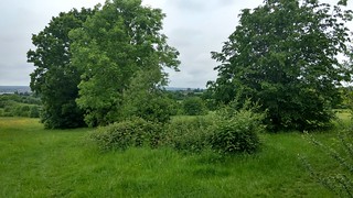

Fryent Country Park
Jul-19 • Malachi Continuous on Flickr
swcwalks evening swcshort2 short2 48306940696

| Start | Preston Road underground station |
|---|---|
| Finish | Kingsbury underground station |
| Length |
5.5km. |
| Time | 1 hour 30 minutes |
| Travel | Preston Road is on the Metropolitan line and Kingsbury is on the Jubilee line. Both are in Travelcard Zone 4. |
| Walk Notes |
Capital Ring signage all the way up to Barn Hill, leave Cap Ring route ~ 1km after Barn Hill. Once across the A4140 and having emerged ftrom the wood, there are various paths that you may follow. Just ensure that overall you maintain a northerly direction. |
| Eat |
J.J. Moon's, 553 Kingsbury Road, NW9 9EL T: 020 8204 9675. Food served until 22:00. |
| Profile | |
|---|---|
| Help Us! |
After the walk, please leave a comment, it really helps. Thanks! You can also upload photos to the SWC Group on Flickr (upload your photos) and videos to Youtube. This walk's tags are: |
| By Car |
Start HA3 0PS Map Directions Finish NW9 9EG Map Directions |
| Amazon | |
| Help |
National Rail: 03457 48 49 50 • Traveline (bus times): 0871 200 22 33 (12p/min) • TFL (London) : 0343 222 1234 |
| Version |
Apr-24 DAC |
| Copyright | © Saturday Walkers Club. All Rights Reserved. No commercial use. No copying. No derivatives. Free with attribution for one time non-commercial use only. www.walkingclub.org.uk/site/license.shtml |

Walk Directions
- Coming out of Preston Road station, turn left to then cross the main road (Preston Road) via pelican lights, and continue along Preston Road for a further 25 metres, to then turn right (marked by the Capital Ring signpost) along Uxendon Crescent. In 280 metres at a T-junction, turn right to go under a railway bridge (after 40m) to then fork left up West Hill and in 60 metres turn left along Uxendon Hill (road).
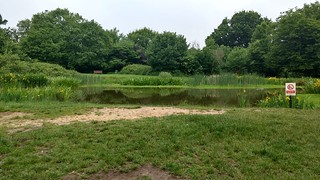
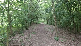
- [!]After 320 metres where the road starts curving to the right, turn left (marked by a Capital Ring signpost) down a car wide grass footpath (between houses). After 50 metres, turn right (following a CR post), to continue along a path through a lightly wooded area. After 150 metres you emerge from the lightly wooded area into the western most corner of Fryent Country Park, to continue ahead, along the edge of the fenced in park, with the Jubilee underground railway beyond. In 100 metres, (with a footbridge over the tube line to your left), turn right (marked by a footpath signpost) to follow a clearly defined path up towards Barn Hill. In 220 metres the path enters a wood. In a further 300 metres you reach the top of Barn Hill with a pond directly ahead of you, to follow the path round to the right of the pond (anti-clockwise), and in 80 metres you reach a footpath signpost and a trig. point with a view of Wembley ahead.
- Continue round the pond to 40 metres before the path you came in on, and turn right to follow a Capital Ring sign, down a footpath, your direction 10 degrees. After 60 metres go over a cross paths, and continue downhill through a wooded area. In 180 metres you emerge from the wood and turn right along its edge, your initial direction east. In 200 metres immediately before a car park with the main road 80 metres beyond, turn right, your direction 160 degrees, onto a footpath along the left hand side of the wood. After 45 metres you pass by a 4 way footpath signpost on your left hand side, to continue in the same direction, signposted Eledestrete. Where the path forks, keep to the left path, along the left edge of the wood, with the road further beyond. In 400 metres the footpath having descended leads out of the wood onto a path along the A4140 (marked by a metal FP sign). Turn left for 10 metres to cross over the busy A4140 with care via a traffic island, and turn right along a tarmac path, with the road to your right. After 100 metres immediately before a block of flats, turn left into a wood to follow the paths through the wood in a north-easterly and northerly direction.
- In 300 metres you emerge from the wood, into the open to head in a northerly direction (subsequently with a 7 storey redbrick building visible in the distance which you will eventually pass by).
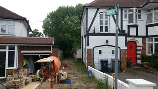
- In 1km exit Fryent Country Park through a gap to then go past a brick utility building on your left, to then go to the left of a wooden fieldgate to go along a broad grass track between garden fences to reach Valley Drive after 50 metres, to turn right and curve left to continue along Valley Drive, your direction 330 degrees, to reach Kingsbury Road and turn left.
- The pub is 80 metres beyond Kingsbury underground on your left.