The Ingrebourne Valley : Hornchurch to Upminster walk
Open water, grassland, woodland, marshland, fenland via a series of linked green spaces along the Ingrebourne River
Ingrebourne Valley Visitor Centre and Ingrebourne Marshes SSSI
SWC Short Walk 34 - The Ingrebourne Valley (Hornchurch to Upminster)
Mar-18 • thomasgrabow on Flickr
swcwalks short34 banner 27057822178

Up Ingrebourne Hill
SWC Short Walk 34 - The Ingrebourne Valley (Hornchurch to Upminster)
Mar-18 • thomasgrabow on Flickr
swcwalks short34 walkicon 40887142722

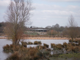
Ingrebourne Marshes SSSI
SWC Short Walk 34 - The Ingrebourne Valley (Hornchurch to Upminster)
Mar-18 • thomasgrabow on Flickr
swcwalks short34 walkicon 40929081121
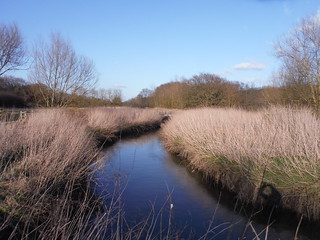
Ingrebourne River
SWC Short Walk 34 - The Ingrebourne Valley (Hornchurch to Upminster)
Mar-18 • thomasgrabow on Flickr
swcwalks short34 walkicon 27057574278
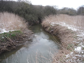
Ingrebourne River
SWC Short Walk 34 - The Ingrebourne Valley (Hornchurch to Upminster)
Mar-18 • thomasgrabow on Flickr
swcwalks short34 40035184015
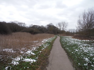
Path in Ingrebourne Valley Local Nature Reserve
SWC Short Walk 34 - The Ingrebourne Valley (Hornchurch to Upminster)
Mar-18 • thomasgrabow on Flickr
swcwalks short34 27057863558
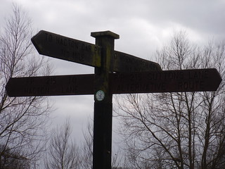
Four-way Signpost by Footbridge over Ingrebourne
SWC Short Walk 34 - The Ingrebourne Valley (Hornchurch to Upminster)
Mar-18 • thomasgrabow on Flickr
swcwalks short34 40929302551
| Length |
11.7 km/7.3 mi Ascent: 90m Time: 2 1/2 hours |
|---|---|
| Walk Notes |
The part of the Ingrebourne Valley walked through on this walk comprises a varied and unique mixture of interlinked and partly overlapping local green spaces - Ingrebourne Valley Greenway, Berwick Glades, Berwick Woods, Hornchurch Country Park, Ingrebourne Hill and the Sutton, Hacton and Gaynes Parkways. These include habitats ranging from river, open water, grassland, secondary and ancient woodland, marshland, fenland (with the largest continuous area of freshwater reed beds in Greater London), and – not to forget – some arable farmland. Partly former airfield, ex-quarries, farmland or landfill site, it is now a continuous green space and contains – pound for pound – one of the best viewpoints of London's Skyline, from all of 11 metres above sea! |
| Walk Options |
|
| Eat |
Ingrebourne Valley Visitor Centre Hornchurch Country Park, off Suttons Lane, Hornchurch RM12 6DF (01708 520 364). Open every day 09.00-17.00 (-16.00 Nov-Jan). The visitor centre is located 3.9 km from the end of the walk.
Refreshments in Rainham:
|
| Notes |
Ingrebourne River/Ingrebourne Valley Local Nature Reserve
Berwick Glades/Berwick Woods
Hornchurch Country Park
Ingrebourne Hill
Ingrebourne Marshes
Saint Laurence, Upminster
|
| Transport |
Hornchurch Underground Station is in Zone 6, on the District Line to Upminster. Journey time from Aldgate East is 36 minutes, from Victoria 53 minutes. You can shave off time by taking mainline trains from Fenchurch Street (or from Limehouse or West Ham) to Upminster and then travel back a couple of stops on the underground. Upminster Station is also in Zone 6 and served by the London, Tilbury and Southend Railway from Fenchurch Street (journey time 22 minutes, via Limehouse, West Ham and Barking), as well as the terminus of the District Line and of the Romford to Upminster Overground. |
| Profile | |
|---|---|
| Help Us! |
After the walk, please leave a comment, it really helps. Thanks! You can also upload photos to the SWC Group on Flickr (upload your photos) and videos to Youtube. This walk's tags are: |
| By Car |
Start RM12 6LS Map Directions Finish RM14 2TD Map Directions |
| Amazon | |
| Help |
National Rail: 03457 48 49 50 • Traveline (bus times): 0871 200 22 33 (12p/min) • TFL (London) : 0343 222 1234 |
| Version |
Apr-24 Thomas G |
| Copyright | © Saturday Walkers Club. All Rights Reserved. No commercial use. No copying. No derivatives. Free with attribution for one time non-commercial use only. www.walkingclub.org.uk/site/license.shtml |

Walk Directions
Full directions for this walk are in a PDF file (link above) which you can print, or download on to a Kindle, tablet, or smartphone.
This is just the introduction. This walk's detailed directions are in a PDF available from wwww.walkingclub.org.uk