Morden Hall Park (NT) and Abbey Mills walk
NT parkland, streams, watermills, and Abbey Mills heritage site

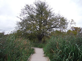
Boardwalk through Wetlands and Viewing Platform, Morden Hall Park
SWC Walk Short 13 - Morden Hall Park and Merton Abbey Mills
Oct-17 • thomasgrabow on Flickr
swcwalks short13 banner 37498178481

Morden Cottage, Morden Hall Park
SWC Walk Short 13 - Morden Hall Park and Merton Abbey Mills
Oct-17 • thomasgrabow on Flickr
swcwalks short13 walkicon 36829092613

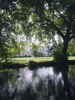
Outflow of Moat around Morden Hall
SWC Walk Short 13 - Morden Hall Park and Merton Abbey Mills
Oct-17 • thomasgrabow on Flickr
swcwalks short13 walkicon 36828963063

Boardwalk through Wetlands, Morden Hall Park
SWC Walk Short 13 - Morden Hall Park and Merton Abbey Mills
Oct-17 • thomasgrabow on Flickr
swcwalks short13 walkicon 23645505578

Wheelhouse on River Wandle, Merton Abbey Mills
SWC Walk Short 13 - Morden Hall Park and Merton Abbey Mills
Oct-17 • thomasgrabow on Flickr
swcwalks short13 walkicon 37466809962


| Start | Morden underground station |
|---|---|
| Finish | Colliers Wood underground station |
| Length |
4.6 km |
| Time | 1 hour 30 minutes. |
| Travel |
The bottom of the Northern Line in zones 3 (Colliers Wood) and 4 (Morden). Phipps Bridge (Croydon Tram between East Croydon and Wimbledon) station is adjacent to Morden Hall Park. By car: There are CPZ around the tube stations till 6:30 Mon-Fri (Mon-Sat Mordon). Mordon Park NT has a free car park that closes at 6:30, or there's free on-street parking in the middle of the walk around SW19 2RR. Mordon (not to be confused with Mordor) and Colliers Wood are on the same tube line. |
| Walk Notes |
This walk does a loop around the NT's Morden Hall Park (free entry) with rose garden, waterways, reed beds, and parkland. The route uses an entrance near the car park that closes at 6pm, year round, so there is an alternate public footpath route open at all times. After passing Deen City (children's) Farm (Tue-Sun 10.00-16.30), it passes Merton Abbey Mills, a collection of heritage industrial buildings associated with William Morris around a riverside piazza which are now cafes. |
| Options |
To extend the walk, you can follow the waymarked Wandle Trail:
|
| Notes |
|
| Eat |
Abbey Mills (about 5 mins from Colliers Wood tube)
Colliers Wood tube station
Not far away, is The Sultan, SW19 1BT, a back street community orientated pub, which won Time Out Most Loved Pub of the Year back in 2018. Note it has changed management since this happened. |
| Profile | |
|---|---|
| Help Us! |
After the walk, please leave a comment, it really helps. Thanks! You can also upload photos to the SWC Group on Flickr (upload your photos) and videos to Youtube. This walk's tags are: |
| By Car |
Start SM4 5AZ Map Directions Finish SW19 2HR Map Directions |
| Amazon | |
| Help |
National Rail: 03457 48 49 50 • Traveline (bus times): 0871 200 22 33 (12p/min) • TFL (London) : 0343 222 1234 |
| Version |
Apr-24 Andrew |
| Copyright | © Saturday Walkers Club. All Rights Reserved. No commercial use. No copying. No derivatives. Free with attribution for one time non-commercial use only. www.walkingclub.org.uk/site/license.shtml |
Walk Directions
- Leaving Morden tube station, cross the road in front of you at a set of lights to the left, and walk down Aberconway Road (past Lidl).
- At the end of the road, cross Morden Hall Road at the lights, and enter Morden Hall Park a lttle to the right.
- Out of hours (after 18.00 in summer) the gate will be locked: turn left (from the previous direction) along Morden Hall Road, with the park on your right, past the pedestrian lights. In 120m pass the high wrought iron gate to Morden Hall on your right and then a bus stop. Pass a roundabout and veer right with the road past another bus stop and in 170m turn right into Morden Hall Park. You pass an info panel with a map and turn right immediately along a wide gravel path, with a stream on your right. In 60m pass a signpost where another path joins from the left and turn right over a bridge across the stream. In 90m ignore a left turning path (signed 'Wetlands Boardwalk') and in 20m cross a set of railed bridges over the outflow channels from Morden Hall's moat. In 75m ignore a right turn towards the fenced (and locked after hours) area of the park and cross the River Wandle on a metal-railed bridge and continue along a wide gravel path, ignoring a left fork. In 100m ignore another right turn towards the fenced (and locked after hours) area of the park and cross a water channel on a bridge. Turn right directly after the bridge along a tarmac path and in 10m [!] fork left off the tarmac path along a clear well-trampled path through the grass. You now broadly follow the metal fence around the Rose Garden on your right: in 50m fork right along a faint path to stay close to the fence and in 125m fork right towards the metal fence and in another 20m enter some trees. In 60m reach a tarmac path at a T-junction by a gate in the metal fence around the Rose Garden on your right and with an arm of the Wandle on the other side of the path. Turn left along the path.
- The water channel on your left is river-fed and supplies the moat around Morden Hall.
- You pass the National Trust-run Potting Shed Cafe, an NT-shop and a plant nursery on your right.
- Further along pass The Stable Yard (Cafe and Bookshop) on your left, by The Snuff Mill on your right.
- Cross the River Wandle and pass Morden Cottage on your right. The Rose Garden is on your right hand side.
- Walk anti-clockwise around the park (through the Rose Garden, along a stream, (see next note), into open parkland, past Phipps Bridge tram stop, and back towards the Rose Garden.
- (At the end of the stream there is a park exit. There is an optional extension here into Ravensbury Park (wikipedia), another river Wandle park, again once a grand house, now just the faded grandeur park remains - recommended if you have the time - see map)
- Pick up the signposted Wandle Trail by a footbridge and turn right over the Wandle, and in 120m turn right with a signpost through the reed beds towards Colliers Wood (leaving the Wandle Trail). This soon goes over newly laid wooden boardwalks with some viewpoints and terraces along the way.
- Pick up the Wandle Trail again and cross the tram line. In 400m pass Deen City Farm (cafe & shop) on your left and continue in the same direction along its drive/car park.
- Cross Windsor Avenue, a small road, and continue towards Merton Abbey Mills.
- In 150m turn right to cross the bridge into Merton Abbey Mills. The William Morris pub has a roof terrace. The Merton Apprentice is a craft beer pub with a large outdoor seating area. There are also some cafes. The small Chinese, and next to it, the Brazilian, are recommended.
- Walk through the buildings and leave the area to the left by re-crossing the Wandle over another bridge and turn right along the Wandle Trail.
- Cross Station Road and veer right with the Wandle Trail, with the river on the right.
- In 260m, as you meet Merton High Street, turn right over a footbridge across the river and turn left along a new riverside path (with a large Sainbury's to the right).
- In 140m cross the Pickle Ditch on a footbridge and turn left around a pub to the High Street.
- Turn right along the road and in 220m reach Colliers Wood Underground.
