Ruislip Woods and Lido walk
Woods and a swimming lake

photo from walk
May-16 • hikinginlondon on Flickr
ruislip woods lido swcwalks short8 hiking walking swimminglake london senderismo 23894514407

photo from walk
May-16 • hikinginlondon on Flickr
swcwalks short8 ruislip woods lido edge hiking walking swimminglake london senderismo 38713448072

photo from walk
May-16 • hikinginlondon on Flickr
swcwalks short8 ruislip woods lido edge hiking walking swimminglake london senderismo 38713796182

photo from walk
May-16 • hikinginlondon on Flickr
swcwalks short8 ruislip woods lido edge hiking walking swimminglake london senderismo 37856456415
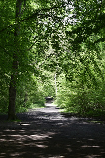
photo from walk
May-16 • hikinginlondon on Flickr
swcwalks short8 ruislip woods lido edge hiking walking swimminglake london senderismo 37856509165

photo from walk
May-16 • hikinginlondon on Flickr
swcwalks short8 ruislip woods lido edge hiking walking swimminglake london senderismo 38743998411
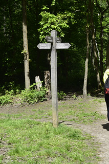
photo from walk
May-16 • hikinginlondon on Flickr
swcwalks short8 ruislip woods lido edge hiking walking swimminglake london senderismo 38744085141
| Start | Ruislip Manor underground station |
|---|---|
| Finish | Ruislip underground station |
| Length |
6km. |
| Time | 1 hour 45 mins |
| Travel | Metropolitan and Piccadilly line trains go from central London to Ruislip Manor and Ruislip underground stations. Both are in Travelcard Zone 6. |
| Walk Notes |
This walk takes you through Park Wood and Poor’s Field, finishing at The Water’s Edge, Reservoir Road for refreshments. If you get disorientated in the woods, don’t worry too much as wandering around, you will in time come across the Lido and or 12” gauge railway (which skirts the Lido), from which you may regain your bearings. |
| Eat |
The Water’s Edge, Ruislip Lido , HA4 7TY. T: 01895 625 241. Alternatively if food is no longer being served, then you may catch the H13 bus back to Ruislip Manor, for J.J. Moon’s (wetherspoon), 12 Victoria Road, HA4 9AA. (Opposite Ruislip Manor station) T: 01895 62237, food served until 22:00. |
| Profile | |
|---|---|
| Help Us! |
After the walk, please leave a comment, it really helps. Thanks! You can also upload photos to the SWC Group on Flickr (upload your photos) and videos to Youtube. This walk's tags are: |
| By Car |
Start HA4 9AA Map Directions Finish HA4 8LD Map Directions |
| Amazon | |
| Help |
National Rail: 03457 48 49 50 • Traveline (bus times): 0871 200 22 33 (12p/min) • TFL (London) : 0343 222 1234 |
| Version |
Apr-24 DAC |
| Copyright | © Saturday Walkers Club. All Rights Reserved. No commercial use. No copying. No derivatives. Free with attribution for one time non-commercial use only. www.walkingclub.org.uk/site/license.shtml |


Walk Directions
- Coming out of Ruislip Manor station, turn right up Victoria Road. In 80 metres cross over Park Way to continue up Windmill Hill. In 450 metres cross Eastcote Road to continue along Kings College Road. In 700 metres at the end of Kings College Road you enter Park Wood.
- A suggested route to the Water’s Edge, R eservoir Road: Follow the car wide track, (in the same direction as Kings College Road, 340º), which after 1200 metres will lead you to the western edge of the wood bordering the Lido. From here you can turn right, initially north, to then head west around the top of the Lido, before taking a southerly path through Poor’s Field to end up at The Water’s Edge pub.
- Route back from Ruislip Lido to Ruislip underground station: If not taking the half hourly H13 bus service from Reservoir Road to Ruislip station. TBC