Balcombe Circular via Ardingly Reservoir walk
Two interlocking circular walks (one for Summer, one for Winter) around Balcombe, taking in Ardingly Reservoir, the Ouse Valley Viaduct, and fine Weald territory.

Ardingly Reservoir
Balcombe Circular walk
Dec-05 • Saturdaywalker on Flickr
swcwalks swcwalk22 banner 32733858975

Book 3, Walk 22, Balcombe Circular
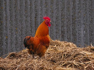
Cock, Westup Farm, 5 May '07
summer book3 walk22 midsussex swcwalks balcombecircular 489784140
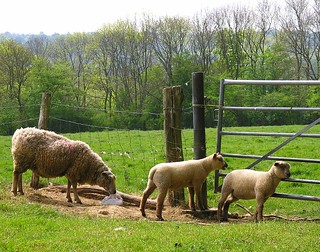
Book 3, Walk 22, Balcombe Circular
5 May '07
summer book3 walk22 midsussex swcwalks balcombecircular 489782478
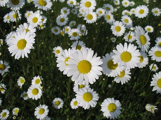
Book 3, Walk 22, Balcombe Circular
Balcombe, 5 May '07
summer book3 walk22 midsussex swcwalks balcombecircular 489776852

Book 3, Walk 22, Balcombe Circular (winter)
One of the less-muddy sections of the walk, 6 Jan '08.
winter westsussex balcombe book3 walk22 swcwalks tocw322 2172400459
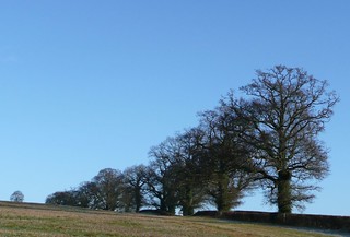
Book 3, Walk 22, Balcombe Circular (winter)
A procession of trees, 6 Jan '08.
winter westsussex balcombe book3 walk22 swcwalks tocw322 2173185772
| Length |
Winter walk: 16.2km (10 miles). Winter walk via Gardeners Arms and shortcut to Wakehurst Place: 15.4km (9.6 miles) Winter walk picnic only version: 12.8km (7.9 miles) Summer walk: 19.5km (12.1 miles). Summer walk via Gardeners Arms and shortcut to Wakehurst Place: 16.7km (10.4 miles) | ||||||
|---|---|---|---|---|---|---|---|
| Toughness |
4 for the Winter Walk 7 for the Summer Walk | ||||||
| Maps |
OS Landranger 198, Explorer 135 - though a tiny portion of Part One of the Summer Walk is on Explorer OL34 (formerly 134) | ||||||
| Features |
Balcombe is a great place to walk - the one stop on the Brighton line that feels truly remote and rural. The moment you leave the station you are in a Wealden wonderland of hills, woods, pasture and hidden farms. These walks also feature Ardingly Reservoir, romantically set between steep hills. "These walks" because this is in fact two walks - a Winter Walk and a Summer Walk, which intersect each other in two places. This allows you to switch between them at these points – for example, doing part one of the summer walk, part two of the winter walk, and part three (and four) of the summer walk - or the morning of the summer walk and afternoon of the winter walk, and so forth. There is also now the possibility on either walk for a shortcut to Wakehurst Place via the Gardener's Arms. Both walks are not just circular walks in that they start and end at the same station, but also because they actually circle around Balcombe, departing westwards from the village, and skirting round its southern side to return to the village from the east. Outlines of the two walks and their constituent parts are as follows: WINTER WALK (16.2km/10 miles)This route is suggested for winter because it has a shorter afternoon and includes quite a bit of walking on quiet lanes and dry tracks, so avoiding most of the mud (though not all of it by any means). Ardingly Reservoir is also particularly beautiful in low winter sunlight. PART ONE (2.1km/1.3 miles) follows a quiet and pretty lane from near Balcombe station. It gives a shorter start to the walk than part one of the Summer Walk. PART TWO (6.7km/4.1 miles) takes you down into the valley and under the Ouse Valley Viaduct - a surprisingly impressive structure, built in 1842 for the London to Brighton Line - before climbing up to Ardingly reservoir and village (or lunch at the Gardeners Arms - see lunchbelow). PART THREE (7.4 miles or 4.6 miles) goes from Ardingly village back down to the reservoir and along its edge to Balcombe for tea. SUMMER WALK (19.5km/12.1 miles)The Summer Walk spends more time on footpaths and in fields, but as a result can be very muddy in January or February. This route is also much more hilly than the Winter Route, especially in the afternoon where there are three big climbs and descents. In its first section it has at least two good bluebell woods in late April/early May (and possibly others in the afternoon). The National Trust tea room at Wakehurst Place also provides a convenient tea stop half way through afternoon, so you don't have to rush to finish the walk on long spring and summer evenings. PART ONE (4.5km/2.8 miles) does a hilly loop on woodland paths and farm tracks as an alternative to the all-tarmac route followed by part one of the winter walk. PART TWO (5.6km/3.5 miles) is a higher level route to Ardingly than its winter walk counterpart, which has some nice views down onto the reservoir in its latter stages. PART THREE (4.1km/2.5 miles) follows the High Weald Landscape Trail from Ardingly village over hilly terrain to Wakehurst Place, owned by the National Trust, and home to Kew’s “country garden” and the Millennium Seedbank. This is also a possible tea stop. PART FOUR (5.3km/3.3 miles) takes you from Wakehurst Place across two more valleys to get back to Balcombe. Transport |
| Balcombe is on the Brighton line, served twice hourly Mondays to Saturdays and hourly on Sundays by Thameslink trains from St Pancras and London Bridge. Catch the nearest train to 9.30am from London Bridge to get to lunch in time. Note that the rear four carriages of the twelve carriage Thameslink trains do not fit on the southbound platform at Balcombe and the driver sometimes forgets to announce this fact. Be sure to move forward in time to disembark.. Lunch |
| The Ardingly Inn (01444 892 214), 8.8km (5.4 miles) into the Winter Walk and 10.1km (6.3 miles) into the Summer Walk, is under new management and is now (February 2024), as far as we can tell, offering food daily. Not sure of food times, but the pub is open all afternoon and evening. Next door is the Ardingly Cafe (01444 891 113), which serves sandwiches, salads, soups and light meals until 3pm Monday to Saturday and 2pm on Sundays. The Gardeners Arms (01444 892328), is an alternative lunch option 8.9km (5.5 miles) into the Winter Walk or 10.2km (6.4 miles) into the Summer Walk. This is an excellent pub, but is often fully booked at weekends, so you would do well to reserve a table in advance. It does have some outside tables, however, and some walkers have managed to get meals served at these without a reservation. The pub is reached by a diversion off the walk route - see paragraph 44 on page 5 or paragraph 137 on page 9 - which if you are doing part three of the Winter Walk only adds 280 metres to the walk length. It is unfortunately inconveniently sited for stage three of the summer walk, but there is a short link by permissive paths to Wakehurst Place and so stage four of the summer walk. Note that this route goes along the edge of the South of England Showground (www.seas.org.uk): on days when there are events at this venue the diversion and pub are probably best avoided. Picnic spots: There are many benches around Ardingly Reservoir. Tea |
| The Ardingly Activity Centre by the dam on the Ardingly Reservoir has a seasonal cafe that serves hot drinks and snacks. Wakehurst Place (01444 894066), 14.2km (8.8 miles) into the Summer Walk (or 11.4km/7.1 miles if you take the shortcut from the Gardeners Arms to Wakehurst Place), has a self-service cafe, the Seed Cafe, which is the recommended tea stop for that walk. It is open until 5.30pm daily from 1 March to 31 October, and 4.15pm from 1 November to 28 February. The Balcombe Tea Rooms seem unfortunately to have closed for good, but it is worth googling to see if they have been revived. The Half Moon Inn in Balcombe is a possible tea stop for both walks. It is open all afternoon and now serves tea and (sometimes) cakes. After 6pm it offers hot food, including deserts. |
| Profile | |
|---|---|
| Help Us! |
After the walk, please leave a comment, it really helps. Thanks! You can also upload photos to the SWC Group on Flickr (upload your photos) and videos to Youtube. This walk's tags are: |
| By Train |
Out (not a train station) Back (not a train station) |
| By Car |
Start RH17 6JQ Map Directions |
| Amazon | |
| Help |
National Rail: 03457 48 49 50 • Traveline (bus times): 0871 200 22 33 (12p/min) • TFL (London) : 0343 222 1234 |
| Version |
Feb-24 Peter |
| Copyright | © Saturday Walkers Club. All Rights Reserved. No commercial use. No copying. No derivatives. Free with attribution for one time non-commercial use only. www.walkingclub.org.uk/site/license.shtml |


Walk Directions
Full directions for this walk are in a PDF file (link above) which you can print, or download on to a Kindle, tablet, or smartphone.
This is just the introduction. This walk's detailed directions are in a PDF available from wwww.walkingclub.org.uk