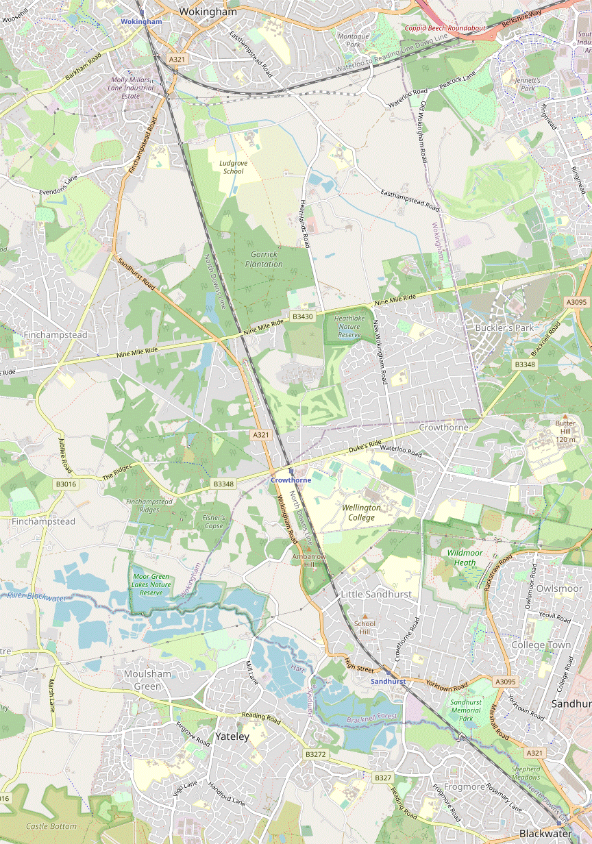
Blackwater to Wokingham walk
A varied walk starting alongside the River Blackwater and taking in meadows, lakes, mixed woodland, pasture and fruit farms before finishing at an attractive market town.

On the ridge
Crowthorne to Sandhurst (avoiding Eversley)
autumn book3 walkicon swcwalks walk83 8178528480

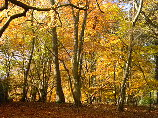
CIMG4923
Beech Hill in autumn
Nov-12 • Sean O'Neill
swcwalk83, swcwalks, walkicon 5809902997178976466 P

CIMG0461
Bluebell wood, Finchampstead
Apr-14 • Sean O'Neill
swcwalk83, swcwalks, walkicon 6005542828008170946 P

CIMG0513
Viewpoint on Finchampstead Ridges
Apr-14 • Sean O'Neill
swcwalk83, swcwalks, walkicon 6005541968655300194 P

DSCF2142
Blackwater River at Mill Lane
Oct-09 • Sean O'Neill
swcwalk83, swcwalks 5442282098355321922 P
| Length |
Main Walk: 25½ km† (15.8 miles). Five hours 50 minutes walking time. For the whole excursion including trains, sights and meals, allow at least 10 hours. Shorter Walk, finishing at Crowthorne: 17½ km† (10.9 miles). Four hours walking time. Direct Walk, omitting Finchampstead: 17½ km† (10.8 miles). Three hours 50 minutes walking time. Alternative Walk, from Crowthorne via Eversley Cross: 14 km (8.7 miles). Three hours 5 minutes walking time. Extended Alternative Walk, to Wokingham: 22 km (13.6 miles). Four hours 55 minutes walking time. Reverse Alternative Walk, to Blackwater: 16¼ km‡ (10.0 miles). Three hours 30 minutes walking time.
† Subtract 3½ km (2.1 miles; 45 minutes) if starting from Sandhurst. See Walk Options below.
|
|---|---|
| OS Map |
Explorer 159. Blackwater station, map reference SU853599, is on the Hampshire / Berkshire border, 9 km S of Bracknell. Wokingham is in Berkshire. |
| Toughness |
5 out of 10 (3 for the Shorter and Extended Alternative Walks; 2 for all the other options). |
| Features |
This walk explores the Berkshire countryside between the River Blackwater and Wokingham. It starts along the riverside path through Shepherd Meadows Nature Reserve, a pleasant ‘green belt’ between the railway and a busy trunk road. After skirting Sandhurst there is a less appealing but unavoidable stretch along roads to a lakeside café at the Horseshoe Lake Activity Centre. This part of the Blackwater Valley is dotted with gravel pits and the walk now loops around the worked-out ones which make up Moor Green Lakes Nature Reserve. Some country lanes (or a permissive path through a large fruit farm, if it ever reopens) then take you through Finchampstead to a rural pub near its parish church, some way outside the main village. The walk then swings back towards the railway line, with attractive stretches of pine woods, heathland and ponds as it goes through the National Trust's Simon's Wood and Finchampstead Ridges as well as Ambarrow Court Local Nature Reserve. A path between the railway and the grounds of Wellington College brings you the station which was built to serve this famous public school but is now simply called Crowthorne. You could call it a day here but the full Main Walk carries on northwards across a golf course to Heathlake Nature Reserve, another picturesque lake surrounded by pine woods. More woodland, a large soft fruit farm and pasture eventually lead to Wokingham. This attractive market town is in the process of regeneration but has retained many of its historic buildings, notably along Rose Street. There are plenty of refreshment opportunities in the town before the short stroll to its station. Parts of this walk are in the floodplain of the River Blackwater and so might not be feasible in exceptional conditions. |
| Walk Options |
The full walk is fairly long but the two intermediate stations on the Blackwater Valley line provide obvious drop-in and drop-out points. Sandhurst is not the most inspiring place to start a walk as the first 20 minutes are along roads, but this shorter start would be worth considering if you missed a train and wanted to join up with a group starting from Blackwater. As noted above Crowthorne station is passed about halfway through the long afternoon leg, so you could complete a Shorter Walk there. There is also a Direct Walk option which replaces the central loop out to Finchampstead with a much shorter loop around Horseshoe Lake. A set of Alternative Walk options has been adapted from an earlier version of this walk (see below). These all start from Crowthorne station and loop out to Eversley Cross instead of Finchampstead, with directions for finishing at any of the four stations along the line. There is relatively little overlap between the Main and Alternative Walks (and some of this is in the opposite direction), so they could be treated as separate walks. Two short optional extensions and a few short cuts are also included in the directions. |
| Additional Notes |
The original version of this walk was from Crowthorne to Sandhurst, later extended to Blackwater. It contained a longer central section via Finchampstead and Eversley, as well as an alternative loop via Eversley Cross. Its main drawback was that there were few refreshment places near any of these three stations (although a couple of places have since opened near Crowthorne station, which improves the variations ending there). As Wokingham is significantly better in this respect – and also has a direct train service to London – the Main Walk was refashioned to end there. |
| Transport |
Blackwater, Sandhurst, Crowthorne and Wokingham are adjacent stations on the Blackwater Valley line between Guildford and Reading. There are two trains an hour on this line, but only half of them stop at Sandhurst and Crowthorne at off-peak times. Wokingham is also on a direct line to London Waterloo via Ascot and Staines, with a half-hourly service taking about 70 minutes. There are three ways of getting to Blackwater, Sandhurst or Crowthorne from central London. The shortest journey time (taking less than an hour with a good connection) is from Paddington, changing at Reading. The other two routes are from Waterloo with a change at Guildford or Wokingham; these are typically 20-40 minutes longer, with the Guildford route being quicker. If you travel out or back via Reading you will need a more expensive “Any Permitted” ticket, which is valid on all three routes. A cheaper “via Ascot / Guildford” ticket is valid only on the two Waterloo routes. With a railcard discount, a Zones 1-6 Travelcard plus an extension to Blackwater or Crowthorne (which is valid on all three routes) is good value if travelling via Reading. Otherwise, buy a return to whichever station is furthest along your choice of route, eg. to Wokingham if travelling out via Guildford. There are a few buses along the A321 parallel to the railway but nothing useful on the loop out to Finchampstead, so you would need to call a taxi if you wanted to abandon the walk at lunchtime. If driving, there are large car parks at Blackwater and Wokingham stations and a small one at Crowthorne. |
| Suggested Train |
For the full Main Walk take the train nearest to 09:00 from either Paddington (via Reading) or Waterloo (via Guildford), depending on your choice of route. A train 30-60 minutes later would be better if starting from Sandhurst or Crowthorne, to avoid arriving too soon at any of the lunch pubs. |
| Train Times |
|
| River Levels |
|
| Lunch |
On the Main & Shorter Walks the suggested lunch pub in Finchampstead is the Queen's Oak (0118-973 1105; food to 2.30pm, later on Sun & BH) near the parish church (10 km from Blackwater; 6¾ km from Sandhurst). In another part of the village the Greyhound (0118-216 1334; food to 3pm, later at weekends) reopened in autumn 2021 as a Brucan pub, but has not been tried. On the Direct Walks there are no pubs between Sandhurst and Wokingham, but the Lake View Café (01252-871808) at the Horseshoe Lake Activity Centre (5 km from Blackwater) is a possible lunch place or picnic spot. On the Alternative Walks there are two pubs alongside the village green in Eversley Cross, after 7 km. The suggested place is a Fuller's pub, the Frog and Wicket (0118-973 1126), with the Chequers (0118-402 7065) as a slightly more up-market alternative, describing itself as “Eversley's gastro pub”. |
| Tea |
There are plenty of pubs and coffee shops in the centre of Wokingham for the longer walk options finishing there. As well as the usual suspects such as Costa (0118-979 9768) and Caffè Nero (0118-977 0277), the suggested route goes through a quiet plaza where Coffee #1 Wokingham (0118-228 6990) has indoor and outdoor seating. The onward route to the station is not bereft of pubs either, passing the historic Queens Head (0118-978 1221) and the Station Tap (0118-977 4548) among others. There is a Café Destino in the station building but it closes at 4pm (3pm weekends). At the end of the Shorter Walks there are two newish places in the parade of shops next to Crowthorne station: The Hive (01344-771199; open to 5pm Mon & Tue, 10pm Wed–Sat, closed Sun), a “craft beer & coffee shop”; and U.Bakery (open to 4pm Sun & Mon, 5pm Wed–Sat, closed Tue), an artisanal bakery with a small café. The Alternative Walks include the possibility of a mid-afternoon refreshment stop as they pass the Lake View Café (see Lunch above). The Circular & Extended variations then have the same choices as above. On the Reverse variations the route passes the Old Mill Coffee Shop & Cafe (01252-874389; open to 3pm daily) and the traditional Rose & Crown (01252-285607) before reaching Sandhurst station, with the Village Inn (01252-957265) just beyond it. As there is nowhere particularly enticing near Blackwater station the suggested place on the longer ending is the Sandhurst Park Cafe (01252-878574; open to 4.30pm Mon–Fri, 5pm Sat, 4pm Sun; may close earlier in winter) at the entrance to Memorial Park. Allow at least 35 minutes for the final 2½ km to the station. |
| Profile | |
|---|---|
| Help Us! |
After the walk, please leave a comment, it really helps. Thanks! You can also upload photos to the SWC Group on Flickr (upload your photos) and videos to Youtube. This walk's tags are: |
| By Train |
Out (not a train station) Back (not a train station) |
| By Car |
Start GU17 9AB Map Directions Return to the start: Finish RG40 2AP Map Directions Travel to the start: |
| Amazon | |
| Help |
National Rail: 03457 48 49 50 • Traveline (bus times): 0871 200 22 33 (12p/min) • TFL (London) : 0343 222 1234 |
| Version |
Sep-24 Sean |
| Copyright | © Saturday Walkers Club. All Rights Reserved. No commercial use. No copying. No derivatives. Free with attribution for one time non-commercial use only. www.walkingclub.org.uk/site/license.shtml |

Walk Directions
Click the heading below to show/hide the walk route for the selected option(s).


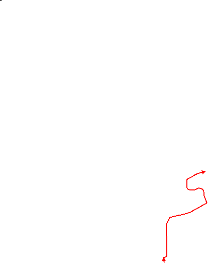
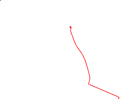


 Walk Map
©
Walk Options ( Main+ | Alt+ )
Click on any option to show only the sections making up that route, or the heading above to show all sections.
- Main Walk (25½ km)
Walk Directions
Click on any section heading to switch between detailed directions and an outline, or the heading above to switch all sections.
If you are doing the shorter start (from Sandhurst), start at [?] in §B.
If you are doing an Alternative Walk (from Crowthorne), start at §G.
- Blackwater Station to Sandhurst High Street (3½ km)
- Go out along Station Approach (crossing the railway if arriving from Guildford). Follow the access road across the River Blackwater and enter Shepherd Meadows Nature Reserve, joining the Blackwater Valley Path (BVP). Go all the way through the reserve (optionally detouring through some of the meadows). Stay on the BVP as it crosses the railway and continues alongside the river to Swan Lane. Turn right onto the road, then in 400m take a footpath on the left going alongside the railway embankment to the A321.
-
Arriving from Guildford / Farnborough
- Leave the platform near the back of the train and go up steps to the A30 (London Road). Turn left onto the pathway alongside the main road, crossing over the railway and later merging with the station access road.
-
Arriving from Reading / Wokingham
- Leave the platform near the front of the train and bear right through the car park. Ignore steps up to the A30 (London Road) and go up Station Approach, merging with a pathway from the main road at the top.
-
Follow Station Approach across the River Blackwater and round to the left. Where the road swings right veer left past a vehicle barrier into Shepherd Meadows Nature Reserve? on the Blackwater Valley Path? (BVP). In 25m there is a wooden kissing gate on the right. Unless the meadow looks waterlogged, the suggested route is to go through this gate onto a clear path through it.
- Alternatively you can simply stay on the riverside path and resume the directions at [?].
- On the main route follow the grassy path in a gentle arc round to the left, going through a gap in the belt of trees across the middle of the meadow. Keep left at path junctions to return to the riverside path through another kissing gate in the corner.
- After the two routes rejoin follow the BVP across the river on a footbridge and through the rest of the nature reserve, around 1 km. After 400m the path briefly splits and you can take either fork. After they rejoin ignore a footbridge across the river (which leads to the reserve car park) to keep the river on your right.
- At the far end of the meadows you go through another kissing gate next to a fieldgate and the BVP swings right to recross the river on a footbridge. On the other side turn left at a path crossing, staying on the BVP. Follow the path across a side stream and then up an elevated walkway. After crossing the railway line and the main river yet again keep right to stay close to the river.
- Follow the tree-lined riverside path for 750m, later with paddocks behind a long wooden fence on your left. The path eventually comes out onto a road. Turn right to cross the river for the last time and continue along Swan Lane past a large water treatment works, partially screened behind trees.
- In 400m, just before the road goes under a railway bridge, turn left onto a signposted footpath. Follow this alleyway all the way alongside the railway embankment, later below the platforms of Sandhurst station. At the end keep right to go out along a short road to the A321 (Sandhurst High Street). Turn left onto the main road.
- Sandhurst High Street • Station to Horseshoe Lake (SW corner) (2½ km)
-
- If starting from Sandhurst station, go down the ramp and turn left onto the A321.
-
Starting from Sandhurst Station
- From either platform go down the ramp and turn left onto the A321, soon joining both the longer start and the Blackwater Valley Path? (BVP) from the first road on the left.
- Head W along the A321 for 600m, passing a couple of very early refreshment places on the left along the way: the Old Mill Coffee Shop & Cafe in a small parade of shops, then the Rose & Crown pub. The main road swerves right and left, then comes to a junction with Yateley Road on the left. Cross the side road carefully and go straight ahead on a pathway through a small housing estate.
- Bear left into Lych Gate Close, go past Belfry Mews and up a short slope to come out onto Lower Church Road opposite a primary school. Turn left and go all the way along this lane, soon passing St Michael's church up on the right and eventually coming to a T-junction, with Mill Lane to the left and Lower Sandhurst Road to the right.
- Go straight across the road junction, temporarily leaving the BVP. Take the left-hand of two paths opposite, going through a pair of small metal gates onto a new path through Horseshoe Meadow. Follow the path past a pylon and up to a T-junction in front of a grassy bank.
-
Main route
- For the main route, turn right at the T-junction. After going past the back of the buildings follow the path round to the left. Leave the meadow through a metal kissing gate and turn right onto the perimeter path around Horseshoe Lake.
-
Route via the café
- Turn left at the T-junction. Leave the meadow through a metal kissing gate and turn right to go along the edge of a car park. Bear right onto a grassy strip in front of the Horseshoe Lake Activity Centre?.
- After a refreshment stop in its Lake View Café carry on along the lakeside path, going past wooden barriers and soon passing the other exit from Horseshoe Meadow.
- In 100m turn left to stay on the perimeter path, ignoring a wooden gate ahead. In 250m keep left at path junctions to stay near the lake. At its north-western corner you pass a “Dog Beach” (but with a “No Swimming” notice for the rest of us). After a straight stretch between scrubland and a field the path turns left to head S on a wooded strip of land between two lakes. At the end go through a gate to join the Three Castles Path? (3CP) as well as rejoining the BVP.
- Horseshoe Lake (SW corner) to Manor Farm (2¼ km)
- Turn right onto the BVP, entering Moor Green Lakes Nature Reserve. Follow the riverside path for just over 1 km. At the south-western corner of Colebrook Lake South turn right onto a path heading north to the reserve's car park. Turn left onto Lower Sandhurst Road and go along it for 375m, to the start of a (possibly closed) permissive path through Manor Farm.
- Turn right onto the broad riverside path, entering Moor Green Lakes Nature Reserve?. You pass a members-only hide overlooking Grove Lake and later a wooden viewing screen opposite Grove Lake Island (favoured by cormorants). Along this stretch there are several more gaps in the undergrowth giving views across this lake and then Colebrook Lake South.
- After going between the river and these two lakes for about 1 km you pass an information panel for the Nature Reserve, opposite a wooden footbridge over the river (where you leave the 3CP). The path ahead splits into a parallel bridleway and footpath and you can take either. In 100m you come to a major path junction and turn right to head N away from the river, also leaving the BVP.
-
As before a bridleway and footpath run parallel to each other and you can take either, although there are better views across the reserve lakes on the right from the footpath (including another viewing screen). The two paths merge briefly to cross a stream (Colebrook Cut) on a footbridge and you have the same choice alongside Colebrook Lake North. The footpath eventually leads into the Nature Reserve car park, with the bridleway passing alongside it.
A notice beside the car park states that new public footpaths are being created in the area off to the left where gravel extraction has ceased. If they provide a useful alternative to the road walking ahead then the walk route will be modified accordingly.
- Go out onto Lower Sandhurst Road and turn left, taking care as there is no pavement and at best a narrow grass verge. In 175m keep ahead at the junction with Dell Road, now with a large fruit farm behind the hedge on your right. In a further 200m, before the road bends slightly left, there should be a gap in this hedge with a notice about a permissive path.
- Manor Farm to Finchampstead (Queen's Oak) (1¾ • 1½ km)
-
If the permissive path is closed, carry on along the road and its continuation (Cricket Hill), veering up to the right into Finchampstead. Turn right onto the B3016, passing the Greyhound pub. Turn left onto the B3348, then in 75m turn right onto a footpath heading north to St James's church. Go down a lane to the Queen's Oak pub.
- Alternatively, take the permissive path through the fruit farm to the B3348. Cross the road and continue on Church Lane to reach St James's church and the Queen's Oak pub.
-
Main route (1¾ km)
- Carry on along Lower Sandhurst Road. In 400m follow the road up to the right, ignoring a private road ahead. The road (now Cricket Hill) climbs gently with houses on the left. In 350m it comes to a crossroads where you turn right onto the the B3016 (Longwater Road). In 100m you come to the first of Finchampstead's two pubs, the Greyhound.
- Carry on briefly along the B3016, then turn sharp left at a road junction onto the B3348. In 75m turn right onto a signposted footpath, soon passing some large playing fields on the left and then climbing gently between woods.
- Keep ahead at a footpath junction, ignoring a path off to the left. At the end go up a slope into a churchyard. Follow the path past the western end of St James's church? (which is usually locked) and round to the right.
- Leave the churchyard and go down a lane, passing to the left of a small triangular green. You come to a crossroads with Finchampstead's other pub ahead on the left, the Queen's Oak?.
-
Alternative route (provisional) (1½ km)
- If access is permitted, go over the stile and keep ahead on a broad track between polytunnels, the start of a waymarked trail through this large fruit farm. In 125m turn left onto another track, passing a yard and outbuildings on your right.
- In 100m veer right as indicated, climbing gently with large fields of soft fruit on your right. In 600m you come to the end of the trail and go out over a stile onto the B3348.
- Turn right and go along the pavement for just 25m, then cross the main road carefully and go down Church Lane opposite. You have a slightly awkward 600m along this winding lane before you pass St James's church? up on the left, followed by a small triangular green. The suggested lunch pub is ahead on the right, the Queen's Oak?.
- The Queen's Oak to Heath Pond (2½ • 3 km)
- Turn left out of the pub and go along Church Lane for 125m, then take a footpath on the left across a field to the B3016. Cross the road and take the footpath opposite to Warren Crest Farm. Bear right onto a byway, then zig-zag left and right to head south-east along Heath Ride for almost 1 km. Shortly before reaching a major path crossing turn right onto a path leading to Brook's Heath. Either bear left to go directly along the edge of woodland to the north-western corner of Heath Pond, or (for an optional extension) take a path on the right looping around the heathland and back along a bridleway to the same point.
-
Turn left out of the pub onto Church Lane, away from the church and heading NE. In 125m there is an easily-missed stile in the hedge on your left, for a public footpath crossing a farm field.
- There is invariably a “Beware of bull” notice here, but the author has never seen one in this field. In the unlikely event that the beast is actually present a more circumspect route would be to go all the way along Church Lane and turn left onto the B3016, passing the exit from the field in a further 100m.
- If undeterred by the warning notice go over the stile and follow a faint grassy path going diagonally across the field to its opposite corner, 300m away. Go over another stile in the hedge to come out onto the B3016. Cross this road carefully onto the continuation of the footpath, just off to the left.
- Follow the path up the right-hand side of a large field, then along an enclosed path past two more fields. After passing the driveway to Warren Crest Farm bear right to continue on what is signposted as a restricted byway but soon becomes a narrow path, passing a cottage and going gently downhill. At the bottom you come to a T-junction with a track.
-
To stay on established rights of way turn left at the T-junction, passing a residential street on the left. In 100m turn right at a T-junction onto another restricted byway. Follow this long straight lane (Heath Ride) past a string of properties for almost 1 km, heading SE.
At one point there used to be a sign for Brunningham Farm on the right by some abandoned outbuildings, but this area will surely be redeveloped into another grand property.
-
After the last house on the right there is woodland on this side of the lane. For the suggested route, turn right after 75m onto an unsignposted path opposite “Foxdale”. A short stretch of boardwalk takes you over a boggy patch and the path soon comes to a T-junction at the north-eastern corner of Brook's Heath.
- If this woodland path looks waterlogged you can simply carry on along Heath Ride to a major path crossing and turn right onto another long straight byway (Hollybush Ride); this leads directly to the north-eastern corner of Heath Pond.
-
Main route
- Turn left at the path T-junction. The path goes along another short stretch of boardwalk and bears right to continue along the edge of woodland. In 150m it comes out in front of the north-western corner of the triangular Heath Pond.
- In front of the lake turn left onto a long straight bridleway, the Devil's Highway?. Go alongside the lake to reach a major path crossing at its north-eastern corner.
-
Optional extension (+½ km)
- Turn right at the path T-junction and follow the meandering sandy path near the heathland edge, soon with the extensive gardens of the properties on Heath Ride visible off to the right.
- After briefly going alongside the garden fences the path gradually curves left through a lightly-wooded part of the heath. It ends at a T-junction where you …
- In 250m you reach the north-western corner of the triangular Heath Pond. Keep ahead …
- Heath Pond to Ambarrow Lane (3 km)
- Go along the eastern side of Heath Pond to its southern tip. Zig-zag right and left to head south along the edge of heathland and continue on the NT Centenary Trail through Simon's Wood, curving up to the left. Cross a byway and then turn right onto a woodland path which returns to the byway just before it reaches the B3348. Turn right and go along the road for 50m to the north-eastern corner of Finchampstead Ridges. Fork left and go across the heather to a viewpoint. Take any route down the slope to leave Finchampstead Ridges in its south-eastern corner. Turn left and go along a byway (Drift Lane) for 400m. Turn right onto a footpath heading east through Fisher's Copse and then alongside Coalpit Copse to Ambarrow Lane. Turn left and go along the lane for 125m.
- At the path crossing do not take any of the main paths but turn sharp right to walk along the eastern edge of Heath Pond. At its southern tip cross a wooden footbridge and keep ahead briefly on a path, with open heathland on your left. In 25m turn left onto a path along the edge of the heathland, heading S. Halfway along you join a NT Centenary Trail with red waymarkers.
-
At the corner of the heathland keep ahead at a major path crossing. Follow the woodland path gently uphill, curving round to the left. In 200m you come to a path crossing with a slightly sunken byway. The suggested route is to go across this (slightly to the left) to pick up the continuation of the NT trail.
- A slightly more direct route would be to turn right onto the byway and follow it out to the edge of the NT land and along a driveway to the B3348, but the track uphill can be muddy and in any case the woodland route described below is more pleasant.
- Staying on the NT trail would take you slightly off route to the main car park but if you keep right at path junctions you will find yourself on a clear woodland path heading back towards the byway and then running parallel with it. As you approach a road the path merges with one coming from the car park and comes out by some magnificent redwoods onto the end of the byway.
- Turn right onto the pavement beside the B3348. You need to cross this road in the next 50m and it is better to do this while you have a clear view of the traffic in both directions; there is only a narrow grass verge on the other side but you do get a striking view back down the road, aptly named Wellingtonia Avenue?. Where the road bends right keep ahead on a narrow path to the left of the chevrons, passing a NT sign and entering Finchampstead Ridges.
- Where the path splits fork left to continue through heather and gorse, moving away from the road. Ignore a path down to the left by a wooden bench but a little further on veer left onto a side path which leads to a gnarled tree. Turn half-left by this tree to come to a viewpoint in a grove of pine trees with a couple of wooden benches, looking over the Blackwater Valley to the Hampshire hills beyond.
-
Take the broad path going downhill from the left-hand end of the viewpoint. In 125m keep ahead at a crosspaths onto a narrower path, slightly to the right. After a further 125m the suggested route is to turn left at a path crossing by a wooden bench. This side path crosses some boggy ground on a boardwalk as it passes Spout Pond off to the right.
- If this side path is waterlogged you could continue on the main path and turn left onto the bridleway at the southern boundary of the NT land (passing Spout Pond on your left), but this route can also be muddy.
-
All routes converge on an exit at the south-eastern corner of the NT land. Leave Finchampstead Ridges and turn left onto a byway (Drift Lane), climbing gently and passing a few properties. In 400m turn right onto a signposted footpath, crossing a ditch on a plank bridge onto a fenced path running along the top of a wooded slope in Fisher's Copse.
The British Horse Society have applied to upgrade this path to a bridleway, so the signage might change in future.
- In 200m the path descends through a slightly awkward gully and continues between fields, with the wooded Beech Hill off to the right. The path turns half-right and goes alongside Coalpit Copse for 300m, then turns half-left to go through this woodland to Ambarrow Lane. Turn left and go along the lane for 125m. Just before a left-hand bend you pass a footpath on the right (signposted to Horseshoe Lake) where the Direct Walk rejoins.
- Crowthorne Station to Heath Pond (2 km)
- Go along the B3348 to a roundabout and take the byway (Heath Ride) heading north-west. In 700m turn half-left at a path crossing onto a long straight bridleway known as the Devil's Highway, soon going alongside Heath Pond to its north-western corner. For the full route make a clockwise circuit around Brook's Heath (ahead on your right), returning to this point from a woodland path on the right.
-
Arriving from Guildford / Farnborough
- Leave the platform near the front of the train. Go up the station's approach road and turn left onto the B3348 (Duke's Ride).
-
Arriving from Reading / Wokingham
- Leave the platform near the back of the train. Go through a parking area and turn sharp left to go back across the railway bridge on the B3348.
- Before reaching the roundabout ahead cross over to the right-hand side. At the junction cross the A321 with great care and take the signposted restricted byway (“Unsuitable for motor vehicles”), heading NW. Follow this long straight track (Heath Ride) between garden fences and then through woodland for 700m.
- At the first major path crossing, just after the entrance to “Heritage”, turn half-left to head W on another long straight byway known as the Devil's Highway?, passing a NT sign for Simon's Wood. In 150m keep ahead at a major path crossing to stay on this broad track (now a bridleway), going along the northern side of Heath Pond to another path junction at its north-western corner.
- For the full route continue on the Devil's Highway for a further 125m, then veer right at an oblique path crossing. This side path goes down a slight dip to cross a ditch on a short wooden boardwalk, then climbs up through the heather on Brook's Heath. Follow the narrow path to a T-junction on the far side of the heath and turn right to go through a lightly-wooded area, with the extensive gardens of some large properties on your left.
- Follow the meandering sandy path through the trees and keep right at path junctions when you reach the north-eastern corner of the heath. The path crosses a ditch on another short stretch of boardwalk and swings right. After 150m along the edge of woodland you are back at the north-western corner of Heath Pond. Turn half-right to take the signposted footpath climbing gently through woodland on the other side of the Devil's Highway.
- Heath Pond to Moor Green Lakes (2 km)
- Follow the path uphill and alongside heathland for 125m, then turn left to go back downhill. Go across a footbridge at the southern tip of Heath Pond and fork right onto a path across another patch of heathland. Go straight across a byway, then in 75m turn half-right onto the NT Centenary Trail. At Simon's Wood car park take a path on the right which returns to the byway just before it reaches the B3348. Turn right and go along the road for 50m to the north-eastern corner of Finchampstead Ridges. Go alongside the road for 100m, then turn half-left by a toposcope to come to a viewpoint. Take any route down the slope to leave Finchampstead Ridges in its south-western corner. Head south along Dell Road and turn left onto Lower Sandhurst Road. Turn right into the car park for Moor Green Lakes Nature Reserve.
- Follow the woodland path gently uphill, gradually curving round to the left and continuing along the edge of heathland where it levels off. At a path crossing in a small grove of pine trees turn left and follow the path gently downhill to the corner of another patch of heathland.
-
Keep left at a path junction, go across a wooden footbridge near the southern tip of Heath Pond and fork right onto a path through the heather. In 100m the suggested route is to go straight across a byway at an oblique path crossing.
- …
- After climbing gently through the trees for 75m turn half-right at another oblique path crossing, joining a NT Centenary Trail with red waymarkers. Go straight across a broad track and follow the NT trail all the way to a metal fieldgate in front of the main car park.
- Skirt around the gate and bear right across the parking area to leave through a gap in the middle of its right-hand side. Follow the path as it bends left and gradually approaches the main road off to the left. Later the path runs parallel with the road for a short distance, merges with another woodland path from the right and comes out by some magnificent redwoods onto the end of a byway.
- …
- Where the path splits fork right to continue between the road and a patch of heathland. In 100m the path leads into a small grassy area with a toposcope on a stone plinth. Turn half-left by this plinth and take a broad grassy path into the trees, heading SW. This leads to a wooden bench in a small grove of pine trees, a viewpoint looking over the Blackwater Valley to the Hampshire hills beyond.
-
Take the narrow path at the right-hand end of the viewpoint, going quite steeply downhill and curving round to the left. In 100m keep ahead at a crosspaths. After negotiating a small boggy patch this pleasant woodland path goes gently downhill towards the south-western corner of the NT land.
If the path layout changes or you go astray then any path going down the slope will eventually meet the bridleway running along the southern boundary of the NT land, where you can turn right to reach Dell Road.
- For the suggested route fork right after 75m to stay on the main path. Later the path crosses a ditch and merges with another path from the right. Eventually you come to a path junction by a “Holly clearance” notice where you veer left. Go past a wooden horse barrier and turn right to go along the bridleway at the bottom of the NT land.
- Skirt around a vehicle barrier to leave Finchampstead Ridges and turn left onto Dell Road. In 300m turn left at a T-junction and go along Lower Sandhurst Road for 150m. Opposite “Blackwater View” turn right into the small car park for Moor Green Lakes Nature Reserve?.
- Moor Green Lakes to Eversley Cross (3 km)
- Take the footpath (or bridleway) from the back of the car park, heading south past the reserve lakes. At the end turn left to go alongside the River Blackwater for 100m. Fork right to cross the river on a footbridge, joining the Three Castles Path (3CP). Follow the bridleway alongside more lakes to Moulsham Green and bear right onto Moulsham Copse Lane. Turn right onto a footpath heading west along the edge of a small green and then between houses to a meadow. Follow the footpath out to Fox Lane and turn right, leaving the 3CP. At the end of the lane turn right onto the B3272 to reach the village green at Eversley Cross, with its two pubs.
-
Take the footpath from the back of the car park (or the bridleway running alongside it), soon passing Colebrook Lake North on your left. At the end of this lake you pass a members-only bird hide and the footpath and bridleway merge briefly to cross a stream (Colebrook Cut) on a footbridge. There is a wooden viewing screen giving views across Colebrook Lake South from the footpath before the two paths meet again in front of the River Blackwater.
Later you will return to this spot from the riverside path on the right and repeat a short stretch up to the footbridge.
- Turn left to go alongside the river for 100m, again with a choice of footpath or bridleway. Where the paths merge fork right onto a footbridge across the river, joining the Three Castles Path? (3CP) and crossing into Hampshire. Take either of two paths bearing left, which merge just before the less tranquil lakes of Blackwater Valley Watersports come into view on your left.
- Follow the winding path across some access roads and a cleared area underneath electricity pylons. The path leads onto a narrow common where you continue along its right-hand side. After crossing a cul-de-sac (Blaire Park) you come to a small triangular green and turn right to go along its northern edge.
-
On the far side turn right briefly onto a lane but almost immediately veer left into the driveway to #23 and take the tarmac path to the left of its entrance. Follow this enclosed public footpath through a housing development, heading W and crossing two residential streets. After going between metal barriers fork right at a Y-junction to come to a gate into a small meadow.
The continuation of this footpath was prone to flooding and when last checked there was still a notice about it (dating from 2018). Some improvement works have since taken place but if you discover that the path is indeed impassable you will have to return to the housing estate and make your way via its residential streets and the B3272 to Fox Lane.
- To stay on the footpath, keep ahead along its left-hand edge and continue on a path between hedges which swings left in front of a fishing lake. The enclosed path turns back to the right and goes past a house to a minor road (Fox Lane), with the B3272 just off to the left. Turn right onto Fox Lane, leaving the 3CP.
- In 200m keep left (staying on Fox Lane) where quarry traffic swings off to the right. Follow the lane out to a T-junction with the B3272 and turn right onto the main road to reach the large village green in Eversley Cross?. Its two pubs are on the left-hand side of the road: the Frog & Wicket and (just past the junction with the B3016) the Chequers.
- Eversley Cross to Horseshoe Lake (SW corner) (3½ km)
- Cut across the village green to join the B3016 and head north along this road. After crossing the River Blackwater at Finchampstead Bridge, turn right onto the Blackwater Valley Path (BVP). After repeating a short stretch of your outward route go past the footbridge to remain on the riverside path for a further 1 km, also rejoining the 3CP.
- The onward route is to head N on the B3016 (Longwater Road), signposted to Finchampstead. From the Chequers it is simplest to walk straight up the B3016 from the road junction; from the Frog & Wicket you can bear left across the village green and make your way past a tree-lined pond to this road.
- You have up to 750m of road walking, but there is a pavement on one side or the other. You pass some distinctive timber-framed Martineau Cottages? on your left and eventually cross the River Blackwater again at Finchampstead Bridge, with an old county boundary post marking your return to Berkshire.
- You will be turning right to join the Blackwater Valley Path? (BVP), which is 150m away from the river at this point. Strictly speaking you should continue along the road and then turn sharp right onto the signposted public footpath, but there is an unofficial path from the bridge which cuts off this corner and merges with the BVP just beyond a small water treatment plant.
- Head E on the riverside path for 1 km, passing a number of large flooded gravel pits on your left and crossing a works access track along the way. Eventually the two parallel paths from the Moor Green Lakes car park join from the left and you retrace your outward route for 100m. This time keep left to stay on the BVP, also rejoining the 3CP (in the opposite direction) from the footbridge over the river.
- In the next 1 km there are several gaps in the undergrowth giving views across Colebrook Lake South and then Grove Lake, with a wooden viewing screen opposite Grove Lake Island (favoured by cormorants). Just after a members-only bird hide there is a wooden kissing gate on the left where the riverside path swings round to the right.
- Horseshow Lake (SW corner) to Ambarrow Lane (1½ km)
- Follow the BVP / 3CP between Horseshoe Lake and the river. Just before reaching Mill Lane leave the BVP by turning left onto a path leading to the Horseshoe Lake Activity Centre, with its café. Leave this perimeter path near the north-eastern corner of the lake, going straight ahead across Lower Sandhurst Road. Take the footpath heading north along three field edges, then turn right onto Ambarrow Lane.
- Follow the riverside path for 600m, with glimpses of Horseshoe Lake through the trees on your left. Just before reaching a gate leading out to a road turn left onto a side path, leaving the BVP. Keep left at path junctions to pass a car park on your right and continue along a strip of grass in front of the Horseshoe Lake Activity Centre?.
- After a possible refreshment stop at its Lake View Café carry on along the lakeside path, heading N. In 200m keep ahead through a wooden gate, leaving the perimeter path. Go across a horse ride and a lane (Lower Sandhurst Road) onto the continuation of the footpath, just off to the right.
- Follow a grassy path along the left-hand edge of three fields, still heading N and with several metal kissing gates along the way. In the top left-hand corner of the last field go out through one more gate and turn right briefly onto Ambarrow Lane.
- Ambarrow Lane to Crowthorne Station (2 • 2½ km)
-
Where the lane bends left keep ahead on a footpath heading east to the A321. Cross this main road into the car park for Ambarrow Court Local Nature Reserve. After a brief detour into Ambarrow Court (or a full circuit around it), take any route around (or over) Ambarrow Hill to the north-eastern corner of the reserve. Cross the railway on Kiln Bridge and turn left, leaving the 3CP. Follow the footpath alongside the railway to Crowthorne station.
- If finishing here, trains to Blackwater and Guildford leave from this side; cross the road bridge for trains to Wokingham and Reading.
-
Where the lane bends left keep ahead on a footpath signposted to Ambarrow Court. At the far end take great care as you cross the busy A321 into the car park for Ambarrow Court Local Nature Reserve?.
An information panel at the back of the car park shows two short trails, with blue waymarkers for the Ambarrow Court circuit and red ones for Ambarrow Hill. The route described here temporarily leaves the 3CP to follow part of each trail, with an optional extension along the Ambarrow Court circuit.
-
Main route
- Take the tarmac driveway to the right of the information panel, parallel with the main road. In 125m turn left onto a sandy side path, which winds through the undergrowth and emerges into the top of a wildflower meadow.
- After passing a nicely-decorated bench the path swings left and goes back past some large trees to a clearing, with an “Archaeology at Ambarrow” information panel about the old manor house (and a small picnic area just off to the left).
- Fork right in front of the panel and keep ahead where the path comes out onto a tarmac driveway. Just after this swings round to the right turn left onto a woodland path with a red waymarker post, rejoining the 3CP.
-
Optional extension (+½ km)
- … Go along this for 300m, later with a wildflower meadow on your left. At the far end of the reserve turn left at a T-junction.
- As it approaches the railway line on the eastern side of the reserve the track comes to an end and you turn left onto a broad woodland path into the trees. This soon swings left and right to climb gently up an incline.
- Where the path splits fork left as indicated by a blue waymarker. Shortly after this becomes a tarmac driveway (which leads back to the car park) turn right …
-
At a three-way footpath signpost keep ahead on the new public footpath, parallel with the railway. The path climbs gently to a small ridge where the suggested route is to keep ahead down the other side, passing the wooded Ambarrow Hill off to your left.
- If you want to make up for the lack of Munros on this walk you could veer left and scramble up the side of the hill. There is a nicely-decorated bench at the summit but not much of a view through the pine trees. A less precipitous descent down a flight of log steps on its north side and curving round to the right would lead you to the railway bridge.
- On the main route the path forks after passing the hill. Ignore the red arrow pointing left to come to a track at the northern end of the reserve. Turn right and cross the railway on Kiln Bridge, heading towards a back entrance into the grounds of Wellington College?.
- Before reaching the college gate turn sharp left at a footpath signpost to double back towards the railway, leaving the 3CP. The path swings round to the right and continues alongside the college grounds for 600m. At the far end follow the path through a small housing development, leaving via a pedestrian side gate if necessary. If you are finishing the Shorter Walk, Crowthorne station is on your left.
-
Finishing at Crowthorne Station
-
Trains to Blackwater and Guildford leave from Platform 1, on this side. For trains to Wokingham and Reading cross the railway on the road bridge and go down steps on the left to Platform 2.
- There are two refreshment places in the parade of shops off to the right on Duke's Ride, The Hive and U.Bakery, plus a convenience store.
- Crowthorne Station to Nine Mile Ride (3 km)
- Head east briefly on Duke's Ride, then turn left into Ravenswood Avenue. At the end keep ahead on a footpath across East Berkshire Golf Course, curving round to the right. On the far side ignore a footpath on the left and continue on a long straight path between housing estates. 100m before coming out onto New Wokingham Road, take an unsigned path on the left between houses to Heathlake Nature Reserve. Head west and then north to go around two sides of the lake, then turn right onto a path leading to the north-eastern corner of the reserve.
- Turn right onto Duke's Ride and cross over at the pedestrian lights, with The Hive and U.Bakery in the parade of shops as possible refreshment stops before the final leg to Wokingham. The Main Walk continues along the side street by the bakery (Ravenswood Avenue), signposted to East Berkshire Golf Club.
- At the end of this residential street keep ahead on a right of way across the golf course, initially through its car park and then on a tarmac driveway (taking heed of the prominent warning notices before each of the fairways you have to cross). On the far side turn right as indicated to continue on a tree-lined path alongside a fairway, heading E.
- In 150m ignore a signposted footpath on the left. The path eventually crosses one more fairway and reaches the eastern edge of the golf course. Go out between wooden barriers to continue through a belt of trees between housing estates. In 75m ignore a path on the left leading into a cul-de-sac and continue on this long straight path for a further 350m.
- The next turning is not signposted. About 100m before the path comes out onto a road, turn left onto a narrow path between garden fences. At the end go straight across a residential street (Merryman Drive) onto a grassy strip between more houses.
- At the end of the estate follow the path round to the left in front of a wood, merging with a path from the right. The path soon swings right and goes past an electricity substation and a wooden noticeboard for Heathlake Nature Reserve to come to the south-eastern corner of Heath Lake.
- You will be leaving the nature reserve in its far right-hand corner, but for the best views of this picturesque lake turn left (away from a wooden footbridge) along its southern edge, heading W through the pine trees. At the next corner turn right to head N along its western edge.
-
At its north-western corner turn right again (by Floss's Bench) onto a path which gradually moves away from the lake, heading ENE. The woodland path becomes less distinct but essentially you need to maintain direction for 400m to the north-eastern corner of the reserve where there is an exit onto a roundabout, the junction of New Wokingham Road with the B3430 (Nine Mile Ride).
- If you stray too far to the left there is a clear path along the northern edge of the reserve (parallel to the B3430) which also leads to this exit.
- Nine Mile Ride to Langborough Recreation Ground (3½ km)
- Go across the B3430 at a roundabout onto a byway (Hatch Ride). Follow this across Heathlands Road and into Gorrick Plantation. At the second major path crossing turn right onto a footpath and follow it out of the wood, then through Heathlands Farm and past Ludgrove School. Cross the railway on a footbridge and turn left onto Gipsy Lane to come to Langborough Recreation Ground on the outskirts of Wokingham.
-
The continuation of the walk is a byway on the far side of the roundabout, so you need to cross some fairly busy roads. From the ‘proper’ exit it is best to go straight across New Wokingham Road at the traffic island, turn left and then cross Nine Mile Ride. A faded Public Byway sign on a lamppost indicates the path into the trees, between the roundabout and a minor road (Honey Hill).
- If you have come out directly onto Nine Mile Ride from a different exit, cross this road carefully and turn right onto a surfaced path; just past the roundabout turn sharp left onto the byway.
- The byway heads WNW, initially as a woodland path and then as a lane after it passes the entrance gates to Heathland Riding Establishment. At the end of the lane go straight across Heathlands Road onto the continuation of the byway, a broad straight track through Gorrick Plantation.
- In 200m keep ahead at a path crossing. In a further 250m, shortly before the track bends slightly right, turn right at the next path crossing (away from a metal vehicle barrier). Follow this woodland path for 200m, heading ENE. A few plank bridges take you across some ditches near the edge of the wood and the path emerges onto the edge of a large soft fruit farm.
- The right of way goes straight through the middle of this farm for 750m, on a broad track between rows of polytunnels slightly to the left of your previous direction. At a path crossing near the far side there is an information panel for Heathlands Farm, promoting its biodiversity features. After a final stretch on a grassy strip you leave the farm via a gap in the fence ahead.
- Maintain direction on a tree-lined path, with another fruit farm on the right and later a school playing field on the left. In 250m, where the path ahead is blocked by a metal fieldgate leading into the school grounds, bear left as indicated to continue on a narrow path alongside the boundary of Ludgrove School?.
- In 350m go straight across the school driveway onto the continuation of the footpath. In a further 500m you reach the Reading-Ascot railway line and cross it on a footbridge. Follow the path out between houses on the outskirts of Wokingham and turn left onto a narrow lane. In 50m bear right onto a tarmac path running along the right-hand side of a recreation ground.
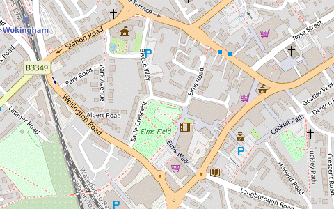
- The Recreation Ground to Wokingham Station (1½ km)
-
 Go along the right-hand side of the recreation ground. At the far end go straight across Langborough Road into Howard Road. Where this bends left, keep ahead on an alleyway (Luckley Path). Cut through Howard Palmer Gardens on the left and go across a car park to Market Place in the centre of Wokingham. For a choice of cafés with outdoor seating, go through an alleyway off Peach Street or Broad Street into Peach Place. Return to Broad Street via Rose Street and turn right. Keep left at the junction with Rectory Road, then turn left into Station Road for the station.
- At the end of the tree-lined path bear right onto Fairview Road. At a junction go straight across a residential street onto the narrow lane opposite (Howard Road). Where this turns half-left, keep ahead on an alleyway (Luckley Path). In 150m turn left into Howard Palmer Gardens.
-
Follow the path through these small gardens, curving to the right. On the far side go straight across a car park to continue on a passageway, signposted as a footpath. This leads into Denmark Street, with Wokingham Town Hall? opposite in the town's Market Place.
- There are several pubs and coffee shops nearby. For the suggested route, turn right and go along the road for 125m, passing a Costa and a Caffè Nero where it becomes Peach Street, then turn left into a broad passageway. This leads into Peach Place, a pleasant spot with outdoor seating at Coffee #1.
- The station is just under 1 km away. Leave Peach Place in its north-western corner and turn left onto the historic Rose Street?, lined with attractive old houses. At the end turn right onto Broad Street, heading NW away from Market Place. Cross over to the left-hand side at the pedestrian lights.
- In 150m fork left at traffic lights, passing the prominent Tudor House?. Unless you want to visit the Queens Head pub (on a terrace across the main road) cross Biscoe Way and bear left into Station Road. In 250m you pass the Station Tap by the crossroads in front of the railway line.
-
The unusual railway footbridge? alongside the level crossing is worth a closer look, but to complete the walk turn right into Station Approach. Go through the station's ticket hall onto Platform 1, for direct trains to London Waterloo (and others to Blackwater and Guildford along the Blackwater Valley line). For trains to Reading, cross the footbridge to Platform 2.
- Horseshow Lake (SW corner) to Sandhurst Station • Yorktown Road (2½ km)
-
Leave the BVP / 3CP by turning left through the gate onto the perimeter path around Horseshoe Lake. Follow the path all the way round to the Horseshoe Lake Activity Centre and its café on the eastern side of the lake. Skirt around the building onto a path heading east through Horseshoe Meadow. Go straight across a road junction and continue along Lower Church Road for 600m. Veer right through Lych Gate Close to meet the A321 at its junction with Yateley Road. Head east along the A321 to Sandhurst station.
- If finishing here, go up the ramp on this side of the bridge for trains to Wokingham and Reading, or the other ramp for trains to Blackwater and Guildford.
- Turn left through the gate, leaving the BVP and 3CP. Follow the enclosed path along a wooded strip of land between two lakes. In 175m the path turns right to head E between a field and scrubland for 150m before coming to the edge of Horseshoe Lake. …
- Keep right at path junctions, staying on the perimeter path. In 250m turn right at a path T-junction near the north-eastern corner of the lake. In 100m there is a metal kissing gate on the left into Horseshoe Meadow.
-
Main route
- Ignore the gate into the meadow and carry on along the perimeter path, going past wooden barriers onto a grassy strip in front of the Horseshoe Lake Activity Centre?.
- After a possible refreshment stop in its Lake View Café carry on briefly along the lakeside path and then bear left through the adjoining car park. Just before its exit turn left through a metal kissing gate into Horseshoe Meadow. In 75m turn right at a path junction.
-
Short cut
- Turn left through the gate into the meadow. Follow the grassy path round to the right to go past the back of the Activity Centre. At a path junction turn left, away from the buildings.
- Follow the path past a pylon and leave the meadow through a pair of small metal gates. Go straight across a road junction to continue in the same direction on Lower Church Road for 600m. Where this long straight road bends slightly left shortly after passing St Michael's church, turn right into Lych Gate Close.
- Follow this residential street round to the left. Go past Belfry Mews and then bear right along a short cul-de-sac to a road junction. Cross Yateley Road carefully and head E along the right-hand pavement of the A321.
- After the road has swerved right and left you pass a couple of refreshment places on the right: the Rose & Crown pub and later the Old Mill Coffee Shop & Cafe in a small parade of shops. The A321 then swings left and right under the railway bridge (where there are ramps on both sides leading up to the platforms of Sandhurst station) and becomes Yorktown Road.
-
Finishing at Sandhurst Station
-
There is no footbridge linking the two platforms. For trains to Wokingham and Reading, go up the ramp on the Rose & Crown side of the bridge to Platform 2. For trains to Blackwater and Guildford, go up the other ramp to Platform 1.
- Another refreshment place nearby is the Village Inn, 125m beyond the railway bridge on the other side of a mini-roundabout.
- Yorktown Road to Blackwater Station (3¼ km)
- Continue along the A321 and then cut through Sandhurst Memorial Park to Shepherd Meadows Nature Reserve. Follow the riverside path all the way to Blackwater.
- To finish at Blackwater you have to go through the town for 800m on Yorktown Road. You pass the Village Inn at a mini-roundabout, followed by several fast food places in a long parade of shops. Eventually you pass a petrol station and in a further 100m can finally turn right into Sandhurst Memorial Park. The final refreshment place along the route is the Sandhurst Park Cafe just inside the entrance.
- The walk continues on the tarmac path heading E past a skateboard area. Bear right in front of the Council Offices (where there are public toilets) onto a broad surfaced path alongside a water channel, leading to the park's Balancing Pond. Unless you want to do a longer walk around it, keep right to go along its western side.
-
Just before the pond's outflow veer right down the slope on a broad track signposted to Shepherd Meadows. At a path crossing keep ahead to cross the River Blackwater on a footbridge, rejoining the BVP for a pleasant riverside stretch through Shepherd Meadows Nature Reserve?.
- You could also take the path across the outflow on the left, which goes through meadows but with few views of the river. If you do this, turn right after 500m to cross the river at the next footbridge.
-
After the second footbridge the riverside path splits and you can take either fork; they rejoin in 150m. In a further 400m the path swings left and a footbridge takes you across the river to the other bank. Unless you want to detour through a meadow on the left, follow the riverside path all the way to a busy road junction.
- The meadow route (a gentle arc round to the right on a grassy path) is not much longer and rejoins the riverside path just before the road junction.
-
At the junction follow the pathway round to the right, crossing the river for the last time. For trains to Guildford and Redhill stay on Station Approach as it descends towards Platform 1 of Blackwater station. For trains to Wokingham and Reading fork left off the approach road onto the pathway alongside the A30. After crossing the railway go down steps to Platform 2.
- There are some fast food shops and a couple of traditional pubs in the parade of shops beyond the railway bridge. There are cafés in the M&S and Tesco stores (and a Costa) in the Meadows Shopping Centre on the other side of the A321, but this is more awkward to reach.
- Shepherd Meadows Nature Reserve consists of wildflower meadows and woodland alongside the River Blackwater. It is named after the wildlife artist David Shepherd.
- The Blackwater Valley Path runs for 37 km, from the river's source near Aldershot in Surrey to Swallowfield in Hampshire, just beyond where the river merges with the Whitewater to become the Broadwater.
- Horseshoe Lake Activity Centre offers sailing, kayaking and similar activities. The name of the lake comes from the shape of its small island.
- The Three Castles Path runs for 98 km between Winchester Great Hall (the only surviving part of the town's castle) and Windsor Castle; the third castle is Odiham, whose ruins are passed on Walk #84. The route is based on the 13thC journeys made by King John at the time of Magna Carta.
- Moor Green Lakes Nature Reserve supports a wide range of wildlife. The viewing hides are only open to members but there are several places where you can get good views from the perimeter path. The reserve is due to be extended to include the flooded gravel pits to the west.
- St James, Finchampstead dates from the 12thC and retains many of its Norman features, including a semi-circular apse. The brick tower was added in 1720.
- The Queen's Oak claims to be the only pub in the country with this name. An ivied plaque on the green commemorates the planting of an oak tree in 1887, the 50th year of Queen Victoria's reign. Another oak tree was planted in 2002 for Queen Elizabeth Ⅱ's Golden Jubilee.
- The Devil's Highway was the name given by Britons to the Roman Road between London and Silchester (Calleva). There are many dead-straight roads and tracks in the area, but surprisingly few are actually shown on the map as Roman Roads.
- The Wellingtonia Avenue redwoods were planted in the 1860s as a tribute to the Duke of Wellington, who had died in 1852 shortly before Sequoiadendron giganteum was discovered in the Sierra Nevada.
- The name Eversley means ‘wild boar clearing’, hence the boar on the village sign.
- The Martineau Cottages on Longwater Road were built between 1890 and 1905 by the philanthropist John Martineau, with uplifting mottos carved over the door or windows. There are others in Walsham le Willows, Suffolk.
- Ambarrow Court Local Nature Reserve was opened in 2002 and consists of two merged areas. Ambarrow Court was a country residence which was bought by the MoD in 1940 and used as a radio research centre, but it fell into disuse after WW Ⅱ; Bracknell District Council acquired the southern part of the site after the house was demolished. In the northern part (owned by the National Trust) Ambarrow Hill is thought to be man-made but archaeologists have been unable to establish its purpose.
- Wellington College grounds are open to the “Friends of Wellington College” but not to the general public. The college itself is 750m away and not visible from the public footpath.
- Ludgrove School is an independent preparatory boarding school for boys aged 8-13. The royal princes (William and Harry) attended the school in the 1990s.
- Wokingham Town Hall was built in 1860, in Gothic revival style. It originally combined the function of town hall and county police station, and included a courtroom and gaol. It is listed Grade Ⅱ*.
- Rose Street is an example of a medieval enclosed street, narrow at both ends (one has since been widened) to allow fairs, markets and other commercial activities to be contained within it. It has retained many timber-framed houses, some dating back to the 14thC.
- Tudor House is the best surviving 16thC building in the town, although the timber-framed façade was actually added in the 1920s. Several houses were joined together in phases to form the present structure.
- The railway footbridge south of Wokingham station was constructed in 1886 after there had been several accidents to pedestrians on the level crossing. It was built by enterprising navvies out of old rails and sleepers, an innovative design which has been listed Grade Ⅱ.
The main route bypasses the café in the buildings ahead but if you want to break for mid-morning refreshments you can take the alternative route in [?]. Note that if you are doing the Direct Walk you will be passing the café after completing the 2 km circuit of Horseshoe Lake.
If you are doing a Direct Walk (omitting Finchampstead), keep left to continue the circuit around Horseshoe Lake and go to §K.
The preferred route for this section was a permissive path through the fruit farm described in [?], but in May 2022 the landowner closed it “until further notice” because the British Horse Society were seeking to establish it as a public bridleway. The main route has more road walking but it does go past an alternative lunch pub.
The walk now has to follow a rather nondescript route along byways for 1 km because a short woodland path leading into the nearby National Trust land (shown as a public footpath on old OS maps) was left off the local authority's Definitive Map. Finchampstead Parish Council have created a clear path which restores this ‘missing link’ but at the time of writing it has not yet been adopted as a right of way.
The short optional extension in [?] is attractive when the heather is in flower.
Continue the directions at §L.
The full route now loops around the semi-open heathland ahead on your right and returns to this point. For a short cut (saving 750m) you could turn half-left onto the signposted footpath climbing gently through woodland and skip to §H.
If you are doing a Reverse Walk (to Sandhurst or Blackwater), go to §P.
Old OS maps show that the right of way crossed the tracks to the right here, but in 2019 Network Rail closed this pedestrian level crossing. Unlike many such closures, the new right of way through the Ambarrow Hill part of the reserve and across a road bridge is an improvement on the old route.
The main route goes past a lakeside café, but if you are not planning to break for refreshments you could take the slightly more direct route in [?].
Walk Notes
» Last updated: September 4, 2024
Return to Top | Walk Map | Walk Options | Walk Directions.