Brecon Circular via Y Gaer Battle and Pen Y Crug walk
Lowland walk along rivers, via a Roman Fort and a low ridge to an ancient hill fort
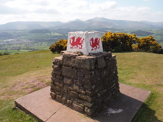
Trig Point on Pen-y-crug
SWC Walk 306 - Brecon Circular (via Y Gaer, Battle and Pen-y-crug)
May-17 • thomasgrabow on Flickr
swcwalks swcwalk306 banner 28246672149
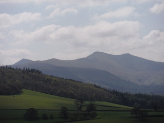
Central Beacons from Usk Valley
SWC Walk 306 - Brecon Circular (via Y Gaer, Battle and Pen-y-crug)
May-17 • thomasgrabow on Flickr
swcwalks swcwalk306 walkicon 28246658439
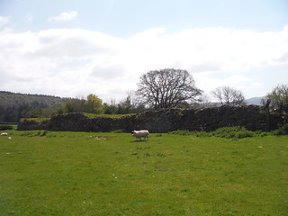
Wall Remnants of Y Gaer (Cicucium Roman Fort)
SWC Walk 306 - Brecon Circular (via Y Gaer, Battle and Pen-y-crug)
May-17 • thomasgrabow on Flickr
swcwalks swcwalk306 walkicon 25155008297
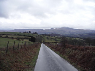
Central Beacons, from Battle Hill Ascent
SWC Walk 306 - Brecon Circular (via Y Gaer, Battle and Pen-y-crug)
Jan-18 • thomasgrabow on Flickr
swcwalks swcwalk306 walkicon 39994260422
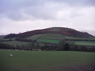
Pen-y-crug
SWC Walk 306 - Brecon Circular (via Y Gaer, Battle and Pen-y-crug)
Jan-18 • thomasgrabow on Flickr
swcwalks swcwalk306 walkicon 39994219802

Northerly End of The Black Mountains, from Pen-y-crug
SWC Walk 306 - Brecon Circular (via Y Gaer, Battle and Pen-y-crug)
Jan-18 • thomasgrabow on Flickr
swcwalks swcwalk306 walkicon 40025732081

Dan-Y-Gaer Mill
SWC Walk 306 - Brecon Circular (via Y Gaer, Battle and Pen-y-crug)
Jan-18 • thomasgrabow on Flickr
swcwalks swcwalk306 40026109401
| Length | 18.1 km (11.3 mi), with 484m ascent/descent. For a shorter or longer walk see below Walk Options. |
|---|---|
| Toughness | 5 out of 10, with 4 ½ hours walking time. |
| Walk Notes |
This short excursion from the heart of the busy market town of Brecon leads out along the Promenade along the Usk River and then through fields and woods to the remains of Y Gaer (CICVCIVM Roman Fort), built around AD 75 and established as a Roman cavalry base for the conquest of Wales. Rebuilt in stone during the 2nd half of the 2nd century AD, it still features interesting remains of walls, gatehouses and turrets. Follow the Ysgir River north up the valley and onto Battle Hill, a modest grassy ridge from where you nevertheless have extensive views of all the spectacular mountain areas around Brecon. A descent through woods and across pastures leads to the remains of Pen-y-crug Iron Age hillfort, with its up to five surviving ramparts, located on The Crug (pronounced cree-g), a hill overlooking Brecon. Despite its modest height, it has extensive views of the central Brecon Beacons, and also views to a number of neighbouring hillforts.
A shortcut cuts the long ascent to Battle Hill and the remaining short walk still provides an interesting introduction to the area with its rivers, woods and views from the Pen-y-crug hillfort site. An extension through the Priory Groves Woodland Gorge, starting from the cathedral, and going up the Honddu valley, is a fascinating excursion up this lovely gorge, which – in parts – is almost alpine in character, despite being only a stone’s throw from the town centre. This can also be done as a (very short but rewarding) standalone walk. |
| Walk Options |
A Shortcut from Battle to Pen-y-crug (entirely on tarmac) cuts out 4.7 km/2.9 mi and 156m ascent/descent (rated 3/10).
|
| Maps | OS Explorer: OL12 (Brecon Beacons National Park)
OS Landranger: 160 (Brecon Beacons) |
| Travel |
Brecon Bus Interchange, map reference SO 047 285, is 227 km west northwest of Charing Cross, 136m above sea level and in ,b>Powys, Wales. It is served by lines
Saturday Walkers’ Club: This walk is doable as a daywalk from London, especially if you have motorised transport, but also if taking trains to Cardiff, Abergavenny or Neath/Swansea to connect to above buses. |
| Lunch |
Picnic |
| Tea |
Numerous options in Brecon. Consult the pdf for details. |
| Welsh Glossary |
aber: estuary, confluence, river mouth; afon: river; affwys: abyss; allt: hillside, cliff; aran: high place; ban/fan/bannau (pl): peak/beacon/crest, hill/mountain; big: peak; blaen: source of river, head of valley; bod: dwelling; bre: hill; bron: hill-breast; bryn: hill; bwlch: gap/col/pass; cadair: chair; cae: field; caer/gaer: stronghold, fort; capel: chapel; carn/garn/carnedd/garnedd: cairn, heap of stones, tumulus; carreg/garreg: stone, rock; castell: castle; cefn: ridge, hillside; celli: grove/copse; cerwyn: pot-hole; cist: chest; clog/clogwyn: cliff; clun: meadow; clwyd: hurdle/gate; clydach: torrent; coch/goch: red; coed: wood; craig/graig: rock; crib/cribyn: crest, ridge, summit; crug: mound; cul: narrow; cwm: hanging valley/corrie/bowl/dale; cyfrwy: ridge between two summits (saddle); ddinas: fort; dibyn: steep slope, precipice; dim: no; din: hill-fortress; disgwylfa: place of observation, look-out point; dôl: meadow; du/ddu: black, dark; dwfr/dŵr: water; dyffryn: valley; -dyn: fortified enclosure; eglwys: church; eira: snow; eisteddfod: meeting-place, assembly; esgair: ridge; fach/bach: small; fawr/mawr: large; fechan: smaller; ffald: sheep-fold, pound, pen, run; ffordd: way, road; ffridd: pasture; ffrwd: stream, torrent; ffynnon: spring/well; gallt: wooded hill; ganol: middle; garth: promontory, hill, enclosure; glan/lan: river-bank, hillock; glas: green (when referring to grass, pasture or leaves), blue (when relating to the sea or air); glyn: deep valley, glen; gors: bog; gorsedd: tumulus, barrow, hillock; gwyddfa: mound, tumulus; gwylfa: look-out point; gwyn/gwen: white; gwynt: wind; hafn: gorge, ravine; hafod: summer dwelling; hen: old; hendre(f): winter dwelling, old home, permanent abode; heol: road; hesgyn: bog; hir: long; is: below, lower; isaf: lower/lowest; llan: church, monastery; llawr: level area, floor of valley; llech: slab, stone, rock; llther: slope; lluest: shieling, cottage, hut; llwch: lake, dust; llwybr: path; llwyd: grey, brown; llwyn: bush, grove; llyn: lake; llynwyn: pool/puddle, moat; maen: stone; maes: open field, plain; mawn: peat; mawnog: peat-bog; melyn: yellow; merthyr: burial place, church; moel/foel: bare, bald/bare hill; mynydd: mountain, moorland; nant: brook/stream, dingle/glen; neuadd: hall; newydd: new; ogof/gogof: cave; pant: hollow; parc: park, field, enclosure; pen: head, top/end, edge; penrhyn: promontory; pentre(f): homestead, village; perfedd: middle; perth: bush, brake, hedge; plas: hall, mansion; pont/bont: bridge; porth: gate/gateway, harbour/bay/landing-place/ferry; pwll: pit, pool; rhiw: hill, slope; rhos: moor, promontory; rhudd: red, crimson; rhyd: ford; sarn: causeway; sgwd/rhaeadr: waterfall; sticill: stile; sych: dry; tafarn: tavern; tâl: end, top; talar: headland (of field); tan/dan: below; tarren/darren: escarpment; tir: land, territory; tor: break, gap; tre/tref: settlement, hamlet, town; twlch: tump, knoll; twll: hole, pit; tŵr: tower; twyn: hill; tŷ: house; uchaf: upper, highest; uwch: above, over; waun/gwaun: moorland, meadow; wen/wyn: white; y, yr, ‘r: the; ynys: island, holm, river-meadow; ysgol: ladder, formation on mountain-side/school; ysgwydd: shoulder (of mountain); ystafell: chamber, hiding-place; ystrad: wide valley, holm, river-meadow. |
|---|---|
| Profile | |
| Help Us! |
After the walk, please leave a comment, it really helps. Thanks! You can also upload photos to the SWC Group on Flickr (upload your photos) and videos to Youtube. This walk's tags are: |
| By Car |
Start Bus Station, Brecon, Powys, South Wales, LD3 9BL Map Directions |
| Amazon | |
| Help |
National Rail: 03457 48 49 50 • Traveline (bus times): 0871 200 22 33 (12p/min) • TFL (London) : 0343 222 1234 |
| Version |
Apr-24 Thomas G |
| Copyright | © Saturday Walkers Club. All Rights Reserved. No commercial use. No copying. No derivatives. Free with attribution for one time non-commercial use only. www.walkingclub.org.uk/site/license.shtml |


Walk Directions
Full directions for this walk are in a PDF file (link above) which you can print, or download on to a Kindle, tablet, or smartphone.
This is just the introduction. This walk's detailed directions are in a PDF available from wwww.walkingclub.org.uk