Haywards Heath to Balcombe via Ardingly Walk
An undulating High Weald walk with a contrasting section alongside Ardingly Reservoir.
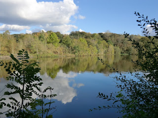
CIMG4447
Ardingly Reservoir
Oct-12 • Sean O'Neill
banner, swcwalk174, swcwalks 5866304756725042882 P
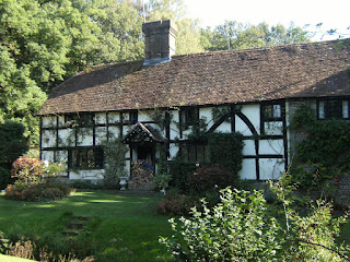
DSCF0017
Old Mill House, Horsted Keynes
Oct-11 • Sean O'Neill
swcwalk132, swcwalk141, swcwalk174, swcwalks, walkicon 5746053402912684626 P

DSCF0017
Old Mill House, Horsted Keynes
Oct-11 • Sean O'Neill
swcwalk132, swcwalk141, swcwalk174, swcwalks, walkicon 5665887190752460018 P

DSCF0028
Broadhurst Lake
Oct-11 • Sean O'Neill
swcwalk132, swcwalk174, swcwalks, walkicon 5665887552233407186 P
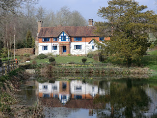
CIMG2107
Great Saucelands, Ardingly
Mar-12 • Sean O'Neill
swcwalk174, swcwalks, walkicon 5866304741775490386 P
| Length |
Main Walk: 16 km (10.0 miles). Three hours 55 minutes walking time. For the whole excursion including trains, sights and meals, allow at least 8 hours. Short Walk, via Little London: 13¼ km (8.2 miles). Three hours 20 minutes walking time. Short Circular Walk, from Balcombe: 12½ km (7.8 miles). Three hours 5 minutes walking time. Alternative Walk, finishing at Horsted Keynes: 13¼ km (8.2 miles). Three hours 25 minutes walking time. Alternative Walk, via Little London: 15 km (9.3 miles). Three hours 55 minutes walking time. Alternative Walk, starting from Balcombe: 14¼ km (8.9 miles). Three hours 40 minutes walking time. |
|---|---|
| OS Map |
Explorer 135. Haywards Heath, map reference TQ330246, is in West Sussex, 20 km N of Brighton. |
| Toughness |
4 out of 10 (3 for the Short Circular Walk, 5 for the Alternative Walks). |
| Features |
Haywards Heath is a large commuter town and there is quite a lot of it to get through at the start of this walk, but the route is better in practice than suggested by the map (and would be even more so if a new right of way is established across a private meadow). An undulating stretch across open ground and woodland typical of the High Weald eventually takes you across the River Ouse, along the dam wall of Ardingly Reservoir and up to the village of Ardingly. Near the start of the afternoon section you have an unusually close encounter with a leading independent school as the walk route takes you on a right of way through the grounds of Ardingly College. You cross over your outward route at the reservoir and join part of the Balcombe Circular via Ardingly Reservoir walk (#22·W, its ‘Winter Walk’) for a long stretch along its northern side. There is a slightly different ending into Balcombe and onwards to the station, but short stretches will be familiar to anyone who knows the Balcombe Circular walk (1–16) or the Balcombe to East Grinstead walk (1–34). As with any walk in the High Weald, you will need to be prepared for muddy or waterlogged paths at almost any time of the year. |
| Additional Notes |
This walk has undergone a number of revisions over the years. For several years the Ardingly Inn could no longer be relied upon as a lunch stop, so a detour was added to another pub in the hamlet of Little London. At first the onward route to Balcombe had to duplicate another part of Walk #22·S (the ending of its ‘Summer Walk’, shown in green on the Walk Map), but in 2023 a footbridge on the approach to Balcombe was repaired and the route changed to minimise this overlap. The walk's alternative ending stems from its original design, which was from Horsted Keynes to Balcombe. However, the transport arrangements for this combination are rather awkward and so the sections were refashioned to create the various options listed below. |
| Walk Options |
As noted above a Short Walk option has been added, which can also be combined with a new start from Balcombe to provide a Short Circular Walk from this station. The afternoon route for these options goes along the southern boundary of Wakehurst (formerly Wakehurst Place), a 16thC mansion and gardens owned by the National Trust and run by the Royal Botanic Gardens, Kew. As these two walk options are relatively short an optional detour has been included in the directions to enable a visit to “Kew's wild botanic garden”: it is open daily to 6pm summer, 4.30pm winter; there is free entry to NT members and half-price admission of £9.25 (2025) to visitors who can “present proof of car-free travel” (eg. a rail ticket). Directions have been provided from both of the possible lunch pubs for some Alternative Walk options finishing in the attractive village of Horsted Keynes (pronounced ‘canes’: see Walk Notes), strung out along a broad village green. These combine in the hamlet of Highbrook and the ending is the reverse of the start of the Horsted Keynes Circular walk (#132), including a particularly scenic section alongside one of the oldest and most successful preservation railways in the country, the Bluebell Railway. |
| Transport |
Haywards Heath is on the main Brighton line, with Thameslink trains from St Pancras, Blackfriars and London Bridge, plus Southern trains from Victoria. There are frequent services on both routes, with a journey time from central London of around 40-45 minutes. On the Thameslink route you can get cheap Super Off-Peak tickets from central and north London (Sat, Sun & BH), but these are not valid on Southern services. Buy a return to Haywards Heath for the walks starting there. For the Short Circular Walk you can buy a return to Balcombe as this is the stop before Haywards Heath; it has a half-hourly Thameslink service. At the end of the Alternative Walks Horsted Keynes is served by Metrobus 270, which runs hourly (two-hourly Sun & BH) between Brighton, Haywards Heath and East Grinstead. The bus stops at the western end of the village green, and also at the Bluebell Railway station on weekends. It is quicker to travel back via Haywards Heath but it is useful to be able to return in either direction; the last service to Haywards Heath is at around 7.30pm (5pm Sun & BH), with a later service to East Grinstead (2025). A “Thameslink only” return ticket to Haywards Heath would not be accepted at East Grinstead and you would have to buy an extra single to East Croydon, where the two lines merge. If you want to abandon the walk after lunch in Ardingly or Little London, Metrobus 272 runs every two hours (Mon–Sat) to Haywards Heath in one direction and Three Bridges in the other. If driving, Haywards Heath station car park costs around £11 Mon–Fri, £7 Sat, £3 Sun & BH. Balcombe station car park costs £3.60 Mon–Fri, free at weekends (2025); roadside parking is also available in the village. For the Alternative Walks there are free car parks in Horsted Keynes village and at the Bluebell Railway station, so you could park there and take the 270 bus to start the walk in Haywards Heath (there is no public transport going directly to Balcombe for that option). |
| Suggested Train |
Take the train nearest to 10:15 from London Bridge or Victoria to Haywards Heath (or Balcombe for the options starting there). |
| Train Times |
|
| Timetables |
|
| Lunch |
The Ardingly Inn (01444-892214; closed Mon & Tue lunchtime) in the centre of the village (7¼ km from Haywards Heath, 6½ km from Balcombe) reopened at the end of 2023 and has been provisionally reinstated as the suggested lunch pub for this walk. On the days when it is closed there are two other possible food places nearby: the Ardingly Café (01444-891113; open to 3pm Mon–Sat, 1pm Sun) and the village bakery (Mon–Sat). When the Ardingly Inn was unable to provide food the preferred walk options were those going via the Gardeners Arms (01444-892328) in the hamlet of Little London, on the B2028 to the north of the village (also 7¼ km from Haywards Heath, 6½ km from Balcombe). This is a Hall & Woodhouse pub with a nice garden, serving good food all day. Both of these pubs are likely to be extremely busy if there is a major event at the South of England Showground. |
| Tea |
On the main walk variations the suggested place in Balcombe is the Half Moon Inn (01444-811582), a community-owned pub which serves tea and coffee all day as well as stronger fare. The Balcombe Tea Rooms (01444-811777; open Wed–Sun to 3pm) used to be a popular alternative but they now close too early to be of much use. Allow 10-15 minutes to reach Balcombe station from the centre of the village; twice as long if you take the optional extension. There are two friendly pubs in Horsted Keynes at the end of the Alternative Walks, the Crown Inn (01825-791609) and the Green Man (01825-790656), although the latter is usually closed on weekday afternoons. Alternatively, you could catch the bus first and have tea while waiting for the train; there is a café in the large Waitrose next to Haywards Heath station, plus other refreshment options in and around the station. If you finish at the Bluebell Railway station the King George Ⅴ Buffet on Platforms 3&4 is normally open when trains are running, although you might have to buy a platform ticket to reach it. |
| Profile | |
|---|---|
| Help Us! |
After the walk, please leave a comment, it really helps. Thanks! You can also upload photos to the SWC Group on Flickr (upload your photos) and videos to Youtube. This walk's tags are: |
| By Train |
Out (not a train station) Back (not a train station) |
| By Car |
Start Map Directions Return to the start: Finish Map Directions Travel to the start: |
| Amazon | |
| Help |
National Rail: 03457 48 49 50 • Traveline (bus times): 0871 200 22 33 (12p/min) • TFL (London) : 0343 222 1234 |
| Version |
Mar-25 Sean |
| Copyright | © Saturday Walkers Club. All Rights Reserved. No commercial use. No copying. No derivatives. Free with attribution for one time non-commercial use only. www.walkingclub.org.uk/site/license.shtml |


Walk Directions
Click the heading below to show/hide the walk route for the selected option(s).
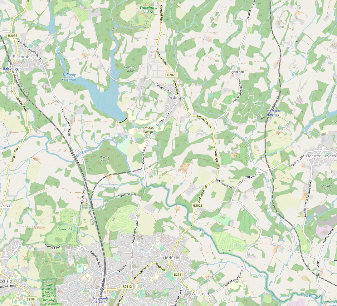






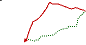



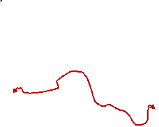
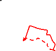
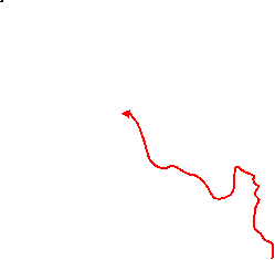


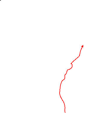
 Walk Map
©
Walk Options ( Main+Short | Alt. )
Click on any option to show only the sections making up that route, or the heading above to show all sections.
- Main Walk (16 km)
Walk Directions
Click on any section heading to switch between detailed directions and an outline, or the heading above to switch all sections.
If you are doing one of the walk options from Balcombe station, start at §G.
- Haywards Heath Station to Copyhold Lane (2¾ km)
- Bear left out of the station and head north alongside the railway, at first on a path beside Sainsbury's car park and then up Wickham Way. Continue on the footpath heading north from Wickham Farm, across a golf course and then through a wood to reach Copyhold Lane.
- Go down steps at the London end of the platform to leave the station through its ticket office and bear left across its forecourt. Cross the road at the pedestrian lights and go under the railway bridge. On the other side turn right by a mini-roundabout onto a combined pedestrian / cycleway going between Sainsbury's car park and the railway.
- At the far end join Burrell Road, passing a small roadside garden? on the right. Go up to a T-junction and turn right to go back under the railway. After passing a timber merchants turn left into Wickham Way, signposted as a pedestrian route to Ardingly Reservoir, and follow this private road uphill past houses. At the top you come to a T-junction, with a metal fieldgate ahead leading into a large meadow (Wickham Fields).
-
Main route
- Ignore the fieldgate and turn right at the T-junction onto another private road (which is also a public footpath), going between brick pillars. In 100m turn left at a footpath signpost opposite more pillars. Go downhill on a gloomy and potentially muddy tree-lined path, heading N.
- At the bottom of the slope go over a stream on a footbridge and continue gently uphill (if the main path is too muddy there are side paths through the woodland on the right as well as in the meadow, but you are likely to encounter more “Private” notices on these). You eventually emerge from the trees on the edge of a golf course, with a path from the meadow joining from the left.
-
Alternative route (provisional)
- If access has been granted, make your way past the (locked) fieldgate into the meadow. Follow a mown path down through the meadow, later curving towards its left-hand side. Go down to the bottom corner to find a substantial plank bridge over a tree-lined stream.
- After crossing the stream veer right, go through a gap in the hedge and follow a path sloping up to the top right-hand corner of another meadow. Go out through a gap to rejoin the public footpath on the edge of a golf course.
- Head N on the public footpath through Haywards Heath Golf Course, which you will be following for about 500m. Initially there is netting on your right protecting you from big hitters on a distant driving range, and shortly afterwards you need to take care when passing in front of a tee. After the path goes into some trees keep right as indicated and follow the obvious path, passing a groundsman's hut along the way.
- Eventually you come to a path T-junction with a three-way footpath signpost. Turn left into a wood, joining the Sussex Ouse Valley Way? (SOVW). Fork right at a minor path junction just inside the wood, then fork left at a waymarker post where a side path branches off to the right.
- The main path down through the wood is often muddy but you can escape the worst of it on some well-trodden side paths (but take care not to stray too far from it). The path eventually bends left and leaves the wood through a metal kissing gate, emerging onto a lane by the remains of a low embankment for the abandoned Ouse Valley Railway?.
- Copyhold Lane to Ardingly Church (3½ km)
- Join the High Weald Landscape Trail (HWLT) and follow it north across the Ardingly branch line, through River's Wood and across the River Ouse to Ardingly Reservoir. Go along the dam wall (leaving the HWLT) and then through a copse alongside the reservoir. Turn right onto a footpath going uphill to Townhouse Farm and continue along Church Lane to St Peter's church.
- Cross Copyhold Lane and take the tree-lined footpath just off to the right, now on both the SOVW and the High Weald Landscape Trail? (HWLT). In 150m go through a gate, past a cottage and through a belt of trees. Keep ahead across a potentially boggy field and continue gently uphill on a tree-lined track.
- At the top of the slope go through a gate and across a brick bridge over the single-track Ardingly branch? line. Keep ahead through a metal kissing gate into River's Wood, part of the extensive Balcombe Estate. Follow the waymarked HWLT through the wood for 800m, gradually curving to the right while always heading roughly N.
- At the end of the wood go through a gate and bear right across a grassy area towards a substantial wooden footbridge. Cross the River Ouse on this bridge (leaving the SOVW, which turns left) and continue along the left-hand edge of another grassy area.
-
Go over a second footbridge and keep ahead up the right-hand side of a field; as you gain height you will be able to see the Ouse Valley Viaduct?, just over 1 km away to the left. About two-thirds of the way up the field, turn right as indicated through a gap in the hedge and follow a grassy path through another field, gradually curving round to the left.
The massive building perched on a hill 600m away to the right is Ardingly College; the main afternoon route to Balcombe passes through its grounds.
- In the far corner go through a kissing gate and keep ahead through a small area of scrubland (leaving the HWLT, which turns right). At the bottom turn right at a three-way footpath signpost and go down a short slope to a corner of Ardingly Reservoir?, with the Activity Centre (which has a small café) on your left. Go all the way along the dam wall and through a gate into a copse.
- Follow the path through the trees, then turn right at a three-way footpath signpost. Go over a stile and up the right-hand side of a field. Go through a gap in the top corner and straight across a larger field, still climbing. At the top you come into the corner of a yard with some old farm buildings, with a four-way signpost. Turn half-right onto the farm track to its left, initially heading NE.
- The track soon bends left and becomes a long residential street (Church Lane), eventually coming to a churchyard on the left. If you detour through it to visit the church of St Peter? (which is usually open) you can leave via its lychgate further up the lane. Either way, go up to its T-junction with Street Lane.
- Ardingly Church to the High Street (1 km)
- Turn right and follow Street Lane into the centre of Ardingly.
- Turn right onto Street Lane and follow it all the way into the centre of Ardingly. In 750m, opposite a crescent-shaped green on the left, there is an inn sign for “The Oak at Ardingly”, but the village's second pub closed a long time ago and has been rebuilt as a modern house. The Ardingly Inn and the Ardingly Café are on the right-hand side of the road 200m further on, just before the junction with College Road and the B2028.
- Ardingly High Street to the Reservoir (2½ km)
- Head south-east on the B2028 for 200m, then turn right to rejoin the HWLT (in the other direction). Head south across several fields, then turn right at a path crossing. Go through Standgrove Wood and across College Road into Ardingly College. Follow the public bridleway through the school grounds. Keep right at a junction onto a footpath going past Great Saucelands, then turn left to come out onto a green space. Turn right (leaving the HWLT) and go up to the dam wall of Ardingly Reservoir.
- From the major road junction in the centre of Ardingly head SE on the B2028, signposted to Lindfield and Haywards Heath. In 200m, shortly after passing Ardings Close on the left, turn right onto a signposted footpath along a driveway, rejoining the HWLT (in the other direction). At the end of the drive veer right and left past the back of a house and continue along a short enclosed path into a field.
- You will be heading S across three large fields for the next 750m. Go along the left-hand edge of the first field, then straight across the second (crossing a concrete track in the middle). In the third field follow a grassy path swinging slightly round to the left, in 250m coming to the end of a hedge projecting into the field.
- Go through a gap and continue along the left-hand edge of a fourth field for just 75m, then turn right at a four-way footpath signpost onto a faint grassy path across the field, heading W. On the far side go into Standgrove Wood and follow the potentially muddy footpath straight through it, ignoring one or two permissive side paths. At the end keep left through a parking area to reach a road (College Road again).
- Cross the road carefully and take the main entrance into Ardingly College?, a public bridleway which follows the main driveway through the school grounds. After passing in front of the imposing main building follow the drive round to the left and past more school buildings, then keep right to go down a slope.
- At the bottom keep ahead and follow the drive as it curves to the right past a large pond, with “Great Saucelands” on the far side. The drive bends left in front of this attractive house and goes across a small wooded valley. About 25m before a fieldgate across the drive, turn left as indicated by a waymarker post.
- At the end of a short woodland path go over a stile and turn right (leaving the HWLT), climbing a grassy slope onto the dam wall of Ardingly Reservoir again.
- Ardingly Reservoir to Balcombe Mill (3½ km)
- Repeat a short section of your earlier route through the copse and continue along the perimeter path around the eastern side of the reservoir. At the end turn left onto a lane (West Hill) going across the Causeway. Turn left onto another section of the perimeter path and go all the way around the northern edge of the reservoir. Continue through Great Burrow Wood and turn left onto Mill Lane to come to Balcombe Mill by the head of the reservoir.
- Veer right at the top and repeat your morning route through a copse. After emerging from the trees simply continue along the perimeter path for 1 km, ignoring a couple of footpaths off to the right along the way. At the end turn left onto a path alongside a lane and follow it across the causeway separating two parts of the reservoir.
- On the far side of the causeway turn left through a gate and follow another section of the perimeter path for 2 km, again with the reservoir on your left. The final section is through a wood where the path climbs gently and comes out onto Mill Lane.
- Turn left and follow the lane downhill, then round to the left where it crosses over an arm of the reservoir. Shortly after the lane passes Balcombe Mill and curves to the right, there is a footpath signpost on the left.
- Balcombe Mill to Balcombe (village) (1¾ • 1¼ km)
-
For the suggested route continue along Mill Lane, then take a footpath on the right to a corner of Balcombe Lake. Follow the footpath through a wood to the west of the lake and turn left at a path T-junction to go uphill into Balcombe village.
- Alternatively, shortly after passing Balcombe Mill turn left onto a footpath going up steps to a field. Turn right at the top and go through a small wood to rejoin Mill Lane. Turn left and follow the road briefly round to the left, then turn right onto a footpath heading north-west. Go across a valley and past a cricket pitch into the village.
-
Main route (1¾ km)
- Carry on along the lane for a further 200m. After it has curved left and started to climb, turn right onto a signposted footpath. Go up a wooded slope, over a stile and along the right-hand edge of two fields, crossing a stream in the belt of trees between them.
- At the end turn right briefly onto a surfaced lane, towards a corner of Balcombe Lake?. Before reaching it turn left through a metal kissing gate by a four-way footpath signpost. Go along the bottom of a small field and into a larger field, via a kissing gate and plank bridge over a stream if necessary.
- Ignore a grassy path going straight ahead up the slope and turn right to go along the field edge. In the corner go through a kissing gate and follow the path round to the left for a short stretch with fine views across the lake, before the path bears left uphill into a wooded area.
- The path winds its way through the trees, crossing a few streams on plank bridges along the way. In 400m turn left at a T-junction with a three-way footpath signpost.
- Follow the path uphill past a large depression and out of the trees through a wooden gate. Keep ahead through a semi-open area and then up a large field, staying near its right-hand side. In the top corner go out through an old metal gate and bear right onto a track, still climbing into the village of Balcombe.
- Keep ahead where the track joins a residential street, which then turns half-left by the entrance to Balcombe House. On the right you pass the Balcombe Stores and then the suggested refreshment place, the Half Moon Inn.
-
Short cut (1¼ km)
- Turn left at the footpath signpost to go up a long flight of newly-restored steps with a sturdy wooden handrail, passing an old millstone and seat “for the enjoyment of walkers” along the way.
- At the top go through a metal kissing gate into the bottom corner of a field. Ignore the fenced path up the field edge and veer right onto a broad grassy ride into a wood, initially heading N. In 75m this bridleway turns left; later it curves back round to the right and emerges from the wood on Mill Lane again.
- Turn left and follow the lane round to the left (note the cautionary sign at the track leading to Woodwards Farm). 50m after this bend, go over a stile in the hedge on the right. Go down across a field and through a gap in the tree boundary. Cross a stream on a wooden footbridge and turn left to go up the side of a field.
- In the top corner go through a metal kissing gate onto a short path between trees, emerging onto a cricket pitch. The right of way appears to cut across it to a gap in the boundary hedge 75m off to the right, although this direct route might not endear you to the players if a game is in progress.
- However you get there, go through the gap and bear right onto a track going gently uphill between hedges. In 200m follow it round to the left, where another footpath joins from the right.
- …
- Balcombe Station to The Causeway (3¾ km)
- Go up onto the station footbridge and out to the B2036. Take a path opposite up a slope and turn right onto Newlands. Follow this residential street and its continuation (Oldlands Avenue) to a T-junction. Turn left onto Haywards Heath Road, then in 150m turn right onto a bridleway. In 300m take a footpath going down steps and turn right onto Mill Lane. Follow the lane over an arm of Ardingly Reservoir, then veer right onto a bridleway going around its northern edge for 2 km to West Hill.
- From either of the platforms go up steps onto the station footbridge and turn right to come out onto the B2036. Cross the main road at the traffic island and take the tarmac path just off to the left, up a short grassy strip away from the main road. At the top cross over a residential street (Newlands) and turn right onto the footway alongside it, still climbing and curving round to the left.
- After passing a few side streets the road name changes to Oldlands Avenue. Go all the way along this tree-lined ‘unadopted road’ (which is also a public footpath), eventually coming to a T-junction with Haywards Heath Road. Turn left and go along its pavement for 150m, coming to Barn Meadow on the right. Cross the main road carefully and take the (rather gloomy) bridleway to the left of this side street.
- The bridleway leads into a field where it continues between a wire fence and a large plantation of young trees (with a plaque for the Queen's Green Canopy?), then alongside a wood. In the bottom corner of the field ignore a broad grassy ride into the wood (the continuation of the bridleway) and go through a metal kissing gate ahead onto a footpath.
-
Follow the path down
…
At the bottom turn right onto Mill Lane.
- If the footpath down the steps is closed for repairs take the continuation of the bridleway through the wood and turn right onto Mill Lane at the far end. The lane has to wind its way downhill before it passes the bottom of the steps in about 400m, so this detour adds nearly 500m.
- From the bottom of the steps follow Mill Lane round to the left, passing Balcombe Mill and crossing a short causeway over one of the arms of Ardingly Reservoir. After the lane swings round to the right and climbs for 150m, veer right through a wooden side gate onto a signposted bridleway. This drops downhill through woodland, levels off and passes a “Welcome to Ardingly Reservoir” information panel.
- Ignore all ways off and simply follow the bridleway through this Local Nature Reserve for a total distance of 2 km, with views of the water through the trees on the right. Eventually the path swings round to the left to head N. At the far end go out through a wooden gate onto another lane (West Hill). Turn right onto a path alongside the lane, which goes across a causeway separating two parts of the reservoir.
- The Causeway to Ardingly Church (1¾ km)
- On the other side of the causeway turn right to continue along the perimeter path. In 450m turn left …
- On the other side of the causeway turn right through a gate onto the continuation of the perimeter path around the reservoir. Follow this path for 450m as it meanders around a couple of inlets. After the second of these, by a “Kingfisher” information panel, turn left at a three-way footpath signpost. Go over (or around) a stile onto a path going up through scrubland and into the bottom corner of a large field.
- Carry on up the left-hand field edge. In the top corner bear left as indicated onto a farm track. This swings right and left and leads into the corner of a yard with some old farm buildings. Keep right as you go across the yard to come to a footpath junction with a four-way signpost and take the farm track to its left, initially heading NE.
- …
- Ardingly Church to Little London (1 km)
- Turn right briefly onto Street Lane, then turn left onto a short link road leading to a driveway. Follow this around the western side of the South of England Showground and out through its North Gate to the B2028, with the Gardeners Arms opposite.
- Turn right briefly onto Street Lane and then almost immediately turn left onto a short private road (which is also a public footpath). At the end go through a wooden side gate and turn left onto a wide tarmac driveway, which you will be following around the South of England Showground. The drive soon turns half-right to head N, with views across a valley on the left containing an arm of the reservoir (not visible).
- In 500m turn half-right at a three-way footpath signpost to stay alongside the perimeter fence. In 200m ignore another footpath off to the right by an entrance to the showground. The main driveway soon turns half-right again and you follow it out via a wooden side gate to the B2028. Cross the road carefully to the suggested lunchtime pub, the Gardeners Arms.
- Little London to Forest Farm (2¾ km)
-
Head north briefly on the B2028 and turn left onto a footpath.
- If you want to detour to Wakehurst, take a permissive path on the right across South Park to its Visitor Centre. You can either resume these directions from the path in the Loder Valley, or switch to Walk #22·S.
-
Go back across the B2028 from the pub and turn right onto its wide grassy verge. In 150m turn left at a footpath signpost into the track to Tillinghurst Farm, soon with a wooden gate in the fence on the right which is the start of a permissive path to Wakehurst.
The main route continues along the track, but follow the directions below if you want to detour to the botanic gardens.
-
Detour to Wakehurst (+1½ km if returning via Loder Valley)
- Go through this gate and a metal gate in the deer fence into South Park. Follow the mown path along the edge of this parkland, dotted with some fine specimen trees. In 600m pass through another metal gate and go through a small grove of birch trees to reach a driveway.
- Cross the driveway and continue across a field. Towards the far side follow the mown path round to the left and go through a wooden fieldgate. Veer right through a gap in the hedge and make your way across the car park to the Wakehurst visitor entrance, 125m ahead on the left.
-
You can visit the Seeds Café and shop in the Visitor Centre without paying the entrance fee to visit the gardens.
- Non-visitors would need to retrace their steps along the permissive path through South Park to resume the walk.
- Wakehurst visitors could exit through the gate into the Loder Valley Nature Reserve? in the south-western corner of the grounds, then in 150m fork right towards a covered footbridge and resume the directions at [?].
-
Alternatively – if you have its directions – you could switch to Part Four of Walk #22·S, which covers the entire route from Wakehurst to Balcombe station.
- Non-visitors would need to pick up the directions at the start of Part Four by taking an inconspicuous pedestrian exit on the northern side of the car park, which comes out by a cattle grid on the right of way through the grounds.
- Wakehurst visitors could either return towards the Visitor Centre and take the driveway going past the side of the Millennium Seedbank building (signposted to Pondfield Cottage and Wakehurst Farmhouse); or pick up the directions where the right of way goes across Bloomers Valley and leaves the grounds through a high wooden kissing gate in the boundary fence.
- To continue the walk without the detour carry on along the farm track, heading W. In 450m go through a metal fieldgate and keep ahead where the main track curves left towards the farmhouse. Keep right past some outbuildings to pick up a track leading away from the farm, going gently downhill and still heading W.
- Go through a metal side gate and carry on down the right-hand edge of two fields, with views ahead across a wooded valley. In the bottom right-hand corner of the second field continue on a path through a wooded area which leads into the top corner of another field. There is a wooden bench from which to admire the view of one of the arms of Ardingly Reservoir, snaking away to the left at the bottom of the valley.
- Follow a faint grassy path going diagonally down across the field. In the tree boundary go through a metal kissing gate, down a short flight of steps and turn left onto a path through the Loder Valley Nature Reserve?. Almost immediately fork right towards a covered footbridge.
- Cross the valley on the long footbridge, high above the water. On the far side follow the path briefly round to the left and then immediately veer right, avoiding a gate into another part of the nature reserve. Follow a meandering woodland path steadily uphill for 500m to a minor road (Paddockhurst Lane).
- Turn right and follow this narrow lane for 800m, taking care as there is no pavement (but not much traffic). Towards the end of this stretch you pass a few properties, then a high brick wall on the left. At the end of this wall continue past a stile on the right, briefly joining the Walk #22·S route from Wakehurst.
- Almost immediately turn left into a driveway with signs for The Crest, Forest Farm and a few other properties (this is a right of way, although there was no footpath marker when last checked). After passing the entrance to The Crest the drive turns half-left and comes to a three-way footpath signpost at the entrance to a field.
- Forest Farm to Balcombe (village) (2¼ km)
- Turn right at a footpath junction to head west past several properties, then across a large field and through a wood to a farm track (Boundary Road). Turn left and go along the track for 700m, then turn left onto a footpath going uphill into Balcombe village.
- Unless you want to switch to the Walk #22·S route (which goes straight on) turn right at the footpath junction. Keep left on the farm track, passing the entrance to several properties. After the last one (Forest Farmhouse) continue on a narrow path into some trees, soon with a wooden fence on the right. Keep ahead at a footpath junction and go through a wooden kissing gate to continue on an enclosed farm track.
- In 100m, where the track swings left, veer right through a metal fieldgate (or over a stile) into a large farm field. Start along its left-hand edge and maintain direction where the field opens out after 100m; if there is no clear path, head past a pole carrying power cables towards a dead tree 200m away. As the field drops away you will see a metal kissing gate in the tree boundary ahead.
- Go through this gate and follow the potentially muddy footpath down through a wood. In 200m it swings right by a waymarker post and crosses a boggy area on a plank footbridge. Follow the path out of the wood and turn left onto a farm track, soon crossing a stream on a brick bridge.
- Follow the track for 700m, gradually curving round to the right. Ignore gaps on the left into farm fields (with ‘No Entry’ signs) but turn left at a three-way footpath signpost in the tree boundary. Follow the woodland path across a long newly-restored plank footbridge and up a flight of steps. Keep ahead at another three-way footpath signpost.
- …
- …
- The village to Balcombe Station (1 • 2 km)
-
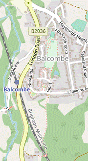 Unless you want to take a direct route along Bramble Hill and the B2036, turn left briefly into Stockcroft Road. Fork right onto a footpath going along the side of the recreation ground and then past housing to Newlands. Turn right onto this residential street and veer left down a short link path leading to the B2036 opposite the station entrance.
-
For a brief extension you can go straight across Newlands onto a footpath leading to a footbridge over the railway line, then double back along a woodland path alongside the B2036 to the station car park.
-
For a brief extension you can go straight across Newlands onto a footpath leading to a footbridge over the railway line, then double back along a woodland path alongside the B2036 to the station car park.
-
From the pub go up to the road junction and take the road opposite, signposted to the Railway Station. Almost immediately turn left into Stockcroft Road, passing Victory Hall on the right.
- The Balcombe Tea Rooms are on the right-hand side of Bramble Hill just past this junction with Stockcroft Road, but they are unlikely to be open after 3pm.
- Where Stockcroft Road bends left after 100m, veer right onto a tarmac path going past a bowling green and a sports pavilion into the corner of Balcombe Recreation Ground. Carry on down its left-hand side.
- In the corner continue on a tarmac path past some houses and keep ahead on a short residential street (Jobes). This comes to a T-junction with Newlands, with a signposted footpath opposite which is the optional extension.
- To go directly to the station, ignore the footpath and turn right onto the footway alongside Newlands, curving down to the right. In 175m veer left across the road onto a tarmac path going down a short grassy strip to the B2036. Cross the main road at the traffic island on the left and go down a few steps onto the station footbridge. Trains to London leave from Platform 1, on the far side.
-
Optional Extension (+1 km)
- Take the footpath opposite Jobes, which soon merges with a track from the left. Go through an area of scrubland and then all the way down the left-hand edge of a large field.
- In the bottom corner go through a metal kissing gate onto a path which leads to a footbridge over the Brighton line. Cross over the railway tracks and continue along a short fenced path.
- Go through a small wooden gate and veer right and left to go out along the driveway to Kemps House. This curves down to the right past the buildings of Kemps Farm and leads to the B2036.
- Cross this main road carefully and turn right onto the grass verge. Continue on the signposted footpath into the belt of trees alongside the main road.
-
In 250m the footpath crosses a farm track. In a further 50m bear right at a path junction to come to the entrance to the station car park. Go through it and onto Platform 1 for trains to London.
- Ardingly High Street to Highbrook (1¾ km)
- Head north briefly on the B2028 and turn right onto a footpath. At Withyland keep right and cross a stream in a valley. At the top turn half-left and follow the footpath past Highbrook Vineyard into the hamlet of Highbrook. Head north on Hammingden Lane to All Saints church.
- From the major road junction in the centre of Ardingly head N on the High Street for about 150m. Opposite Holland House (#29) turn right into a short lane signposted to 28-60 High Street.
- At the end go through an old kissing gate next to a fieldgate and take a faint grassy path across a field (slightly to the left), soon starting a long descent into a valley. Go over a stile in a belt of trees and continue down the right-hand edge of the next field. In the bottom corner go over another stile and follow the path between a wood and a garden fence.
- At the start of an open area fork right at a three-way footpath signpost, then keep ahead at another one, ignoring a footpath off to the right. Go along the right-hand side of a grassy strip, gently downhill towards a wood. Go into these trees and across a stream, then uphill on a narrow path at the edge of the wood.
- At the top of the wood go through an old gate and keep ahead on a broad grassy path, soon alongside a young hedge between wire fences. Follow the footpath as it turns half-left, going through a metal fieldgate and now with high hedges on both sides.
- At the far end go through another fieldgate and keep ahead, passing a gate leading into Highbrook Vineyard? on the right and a modern barn on the left. Briefly join a surfaced driveway, then opposite a large new house turn left as indicated. Cross a ditch on a plank bridge and follow an enclosed grassy path towards the spire of Highbrook church.
- At the far end go through a new wooden gate and turn right to go diagonally across a grassy enclosure. In the opposite corner go over a stile and turn left, emerging onto a minor road (Hammingden Lane) at a bend. Keep ahead through the hamlet of Highbrook, merging with the other route from a footpath by stables on the left.
- Little London to Hook Lane (2¼ km)
- Head south on the B2028 for 500m, then take a bridleway almost doubling back along a wooded hillside. At Fulling Mill Farm turn right onto the High Weald Landscape Trail (HWLT) and follow it across a stream in Hoathly Shaw and up the other side of a valley to Hook Lane.
- Turn left out of the pub to head S on the B2028. In 300m you can move away from the main road by veering left into a long lay-by. Shortly after this rejoins the road turn left onto a signposted bridleway into the trees, soon swinging left to head N. This potentially muddy path becomes increasingly uneven as it gradually descends the wooded hillside.
- In 500m the bridleway emerges from the trees and curves around the top of a sloping field. In 300m it merges with a farm track coming in from the left. There is a small triangular field on your right and it is tempting to go straight down to its bottom corner, but to follow the right of way you should carry straight on as indicated by a blue waymarker and then turn sharp right at a three-way footpath signpost.
- Either way, go into the trees at the bottom of the field to continue on a clear path sloping down the hillside, briefly back on another section of the HWLT and heading SE. After crossing a stream on a wooden footbridge follow the woodland path uphill, passing a large depression near the top and emerging into a large meadow.
- Follow a broad grassy path across the meadow, heading E. On the far side go through a wide gap and keep ahead along a track, fenced-off from the field on your right. At the top do not be tempted to follow this broad grassy strip round to the right (there is no exit further along), but go out past a wooden barrier in the left-hand corner onto a minor road (Hook Lane).
- Hook Lane to Highbrook (1¼ km)
- Turn right and go along Hook Lane for 250m, then fork left onto a farm drive (leaving the HWLT). Follow the footpath across another valley and up to the village of Highbrook.
- Turn right and go along this narrow lane carefully for 250m, heading S. Where the lane bends right bear left onto a farm track, signposted as a public footpath. In 150m fork left off the HWLT at a three-way footpath signpost, towards Holly Farm.
- After passing a cottage and the farmhouse veer left through a gap in the hedge, as indicated by a waymarker post and a ◄FOOTPATH sign. Go over a newly-restored stile and turn right to go down the edge of a field (directly towards Highbrook's church spire on the horizon, 750m away).
- In the next corner veer right and left into another large field. Keep right to go down to its bottom corner and go past an old stile into a wood. Follow a potentially muddy path down a steep little bank, over a stream on a wooden footbridge and up through a gate into another sloping field.
- Make your way steeply uphill to its top right-hand corner. Go out through a fieldgate onto a farm track curving left past some dilapidated farm buildings, then stables. At the end go over a stile to the right of a double metal fieldgate and turn left onto a minor road (Hammingden Lane) heading N through the hamlet of Highbrook.
- Highbrook to Leamland Wood Bridge (2 km)
- At the church turn right onto the footpath heading east across a valley and up to the Bluebell Railway line. Turn right onto the footpath running alongside the track, then round a short loop onto Leamland Wood Bridge.
- In front of the lychgate for All Saints? church turn right onto a broad track, signposted as a footpath and immediately going past an unusual building on the right, Highbrook Smokery?. Keep left alongside the churchyard and continue between hedges for 300m, heading E with fine views ahead as you gently descend into a valley.
- The track eventually opens out and you carry on downhill near the edge of several large fields, always with a hedge on your left. In the bottom corner of the last field go through a metal fieldgate onto a path through a small wood, curving round to the right. After crossing a wooden footbridge over a stream go up earth steps and leave the wood over a stile. Follow a grassy path slightly to the left across a field, climbing steadily.
- At the top go over a stile in the fence and follow the signposted route ahead between fences. Go over another stile in the trees on the far side to come out in front of a level crossing over the single-track Bluebell Railway?. Do not cross the track but turn right onto a footpath running along the railway embankment, with fine views on both sides.
- In 500m you can see Leamland Wood Bridge over the railway ahead, but you have to take a circuitous route to reach it: over a stile on the right and through a small plantation, round to the left along a short enclosed path and then up a track curving round to the right. At the top turn left to go over the bridge, with a view of Horsted Keynes station? off to the right.
- Leamland Wood Bridge to Horsted Keynes (village) (2¼ km)
-
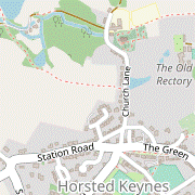 To finish in the village, veer left at the top of the slope overlooking the picnic area and take the footpath alongside Leamland Wood to Cinder Hill Lane. Turn right briefly onto the road, then take the footpath on the left down through a wood to Mill Lake. Keep ahead at a path crossing to go along the valley floor and turn right up Church Road to the village green.
-
Alternatively, simply go down past the Bluebell Railway station to the bus stop at the end of its approach road.
-
Alternatively, simply go down past the Bluebell Railway station to the bus stop at the end of its approach road.
-
On the other side of the bridge veer right through a small parking area. Follow the track to the top of a sloping field used as a picnic area.
- At weekends the 270 bus calls at the station. If you want to cut the walk short (or take a closer look at the heritage railway), go down the slope and past the right-hand side of the visitors' car park onto a short access road leading to the station buildings. The bus stop is at the far end of the station approach road.
-
To finish in the village follow the track round to the left at the top of the slope. Go through a metal kissing gate onto an enclosed path heading E alongside Leamland Wood. In 200m go over a stile in the fence on the left to continue on a grassy strip between the fence and paddocks; in a further 200m another stile takes you back over the fence.
In the past it was easier to ignore the first stile and stay on the narrow enclosed path, but this is becoming overgrown.
-
Go down an earth bank and turn right onto a minor road (Cinder Hill Lane). In 100m go over a stile on the left and follow a path through a strip of grassland dotted with trees, then steadily downhill through a wood. At the bottom turn right at a three-way footpath signpost onto a grassy path. This curves gently to the left around Mill Lake? and comes to a path crossing.
- If you want to detour to St Giles church, turn left and follow the path past the picturesque Old Mill House and up through a wood to the village school and church. After visiting the church, go along Church Lane towards the main part of the village and resume the directions at [?].
-
For the most direct route into the village, keep ahead on a signposted footpath and follow this narrow path through the trees, heading SE and ignoring ways off. In 150m you pass a pond on your left and continue on a fenced grassy path along the valley floor, between paddocks and a meadow. At the far end go out between houses and turn right onto Church Lane (away from the church, up on the left).
-
Follow the lane uphill, passing the imposing gates to the Old Rectory on the left. At a road junction the suggested route is to follow Church Lane round to the left to come out onto the long village green in Horsted Keynes? opposite the Crown Inn?, with the village stores on the left.
- Alternatively, you can go straight ahead up the steep little path. The bus stop for Haywards Heath is off to the right on the other side of the main road, but you should veer left at the top of the path (as indicated) to a safer crossing point.
- To complete the walk turn right at the top of Church Lane (or left if leaving the Crown) and go along the green, passing the Green Man and the stop for buses to East Grinstead on the right. Buses for Haywards Heath leave from a stop just beyond the road junction at the western end of the green.
- The small roadside garden on Burrells Road was established in 2013 to commemorate the outbreak of World War Ⅰ.
- The Sussex Ouse Valley Way runs for 68 km, closely following the course of the River Ouse from its source in Lower Beeding to Seaford.
- The Ouse Valley Railway was a ‘spoiler’ operation by the London, Brighton & South Coast Railway, which wanted to keep rivals out of its territory. It would have linked the Brighton line to St Leonards (near Hastings) via Uckfield and Hailsham. Shortly after work began in 1866 the collapse of the bank financing its construction led to the project being abandoned.
- The High Weald Landscape Trail runs for 145 km across the length of the High Weald, mostly near its northern edge, from Horsham in West Sussex to Rye.
- The Ardingly branch connected the Bluebell line with the Brighton main line at Haywards Heath. The intermediate station at Ardingly (2 km south of the village, on College Road) was popular with ramblers and often the destination for special trains. The short section from the Brighton line to its old goods yard is still used by freight trains.
- The Ouse Valley Viaduct (seen to better effect on Walk #22) was opened in 1841 and carries the Brighton main line 450m across this wide valley, 29m above the river. Its 37 brick arches are topped with a stone balustrade and four classical pavilions, making it one of the most elegant railway structures in Britain.
- The 198-acre Ardingly Reservoir is a popular venue for fishing and watersports such as sailing, canoeing and windsurfing.
- St Peter, Ardingly dates from around 1330, with the tower added in the early 15thC. The village later developed around the main road to the east, leaving the church on the outskirts.
- Ardingly College is a fee-paying independent school, catering for around 750 pupils from 2½ to 18. It was founded by Canon Nathaniel Woodward in Shoreham-by-Sea in 1858 and moved to these new buildings in 1870 (with an inaugural sermon from “Soapy Sam” Wilberforce). Now one of a group of Woodward Schools, it retains a strong Anglo-Catholic tradition.
- Balcombe Lake and Mill Lake were created to supply water for the local mills. Both are now popular fishing ponds.
- The Queen's Green Canopy plaque commemorates a plantation of several hundred young trees planted for Her Majesty's Platinum Jubilee in 2022.
- The Loder Valley Nature Reserve is a mix of meadows, wetlands and woodland linked to the botanic gardens. It is only accessible to Wakehurst visitors, who can pick up a trail guide and map from the admissions desk.
- Highbrook Vineyard was planted with Pinot Noir, Pinot Meunier and Chardonnay vines in 2018. It expects to produce its first harvest of sparkling wine in 2023.
- All Saints, Highbrook was built in 1884, mainly using local sandstone. The tower used to have a carillon mechanism which played tunes on the church bells, but this has reportedly been removed to a museum.
- Highbrook Smokery was built around 1780 to preserve meat from pigs brought into the Weald to feed on acorns in autumn. The building was restored in 2009.
- The Bluebell Railway began operating a steam railway between Sheffield Park and Horsted Keynes in 1960, just two years after British Rail closed the line from East Grinstead to Lewes. It was extended north as far as Kingscote in 1994, and to East Grinstead in 2013 after a major project to clear a cutting of landfill waste.
- Horsted Keynes Station has been restored to the Southern Railway period in the mid-1920s. It is surprisingly large for a sleepy country station on a secondary line, some way from the village it was built to serve. There is a £3 admission charge for non-travellers when trains are running, rather more than the 1d platform ticket in 1935.
- The name Horsted means ‘a place where horses are kept’. The Saxon manor was given to the Norman knight Ralf de Cahaignes by William the Conqueror. The anglicized version of his name changed over the centuries to Keynes but the pronunciation stayed as canes, not keens.
- The Crown Inn was seriously damaged by fire after being struck by lightning in 2003, and was closed for six years.
The alternative route through Wickham Fields in [?] is much more appealing than the main route, but the landowner has erected “Private” notices around the meadow. Local residents have used these field paths for many years and the (provisional) alternative directions are for a new right of way which a Community Action Group is seeking to establish.
If you are doing one of the walk options via Little London, go to §I.
If you are doing an Alternative Walk (finishing at Horsted Keynes), go to §M.
The suggested route has been changed to go past Balcombe Lake. The previous directions have been retained as the short cut in [?], although the bridleway through the wood at the top of the steps can be very muddy.
Complete the directions at §L.
If you are doing an Alternative Walk (finishing at Horsted Keynes), go to §N.
The suggested route to Balcombe station is different from the usual route along Bramble Hill and Rocks Lane (or the B2036), with less road walking. You can extend it with a short loop to the south of the station, essentially combining the main and shortcut endings of Walk 1–16.
Continue the directions at §P.
At Haywards Heath alight at the Perrymount Road stop, just past a roundabout and opposite a large Waitrose store. Cross Perrymount Road at the roundabout and go past the store (which has a café) on your left to reach the station entrance.
Walk Notes
» Last updated: March 12, 2025
Return to Top | Walk Map | Walk Options | Walk Directions.