Knebworth Circular Walk
Knebworth Hall, pretty Hertfordshire Villages, undulating woodland and fields

Snowdrops
Walden Bury, Knebworth Circular walk
Feb-23 • Saturdaywalker on Flickr
swcwalks swcwalk353 walkicon 52685409644

Aconites growing wild in the woods
Knebworth Circular walk
Feb-23 • Saturdaywalker on Flickr
swcwalks swcwalk353 walkicon 52685192815


| Length |
Circular Walk: 19.87km (12.35 miles) with 787 feet (240 m) of ascent. Finish in Hitchin: 11.6 miles (18.7 km) with 700 feet (200 m) of ascent. |
|---|---|
| OS Maps |
Explorer 193 for Knebworth and 182 for Welwyn Garden City. Landranger 166 |
| Toughness |
4 out of 10 |
| Features |
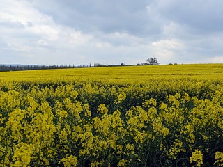
This is a companion walk to SWC 340 Knebworth to Welwyn Garden City, and shares the opening leg of the Welwyn walk, through Old Knebworth and Knebworth Hall, then its extensive grounds and deer park, and on through Graffidge Wood to exit onto Rusling Lane. Here the walks go their separate ways. The Circular walk now heads along this quiet lane to either the village of St Paul’s Walden, or to the village of Whitwell via Reynolds Wood (depending on your choice of lunch pub). On your way to Whitwell you go past the country estate of the Bowes-Lyon family (St Paul's Walden Bury). After Whitwell you cross over some vast fields on the Hertfordshire Way as you head for Hoo Park then Codicote before returning to Knebworth via Rabley Heath. There is a fair bit of road walking after Graffidge Wood and at the start and end of this walk, but some of this is on quiet lanes and it should not detract from the walk. However, in dry conditions you might like to don well cushioned trainers instead of walking boots, although the latter should always be worn in winter, when you are likely to encounter muddy sections en route. In early February you will find some fine displays of snowdrops along the way which, together with some nice views, should add to your enjoyment of this walk. On the route to Hitchin you pass through a number of magnificent bluebell woods. |
| Walk options |
The walk in reverse (clockwise)This walk also works well when done "backwards" - that is, clockwise. Directions this way round are found after the main (anti-clockwise) directions. Knebworth to HitchinThis option is recommended when Spring flowers are at their best - and particularly in bluebell season: this walk is arguably the very best bluebell walk in the entire SWC repertoire, including - and even better than - Dockey Wood and Flat Isley ! It shares the same start (Knebworth deer park and the route to St Pauls Walden Bury), but then heads north via Stagenhoe (now a Sue Ryder home with a huge bank of snowdrops in spring), Hitch Wood (a beautiful bluebell wood), Preston (a pretty village with snowdrops on the verges), Wain Wood (a SSSI for its flora and fauna - black squirrels have been seen here - known for its huge and dense carpet of bluebells in Spring), the piggery at Charlton, and Old Hitchin, with its historic market place and wonky buildings. |
| Transport |
Trains to Knebworth run from London Kings Cross station. There are two an hour during the week and one an hour on Saturday and Sunday. Journey length 37 mins to 43 mins. Trains stop at Finsbury Park for connections to the LT Victoria and Piccadilly lines. If doing the Hitchin ending, buy a return to Hitchin, 2 stops further from London. Suggested Train: Get the nearest train to 10 am from London Kings Cross (Finsbury Park 10 mins later). |
| Lunch and Tea |
Your first lunch pub on this walk is the Strathmore Arms (tel 01438 8717654) in the village of St Paul’s Walden. It describes itself as a “traditional, no-nonsense British country pub “(so no pretentious food served here). The pub specialises in draught ales and real cider, and it serves bar food - sandwiches, jackets and ploughmans - (winter 2025) from 12 noon to 2.30 pm on Tuesday to Friday only. In summer, weather permitting, it holds Sunday BBQ's in its garden. If you opted to leave Rusling Lane shortly after Easthall Farm and taken the pleasant footpath through Reynolds Wood to Whitwell, you currently have two lunch options in this village. Your pub is the Bull Inn (tel 01438 871254),a 16th century country pub, under new management since late 2021, and now open for lunch (winter 2025) Monday to Friday from 12 noon until 2.30 pm, Saturday 12 noon until 3 pm, and on Sunday from 12 noon until 4 pm. The second pub in the village, the Maidens Head, a Grade 11 listed building, is long closed: its owner since 2020 is trying to obtain planning consent for change of use to a private dwelling, despite strong oppositon from the local community who are trying to save the pub as a pub. Nearby, at 12 The Valley, you will find the homely Emily’s Tea Shop (tel 01438 871929), serving from a menu (winter 2025) of sandwiches, soup and baked potatoes,cakes from 10.30 am to 2.30 pm, Wednesday to Friday, and from 10 am to 4 pm on Saturday, and from 12 noon until 4 pm on Sunday 5 pm (closed Monday and Tuesday). For a late lunch or early tea stop in the village of Codicote you have a choice of pubs in the centre of the village. The first you come to The Bell Motel remains CLOSED (since Spring 2024) - Permanently, per the website: the property and site is beginning to look run down. A short distance further up the High Street at No 77 you come to The Goat (tel 01438 820475), a 16th century farmhouse converted to a hostelry in the 18th century. Pub grub is served from 12 noon to 2-30 pm. In a further 150 metres along the High Street you come to The Globe pub. Your first tea stop closer to home in the hamlet of Rabley Heath is the attractive Robin Hood & Little John pub (tel 01438 812361). This 16th century country inn, with cosy log fires in winter, was refurbished by its new owners in 2024, and is about a mile from the finish of your walk. The pub bar is open afternoons, seven days a week and food can be ordered (winter 2025) after 5.30 pm on Wednesday and Thursday, and all day Friday and Saturday, and until 5.30 pm on Sunday. On reaching Knebworth, the pub opposite the railway station – the Station pub is a comfortable walk-end refreshment stop for those in need of an alcoholic drink. Food is also served in the afternoon. Just past the station, under the bridge to the left, there are two cafes – Cafe Vero – which closes early at 4 pm, and Sugar Boutique (tel 01438 221144) – small but nice – which stays open until 5 pm (last order 4-45 pm). Their cupcakes are delicious. |
| Notes |
Knebworth House and ParkThe house has been the home of the Lytton Family since 1490. The house was originally built in red brick as a late Gothic Manor house around a central court. The house was remodelled in Tudor Gothic style in the early 19th century and the interior of the house was redesigned by Sir Edwin Lutyens in the early 20th century. The current resident is Mr Henry Lytton-Cobbold and his family. The house and grounds have been a popular setting for films and pop concerts. Since 1974 Led Zeppelin, the Rolling Stones, Pink Floyd and many others have performed in the grounds. Recent films include the Kings Speech (the Balmoral party) and scenes from the Harry Potter series. The house, extensive parkland grounds and tea room are open to the public (2025 season) as follows: 22 to 30 March - at weekends; 05 to 21 April - daily; 26 April to 18 May - at weekends and Bank Holiday Mondays; 24 May until 01 June - daily; 07 to 29 June - at weekends; 05 July to 07 September - daily; 13 to 28 September - at weekends. Closed all other times. The park, gardens, adventure playground, dinosaur trail and tea rooms are open from 10-30 am until 5 pm, and the house from 11-30 am until 5 pm. Prices (2025): adult including the house, park and gardens: on-line: £ 20.50, at gate: £ 21.50. Park and gardens excluding the house: on-line: £ 14, at gate: £ 15.50. Concessions and family tickets are also available. The walk route takes you by the beautiful St Mary and Thomas of Canterbury church in Knebworth Park. The church dates from the 12th century and is a Grade 1 listed building. The churchyard has listed tombstones by Edward Lutyens. KnebworthIs a village and civil parish in the north of Hertfordshire, immediately south of Stevenage, with a population of some 4,500. The village is mentioned in the Doomsday Book of 1086. St Paul's Walden BuryIs a Grade 11* English country house, located in Grade 1 listed ladscaped grounds of 50 acres. The house, built in red brick with stone dressings under a slate roof, dates from the early 18th century, with a substantial Victorian addition. The grounds with a long avenue leading to temples, statues, a lake and ponds were landscaped in a style infuenced by the Court of France. The Bury estate has been in the ownership of the Bowes-Lyon family since 1720, with the current 19th Earl of Strathmore and Kinghorne - Simon Bowes-Lyon - living in the central part of the house with his family. The remainder of the house, including its Green and Red Drawing Rooms, is let out for weddings and concerts. A guided tour of the house and access to the extensive gardens is available on a few specified days in the year, or by prior appointment for groups of six plus (2025 prices): £ 16 - all proceeds go to charity. The gardens are also open on most Sundays during the year: cost £ 8. To book a visit, e-mail with dates and times to stpaulswalden _AT_ gmail.com. Queen Elizabeth 11's mother - the Queen Mother - spent her childhood between the Bury and Glamis castle, Angus, the family's Scottish home. It is not substantiated that Elizabeth Bowes-Lyon was born at the Bury, although she was baptised in the local church (see below) in 1900. All Saints Church, St Paul's WaldenThe most impressive architectural features of this church, built in phases between the 13th and 15th centuries, are its west tower with substantial butresses, its castellated elevations, and the Georgian screen added after the chancel was remodelled in 1727. Within the church are several memorials to the Bowes-Lyon family, and included on the poignant War Memorial by the entrance to the Lady Chapel is the name of Fergus Bowes-Lyon, the Queen Mother's favourite brother and Captain in the Black Watch Regiment, who was killed in action at the Battle of Loos in 1915. Within the nave is a commemorative tablet recording the Queen Mother's visit to the church on her 100th birthday - 04 August 2000. In the churchyard is the Bowes-Lyon Memorial Column. The church is usually open during daytime and a vist is recommended. Hoo Park (The Hoo, Kimpton)The Manor of Hoo was owned by the Hoo family since the 13th century. A grand Manor House was built for the family within the park’s 120 hectares in 1661, designed by Sir Jonathan Keate. Sir Henry Hoo-Keate sold the estate in 1732 and in the 1760s the new owners commissioned Lancelot (Capability) Brown and William Chambers to landscape the park. Having fallen into disrepair the Manor House was demolished in 1958. All that remains of the property is its stable block and coach house. But the parkland remains, to be enjoyed on this walk. The Bury, CodicoteIs a grade II* listed building dating from the 16th century. The property was converted in recent times to retirement flats. |
| Version |
Directions to Hitchin added March 2022. This latest Book check and walk update - Circular walk - May 2022, and Knebworth to Hitchin - April 2025. GPX corected November 2023. Entrance fees , lunch and tea updates, February 2025. |
| Profile | |
|---|---|
| Help Us! |
After the walk, please leave a comment, it really helps. Thanks! You can also upload photos to the SWC Group on Flickr (upload your photos) and videos to Youtube. This walk's tags are: |
| By Train |
Out (not a train station) Back (not a train station) |
| By Car |
Start Map Directions |
| Amazon | |
| Help |
National Rail: 03457 48 49 50 • Traveline (bus times): 0871 200 22 33 (12p/min) • TFL (London) : 0343 222 1234 |
| Version | |
| Copyright | © Saturday Walkers Club. All Rights Reserved. No commercial use. No copying. No derivatives. Free with attribution for one time non-commercial use only. www.walkingclub.org.uk/site/license.shtml |


Walk Directions
Main Walk (anticlockwise)
- Exit Knebworth Railway Station and go straight ahead up Park Lane, immediately passing the Station pub on your left. You are heading gently uphill, your direction west. The road swings gently to the left and some 650 metres from the railway station you cross the A1(M) on a bridge.
- Keep ahead, still on Park Lane, and in 550 metres you come to the village of Old Knebworth at the start of houses on your left and right. In a further 300 metres, immediately after the last semi-detached house on your right-hand side (Lodge Farm Cottage, 190 Park Lane), with the second of two road narrowing measures ahead of you, there is a green footpath sign at the top of and within the hedge on your right-hand side (in summer it is likely this sign is hidden from view). Here turn right onto a grassy, car wide path between hedges, gently downhill, your direction north.
- In 50 metres, with a wooden gate ahead, the path reduces in width and heads down between hedges, with a playing field over to your right. In a further 50 metres go through a wooden kissing gate and keep ahead along the left-hand edge of a field, soon with Cowpasture Wood over to your left. In 115 metres at the end of the field pass through a wooden kissing gate and turn left on to a broad path along the edge of the wood, with an open field to your right, your direction 305°. In 70 metres at a dip in the path, go through a field boundary and keep ahead, uphill. In 110 metres go through a wooden barrier and come out onto Old Knebworth Lane. Cross over and enter Knebworth Park through a deer protection gate, with a cattle grid to its right.
- You now walk through the Park. In some 200 metres you pass Knebworth House over to your left. 75 metres before you come to the church of St Mary and Thomas of Canterbury on your right (usually kept locked) you may have to pass through a temporary barrier and controller's hut if there is an event taking place in the grounds. Enter the churchyard by the lychgate and follow the path around to the left of the church, to leave the churchyard through a metal swing gate. Now keep ahead over a grassy lawn for some 100 metres to bear right then left to join the estate road.
- In a few metres, with a Welcome to Knebworth green-coloured panel sign ahead of you to your right, turn right onto a concrete drive and head down it between an avenue of trees, your direction 330° following the directions for the Exit and the estate's Adventure Playground. In 320 metres, at the far end of the drive, with Wintergreen Wood directly ahead of you, and where the road bears right towards the Exit, turn left and in a few metres join a broad, grassy way, your initial direction 235°.
- Follow this grassy way, parallel to the wood on your right. Some 450 metres along this grassy way, you come to a track junction by a footpath post. Either bear right here (recommended) to be closer to the wood on your right - now a deer park - with deer often in view - or keep ahead.
- In 200 metres, with a fenceline ahead of you, turn right (or continue almost ahead if on the lower path) and at a footpath post with multiple arrows, make for the exit of the park, with a view of a very wide and high double metal bar car gate ahead of you. In 20 metres pass through a deer protection gate, to the left of the car gate. You now head over what use to be overgrowth but is now part of a gravel track to the car gate,in 25 metres coming out onto the B656 road.
- Cross over the road and enter Graffidge Wood by a footpath sign, on to tracks and paths that can be muddy in winter. This wood is a superb bluebell wood in season. Keep ahead on the main track, initially close to the right-hand edge of the wood, as it meanders through the wood. After some 380 metres (in summer you might have passed a seasonal campsite over to your right) [!] you come to a path junction (its marker post with yellow and green arrows was missimg April 2023). Here take the right fork and keep ahead for 25 metres to cross over another main earth track, and by another marker post with similar coloured arrows [!] take the narrower path directly ahead of you, into woodland, your direction 285°.
- Following this path as it meanders through the wood, latterly though some sharp turns. The woodland clearance and tree felling in 2019 which made it difficult to follow this path has been completed and the route is now clear. In 310 metres you come out onto a tarmac lane. Turn right onto this country lane (Rusling Lane).
- Keep ahead along this quiet lane, and in 200 metres you pass Rusling End Cottages on your left-hand side. The Knebworth to Welwyn Garden City walk turns off left here, but this Circular walk continues ahead along the lane, now slightly uphill. In 185 metres you come to Rusling End Farm on your left-hand side. Ignore the signed footpath on your right - to the village of Langley - and keep ahead. In a further 315 metres ignore a signed bridleway on your right, also to Langley.
- Rusling Lane now continues through several sharp bends. In 450 metres, with farm houses on your right, the lane turns sharp right , with a major footpath - Nortonstreet Lane - starting on your left. From this turn you pass more farm houses, then a pond and then Easthall Farm all on your right-hand side. Next you pass a barn on your left as the lane bears left at a junction with a farm access road ahead of you (slightly right). Stay on the lane and in 35 metres [!] take the footpath on your left .
- Here you have a choice of onward route which might depend on your choice of lunch stop.
- Option 1) Via St Paul's Walden (village) and Strathmore Arms pub
- Stay on the road here. In 415 metres ignore a turning on your right, signposted Shilley Green and Langley, and keep ahead on the road. In a further 260 metres ignore a minor (unsigned) road on your right which leads to Little Easthall Farm. You are now on Bullocks Hill and the road soon starts to head steadily downhill towards the village of St Paul's Walden. 370 metres from the unsigned road junction you come down to the B651 road. Almost opposite, slightly to your left, is the Strathmore Arms pub , a potential light lunch stop in this village, Tuesday to Friday only, and in summer for a Sunday BBQ (weather permitting). Having crossed the B road, head up the minor road opposite, quite steeply. In 95 metres at the top of the slope, as the road levels out, a major path junction crosses the road. You will be turning left shortly on the public footpath signed Chiltern Way Extension, and the Bury half a mile.
- But first, turn right and enter the churchyard of All Saints Church, St Paul's Walden and enter the church (usually open - and a visit is recommended). Inside the church you will see memorials to the Bowes-Lyon family and commemorative plaques to the Queen Mother. In the churchyard is the Bowes Lyon Memorial column.
- After your visit head down the footpath signed to the Bury, on a car-wide earth track, gently downhill, your direction 200°. In 200 metres over to your left - out of view behind a bank - is a disused quarry. In a further 400 metres, with the grounds and gardens of the Bury Estate now visible to your right, you come down to a major track junction, at a grassy triangle of land. On your left is a tarmac estate road which heads down to the Bury Estate lodge by the B651 road. At this track junction turn right on another tarmac estate road and in 50 metres, on your left, the main route joins through a wooden kissing gate.
- [H]The Finish in Hitchin Option starts here - directions are provided at the very end of these walk directions after the end of all other walk options, including the directions in reverse.
- Option 2) Shortcut by-passing St Paul's Walden .
- Having turned left onto the footpath in the preceding paragraph, your initial direction 230°, cross a farmyard and apron and by a white topped post keep ahead on a clear footpath - an earth track -over a large open field towards Reynolds Wood. In 220 metres, and just before another white topped post, your way turns sharp right and in another 50 metres you enter the wood. In 75 metres keep ahead as you go over a cross-tracks. Walk through the wood, steadily downhill, through turns, and in another 265 metres exit the wood. Now keep ahead, downhill, along the right-hand edge of a large grassy field, with a hedge on your right, with fine views all around.
- In 270 metres you come down to the B651 road, which you cross over. On the far side is the lodge (building) to the Bury Estate. Turn left on this B road, and some 5 metres past the estate drive heading uphill on your right, [!] turn right onto an unmarked footpath, through undergrowth, and in 10 metres go through a rusty metal swing gate to come out into a grassy, open field. Now follow a clear path steadily up this field, in a westerly direction. In some 265 metres at the top of the field go through a wooden kissing gate to come out onto a tarmac estate road, opposite St Paul's Walden Bury , the English country home of the Bowes-Lyon family. Turn left onto this estate road - the St Paul's Walden route joins here.
- Both routes continue
- Keep ahead on the estate road and in 50 metres, as the road swings to the right, [!] turn left through a rusty metal kissing gate, by a post with multiple arrows. Keep ahead on a broad grassy track, your initial direction 250° (ignoring the enclosed footpath which heads downhill to your left). Head down this track, with wire fences to your left and right. In some 220 metres go through a wooden kissing gate to the the right of a metal fieldgate and continue downhill, now on an earthen track, in a woodland strip. In 100 metres the track swings sharply to the left and descends more steeply.
- Continue down the track, now in a shallow cutting and in 160 metres the track comes down between houses and levels out, now a tarmac way. Over to your left - but out of sight - is Water Hill Farm. In 50 metres turn left into a small business and craft centre (converted farm buildings). Emily's Tea Shop is over to your right, a lunch stop option, Wednesday to Sunday. Ladies and Gents WCs can be found in the portakabin building opposite the tea rooms.
- Coming out of Emily's, at the centre's entrance, turn left and head up the road (Valley Road). In 65 metres cross over the River Mimram on a bridge and in a further 80 metres, at a T-junction with Whitwell High Street , turn left. Continue along the High Street, passing a Landis store and Post Office on your left-hand side. Further on, to your right, is the closed and boarded and up for sale, the former Maidens Head pub. Next you come to the Bull Inn on your left-hand side, your pub lunch stop option in this village. 50 metres beyond the pub [!] turn right onto a footpath signed Hertfordshire Way - to Kimpton.
- Head up a grassy bank for 15 metres to enter a path between houses, your direction 220°. In 100 metres at a path junction, by a footpath post, keep ahead , now on a path within a woodland strip. In a further 105 metres you come out into a vast open field. A footpath joins from the right. [!] Here turn left for 10 metres, then turn right following the HW sign, to head gently up and over the brow of the field, your initial direction 220°.
- In 165 metres, at the brow and beside an electricty pole, bear left to join the footpath coming in from your right, your direction now 170°. In 190 metres pass through a field boundary (and a footpath called Shacklegate Lane) and you come to a marker post. Your way ahead now is to ignore the more obvious turning right and instead follow the direction of the HW arrow on the post, over "No Mans land", a vast open field. When ploughed up no path is clear, so close your eyes, think of England, and head off into the unknown, in a southerly direction, aiming slightly to the right of a large Transmitter on the horizon.
- Once over the brow of this field you start to descend - and you now aim for a post ahead of you with a white top and directional arrows in a field boundary - some 385 metres or so from Shacklegate Lane. Once at this post, the way ahead points slightly to your right (a quarter right), again over an unmarked way when the field - Thrift Plantation - is ploughed up.
- Until the path ahead is properly reinstated, try the following: Go through the field boundary and bear half left over the open field, aiming for a circle of trees ahead of you. In some 160 metres or so you come to a grass verge below the circle of trees. Here turn right and keep ahead on this grass verge, soon passing to the right of a row of soggy haybales. Some 500 metres along this verge you go through a field boundary (the official route joins here from the right) and you turn left . Now continue with the main directions.
- When the footpath has been reinstated, follow it in a south-westerly direction for 600 metres until you come to a field boundary directly ahead of you. Here turn left on a signed path along the field edge, and in 190 metres you keep ahead as a path joins from your left (the alternative route, as above). Keep ahead and you soon pass a barn on your left, then Hoo Park cottages over to your left.
- Some 140 metres from the path junction, you come to a concrete farm access road. [!]. Turn left on the access road for 5 metres, then turn right , to follow the direction of the HW footpath post through a metal kissing gate to head over a grassy field, your direction 100°. You are now going to head in an easterly direction along the southern end of Hoo Park , enjoying some pleasant views along the away, until you reach The Bridge. In summer it is worth venturing north into the Park proper when you can find an access point into it.
- Continuing through the southern end of the Park: In 205 metres go past a wooden barrier and keep ahead along the edge of a wood to your right (excellent bluebells in season). In a further 200 metres, as the wood on your right ends, go through a wooden kissing gate and head down the left-hand edge of a vast agricultural field, your direction 120°. In 200 metres go through a field boundary and keep ahead, now gently downhill with a wood on your left-hand side. In a further 200 metres as the wood on your left ends, go through another field boundary and through a wooden kissing gate. Now bear a quarter left and head down over a grassy field towards The Bridge. In 180 metres go through an open fieldgate, turn left then right to cross over The Bridge , an impressive stone structure.
- On the far side of the Bridge continue ahead on a gravel car-wide access road and in 115 metres go through a gateway-entrance to come out onto a road at a bend. Here turn right and in 5 metres [!] bear right onto the Hertfordshire Way (HW), here an earth track, gently downhill, your direction south. In 190 metres the track swings to the right, then left, as you continue ahead. In a further 200 metres you pass Rye End cottages on your right-hand side, at a track junction where turning right leads to Rye End farm. But you stay on the Hertfordshire Way as you keep ahead - slightly left - now on a worn, surfaced car-wide track.
- In 385 metres the track joins a road coming in from the left. Bear right on this road. In 75 metres - and some 95 metres before the road T-junction with Kimpton Road by Kimpton Ford [!] turn left onto a signed bridleway, a continuation of the Hertfordshire Way, signed to Codicote Bottom , your direction due east.
- Follow this bridleway through a woodland strip, with the River Mimram down below you on your right-hand side. In some 600 metres, having entered woodland, you come to a path junction.[!]. At this junction is the start of one suggested onward route to Codicote and Rabley Heath. It is maginally shorter than other onward routes which you can explore if you wish, armed with OS sheet 193.
- At the path junction, [!] take the left fork through woodland, uphill, your direction 70°. In 200 metres, with a wooden footpath post directly ahead of you, turn left and head upwards, in 15 metres to go up four earthen steps to go through a metal kissing gate. Now bear half-right over a large grassy field, your direction due east.
- In some 200 metres the field narrows and in 30 metres you go through a wooden kissing gate to head down a path in a woodland cutting. In 40 metres you come down to a road which you cross, to head up an earthen track on the other side, your direction 140°. In 60 metres the track joins a road coming in from your right and below you. You now keep ahead on the tarmac footpath to the left of and above the road (Heath Lane), steadily uphill.
- In 250 metres at the brow of the hill, you come to a "Welcome to Codicote" sign. Keep ahead along the pavement, crossing over road junctions. In some 300 metres Heath Lane joins the High Street at a road T-junction, in the centre of the village of Codicote . Opposite you at this junction is The Bell Motel ( Permanentyly CLOSED per its website). Cross the road at this junction and [!] keeep ahead up a signposted, surfaced footpath (initially along the right-hand side of the Bell Motel site).
- In 175 metres the footpath comes out at a junction with a residential road - Valley Road. Turn left on this road and head uphill. In 15 metres this road joins Bury Lane at a T-junction. Turn right into Bury lane and keep ahead, gently uphill, as the road bends to the left. Just before a second left-hand bend, you come on your right to The Bury , a 16th century Grade 11* listed building, recently converted into retirement flats.
- Some 20 metres beyond the Bury, [!] turn right onto a footpath signed to Tagmore Green. The path starts over a tarmac drive and in 70 metres you keep ahead down an earth track between hedges. The track narrows to a footpath and in 150 metres go through a wooden kissing gate to the left of a wooden fieldgate, to come out into a vast agricultural field.
- Head down a clear path to a dip after 50 metres. Ignore the footpath which is on your right and keep ahead, now uphill, in 80 metres coming to a lone holly bush on your left-hand side. [!] Here there should be a footpath which continues directly ahead of you but after autumn ploughing this path tends not to be reinstated. Instead, bear left on the clear path which continues over the vast field, your direction now north-east.
- In 600 metres you have a hedgerow on your left-hand side as you continue along this path. In a further 200 metres you have hedges to your left and right. In another 150 metres the path comes out onto a minor road directly opposite Plummer's Farm. Turn right on this road and in 85 metres, with Deards Farm on your right, the road swings sharply to the left. In 130 metres, as the road starts to bear to the right, [!] you keep ahead through a wooden kissing gate to the left of a wooden fieldgate, to come out into a grassy field.
- Keep ahead over this field on a clear path, your direction 50°. In 150 metres cross a stile in a field boundary marked by a wooden slat fence and keep ahead over the grassy field, your direction now 60°. In a further 200 metres you cross a stile (or pass to its side) to exit the field and come out onto a road. Turn right along this road and in 75 metres you turn left onto a signed footpath.
- Should you wish to stop for refreshments at the pub in Rabley Heath, keep ahead along Rabley Road past the footpath junction. In some 140 metres, the road having swung to the right, you come to a road junction. On your right is the Robin Hood and Little John pub . After stopping for tea here, retrace your steps to the footpath junction.
- Keep ahead on a track, your direction 30°, with a wood soon on your left-hand side. In 310 metres go through a field boundary and keep ahead along a tree-lined earthen track between vast fields. In a further 200 metres pass through another field boundary, and in another 100 metres you pass Homewood Lodge on your right at the start of Homewood (wood). In a further 50 metres you ignore a signed footpath turning to your left. Keep ahead on this earth and gravel car-wide track and in 250 metres the track emerges through brick pillars out onto Park Lane (road).
- Turn right along Park Lane's pavement and in 370 metres cross back over the bridge over the A1(M). Now head back gently down Park Lane all the way to Knebworth Railway Station on your left-hand side. For tea, either stop at the Station pub on your right-hand side, opposite the railway station, or continue past the station and turn left under the railway bridge. Ahead of you, you come on your right to shops and two cafes. The Sugar Boutique is the recommended cafe for your tea stop. Return to the railway station after tea for your train journey home.
Walk in reverse ( clockwise )
| Travel |
As the morning leg of the walk this way round - to Whitwell- takes longer (two and a half plus hours) it is recommended you take a train 30 mins earlier than in the main directions. If, however, you intend stopping for an early lunch in the village of Codicote, after just one hours walking, you should take a train 30 mins later than in the main directions. |
|---|---|
| Lunch |
You can stop for an early lunch at one of the pubs in Codicote. Or you can wait until you reach the village of Whitwell and stop at the Bull Inn , under new management since late 2021, and now serving lunch (winter 2025) Monday to Friday from 12 noon until 2.30 pm, and on Saturday from 12 noon until 3 pm, and on Sunday from 12 noon until 4 pm. Your alternative option in Whitwell is Emily's tea room, which serves excellent light fare to give you sustenance for the afternoon leg of your walk. If you are intending to walk into the village of St Paul's Walden you might just be in time for a late, light lunch, Tuesday to Friday only,at the Strathmore Arms. |
| Tea |
If you stopped for an early lunch in Codicote you can stop at Emily's in Whitwell for an early tea. Otherwise, your tea stop before you return down Park Lane is in the grounds of Knebworth House at its visitors' cafe: check on-line for its opening and closing times. Back in Knebworth you have the choice of the pub opposite the railway station, the Station or two cafes nearby: Cafe Vero, which usually closes at 4pm, and the excellent Sugar Boutique which stays open until 5pm: it's cupcakes are delicious. |
- Exit Knebworth Railway Station and go straight ahead up Park Lane, immediately passing the Station pub on your left. You are heading steadily uphill, your direction west. The road swings gently to the left by Deards End Farm and some 650 metres from the railway station you cross the A1(M) on a bridge.
- Keep ahead, still on Park Lane, and now gently uphill, and in 370 metres, as the road levels out, with the entrance to Lodge Farm on your right, at with a footpath sign on your left, turn left and in 25 metres go through brick pillars (on the left-hand one is a sign for Home Wood) onto a gravel and earth car-wide track, your direction 200°, with woodland to your left and a large, open grassy field on your right. Keep ahead and in 250 metres ignore a signed footpath on your right. In a further 50 metres you pass Homewood Lodge on your left-hand side, at the start of Homewood (wood) on your left.
- In 100 metres go through a field boundary to come out onto a broad track with a treeline on both sides. In 200 metres go through a field boundary and keep ahead, now with a large agricultural field to your left. You now walk along the right-hand edge of this field, on a track which can be muddy in winter, with a wood now on your right.
- In 310 metres you come out onto a car road. Turn right on this road and in 75 metres, by a finger signpost [!] turn left over a stile into a grassy field. Keep directly ahead on a clear path down the middle of his field, your direction 240°. In 200 metres cross a stile in a field boundary – a slat wooden fence - and keep ahead, a quarter right, aiming for the far side of the field. Note : after this stile there are no more to cross on the rest of the walk ! In 150 metres go through a wooden kissing gate to the right of a wooden fieldgate to come out onto a car road.
- Turn right on this road, which soon swings to the left and in 130 metres, with Deards Farm directly ahead of you, the road swings sharply to the right. In a further 85 metres, with Plummer’s Farm on your right-hand side, turn left onto a footpath, signed to Codicote Church, with a fence on your left and a hedge to your right, your direction 220&derg;.
- In 150 metres the path comes out into a vast agricultural field, initially with a hedgerow on your right. In 200 metres at the end of this hedgerow you keep ahead on a clear path over the field. You now have a fine view of the village of Codicote directly ahead of you. In 600 metres, and just over the brow of a slight incline, you come to a path junction, with a solitary holly bush on your right-hand side. [!] There should be a path leading off to your left at this junction, but after autumn ploughing the path tends not to be reinstated.
- At this junction bear right on the continuation of the clear path, your direction now due west. Head down a dip and in 85 metres on the far side you ignore a clear footpath to your left. Now keep ahead, gently uphill, and in 50 metres at the far side of the field go through a wooden kissing gate to the right of a wooden fieldgate and head up a path between hedges. This path widens to a track and you keep ahead uphill.
- In 150 metres the track joins a tarmac drive and in 70 metres it comes out onto Bury Lane. Cross over the road and turn left along its pavement. In 20 metres you pass on your left The Bury , a 16th century Grade 11* listed building, recently converted into retirement flats. Keep ahead on Bury Lane through its bends, gently downhill, until you come, on your left-hand side, to Valley Road: there is a red post box in a brick pillar ahead of you. Turn left down this residential road for 15 metres, then turn right down an unsigned bridleway, a surfaced path.
- In 175 metres the bridleway comes out into The High Street in the centre of the village of Codicote . To your left is the Goat pub - an early lunch option - and a few metres to your right is the Bell Motel (Permanently CLOSED per its website). Directly opposite the motel is another main road – Heath Lane. Head along this road, gently uphill, ignoring roads off, and in some 300 metres you pass a “Welcome to Codicote” sign on your right. Continue on Heath Lane, along the pavement to the right and now above the road, steadily downhill. In 250 metres, as the road bears to the left, turn right onto an earthen track heading gently downhill, your direction 300°.
- In 60 metres the track comes down to a road, which you cross over, to head up a signed footpath in light woodland. In 40 metres you go through a wooden kissing gate to come out into a narrowing of a grassy field. Follow the initially faint path over this field which in 30 metres widens out into a large open grassy field. Bear slightly left then keep ahead on a now clearer path, your direction due west.
- In 200 metres at the far side of the field go through a metal kissing gate and head down four earthen steps and keep ahead, downhill, now in woodland. In 15 metres at a path junction, with a footpath post ahead of you, turn right onto a path through the wood, steadily down then up on an undulating, winding path, your initial direction 300°. In 200 metres your path joins a bridleway coming in from the left, at a signed path-bridleway junction. Bear right on the bridleway which continues through a woodland strip, with the River Mimram down below you over to your left.
- In 600 metres the bridleway comes out onto a car road, with Kimpton Ford some 95 metres to your left. Turn right on the road. Over to your left there is a watercress farm. In 75 metres, as the road bears to the right, keep ahead on a worn, surfaced farm access road, signed to Rye End Farm, with scrub and woodland to your left and an open field to your right. In 385 metres as the access road swings to the right and then sharply to the left, with Rye End cottages ahead of you, keep ahead on the Hertfordshire Way, now as earthen track.
- In 200 metres the track swings to the right and then to the left, and you keep ahead, now gently uphill. In a further 190 metres the track comes out onto a car road, at a bend. Keep ahead for 5 metres, then [!] turn left through a gateway entrance onto a gravel, car-wide access road. Keep ahead and in 115 metres cross the Bridge , an impressive stone structure. Keep ahead on the other side for 25 metres, then turn left onto a farm road and turn right through an open fieldgate to head a quarter left up a grassy field, on a clear way, your direction 250°.
- In 180 metres, at the top of the field, go through a wooden kissing gate in a field boundary and keep ahead, your direction 260°. You are now going to walk along the southern end of Hoo Park . Walk along the right-hand edge of a grassy field, gently uphill, with a wood to your right. In 200 metres go through a field boundary and keep ahead, now with a hedge on your right, still gently uphill. In a further 200 metres go through a wooden kissing gate. You now have a wood on your left-hand side (excellent bluebells in season).
- In 200 metres go past a wooden barrier to come out into an open, grassy field. Keep ahead on a clear path, your direction 280°, and in 205 metres go through a metal kissing gate by a post with multiple arrows to come out onto a concrete farm access road, with Hoo Park cottages ahead and to your right. Turn left on this road for 5 metres then [!] turn right onto a clear path. In 140 metres, having past a barn to your right, you come to a track junction. Here turn right along a clear path, a narrow grassy strip, with a vast open agricultural field to your left and light woodland, initially, to your right, your direction 30°.
- In 280 metres at a fork in the path keep left still on the narrow grassy strip, to pass a row of soggy haybales on your immediate right. Continue ahead, aiming for a circle of trees ahead and just above you. In a further 220 metres you come to the edge of the trees. You will now aim for a post with a white top and arrows in a field boundary, a quarter-left of you, slightly downhill, over the open agricultural field, your direction due north.
- In 160 metres you come to the post in the field boundary. Go through the boundary, to come out into a vast agricultural field, with no obvious, defined path ahead of you (when ploughed up). [!] Having blind faith in the walk author, you are now going to strike out into the unknown, up and over the field on a bearing of due north. Once over a brow you will see ahead of you a post to the right of a gap in a field boundary (hedgerow) with a HW (Hertfordshire Way) arrow and other arrows. This is Shacklegate Lane, a footpath. In 385 metres from the lower post you come to this upper post by Slacklegate Lane.
- Pass through the gap in the field boundary and keep directly ahead on a clear path over the next open field, your direction 350°. In 190 metres you come to the brow of this field, with an electricity pole ahead of you. At a path junction here take the right-hand, clear path ,(the right of two paths) your direction 40°, still over an open field.
- In 165 metres you come to the far side of the field, with woodland beyond, and a footpath post ahead of you. Here turn left on the path which runs alongside the edge of the wood, but in 10 metres [!] turn right down a signed path in a woodland strip. In 100 metres at a path junction keep ahead , and you soon pass the backs of houses as you descend this path, in 100 metres coming out onto a grass bank which in 15 metres joins the High Street of the village of Whitwell .
- Turn left on the High Street and in 50 metres you pass on your right-hand side the Bull Inn , a lunch-stop option. Keep ahead on the High Street. You pass the long closed and up-for-sale Maidens Head pub on your left, then on your right a Landis store with Post Office, for picnic provisions. At a road junction on your right – Valley Road – turn right down this road. In 80 metres you cross a bridge over the River Mimram .
- In a further 65 metres you have on your right-hand side a small business and craft centre (converted farm buildings). Turn right into this centre and you come, on your right, to Emily’s Tea Shop , another lunch option. Opposite the tea shop in portakabins are ladies and gents WCs. After lunch here turn right at the entrance and head up a tarmac track.
- In 50 metres, with Water Hill farm over to your right (and out of sight) keep ahead up what is now an earthen track, in a shallow cutting through a woodland strip. Head up this track, initially quite steeply. In 160 metres the track swings to the right and you continue on it, now less steeply but still in a woodland strip. 100 metres, as the tracks swings sharply to the left to continue uphill to the Bury Estate, you keep ahead to go through a wooden kissing gate to the left of a metal fieldgate to come out into an open, grassy field, with wire fences on both sides. In 220 metres at the top of the track, go through a rusty metal kissing gate, by a post with multiple arrows, and bear right onto a tarmac estate road. Directly ahead of you (slightly behind you and to your left) on the other side of a metal railings, is the St Paul’s Walden Bury Estate country house in its extensive, landscaped grounds.
- Turn right on the main estate road, ignoring the turn downhill to your right, and in 50 metres, as it bears to the left, there is a wooden kissing gate on your right-hand side. [!]. Here you have a choice of onward route.
- Route to St Paul’s Walden village and the church of All Saints . At the wooden kissing gate keep ahead on the estate road. In a further 50 metres you come to an estate road junction, with the estate road turning right downhill to a lodge beside the B651 road. At this junction is a grassy triangle of land. Bear left here to go up an earthen track. Head up this track, with views to your left of the Bury Estate grounds. In 400 metres over to your right and out of view on the other side of a bank is a disused quarry. In 200 metres the earthen track comes out onto a road, with the Church of All Saints, St Paul’s Walden directly ahead of you. A visit to this church, with its memorials to the Bowes-Lyon family, is recommended. Coming out of the church and back to the road, turn left (or, if you did not visit the church, turn right on the road when joining it from the earthen track). Now head down the road as it narrows to little wider than a single carriageway, and in 95 metres you come down to the B651 road at a cross roads. On your right-hand side at this junction is the Strathmore Arms pub , your late lunch option on this walk. Go straight over the cross roads and head up the road ahead, on Bullocks Hill. Keep ahead on this road, which soon levels out. In some 370 metres from the cross roads ignore a minor road to your left, to Little Easthall Farm, and keep ahead on the road. In a further 260 metres you ignore a road on your left-hand side signposted to Shilley Green and Langley. In a further 415 metres, having just past on your left (almost directly ahead of you) a farm access road, you pass on your right a footpath post. The alternative route from the Bury via Reynolds Wood joins here .
- Route from the Bury via Reynolds Wood .
- Turn right through the wooden kissing gate and head down a clear path over a grassy field, a half-left, your direction 60°. In some 265 metres at the lower end of the field go through a rusty metal kissing gate, then through some undergrowth to come out onto the B651 road. Here turn left , to pass over the surfaced estate drive - with an estate lodge on its right - which heads uphill to the Bury. Now cross the road and on the far side head up the signed footpath, along the left-hand edge of a large grassy field, with a hedgerow on your left-hand side, your initial direction 70°.
- Head up this footpath and in some 270 metres you enter Reynolds Wood . Continue uphill through this wood, ignoring turns off. In 265 metres go over a cross-tracks and in another 75 metres exit the wood, to come out into an open field. Keep ahead on a clear path along the right-hand edge of a field, your direction 120°. In 50 metres, with a white topped post on your right-hand side, turn left onto another clear path and head across the field towards farm buildings, your direction now 40°. In 220 metres, pass by another white topped post to enter a farmyard, cross over an apron and drop down to a car road. Here turn right and both routes now continue .
- In 35 metres, the road swings to the right, where the other end of the farm access road comes in from the left. You continue ahead on the road, soon passing a barn on your right, then the buildings of Easthall Farm on your left, followed by a pond and then farm houses on your left. In 125 metres, the road – now Rusling Lane – swings sharply to the left, with a main footpath – Nortonstreet Lane – starting ahead of you.
- Turn left on Rusling Lane. This quiet road soon heads through some sharp turns, both to left and right. In 450 metres ignore a signed bridleway on your left to the village of Langley. In a further 315 metres ignore a footpath on your left, also to Langley, with Rusling End Farm on your right. In 185 metres you pass Rusling End Cottages on your right, with footpath signs to your left and right.
- In 200 metres [!] turn left at a footpath sign onto a path into Graffidge Wood . Proceed along a meandering path through the wood, through some sharp turns, in a general easterly direction, and in some 310 metres you come to a cross paths, with a more prominent, wider track to your left and right, beside a marker post with yellow and green arrows. Cross over this wider track and keep ahead on a lesser track for 25 metres. This in turn connects with another more prominent track coming in from the right, beside another marker post with yellow and green arrows.
- Turn left on this prominent track (in summer you might pass a seasonal camp and outward-bound centre on your left-hand side). In 380 metres you exit the wood onto the B656 road. Cross this road and directly ahead of you take the signposted path into Knebworth Park , to the immediate right of an access road to cottages, with a very wide and high double metal bar car gate ahead of you. Cross over the gravel track to the car gate and in 25 metres you go through a deer protection gate. Keep ahead for 20 metres and you are now at the edge of the park proper, with a footpath post with multiple arrows ahead of you.
- At the post bear half-left then keep ahead ,initially on an indistinct path over the parkland grass, your initial direction 120°. The path soon becomes more distinct as you keep ahead over the grass, in some 355 metres passing a marker post along the way. Keeping ahead, still gently uphill, in a further 225 metres your way comes out onto an estate road, beside a marker post.
- Turn left along this estate road. In 200 metres you come to a visitor car park. To your right are the buildings of Knebworth Barns Conference Centre and Visitor café and tea rooms – an early tea stop option for you. Walk through the car park and keep ahead, in 60 metres coming to a turn left. A few metres beyond this junction turn right off the road then turn left to keep ahead over a grassy lawn, heading towards a church. At the end of this lawn in some 100 metres you pass through a metal swing gate to enter the churchyard of The Church St Mary and Thomas of Canterbury with the church ahead of you (usually kept locked). Bear right with the path and the follow the path around the church, to exit the churchyard through a lychgate.
- Now keep ahead along the estate road, ignoring a turn to the left, and soon you have the impressive Knebworth Hall over to your right. 75 metres beyond the church you may have to pass through a temporary barrier with controller's hut if an event is taking place in the grounds. Where the estate road turns to the right you keep ahead on an earthen track, and some 200 metres from the church lychgate exit Knebworth Park through a deer protection gate, with a cattle grid to its left. You come out onto Old Knebworth Lane, which you cross to pass a wooden barrier to enter a footpath. Head down this path (muddy in winter) along the right-hand edge of a field, with a hedgerow to your right. Head down to a dip after 110 metres, pass through a field boundary and continue up the other side, now with an open field to your left.
- In 70 metres [!] by a footpath post turn right through a wooden kissing gate and walk up the right-hand edge of the next field with Cowpasture Wood to your right. In 115 metres in the top right-hand corner of this field pass through a wooden kissing gate and head up a path. In 50 metres the path widens to a grassy track, with a wooden gate on your right. Head up this grassy way and in a further 50 metres you come out onto a main road in Old Knebworth.
- Turn left along the road – Park Lane – for your return walk to Knebworth. In some 480 metres you pass on your right-hand side the footpath in the direction of Rabley Heath which you took soon after the start of this walk. Keep ahead on Park Lane and in another 370 metres you cross back over the bridge over the A1(M). Now continue down Park Lane, ignoring turnings off, and in 650 metres you are back at Knebworth Railway Station. For refreshments in Knebworth, you can either stop at the Station pub or you can continue on the road past the station, turning left under the railway bridge to come to shops on your right-hand side. Amongst them you will find your two cafes – Café Vero, and the recommended Sugar Boutique . After tea, return to Knebworth Railway Station for your journey back to London.
Knebworth to Hitchin
| Notes |
Hitchin The market town of Hitchin is described in the Doomsday Book as being a Royal Manor, with a small river - the River Hiz - running through it. Hiz would have been pronounced "Hitch" in mediaeval times, hence the town's name. The town prospered from the wool trade, hence it could afford to build the impressive, large church of St Mary's in the heart of the town centre (see below). Today, the town has a population of some 34,000 (as of 2011) and is administered by North Hertfordshire District Council. The historic town retains many of its Elizabethan buildings - or as your walk author calls them - "wonky" buildings. St Mary's Church, Hitchin The church started life as a Benedictine Monastery. Following a fire, the monastery decamped to St Albans (Abbey), where it remained after the St Mary's was rebuilt. Today's structure dates from the 14th and 15th centuries and has many impressive features. Visiting times (2023) are daily from 9am to 4pm, but note: the church may be closed to visitors during weddings and funerals and on days when maintenace is taking place. Stagenhoe Is a Grade 11 Listed stately home, built in the 18th century with more recent additions. The estate is now owned by the Sue Ryder charity as a neurological care centre. The Red Lion pub, Preston the suggested lunch pub stop on the walk, was the first pub in the UK to be purchased by the village community and run as a community facility. The purchase from Whitbread took place in 1982. Since then, many a village pub in the UK has been saved from closure and conversion to housing by the local community buying their pub. The villagers of Preston, Hertfordshire, led the way. |
|---|---|
| Travel |
As it is a good three and a quarter hours of walking from Knebworth to the lunch pub in Preston, your suggested train from London Kings Cross is the service nearest to 9-30 am. Trains back from Hitchin go to Kings Cross and St Pancras. Buy a day return to Hitchin. |
| Lunch and Tea |
You can divert to the village of Whitwell after St Paul's Walden to visit the pub and the tea room in the village if you wish, but your suggested lunch pub stop comes 8 miles into the walk (and after some three and a quarter hours of walking) in the village of Preston at its community owned pub, The Red Lion (tel 01462 459585) The pub has indoor seating and a large rear pub garden. Lunch - main courses and lighter fare - is served (winter 2025) Tuesday to Friday from 12 noon to 2 pm, on Saturday and Sunday from 12 noon until 2.30 pm. The food is a bit hit and miss - offering and quality - and they tend to run out of main courses after 2 pm, but the beer is good. The pub is well supported by its community (who own it!) so booking ahead on Saturdays and Sundays is recommended. Although in Hitchin's town centre you can find the usual suspect chain coffee shops, the retail centre supports many independent businesses, including independent tea shops. You might like to try one of these before you head uphill to the railway station. One suggested option is Halsey's Deli & Eatery , by the church. From this cafe allow 30 minutes for an unrushed onward walk to the railway station. |
- At point [H] in the Main, Anti-Clockwise Directions, with St Paul's Walden Bury country house ahead of you, after passing through the wooden kissing gate to come out onto the tarmac estate road, instead of turning left on the Circular Walk [!] turn right along the estate drive, gently downhill, your direction 50°. In 150 metres, at a drive junction, with a grassy triangle in its centre, bear left , your direction 30° to head up towards the village of St Paul's Walden.
- The drive soon turns into a stone and earth track, rutted in places, as you head steadily uphill. In 320 metres the track levels out and in a further 180 metres you come out on to a tarmac road, with the entrance to All Saints Church opposite (well worth a visit).
- After visting the church, turn right on to the tarmac road (or if not visiting, turn left in front of the church) to continue along this quiet country road, passing the churchyard on your right-hand side. In 360 metres ignore a footpath to your left (to Whitwell) and keep ahead, following the direction of a footpath sign "To Hitch Wood - 1 mile". The tarmac road surface now ends and you are now on a gravel track, direction 300°.
- Continue ahead on this track, gently downhill, through bends, and at the bottom of a slope pass around to the right of The Dower House and head up to a road junction, passing a tennis court at the top and on your left. In 80 metres, at this junction with a new access road, turn left , direction due west.
- In 90 metres, with the entrance to Stagenhoe directly ahead of you [!] take the signed footpath immediately to the right of the entrance, initially parallel to Stagenhoe's drive. In 100 metres the path swings to the right, away from the drive, and keep ahead. In a further 65 metres, at a footpath junction, by a footpath post, turn right , your direction 60° to continue on a woodland path along the right-hand edge of Foxhole Wood .
- In 150 metres exit the wood and come out into an open field, your direction now 30°. Ahead and over to your left is an isolated red brick house. In 170 metres the clear path over this field comes out on to a gravel drive, with woodland ahead of you. Turn left along this drive towards the red brick house and at its entrance gates [!] take the path immediately to its right.
- The path heads down then swings to the right to follow the left-hand edge of Pinfold Wood on a grassy way, gently downhill. In 95 metres at the end of the wood on your right-hand side, keep ahead on another clear path over an open field towards Hitch Wood , your direction 35°. In 200 metres enter the wood by a wooden post with a white top.
- You now walk through Hitch Wood on a broad earthen track in a northerly direction, seldom straying far from the left-hand edge of the wood. In some 515 metres you pass a Gas NTS red and white marker post on your right. The track, slighly narrower, is now between fences as you head downhill, exiting the wood in 35 metres by a footpath post.
- Keep ahead now on an access drive with cottages on your right-hand side. In 85 metres the drive comes out onto a tarmac road. Turn left along the road, gently uphill, your direction 340°. In 150 metres you pass the start of the impressive Ladygrove Mews residences on your left and an entrancer to Highwood (house) on your right.
- Some 200 metres from the end of Ladygrove Mews you turn left into School Lane. [!] In 8 metres turn right through a wooden kissing gate and keep ahead on a clear permissive path over the grassy fields belonging to Princes Helena College , your direction due west. The main college buildings can be seen ahead and over to your right. [!] But Warning [!] : there is often a herd of young, inquisitive bullocks grazing in this field, usually close to its far exit. The bullocks will come up to a walker as one inquisitive cohort, and although waving at the bullocks will stop them in their tracks, those walkers not used to cattle could find this intimidating and scary. Should this be you, instead of entering the field from School Lane [!] stay on School Lane, which in 350 metres swings to the right. In a further 205 metres the walk continues as per the route having exited the grassy field.
- In 420 metres exit the grassy field through a wooden kissing gate to the left of a metal fieldgate between red brick gate pillars. You come out onto a continuation of School Lane, where you turn right , to pass the entrance to the College on your right-hand side as you head down the road into the village of Preston .
- Ignore ways off and in some 150 metres you come to the attactive village green. On your left is The Red Lion pub , your suggested lunch stop. After lunch, coming out of the front entrance to the pub, keep directly ahead over the green (or the road to its immediate right) on what was School Lane - now Hitchin Road. At the end of the green keep ahead on this road and after some 80 metres, as the road swings to the right, turn left into Chequers Lane.
- Head gently uphill on this mostly residential street. In 150 metres ignore a footpath on your left. In a further 100 metres, after the road has swung to the left, [!] turn right onto a footpath signed "Tatmore Hills Lane, 1 mile". Pass through a metal kissing gate and head along a footpath, through bends. In 250 metres, and some 20 metres after the footpath has swung sharply to the left, turn right past a barrier into Wain Wood : there is a panel notice here.
- Once in the wood, do not take the more obvious footpath directly ahead. Instead, turn left on to a permissive path which meanders through this wood, your direction 300°. In some 325 metres pass to the left of another Wain Wood panel notice to drop down and turn right to join a broader path onwards through the wood, downhill, your direction now due north.
- In 100 metres the woodland strip to your left ends and you have large open fields on your left, with woodland still on your right. In 200 metres Wain Wood on your right ends and you pass through the frame of a wooden kissing gate ("kiss" missing since April 2023). In 5 metres go through another, similar kissing gate frame and keep ahead, steadily uphill, by a footpath sign, in a woodland strip.
- In 110 metres the path begins to level out as you come out into the open, with open fields to your left, treeline to right with vast fields beyond. In 320 metres keep ahead through a field boundary and at a T-junction with Tatmorehills Lane , turn right to join this lane - an earthen path, your initial direction 20°, soon gently downhill, with light woodland to your right and a woodland strip on your left.
- In 160 metres the woodland on your right ends. Pass through two metal poles each with a red band. You are now in a shallow cutting as the path descends more steeply. In 250 metres the path levels out. Now keep ahead with vast open fields to your left and treeline on your right.
- In 210 metres you come to a public highway / public footpath junction. [!] Ignore the path on your right and keep ahead (slightly left) on the main path, your direction 340°. This path gently descends, soon with a hedgerow on its left, then with high hedges on either side. In 380 metres the path comes down to join Maydencroft Lane , at a track and path junction.
- Cross the lane and take the footpath ahead and slightly to your left , (not the car-wide track directly ahead), passing through a wooden kissing gate, your direction 350°. Head over an open field. In 85 metres you come up to a fenceline and you swing right to follow this fence on your left. In 220 metres the fence ends on your left as it takes a right-angle to the left. Continue ahead over the grass and in 75 metres at the far end of the field turn right to join a minor path which you follow gently downhill along the fenceline on your left-hand side, your direction 20°.
- In 85 metres [!] turn left through a wooden kissing gate and go down a flight of 20 earthen steps. At the bottom, turn left and head towards the village of Charlton . You soon come to Charlton Hill Piggery on your right, with free-range porkers wallowing in mud. Some 75 metres from the bottom of the flight of earthen steps, turn right up public footpath 38 to Hitchin Hill , an enclosed uphill path between pig pens.
- In 75 metres at the top of the enclosed path, come out into the open. Keep ahead on a usually clear path up and over a brow and in 120 metres you come to an earthen path T-junction. Here turn left , your initial direction 35°. You now take a left-hand sweep over Hitchin Hill, a vast empty open expanse of field and meadow (but ploughed for crop planting, April 2023).
- In 250 metres, at the far side of the Hill, at a path junction, swing right with your path, now gently uphill. Below you and to your left is the A602 road. In 200 metres at a path junction, keep ahead, into a light woodland strip, with a footpath post on your right. In further 20 metres turn left to cross a pedestrian concrete footbridge with metal railings.
- At the far end of the bridge, with Milford Lodge Residential Home below you and over to your right, keep ahead down a surfaced path with a road (Priory End) below you and to your right. The path becomes the pavement to a main road (Hitchin Hill) as the roads join to head into the town of Hitchin , now on Park Street.
- There are several routes you can take through the town centre - or skirting it - to get to the railway station, which is 1 mile away, north-east of where you now are. The suggested route, although not the shortest, gives you a flavour of the town centre, its market place, lovely church, and high street with cafes and retail offer before you head for the railway station, latterly on quiet, enclosed paths away from the road network. Enjoy !
- The pavement levels out as you pass a sign for Hitchin Market Town on your left-hand side. Some 130 metres past this sign, at a roundabout, with the Lord Lister Hotel to your right turn left into Bridge Street. In 125 metres, with the entrance to Hitchin Priory on your left, you pass Sun Street on your right-hand side. In a further 65 metres turn right into Bucklesbury.
- Head along this street passing a historic public house on your left and some other old, interesting buildings. In some 160 metres Bucklesbury ends with Market Square on your right. At the lower end of the square over to your right is St Mary's Church , well worth a visit. A suggested tea option Halsey's Deli & Eatery is just before the church. [!] Note : from this cafe allow 30 minutes for an unrushed walk to the railway station.
- After tea enter the churchyard and turn right to pass the church on your left. Keep ahead and at the end of the gardens bear slightly right to cross a bridge over some water, with a fountain, then climb steps to the main road. Cross the main road and turn left towards a pocket park. At the park turn right onto a surfaced path, quite steeply. At a path junction take the left-hand surfaced path, still quite steeply, to the top of this park. Now keep ahead along an enclosed path, initially with a brick wall on your right.
- Alternative route from the church to the top of the pocket park, taking in the High Street and its shops: From the church return to Market Square, with its open air cafes, and at its top right-hand corner, turn right into High Street , the town's main shopping area, with shops and cafes. In 240 metres turn right into Hermitage Road. In 190 metres, at the top of the road, cross a main road by its traffic signals and head up the grassy, pocket park opposite, on a surfaced path, and head quite steeply uphill. In 95 metres at a path junction, keep ahead (left) and in 40 metres the path levels out. Leave the pocket park and continue ahead, initially with a brick wall on your right.
- Both routes continue: you soon pass the buildings of Hitchin Girls School on your right and later, below you on your left.
- Having passed the school's buildings, the path drops down 7 concrete steps to Highbury Road, which you cross next to a barrier, to head up the minor road opposite. [!] In 15 metres turn left into Avenue Path, a surfaced, enclosed path. [!] This is the first of three enclosed paths which will take you gently downhill to the railway station [!].
- In 170 metres Avenue Path comes out onto a residenial road (The Avenue). Cross this road and head along Benslow Path, soon passing St Andrew's Church of England Primary and Nursery School to your right. In 145 metres this path comes out by barriers onto a residential road (Benslow Lane). Turn right along its pavement for 20 metres before crossing this road, to pass a barrier into Burton Path. Head down this path for 280 metres.
- At the bottom of Burton Path, drop down past a barrier and with a Tesco Express store over to your left, cross the pedestrian crossing ahead of you. Turn right to enter the forecourt of Hitchin Railway Station .