Knockholt to Otford walk
A moderately strenuous stroll in the North Downs, taking in the pretty village of Shoreham
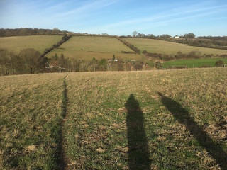
View back on the morning climb
Knockholt to Otford walk
Dec-16 • Saturdaywalker on Flickr
swcwalks swcwalk37 walkicon 31604997220

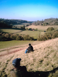
Magpie Bottom
Knockholt to Otford walk
Dec-16 • Saturdaywalker on Flickr
swcwalks swcwalk37 walkicon 31830488882

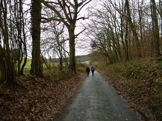
Magpie Bottom in the snow
Knockholt to Otford walk
Dec-22 • Saturdaywalker on Flickr
swcwalks swcwalk37 walkicon 52568008794
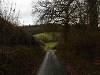
extra New walk - Knockholt to Otford
Long rest on Eastdown looking back towards Magpie Bottom. D.Allen. Vivitar 5199mp
Feb-08 • magyardave2002 on Flickr
book3 otford knockholt swcwalks walk37 eastdown 2272127736

| Length |
Main walk: 12.9km (8 miles) Knockholt to Shoreham: 5.9km (3.7 miles) |
|---|---|
| Toughness |
7 out of ten: two big hill climbs and several lesser ones |
| OS Map | Explorer 147, Landranger 188 |
| Features |
This walk approaches the familiar walking territory around Shoreham and Otford in Kent from an unfamiliar angle, passing at first over wooded hills, then climbing up and over a steep ridge to get down to Shoreham. In the first 3km/2 miles of the walk there is some traffic noise from the M25, but how much depends on the way the winds are blowing and other atmospheric factors. As you approach Shoreham this fades. In the afternoon the route goes into a lovely hilly area of woodland and fields, passing through the lovely hidden valley of Magpie Bottom, a nature reserve, with fine downland flowers and butterflies in the summer. The walk also has several nice bluebell woods, particularly (but not exclusively) in the latter part of the walk, and in autumn there are lots of beech and sweet chestnut woods to provide colour. In winter the walk is not over-afflicted with mud, but the descents into Shoreham and Otford can be a bit slippery. |
| Walk options |
Just after lunch – 5.9km (3.7 miles) from the start - this walk passes Shoreham station, which is on the line from Otford to London and is a possible place to finish or start the walk. It is also possible to vary the ending by walking from Shoreham to Eynsford, a distance of 7.5km (4.6 miles): see the Eynsford Circular on this website for details. |
| Transport |
Knockholt is on the Sevenoaks line out of Charing Cross and London Bridge. Catch the nearest train to 10am to get to lunch in Shoreham in time. Otford is on the line from Sevenoaks back to Bromley South, with twice hourly Thameslink trains to Blackfriars as well as faster direct trains to Victoria which run twice an hour Monday to Saturday and hourly on Sundays. Shoreham (Kent) is the outbound stop before Otford on the Thameslink services. A day return to Sevenoaks covers you out and back on both lines (and is the same price as a day return to Otford): this also covers you for travel back fro, Shoreham. Alternatively you can use Oyster to get to Knockholt station as it is in London Transport zone six: but coming back you then need to buy a single from Otford to Swanley and touch in there (possible on Thameslink trains, which stop there, but not always on Victoria trains) Rail planners also sometimes show the fastest return journey being to take the Thameslink train to Sevenoaks and then get one of the very regular fast trains from there to London Bridge or Charing Cross, a route which is feasible if you have a day return to Sevenoaks. |
| Lunch and Tea |
Shoreham, 5.3km (3.3 miles) into the walk, has three possible lunch pubs. Serving more standard pub fare (and also being on the walk route) is the Kings Arms (01959 523100), with the more upmarket Samuel Palmer (01959 525442) just up the road. Both have some outside seating, but for a more tranquil garden the Crown (01959 522903) is recommended, reached by a small diversion off the walk route and also serving standard pub fare. The village also has the Shoreham Aircraft Museum (01959 524416), open 10am-4pm on weekends year round, which has a tea room set in a pleasant garden, while the Mount Vineyard (01959 524008) in the heart of the village has a restaurant (booking advised) serving pizza. In Otford, the most obvious tea option is the Pond View Cafe (01959 522150) on the roundabout, open until 4.30pm daily. In another 70 metres on the left the Hospices of Hope charity shop has a tea room at its rear, which is open till 5pm on Saturdays and 4pm on other days Almost opposite the Hospices of Hope there is also Sally's Cake Emporium, open to 4pm Tuesday to Sunday. Otford also has two pubs, the first one you pass being the more basic Woodman by the roundabout, with the Bull, a cosy chain pub, 150 metres beyond the roundabout on the left. |
| Profile | |
|---|---|
| Help Us! |
After the walk, please leave a comment, it really helps. Thanks! You can also upload photos to the SWC Group on Flickr (upload your photos) and videos to Youtube. This walk's tags are: |
| By Train |
Out (not a train station) Back (not a train station) |
| By Car |
Start TN14 7HR Map Directions Return to the start: Finish TN14 5QY Map Directions Travel to the start: |
| Amazon | |
| Help |
National Rail: 03457 48 49 50 • Traveline (bus times): 0871 200 22 33 (12p/min) • TFL (London) : 0343 222 1234 |
| Version |
Apr-24 Peter |
| Copyright | © Saturday Walkers Club. All Rights Reserved. No commercial use. No copying. No derivatives. Free with attribution for one time non-commercial use only. www.walkingclub.org.uk/site/license.shtml |


Walk Directions
Full directions for this walk are in a PDF file (link above) which you can print, or download on to a Kindle, tablet, or smartphone.
This is just the introduction. This walk's detailed directions are in a PDF available from wwww.walkingclub.org.uk