Llangynidr to Bwlch or Circular walk
Up a tight valley to the Chartist Cave in the limestone uplands of Mynydd Llangynidr, return along the rim of the Crawnon Valley.
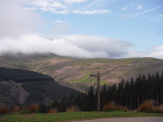
Clouds Rolling Down from the Waun Rydd
SWC Walk 332 Llangynidr to Bwlch or Circular
May-18 • thomasgrabow on Flickr
swcwalks swcwalk332 banner 46766054395

Lone Walker in Upper Cwm Cleisfer
SWC Walk 332 Llangynidr to Bwlch or Circular
May-18 • thomasgrabow on Flickr
swcwalks swcwalk332 walkicon 33804623288

Chartist Cave on Mynydd Llangynidr
SWC Walk 332 Llangynidr to Bwlch or Circular
May-18 • thomasgrabow on Flickr
swcwalks swcwalk332 walkicon 40715915613

Sugar Loaf, from above Llangynidr
SWC Walk 332 Llangynidr to Bwlch or Circular
May-18 • thomasgrabow on Flickr
swcwalks swcwalk332 walkicon 40715905373
![Scene from Footpath along River Usk through Llangynidr SWC Walk 332 Llangynidr to Bwlch or Circular [Riverside Walk Alternative]](https://live.staticflickr.com/65535/47629163922_98d3b12815_n.jpg)
Scene from Footpath along River Usk through Llangynidr
SWC Walk 332 Llangynidr to Bwlch or Circular [Riverside Walk Alternative]
Apr-19 • thomasgrabow on Flickr
swcwalks swcwalk332 walkicon 47629163922

...through a wooden gate in a wall into the churchyard of St. Mary & St. Cynydr, Llangynidr
SWC Walk 332 Llangynidr to Bwlch or Circular
May-18 • thomasgrabow on Flickr
swcwalks swcwalk332 40715920953
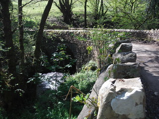
Bridge over the Nant Cleisfer
SWC Walk 332 Llangynidr to Bwlch or Circular
May-18 • thomasgrabow on Flickr
swcwalks swcwalk332 33804626348
| Length |
21.9 km (13.6 mi), with 781/685m ascent/descent. For a shorter walk see below Walk Options. |
|---|---|
| Toughness |
7 out of 10. Time: 6 ½ hours walking time. |
| Walk Notes |
This walk leads from Llangynidr village up along a tight valley, the Cwm Cleisfer, and onto the open limestone uplands of Mynydd Llangynidr, initially along a lane then through pastures, in the latter stages with some difficult-to-find-and-negotiate paths near the transition to the open moorland. Mynydd Llangynidr is a basically treeless undulating mountain of open limestone uplands with numerous depressions, shake holes and pits, as well as many ancient cairns (burial mounds) dotted across the moorland. You climb to the source of the Cleisfer, a perfect picnic spot, and then across the scarred landscape (map and compass come in handy) to the Chartist Cave, arguably one of Wales' most important historic monuments. The Chartists were a 19th century working-class movement for political reform and this cave is where the local group met and stored weapons before the Newport Rising of 1839.
A detour near the end leads across Tor y Foel, one of the best mid-level viewpoints in the Brecon Beacons.
|
| Walk Options |
A start from Bwlch (with its more frequent bus service) is possible. But currently the service to Llangynidr is sufficient in the morning, and thus is a map-led option.
|
| Maps |
OS Explorer: OL12 (Brecon Beacons NP West) and OL 13 (Brecon Beacons NP East)
|
| Travel |
Llangynidr Village Hall Bus Stop, map reference SO 155 196, is 14 km south east of Brecon, 218 km west northwest of Charing Cross and 123m above sea level. Bwlch All Saints Bus Stop, map reference SO 148 220, is 2.5 km north of Llangynidr and 223m above sea level. Both are in Powys, Wales. Llangynidr is served by line 43 (Abergavenny – Brecon) with 4-5 buses a day Mon-Sat only. Bwlch is served by line X43 (Abergavenny – Brecon) with 7-8 buses a day Mon-Sat and 5 on Sundays and Bank Holidays. Saturday Walkers’ Club: This walk is doable as a daywalk from London, especially if you have motorised transport, but also if taking a train to Abergavenny to connect to above bus services. |
| Lunch (off route) |
Tafarn-Ty-Uchaf (Top House) Trefil Road, Trefil, Tredegar, Blaneau Gwent, NP22 4HG (01495 717 690). The Top House is located 1.8 km off route, after 9.3 km/5.8 mi of walking. |
| Tea |
The Coach & Horses Inn Cwm Crawnon Road, Llangynidr, Crickhowell, Powys, NP8 1LS (01874 730 245). Located 3.1 km from the end of the walk.
|
| Brecon Beacons |
The Brecon Beacons National Park is in south Wales. It consists of bare, grassy, glacial mountains, with north facing escarpments. Its peaks, just shy of 1,000m (3,000ft), are the highest mountains in the southern UK. The national park is also noted for reservoirs, and the Dan yr Ogof caves. Its 4 mountain areas, from west to east are:
|
|---|---|
| Welsh Glossary |
aber: estuary, confluence, river mouth; afon: river; affwys: abyss; allt: hillside, cliff; aran: high place; ban/fan/bannau (pl): peak/beacon/crest, hill/mountain; big: peak; blaen: source of river, head of valley; bod: dwelling; bre: hill; bron: hill-breast; bryn: hill; bwlch: gap/col/pass; cadair: chair; cae: field; caer/gaer: stronghold, fort; capel: chapel; carn/garn/carnedd/garnedd: cairn, heap of stones, tumulus; carreg/garreg: stone, rock; castell: castle; cefn: ridge, hillside; celli: grove/copse; cerwyn: pot-hole; cist: chest; clog/clogwyn: cliff; clun: meadow; clwyd: hurdle/gate; clydach: torrent; coch/goch: red; coed: wood; craig/graig: rock; crib/cribyn: crest, ridge, summit; crug: mound; cul: narrow; cwm: hanging valley/corrie/bowl/dale; cyfrwy: ridge between two summits (saddle); ddinas: fort; dibyn: steep slope, precipice; dim: no; din: hill-fortress; disgwylfa: place of observation, look-out point; dôl: meadow; du/ddu: black, dark; dwfr/dŵr: water; dyffryn: valley; -dyn: fortified enclosure; eglwys: church; eira: snow; eisteddfod: meeting-place, assembly; esgair: ridge; fach/bach: small; fawr/mawr: large; fechan: smaller; ffald: sheep-fold, pound, pen, run; ffordd: way, road; ffridd: pasture; ffrwd: stream, torrent; ffynnon: spring/well; gallt: wooded hill; ganol: middle; garth: promontory, hill, enclosure; glan/lan: river-bank, hillock; glas: green (when referring to grass, pasture or leaves), blue (when relating to the sea or air); glyn: deep valley, glen; gors: bog; gorsedd: tumulus, barrow, hillock; gwyddfa: mound, tumulus; gwylfa: look-out point; gwyn/gwen: white; gwynt: wind; hafn: gorge, ravine; hafod: summer dwelling; hen: old; hendre(f): winter dwelling, old home, permanent abode; heol: road; hesgyn: bog; hir: long; is: below, lower; isaf: lower/lowest; llan: church, monastery; llawr: level area, floor of valley; llech: slab, stone, rock; llther: slope; lluest: shieling, cottage, hut; llwch: lake, dust; llwybr: path; llwyd: grey, brown; llwyn: bush, grove; llyn: lake; llynwyn: pool/puddle, moat; maen: stone; maes: open field, plain; mawn: peat; mawnog: peat-bog; melyn: yellow; merthyr: burial place, church; moel/foel: bare, bald/bare hill; mynydd: mountain, moorland; nant: brook/stream, dingle/glen; neuadd: hall; newydd: new; ogof/gogof: cave; pant: hollow; parc: park, field, enclosure; pen: head, top/end, edge; penrhyn: promontory; pentre(f): homestead, village; perfedd: middle; perth: bush, brake, hedge; plas: hall, mansion; pont/bont: bridge; porth: gate/gateway, harbour/bay/landing-place/ferry; pwll: pit, pool; rhiw: hill, slope; rhos: moor, promontory; rhudd: red, crimson; rhyd: ford; sarn: causeway; sgwd/rhaeadr: waterfall; sticill: stile; sych: dry; tafarn: tavern; tâl: end, top; talar: headland (of field); tan/dan: below; tarren/darren: escarpment; tir: land, territory; tor: break, gap; tre/tref: settlement, hamlet, town; twlch: tump, knoll; twll: hole, pit; tŵr: tower; twyn: hill; tŷ: house; uchaf: upper, highest; uwch: above, over; waun/gwaun: moorland, meadow; wen/wyn: white; y, yr, ‘r: the; ynys: island, holm, river-meadow; ysgol: ladder, formation on mountain-side/school; ysgwydd: shoulder (of mountain); ystafell: chamber, hiding-place; ystrad: wide valley, holm, river-meadow. |
| Profile | |
| Help Us! |
After the walk, please leave a comment, it really helps. Thanks! You can also upload photos to the SWC Group on Flickr (upload your photos) and videos to Youtube. This walk's tags are: |
| By Car |
Start Llangynidr, Powys, Wales Map Directions |
| Amazon | |
| Help |
National Rail: 03457 48 49 50 • Traveline (bus times): 0871 200 22 33 (12p/min) • TFL (London) : 0343 222 1234 |
| Version |
Apr-24 Thomas G |
| Copyright | © Saturday Walkers Club. All Rights Reserved. No commercial use. No copying. No derivatives. Free with attribution for one time non-commercial use only. www.walkingclub.org.uk/site/license.shtml |


Walk Directions
Full directions for this walk are in a PDF file (link above) which you can print, or download on to a Kindle, tablet, or smartphone.
This is just the introduction. This walk's detailed directions are in a PDF available from wwww.walkingclub.org.uk