Macclesfield to Leek Walk
Reservoirs, Macclesfield Forest, the 'Cheshire Matterhorn', lonely Wildboarclough, the Dane Valley, Lud's Church chasm and the Roaches gritstone escarpment

The Roaches, from field by Windygates Farm
SWC Walk 380 Macclesfield to Leek (via Shutlingsloe, Lud's Church and the Roaches)
Jun-21 • thomasgrabow on Flickr
swcwalks swcwalk380 banner 51354433400
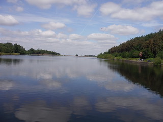
Ridgegate Reservoir
SWC Walk 380 Macclesfield to Leek (via Shutlingsloe, Lud's Church and the Roaches)
Jun-21 • thomasgrabow on Flickr
swcwalks swcwalk380 walkicon 51353637568

Shutlingsloe from Berry Bank (close up)
SWC Walk 380 Macclesfield to Leek (via Shutlingsloe, Lud's Church and the Roaches)
Jun-21 • thomasgrabow on Flickr
swcwalks swcwalk380 walkicon 51353408006

Lud's Church Chasm (detail)
SWC Walk 380 Macclesfield to Leek (via Shutlingsloe, Lud's Church and the Roaches)
Jun-21 • thomasgrabow on Flickr
swcwalks swcwalk380 walkicon 51352670362

Last Rockface on The Roaches, plus Hen Cloud
SWC Walk 380 Macclesfield to Leek (via Shutlingsloe, Lud's Church and the Roaches)
Jun-21 • thomasgrabow on Flickr
swcwalks swcwalk380 walkicon 51354433200
| Length |
27.7 km (17.2 mi), with 934/875m ascent/descent. For a shorter or longer walk see below Walk Options. |
|---|---|
| Toughness |
9 out of 10, with 7 ¼ hours walking time. |
| Walk Notes |
A tour de force of highlights in the Cheshire/Staffordshire borderlands within easy reach of London. You rise quickly out of the historic Silk Town of Macclesfield over The Hollins, a modest hill with fine views over the Cheshire Plain and across the valley of the River Bollin to pass a string of reservoirs and enter the enchanting Macclesfield Forest. A steep ascent through the woods brings you out onto the open High Moor and a following easy ascent of the ‘Cheshire Matterhorn’: Shutlingsloe. From there descend steeply into the scenic Clough Brook valley and walk back up across another modest hill with quiet pastures into the very scenic Dane Valley by Gradbach Mill, almost at the halfway point.
Buses at the start or from alternative endings on the A53 enable shorter walks. |
| Walk Options |
Bus Line 14 (Macclesfield – Langley, about hourly Mon-Fri, every two hours Sat) enables a start in Langley (cut 3.6 km/2.4 mi and 95m ascent). Alight at the final stop by Langley Church and go back down the road (Cock Hall Lane) for 40m to a three-way junction and turn right along Main Road (50°, signed ‘Macc. Forest 1 ¼’). Pick up the directions on page 6 at the single asterisk *).
|
| Maps |
OS Explorer: 268 (Wilmslow, Macclesfield & Congleton) – just for the urban start – and OL24 (The Peak District – White Peak Area)
|
| Travel |
Macclesfield Station, map reference SJ 919 736, is 237 km northwest of Charing Cross, 133m above sea level and in Cheshire East. Leek Bus Station, map reference SJ 986 563, is 18 km southeast of Macclesfield, 192m above sea level and in Staffordshire. Macclesfield Station is on the Stafford to Manchester branch line off the West Coast Main Line from London Euston. Travel time from London is from 101 minutes Mon-Sat, but 2 ¼ hours on Sundays. Relevant bus lines serving Leek are: 109 (Leek – Macclesfield) with 5 buses a day Mon-Sat and lines 16 and 18 (Leek – Hanley, half-hourly Mon-Sat/hourly on Sun); Hanley Bus Station has frequent buses to Stoke Station (which is a 2.3 km walk away). Saturday Walkers’ Club: The walk is doable as a daywalk from London with a train no later than 09.20 hours. |
| Elevenses |
The Forest Snug Food Van Trentabank Reservoir Car Park, Macclesfield Forest Visitor Centre, Langley, Cheshire, SK11 0NS (07743 909 339). The Forest Snug is located 6.0 km (3.7 mi) into the walk. |
| Lunch |
The Crag Inn Wildboarclough, Macclesfield, Cheshire, SK11 0BD (01260 227 239). The Crag Inn is located 9.8 km (6.1 mi) into the walk.
|
| Tea |
Tea all options
Tea Upper Hulme Ending
Tea Blackshaw Moor Ending
Tea Leek Ending
|
| Profile | |
|---|---|
| Help Us! |
After the walk, please leave a comment, it really helps. Thanks! You can also upload photos to the SWC Group on Flickr (upload your photos) and videos to Youtube. This walk's tags are: |
| By Train |
Out (not a train station) Back (not a train station) |
| By Car |
Start Map Directions Finish Map Directions |
| Amazon | |
| Help |
National Rail: 03457 48 49 50 • Traveline (bus times): 0871 200 22 33 (12p/min) • TFL (London) : 0343 222 1234 |
| Version |
Sep-22 Thomas G |
| Copyright | © Saturday Walkers Club. All Rights Reserved. No commercial use. No copying. No derivatives. Free with attribution for one time non-commercial use only. www.walkingclub.org.uk/site/license.shtml |


Walk Directions
Full directions for this walk are in a PDF file (link above) which you can print, or download on to a Kindle, tablet, or smartphone.
This is just the introduction. This walk's detailed directions are in a PDF available from wwww.walkingclub.org.uk