Pangbourne via Goring Circular walk
Part-wooded ridges above the Thames Valley to lunch in Goring, shorter return along the Thames through meadows
![Thames Valley Upstream, from Hartslock Nature Reserve SWC Walk 170 Pangbourne Circular via Goring-on-Thames [Hartslock Nature Reserve Extension]](https://live.staticflickr.com/65535/50536680932_e0bf1cfa23_n.jpg)
Thames Valley Upstream, from Hartslock Nature Reserve
SWC Walk 170 Pangbourne Circular via Goring-on-Thames [Hartslock Nature Reserve Extension]
Oct-20 • thomasgrabow on Flickr
swcwalks swcwalk170 banner 50536680932

Whitchurch Mill and St. Mary the Virgin, Whitchurch-on-Thames, from Whitchurch Bridge
SWC Walk 170 Pangbourne Circular via Goring-on-Thames
Oct-20 • thomasgrabow on Flickr
swcwalks swcwalk170 walkicon 50536529736

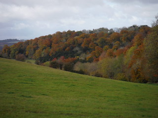
Autumnal Beech Wood
SWC Walk 170 Pangbourne Circular via Goring-on-Thames
Oct-20 • thomasgrabow on Flickr
swcwalks swcwalk170 walkicon 50536683072

View downstream along Thames, Goring-on-Thames
SWC Walk 170 Pangbourne Circular via Goring-on-Thames
Oct-20 • thomasgrabow on Flickr
swcwalks swcwalk170 walkicon 50536528271

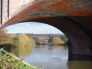
View through Railway Bridge over Thames, near Gatehampton Manor
SWC Walk 170 Pangbourne Circular via Goring-on-Thames
Oct-20 • thomasgrabow on Flickr
swcwalks swcwalk170 walkicon 50535804283
![Thames Valley Downstream, from Hartslock Nature Reserve SWC Walk 170 Pangbourne Circular via Goring-on-Thames [Hartslock Nature Reserve Extension]](https://live.staticflickr.com/65535/50535803723_cc1e91a74c_n.jpg)
Thames Valley Downstream, from Hartslock Nature Reserve
SWC Walk 170 Pangbourne Circular via Goring-on-Thames [Hartslock Nature Reserve Extension]
Oct-20 • thomasgrabow on Flickr
swcwalks swcwalk170 walkicon 50535803723
| Length |
16.0 km (10.0 mi), with 202m ascent/descent. For a shorter or longer walk and an Alternative Ending see below Walk Options. |
|---|---|
| Toughness |
2 out of 10, with 3 hours 45 minutes walking time. For the whole outing, including trains, sights and meals, allow at least 7 hours. |
| Walk Notes |
Starting on the West Berkshire side of the Thames, this short walk links three pretty Thames-side villages via wooded ridges with splendid views. From Pangbourne you cross the river on the delightful Whitchurch toll bridge into Oxfordshire and ascend through Whitchurch-on-Thames and then some pastures to the highest point of the walk, with first scenic views down some pretty combes. The route follows the part-wooded ridge above the Thames Valley, with occasional splendid views of the valley and the Goring Gap between the Chilterns and the Berkshire Downs, before descending through a wildflower nature reserve and then leading along the Thames Valley's bottom to Goring-on-Thames for lunch.
This walk is based on a sketched walk originally developed by YHA Streatley (located across the river from Goring, beds from £15, rooms from £29 [2019]). The original leaflet with its user-friendly drawn map is still available on the webpage under a separate tab. |
| Walk Options |
Longer Morning: Using parts of Book 1 Walk 4 and SWC Walk 243, adds 1.7 km/1.1 mi and 64m ascent/descent, and is rated 3/10.
|
| Maps |
OS Explorer: 171 (Chiltern Hills West)
|
| Travel |
Pangbourne station, map reference SU 632 766, is 67 km west of Charing Cross, 7 km west north west of Reading, 51m above sea level and in West Berkshire. It is on the original line of the Great Western Railway to Bristol, between Reading and Didcot Parkway. Journey times are from 52 minutes on a stopping service, and from 38 minutes if changing at Reading, and a little longer on Sundays. Saturday Walkers’ Club: Take the train closest to 10.00 hours. |
| Lunch |
The Sun Inn Hill Bottom, Whitchurch Hill, South Oxon, RG8 7PU (01189 842 260). The Sun Inn is located – 900m off-route the morning extension – 4.2 km (2.6 mi) into the extended walk.
|
| Tea |
Plenty of options in Whitchurch-on-Thames and Pangbourne. Check page 2 of the pdf for details. |
| Profile | |
|---|---|
| Help Us! |
After the walk, please leave a comment, it really helps. Thanks! You can also upload photos to the SWC Group on Flickr (upload your photos) and videos to Youtube. This walk's tags are: |
| By Train |
Out (not a train station) Back (not a train station) |
| By Car |
Start RG8 7DY Map Directions |
| Amazon | |
| Help |
National Rail: 03457 48 49 50 • Traveline (bus times): 0871 200 22 33 (12p/min) • TFL (London) : 0343 222 1234 |
| Version |
Apr-24 Thomas G |
| Copyright | © Saturday Walkers Club. All Rights Reserved. No commercial use. No copying. No derivatives. Free with attribution for one time non-commercial use only. www.walkingclub.org.uk/site/license.shtml |
Walk Directions
Full directions for this walk are in a PDF file (link above) which you can print, or download on to a Kindle, tablet, or smartphone.
This is just the introduction. This walk's detailed directions are in a PDF available from wwww.walkingclub.org.uk


