Pulborough to Petworth walk
Across the Arun valley and Greensand Hills to an attractive town with one of the National Trust's finest properties.

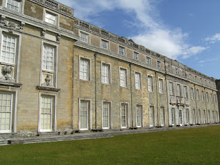
CIMG3996
Petworth House from Upper Pond
Sep-12 • Sean O'Neill
banner, swcwalk128, swcwalks 5785883699023386834 P
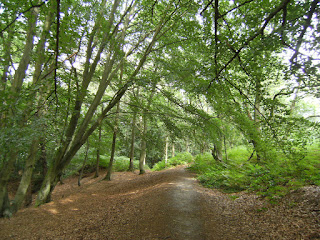


CIMG3989
The River Arun at Pallingham
Sep-12 • Sean O'Neill
swcwalk128, swcwalks, walkicon 5785883538751205570 P
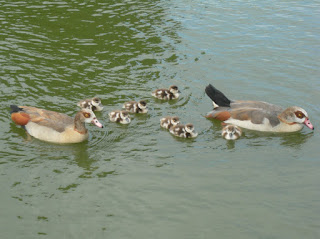
DSCF1496
Egyptian Geese on Upper Pond
Jul-09 • Sean O'Neill
swcwalk128, swcwalks 5643991610916904882 P

DSCF8269
Old Place, Pulborough
Jun-11 • Sean O'Neill
swcwalk128, swcwalk14, swcwalks 5631050346164055458 P
| Length |
Main Walk: 15½ to 18¾ km (9.7 to 11.7 miles). Up to four hours 45 minutes walking time. For the whole excursion including trains, buses, sights and meals, allow at least 11 hours. Long Circular Walk, from Pulborough: 23¾+ km (14.8+ miles). At least six hours walking time. Short Walk, starting from Fittleworth: 10 to 13¼ km (6.2 to 8.2 miles). Up to three hours 15 minutes walking time. Short Circular Walk, from Fittleworth: 13¾+ km (8.5+ miles). At least three hours 20 minutes walking time. |
|---|---|
| OS Maps |
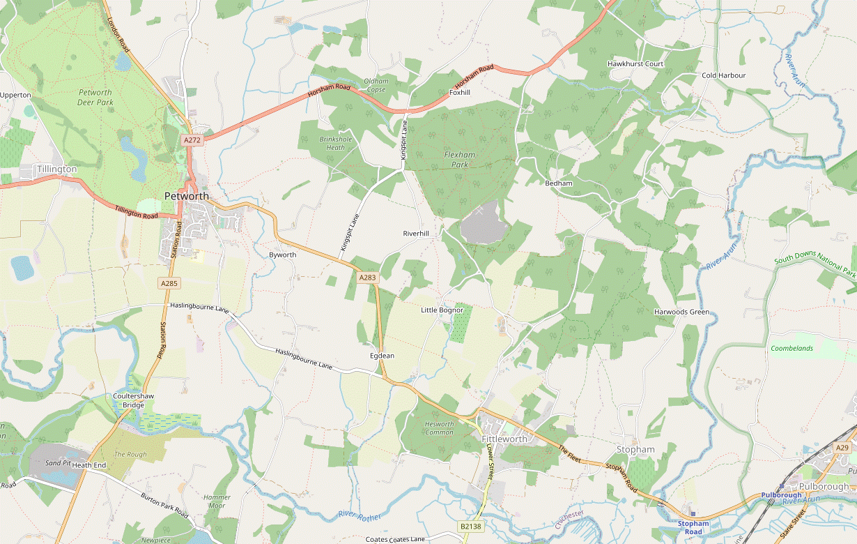
Explorers OL10, OL33 & OL34 (previously 121, 133 & 134). Pulborough, map reference TQ043186, is in West Sussex, 18 km SW of Horsham. |
| Toughness |
6 out of 10 (7 for the Long Circular Walk, 4 for the Short Walks). |
| Features |
Petworth House is one of the National Trust's finest properties but it is not easy to visit without a car. The idea here is that you can do a three-hour walk to the town and spend the afternoon visiting the house or exploring the deer park, then catch a bus back to Pulborough. The present mansion was built in the 1690s and contains the National Trust's finest art collection, including paintings by Turner, van Dyck, Reynolds and Blake, elaborate carvings by Grinling Gibbons and many classical sculptures. The House is open daily except for a few days at Christmas; admission for non-NT members is £19 (2024). There is no charge to enter Petworth Park, landscaped by Lancelot “Capability” Brown in the 1750s and widely acknowledged to be one of his finest creations. Seen from the house, the gradual transition from the parkland with its lakes and clumps of trees to the woods in the distance looks entirely natural but required an immense project to achieve. It is open all year round from 8am to dusk. Petworth Cottage Museum at 346 High Street is a Leconfield Estate worker's cottage restored and furnished as it might have been in about 1910. It is open from Apr–Oct on Tue–Sat afternoons; admission is £5 (2024). Petworth is of course the highlight of the walk but the route from Pulborough across the Wealden Greensand is not without interest. You start by heading north across some low hills where you might see racehorses being put through their paces, and continue under the gaze of a tall brick folly, the Toat Monument. The route then heads west to cross the River Arun at Pallingham, where it was once joined by the Arun Navigation. The Wey & Arun Canal Trust are gradually restoring this and the canal which linked it to the River Wey at Shalford – an important transport link between London and the South Coast in the early 19thC – but a glance at the abandoned waterway will show you the scale of their task. The rest of the morning section is on potentially muddy paths across wooded hills, interspersed with more open sections giving views of the South Downs and the High Weald. Eventually you emerge on a hillside with a dramatic view of Petworth across an open valley. After lunch in the town you can do as much or as little walking around Petworth Park as you wish: some routes are suggested but you can of course wander freely around this deer park. |
| Walk Options |
For a longer outing you can complete a Long Circular Walk back to Pulborough on a more southerly route between the A283 and the Rother valley, with views of the South Downs along the way. This is a mixed landscape of farmland and wooded commons, with Hesworth Common being particularly attractive. The route passes two fine old churches at Fittleworth and Stopham, and crosses back over the River Arun on the medieval Stopham Bridge. The final 4 km is the same as the Amberley to Pulborough walk (#39). The return leg goes back through Fittleworth and in 2023 a link route was added from the village to meet the outward leg on Brinksole Heath, allowing for a shorter and easier walk to (as well as from) Petworth. These Short Walk variations are obviously more convenient for drivers but they could be done with a bus journey at each end. Alternative sections were also included for the morning legs of both the Main and Short Walks to take in some extra stretches of the Serpent Trail, a long-distance walking route which goes through Petworth, Fittleworth and Hesworth Common. On the Main Walk it has the advantage of avoiding a couple of potentially muddy stretches around Bognor Common, but it does lengthen an already long morning by 1 km. Taking the bus to or from Fittleworth or Stopham would allow you to shorten the Long Circular Walk in several ways, as the return leg is never far from the A283 (see Transport below). |
| Transport |
There is a half-hourly service from Victoria to Pulborough (hourly on Sundays), taking 1 hour 15 minutes. There is no station in Petworth but a direct bus route along the A283 via Byworth, Fittleworth and Stopham to Pulborough station: Stagecoach 1 runs hourly (Mon–Sat) and two-hourly (Sun & BH) up to about 7pm. If driving, the station car park at Pulborough costs around £7.50 Mon–Sat, £3 Sun & BH (2024). |
| Suggested Train |
Take the train nearest to 09:30 from Victoria to Pulborough. |
| Train Times |
|
| Timetables |
|
| River Levels |
|
| Lunch |
There are no refreshment places on the walk route until you reach Petworth (12 km from Pulborough, 6½ km from Fittleworth; 1–1½ km longer on the alternative routes). There are two pubs near the town centre: the Angel Inn (01798-344445) has a fairly up-market menu; The Star (01798-368114) has a patio area on Market Square and serves traditional pub food to 2.30pm Mon–Fri, all day at weekends. Some of the cafés and tearooms in the town (like Tiffins and The Hungry Guest Cafe: see below) also do light lunches. Visitors to Petworth House could have lunch in its Audit Room Café and/or tea in its Servants' Hall Coffee Shop, which are open until 5pm (earlier in winter). |
| Tea |
If you are finishing the walk in Petworth (and not visiting Petworth House) there are several tea places in the town. Three places just off the central Market Square are Coco Café & Sugar Lounge (01798-344006; open to 4pm Fri–Mon, closed Tue–Thu); Cherry's Deli & Bakery (01798-343634; open to 5pm Mon–Sat, closed Sun); and Tiffins Tearoom (01798-344560; open to 4pm Tue–Sun; closed Mon). A little further away The Hungry Guest Cafe (01798-344564; open to 5pm Wed–Sat, 4pm Sun; closed Mon & Tue) is attached to the Newlands House Gallery on Pound Street. The suggested place to stop for refreshment on the Circular Walk is the White Hart (01798-874903) at Stopham Bridge, a picturesque spot by the River Arun 2¼ km before the finish. There are only some fast food shops near Pulborough station, but a five-minute walk along the A283 towards the centre of the village would take you past a couple of places: River Moon (01798-874141), a Thai Restaurant & Bar; and Macklin's Bar (07930-988666; closed Mon), a new cocktail and wine bar by the junction with the A29. If you finish in Fittleworth the only possible refreshment place is the Fittleworth Stores, a community-run village shop which includes a café; this tends to close in mid-afternoon but takeaway drinks are available while the shop is open. |
| Profile | |
|---|---|
| Help Us! |
After the walk, please leave a comment, it really helps. Thanks! You can also upload photos to the SWC Group on Flickr (upload your photos) and videos to Youtube. This walk's tags are: |
| By Train |
Out (not a train station) |
| By Car |
Start RH20 1AH Map Directions Finish Petworth, West Sussex, GU28 0AE Map Directions |
| Amazon | |
| Help |
National Rail: 03457 48 49 50 • Traveline (bus times): 0871 200 22 33 (12p/min) • TFL (London) : 0343 222 1234 |
| Version |
Jun-24 Sean |
| Copyright | © Saturday Walkers Club. All Rights Reserved. No commercial use. No copying. No derivatives. Free with attribution for one time non-commercial use only. www.walkingclub.org.uk/site/license.shtml |


Walk Directions
Click the heading below to show/hide the walk route for the selected option(s).


 Walk Map
©
Walk Options ( Main | Short )
Click on any option to show only the sections making up that route, or the heading above to show all sections.
- Main Walk (15½ to 18¾ km†)
† The two distances are for the short and long circuits around Petworth Park.
‡ The longer distance includes the optional extension through Petworth Park.
Walk Directions
Click on any section heading to switch between detailed directions and an outline, or the heading above to switch all sections.
If you are doing a Short Walk (from Fittleworth), start at §E.
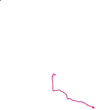
- Pulborough Station to Oakhouse Farm (3¼ • 2½ km)
-
Turn left out of the station and take the footpath on the other side of a chainlink fence. Go up to a lane and turn left to cross the railway. In 75m there is a choice of routes to join the Wey-South Path (WSP):
- For the main route, bear right onto a driveway heading north past Old Place, Middle Barn Farm and The Gallops. Turn left briefly onto Hill Farm Lane and then turn right onto a footpath going downhill past Littlehill Copse. Turn left at a footpath T-junction to join the WSP on Coombelands Lane near Oakhouse Farm.
- Alternatively, stay on the lane for a further 225m and turn right onto a footpath going past the bottom of The Gallops. Join the WSP heading north alongside Coombelands Lane, passing the racing stables and joining the lane at the brow of the hill. Go past Hill Farm Lane to join the main route at Oakhouse Farm.
- After leaving the station building, do not go down to the main road but instead turn left. Head briefly towards the main car park but almost immediately veer right by a small bicycle shelter to get onto a public footpath on the other side of a chainlink fence, with the car park on your left and a service road to an industrial estate on your right.
- In 350m this footpath comes out onto a minor road where you turn left, crossing over the railway. In 75m, where the lane curves round to the left, there is a driveway off to the right signposted as a footpath.
-
Main route (3¼ km)
- At the bend bear right onto the driveway to go past an attractive stone house, Old Place. You soon go past an old mill pond (opposite the converted mill, now a cottage) and looking back to your right you can see another imposing house behind the pond, Old Place Manor?.
- At Middle Barn Farm go through a side gate to the left of a wooden fieldgate. After passing the buildings keep right to stay on the main track, later along the left-hand side of a large farm field. In the corner go through a wooden kissing gate and onwards between more large fields, with a wire fence on your right.
- At the far end go straight ahead across The Gallops?, taking heed of the warning notices about racehorses. The well-waymarked right of way takes you through a series of gaps in hedges and across horse rides towards farm buildings.
- Keep ahead through the farmyard, passing a landscaped quarry down on your left. You come out onto a lane (Hill Farm Lane) with a distant view of the Toat Monument? ahead on the horizon, 1¼ km away.
- Turn left onto the lane, heading W. In 100m go over a stile on the right onto a footpath descending a long flight of steps. At the bottom it continues as a grassy track between hedges, ending at a three-way footpath signpost in front of a hedge where you turn left.
- To stay on the right of way you would need to make your way along a narrow and potentially overgrown path between hedges for 350m, but a faint grassy path along the field edge suggests that most walkers avoid this. Several gaps in the hedge would let you switch between the two paths, including one in the far corner.
- The enclosed path leads into another large field where the right of way is now along its right-hand edge. At the far end go through a gate in a hedge and up a short fenced path. Go through another gate and turn left as directed to walk around two sides of a small field towards Oakhouse Barn.
- In the top corner go through a wooden gate and bear left across a gravel drive. Go over a stile and turn right onto a lane (Coombelands Lane), joining the Wey-South Path? (WSP) and soon passing Oakhouse Farm on the right.
-
Alternative route (2½ km)
- Follow the lane round to the left, ignoring the driveway. In 225m turn right through a wooden gate onto a signposted footpath. Go down the right-hand edge of a field and cross a tree-lined stream at the bottom.
- Go up a short rise and turn left to walk near the edge of a broad grassy strip, parallel to the stream. This curves gently round to the right and in 300m you go past the bottom of The Gallops?, taking heed of the warning notices about racehorses.
- Continue in the same direction alongside the horse ride, with a FOOTPATH ↔ sign on the railings to confirm the right of way. As you approach a lane (Coombelands Lane) veer right to walk alongside a tarmac driveway between tall hedges, joining the Wey-South Path? (WSP).
- The drive climbs gently and in 350m you pass the entrance to Coombelands racing stables across the lane to your left. In a similar distance keep ahead where the tarmac drive swings off to the right, then in a further 75m go over a stile on the left to continue in the same direction on Coombelands Lane.
- In 200m keep ahead at a road junction, with a distant view of the Toat Monument? ahead on the horizon, 1½ km away. The lane now starts to descend and in 200m you pass Oakhouse Barn and then Oakhouse Farm on the right, rejoining the main route.
- Oakhouse Farm to Pallingham Quay (1¾ km)
- Follow the WSP all the way to Pallingham Quay: north on Coombelands Lane, then west on a bridleway along the driveway to Sheepwash Farm, past Pallingham Lock and over the River Arun at Pallingham Bridge.
- Follow the lane for 500m, gently downhill and eventually crossing a stream in a dip. After a short climb the lane comes to Pickhurst Farm where you turn left onto the long driveway to Sheepwash Farm, signposted as a bridleway.
- In 400m turn right in front of the farm gate, staying on the bridleway. In 150m you come to a Y-junction, where the left-hand track is a private drive to Lock Cottage. There are two rights of way ahead which you could take: the bridleway continues along the other track and there is a footpath through the small wooden gate straight ahead.
-
Main route
- Take the right-hand track, staying on the WSP. In 300m, after passing some derelict farm buildings, follow the track round to the left at a junction.
- In a belt of trees the track crosses an abandoned stretch of the Arun Navigation? on the hump-backed Pallingham Bridge?. Go through a gate and continue along a fenced track between water meadows, in 100m passing a gate on the left (the alternative route).
-
Alternative route
- Go through the gate into a narrow meadow dotted with walnut trees, taking either of the mown grassy paths ahead at a Y-junction. The grounds of Lock Cottage are behind the hedge on your left and after passing the property the two paths rejoin.
- Turn left as indicated to go down a slope. At the bottom a somewhat dilapidated plank bridge takes you across an abandoned stretch of the Arun Navigation? into the corner of a water meadow.
- Turn right and follow a faint grassy path across the meadow. On the far side go through a new metal gate in the fence (or over an old stile) and turn left onto a track.
- Cross the River Arun? on a footbridge and then a backwater on a more substantial brick and stone bridge. Go up to a broad track, with a new development at Pallingham Quay Farm on your left.
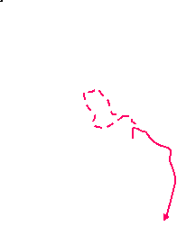
- Pallingham Quay to Bognor Common (3 km)
- Leave the WSP by taking the footpath heading west past Pallingham Quay Farm, which goes around a large field. Go through a copse to join a bridleway heading south. At the top of a hill turn right to head west past Springs Farm to Bedham Lane. Turn left briefly onto the lane and take the footpath heading south-west into Lithersgate Common. In 250m turn right at a footpath junction, joining the Head Route of the Serpent Trail (ST·HR). Follow it westwards to a path crossing on the eastern edge of Bognor Common.
- Leave the WSP (which turns right) and go straight ahead into a field, with the new house behind a ditch and hedge on your left. In 50m a plank bridge over the ditch was the original right of way, but the owners have provided a much easier ‘Alternative Footpath’ route up to the left-hand field corner. Go through a side gate and straight across a track towards a waymarker post.
- Veer right as indicated to go around the edge of a very large field, initially heading W and gradually curving round to the left to head S. Ignore turnings into the wood on your right (including a public footpath after 500m), but in the field corner 50m further on go over a stile onto a woodland path.
- In 40m go straight across a woodland track. In a further 40m go over a stile on the right and turn left onto a bridleway. Follow this uphill in a slow curve round to the right, soon passing the attractive Lane End Cottage on your right. 200m past the cottage, turn right at a three-way signpost and go through a metal fieldgate into the corner of a large field.
- Keep ahead along the field edge, heading W and soon with views of the South Downs on your left. In the next corner go through a side gate into the top corner of a long narrow field, sloping down to the left. Follow a grassy path slightly left down the slope to the opposite field edge, then up the slope on that side of the field.
- Keep ahead past a fenced-off area to the top corner and go over a stile onto a farm track, with Springs Farm off to your right. Ignore a footpath into the wood on your left and go along the track for 400m to a minor road (Bedham Lane).
- Turn left briefly onto Bedham Lane. Immediately after the driveway to Warren Barn go over a stile on the right into the wooded Lithersgate Common, heading SW. In less than 50m keep ahead at a three-way footpath signpost, but in a further 200m turn right at a second signpost, joining the Head Route of the Serpent Trail? (ST·HR).
- In 25m fork left to go down across a small valley, passing a pond at the bottom and climbing up the other side alongside an old stone wall. At the top keep ahead along a grassy track between a chestnut coppice and a hedge, heading W. In 200m the track goes into a wood where you immediately bear right onto a narrow woodland path, as indicated by a footpath signpost.
- At the end of the wood go over a stile into a field and continue along its edge towards another wood, still heading W. On the far side go through a new wooden kissing gate and follow a path down through a wood, which in 200m comes to a footpath crossing with a four-way signpost in a small clearing.
- Bognor Common to Kingspit Lane (1½ km)
- Keep ahead at the path crossing, leaving the ST·HR. On the far side of Bognor Common turn right onto a lane going downhill towards Riverhill, then take a footpath heading north-west between Riverhill Lane and Flexham Park. Turn left onto a bridleway, joining the Sussex Diamond Way (SDW) and rejoining the ST·HR. Follow it out to Kingspit Lane at its junction with Riverhill Lane.
- Keep ahead (slightly to the right) at the path crossing, leaving the ST·HR. Follow this broad and potentially waterlogged track for 500m, crossing some wide access tracks into a huge sand pit (Bognor Common Quarry) behind the belt of trees on your right.
- At the far end turn right onto a lane going steeply downhill, ignoring a signposted footpath opposite. At the bottom ignore paths off to both sides, cross a stream and go uphill. Where the lane makes a hairpin turn to the left, bear right at a footpath signpost onto a broad track into a wood.
- In 100m, where the main track curves down towards some houses, bear left onto a potentially muddy woodland path climbing gently and heading NW. In 350m keep ahead at an oblique path crossing, but at the next crossing 250m later turn left onto a broad track with a bridleway waymarker, joining the Sussex Diamond Way? (SDW) and also rejoining the ST·HR. Follow the bridleway up to a road (Kingspit Lane).
- Fittleworth (School Lane) to Churchwood (¾ km)
- From the School Lane bus stop on the A283 take the footpath heading north, joining the Head Route of the Serpent Trail (ST·HR). At Churchwood turn left onto a bridleway and follow it for 150m to a path junction.
- From the bus stop in Fittleworth cross the main road carefully and take the track opposite, signposted as a footpath and joining the Head Route of the Serpent Trail? (ST·HR). After going past a house and allotments the footpath turns slightly right and continues as an enclosed grassy path.
- On reaching the hamlet of Churchwood the footpath turns sharply left in front of a garden gate to go alongside a hedge. Follow the path through a couple of gates and across a small grassy area to reach a tarmac driveway, passing an old well on the left.
- Turn left onto the drive, which is also a public bridleway. In 150m keep ahead on a grassy track where the drive swings right into a private property. Almost immediately you come to a three-way signpost, with a footpath branching off to the left.
- Churchwood to Little Bognor (1¾ km)
- At the path junction fork left onto a footpath, leaving the ST·HR. Continue on lanes past Fitzleroi Farm, then bear left onto a footpath heading west to the hamlet of Little Bognor.
- At the path junction fork left onto the footpath, leaving the ST·HR and heading NW. In 150m keep ahead where the main track veers left towards a fieldgate. Shortly afterwards the footpath turns half-left and climbs gently through a wooded area; there are side paths which you can use if the slightly sunken main path is too muddy.
- After turning half-right the path comes out onto a minor road (Bedham Lane). Turn right onto the lane, then in 50m turn left into a narrow side road. Go all the way along this lane, passing Amen Cottage and continuing between paddocks and large farm fields. In 350m keep ahead across a farm track, after which the lane runs parallel to another on the left before dropping down to join it.
-
Carry on briefly along the lane, but where it curves right after 50m bear left onto a wide grassy strip between farm fields, signposted as a footpath. Follow this meandering path for 600m, heading roughly W and later with a wood on your left. The path eventually goes down a slope, crosses an old millstream and climbs a grassy bank to emerge on a lane in the hamlet of Little Bognor.
As you cross the stream there are glimpses of a long narrow garden on your right. A short detour along the lane would let you see more of this attractive garden and the millpond beyond the house.
- Little Bognor to Brinksole Heath (exit) (2½ km)
- Take the footpath heading north to Riverhill. Turn left briefly onto a lane, then veer right through a copse to join Riverhill Lane, heading north. In 250m fork left onto a permissive bridleway leading to the south-eastern corner of Brinksole Heath. Follow a track along its southern edge: crossing Kingspit Lane, joining the Sussex Diamond Way (SDW) and rejoining the ST·HR along the way.
- Turn half-right as indicated by the footpath signpost, crossing the lane onto a grassy track in front of a low wall. Ignore steps leading up to a wooden gate in this wall and follow the track up to a metal fieldgate. After going through this immediately fork right onto a path going uphill between trees, the continuation of the right of way.
-
At the top go through a metal gate to head N on a fenced grassy strip between two large fields, which turns slightly left halfway along. On the far side follow the footpath out between hedges to a lane. Turn left briefly onto the lane, then veer right onto a signposted footpath through a copse. At the end turn right onto another lane (Riverhill Lane).
- This woodland path is a useful short cut, but if it is overgrown you could simply continue on the first lane and turn sharp right at a road junction to double back on Riverhill Lane; this is 100m longer.
- Go along the lane for 300m and then veer left onto a potentially muddy tree-lined track, shown on maps as a permissive bridleway. This bends slightly left to head WNW for 300m, then swings right and left to continue in the same direction along the southern edge of an Open Access wood, Brinksole Heath.
- In 200m go straight across Kingspit Lane onto an unsurfaced track, joining the Sussex Diamond Way? (SDW). In 400m ignore a track forking left towards Goanah Lodges. In a further 75m keep ahead at a path crossing where you rejoin the ST·HR; you will be following both waymarked trails into Petworth.
- …
- Churchwood to Bognor Common (2¼ km)
- Keep ahead at the path junction, staying on the bridleway. In 500m turn left at a bridleway T-junction to come out onto Bedham Lane. Turn right onto the lane, then in 250m bear left onto a footpath heading north through Lithersgate Common. In 500m turn left at a footpath junction to head west, eventually coming to a path crossing on the eastern edge of Bognor Common.
- Keep ahead at the path junction and follow the bridleway gently uphill through a large wood for 500m, going straight on at path crossings until you reach a junction with bridleways signposted to both sides and a narrow path ahead marked “Private · Stopham Estate”. Turn left and follow the bridleway out to a minor road (Bedham Lane).
- Turn right and go along the lane for 200m, then bear left onto a signposted footpath into the wooded Lithersgate Common, still climbing gently. In 450m the path swings left in front of an earth mound and climbs more steeply through some birch trees. It curves right and soon comes to a three-way footpath signpost where you turn left.
- …
- …
- Bognor Common to Kingspit Lane via Flexham Park (2½ km)
- Turn right onto a footpath heading north along the eastern edge of Bognor Common to Wakestone Lane. Bear left briefly onto the lane, then turn left onto a bridleway, joining the Sussex Diamond Way (SDW). Follow the bridleway all the way through Flexham Park to Kingspit Lane.
- Turn right at the path crossing to head NE on a broad grassy track, climbing gently with a huge sand pit (Bognor Common Quarry) hidden behind the trees on your left. In 300m, just before reaching a fieldgate at the edge of the wood, veer left as indicated. The footpath continues to climb near the woodland edge, turning half-right after 100m to head N.
- In 250m the woodland path turns slightly right and continues climbing for a further 400m, before eventually dropping down slightly and coming out onto a minor road (Wakestone Lane) at a hairpin bend. Bear left to go downhill on the lane for 40m, then veer left past a fieldgate onto a signposted bridleway, joining the Sussex Diamond Way? (SDW).
- You now simply follow the main track through Flexham Park?, heading roughly W and with good views of the South Downs across areas which have recently been coppiced. After 1 km the track drops downhill and you go past a fieldgate to leave the managed woodland, then climb back up. Keep ahead at a path crossing and follow the bridleway up to a road (Kingspit Lane).
- Kingspit Lane to Brinksole Heath (exit) (1 km)
- Head west through the wooded Brinksole Heath. Join a footpath running along its southern edge to leave in its south-west corner.
- Go straight across a side road on the left (Riverhill Lane) and continue briefly along the left-hand side of Kingspit Lane. As soon as it is safe to do so cross the main road carefully so that before it bends left downhill you can take the potentially muddy track ahead into the wooded Brinksole Heath.
- In 200m ignore a driveway on the left opposite Montpelier Farmhouse, but 75m later fork left onto a track. Go straight on at path crossings for the next 400m, until you come to a T-junction with a wider track. Bear left briefly onto this track; ignore a fork to the left and then turn right at a path crossing onto a waymarked public footpath.
- Follow this track near the edge of the wood for 300m, with occasional glimpses of the distant South Downs on your left. Where the main track bends right at a corner of the wood, fork left onto a narrow and potentially overgrown path to leave Brinksole Heath.
- Brinksole Heath to Petworth (Market Square) (1½ km)
-
 Follow the footpath down through a belt of trees, then over a small hill and into Shimmings valley. Take the left-hand of two footpaths going up the other side of the valley. Continue along the A283 to Market Square in the town centre, leaving both the ST·HR and SDW.
-
Go downhill on this narrow path for 250m, heading W again. At the end go through a wooden kissing gate and continue in much the same direction across an open grassy area; if there is no clear path, aim to pass to the left of a clump of trees on the small hill ahead.
As you go over the brow of the hill there is a fine view of Petworth 1 km away on the other side of Shimmings valley, with the town dominated by its large parish church and (directly behind it) Petworth House.
- On the other side of the hill there is a tall hedge ahead. Aim to the left of the church; where the hedge zig-zags right and left there is a fieldgate leading into another field. Go through this (or a wooden kissing gate in the hedge) and head SW down the hillside, with another tall hedge on your right.
- About halfway down bear left at a three-way footpath signpost and aim for the nearest tree in a short line pointing towards the town. Go alongside a ditch by these trees to the bottom of the valley and cross a stream on a stone bridge.
-
Climb the steep slope ahead, with a few steps at the top. Go through a small wooden gate and straight across a footpath running along the top of the valley, leaving both the ST·HR and SDW. Continue up the lane into the town, passing the Catholic church on your right.
- Soon after joining the A283 (Angel Street) you come to the Angel Inn on your right, the first of the possible lunch stops. The Star pub is 200m further on, where the main road (now New Street) turns into Market Square.
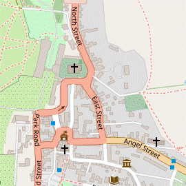
- Market Square to Petworth Park (½ km)
- Go up Lombard Street towards St Mary's church. Unless visiting Petworth House (its entrance is on the left), head east along Church Street and fork left into North Street. Bear left past NT offices to find Cowyard Tunnel, the pedestrian entrance into Petworth Park.
- Make your way to the north-eastern corner of Market Square and go up the cobbled Lombard Street. At the top the imposing parish church of St Mary the Virgin? (which is well worth a visit) is across Church Street, and the Church Lodge (town) entrance of Petworth House? is on the left.
-
Notes on visiting Petworth House
- The Audit Room Café is opposite the Reception desk and the Coffee Shop a short distance along the main corridor through the Servants' Quarters.
- As well as the house itself, visitors have access to some waymarked walks in the partly-wooded Pleasure Grounds to the north of the house, walled off from the main park.
- There is a gate leading into Petworth Park outside the north-western corner of the house. The leaflet given to visitors includes a map of the park with suggested routes, similar to the ones described in §M.
- If you are not a NT member, keep the sticker given to you on arrival so that you can re-enter the grounds from the park, visit the café and exit at Church Lodge. Alternatively, leave the park via Cowyard Tunnel and go to §N.
- If not visiting the house, head E along Church Street to the junction with North Street and East Street. Keep left at the junction to go around the eastern end of the church into North Street. The road narrows and you need to take care where the pavement on the left ends.
- About 100m past the road junction bear left into The Cowyard, with a “Pedestrian Entrance to Park” sign. Keep to the right of the NT offices and go down to a yard with some old outbuildings. At the bottom turn left and go through Cowyard Tunnel into Petworth Park.
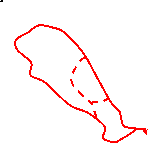
- Around Petworth Park (5½ • 3½ • 2¼ km)
-
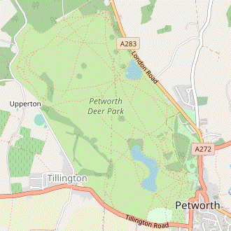 Take any route around the park, then return to the tunnel and go back out to North Street.
- Inside the park start by climbing the slope ahead of you towards a clump of trees. Continue along the left-hand side of the higher ground for about 500m, passing the serpentine Upper Pond? below on your left. When level with its northern end you come to a major path junction.
-
Short Cut 1 (2¼ km)
- Turn left to go down to the wooded enclosure at this end of Upper Pond and turn right onto a path which curves left around it. Continue alongside the lake itself, with a fine view of the house beyond it. Resume the directions at [?].
- For a longer route, keep ahead on a broad grassy path going gently downhill towards the left-hand end of Lower Pond, 500m away. Near the lake you come to another major path junction.
-
Short Cut 2 (3½ km)
- Turn left and follow a path curving left through a valley between low hills. Bear right in front of the wooded enclosure at the northern end of Upper Pond. … Resume the directions at [?].
- For the full circuit (5½ km) take the left-hand of two paths ahead, into the northern part of the park. In 500m turn half-left at an oblique path crossing. In 200m go straight across a stony track (the old driveway through the park) onto a path which swings left and climbs towards the western edge of the park.
- Near the top of the slope stay on the main (higher) path as it curves left around the hillside. There is a small reservoir off to your right and soon you will be able to see a stone tower on its right, the Upperton Monument?.
- At some point make your way onto the old driveway, which you can see down to your left. The suggested route is to follow the path round to the right to stay on the higher ground for a little longer before forking left downhill. However, you might have to skirt around a boggy patch at the bottom of the slope before joining the path from Upperton Gate leading to the driveway.
- Follow the stony driveway gently uphill, then through a small wooded area. Shortly after it emerges from a copse of beech trees fork left onto a grassy path heading directly towards the house, with Upper Pond coming into view. Follow the path down towards the lakeside and turn right to go alongside it, merging with the Short Cut routes.
- At the southern end of the lake turn left onto the stony track running alongside it. After passing the lake veer left to go diagonally across the grassland in front of the house. The entrance to Cowyard Tunnel is about 100m to the left of the house; leave the park through it and veer right to go up through the yard.
- Petworth Park to Angel Street (¾ km)
- Go back into the town for refreshments, then either return to the Church Street bus stop or continue to the Sheepdown Drive stop on Angel Street.
-
Leave The Cowyard and keep ahead on North Street. Fork right at the road junction to continue along Church Street. Unless you want to finish the walk at the bus stop by the church, go back down the cobbled Lombard Street towards The Star on Market Square.
- Coco Café & Sugar Lounge is off to the right on Saddler's Row, the street leading off the south-western corner of Market Square.
-
Continue past the pub and the United Reformed Church on a short street, Golden Square. This swings sharply left and becomes the High Street, with Tiffins Tearoom on its left-hand side.
- At the sharp bend Cherry's Deli & Bakery is in a pedestrianised area ahead on the right. To visit the Newlands House Gallery (with The Hungry Guest Cafe) you would have to go past Cherry's Deli and take the long straight tarmac path beside the town's main car park; the gallery is in the large town house at the far end.
- To head for the Sheepdown Drive bus stop (rather than retracing your steps to Church Street), carry on past Tiffins on the High Street. Go straight across the junction with Middle Street, in 60m passing the Petworth Cottage Museum on the left. In a further 40m bear left past a metal gate onto an unnamed lane. At the far end turn left onto Sheepdown Drive to reach the A283 (Angel Street).
- There is only one bus stop (on the left, for westbound buses to Midhurst) but it confirms that eastbound buses stop on the other side of the main road. To return to Fittleworth or Pulborough cross the road carefully and take a Worthing-bound bus.
- Market Square to Haslingbourne Lane (2 • 4¾ km)
-
Go up Lombard Street towards St Mary's church. Head east along Church Street to the junction with North Street and East Street.
- For an optional extension, fork left into North Street and bear left past NT offices to find Cowyard Tunnel, the pedestrian entrance into Petworth Park. Take any route through the park, then return via the tunnel and North Street.
- …
- Turn right and go along Church Street to the junction with North Street and East Street, with Bartons Lane across North Street being the start of the return leg.
-
Optional short tour of Petworth Park (+2¾ km)
- …
- …
- …
- … …
- …
- Leave The Cowyard and keep ahead on North Street. Shortly before the junction with East Street and Church Street turn left into Bartons Lane.
-
Go down Bartons Lane, passing Coach House (with its wooden notice-board warning about damage to property) on the right. In 100m the lane turns half-left by the last house and continues downhill as a tarmac path. After passing an old cemetery follow the path round to the right, going past a wooden turnstile onto a level path along the top of Shimmings Valley.
There are some benches along this path where you could pause to admire the view across the valley.
- In 200m go past another turnstile and straight across the path you took into the town. The path runs between a wooden fence and a high garden wall for 100m, then comes out abruptly onto the A283 (Angel Street). To continue the Circular Walk, cross this main road carefully and take the tarmac driveway off to the left, signposted as a footpath.
- Go along the driveway for 200m, passing several houses. Where it curves sharply left down towards a large house, keep right to continue on a grassy path alongside garden fences, heading S along the top of Sheep Downs. In 200m keep ahead at a crosspaths at the end of the gardens. The path leads out through a wooden kissing gate into a large open area.
- Make your way across this field (with only a faint grassy path at best) to the far right-hand corner, about 300m away; you can more or less follow a line of overhead cables. In this corner go through a wooden kissing gate in the hedge on the right and continue in much the same direction along the left-hand edge of a large farm field, directly towards the South Downs.
- At the end of the wood on your left keep ahead across another large farm field, aiming just to the left of a house which comes into view as it slopes downhill. Go over a stile to the left of a fieldgate and down the driveway between the house and its garden. At the bottom go through a side gate beside its electrically operated main gate onto a road (Haslingbourne Lane).
- Haslingbourne Lane to Hesworth Farm (3¼ km)
- Cross the road and take the driveway 75m off to the right (or the footpath opposite through a small meadow, if not obstructed). Continue past an isolated house and head south across farm fields for 500m. Turn left at a path T-junction to go past another farmhouse and across meadows to a lane. Head south-east on the lane and then take the footpath heading east past High Hoes to Hesworth Farm.
-
Cross the road carefully. The most direct continuation is indicated by a footpath signpost pointing to a wooden kissing gate, but access through this meadow has sometimes been obstructed. A straightforward route is to walk along the grass verge to the right for 75m and turn left into a driveway, also signposted as a footpath. In 200m you pass another kissing gate on the left, the exit from the meadow for the direct route.
At the time of writing both of these kissing gates had been nailed shut. The obstruction was being investigated by West Sussex Council.
- Go along the driveway towards a house, but keep to the right of its garden gate to pass the house on a narrow path alongside its boundary fence. Continue in the same direction for 500m, at first across a large farm field and then alongside a hedge separating two more large fields, to reach a T-junction with a farm track.
- Turn left onto this track to head E, in 250m going between a farmhouse and its outbuildings. Go through a wooden kissing gate and keep ahead across a field, with a hedge on your right.
- Towards the end there is an awkward stile in the hedge which is the right of way, but it might be easier to carry on to the field corner and turn right through a fieldgate. Either way, continue near the left-hand edge of an irregularly-shaped field for 250m, veering left halfway along. At the far end go out through a wooden kissing gate and up to a lane.
- Turn right onto the lane, initially heading SE and going gently uphill. In 350m turn left onto a broad track leading to High Hoes, signposted as a footpath. Follow the main track round to the right, passing a house and ignoring another footpath forking left into a wood. As you approach another house (350m from the road) bear left onto a grassy track going gently downhill past the side of the property, making your way around a metal fieldgate along the way.
- The track swings round to the right into a field where you veer left to go down its left-hand side, heading E. At the bottom continue past a house and then an attractive pond on your left. Where the track bends left, veer right across a patch of grass and go over a stile beside a metal fieldgate. Bear left to continue along the left-hand edge of a field, with a hedge on your left.
- In 200m go through a wooden kissing gate and follow a short path through some undergrowth. On the other side there is a hedge ahead separating two large farm fields. Go to the right of this hedge and continue alongside it for 300m, still heading E. In the field corner bear left onto a narrow path past a house, which emerges onto a lane by Hesworth Farm.
- Hesworth Farm to Fittleworth (School Lane) (1¾ • 2 km)
-
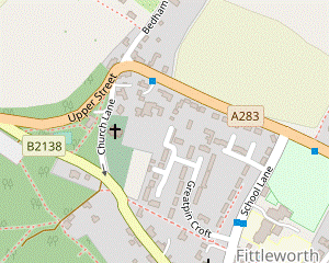 Turn left and go uphill on a lane into Hesworth Common. Follow the public footpath heading north-east across the wooded common, then veer left up to the trig point. Leave the common near the junction of the A283 and B2138 and take the footpath alongside the main road to Fittleworth church. Go through the churchyard and turn left briefly onto the B2138, then bear left onto a footpath going past houses to School Lane.
-
If finishing the walk here, turn left and go along School Lane to the bus stop on the A283.
-
If finishing the walk here, turn left and go along School Lane to the bus stop on the A283.
- Turn left onto the lane and follow it uphill and round to the right. Ignore a track forking down to the right, but where the lane makes a hairpin turn to the left keep ahead on a footpath into Hesworth Common.
- Just inside the common, ignore a path to the left and follow the main path on a gently undulating route through ferns and trees, heading NE. In 250m keep ahead at a footpath crossing, joining another short stretch of the ST·HR for a zig-zag route across the common to its car park near the junction of the A283 and the B2138.
- The path narrows and climbs a small gully, at the top of which you turn sharp left onto a sandy path climbing through the heather, away from a bench with a view towards the South Downs. At the highest point of the common there is a better viewpoint in front of the treeline, with another bench by a trig point.
- Any of the other three paths away from the trig point would get you to the car park, but to stay on the ST·HR take the leftmost path while facing the trees (ie. briefly heading back towards Petworth). This sandy path goes downhill and soon veers into the trees. In 100m you come to a T-junction with a broad path and turn right, with the A283 off to your left beyond a deep gully.
- Where the woodland path splits fork left to go gently downhill into the car park. Go straight through it onto another broad woodland path, but immediately turn left onto a narrow path leading out to the B2138, just past the vehicle entrance. Traffic branching off the A283 can be going quite fast, so cross this side road with great care onto the continuation of the footpath, parallel to the main road on your left.
-
In 100m the footpath zig-zags right and left to go past a brick scout hut. Go down its driveway and straight across Church Lane into the churchyard. Follow the tarmac path past the church of St Mary the Virgin?, which is worth a quick visit.
- Leave the churchyard through a gate at the bottom and turn left onto the B2138. The pavement soon leads into a signposted footpath where you fork left by the entrance to Orchard House (and possibly a cedarwood sculpture?). In 200m the tarmac path comes out onto a residential street (School Lane).
-
Finishing in Fittleworth (+¼ km)
-
Turn left into School Lane, passing a primary school and then the Fittleworth Stores (which has a café) on the right. At the top of the road the bus stop for Pulborough is 50m off to the right, on the other side of the A283.
- School Lane to Stopham Bridge (2½ km)
- Go straight across School Lane and follow the footpath into the wooded Fittleworth Common. Head east near its northern edge and then cross the A283. Take a footpath followed by a bridleway along the southern edge of Walters Plantation to Stopham church. Return to the A283 and head south-east on the main road, branching off by the entrance to Stopham House to cross Stopham Bridge.
- Go straight across School Lane onto the path opposite, leaving the ST·HR. In 150m the path crosses a stream and after a few sharp turns enters the wooded Fittleworth Common. Keep ahead on the main path into the trees, ignoring a narrow path off to the left (an alternative but slightly awkward route). After going up a short slope turn left onto a clear level path, heading E.
- The path gradually approaches the garden fences on the left, where it merges with the narrow path you passed earlier. Follow the path along the boundary of the common for 300m: at first steadily uphill with a low wooden fence on your left, then turning slightly left and dropping down to the A283.
- Cross the main road carefully and take the footpath opposite into a wood, ignoring an alternative route to the right. Where the path splits after 50m, ignore a footpath waymarker pointing left and fork right. In a further 50m the woodland path swings right to head E.
- Simply follow the main path in this direction for 700m, with a footpath joining from the right and a bridleway from the left along the way. The path eventually passes a few houses and leads into a lane. Go up to a T-junction (with an old manor house visible across the field ahead) and turn right, signposted to Stopham Church.
- In 75m the suggested route is to veer left across a triangular green for a closer look at the attractive medieval church of St Mary the Virgin?, which is usually open. Return to the lane and follow it down to the A283, with glimpses of the large Stopham Vineyard? off to your left.
- Cross the main road carefully and turn left onto the footway. In 400m the path moves slightly away from the road and you pass the ghostly ruins of a lodge house at the entrance to Stopham House. The path leads you over the medieval Stopham Bridge? to the suggested tea stop, the White Hart pub.
- Stopham Bridge to Pulborough Station (2¼ km)
-
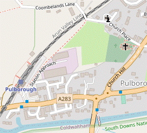 Cross the A283 and take the WSP along the edge of a wood for 1 km. Turn right to go past Park Farm and continue along Coombelands Lane. After crossing the railway retrace your outward route back to Pulborough station.
- Go up a short pathway between the bridge and the pub to the A283, joining another part of the WSP. Cross the main road carefully and take the bridleway on the right-hand side of a small parking area, climbing steeply into a wood.
- In 500m the bridleway swerves right and left to give views out across Pulborough Brooks to the South Downs. In a further 500m, with the tree-covered Park Mound? on your left, follow the track round to the right as indicated. The bridleway goes gently downhill past a house and garden to a tarmac lane by the entrance to Park Farm.
-
Cross over the lane (leaving the WSP) and follow the path round to the left into the top corner of a field. Veer right in front of a WW Ⅱ pillbox and follow the path down through the field. Go out through a wooden kissing gate and turn right onto Coombelands Lane.
-
Follow the lane round to the right after 225m, retracing your outward route back to Pulborough station: over the railway and turning right onto the tarmac path parallel to the tracks. Make your way around the left-hand side of the station building and go under the tunnel to Platform 1 for trains to London.
- Old Place Manor was built around 1450 and has a large medieval hall. Old Place was part of the farmstead of the manor house.
- The Gallops are used by horses at the Coombelands racing stables, owned by the Harwood family.
- The Toat Monument is a six-sided tower built as a memorial to Samuel Drinkald of Toat House, who fell from his horse and died near here in 1823.
- The Wey-South Path runs for 58 km between Guildford to Houghton Bridge, following the route of the River Wey, the River Arun and the canal linking them.
- Pallingham Bridge was restored by the Wey & Arun Canal Trust in 1976. The canal linking the two rivers briefly provided a trading link between London and the South Coast in the 19thC before being superseded by the railway.
- The River Arun is one of the fastest-flowing rivers in England and is tidal up to Pallingham. This hamlet's importance as a transport link is reflected in the names of two local farms, Pallingham Quay and Pallingham Lock.
- The Serpent Trail runs for 103 km between Haslemere and Petersfield, in a winding route through the heathlands of West Sussex. It has waymarkers in both directions: green ones for the ‘Head Route’ towards Haslemere and purple ones for the ‘Tail Route’.
- The Sussex Diamond Way runs for 97 km, from Midhurst to Heathfield through the Low Weald. It was devised by the Sussex branch of the Ramblers to mark its 60th anniversary in 1995.
- Flexham Park is not parkland but a large area of commercial woodland, mainly chestnut coppice.
- St Mary the Virgin, Petworth dates from the 13thC but has been much altered over the centuries; for example, the brick extension to the 14thC sandstone tower (a steeple was judged unsafe in 1947 and had to be removed). It is listed Grade Ⅰ but this did not prevent the church authorities from controversially replacing its Gothic main door with a modern glass porch in 2023.
- Petworth House is surprisingly close to the town centre. Medieval manor houses were usually built next to the parish church but in later periods mansions of this size were nearly always located on more private sites (or the neighbouring village re-sited).
- The serpentine shape of Upper Pond was one of Capability Brown's trademark features, designed to look like a wide meandering river.
- The Upperton Monument was probably built as a verderer's lookout in the late 18thC.
- St Mary the Virgin, Fittleworth dates from the early 13thC, although the nave was rebuilt in 1871. It is listed Grade Ⅰ.
- At the time of writing there was a cedarwood sculpture “Love & Science” (2010) by the Sussex artist Jon Edgar on public display by the entrance to Orchard House, with other sculptures by the same artist along its garden wall.
- St Mary the Virgin, Stopham mostly dates from the 12thC, with some parts surviving from the 11thC. It has some impressive brasses and monuments commemorating many generations of the local Barttelot family. It is listed Grade Ⅰ.
- Stopham Vineyard was planted in 2007 and mainly produces still white wines from Pinot Gris, Pinot Blanc, Auxerrois and Bacchus grapes.
- Stopham Bridge was built in 1423, replacing an earlier wooden bridge. The central arch was raised in 1822 to allow barges to pass. The bridge was still being used by traffic until the new A283 road bridge was constructed alongside in 1986. It is a Scheduled Monument and listed Grade Ⅰ.
- Park Mound is the site of a motte and bailey fortress, built shortly after the Norman Conquest. There is no longer any public access to the site.
On the main route a narrow enclosed footpath between Hill Farm Lane and Coombelands Lane has become neglected and overgrown, although some respite should be available along the adjacent field edge. If there are reports of it being too awkward there is an alternative route in [?]; this is shorter, but with more road walking.
The alternative route in [?] is more interesting but includes a couple of potential hazards: halfway along a plank bridge leading into a water meadow was slightly awkward when last checked, and the meadow itself could be boggy in wet weather.
If you are doing the alternative route via the Serpent Trail, go to §I.
Continue the directions at §J.
If you are catching a Midhurst-bound bus from Pulborough, leave the station and go down to the A283; the stop is on the other side of the main road. Alight at the School Lane stop in Fittleworth.
If you are doing the alternative route via the Serpent Trail, go to §H.
Continue the directions at §K.
The following three sections assume you will be finishing the walk in the town after exploring Petworth Park and perhaps visiting Petworth House. If you are planning to complete a Circular Walk back to Fittleworth or Pulborough with (at most) a short loop around the park, go to §O.
NB. The #1 bus for Pulborough does serve the stop outside the church, although for some reason it is not listed in the Stagecoach timetable and there is no timetable displayed on the stop.
The full directions in this section are for a long anti-clockwise circuit around the deer park, returning to this tunnel. There is no need to follow this route (or one of the suggested short cuts) precisely, but it is well worth going around Upper Pond for the classic view of the house beyond the lake.
The directions in this section pick out some refreshment places in the town and continue to the Sheepdown Drive bus stop on Angel Street (in case the Church Street stop is withdrawn in future).
If you have changed your mind and decided to do some or all of the return leg, turn right and go along the main road for 100m. Bear right onto a tarmac driveway signposted as a footpath and resume the directions at [?] in the next section.
The directions below are for a circuit around Petworth Park's Upper Pond for the classic view of the house beyond the lake, but they can be skipped if you want to head straight back.
If you have changed your mind about doing the return leg, the Angel Street / Sheepdown Drive stop for buses to Fittleworth and Pulborough is 100m off to the right.
There are many paths across this wooded common. The suggested route takes you to the trig point at its summit and leaves at a car park near the junction of the A283 and the B2138. If you get side-tracked onto a different path you might come out at another exit, 200m to the south-east. In this case head north-east down a lane past a few cottages, turn right onto the B2138 opposite the exit from Fittleworth churchyard and pick up the directions at [?].
If you are completing the Long Circular Walk back to Pulborough, skip to the next section.
Walk Notes
» Last updated: June 18, 2024
Return to Top | Walk Map | Walk Options | Walk Directions.