Thames Path: Tower Hill to Putney walk
The Thames Path through the centre of London, passing the City, Westminster, Chelsea, Battersea and Putney via 18 bridges


| Length |
18.2 km (11.3 miles) All tarmac. | ||
|---|---|---|---|
| OS Map |
OS Explorer maps 161 (London South) and 173 (London North) | ||
| Toughness |
1 out of 10. But as the entire walk is on tarmac or hard surfaces, it is recommended you wear well cushioned trainers instead of walking boots. | ||
| Features |
This walk follows the River Thames Path from Tower Bridge through Central London past the main tourist sites - The Tower of London, HMS Belfast, St Paul's, The Tate Modern, The Houses of Parliament to name a few - and follows it to the city's western suburbs of Battersea, Pimlico, and Putney, passing apartment blocks from the Victorian, Edwardian and modern eras, city parks, riverside pubs, and on-river pubs (boats). Early in the walk you will cross the river half a dozen times! Its easy to take time out from the walk to visit an art gallery (Tate Modern and Tate Britain), a concert (the Queen Elizabeth Hall usually has lunchtime music), or a tourist attraction (the Tower of London, the London Dungeon, St Paul's Cathedral, London Sealife Aquarium and the London Eye) along the way. The walk can be done in either direction, you can also choose between the north bank and south banks paths, swapping between them at any of the bridges. The recommended route has you crossing several of the 18 bridges you'll pass (3 more are rail bridges without a pedestrian footpath, and 1 is a rail bridge, but you'd need a ticket) but if you prefer, having crossed Tower Bridge at the start of the walk, you can stay on the South Bank. But crossing the bridges as suggested in these directions is much more fun ! Every time a new development opens, as part of planning permission, the route gets closer to the riverside, so the route in continually improving, and will be better than the map shows. You could easily do a shorter or circular walk. | ||
| Options |
Westminster to Putney 7.9 km (4.9 miles) Meeting place for groups: On the south bank, there are steps down from the north side of Westminster Bridge in the direction of the London Eye (big wheel). The bottom of these steps is our recommended meeting place for groups. Westminster tube is just across the river, and Waterloo tube is nearby on the south bank. Directions from Westminster tube are as follows: "Turn left out of Westminster tube station. Cross the bridge. Go down the stairs at the far end (in the direction of the London Eye (big wheel). Meet at the bottom of the stairs, in front of a cafe." | ||
| Travel |
This walk passes lots of tube and train stations. Tower Hill is on the Circle and District Lines. London Bridge mainline railway station is also served by the Northern and Jubilee tube lines. Westminster is on the Circle, District and Jubilee lines. Putney Bridge is on the District line. Putney mainland railway station has trains direct to Waterloo (change at Clapham Junction for Victoria). Drivers could find somewhere on the south side of Putney Bridge on Sundays (it's controlled parking Mon-Sat). There is a direct tube trains between the 2 stations, or you could get the river bus To cross Blackfriars Rail Bridge, you need a ticket as its a train station, either a travelcard, pass, or "10p plaform ticket" from the ticket office (only). SWC: This walk suits a mid-morning start, say 10:30 am | ||
| Places to Eat |
There are many nice places to stop for a drink along the way. A selection, from east to west:
| ||
| Bridges |
All except 3 have pedestrian access, although a 4th requires a train ticket. See London Bridges (wikipedia)
|
| Thames Path |
This walk is part of the Thames Path [wikipedia] [National Trails] - a 184 mile national long distance path - that follows the Thames from its source in Kemble to the Thames Barrier at Charlton in SE London. There is an unofficial 10 mile south bank extension on to Crayford Ness. It follows the river's historic towpath where possible. In a few places, nearby paths are used instead as towpath sections do not match up where former "horse ferry" crossing have been lost. Through London, and on to the sea, there are north and south bank paths. |
|---|---|
| Profile | |
| Help Us! |
After the walk, please leave a comment, it really helps. Thanks! You can also upload photos to the SWC Group on Flickr (upload your photos) and videos to Youtube. This walk's tags are: |
| By Car |
Start EC3N 4DJ Map Directions Finish SW6 3UH Map Directions |
| Amazon | |
| Help |
National Rail: 03457 48 49 50 • Traveline (bus times): 0871 200 22 33 (12p/min) • TFL (London) : 0343 222 1234 |
| Version |
Apr-24 Andrew |
| Copyright | © Saturday Walkers Club. All Rights Reserved. No commercial use. No copying. No derivatives. Free with attribution for one time non-commercial use only. www.walkingclub.org.uk/site/license.shtml |


Walk Directions
There is a Thames Path on both banks of the river. We suggest a route, crossing almost every bridge along the way. We also give a summary of the opposite bank, so feel free to pick and choose your own route!
Note: the GPS route is slightly out of sync with the suggested route below - we swapped some of the north/south banks around :)
Tower Hill to Westminster
5 km (3.1 miles) including bridge crossings
The Start - Tower Hill tube station
- Leave Tower Hill tube station, and turn right. The Tower of London is opposite. Cross the road by The Liberty Bounds, a Wetherspoons pub.
- All Hallows by the Tower (a church, free entry) is worth a visit. Established in 675 on the site of a Roman building (the Roman remains are visible in its basement museum). Restored in 1650, and again after WW2. Samuel Pepys watched the great fire of London from its spire. William Penn was baptised here, and (US President) John Quincy Adam married.
- Walk down to the river, and then head for Tower Bridge, with the river on one side, and with the moat below on the other, to start your walk.
#1 Tower Bridge
South Bank (recommended)
- Cross Tower Bridge to the South Bank, turn right (west).
- Continue for 1 km to the next bridge. You will pass in order on your left-hand side (or where right [R]) : Bridge Theatre (London's newest theatre), City Hall (affectionately known as Ken's Wigwam - after the first Mayor of London in the modern era), HMS Belfast [R], Hays Galleria (a modern development of restaurants and shops), London Bridge City Pier [R] (for the Thames Clipper boat service).
- Turn left for London Bridge Station, otherwise keep ahead.
North Bank (good)
- Pass in front of the Tower of London, then a few zig zags away from the river (but nice none the less).
#2 London Bridge
North Bank (recommended)
- Go up granite steps onto London Bridge which you cross to the North Bank.
- Ahead of you are fine views of the City's newest skyscrapers - The Walkie Talkie and the Cheesegrater.
- Head along the Thames Path on the North Bank, on Fishmonger's Hall Walk, then Oystergate Walk, then Hanseatic Walk. Turn right then left through Steelyard Passage, passing under railway bridges. Return to the Thames Path, with the Banker pub in an arch under Cannon Street railways bridge on your left.
- You are now on Walbrook Wharf. At its end, go up steps to Southwark Bridge.
South Bank (also very good)
- Pass Southwark Cathedral (the path has a short detour away from the river), The Golden Hinde (a sailing ship), and The Anchor pub (a historic pub with a large riverside terrace)
Cannon Street railway bridge has no pedestrian path
#3 Southwark Bridge
South Bank (recommended)
- Turn left to cross Southwark Bridge
- At its end, turn left down steps, then left under the bridge as you return to the South Bank.
- You have cafes and restaurants in modern development on your left. Pass Bankside Pier (Thames Clipper service) on your right and keep ahead on the riverside walk.
- Pass the Globe Theatre, then Tate Modern
- Tate Modern : the large former power station is now a modern art gallery. Free entry - do walk through its large ground floor turbine hall which has changing exhibitions. The top floor cafe is nice, as is the tower extension behind in. Its art is a little too contemporary for my taste.
North Bank (recommended)
- View of the Globe Theatre and tate Modern. NB: A new riverside section opened in Mar-23, so no more inland detours.
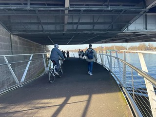
#4 The Millennium Bridge
The Tate Modern Art Gallery (free, in the old power station building) is at one end, and steps to St Pauls Cathedral are at the other end.
North Bank (recommended)
- Turn left up a ramp and cross the Millennium Bridge (affectionately known as the Wobbly Bridge, after initial problems with vibration on its opening - now fixed).
- At the end of the bridge, if you wish to visit St Paul's Cathedral then keep ahead up a slip road.
- Otherwise, to continue the walk, now back on the North Bank, turn left down steps onto Paul's Walk, passing the City of London School on your right. Pass Blackfriars Pier (Thames Clipper service) on your left. Pass under Blackfriars railway bridge.
South Bank (also very good)
- Pass the Tate Modern. Pedestrianised. But you have to cross the Millennium Bridge for the views
#5A Blackfriars Rail Bridge
It is possible to cross Blackfriars railway bridge, but only with a ticket. It's a station across the river with entrances on both banks, and platforms over the river. If you don't have a travelcard or pass, ask at the ticket office (only!) for a "10p Platform Ticket". Cross, and then cross back on the opposite platform.
#5B Blackfriars Bridge
South Bank (recommended)
- Go up steps and turn left to cross Blackfriars road bridge, to return to the South Bank.
- At the end of the bridge, turn left down steps, and go under the bridge. You have the Doggett's pub (now sans Coat and Badge) on your left - a popular venue for SWC walkers. Keep ahead on this riverside walk, along Oxo Tower Wharf, with retail units on your left. Pass the ITV studios, then the National Theatre complex .
North Bank (ok)
- A wide footpath along a noisy road - the vibrant pedestrianised southbank is better
#6 Waterloo Bridge
North Bank (recommended)
- Turn left up steps and turn right to cross Waterloo Bridge to the north bank, and at its end you turn right down steps onto the Victoria Embankment road. Stay on the south side of this road to cross Savoy Street and turn right into Victoria Embankment Gardens . Walk through the gardens with its many memorial benches and statues. Over to your left on the Embankment is Cleopatra's Needle with guarding sphinxes on either side of the obelisk.
- Exit the gardens, turn left through Embankment underground railway station hall, and at its far end turn right up steps.
South Bank (very good)
- Stay on the South Bank if you wish to visit the brutalist concrete buildings of the South Bank Centre and Festival Hall . But you should cross both Waterloo and Hungerford (Charing Cross) railway bridges
- Royal Festival Hall (Terrace bar) : The riverfront cafe bar in the Royal Festival Hall (near the railway bridge) has a nice view and is recommended. Its a good place to meet friends. The large foyer often has free music/events, and you're allowed to eat your own food/drinks
#7 Hungerford (Charing Cross) Railway Bridge
The railway bridge has footpaths on either side. One side has views to the city and St Pauls, the side other to Parliament. Both are recommended. Its worth crossing twice!
South Bank (recommended)
- Turn left to cross the river to the south bank on a modern steel footbridge which runs alongside Charing Cross Railway bridge.
- At its far end go down steps and return to the South Bank, now on Queens Walk. Keep ahead on this riverside walk and you come to Jubilee Gardens on your left. There are useful public WCs over to your left (50 pence). In a further 100 metres you come to the London Eye (a very big ferris wheel).
- You now have the start of the large (former) County Hall complex on your left. Pass the London Dungeon, Shrek's Adventure, then London Sealife Aquarium.
North Bank (ok)
- The footpath is alongside a busy road - the pedestrianised southbank path is nicer. But you do pass the Tattershall Castle, a pub on a moored ship. Very popular on summer evenings when you can sit out on its deck.
#8 Westminster Bridge
The Westminster to Putney option starts here
South Bank (recommended)
- Pass under Westminster Bridge and keep ahead on the south bank, along the Albert Embankment.
- You pass St Thomas' Hospital over to your left. Across the river you have a fine view of the Palace of Westminster (Houses of Parliament).
North Bank (ok)
- Also quite interesting. Crossing Westminster Bridge gives you great views. You walk around Parliament via busy Parliament Square. There is heavy security, but you can go in and look around the public parts. You rejoin the river path in a small riverside park beyond it
#9 Lambeth Bridge
North Bank (recommended)
- At the far end of the embankment go up steps and turn right to cross Lambeth Bridge to the north bank.
- At its far end, cross the busy road on the pedestrian crossings, go through a metal gate and go down steps to enter Victoria Tower Gardens South. Walk through these gardens and exit them onto Millbank. Turn left along this busy road, passing Millbank Tower skyscraper on your right.
- Cross Millbank at the pedestrian lights, and you have Tate Britain art gallery on your right
- Tate Modern : Classic British art, in a classic art gallery building. Free entry. Do go in for a quick look around.
- Keep ahead on Millbank and shortly after the road swings to the right you come to the Morpeth Arms pub, a recommended lunch stop. After lunch continue along Millbank.
South Bank (OK)
- OK - a little quieter than the opposite bank, but no art galleries
- In Jan-2022, a small inland diversion around a Thames Tideway (mega sewer) site
#10 Vauxhall Bridge
North Bank (OK)
- At Vauxhall Bridge , cross this busy road junction with care and on the far side (Vauxhall Bridge Road) turn left for 35 metres, to go down steps back onto the Thames Path, along a riverwalk.
- Go through a gate into Crown Reach, alongside private development. At end of the riverwalk turn right briefly onto Grosvenor Road, then return to the riverwalk, again beside private development on your right-hand-side. At the end of the riverwalk, turn right through Pimlico Gardens green space and return to Grosvenor Road. Keep ahead on this road, soon passing Westminster Boating Base on your left, then the Churchill Gardens Housing estate over to your right. You pass a Shell Petrol station on your left.
- In some 800 metres you go under Grosvenor railway bridge. On the other side of the river you have a clear view of the Battersea Power Station redevelopment scheme as it progresses. Keeping ahead on Grosvenor Road, in 100 metres you come to Chelsea Bridge .
South Bank (recommended as the Battersea Power Station complex is open)
- After a pleasant pedestrian path, there is a inland detour around a waste transfer dock.
- Return to the river in front of the large Battersea Power station building. There is a new riverside park, the riverside wharf (pier) has nice views, especially at night, and has picnic tables,
- Battersea Power Station is now an upmarket shopping mall. Free entry. Worth a look inside, interesting architecture, they've kept the old generating halls, but doesn't work for me.
- Continue along the riverside path, under the railway bridge, to Chelsea Bridge
Grosvenor railway bridge, which carries the main line to Victoria station, has no pedestrian path
#11 Chelsea Bridge
If you took the north bank route in the previous stage, walk back on the south bank 200m (past the railway bridge) to the new riverside park in front of the power station
South Bank (recommended)
- Cross to the South Bank - you will now stay on the this side of the river almost all the way to walk-end in Putney.
- At the far end of the bridge, turn right at the pedestrian lights, cross the road and enter Battersea Park through its Chelsea Gate. Follow the sign on your right for the Thames Path and walk ahead beside the river (on your right-hand side) on a riverwalk (unless you prefer walking on the grass to the left of the path for a softer footbed). You pass a cafe and public WCs (free) some 65 metres over the grass to your left. You next pass the buddhist London Peace Pagoda on your left.
- After walking through the park for 1 km, you exit it through a metal swing gate, to come out onto a major road, where you briefly turn right towards Albert Bridge .
North Bank (OK)
- The river path is beside a busy road, the south bank path through a park is much nicer
#12 Albert Bridge
South Bank (nicer)
- Albert Bridge is arguably the most attractive of the river bridges. Note the unusual and amusing notice on the sentry box beside the bridge "All Troops must break step when marching over this bridge". Do not cross Albert Bridge, marching in step or not, but instead cross the road to go down steps to return to the riverfront on the Thames Path.
- In some 300 metres you go up steps to come out onto Battersea Bridge Road, with Battersea Bridge to your immediate right.
North Bank (less nice, but recommended)
- The path is alongside a busy road - the south bank is nicer, but its only a short stage, and you get to cross both Albert and Battersea bridges with nice views
#13 Battersea Bridge
Jan-2022 : The new southbank riverside path past the power station is not open yet - the new riverside park is open, but is a 'dead end'.
South Bank (recommended)
- You now follow the south bank all the way to Putney
- Again, you do not cross this bridge, but cross the road to return to the riverwalk, passing a sculpture of a family entitled "In Town". Keep ahead on the riverwalk, with low rise residential development on your left-hand-side.
- At the end of this stretch of riverwalk, with houseboats ahead of you, keep ahead through the grounds of St Mary's Church (a good picnic spot) and at its far side return to the riverfront. You now have modern medium rise housing development to your left. In some 300 metres you pass under Battersea Railway Bridge and keep ahead on the riverwalk, soon on Lombard Wharf, with more moored houseboats to your right.
- You pass Oyster Pier and go over two water inlets. At the end of this section of riverwalk you come to London Heliport ahead of you. Turn left away from the riverfront and walk around the heliport. You pass Crowne Plaza and the heliport offices then turn right to return to the riverfront.
- Keep ahead on this next section of riverwalk, soon passing Plantation Wharf, then Battersea Reach modern high rise development. At the end of the riverwalk, with Wandsworth Bridge ahead of you, turn left, then right to go under the bridge.
North Bank (ok)
- The north bank path is a mix of modern developments, but there are 2 diversions away from the river, a short one around Chelsea Creek, and a longer one at the end around a fuel depot.
Battersea Railway Bridge, which carries the West London Line (Clapham Junction to Kensington Olympia), has no pedestrian footpath.
#14 Wandsworth Bridge
South Bank (recommended)
- Remain on the south bank.
- Keep ahead through an industrial area, with a cement plant on your right. In 70 metres you come to The Ship, your late lunch pub option.
- Pass to the left of this pub on Jews Row and turn right by Brady's Bar and Restaurant to return to the riverfront, now on Nickols Walk. You next pass Riverside West residential development before the way ahead is blocked by a large household waste recycling plant. Note the two massive cranes which jut out into and above the river. Turn left (inland) beside the waste plant for some 150 metres to Smuggler Way. To end the walk here, turn left for 100m to Wandsworth Town railway station.
- To continue the walk, at the end, turn right on Smugglers Way passing the Recycling Centre / Docks.
- Cross a bridge over the River Wandle and Bell Lane Creek (follow the River Wandle path inland to Earlsfield and Colliers Wood). Between the 2 is a small path to the right leading to the mouth of the Wandle - a quiet picnic spot.
- Walk back to the river front, in front of new residential buildings (Then, in 2022, inland past 3 blocks having their cladding removed).
- Continue ahead to Wandsworth Park and walk on its surfaced path with an avenue of London plane trees to your left - and a line of lime trees to their left. In some 425 metres, at the end of the park, turn left for some 40 metres to exit the park through a gated brick archway into Blade Mews. At the end of this road keep ahead, now on Deodar Road.
North Bank (avoid!)
- There is a long inland detour around the private riverside Hurlingham Club
#15 Fulham Railway Bridge
The Bridge leads directly to Putney Bridge tube station. Just walk half way across for the view.
South Bank (recommended)
- Remain on the south bank
- You pass under the London underground railway bridge, with access steps to its right up onto a walkway beside the bridge over the river which takes you direct to Putney Bridge station, should you wish to bypass your tea stop. Otherwise, keep ahead on Deodar Road until it swings to the left. Here you turn right to return to the riverfront. You pass, on your left, Carluccia's restaurant, then the Boathouse pub, then you come to The Rocket, a Wetherspoons pub restaurant with a riverside terrace, your suggested tea stop.
- After tea, exit the pub via its rearmost exit to come out into Church Square, with St Mary's Church over to your right. Walk 40 metres through the square and you come out onto Putney High Street.
North Bank
- You miss out on the riverside pubs with a terrace
#16 Putney Bridge
The bridge is noted for having churches at both ends!
This is the end of the walk. You have a choice
- To visit Fulham Palace and Bishop's Park (recommended) : Turn right to cross Putney Bridge. At its far end, turn left past the church into Bishop's Park (a riverside city park) and Fulham Palace (a former Bishop's palace with grounds, free entry). Its an impressive building. Not much inside, but a nice tea room overlooking the garden.
- To finish at Putney Bridge (tube) station : Turn right to cross Putney Bridge. At its far end, turn right down steps and keep ahead for Putney Bridge underground station. (District Line).
- To finish at Putney (rail) station : Turn left and walk gently uphill for a few hundred metres passing Putney's shops en route until you come to Putney overland railway station , for a service to London Waterloo.
- To continue the Thames Path to Hammersmith : You can continue along either bank to Hammersmith. Both are nice, but the southbank is nicer, almost rural!