Wickford to Battlesbridge or South Woodham Ferrers Walk
Grassy fields, quiet lanes, a smattering of woods, Hanningfield Reservoir Nature Reserve and the tidal River Crouch.
![Backview from Mark's Farm towards Rettendon SWC Walk 157 - Wickford to Battlesbridge or South Woodham Ferrers [Battlesbridge Ending]](https://live.staticflickr.com/65535/49945388907_9e031bb2c1_n.jpg)
Backview from Mark's Farm towards Rettendon
SWC Walk 157 - Wickford to Battlesbridge or South Woodham Ferrers [Battlesbridge Ending]
May-20 • thomasgrabow on Flickr
swcwalks swcwalk157 banner 49945388907
![View down the Crouch, from point at Clementsgreen Creek confluence SWC Walk 157 - Wickford to Battlesbridge or South Woodham Ferrers [South Woodham Ferrers Ending]](https://live.staticflickr.com/65535/49956168273_826dbd1e45_n.jpg)
View down the Crouch, from point at Clementsgreen Creek confluence
SWC Walk 157 - Wickford to Battlesbridge or South Woodham Ferrers [South Woodham Ferrers Ending]
May-20 • thomasgrabow on Flickr
swcwalks swcwalk157 banner 49956168273

Hanningfield Reservoir
SWC Walk 157 - Wickford to Battlesbridge or South Woodham Ferrers
May-20 • thomasgrabow on Flickr
swcwalks swcwalk157 walkicon 49945101361

Alpacas and Buttercups, East Hanningfield
SWC Walk 157 - Wickford to Battlesbridge or South Woodham Ferrers
May-20 • thomasgrabow on Flickr
swcwalks swcwalk157 walkicon 49945098856
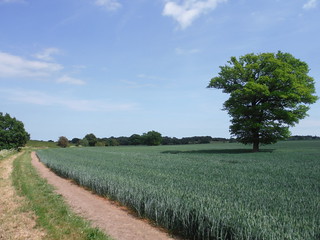
Tree in Field, south of Rettendon
SWC Walk 157 - Wickford to Battlesbridge or South Woodham Ferrers
May-20 • thomasgrabow on Flickr
swcwalks swcwalk157 walkicon 49945097211
| Length |
21.0 km (13.1 mi), with 205/209m ascent/descent. For a shorther walk or an Alternative Ending see below Walk Options. |
|---|---|
| Toughness | 3 out of 10 , with 4 hours 40 minutes walking time. For the whole outing, including trains, sights and meals, allow at least 7 hours. |
| Walk Notes |
This surprisingly diverse and rural walk avoids industrial and suburban features often associated with walking in Essex, but instead leads through plenty of rolling grassy fields, along quiet lanes and through a smattering of woods, before heading through the enchanting – Essex Wildlife Trust run – Hanningfield Reservoir Nature Reserve. After a short stretch along the reservoir itself it then heads for the lunch pub: The Old Windmill in South Hanningfield. The afternoon route leads through more pastures, valleys and wooded strips, before descending into the Crouch Valley and following the tidal River Crouch for a short stretch into Battlesbridge past its famous Antiques Centre. An Alternative Finish in South Woodham Ferrers loops around the town through a fenland nature reserve, some saltmarshes and along the tidal River Crouch with its mudflats, sailing boats and plenty of birdlife. It is especially attractive at low tide. |
| Walk Options |
Shortcut: You can return from the lunch pub to Wickford by bus (approx. every two hours, though not on Sundays).
|
| Maps | OS Landranger Map: 167 (Chelmsford), 168 (Colchester) and 178 (Thames Estuary).
OS Explorer Map: 175 (Southend-on-Sea & Basildon). |
| Travel |
Wickford Station, map reference TQ 745936, is 14 km south east of Chelmsford and 13m above sea level. Battlesbridge Station, map reference TQ 776948, is 3 km north east of Wickford and 9m above sea level. Both are in Essex. Trains to Wickford leave from Liverpool Street station via Stratford every 20 minutes (journey time from 35 minutes), half-hourly on Sundays (journey time 38 minutes). Wickford is on the Shenfield to Southend Main Line, which diverges at Shenfield from the Great Eastern Main Line. South Woodham Ferrers and Battlesbridge are on the single-track Crouch Valley Branch Line from Wickford to Southminster, with one train every 40 minutes Mon-Sat, and hourly trains Sun (journey time from Battlesbridge between 48 and 60 minutes, 4 mins longer from South Woodham Ferrers). Saturday Walkers’ Club: Take the train closest to 10.15 hours (9.45 if walking the full South Woodham Ferrers walk). |
| Lunch |
Café on the Water The Fishing Lodge, Hanningfield Reservoir, Giffords Lane, Chelmsford, Essex, CM3 8HX (01268 712 182). Open daily 09.00-17.00 in summer (to 16.00 in shoulder season and to 15.00 in winter). Located 8.3 km from the start of the walk.
|
| Tea |
Several good options at the end in both Battlesbridge and South Woodham Ferrers. For details see the pdf. |
| Profile | |
|---|---|
| Help Us! |
After the walk, please leave a comment, it really helps. Thanks! You can also upload photos to the SWC Group on Flickr (upload your photos) and videos to Youtube. This walk's tags are: |
| By Train |
Out (not a train station) Back (not a train station) |
| By Car |
Start Map Directions Return to the start: Finish Map Directions Travel to the start: |
| Amazon | |
| Help |
National Rail: 03457 48 49 50 • Traveline (bus times): 0871 200 22 33 (12p/min) • TFL (London) : 0343 222 1234 |
| Version |
Jun-21 Thomas G |
| Copyright | © Saturday Walkers Club. All Rights Reserved. No commercial use. No copying. No derivatives. Free with attribution for one time non-commercial use only. www.walkingclub.org.uk/site/license.shtml |


Walk Directions
Full directions for this walk are in a PDF file (link above) which you can print, or download on to a Kindle, tablet, or smartphone.
This is just the introduction. This walk's detailed directions are in a PDF available from wwww.walkingclub.org.uk