Ashurst Circular walk
A walk via Pooh Bridge to the attractive Wealden village of Hartfield, with a longer option over the elevated heathland of Ashdown Forest.

1006120062
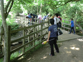
Dual language sign to Pooh Bridge
Jun-10 • Sean O'Neill
banner, swcwalk29, swcwalks 5482210484509432034 P

CIMG7321
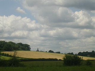
Rape fields, Medway valley
Jun-13 • Sean O'Neill
swcwalk29, swcwalks, walkicon 5895564750207554338 P
CIMG7324
Pooh Bridge, Ashdown Forest
Jun-13 • Sean O'Neill
swcwalk29, swcwalks, walkicon 5895564832335817074 P
CIMG7333
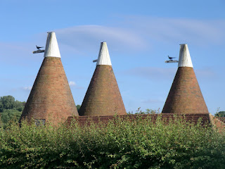
Oast houses, Summerford Farm
Jun-13 • Sean O'Neill
swcwalk29, swcwalks, walkicon 5895564931592929890 P


| Length |
Main Walk: 19½ km (12.1 miles). Four hours 45 minutes walking time. For the whole excursion including trains, sights and meals, allow at least 9½ hours. Long Circular Walk: 24¼ km (15.0 miles). Six hours walking time. Short Circular Walk: 15 km (9.3 miles). Three hours 30 minutes walking time. |
|---|---|
| OS Map |
Explorer 135. Ashurst, map reference TQ507388, is on the East Sussex/Kent border, between East Grinstead and Tunbridge Wells. |
| Toughness |
5 out of 10 (7 for the Long Walk, 3 for the Short Walk). |
| Features |
This walk makes a gentle start along the Medway valley, soon joining the Wealdway long-distance path. After an early pub lunch in the small village of Withyham with its notable parish church there is a choice of three routes. All lead eventually to the neighbouring village of Hartfield, associated with the author AA Milne and his most famous creation: coachloads of tourists regularly descend on Pooh Corner to buy all manner of Winnie-the-Pooh memorabilia. The Short Walk heads directly for this village, while the other variations continue through the extensive Buckhurst Estate into Five Hundred Acre Wood. This is the furthest point for the Main Walk, which crosses the famous Pooh Bridge on its way round to Hartfield. The Long Walk climbs steadily through the wood and continues around the rim of a valley in Ashdown Forest, the largest area of elevated heathland in south-east England. It goes past some recognisable features from the children's stories and a memorial commemorating AA Milne and his illustrator, EF Shepard. From this viewpoint it makes a long descent into Hartfield, rejoining the Main Walk shortly before Pooh Bridge. After a tea stop in this attractive Wealden village the circular options go back along the Medway valley to Ashurst station (since 2020, on a slightly different route which avoids any overlap with the outward route). As with any walk in the High Weald, you will need to be prepared for muddy or waterlogged paths at almost any time of the year. |
| Walk Options |
You could finish any of the variations at Hartfield and take Metrobus 291 to East Grinstead (details below). Conversely, you could start at Withyham by initially travelling to East Grinstead and then taking the same service to this village. If you want to shorten the walk after lunch at the Dorset Arms, you could switch to one of the shorter options or simply catch the 291 bus from outside the pub. On the Long Walk you can take various short cuts across Ashdown Forest. |
| Transport |
There is an hourly service (Mon–Sat) from London Bridge to Ashurst (Kent), taking 50 minutes. On Sundays you have to travel from Victoria and change at Oxted, with a longer journey time of around 70 minutes. For the variations which finish in Hartfield, Metrobus 291 goes to East Grinstead in one direction and Tunbridge Wells in the other (hourly Mon–Sat, two-hourly Sun & BH). A return ticket to Ashurst (Kent) is more likely to be accepted at East Grinstead since this route is also operated by Southern, with a half-hourly off-peak service to Victoria. At the time of writing the last bus to East Grinstead leaves Hartfield at about 7.30pm (5pm Sun & BH); an hour earlier to Tunbridge Wells. If driving, the station car park at Ashurst costs £2.90 Mon–Fri, free at weekends (2022). There is no public transport from Hartfield to Ashurst, so you would have to complete a circular walk. |
| Suggested Train |
Take the train nearest to 10:00 from London Bridge to Ashurst (Kent). |
| Train Times |
|
| Timetables |
|
| River Levels |
|
| Lunch |
The suggested lunch place is the Dorset Arms (01892-770278) in Withyham, after 5¾ km. In 2014 this attractive old pub was bought by the Buckhurst Estate and fully refurbished; it has plenty of outdoor seating (including a new back garden) and serves good home-cooked food until 2.30pm (4pm Sun). There are no further pubs on any of the walk options until you reach Hartfield, where the Anchor Inn (01892-770424) would be a good alternative for lunch on the Short Walk. |
| Tea |
There are no refreshment places near Ashurst station so you would need to stop for tea in Hartfield, 6¼ km before the end of the Circular Walks. If you arrive before 4.30pm (3.30pm Sun & BH) you can take some of Kanga's ‘Strengthening Medicines’ at Piglet's Tearoom (01892-770595); if not, the Anchor Inn (see above) is open all day. If you return via East Grinstead you might find the station café open but you will have more choice if you get off the bus a little earlier, in the High Street. There are plenty of refreshment places in Tunbridge Wells if you take the bus there. |
| Profile | |
|---|---|
| Help Us! |
After the walk, please leave a comment, it really helps. Thanks! You can also upload photos to the SWC Group on Flickr (upload your photos) and videos to Youtube. This walk's tags are: |
| By Train |
Out (not a train station) Back (not a train station) |
| By Car |
Start TN3 9TL Map Directions |
| Amazon | |
| Help |
National Rail: 03457 48 49 50 • Traveline (bus times): 0871 200 22 33 (12p/min) • TFL (London) : 0343 222 1234 |
| Version |
Apr-24 Sean |
| Copyright | © Saturday Walkers Club. All Rights Reserved. No commercial use. No copying. No derivatives. Free with attribution for one time non-commercial use only. www.walkingclub.org.uk/site/license.shtml |


Walk Directions
Click the heading below to show/hide the walk route for the selected option(s).


 Walk Map
©
Walk Options
Click on any option to show only the sections making up that route, or the heading above to show all sections.
- Main Walk (19½ km)
Walk Directions
Click on any section heading to switch between detailed directions and an outline, or the heading above to switch all sections.
If you take bus 291 from East Grinstead to Withyham, get off at the stop opposite the Dorset Arms and start at §C.
- Ashurst Station to Summerford Farm (3½ km)
- Turn right out of the station to join the Sussex Border Path, which goes up along the side of the valley, then descends. At a path junction, turn right to join the Wealdway (WW). Go under the railway and follow the WW across fields and water meadows alongside the River Medway to Summerford Farm.
- From the station's small car park do not go out along its access road to the A264, but take the private road in the opposite direction, heading S and joining the Sussex Border Path? (SBP). This lane winds uphill and curves to the right where a footpath joins from the left. Continue along a straight farm track for 200m, passing the attractive Linkhorns Farmhouse? on your right.
- At Jessup's Farm turn left to go uphill on a grassy track between hedges. At the top turn right onto a tree-lined track which soon starts to go back downhill. Go over a stile to continue with fields sloping down to your right, passing a few derelict brick outbuildings after 500m. In a further 150m, after going through a belt of trees, veer right at a footpath sign to go down a broad grassy path, joining the Wealdway? (WW).
- At the bottom of the field go through a side gate and under the railway. On the other side turn left and follow a grassy path through a meadow. Cross the River Grom? on a footbridge and bear right to go across the next field, aiming for a metal gate on the far side if there is no path visible.
- Turn right by this gate (leaving the SBP) to cross Eridge Stream? on a concrete bridge. Go straight on across the meadow, following the overhead power cables. At the end of the meadow, cross the River Medway on another concrete bridge and turn half-left to go across a field.
- On the far side, ignore a wooden bridge across a ditch and turn left along the field edge, heading SW. In 100m cross the ditch on a footbridge and continue with a hedge on your right for 350m to reach a loop of the River Medway.
-
Keep ahead through a copse, crossing more ditches. Continue along the right-hand edge of water meadows for 700m, with the river meandering away on your left. Eventually you go through a metal side gate and come out onto a lane opposite the driveway to Summerford Farm.
- For a direct road route to the Dorset Arms you could turn left and follow the lane through the village of Balls Green, then turn right at the T-junction with the B2110 to reach the pub. If you take this short cut (saving 1 km), continue the directions at §C.
- Summerford Farm to Withyham (2¼ km)
- Continue on the WW through Summerford Farm, then across the River Medway and the Forest Way. Head south towards Withyham, crossing the B2110 and taking the lane up towards the church. Turn sharp left onto a driveway leading back to the B2110 and go along the road to the Dorset Arms.
- Cross the lane (slightly to the right) and go along the driveway past barn conversions and cottages, still on the WW. Pass to the right of the Oast House and follow the drive over a slight rise (with Hartfield's church spire visible ahead on your left, 2 km away). At the bottom of the slope go through a metal fieldgate to the right of the last house.
- Ignore a stile into the field ahead and bear left onto a broad grassy track between hedges. In 100m turn left at a partly-concealed footpath signpost to go down through the hedge onto a narrow path between fences. In 175m fork left down a slope, staying on the WW.
- At the bottom follow a grassy path diagonally across a meadow and go back across the River Medway on a new footbridge. Go straight across the Forest Way? (Cycle Route 21) and over a stile into a large meadow. Follow a broad grassy path heading S across this meadow and another one to meet the B2110 just to the right of Hewkins Bridge.
-
Turn left to go over the narrow bridge, crossing over with great care to the other side of the road so that you can fork right up a lane signposted to the church. In 75m you come to a junction of lanes, with a Private Drive ahead and the church on a small hill on your left.
- The route now loops out to the Dorset Arms and returns to this junction via the churchyard (when you could visit the church). If you are not stopping at the suggested lunch pub you could detour up the slope to do this before continuing the directions at [?] in §C (or [?] if you want to carry straight on).
- For the pub turn sharp left at the junction of lanes, almost doubling back. The path curves round to the right past a few cottages and continues along a pavement beside the B2110. The Dorset Arms is on this side of the road but where the pavement inconveniently switches to the other side you have to cross the road, go past the village hall and then cross back again to reach it.
- Withyham to Forstal Farm Cottage (drive) (¾ km)
- Return briefly along the B2110, now on the High Weald Landscape Trail (HWLT). Unless it is closed, take a permissive path uphill and through the churchyard. Go back down to the junction of lanes below the church and take the Private Drive heading south, on both the WW and HWLT. In 300m the two trails split by the driveway to Forstal Farm Cottage.
-
Return to the B2110 and turn left, joining the High Weald Landscape Trail? (HWLT). As before, you have to use the pavement on the other side and cross back again after going past the village hall. Instead of continuing on the pavement, go through a metal kissing gate in the hedge.
- A notice at the top of the slope advises visitors that the continuation of this permissive path through the churchyard is locked twice a year, on March 25th and September 29th. On these days retrace your outward route back to the junction of lanes below the church and continue the directions at [?].
- For the normal route go up a grassy path to the top of the slope. Go through a wooden kissing gate and follow the churchyard path round to the far side of the church of St Michael and All Angels? to find its entrance.
- After visiting the church, return to the churchyard path and turn right. Ignore a private path on the left leading to the Rectory? but veer left down a flight of steps and turn right at the bottom to go down its driveway. At the junction of lanes from your outward route turn sharp left.
- Head S on this Private Drive, with both WW and HWLT waymarkers confirming that this is also a public footpath. You pass some interesting old houses off to the left, the first one (with the ‘sawn-off’ corner) being Monk's House?. In 300m there is a stile on the right immediately after the driveway to Forstal Farm Cottage.
- Forstal Farm to Five Hundred Acre Wood (2¾ km)
- Carry on along the Private Drive, leaving the HWLT. At Fisher's Gate, turn left to skirt around the property and enter Five Hundred Acre Wood. Follow the WW round to the right, going across a small valley by Kovacs Lodge and up to a path junction.
- Ignore the stile and continue along the drive, leaving the HWLT but staying on the WW. After 1¼ km you go past a string of cottages and “The Farmhouse”. In a further 200m (where the way ahead is a private driveway) go over a stile on the left, next to another gated driveway. Continue along the edge of a field, with the drive behind a fence on your right.
- Follow the field edge downhill and round to the right. Go over a stile onto a short woodland path, soon joining the parallel driveway. Keep ahead at a crossing, passing a cottage on the right. Stay on the surfaced drive through Five Hundred Acre Wood?, taking the right fork at a couple of junctions in the next 150m.
- The drive goes gently downhill for 400m, curving round to the left. At the bottom of a slope pass to the left of the gated entrance to Kovacs Lodge to climb back uphill on a rough track, heading W. At the top the path turns half-left in front of a high fence, then 25m further on comes to a junction with a concrete footpath marker.
- Five Hundred Acre Wood to Posingford Wood (1½ km)
- Fork right off the WW at the path junction and follow the footpath to the B2026. Turn left and go along the road for 150m, then take a footpath on the right across a horse training ground. Continue around a field to Posingford Wood and turn sharp right onto a new bridleway.
- Fork right at the path junction, leaving the WW and heading W. In 500m the path crosses a stream on a wooden footbridge and veers up to the right, merging with a sunken track.
- Follow this potentially muddy track as it curves round to the left and continue up a bank to the B2026. Turn left and go along the road for 150m, taking care as there is only a narrow grass verge. Just before a gate for Forest Ridge House on the left, turn right off the road onto an inconspicuous narrow path, leading to a concealed stile in the trees.
- Go over the stile (which has a yellow footpath marker) into a horse training ground. Follow the clearly waymarked route straight across it: over a horse track flanked by wooden gates, across a patch of grass, then back over the track on the far side. Keep ahead through a gap in the hedge onto a broad track heading NW, with a large field on your left.
-
At the end of the field turn left as indicated onto a grassy path along its bottom edge. On the far side follow the path into Posingford Wood. The right of way turns half-left and soon comes to a broad track (a rerouted bridleway) where you would turn sharp right, almost doubling back.
- At the entrance to the wood a well-used path down to the right suggests that most walkers cut off this corner and join the track further down.
- Five Hundred Acre Wood to Gills Lap car park (4 km)
- Fork left and follow the WW uphill through the wood and into Ashdown Forest, eventually emerging onto open heathland. At Greenwood Gate Clump fork right off the WW. Just before reaching the B2026, turn right onto a ride parallel with the road (briefly joining the Vanguard Way), which leads to Gills Lap car park.
-
Fork left at the path junction, heading S. Keep to the main path as indicated by occasional WW posts, climbing steadily through this large wood and veering right after 450m to head SW. In a further 200m keep ahead at a path crossing, going past a wooden fieldgate into the Access Land of Ashdown Forest?. Follow the main path through the wood, still climbing steadily.
As before there are occasional wooden posts with WW signs, which originally had white-painted notches at the top indicating the direction. Although these have deteriorated over time they are still of some help in determining the route at path junctions.
- In 700m (where you can see open countryside through the trees ahead on your right) fork right to emerge onto heathland, with fine views across a valley? on your right. Continue to follow the WW posts on a broad ride across Ashdown Forest, initially heading S and later curving gently to the right.
-
In 800m you come to a T-junction in front of a small clump of trees, where the simplest route is to go straight ahead on a short path through the trees. At the end bear right onto a broad ride, soon merging with another from the right. In 50m fork right at a Y-junction in front of another clump of trees. In a further 100m keep left at the next junction?.
- For a short cut you could take the right fork here, then in 500m turn right at a major path crossing to go directly to the car park (which you can see 500m away). If you do this, continue the directions at §G.
-
On the suggested route you come to a clearing in 150m, with Greenwood Gate Clump ahead on your right. Make your way to the far side of these trees (going round either side) to continue on a similar grassy ride about 60m to the right of the WW, gradually diverging from it but still heading roughly SW. In 200m keep ahead at a major path crossing.
- Again, you could turn right here to go directly to the car park (which you can see 750m away). If you do this, continue the directions at §G.
- On the suggested route you are rewarded with views of the South Downs, 20 km ahead. In 300m you come to a T-junction with another broad ride, with the B2026 (partly screened by trees) 50m ahead. Turn right at this junction, parallel to the road. In around 400m the ride drops gently downhill. Bear left as it levels out, go up to the B2026 and cross over into Gills Lap car park.
- Gills Lap car park to Posingford Wood (2¼ km)
- Head north across a grassy area onto a broad ride to Gills Lap Clump. Unless you want to detour to see Pooh's Heffalump Trap, carry on to a viewpoint at the Memorial. Head north downhill on the main ride to meet Chuck Hatch Lane. Cross over onto a new bridleway which goes past Pooh Bridge car park and down through Posingford Wood.
- On the right-hand side of the car park there is a stone plinth with an information panel about “the playground of Winnie-the-Pooh”. From this plinth head N across a grassy area and bear right onto a broad ride along the ridge, with fine views to the north-west.
-
In 400m you come to Gills Lap Clump? and a trig point on your right. A straightforward route is to carry on along the main ride for a further 200m; before it starts to go steeply downhill an opening on the left leads to a celebrated viewpoint.
- For a little detour you could turn left off the main ride at Gills Lap Clump onto a path leading to a pine tree growing in a hollow? (taking care not to fall in). About 20m before reaching it, a narrow path winds through the gorse on the right for 200m and leads directly into the viewpoint.
- At the viewpoint there is a bronze memorial plaque to AA Milne and EF Shepard, the author and illustrator of the Winnie-the-Pooh stories. Return to the broad ride and turn left to start a long descent, quite steeply in places.
- In 500m, where the right fork leads to Wren's Warren car park, veer left and right to continue downhill on the main ride. In a further 350m, fork left into a lightly wooded area. The path swings right and a straight stretch through the trees leads to a minor road (Chuck Hatch Lane).
- Cross over the road onto a broad track (a rerouted bridleway), soon passing Pooh Bridge car park on the right. Follow the track down through Posingford Wood, rejoining the Main Walk route at a footpath crossing after 250m.
- Posingford Wood to Hartfield (2½ km)
-
 Follow the bridleway down to Pooh Bridge. Cross over and continue up to Cotchford Lane. Bear left briefly onto the lane, then go through a gate on the right and up across two meadows. Turn right onto a footpath past some new houses, then turn left at a three-way junction to go down to the B2110. Turn right and follow the road round to the left into Hartfield's High Street.
-
If finishing the walk here, the bus stops are in the village centre.
-
If finishing the walk here, the bus stops are in the village centre.
- Go downhill on the broad track through the wood. In 250m it curves left to cross a stream on a wooden footbridge, then swings right to rejoin the old bridleway. Follow the main track for a further 150m to reach Pooh Bridge, where it is of course obligatory to play a few games of Pooh Sticks?.
- Cross the bridge and continue on the bridleway, which climbs gently for 250m before merging with a short driveway and coming to a lane. Bear left and go along its broad grass verge for 100m, then go through a metal side gate on the right (just past “Mole End”). Follow a clear grassy path across a wildflower meadow and continue up to the top right-hand corner of a second meadow (with fine views back to Ashdown Forest).
- Leave the meadow over a stile and bear right across a junction of driveways. Go through a wooden side gate onto an enclosed path heading E, passing the gardens of two large new houses on the left and then swerving around another (“Landhurst”). In a further 100m turn left at a footpath junction, signposted to Hartfield village.
-
Follow the path alongside a high wooden fence, past a (possibly dried-up) pond and then gently downhill, later with a field on the right. At the bottom make your way past a wooden fieldgate? and out to the B2110.
-
Turn right and walk along its pavement, keeping left at a road junction
to go up Hartfield's High Street. Piglet's Tearoom is on the left in 125m, part of the Pooh Corner shop. The Village Stores and the Anchor Inn are a similar distance further on, near the junction with Church Street.
Opposite the Village Stores the Hay Waggon still looks like Hartfield's alternative pub, but it has been elegantly converted into a pair of houses.
- If finishing the walk here, the bus stop for East Grinstead is opposite the Village Stores. The stop for Tunbridge Wells is just past the junction with Church Street.
- Forstal Farm to Hartfield (2¼ km)
-
Go over the stile on the right, leaving the WW. Follow the HWLT through fields and a small wood, later passing the house. Fork left off the HWLT to come out onto the B2026 just south of its junction with the B2110, and turn right into the village.
- Go over the stile, leaving the WW but staying on the HWLT. Follow a grassy path across the field, passing to the left of a large oak tree and with a stone tower? coming into view ahead on the left. Follow the path into a small wood, where you might have to negotiate some muddy patches.
- On the far side of the wood the path bends left and comes to a track where you turn sharp right to cross a stone bridge over a stream. On the other side bear right off the track to continue along the bottom edge of a large field, heading NW towards Forstal Farm Cottage. After passing the house go through a gate and across a small grassy area into the bottom corner of a large field, with a signpost indicating two footpaths ahead.
-
Take the left-hand footpath, a faint grassy path sloping up the field towards a footpath marker post in the centre of a line of tall trees 250m away. Keep ahead past the trees to the far side of the field. Go over a stile into another field and turn half-left to go diagonally across it to the opposite corner.
At the time of writing there was no path through the crops, but footpath waymarkers at both corners confirm that this is the right of way. Other walkers appear to have gone around two sides to the far corner but you would be entitled to go directly across the field.
-
In the far corner go through a gap in the trees into another field and continue along its right-hand edge. Follow the tree boundary round to the right, go out through a gap and turn right onto the B2026. As there is no pavement cross over carefully to go along the edge of a small triangular green with a large oak tree.
-
At the road junction cross the B2110 carefully and turn right onto the pavement
…
…
- Hartfield to Beech Green Lane (2¾ km)
- Go up the High Street and turn right into Church Street. Turn left at Lych Gate Cottage to go through the churchyard and across a small green. Cross over the B2110 and take a residential road out to some fields. Follow a footpath as it curves round to the right and later crosses the Forest Way. Continue across the River Medway and take the footpath going uphill to Top Hill Farm. Turn right at a footpath junction and follow its long driveway out to Beech Green Lane.
- From the centre of the village go up Church Street, passing the Anchor Inn on your left and several picturesque cottages. At the top of this short street turn left under part of Lych Gate Cottage? into the churchyard of St Mary the Virgin?. Follow the path along its left-hand side, passing a magnificent tulip tree.
- Exit down steps onto a tarmac path past a school and continue on a driveway leading to a small green. Keep ahead through a gate and go across the green on a tarmac path to reach the B2110. Cross the main road carefully and continue along a side street just off to the right, part of Castlefields.
- At a T-junction turn right into Mottefield. Ignore a short cul-de-sac on the left, but 20m later turn left onto a tarmac path. Go over a stile into a field and turn right as indicated to head E on a grassy path, away from a small mound?. In 100m cross a ditch and go up to a gap in the hedge ahead.
- Cross a stile here and follow the left-hand field edge, initially heading NE and slowly curving round to the right. 100m after entering a second field, veer left through a gap in the hedge and head diagonally across another field. In the far corner go through a fieldgate, up a bank and straight across the Forest Way.
- Cross a footbridge over the River Medway and continue with a fence on your left. At the top of a short slope ignore a footpath off to the right along a grassy strip and keep ahead through a gap (via two stiles if necessary) onto a footpath climbing steadily up the large field ahead.
- The exit is in the top right-hand field corner, with the final 100m being alongside the tree boundary on your right. As you approach the corner go straight across a farm track onto a faint grassy path leading into a small wood. Go through the wood and continue along a narrow fenced path, initially with a tall hedge on your right and then a large outbuilding.
- Go through a wooden barrier and turn right at a three-way footpath signpost, going through a fieldgate onto a track past the buildings of Top Hill Farm. Ignore a footpath off to the right at Walstead Stud and follow the long driveway out between paddocks. At the end use a stile in the hedge on the right to skirt around the electrically-operated gate and go out onto Beech Green Lane.
- Beech Green Lane to Ashurst Station (3½ km)
- Turn right and go along the lane for 500m. Where it curves right, turn sharp left into the driveway to Hale Court Farm. Follow it round to the right and downhill, then turn left onto an unmarked footpath along the right-hand edge of some fields and through a small plantation. After crossing a stream, turn right to go around the edge of a large field to its far corner. Go down to the River Medway and turn left to head north alongside it on the edge of a large meadow. At the far end follow the path across the river at a weir and out to the A264. Turn right onto the main road, then right again to reach the station.
- Turn right onto the lane. You have to go along this minor road with no pavement for 500m, but it is fairly wide and does not usually have much traffic. Where it passes a pond on the left and makes a long curve to the right, turn sharp left into the driveway to Hale Court Farm, with an inconspicuous ground level bridleway marker.
- In 300m stay on the driveway as it curves right, ignoring a rough track going straight on. You pass a house off to the left and continue gently downhill, with a field on your left. The next turning is not signposted. At the end of this field turn left off the concrete track to head N along its bottom edge, with a hedge on your right.
- In 75m go through a metal fieldgate (with a footpath waymarker) into the next field and continue down its right-hand edge. In the bottom corner cross a stile and a plank bridge to go through a small plantation. On the far side follow the path through a belt of trees and across a stream on a wooden footbridge to emerge in the corner of a large fenced-off field.
-
Turn right and go along a broad grassy strip, gradually curving left around the field. In the far corner turn right as indicated to go through a gap in the trees into a large field. Go straight ahead across the field towards a gap in the tree boundary, about 100m in from the far right-hand corner.
- This is the right of way according to the OS map, but if there is no clear path it might be easier to walk along the right-hand field edge and turn left in the corner to reach this gap.
-
Either way, go through the gap and follow a grassy path round to the left. You will now be heading N along the right-hand edge of a huge meadow for 800m, never far from the River Medway on your right.
Progress along this stretch is more awkward than it used to be, because the meadow has been ploughed up and the grassy strip next to the river has become overgrown.
- Towards the end of this long stretch you might be able to glimpse Ashurst station across the river. Leave the meadow in the corner, on a path which crosses the river at a weir and then goes under the station platforms. Unless some steps have been provided up to Platform 1 you will have to continue along the narrow path between garden fences and a tree-lined stream to the A264.
- Turn right onto the main road, go past a cul-de-sac and turn right into the access road to the station. At the far end of its small car park cross the footbridge to Platform 1 for trains to London.
- The Sussex Border Path runs for 240 km along the length of West & East Sussex, from Thorney Island on the Hampshire border to Rye.
- Linkhorns Farmhouse is a pre-Elizabethan cottage with a fireplace and chimney stack added in the 16thC, typical of Kent and Sussex Tudor architecture.
- The Wealdway runs for 130 km through the Kent and Sussex Weald, from Gravesend on the Thames estuary to the outskirts of Eastbourne.
- Eridge Stream and the River Grom are both tributaries of the River Medway, joining it nearby.
- The Forest Way runs for 17 km between East Grinstead and Groombridge, along part of a branch line closed by Beeching in 1966. It is now a popular cycle route.
- The High Weald Landscape Trail runs for 145 km across the length of the High Weald, mostly near its northern edge, from Horsham in West Sussex to Rye.
- Most of the medieval St Michael and All Angels, Withyham was rebuilt after it was struck by lightning in 1663. Near the entrance hang full-size photographic reproductions of four 14thC paintings of scenes from Christ's Passion by the Florentine artist, Niccolo Gerini. In the Sackville Chapel, the central monument of Thomas Sackville and his parents by Caius Gabriel Cibber was described by Pevsner as having “a directness of feeling and expression unprecedented in England”.
- The Rectory had a Georgian façade added in the late 18thC or early 19thC. The unusual veranda in the recessed centre has slender iron columns supporting a lead roof.
- The curious ‘sawn-off’ aspect of the north-west corner of Monk's House is attributed to a 19thC rector, who wanted to be able to see Old Buckhurst (the home of his ancestors) from the Rectory.
- Hundred Aker Wood in the Winnie-the-Pooh stories.
- Ashdown Forest did not impress William Cobbett. A diary entry from January 1822 recorded in his Rural Rides vividly describes it as “verily the most villainously ugly spot I saw in England…getting, if possible, uglier and uglier all the way”.
- Eeyore's Sad and Gloomy Place in the Winnie-the-Pooh stories.
- On this section you are following the line of the Roman road from London to Lewes. Traces of it can be seen at the Roman Road car park near Camp Hill, about 1½ km off the walk route.
- In the stories, Christopher Robin called Gills Lap Clump “The Enchanted Place” because nobody had ever been able to count whether there were sixty-three or sixty-four trees in the circle.
- Pooh's Heffalump Trap in the stories. The name has come to mean a trap set to catch an opponent which ends up trapping the person who set it (as happened to Pooh).
- Pooh Sticks is of course the game invented by Pooh in the stories (the Pooh Corner shop in Hartfield will sell you the Official Rules). Contestants are requested to bring their own sticks, although the cognoscenti know that Pooh originally used fir-cones.
- A dual-language sign for Pooh Bridge on this gate reveals the nationality of many of the tourists making this pilgrimage.
- The stone tower was a gatehouse, all that survives of the Sackville's original family seat. In its time Old Buckhurst was one of the largest houses in England, similar in size to the one later granted to them by Elizabeth Ⅰ (Knole).
- Lych Gate Cottage does indeed incorporate the gate into the churchyard, an unusual arrangement.
- St Mary the Virgin, Hartfield is a mixture of styles dating from the 13th–15thC, but was heavily restored in Victorian times.
- The mound is all that remains of an old Motte and Bailey fortification, as revealed by the nearby street names Mottefield and Castlefields.
If you are doing the Short Walk, go to §I.
If you are doing the Long Walk, go to §F.
Continue the directions at §H.
To complete a Circular Walk back to Ashurst, go to §J.
Walk Notes
» Last updated: September 27, 2022
Return to Top | Walk Map | Walk Options | Walk Directions.