Broxbourne Circular walk
Along the New River and up through the Spital Brook valley into Broxbourne Woods National Nature Reserve and an assortment of ancient, diverse and wild woods.
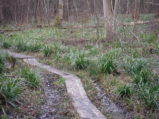
More Boardwalks in Broxbourne Wood
SWC Walk 168 Broxbourne Circular
Feb-16 • thomasgrabow on Flickr
swcwalks swcwalk168 walkicon banner 25102714051
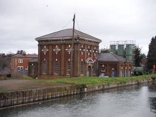
Broxbourne Pumping Station on The New River
SWC Walk 168 Broxbourne Circular
Feb-16 • thomasgrabow on Flickr
walkicon swcwalks swcwalk168 24828423089

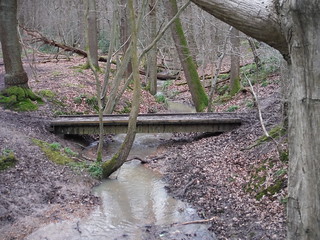
Spittal Brook, Cowheath Wood
SWC Walk 168 Broxbourne Circular
Feb-16 • thomasgrabow on Flickr
walkicon swcwalks swcwalk168 25077713432

Paths in Wormley Wood
SWC Walk 168 Broxbourne Circular
Feb-16 • thomasgrabow on Flickr
walkicon swcwalks swcwalk168 24569092173
Wormleybury Brook, Wormley Wood
SWC Walk 168 Broxbourne Circular
Feb-16 • thomasgrabow on Flickr
walkicon swcwalks swcwalk168 24900241280
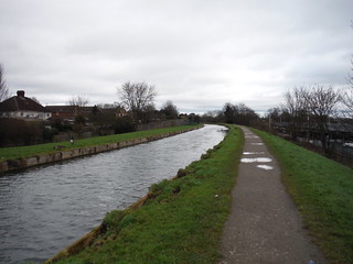
The New River at Broxbourne
SWC Walk 168 Broxbourne Circular
Feb-16 • thomasgrabow on Flickr
swcwalks swcwalk168 24828432289
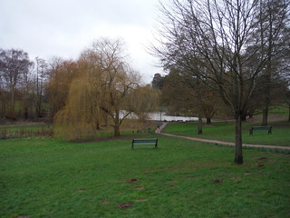
Barclay Park, Broxbourne/Hoddesdon
SWC Walk 168 Broxbourne Circular
Feb-16 • thomasgrabow on Flickr
swcwalks swcwalk168 24565431504
| Length |
24.3 km (15.1 mi), with 325m ascent/descent. For a shorter walk or an Alternative Ending, see below Walk Options. |
|---|---|
| Toughness | 5 out of 10, with 5 hours 30 minutes walking time. For the whole outing, including trains, sights and meals, allow at least 7 ½ hours. |
| Walk Notes |
After winding its way out of Broxbourne along a canal and through a park, this walk ascends through the Spital Brook valley into Broxbourne Woods National Nature Reserve, an assortment of varied, ancient and wild woods, serrated by a plethora of streams. A circuitous route linking up separate woods follows age old trails, paths and green lanes through a magnificent and diverse woodland setting. While broadly following a well signposted trail through the Nature Reserve, the walk often diverts from it to take more interesting directions. Most of the distance and the ascent are covered before lunch, but the lunch pub serves food all afternoon, so a leisurely pace is entirely possible. There are plenty of signed and unsigned paths in the woods, thus following the detailed written directions is essential, and a map and a compass are recommended. |
| Walk Options |
A Shortcut just before lunch cuts out 0.9 km (0.6 mi).
|
| Maps | OS Explorer: 174 (Epping Forest & Lee Valley)
OS Landranger: 166 (Luton & Hertford) |
| Travel |
Broxbourne Station, map reference TL 374 072, 7 km south east of Hertford, and 30m above sea level. Bayford Station, map reference TL 315 082, 5 km south of Hertford, and 73m above sea level. Both are in East Hertfordshire. The station is on the Liverpool Street to Cambridge North or Hertford East lines with four trains an hour every day, journey time between 25 and 33 minutes. It is also serviced by trains from Stratford, with up to four trains per hour taking from 25 minutes. Trains stop at Tottenham Hale (connect from the Victoria Line).
Saturday Walkers’ Club: Take the train closest to 9.30 hours. |
| Lunch | The Woodman & Olive 20 Wormley West End, Broxbourne, Hertfordshire, EN10 7QN (01992 463 719). The Woodman & Olive is located 14.5 km (9.0 mi) into the main walk.
|
| Profile | |
|---|---|
| Help Us! |
After the walk, please leave a comment, it really helps. Thanks! You can also upload photos to the SWC Group on Flickr (upload your photos) and videos to Youtube. This walk's tags are: |
| By Train |
Out (not a train station) Back (not a train station) |
| By Car |
Start EN10 7AW Map Directions |
| Amazon | |
| Help |
National Rail: 03457 48 49 50 • Traveline (bus times): 0871 200 22 33 (12p/min) • TFL (London) : 0343 222 1234 |
| Version |
Apr-24 Thomas G |
| Copyright | © Saturday Walkers Club. All Rights Reserved. No commercial use. No copying. No derivatives. Free with attribution for one time non-commercial use only. www.walkingclub.org.uk/site/license.shtml |

Walk Directions
Full directions for this walk are in a PDF file (link above) which you can print, or download on to a Kindle, tablet, or smartphone.
This is just the introduction. This walk's detailed directions are in a PDF available from wwww.walkingclub.org.uk