Ealing Broadway Circular Walk
The green spaces of West London, including The Grand Union Canal, Boston Manor, Syon House, The Thames towpath, Kew Gardens, and Gunnersbury Park.
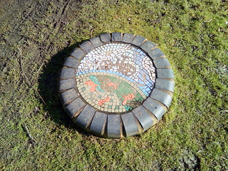
Tyred tiles
Well, semi-engineering bricks really
Feb-18 • quitenearmike on Flickr
swcwalks swcwalk104 38545786040


| Length |
17¾ km (11 miles). |
|---|---|
| Maps | London A-Z Map. |
| Toughness |
1 out of 10. |
| Features |
This is a walking tour of green spaces and interesting places to visit in West London. Starting and finishing at Ealing Broadway, served by British Rail, London Underground and local buses, it is particularly suitable for a Bank Holiday outing or for a local outing for West Londoners. The route is rich in places of interest, passing Pitshanger Manor, the Grand Union Canal, Boston Manor, Syon House, the River Thames, Richmond Old Deer Park, Kew Gardens, Kew Bridge Steam Museum, Gunnersbury Park, Lammas Park and Walpole Park. Boston Manor tube station and Brentford main line station are close to the route (see A-Z) and Kew Bridge is directly on it, so portions of the route can be used as half day or evening walks. |
| Saturday Walkers Club |
Take the first train after 10:30am from Paddington to Ealing Broadway. |
| Lunch |
Syon Park Refectory or The London Apprentice. |
| Tea |
There is a wide choice of venues at Ealing Broadway. |
| Profile | |
|---|---|
| Help Us! |
After the walk, please leave a comment, it really helps. Thanks! You can also upload photos to the SWC Group on Flickr (upload your photos) and videos to Youtube. This walk's tags are: |
| By Car |
Start Map Directions |
| Amazon | |
| Help |
National Rail: 03457 48 49 50 • Traveline (bus times): 0871 200 22 33 (12p/min) • TFL (London) : 0343 222 1234 |
| Version |
Feb-17 JonG |
| Copyright | © Saturday Walkers Club. All Rights Reserved. No commercial use. No copying. No derivatives. Free with attribution for one time non-commercial use only. www.walkingclub.org.uk/site/license.shtml |

Walk Directions
- Leave Ealing Broadway Station, cross the main road and take the road opposite across the Green.
- In 20m, fork left on a path by a low wall.
- In 100m, at the road, turn left.
- In 100m, cross "New Broadway" to turn right along it with a church on your right.
- In 100m, turn left along Bond St.
- In 100m, turn right by "Ealing Green".
- In 20m, cross Mattock Lane towards Pitshanger Manor, an interesting house to visit, and enter the park through a gate under an arch.
- Turn immediately right and follow the path for 500m along the side of Walpole Park, passing toilets and a cafe, to reach a gate on your right.
- Leave the park by the gate and turn left to continue in the same direction as before.
- In 100m cross Culmington Road and, in a further 50m, cross another road at a junction with a substantial traffic island.
- With the entrance to St John's church on your right, turn left along the "Public Footpath", passing between yellow bollards to walk beside allotments on your right.
- In 400m, turn right along Occupation Road.
- In 50m, cross Northfield Road by the zebra crossing to continue along Seaford Road, slightly to the right of Occupation Road.
- In 30m, reach "The Forester" and turn left along Leighton Road.
- In 500m, cross Boston Road to enter Elthorne Park.
- Follow the left hand edge of the park, leaving it between bollards to continue between the park fence and the enclosed sports pitches, towards the open fields.
- In 40m, when you reach the open fields, turn left beside the enclosed sports pitches.
- In 100m, turn left.
- In 100m, at a gap in the fence, turn right.
- In 100m, bend left and immediately right through a gap in the fence.
- In 200m, turn right to follow the footpath past arrows with woods on your right.
- In 100m, ignore a cross paths and carry straight on.
- In 200m, when you reach the canal, turn left to follow the tow path under the M4.
- In 500m, cross the bridge and continue along the canal.
- In 750m, you come to another bridge.
- To visit Boston Manor Park, with its house, tea-rooms, toilets and fine views of the GSK Building, cross the bridge and continue up the right-hand side of the park, turning left just before reaching the road. Boston Manor tube station is nearby. Return the same way.
- In 500m, you come to an old iron structure, followed after 200m by a marina complex and Holiday Inn.
- Continue to the road and turn right.
- To finish the walk here and return from Brentford Station, turn left instead. In 400m turn left at the traffic lights into Half Acre, the A3002. The station is 500m along this road.
- In 150m, turn left at the "Pedestrian Entrance to Syon Park".
- In 200m, ignore a left turn and join the pavement.
- In 100m, continue along the left hand edge of the car park.
- In 50m, reach the garden centre and refectory tea-room on your left.
- In 30m, where the road leaves the car park, follow the path as it diverges from the road.
- In 400m, rejoin the road at the entrance to Syon House.
- Turn left on the road, towards the River Thames, and cross the road to join a raised path on the right hand side of the road.
- In 100m, reach the London Apprentice, the suggested lunchtime stop.
- In 50m, cross a bridge.
- In 10m, leave the main road, which bends to the right, to continue in the same direction.
- In 30m, cross Lower Square on its left hand side, following the Thames Path sign.
- In 30m, turn left and, in 20m, reach Town Wharf pub where you turn right.
- In 30m, turn right, away from the River Thames.
- In 50m, at a roundabout, turn left, opposite "The Castle".
- In 200m, cross the bridge and turn left to leave the road on "Thames Path Capital Ring"
- In 30m, reach the river and follow the path as it bends to the right.
- In 300m, where the path bends to the right, leave it to follow a passage by the river. Emerge in 80m and continue by the river. (In case of flood, turn right, left and then left again.)
- In 20m, ascend steps to a bridge and cross the river.
- To finish the walk here, you can turn right on the other side and in 20m turn left into Old Deer Park, across which you can walk towards Richmond Station.
- The main route, however, is to turn left and continue on the riverside path for 4km to Kew Bridge, passing Kew Gardens on your right towards the end of this stretch.
- Just before going under Kew Bridge, turn right to follow the sign to "Kew Gardens".
- In 50m, reach Kew Green, with catering facilities at "Ask Italian" and the "Rose and Crown".
- From here you can explore Kew or visit Kew Gardens, with its tea room on Station Approach, returning to London from Kew Gardens BR & LU station.
- The main route is to ascend the steps and turn left to cross Kew Bridge.
- To visit the Kew Bridge Steam Museum, turn left. Its entrance is along Green Dragon Lane on the other side of the main road.
- For the main route, turn right to reach Kew Bridge Station, a possible end of the walk.
- 20m past the station, turn left into Lionel Road South.
- In 150m, use the crossings to cross the main road (A4) under the M4 and turn left.
- In 20m, fork right, away from the A4.
- In 20m, turn right into Gunnersbury Park.
- In 10m, turn left and, in 5m, turn right, to follow a path with the lake to your right.
- In 80m, after passing the Potomac Tower, fork left to follow the lake side.
- In 30m, turn right and follow the path as it bends to the left.
- In 30m, turn left again to pass to the left of the tennis courts and pavilions.
- In 80m, pass a children's playground on your right.
- Turning right after this and passing a lake will take you to a cafe, but the main route is to carry stright on to pass a hedge and a car park and across a grassy area to a path where you turn left.
- In 100m, turn left to leave the path between red brick walls.
- Use the crossing and go up Elderberry Road.
- In 200m, after the bridge over the tube line, turn left into Ranelagh Road.
- In 20m, turn left into Baillies Walk, passing allotments on your left.
- In 300m, pass a graveyard and turn left at the path T-junction to turn right at the road and reach the Rose and Crown, a pub with a fine garden.
- Passing the pub, cross the main road to go down Church Lane.
- In 30m, bend right with the road and then turn left into Lammas Park.
- Immediately turn right to proceed in the same direction with tennis courts on your left.
- In 200m, turn right to leave the park and cross the road into Lammas Park Gardens and then turn left into Walpole Park.
- Immediately turn right to follow a winding path.
- In 300m, reach a band stand and turn half right to cross a path and carry straight on with ornamental gardens on your right, 20m to the right of the pavilion, currently Spencer's Cafe.
- In 80m, turn right to pass between railings and flower beds and pass Pitshanger Manor on your right.
- Leaving the park, cross the road to turn right in front of a catering establishment, currently named "Flava".
- In 20m, turn left at the main road along Bond Street.
- In 100m, turn right along the Uxbridge Road.
- In 200m, having ignored High Street and Spring Bridge Road, turn left along "The Broadway" to follow the signs to Ealing Broadway station.